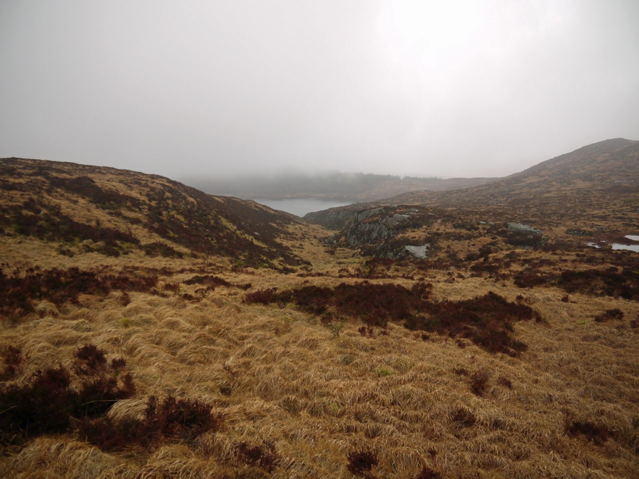
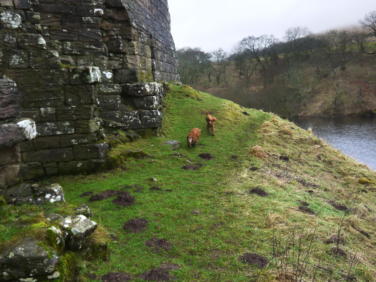
A burn, labelled Altiwhat on older OS maps, empties into northern apex of Loch Fleet, the Loch itself becoming the source of Little Water of Fleet. The burn is protected by steep rocky sides which open up at about 430m where the land broadens into a small hanging valley. This flatter area, lying between the higher ground of Fell of Fleet and Back Hill of Orchars is an upland bog with exposed granite slabs in places and some islands of more prominent granite blocks.
Maxwell’s Studies in the Topography of Galloway gives the derivation of Altiwhat as Allt na Chat, Glen of the Wildcat. And he goes on to explain… Allt itself is a word which has travelled very far from its original root-meaning. Connected originally with Latin altus (high), it signified a height or cliff, but the meaning slid thence to the vale or glen between the heights, and finally into the stream within the vale.
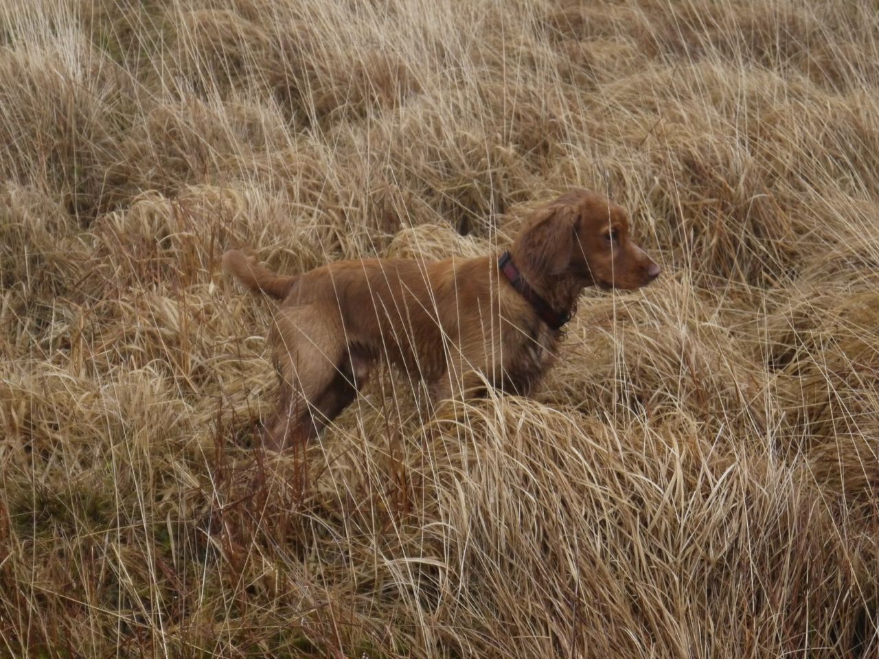
The maps clearly label the burn Altiwhat, but Maxwell in the 1880s might have had other information. I found it more romantic to think of myself crossing the glen of the wildcat rather than crossing the bog above the stream of the wildcat. Having said that I didn’t see any cats.
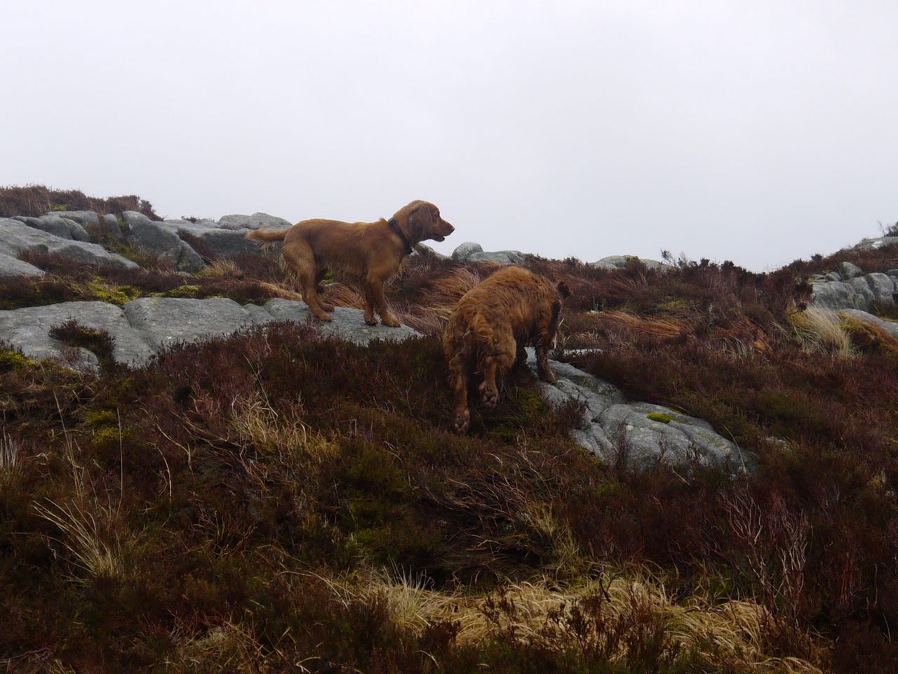
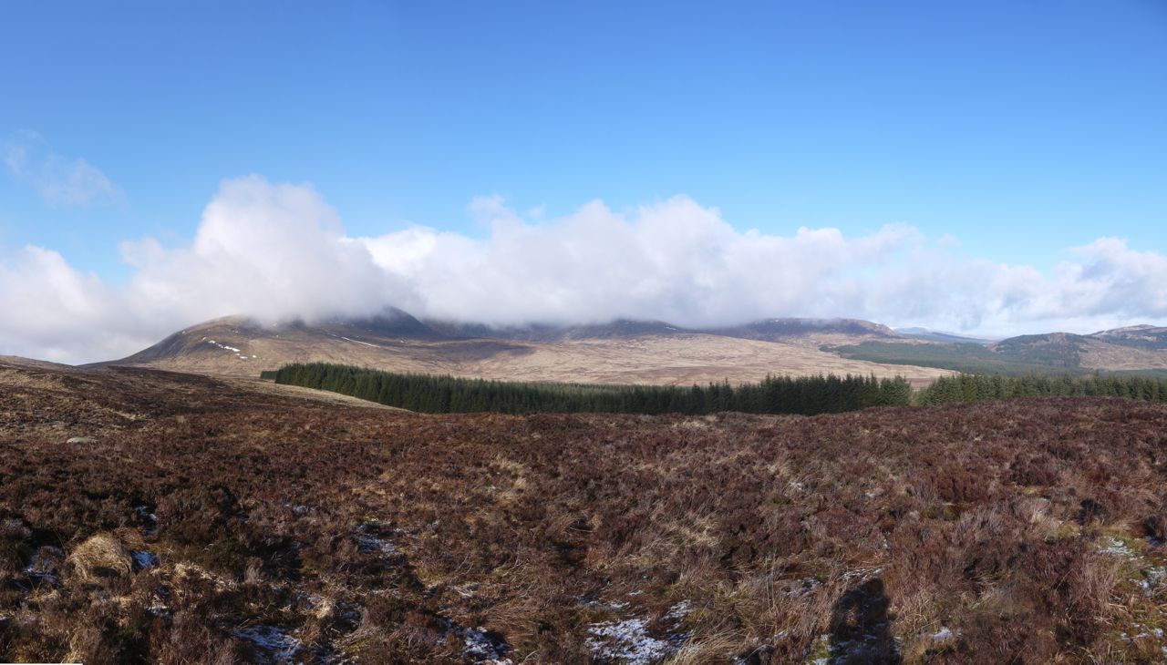
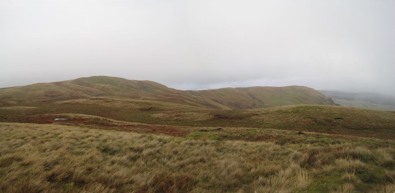
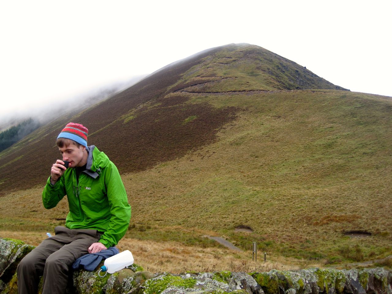
Fell of Fleet is another D&G Marilyn to add to my list; it is not a big ascent but tiring terrain and low cloud made this simple walk a little more challenging. Heather, tussock, moss, bog and sometimes granite slabs, with no tracks to follow, and when the cloud was low, direction finding by compass.
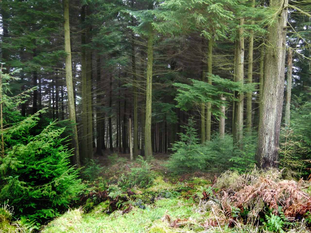
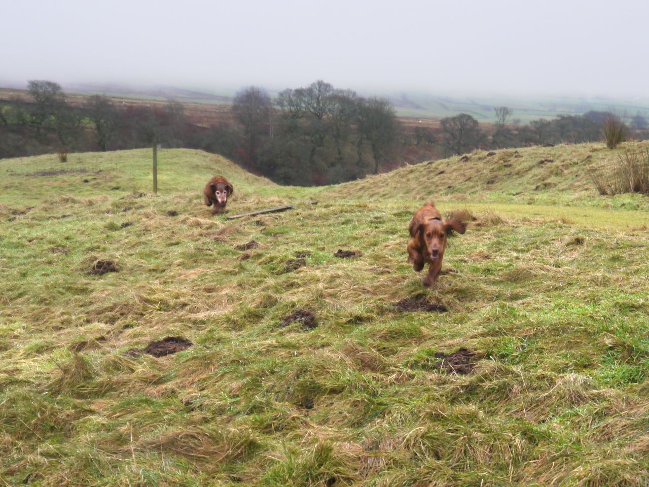
I started from the forestry track above Loch Grannoch. I chose a forest break between mature trees and a planting of young conifers about 3m tall. This was a little waterlogged in places but easy enough. Unfortunately the forest break was blocked by a further plantation of conifer and, higher up, deciduous trees. A large mature tree had fallen across my route and required some clambering. Sweep, old dog that he is, with his bad leg, couldn’t jump onto it and had to be manhandled over.
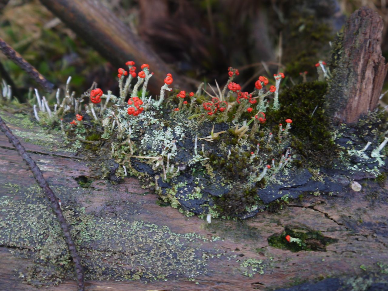
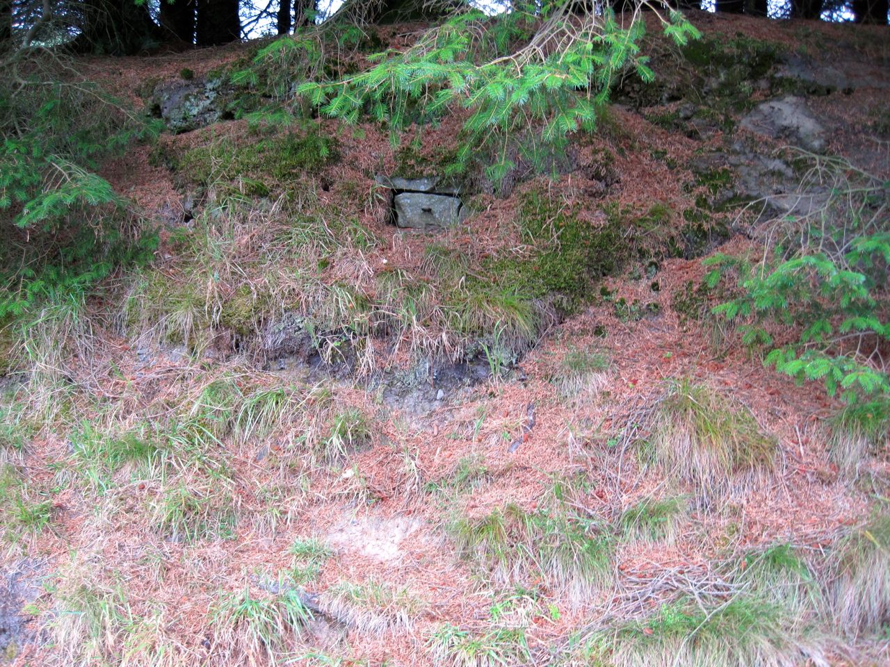
Amongst the browns and greens of the slope a single flash of red caught my eye which was fruiting lichen.
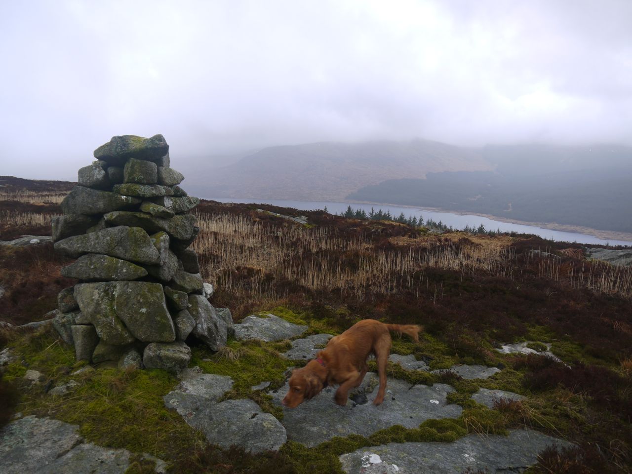
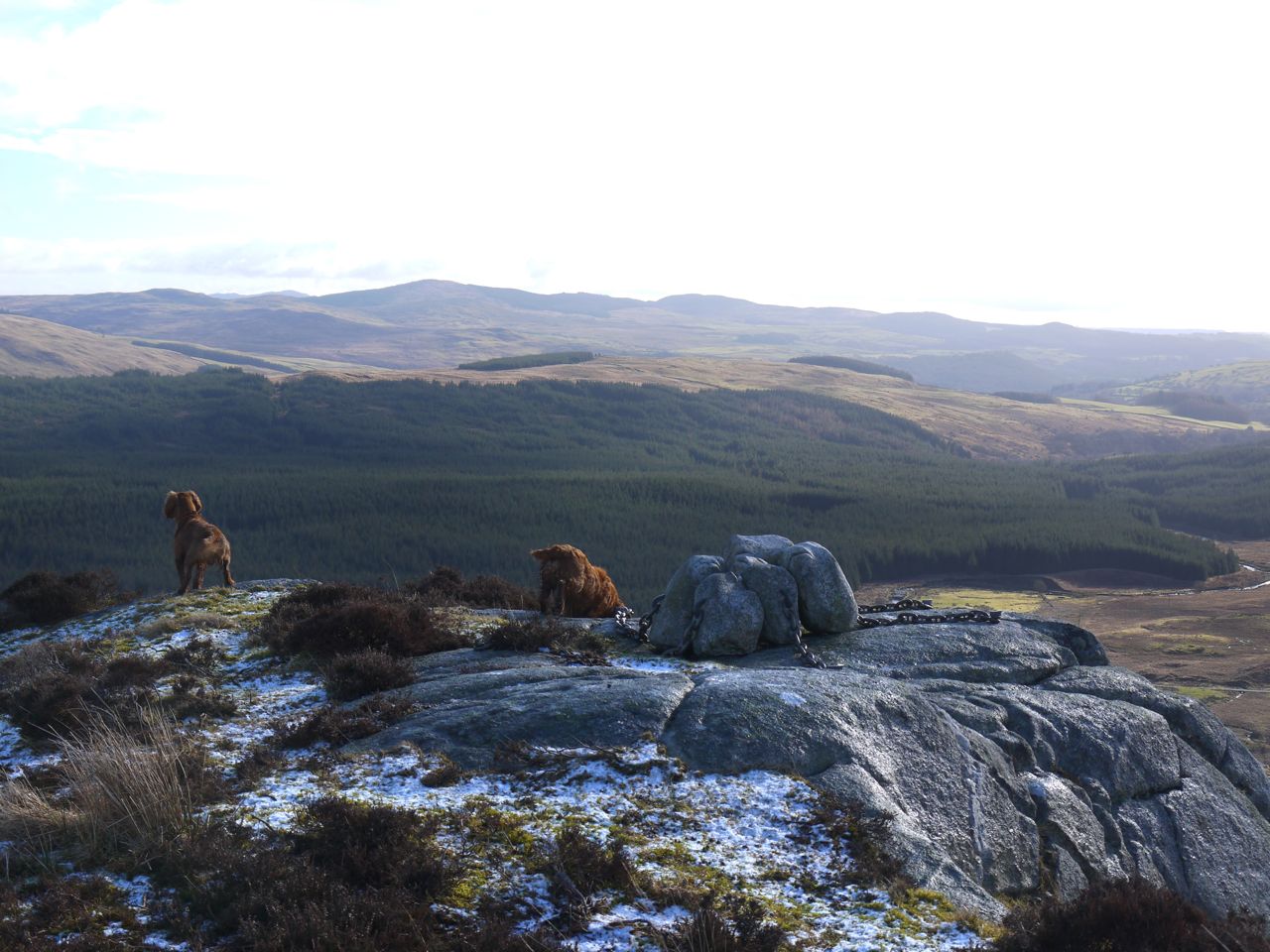
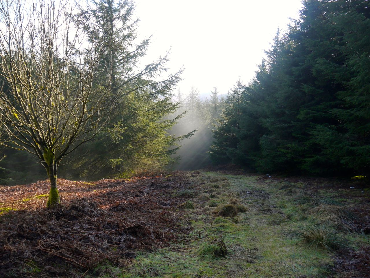
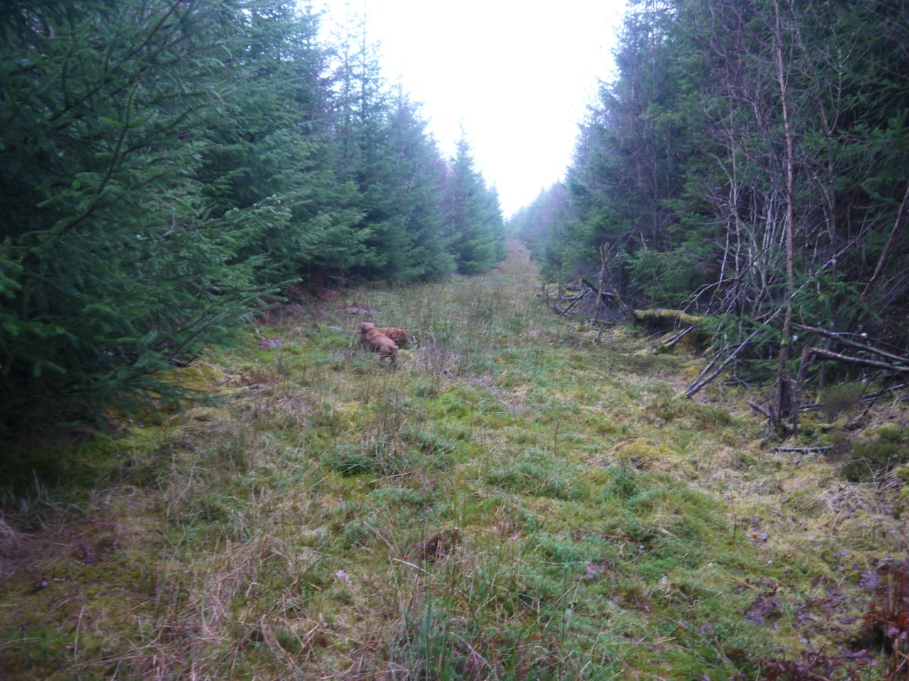
The new plantings were not particularly dense and it was possible to pick a way through. Above this was a rough forestry track not marked on the OS map. It looks quite temporary but offered a brief respite from the difficult terrain of newly planted forest on a background of felled forest. I only stayed on it a short distance and then headed straight up the ridge of Back Hill of Orchars, arriving very close to the summit cairn.
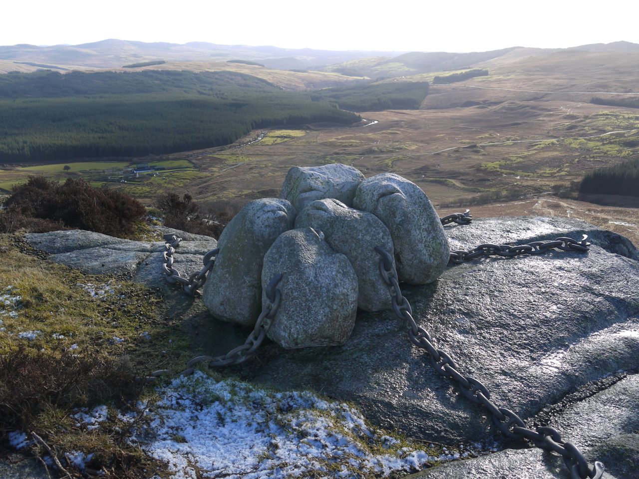
Summit, Back Hill of Orchars. Loch Grannoch in the background
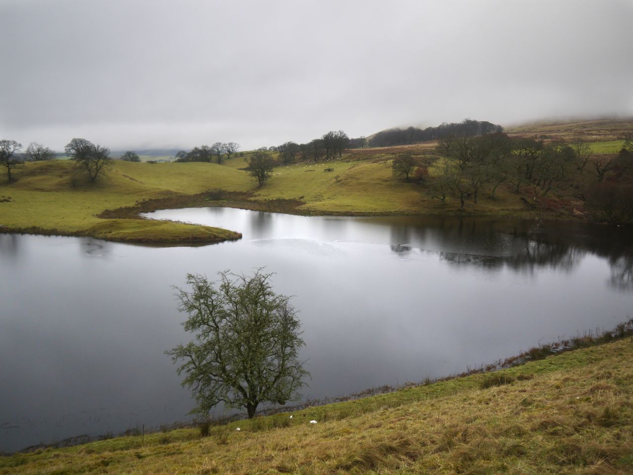
There were views of Lochs Grannoch and Clatteringshaws from the summit and Loch Fleet could be seen from just a little way beyond the cairn. The surrounding hills however were lost in mist. Loch Fleet, having collected water from the Fell of Fleet is the source of the Little Water of Fleet, whereas the Big Water of Fleet arises from the slopes of the much larger Cairnsmore of Fleet.
Loch Fleet
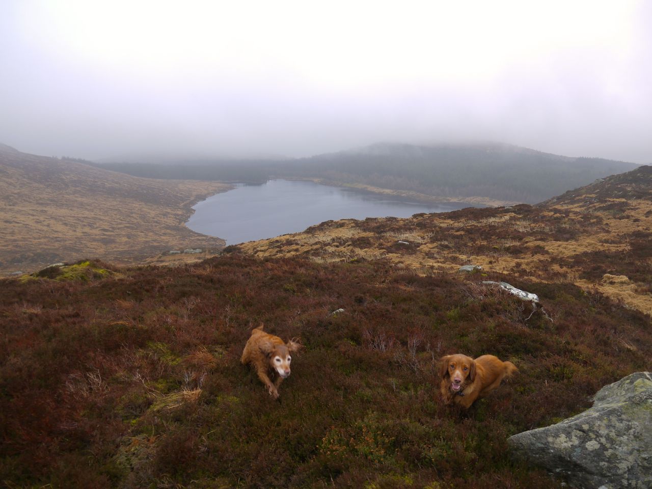
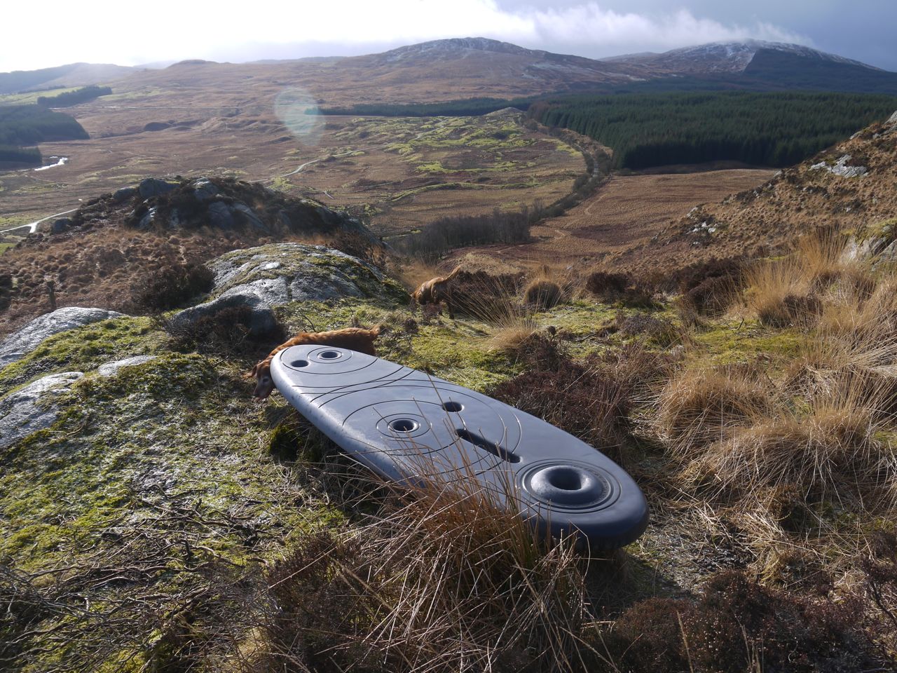
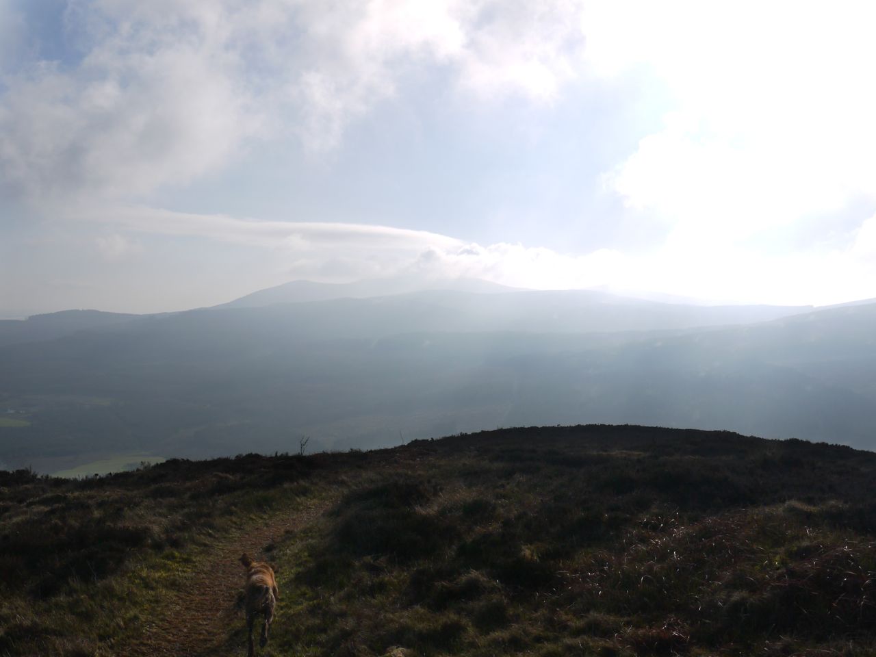
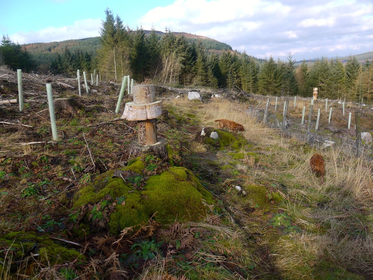
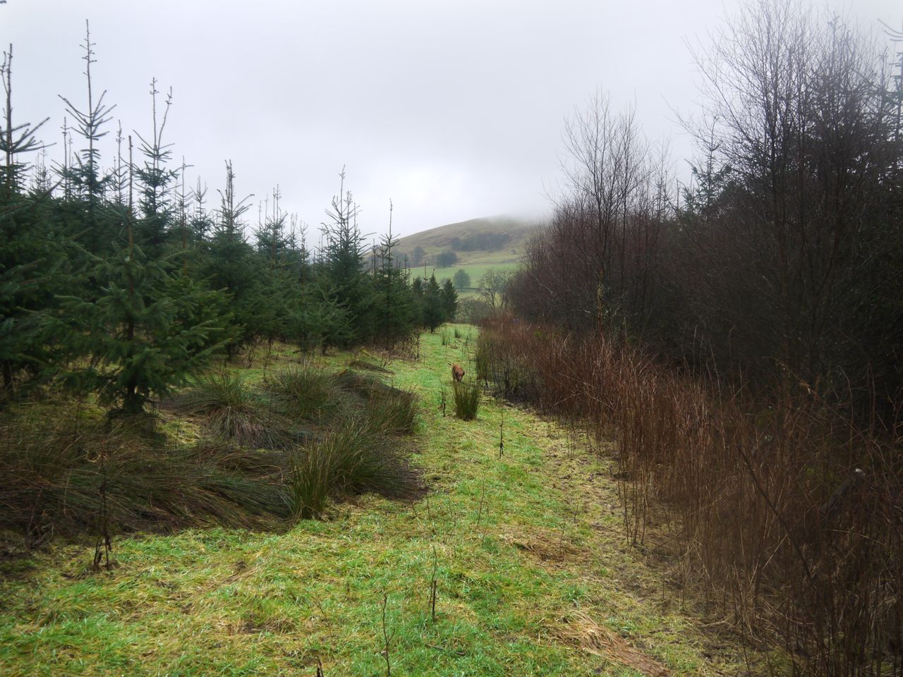
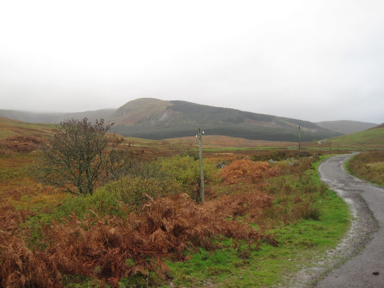
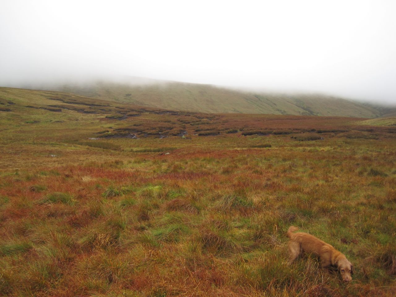
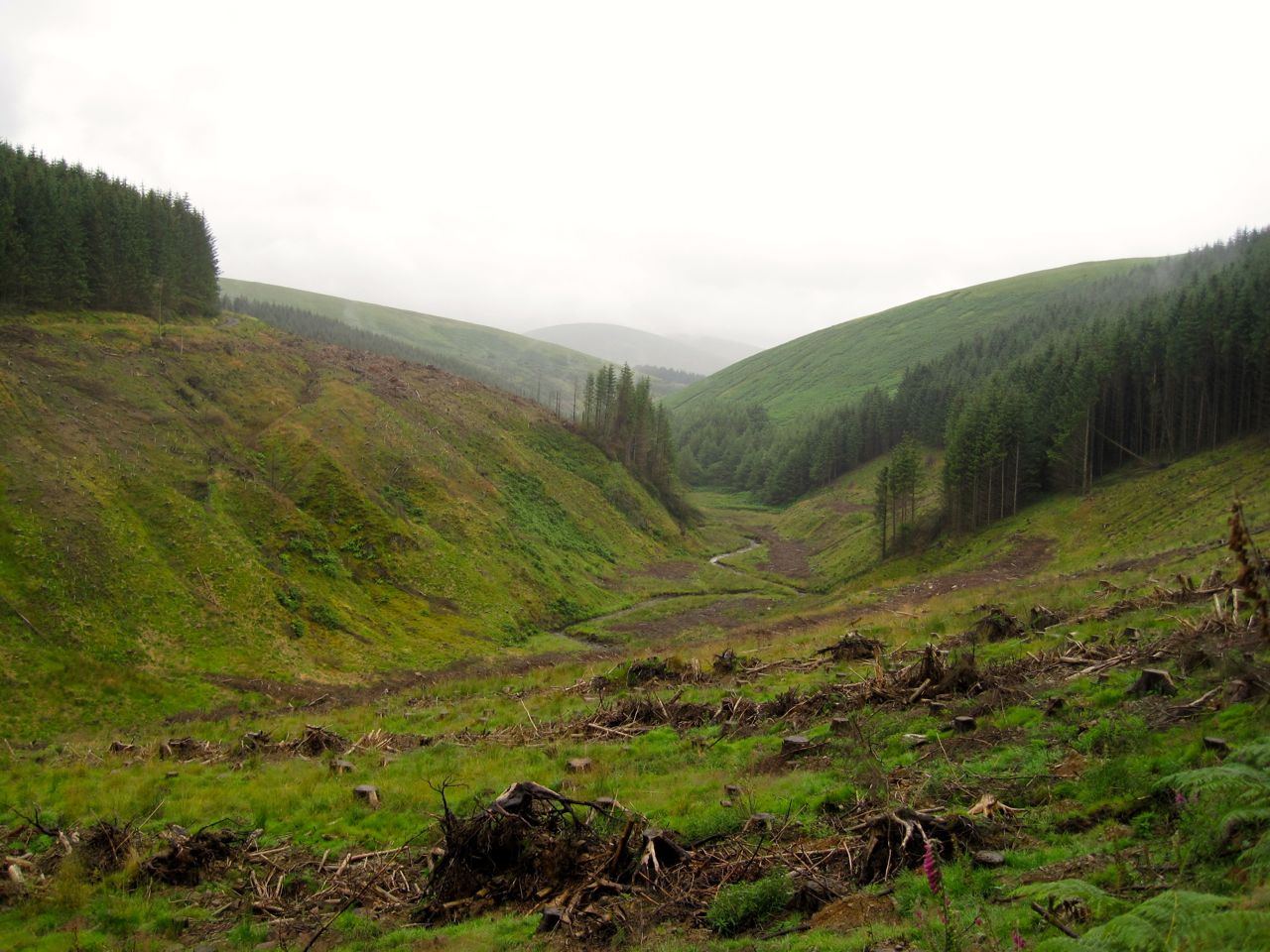
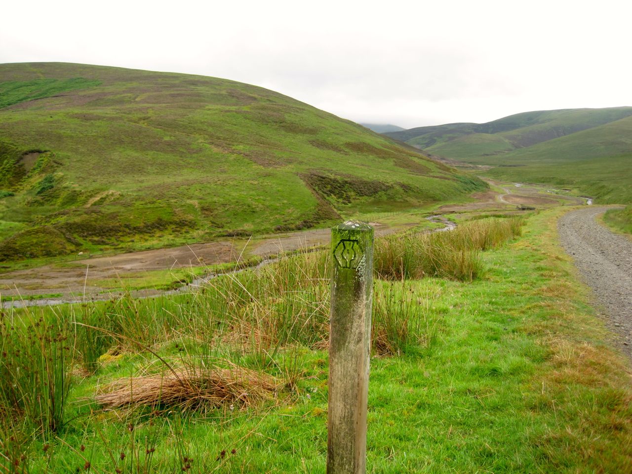
I had hoped that the way across to the Fell of Fleet would be obvious but the summit was hidden in cloud and I could not see any obvious route. Between Back Hill of Orchars and Fell of Fleet is the shallow valley, Altiwhat, the Glen of the Wildcat, a granite strewn bog with areas of standing water to avoid.
Altiwhat
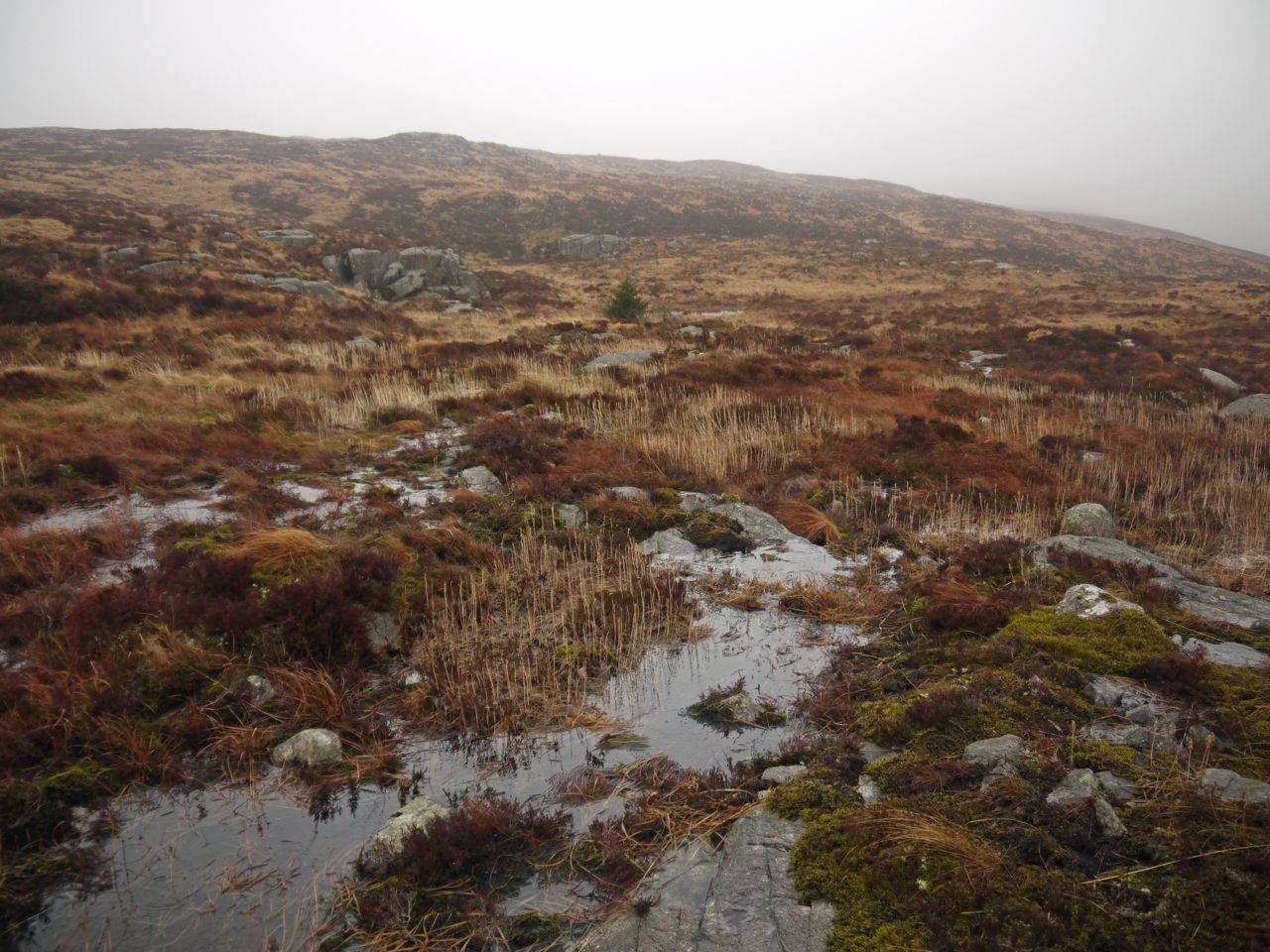
I decided to skirt around to the north to avoid too much descent and re-ascent but still found myself in boggy ground. A castle of granite slabs looked like a good staging post but turned out to have a boggy moat. The standing water was sometimes deep enough that the dogs swam across pools, so I trod carefully.
Altiwhat, looking down to Loch Fleet
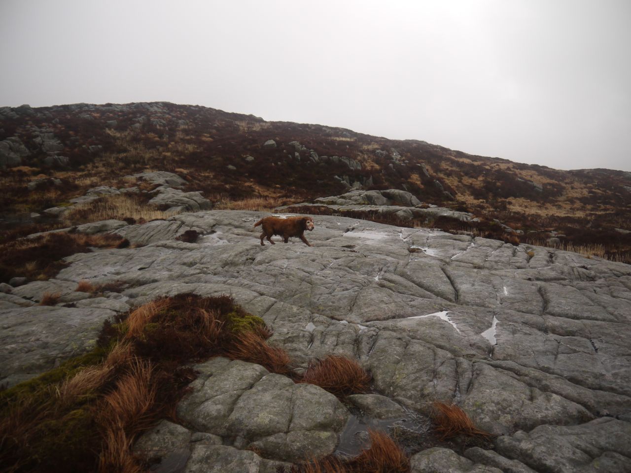
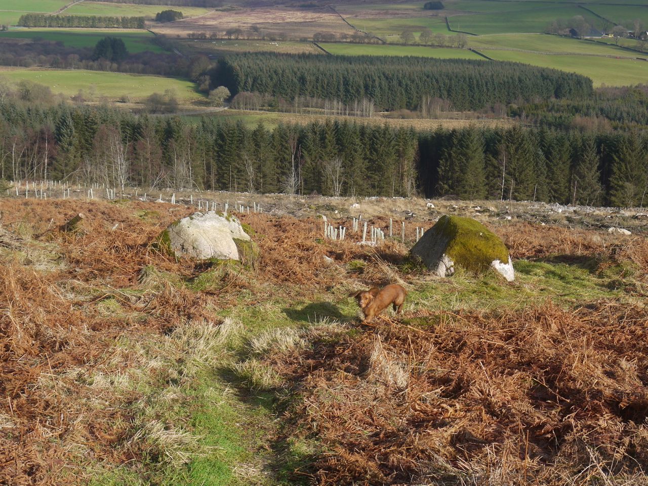
Once on the higher slopes there were granite slabs in places to make the going easier.
Fell of Fleet
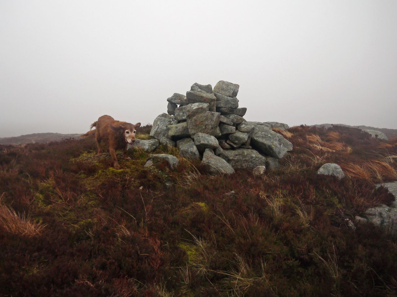
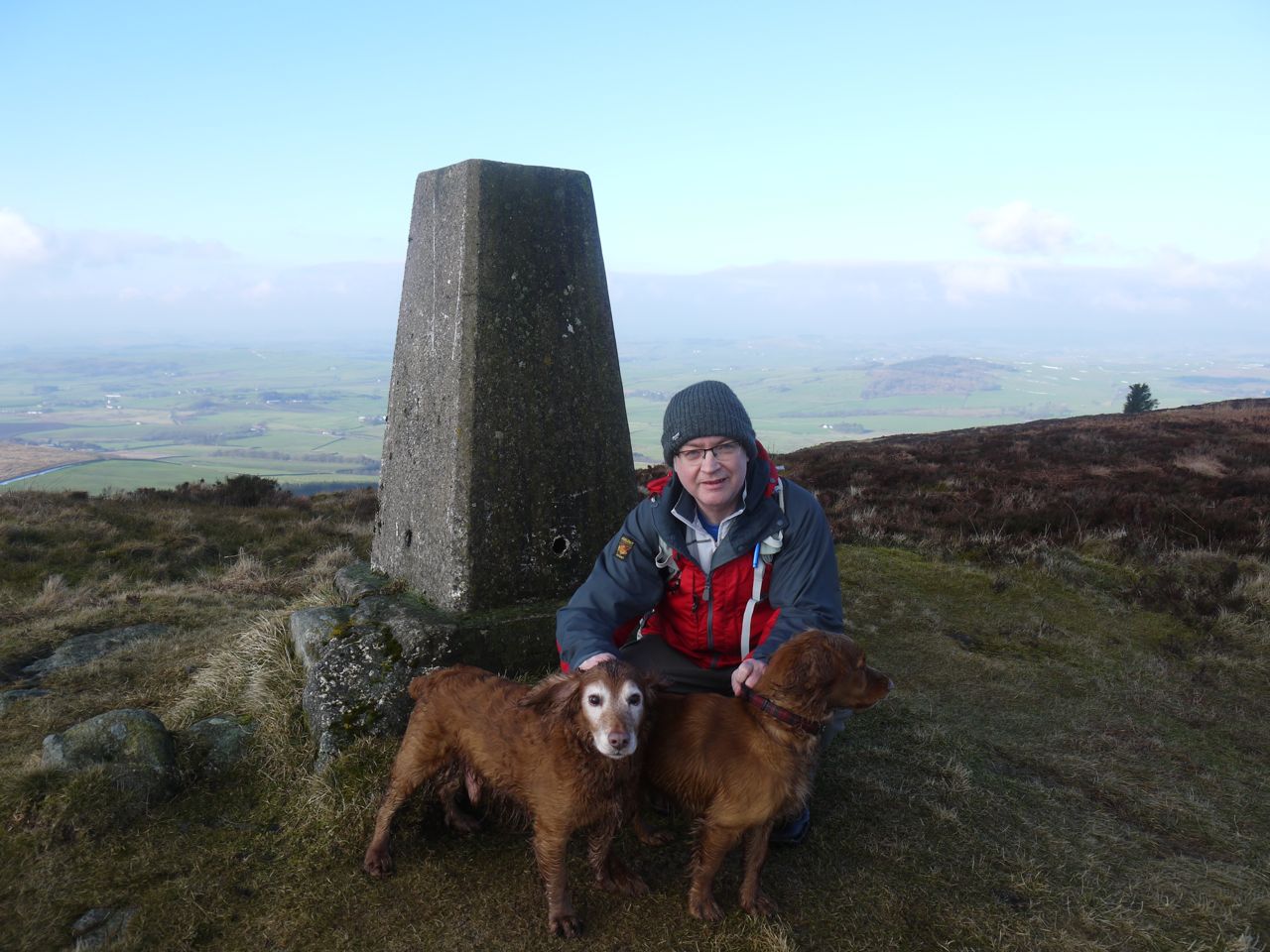
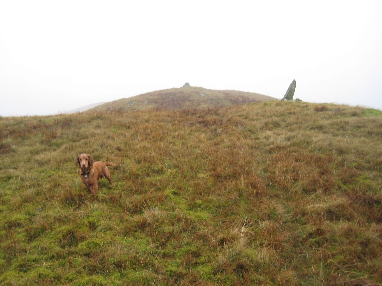
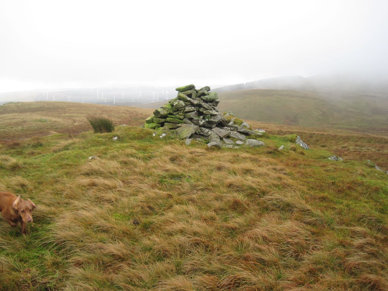
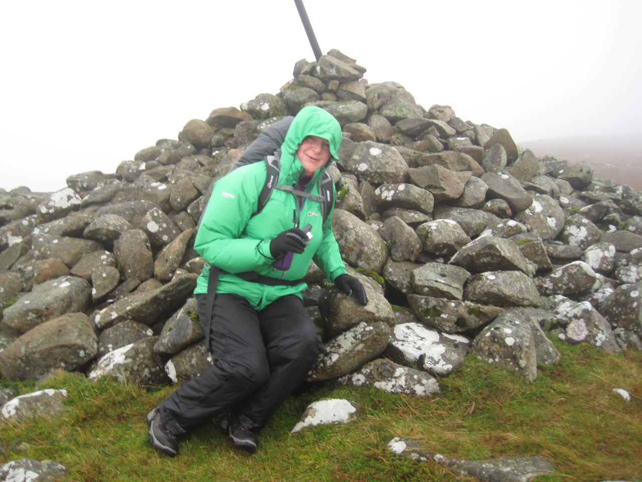
Once on the Fell of Fleet I was in low cloud that would briefly clear allowing some views but quickly descend again. I came across a cairn, which it turns out is the summit, but while standing there the cloud thinned showing me what appeared to be higher ground to the NE. So off I went searching for the higher point.
Summit, Fell of Fleet
Having waked along Fell of Fleet’s summit ridge, to the possible higher ground, the mist lifted again and I could look back to see that the cairn was higher. This seems to be quite a common phenomenon, for me at least.
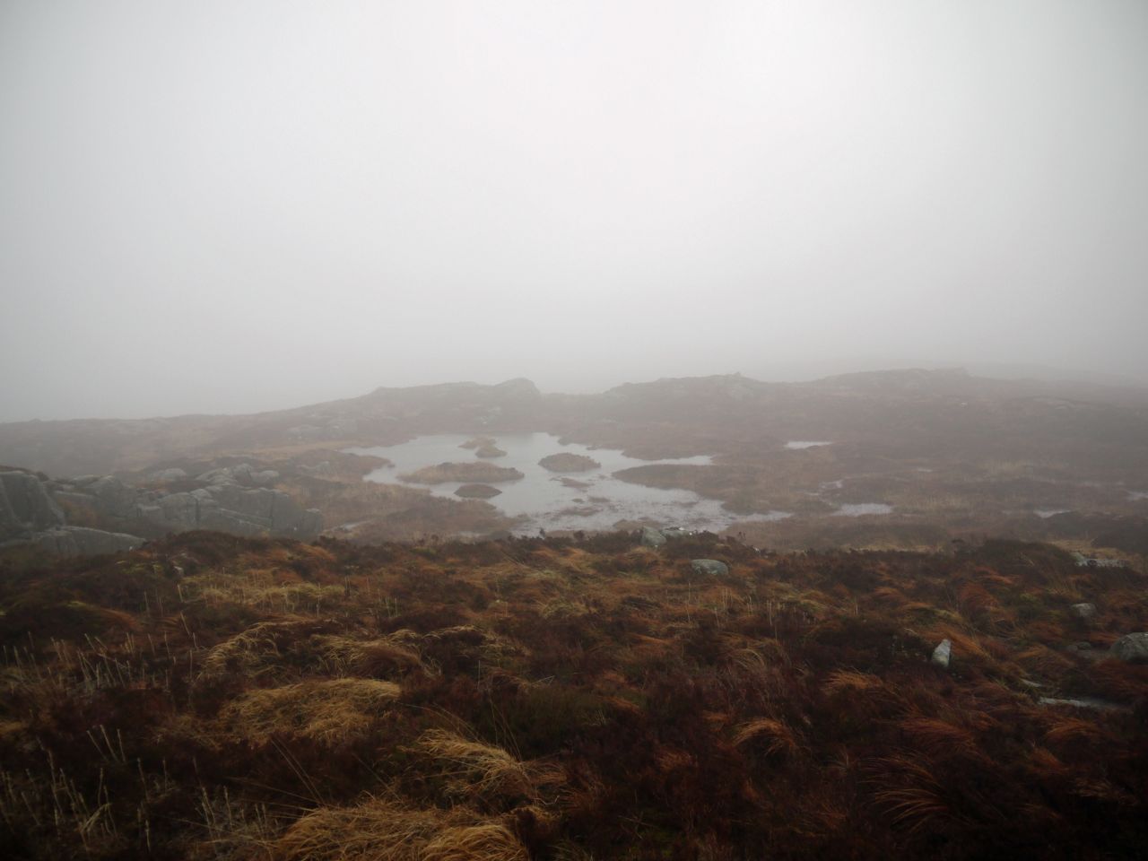
Lochan on Fell of Fleet
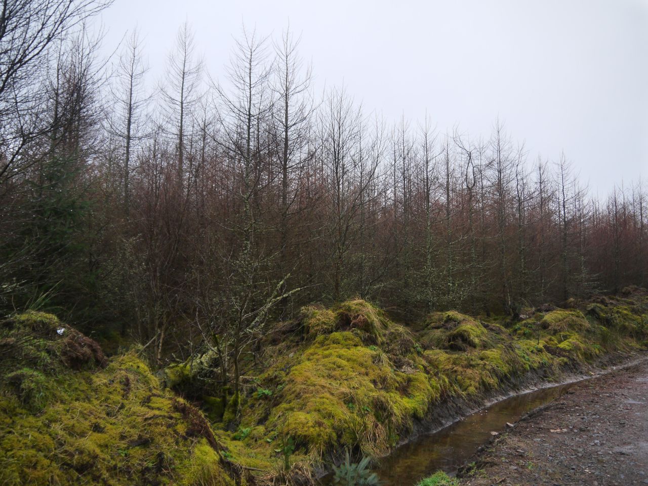
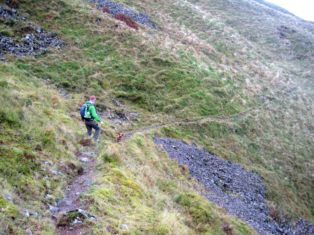
So, comfortable that I had visited the summit I turned to head home, crossing the boggy glen a second time and heading directly over the ridge of Back Hill of Orchars. This took me down through some felled and replanted forest and on to the rough track which I followed for about 100m to a forest break that I hoped would carry me back to the main forestry road.
Back Hill of Orchars
I was quite pleased with this forest break which had quite firm footing, but it wasn’t to last. The ground became more boggy and then the forest break was blocked by a densely planted forest. Luckily it was possible to find a way through with a bit of clambering over fallen trees and detours to get around water.
Back Hill of Orchars
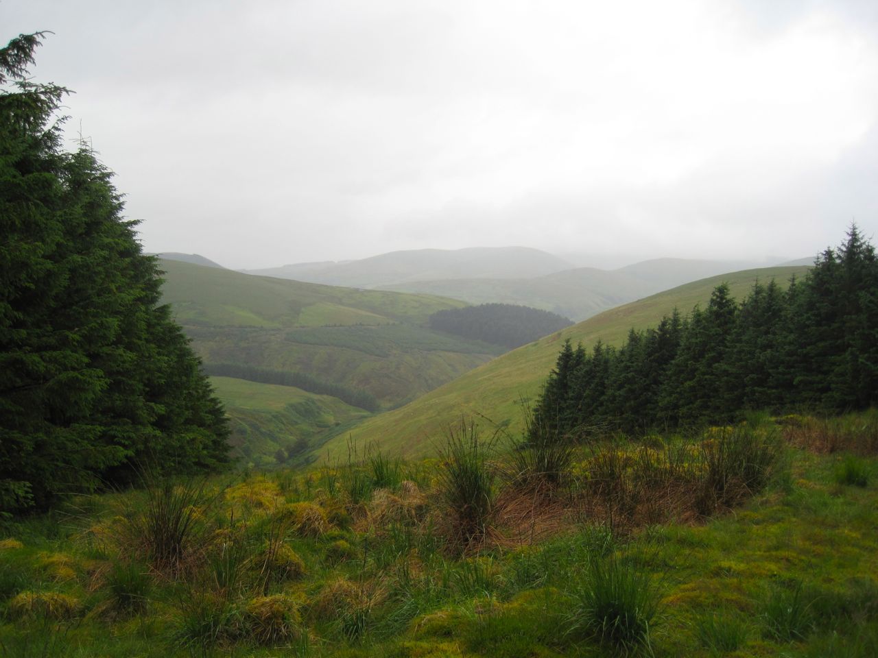
I suspect the views from Fell of Fleet could be quite extensive, but I’ll have to wait for another day to find out.
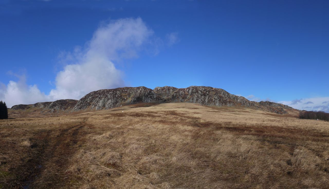
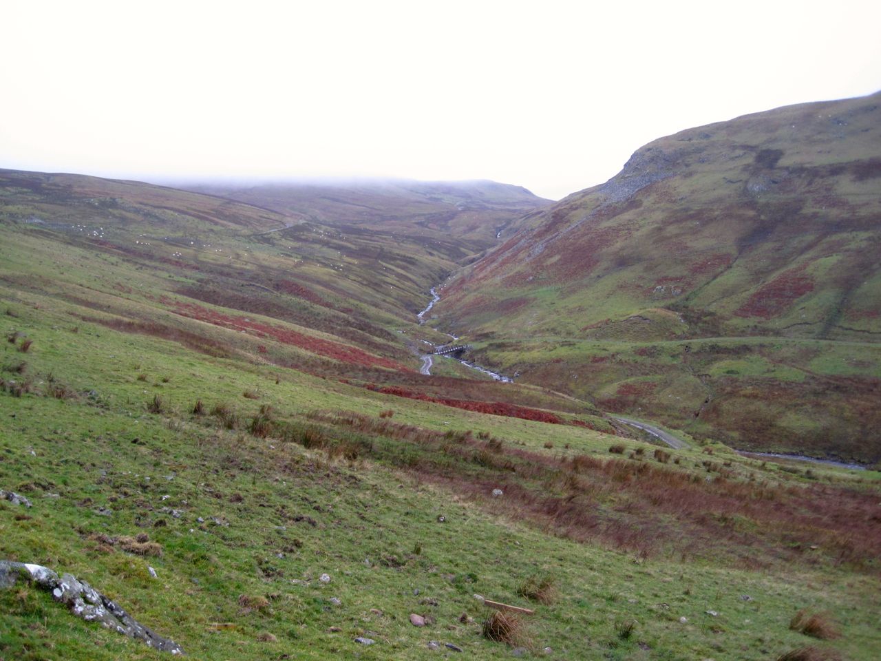
The Clints of Dromore are a section of steep south facing cliffs at the southern margin of the Cairnsmore of Fleet granite intrusion. The surrounding peat bogs are said to have 10m of peat in places, representing 7,000 years of accumulation. Where the peat has eroded and granite slabs are now exposed the effects of the long melted glaciers can be seen and the melting glaciers have left a drumlin field stretching out below the Clints.
The last time I came here I was picking my way through the heather of the clifftop in mist, looking in vain for the “Hush” sculpture. This time I set off from home under blue skies hoping for better luck. As I drove along the A75, however, the clouds rolled in from the south and settled on to the hilltops. Ho hum.
I passed the visitor centre, which looked to be closed up, and parked instead at the small parking spot below the viaduct, giving little thought to the “Beware Falling Masonry” sign. Both Sweep and Eddie were with me and there were sheep between us and the Big Water of Fleet so we didn’t go down to see the sculpture on the rocks down there.
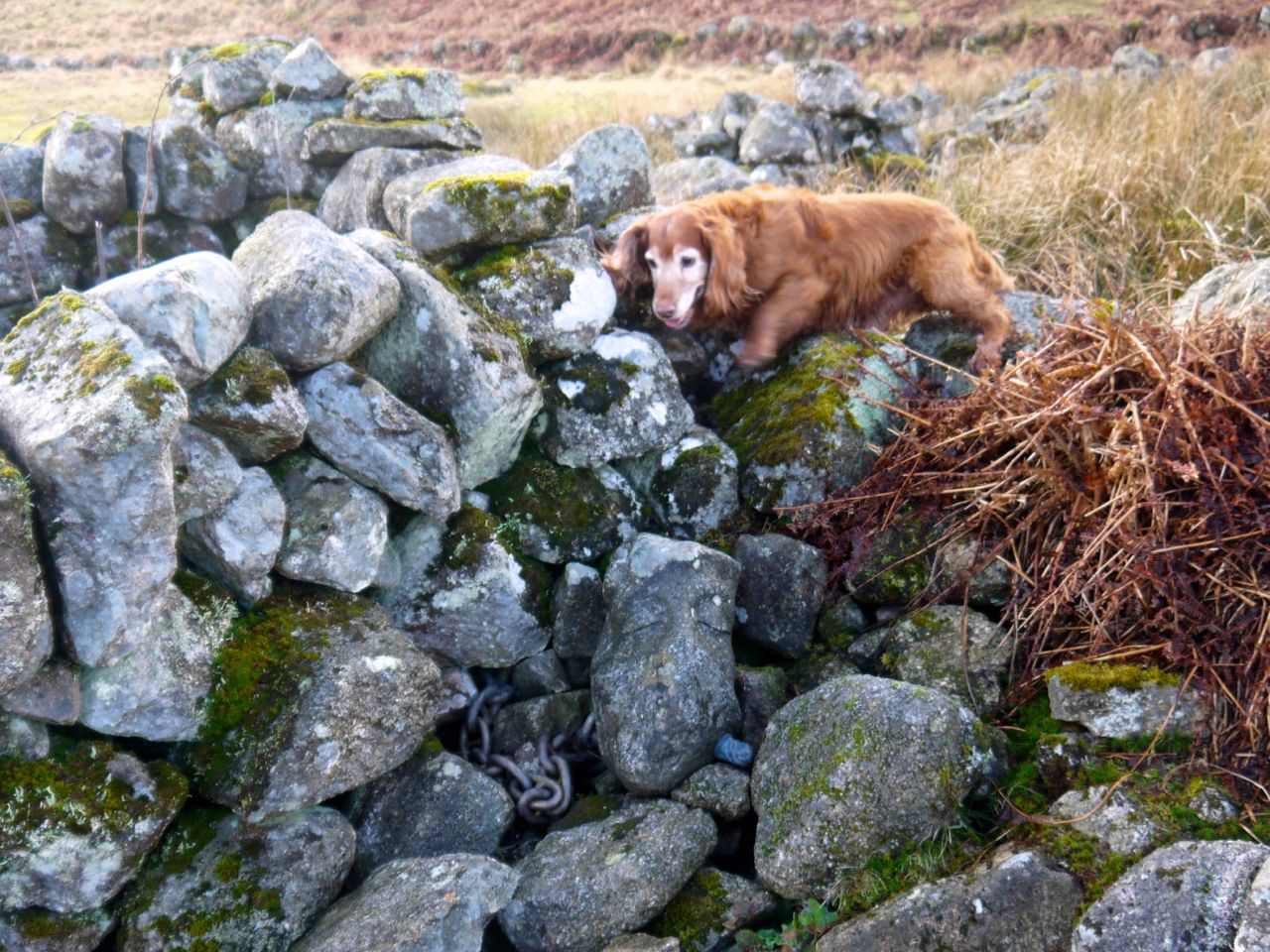
Our first stop was the ruins of Little Cullendoch, described by RCAHMS as a township of seven buildings including a farmstead. Among the stones of the walls is “Heart” a sculpture, including heads, chained in place, one with a knife buried to its hilt in the neck.
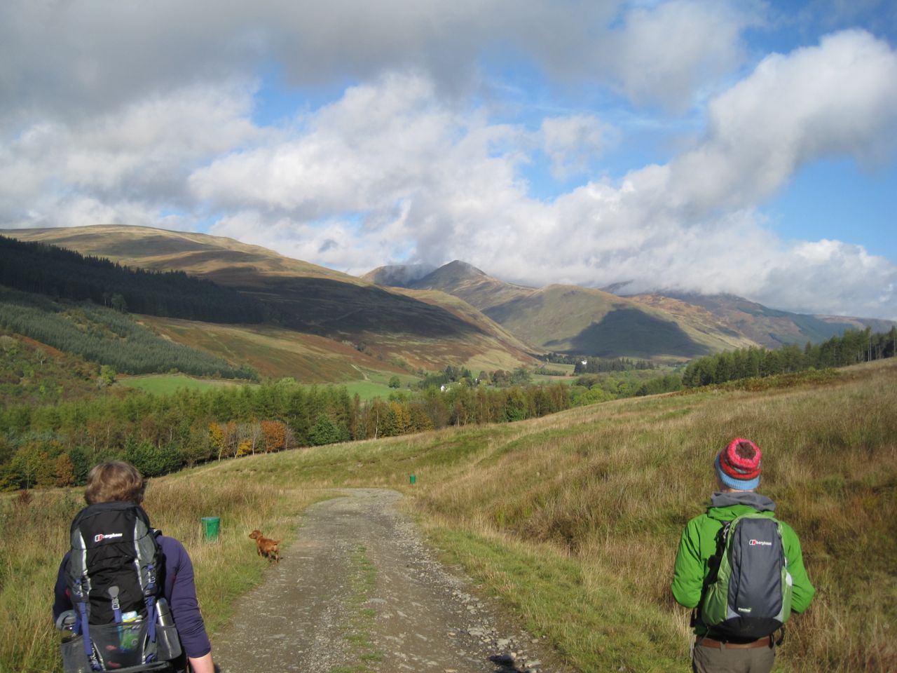
From the ruins we walked up to the path on the disused railway track. Once on the track we had our first view of the drumlin field and Pibble Hill and Stey Hill in a dusting of snow beyond it. My enjoyment of the view was somewhat tempered by feeling the first drops of rain on my face. It was soon heavy enough to force jacket deployment. At my last visit I had gone directly up onto the Clints but this time I decided to take the easier route. This is now waymarked as the Mountain End Route.
This route leaves the railway track at a wooden bench. Where once there was just a ladder over the wall, a gate now allows access to the hill and the boggy section by the wall is crossed by a short walkway. The manmade stuff soon ends however and there is a short steep climb. It was slightly annoying and hot to climb wearing a jacket, and by the time I was past the steep section the sky had cleared and I could shed the outer layer. The dogs raced up the hill ahead of me then realised I was coming up in first gear and came back down to see what was keeping me.
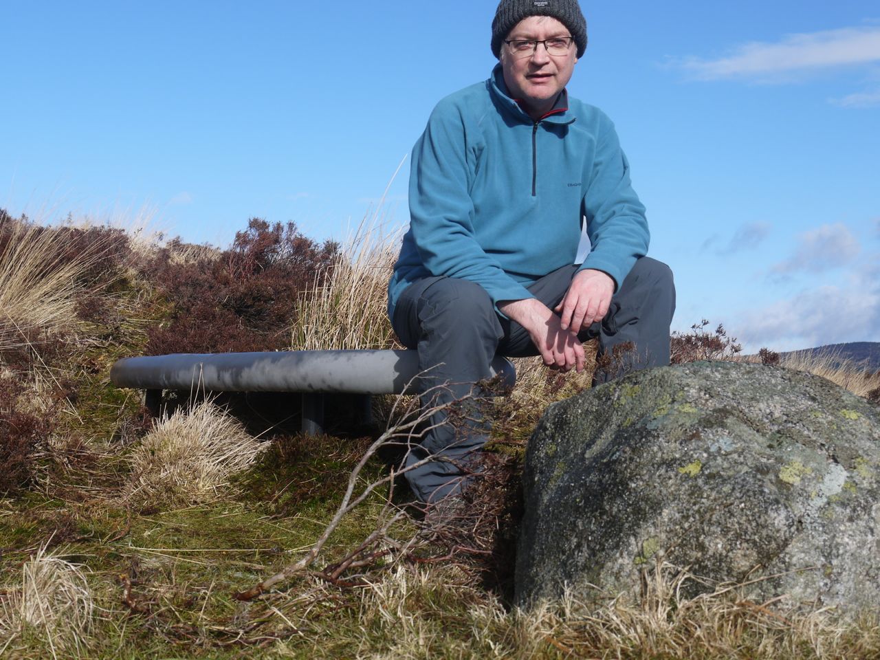
Rosnes Bench, Clints of Dromore
I wasn’t thinking about the Rosnes Benches as I walked along so was please to notice them. These benches are placed to “slow us down, create stillness, change our viewpoint and help us to remain in the moment and be part off the immediate context that surrounds us“, and I think they achieved this. The benches are on a small shoulder a little way below the top of the cliffs and I suspect I would have just kept on to the top if they had not been there. As it was I spent some time there experiencing my surroundings.
The benches were wet so I didn’t lie down on them but experiencing the surroundings is the aim I think.
Once on the exposed top of the escarpment the wind was just a little on the cold side of cooling, but not strong enough to impede movement. Just right. There is no defined track across the heather. In places people or sheep have chosen the same route and left a defined way but in others you have to find your own path. The Mountain End path way markers are useful targets to head for, but don’t always define the easiest way.
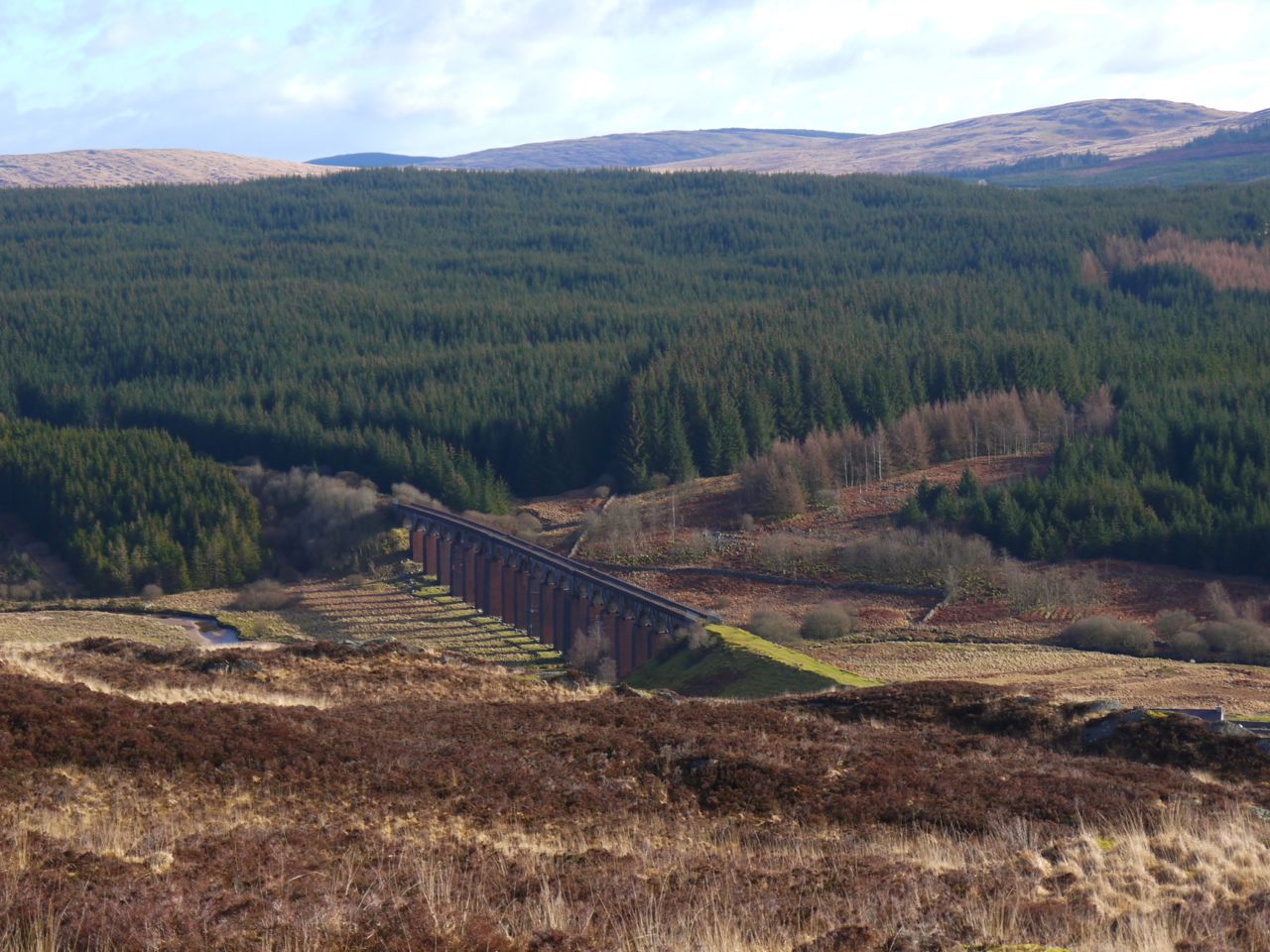
Big Water of Fleet Viaduct (telephoto)
The Clints of Dromore do not have a flat top but are cut by several dips, the deepest being named on the OS as the Deep Nick of Dromore. What this means is that the Clints seem to be made of several fingers or promontories. By sticking to the waymarked route one would lose the views to the south, so it’s worth drifting across a little.
There were sheep on the steep slopes of the dips but the dogs just looked on from a distance. More temptation was to meet us later. The visibility was good and to the north, Loch Grannoch could be seen between Craigwhinnie (and Fell of Fleet) and Craigronald, with Meikle Millyea in the distance.
Loch Grannoch and Meikle Millyea from the Clints of Dromore
I mentioned earlier that on my last visit here I had been looking for the Hush sculpture but couldn’t find it. I hoped for better luck this time but my first foray towards the edge of the Clints wasn’t successful. Looking west from this promontory however I could see what looked like a small cairn on the two promontories away. I headed for it and was rewarded.
Though as you can see the dogs beat me to it. I set up the camera with a timer to commemorate my visit but had to set it up quite a way off, but close enough for a ten second dash. So I readied myself, pushed the button, ran back to the rocks, turned and struck a pose. But the camera wasn’t on the rocks anymore, one of the dogs having knocked it over. It had fallen a metre but onto snow covered heather. I wiped it clean and tried again. Unfortunately I did not realise, until home, that the lens was a little smeared so I am blurred out. So here is a close up of Hush instead.
Hush
I was tempted to put a dog treat into the mouths and photograph the dogs apparently kissing the mouths but I suspected I would not have the speed to step back, point and shoot before the treats were eaten.
The path takes quite a turn to the north to avoid the very steep sides of the Deep Nick. This took us as far as what was the treelike the last time I was here but has now been felled allowing better views, well of the hills anyway, the forest looking a mess. We had a little more light rain which gave us a rainbow looking north and there were great views of the Cairnsmore of Fleet hills from Knee of Cairnsmore to Craigronald all topped with cloud.
Cairnsmore of Fleet
After the Deep Nick of Dromore the ground was a little boggier and in places there was standing water so it was easier to climb back onto higher ground. The mountain end signposts led eventually to a promontory and pointed onwards. I couldn’t see a definite way down so backtracked a little and found another way down. Looking back from below however I think it would have been OK to continue along the promontory. Next time.
It was between the top of Mountain End and below the Deep Nick that we were thrice tempted. Now before you get too excited, this doesn’t involve me meeting three naked sirens. It was the dogs who were tempted.
Mountain End had a flock of sheep standing in our path. They moved off as we approached, and the dogs stayed with me until they were gone. Then on the way down the slope four deer crossed our path before heading up Craig Hill. The dogs froze in concentrated attention but stayed with me still. Wild goats were the last temptation. I saw them ahead of us so slowed down and kept the dogs with me until they had passed, but some stragglers from the group crossed our path only a few metres away. I was worried that they could do the dogs some damage with their horns but the dogs kept with me when called. I was very impressed.
Below the clints there is a narrow track, probably an animal track which offers better walking than a wider boggy track lower down. There are some well placed wooden bridges to help you across waterways though these all looked to be easily stepped across anyway.
We eventually rejoined the disused railway and followed that back to the start. This was an easy stroll. My only concern was when what can only be described as a massive bird of prey swooped along the track ahead of us, initially silhouetted against the sky. Its wingspan was greater than my arm span and given its size I worried it might be able to take the younger dog. Indeed I was too worried for the dogs to get the camera up, but happily it just wheeled away. From the size I think this was an eagle. I have read that white tailed eagles have been seen here but this did not have a white tail so presumably was a golden eagle.
When driving home I passed a buzzard on a post by the road, perhaps 3 miles away, and he bird I had seen on the railway was much larger.
Forestry tracks, paths (stony, mossy, boggy), pine-needle covered forest walks, heathery moorland, fallen trees, felled trees, distant gunshots, rocky outcrops, erratics, collapsed dykes, burns, bridged and unbridged, forest (conifer, deciduous, felled and replanted), ad hoc wooden sculptures, with views of sea, lochs, hills, dales, and monument to 19th century victory.
Quite a collection for a short local walk.
Having been struck down by minor illnesses which rendered me unfit for Drow ‘n’ Smirr type walks (e.g. wandering through bogs in low cloud, facing burn crossings where the bridge is but a memory, the plunk of a foot entering an unseen pool….ahhh…the dopamine rush), this was my first outing for a wee while. I decided a short walk close to base camp would be the ticket, and being a short walk both dogs (one with unlimited energy and one who limps) could accompany me. Being slightly out of practice, I could only find one gaiter and Audrey forgot hers.
On a handful of occasions there has been a deer in the car park when I have arrived, but not on this day. The small car parking space at Kissock Forest was in fact empty when we arrived. A map here shows some waymarked walks and there were waymarker posts all the way around though their positioning seems aimed at reassuring you that you are on the route rather than directing you. I didn’t pay much attention to the colours on the posts but I think we went red, then yellow, then green, our route taking us up the northern slope of Lotus Hill, down the south slope choosing the longer route that crosses Drungan Burn, across the end of the forestry track, then down through the forest close to Drungan Farm and back along the forestry track.
The kissing gate at the car park clearly isn’t designed for a person with a rucksack on his back and a camera hanging in front of his protruding abdomen, but some wriggling got me past the obstacle. The track up the northern slopes of the hill is firm but degenerates higher up and has a couple of short boggy sections. There are pools of crystal clear water beside the track but the dogs ignored these and explored the steeper slope below the path. The scents must be more interesting there. The fields below us didn’t have any sheep so I wasn’t too worried.
The track ends at what once must have been a turning area but is now overgrown and boggy. I remember there being a bench here years ago and a bit of a view of Loch Arthur, one of the candidates for Excalibur’s resting place, but the bench is long gone and the trees so thick that I must be mistaken about views of the Loch. The waymarked route turns left along a narrow path up the hill, though a faint track does continue on.
The single file path winds up through the trees, the friable ground on steeper sections transmuted into mud requiring care by the humans, but of no concern to the dogs who happily ran up and down through it. Once out of the trees and on the heather covered hill top we had our first good views of Loch Arthur. The way here is through boggy ground, sometimes obviously muddy with tricky sections of bright green moss that might support a foot but could just as easily give way into water. This reminded me of stripping the willow, flinging yourself, or being flung, with gusto towards a waiting dancer to find her arm is just there for show and isn’t going to twist you back into the dance.
Criffel in cloud
Well, across the moorland and on to the summit, where stood another walker with a spaniel (volume set at 11). Eddie was hackles up, Sweep unperturbed. The walker and his spaniel, peace disturbed left the summit to us and we had nice views from the top, Criffel’s summit hidden in cloud, Waterloo Monument below it. Stopping was not to Sweep’s liking however and he barked and barked and barked until we got going again.
I wonder if one day I should come over Lotus Hill and head across to Cuil Hill. I bet that will be battle with tussock and bog. Best done during a drought perhaps.
We headed down the southern slope of the hill, along the obvious track and used the stones of the collapsed dyke as seats for our coffee break. For reasons that escape me, Sweep tried to climb onto the wall, which wasn’t a good idea with his arthritis. When denied that option he took to rooting in holes, but the rabbits must have been beyond his reach.
Post coffee, onward. Down to the forest again and along a wide forest break carpeted with the friable moss. The dogs running ahead gave us some warning as to how deep one might sink into this. The gap between the trees then lessened and we walked around several large erratics that would be good seats for lunch. We passed the well walked waymarked path leading back down to the forest track and continued on the other waymarked forest break, but now without any discernible path. A word of warning here. If you are expecting to take the shorter route beware that a path seems to go off about 50m before the real route. I’ve used that by mistake before and it goes nowhere.
We crossed the Drungans Burn which at this level is two small watercourses that are easily stepped across. I fact you could hop across them if you felt inclined. After more forest break and erratics we emerged at the turning circle at the end of the main forestry track. The trees below here have been felled so there is now a good view across to Mabie. A wooden bench sits here for the weary to rest. That wasn’t us. The bench used to be a little further up the slope amongst a mire but I presume it has been moved since the tree felling.
We could now look back up to Lotus Hill and see the wall where we had our coffee. We now had a choice of walking back along the forestry track or taking to the woods again and chose the latter. It isn’t particularly obvious where the path leaves the forestry track but that said, it isn’t particularly hidden. The dogs went along it unbidden. Initially this descends through felled forest but the path hasn’t been destroyed in the felling. We walked past several curious wooden things that I had previously thought were pulleys but they are in fact just stacked wood.
Once back in the trees we had a few sections of boggy ground but most was firm. We crossed the burn again but this time on a footbridge and soon emerged back onto a branch of the main forestry track and followed these back to the car.
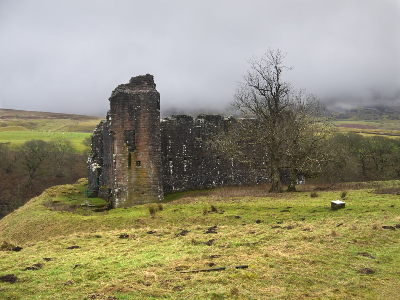
Easing myself back in to walks, I decided to visit Morton Castle and explore Morton Woods which proved a shorter walk than I had expected.
Morton Castle stands on high ground above Morton Loch. The original castle may have stood here since 1260 but the present buildings date from the mid 1400s. Presumably there would not have been much of a loch back then since the loch’s dam is only a couple of hundred years old.
Since we were visiting in drow ‘n’ smirr the views were a little limited and the castle isn’t shown in its best light.
After exploring the castle we headed back to the entrance gate to cross the road into the woods. The kissing gate, as seems usual, swung over a dirty puddle of uncertain depth. Since the dogs went before me I was forewarned to step around its edges.
Once in Morton Woods I found there were some waymarkers so I decided to forego my planned route and see where the waymarked path took us. As a backup, since Sweep has a bad leg I decided that if we weren’t obviously heading back by 45 minutes we would just re-trace our steps. I imagine in better weather there might have been some views, but we had to make do with trees.
The dogs enjoyed splashing through the puddles and running into the woods, while I picked my way around puddles. We spent the early part of the walk on forestry tracks through a piety of woodland: young conifer, some deciduous and felled wasteland.
The last way marker we passed, set on a short piece of wood on the ground, had I presume been repositioned, whether by accident or malice I cannot tell. But rather than following the forestry track off to the left we continued along a less well maintained track. I suppose in retrospect it was just the track left by vehicles involved in felling.
There was more mud, larger puddles, and more detours to keep going. We did though seem to be looping back to where we started so on we forged. The path, looking less and less like a track, turned up hill cut back on itself then gave up any pretence of being a path.
The forest break
A forest break headed up from my left so we headed up along that. There wasn’t any sign that it had been used as a path but at least there weren’t that many boggy sections. Any hope that this might still be the way marked path when the forest break ended. I am sure the dogs could have made it through the woods but the branches down to knee height would have stopped me.
The lactation of conifers
A little to the left was a plantation of young conifers (PS the laptop tried to autocorrect plantation to lactation). Between us and the lactation of conifers was a barbed wire fence, but luckily, amidst the fence posts at the fence corner, was a space large enough to get the dogs through. There was a 5m margin around the new trees, which was mostly grass, and not boggy, so we followed that which led us back to the minor road near Morton Mains.
Morton Loch
From there it was just a short way back to the car, but since it had ben just a short walk we went back to explore the castle again before leaving.
9.0 miles 5h 29m 552m ascent max elevation (Queensberry) 697m
Route: Kinnelhead-Blairmark-Harestanes Heights-Mount Glass-Pot of Ae-Lochanhead
A gentle stroll up Queensberry from the NE, taking in Harestane Heights (picture above). The forecast said that any rain would clear up after lunchtime, but the weather didn’t get the memo.
By the time we had driven up the Crooked Road the rain was falling heavily and it was clear we were in for a walk in waterproofs. I had sudden anxiety that I had forgotten my jacket, which would have meant abandoning the walk before it started, but it was there on the back seat so the walk could go on. I had intended to park at a very large cleared area a kilometre short of Kinnelhead but it now has large rocks around it preventing vehicle access. So on we drove but at the bridge over Kinnel Water the road has a “private road” sign so we turned back and parked just off the public part of the road. Getting our waterproofs on in the car was a bit of a challenge but we succeeded and set off with Eddie on his lead (until we were away from livestock).
Craighoar Hill from Kinnelhead
We walked at first along the track following Kinnel Water. One route I had read suggested following Threepenny Burn and then climbing Craighoar Hill but the steep slopes of Craighoar did not look particularly inviting. We walked on past an abandoned cottage at Blairmark and over a small bridge. Then the track started to climb across the northern slopes of Craighoar Hill. Below us a track crossed the burn on a footbridge and would head back to Rivox and the SUW, a good low level circular route for bad weather.
At a crossing of roads we went straight on until we were almost at the heighest point of the track. We paused at a gate here for a breather, much to Eddie’s annoyance, and the photo below is taken from there. Then we struck off directly up the hill and in to the mist.
Kinnel Water and footbridge (path to Rivox)
I find climbing slopes in mist quite sapping. It is difficult to gauge how much further there is to go and there isn’t much to see other than the ground. So we just trudged on up. There is a fence not marked on the OS map and I thought it might mean we were close to the top of the ridge. It’s about two thirds of the way up. We needed to divert a wee bit to use a gate next to the tree line so there is little to be gained by heading more directly for Harestanes Heights unless you want to climb a barbed wire topped fence. There might be another gate for all I know, but we couldn’t see far.
In better visibility I would have walked up to the edge of Craighoar Hill for the views but as it was, once we got to the top, we turned right for Harestanes Heights. We were given a brief glimpse of the ridge leading up with a couple of cairns visible. A moment later though they disappeared back into the mist and we pressed on with the wind and rain blowing in our face. It was around here thatI felt water running down my neck.
The two cairns we could see were not far away and when there we had another lifting of the mist for photos. Eventually we reached a sizeable cairn and checked the GPS to check where we were. This was the cairn at the 578m spot height of the unnamed hill between Craighoar Hill and Harestanes Heights. We left there on a compass bearing descending in the mist to a waterlogged col.
Harestane Heights 566m summit
A drystone dyke barred our way up the further slope. As we drew closer I could see a gate but it seemed to be up against the wall rather than guarding a break in the wall. No photos of this unusual set up I’m afraid since the rain was keeping the camera under cover. I could see a short section of wall that had partially fallen so we headed for that but once there we found a new fence, with unrusted barbed wire running this side of the wall.
I walked up the the strange gate 75m or so to my right and found we could get between the fence and the wall and walk back to the fallen section of wall where we squeezed between the stones and the remains of an older fence. Why a vehicle sized gate has been put up against a wall escapes me.
Another cairn marks the top of Harestanes Heights but too small to offer much shelter. By then I could have done with a break and some carbohydrate but with the weather we decided to press on until we got better shelter. This meant I was in first gear.
Fortypenny moss
While coming down onto Fortypenny Moss we had occasional glimpses of Queensberry looming before us. Hills do look bigger in the mist so I tried not to get too dispirited. The higher ground of Fortypenny Moss has numerous peat hags so we accepted a little more descent and reascent, avoiding the hags. There was no escaping the marshy ground though.
Mount Glass now stood between us and Queensberry, a little more uphill before getting back into the marshy ground below Queensberry itself. My plan for climbing Queensberry was relatively easy. Head uphill, pass between two burns (Crook Burn and Hangingshaw Linn), walk to the acute angle in the wall/fence and then uphill to the summit. There did seem to be a faint quad bike track initially but that soon disappeared. Amongst the desolation, and lack of paths, there was a single well-defined boot print in the ground, so others had come that way.
The climb up Queensberry was a recurring cycle of seeing what looked like a large cairn at the top of a hill and then finding it was a stand of grass or a lone rock, and certainly not the top. With each disappointment we stopped briefly, gathered our energy, then pressed on. Then came the fence, and relief, since I knew we were now close to the summit.
A hare jumped out ahead of us and ran off with Eddie in pursuit, 12,000 years of domestication having failed to breed the predator out of him. The hare went through the closed gate but Eddie couldn’t follow so the hare lives to run another day. Eddie didn’t notice the vole (I think it was a vole anyway) that scurried across our path on the way down later in the day.
The ground changed becoming more rocky and less mushy and Eddie ran on ahead coming back when called but looking as if he had something on his mind. A few more paces on and I could see the problem. There were sheep on the summit of Queensberry, so poor Eddie went back on his lead until they had wandered off.
Queensberry was shrouded in mist, it wasn’t raining as such but the air itself seemed wet, and worse of all the wind was strong enough to blow Eddie aside and make it difficult for us to stand up without being buffeted to one side. This played havoc with our summit photos and there was no chance of setting up the camera with a timer.
Queensberry summit
We hunkered down in the stone shelter by the summit cairn, sheltered from the worst of the wind. The sandwiches and coffee were very welcome and we knew the worst was over. Ah, ignorance is bliss.
Fed, watered, and rested, we knew that it was all downhill from then on. As I have done on all my visits to Queensberry I took a bearing and we descended in to the mist. We were soon out of the wind and the cloud base was rising so we were soon able to see the way ahead. We followed the fence down to the Pot of Ae. This is a steep descent, not a big problem, except for the knees, but I wouldn’t want to attempt it in snow.
Pot of Ae, NT0000 is down there
Our route was then along the tree line, though many trees have been cleared for wind turbines. This section of the walk was very boggy in places and there were several small waterways to cross. Eddie was a useful point man, I watched to see how far he sank to gauge whether I should take a particular line through the waterlogged reeds.
This section went on and on and on, the sound of squelching feet mixing with the whoosh of the turbines. The most interesting aspect was walking through square NT0000. There was no sign of Lochanhead and I began wondering if we could be going the wrong way, but there was no mistaking that we were between the tree line and Lochan Burn, just where we were supposed to be. In actual fact it wasn’t that far, just under a couple of miles, and it didn’t take us particularly long, it just seemed that way.
Eventually we came to Lochanhead. We could see a a nice dry rocky path on the other side of the Lochan Burn but where it came down to the burn there was no way to make a dry crossing. I presume the burn was a little fuller with the recent heavy rains. The south bank of the burn, where we were, was particularly boggy and poor Eddie slipped into a pool and needed help to get out.
Looking ahead we could see cyclists on what turned out to be a newly built road emerging from Ae forest which presumably serves the wind farm. So we headed for the road, climbed onto its firm rocky surface and walked along it to the burn expecting a bridge. The road just ended there. No bridge.
This called for a plan. After a break for a drink we had our options in order. We walked back up the burn a little way. No dry crossings there, and we couldn’t face walking too far back up the hill. Next we tried continuing down along the south bank, but our way was blocked. So we embraced nature, accepted wetness, and decided to wade across. We found a place where it was mostly less than knee deep, got wet feet and climbed out onto the far bank with boots full of water. Eddie can’t cope with moving water yet so he got carried part way across then flung onto the bank.
There was then a maze like walk between parallel fences to get onto the road from Lochanhead to Kinnelhead. The ground between the fences was either waterlogged or flooded, but since we already had wet feet that wasn’t a problem.
I tried lifting my feet to let some water out of my boots, to no avail, and found myself torn between wanting to empty the boots to reduce the sensation that I was walking in water-filled wellies and the competing feeling that I couldn’t be bothered with the effort. I decided to try taking one boot off, emptied out water and squished my foot on a rock but that didn’t make much of a difference. Perhaps if I had changed socks it would have helped but since it was only about a mile back to the car we just squelched on.
As we reached the car, the heavens opened again, just to make it more troublesome for us to get changed.
PS That was a strenuous outing. I had some discomfort in my left calf as I walked. I am now limping badly when I move and finding it difficult to keep my eyes open when I sit down. Eddie is asleep at my feet which is usual for him. Even his energy has a limit.
Route: SUW from near Craigbeck (low level route) then along the Selcoth Burn to Sailfoot
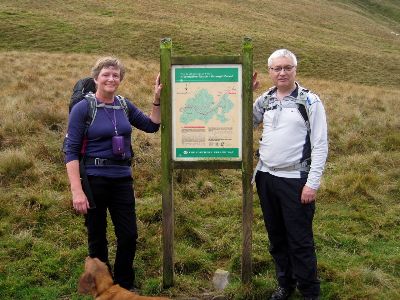
Despite completing the SUW coast to coast in July, I was left feeling that the job wasn’t done until we had walked the two alternative sections. We had been back to walk the alternative route between Cogshead and Wanlock Water, and now we were ready to finish the last remaining section. When walking the Beattock to Potburn section we had previously used the high level route over Croft Head with its stunning views of the Moffat Hills. Now we needed to walk the low level route through Garrogill forest. This low level route is slightly longer by a few hundred metres but with 250m rather than 400m of ascent. Rather than doing the whole Beattock to Potburn section I chose a shorter walk, joining the SUW near Craigbeck and heading back along the Selcoth Burn.
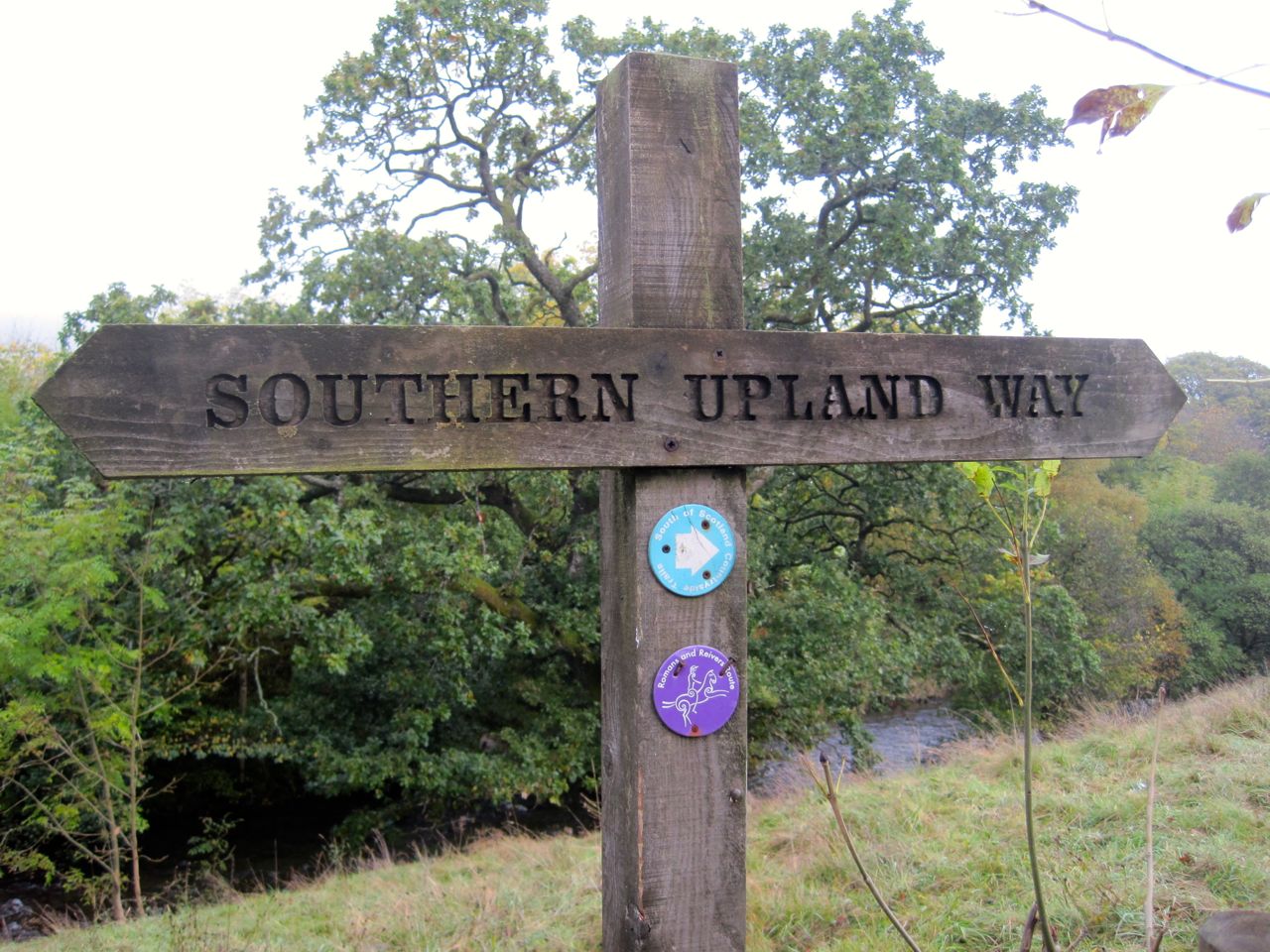
Audrey, Conor, myself and Eddie (the pup on his first 4+ mile walk) set off from the A708 near Craigbeck, along a minor road and joined the SUW after crossing the bridge over Moffat Water. An SUW sign here also sports a Romans and Reivers marker so hopefully that route will have way markers when we come to do it. I took out the camera to get a photo….and it wouldn’t turn on. I had forgotten to put the battery in it. Luckily the back-up camera was charged and looking on the bright side, I could carry the point and shoot in my pocket rather than having the heavier camera round my neck.
SUW sign with Romas and Reivers marker
So with bigger camera stowed, and the wee camera in my pocket, I took Eddie through the gate beside cattle grid and we followed the farm track up a gentle slope. The cows were on the far side of the field and Eddie didn’t notice them being more interested in the nearby cow pats. There is a rather surreal gate here with a “lock the gate” sign and a STOP road sign just beyond it. This gate even if locked, and it was, can be walked or driven around since there is no fence at the side of it.
At the top of the field we came upon some sheep and a long necked black creature that Eddie found frightening. We can now add llama to the list of animals seen during our SUW walks. We past the last livestock here and Eddie was free to roam, taking the strain off my arm.
Misty forest
When we were last here there were good views along the Moffat valley but unfortunately we were walking in mist so there was little to see beyond our immediate surroundings and by the time the sun had burned it away we were in the valleys.
Craigbeck Hope
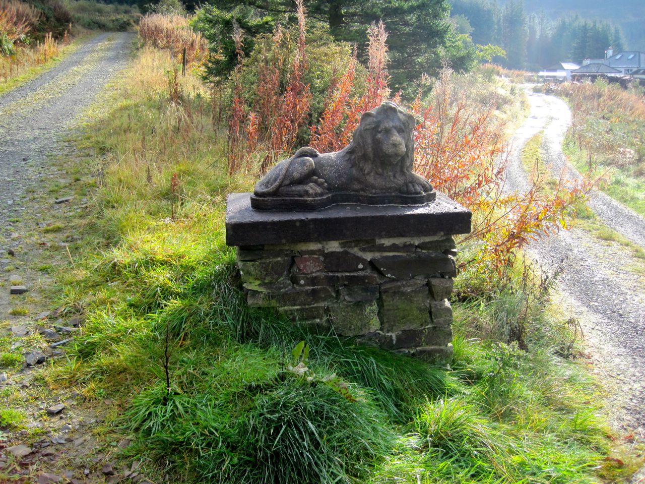
The walk was a slow climb along forestry tracks initially enclosed among the trees and then more open once we crossed Cornal Burn. Soon after passing the place where the SUW routes diverge we came to the isolated buildings at Craigbeck Hope with their Lion topped gateposts, a good excuse to stop for photos and a breather.
After a further mile and a half the forestry track dog legs, the Romans and Reivers route continues on the track but the SUW leaves on a narrow path through a forest break beside Wamphray Water. The ground within the dog leg was a profusion of different greens, looking too bright to be real but the point and shoot didn’t do it justice.
Eventually we could see Croft Head above us and Craigmichen Scar ahead. An information board stands where the alternative route join. We stood there, having now completed all of the SUW, “every inch” as Audrey put it. The SUW’s end is rather elusive. I felt I had reached the end when I stood with the sea lapping my feet at Cove Harbour, but later stood beside an information board claiming to be the end and later still, the Mercat Cross in Cockburnspath which the official guide has as the end. But it is done now and I feel the spell that had driven me along the SUW has been lifted. I am released to walk other paths if I choose.
Cat Shoulder
The end of the SUW it may have been, but not the end of this walk. We had a late elevenses/early lunch in the sheep fold below the zig zag path of Cat Shoulder. It was not raining but the stones of the sheepfold suggest that wet is their usual state. The moss growing on them looked like seaweed.
Narrow track above Selcoth Burn
There is a narrow track along the Croft Head side of Selcoth Burn. This crosses a steep scree slope and at times winds along rocky sections that are eroded in places. I wouldn’t want to walk here in bad weather but it soon levels out. We were able to cross the burn and join a farm track on the other side that took us down to Selcoth and then Sailfoot.
By now the mist was gone and the sun shining on the Moffat hills. Eddie had a good time jumping through the bracken, and luckily he didn’t notice the deer on the track ahead of us.
Route: Crawick Water at Nether Cog to Cogshead then the northern SUW loop to Wanlock water and Wanlockhead
Between Cogshead and Wanlock Water the SUW offers two routes, and when we last came this way in October, walking from Sanquhar to Wanlockhead, we took the route over Glengaber Hill, which is shorter. Having completed the SUW coast to coast I felt drawn to walk the alternative routes as well for completeness. The weather forecast was an amber warning for heavy rain all day, so we had a day in waterproofs. It certainly proved to be a wet day, but sometimes it was only light drizzle.
I presume this longer northern route exists to provide an alternative way across the hills if there is grouse shooting on Glengaber Hill. Descriptions I’ve read don’t exactly sell the Duntercleuch route, suggesting it is a boring trek along forest tracks with nothing to see but trees. And to be honest, there isn’t much evidence at Cogshead that the Duntercleuch route even exists. The SUW signpost at Cogshead only points towards the Glengaber route and gives no clue that there is a second route.
Cogshead is a bit isolated and getting to it offers limited options: The Glengaber SUW route from Wanlockhead, Stood Hill from Wanlockhead, the SUW from Sanquhar, or Nether Cog to Cogshead. Rather than walk routes I had used before I thought I would try something different, so we set off from the minor road near Nether Cog. A small bridge took us over Crawick Water then we followed a farm track that zig-zags up the steeper slopes of the hill. This gave us some views up the Crawick Valley albeit limited by the rain. On the flatter section we were faced with a junction. The main track continued on and another track went off to the left. A weathered signpost indicated that the onward track led to Sanquhar but the other part of the signpost was partially obscured by moss. With a little effort though we could make out “Cogshead 6km”. So that was our route.
This track led into the trees and then wound around the slopes of The Dod, steadily climbing until the cleuch of Glendorch Burn on Conrig Hill. The experience here is of walking uphill hoping each time we approached a bend in the track that we would find the climb was over.
Cogs Burn
From the track above Cogshead we could look down on the ruins of Cogshead, the SUW signpost and the rather unusual grassy hillock. Is it a hillock or is it a saddle? Who knows. From this point I stepped up my level of alertness. We had missed one of the SUW’s hidden kists back in November and this was a second chance to find it. We found the Ultreia marker post and knew the secret horde to be somewhere nearby.
The trees beside the path had been felled in the last few seasons and I thought that if the kist had been among the trees it would now be lost. But I kept my eyes peeled for the unusual and spotted something unnatural, the kist. I scrambled to it, pulled it open and retrieved my treasure, a bright coin with a pine cone emblem. I can see how easy it would be to overlook it.
Hidden Kist
Now we were back on the SUW and ready to take the alternate route. I had a recollection that the signpost at Cogshead had pointed to both routes when I was there in 2012, but I have since dug out the photos and I was mistaken. The photos do show though that the weather deteriorates with each of my visits to Cogshead.
The track from Cogshead wasn’t the boring forest trek I had been expecting. There has been tree felling but long enough ago that the desolation of the felled forest has been replaced by regenerated growth, heather with its purple flowers, bracken with green and yellow fronds and bright green saplings. And there were open views across the northern reaches of the Lowther Hills.
Kirkconnel’s Hills
I began to wonder if the SUW still considered this trail part of the official Way. We saw no SUW marker posts and there were no stiles or SUW kissing gates, so we had to use the normal gates which though not unheard of is unusual on the SUW. After about 2.5 miles of this forgotten route we reached a T-junction. Just a little while before this I had commented to Audrey that I wasn’t sure what direction the track was heading, having followed a wriggling route for over an hour. My compass was tucked away with the map in my rucksack, sheltering from the rain.
I wasn’t expecting the T-junction and having lost all sense of direction I realised I would need to get the navigation gear out. But then we noticed the SUW marker post with a bright yellow arrow instructing us to turn right. So the SUW hadn’t forgotten this route after all.
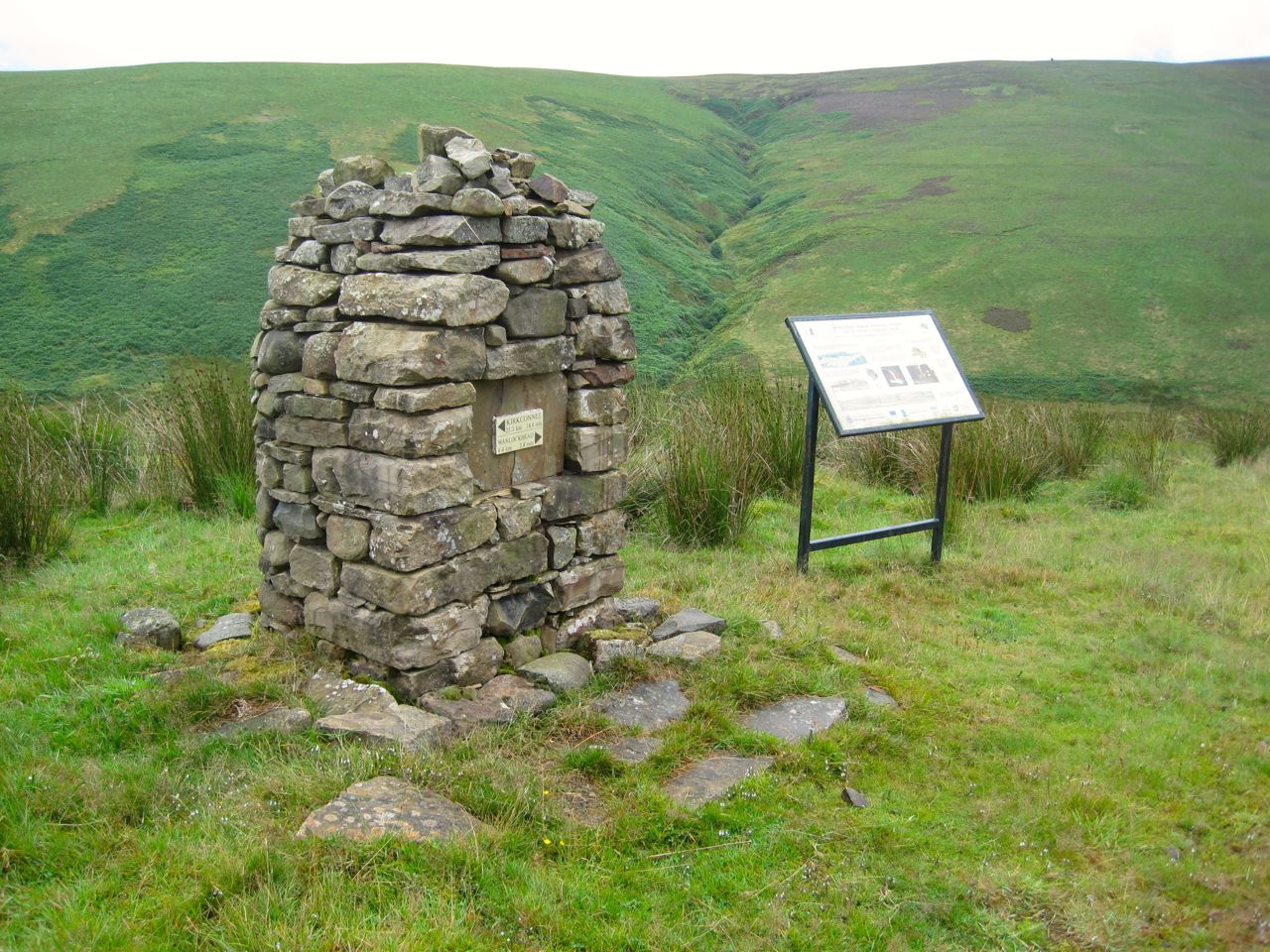
The marker post also had a Kirkconnel Paths Project disc, so we were joining the Kirkconnel Geology Trail. So we turned right and continued on our way. After another couple of dips and climbs we were looking down into the valley of Wanlock Water. A cairn above Duntercleuch, associated with the geology trail, informed us we were 14.4 miles from Kirkconnel and 2.8 miles from Wanlockhead. From there it was a welcome downhill stroll to the river.
From a distance Duntercleuch looked inhabited but close up it was in serious disrepair, especially the roof, and not fit for habitation. A small weather station stood on the hill nearby.
Wanlock Water
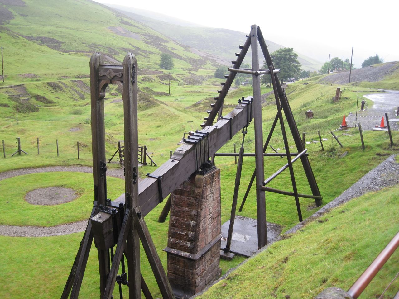
At Wanlock Water we had a choice, a bridge or a ford. I chose the bridge after stamping on it to test its firmness. The ford though would be easy to cross with dry feet (in waterproof boots). We then walked along the track, passed the point where the other SUW route rejoined us. The rain became heavier so we pressed on past the lead mining ruins of Sowen Dod, the ruined smelting works and the Beam Engine, into Wanlockhead. We spotted a heron flying along the river but too far away for photos.
Beam engine
I’ve walked this last section a couple of times before and always thought of it as flat. It was obviously uphill this time. Perhaps in nice weather I didn’t notice the gradient? At least the Visitors Centre gave me a dry place to get changed.
So that’s another 4.8 miles of SUW done.
[sgpx gpx=”http://www.screel.co.uk/walks/wp-content/uploads/2014/08/RK_gpx-_2014-08-02_0928.gpx”]
The 212.6 miles of the southern upland way include coastal cliffs, upland moors, hills and mountains, meadows, riverbanks, loch side paths, farmland, parkland, woodland, country estates, paths across dams, farm tracks, drove roads, roman roads, ancient trade routes, and coffin routes. There are numerous stiles, kissing gates, and many bridges to cross both literal and metaphorical. The trail visits neolithic burial sites, cairns old and new, lead mines, ruined farms, pele towers, ancient earthworks, modern sculptures, fairy wells, castles, standing stones, covenanter memorials, one of the seven stanes, and the world’s oldest post office. Nature is all around, deciduous and coniferous woodland, numerous plants, farm animals as well as rabbits, hares (in both winter and summer coats), deer, mice, squirrels, foxes, and various birds both large and small. We walked in all weathers and trod upon dirt, mud, rock, grass, tussocks, heather, sand and even seaweed.
Our lunch spots were grassy knolls, tree stumps, sylvan glades, hillsides, a bus shelter, dense forest, moors (bleak and less bleak), ruined buildings (twice), deserted sheds, stiles (twice), sheep shielings, benches, dips, logs, and mossy banks.
According to the official guide the SUW is 212.6 miles long , but our GPS logged 230.2 miles. 6.8 miles were diversions off the official route either to visit interesting places or get to/from our cars, so our SUW distance was 10.8 miles longer than the official distance. 11.1 miles were above 500m and our highest point was at 725m on Lowther Hill. The SUW misses the top by 2m but we went the extra 2m.
The official guide splits the walk into 16 sections, varying in length from 7.75 miles to 20.5 miles. I split the walk into 19 sections, varying in length from 8.7 miles to 15.2 miles. The longest walks whether in distance or time were not the most arduous and in retrospect I think we were right to keep the distances below 15 miles for each day. We had more time to stop and stare.
The plan had been that a group of us would walk the complete Southern Upland Way one day at a time. I had foreseen that we would not all be available to walk each section together so some members of the group might walk some sections on different days, but I hoped we would resynchronise every so often. The first such synchronisation was to be at Beattock. I expected to re-walk some sections and thought the whole thing might take us 18 months.
Audrey and I have now completed the walk (between August 2013 and July 2014), but we were joined on several sections by other friends: David, Elaine, Joanna, Derek and Gwyneth. The company was a great help and everyone did their bit providing humour, stoicism, knowledge, encouragement, navigational advice, sweeties (both natural and processed), transport, eagle-eyes, and sunscreen when needed.
My recurring fantasy was of sitting with my feet in cool running water at the end of a hot day’s walking, and at Abbey St Bathans I sat in the sun, at the end of a 12 mile walk with my feet in the cool waters of the Whiteadder. Living the dream.
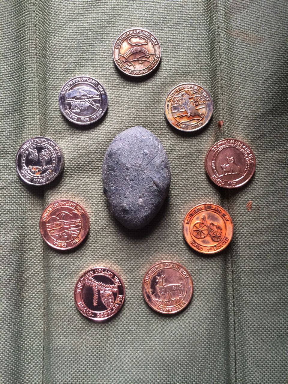
I carried a pebble from the west coast to the east coast. Hidden along the way are thirteen kists, hordes of specially minted coins called 13ths hidden in individually sculpted containers. The word “Ultreia” is found on way-markers to give clues that the kists are nearby. We have come away with nine. (PS we subsequently found a tenth)
There are two sections with alternative routes. Between Cogshead and Wanlock Water there is the standard SUW route which takes a direct line across the upland moors and the longer alternative which I imagine exists to provide a detour if the moors are in use for grouse shooting. It winds north along forestry tracks through what is mostly forest on the map but is much more open now after felling. This track joins the “Set in Stone” geology trail for the last 2.8 miles into Wanlockhead. We returned to walk the alternative route in August and found the coin horde we had missed before.
We walked the other alternative route in October. It offers a choice between a high level route over Croft Head (637m) or a low level route beside Wamphray Water. I can only presume this is to offer a detour if the lower level route is closed for forestry operations or the weather makes the high level route too dangerous.
A few more stats:
Average mileage 12.1
Average climb 542m
Average time 5h 45m
Average mph 2.2
Average in excess of Naismith’s predicted time 30 minutes
Maximum elevation – Mount Lowther 725m
Minimum elevation – The North Channel and the North Sea sea level
Maximum climb – Beattock to Potburn 881m
Smallest climb – Tannylaggie to Caldons 263m
Total Net Climb – minus 39m (yes it is possible)
Shortest walk – Sanquhar to Wanlockhead 3h 45m (also shortest distance 8.7 miles)
Longest walk – Clenrie to Stroanfreggan 6h 37m (flooded fields etc)
Quickest pace 2.6 mph (Galashiels toLauder and Lauder to Watch Water)
Slowest pace 1.8 mph (Beattock to Potburn, steep climbs and trudging through snow)