
8.88 miles 4h 28m ascent 217m
Mossdale to Merrick (part 4)
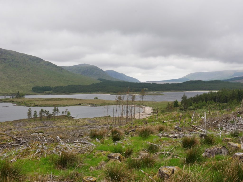
Loch Dee looking north
Craigencallie to the Axe Head Stane
Part 5 of our Raiders outings took us from Craigencallie to the Axe Head Stane (and back). Had car sharing been allowed this section might have taken us to Loch Trool. But there is something about retracing ones steps. Things do not look quite the same and I noticed things returning along the same route that I had missed on the way out, such a the big gate only noticed when walking back. So unexpected was the gate that I checked it hadn’t been installed while we were walking.
There are ruined walls at Craigencallie but the house still stands, and if not occupied it and its gardens are certainly maintained. Creagdn Cailleaich, means crag of the old woman and legend has it that Robert the Bruce stayed at the old woman’s house here.
King Robert, being by a part of the English army defeat in Carick, fled into the head of Lochdie to a few of his broken partie, and lodging in a widow’s house, in Craigencallie, in the morning she, observing some of his princely ornaments, suspected him to be a person of eminence, and modestly asked him in the morning, if he was her Leidge Lord. He told her “Yes”, and was come to pay her a visit; and asked her if she had any sons to serve him in his distress. Her answer was, that she had three sons to three severall husbands; and that, if she was confirmed in the truth of his being their sovereign, they should be at his service. He askt her farther, if she could give him anything to eat. Her answer was, there was litle in the house, but agust meal and goat’s milk, which should be prepared for him ; and while it was making ready, her three sons did appear, all lusty men. The King askt them if they would chearfully engage in his service, which they willingly assented to ; and when the King had done eating, he askt them what weapons they had, and if they could use them; they told him they were used to none but bow and arrow.
A Large Description of Galloway (1824), Andrew Symson
Black Water of Dee
A sign at Craigencallie warns that unauthorised vehicles should go no further, but there is space to park half a dozen cars. We have walked this route a good few times, in sunshine and in rain, with dogs and without, heading west and heading east, but each time we see the view in the photo above I am reminded of Malcolm Harper’s description:
Loch Dee is a lonely mountain lake, in a treeless waste, about five miles north-east of Loch Trool, and is only approachable by the pedestrian, or by very rough bridle roads. Heath and moss, rocks and stones without end, and jagged hills, with here and there bright verdant patches on their rugged sides, form the chief features of the landscape. Agriculture is nowhere to be seen, and the traveller might in a day’s walk not alight on a human habitation. The whole region being one vast sheep farm, only here and there a solitary shepherd’s sheiling is to be found in low sheltered places. The district is not opened up by roads, and its interesting character is but little known — its solitudes
Rambles in Galloway: Malcolm M’Lachlan Harper (1876)
being seldom trodden save by the shepherd, the sportsman, and the student of nature.
We had it easy, walking along a forestry road built long after Harper’s time. When it was built I cannot say but OS maps from the 1950s still show the track ending at Craigencallie. The land beside the roads does not look particularly easy going wherever you look. Indeed when I spotted some orchids growing a just few metres from the track I decided not to venture over for a closer look.
At the Green Burn I spotted what looked like a human-made artefact by the stream, then noticed one near enough that I could scramble down to investigate. A note explained that the box contained a data recorder for monitoring the depth of the burn.
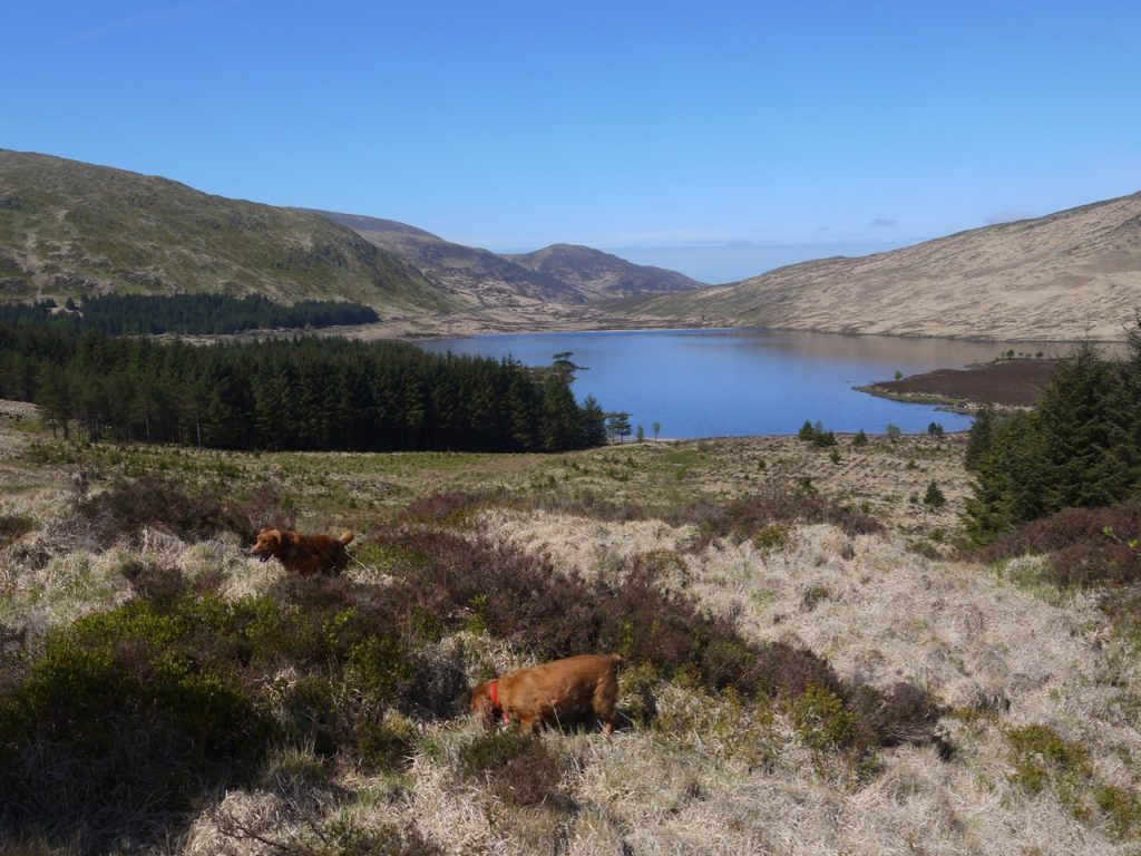
Loch Dee and Lamachan Hills
2015
There had been a great deal of felling since we were last here. Places where once we would have been walking through mature forest we found ourselves able to see much further with only low eared willow between us and the distant hills. The views seemed quite different from those I recalled though, looking at old photos, close to the loch itself they might not have been quite as different as I had thought.
The wee photo here is from a similar direction as that above it though the older photo has an old spaniel, prone to rooting about in the undergrowth and the recent one a younger spaniel whose attention is generally directed above ground.
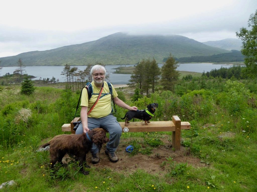
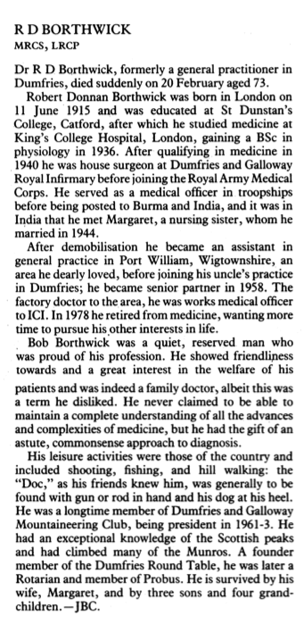
Borthwick’s new bench
The old wooden bench that once stood here or hereabouts has gone, as has the Angler’s hut but there is a brand new bench with a Southern Upland Way Sign and a similar inscription to the old one:
“In memory of
Robert Donnan Borthwick
1915-1989
A Doctor in Dumfries for 33 years
He loved these Hills.
Donated by his family March 1989″
The old bench had the same inscription though the dates were 1914-1989. I’m not sure it is exactly where the original was but I doubt that matters much. I share his love of the area but my doctoring in Dumfries falls short of his by five years or so. And just so he isn’t forgotten….
The finding of any bench on our walks is of particular interest. Many is the wet bank we have have sat upon and many the mile we have walked, eyes peeled for a seat that will offer rest, with dry feet and dry backsides, freedom from midge, bee or cow, safety from the more uncomfortable elements and a view that adds joy to the repast. Such places are not unknown, but rare to find when needed.
We found ourselves walking uphill a little more than I remembered and as we approached the hollow between Cairnbaber and Curleywee. Curleywee is a wonderfully strange name but is just a simple description, Cor le gaeith (pron. gwee) the peak in the wind. Cairnbaber, I can’t find a meaning for. Older maps have Cairnbaber as Garnbabbyir or Carnbabyirt, which hasn’t really helped me much. Cairn is obviously hill and I wonder having looked up at Cairnbaber from the glen, if the “baber” might have been bábhan, rampart. That would be a true description of the hill as looking like a rampart. That would be a mixture of Gaelic and Norse but it wouldn’t be the first hill with a name of mixed parentage.
As we walked, a distant cuckoo called, the clouds descended, the wind became noticeably cooler and the first faint drops of rain brushed my arm. The dachshund who won’t venture into the garden if it’s raining, paid no heed. The spaniel, I am sure, didn’t care one way or another. We wondered about jackets. But the rain didn’t come.
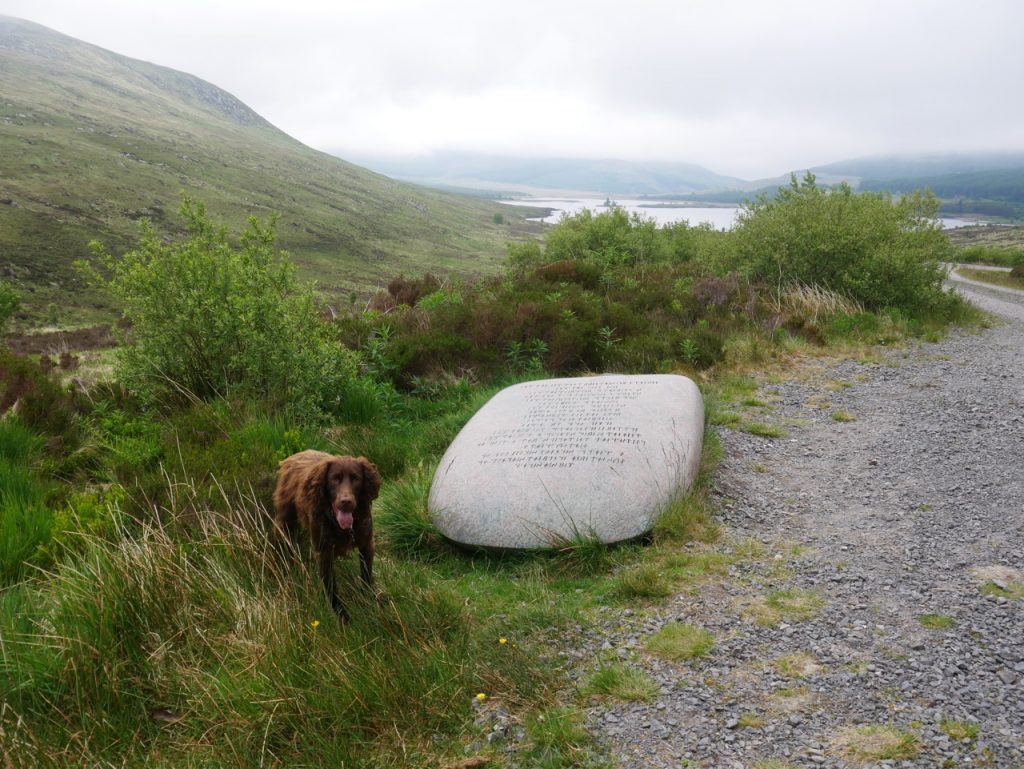
Black Laggan
The ruins in the photograph above are those of Black Laggan. I’ve tramped across to them in the past, but the ground between them and the track is a lot boggier than it looks in the photo. I admired it from afar. Malcolm Harper had stayed there a century and a half ago.
Depending upon the frank hospitality and honest kindness which in olden times characterised the peasantry of Galloway, we had taken little, save a few necessaries of apparel, in our knapsacks; and on arriving at Loch Dee had no reason to regret having done so. With the shepherd at Black Laggan, a lonely cot situated near the loch, we found comfortable quarters and, with the fresh mountain air and exercise as an appetiser, princely fare in the brimful ” aschet” of ham and eggs, and “crumpie farles” of Scotia’s oaten cake, which the “gudewife” liberally supplied. After a brief period of rest, and having done ample justice to a substantial repast, we went out in the evening to take a sketch of the loch, and on retiring to rest, with the giant mountains keeping guard around, our slumbers were serene.
Rambles in Galloway (1876), Malcolm Harper
Aschet: n. An oval, flat plate or dish, generally large, on which a joint or other food is served, from assiette (French).
Crumpie: adj. Crisp, brittle; applied to bread that is baked dry.
Farle: n. Curly flakes; anything curly and fluttering, e.g. wisps of cloth, clouds
I can’t wait for lockdown to end. Then I can have visitors over and ask if they might care for “a aschet of crumpie farles”. And putting “crumpie farles” in Google spat out this poem. Nothing to do with the walk but I like it so here it is.
A CLEVER young dominie—noo in a kirk—
Was keepin’ a schule near to auld Grannie Mirk—
A couthie auld grannie as e’er ye micht fin’,
She wadna be idle, though feckly gane blin’.
Her heid was weel stockit wi’ guid common-sense—
In ilk thing she did there was kindness an’ mense;
To clashes an’ clavers she wadna gae heed,
But ne’er was she hainin’ to bodies in need.
Whan bairnies to schule wad come dreepin’ wi’ rain,
She dried the wat duds o’ ilk puir drookit wean;
At her weel-beetit fire and cozie fire-en’
She gather’d the bairns like an auld clockin’-hen.
An’ aft at twal’-oors, to auld grannie’s fireside,
The dominie cam’ for a weeock to bide;
A crumpie ait farle, wi’ butter weel spread,
She gi’ed him, an’ wow but the chappie was glad.
Oor grannie was juist a real auld-warl’ wife,
An’ butter’d her cakes wi’ an auld-fashion’d knife,
An’ that was nae ither but grannie’s ain thoom;
But the chiel bein’ yaup ne’er thocht o’ the coom.
Noo the schule it is skail’d, an’ grannie’s gane hame,
An’ the dominie’s eekit D.D. to his name;
An’ lang may he bruck a’ the honours he’s won,
The goal be as bricht as the race he has run.
Grannie Mirk, Janet Hamilton (1795-1873)
I do like “puir drookit wean“
White Laggan
Back to the walk. There wasn’t much noise, an aircraft, a cuckoo, and the wind. Then a low rumble, a car, in fact a forestry commission van. I wondered if he was going to stop us and ask if ours was the tent we had passed by the road. He stopped ahead of us but paid us no heed.
I hurried over the White Laggan Burn (to dissuade the dogs from jumping off the bridge). Christy loves to drop things (sticks, balls) in water then jump in after them, Mabel likes to walk on parapets. We stopped by the National Cycleway Sign, “8m Glentrool Village; Clatteringshaws 7m”
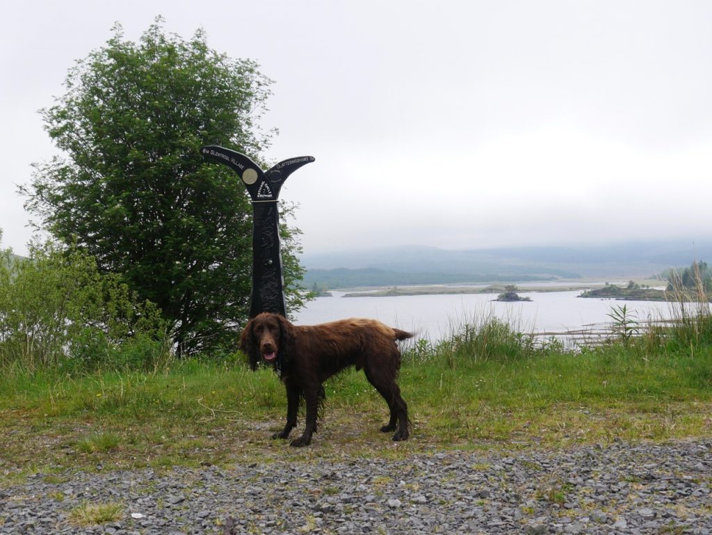
National Cycleway Sign
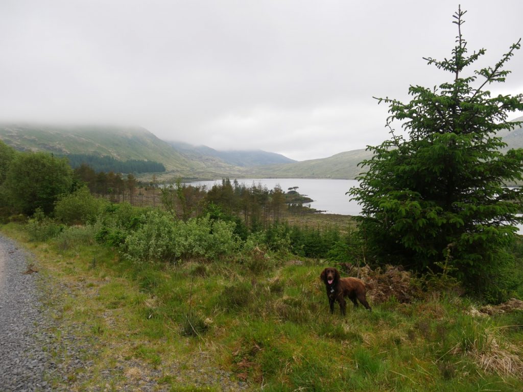
I had forgotten that there were a pair of Rosnes Benches overlooking Loch Dee, but Audrey pointed them out. Dry(ish), firm(ish) underfoot, and with a gentle breeze blow away the hideous midge. For once, we had adequate seating for lunch, but it was too early. We decided to head up to the Axe Head and come back to the benches on the way back.
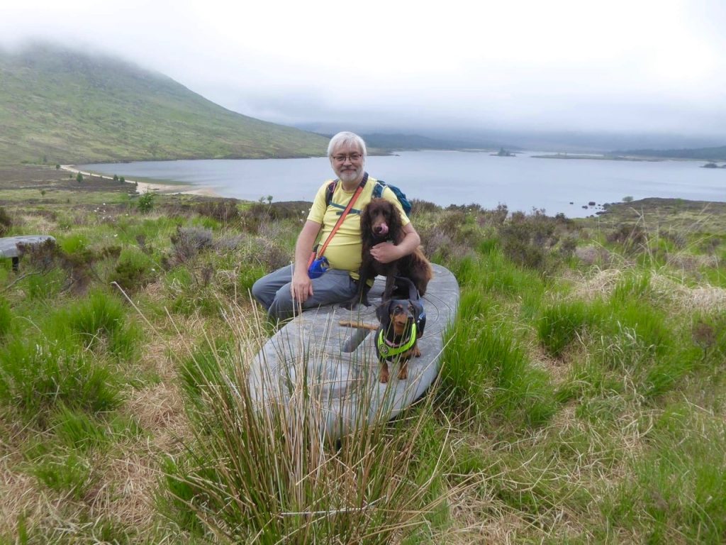
Rosnes bench at Loch Dee
We had seen a great many wildflowers along the way: orchids, buttercups, cuckoo flowers, violets, dandelions, coltsfoot, daisies, bugles, bluebells, milkwort, tormentil, sheep’s sorrel, stitchwort, ox-eye daisies, broom, hawkweed, heath speedwell, mouse eared hawkweed, red and white clover, bedstraw, wild strawberry, lousewort, forget-me-nots, ribwort plantain, marsh marigold, lesser trefoil, cross leaved heath, bramble, blaeberry, bird’s foot trefoil. And butterwort.
When we spotted the butterwort I recognised its characteristic star-shaped leaf rosette, but could I remember its name? No. I thought “something-wort” and that the “something began with “b”. Bogwort – No. Bladderwort – No. But I eventually got it.
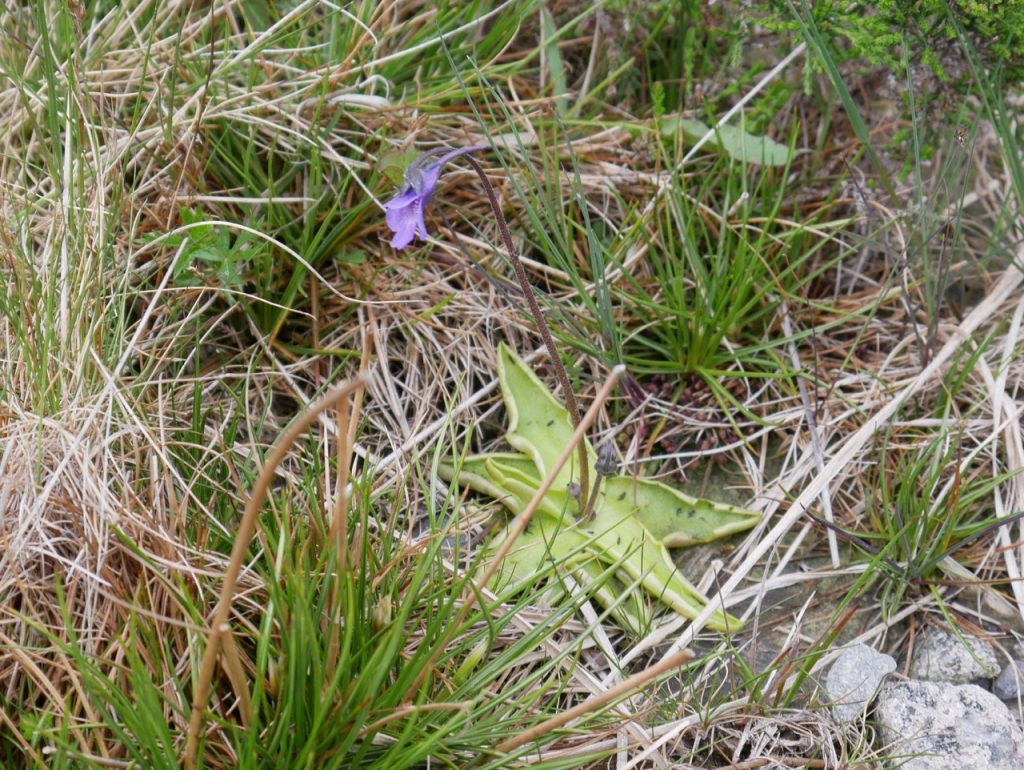
Butterwort
Butterwort is a carnivorous plant. Growing in nutrient-poor soil it supplements its diet with insects. Are those midges stuck to its leaves? The slimy leaves could be used to separate cream and curdle milk, something that Linnaeus mentions the Sami people doing. But butterwort had more magical powers. It would protect babies from evil spirits. Cows that had eaten the plant were protected from fairies and elves and drinking milk from those cows gave the drinker the same protection. If a woman went down on one knee, plucked nine roots of the plant, knotted them together in a ring and placed them in a girl’s mouth while reciting a blessing, the next man the girl kissed would be forever obedient to her. And what’s more, he would be bound to her by invisible cords stronger than the chains of a giant. A similar effect could be achieved by drinking an infusion of butterwort in uisge sèimh (still water) drawn from the well whilst remaining silent from the time of setting out to the time of returning. (Flora Celtica). It is also known as the bog violet, though there is an actual bog violet which is a different plant altogether.
It was not the only wort along the way, milkwort, lousewort and stitchwort were also there as well as crossword and ragwort though these last two were not yet in flower. Also present was bollockwort, though I know it by its fancier modern name, orchid. I must say I’ve never thought they look much like testicles, but I find it is the shape of the root bulbs that are said to have that appearance. (I’ve never dug up wild orchids so I can’t comment on this, but having googled for images, I’m not convinced they are any more testicular than daffodils for example.)
Axe Head Stane
It is less than a kilometre from the Rosnes Benches to the 7 Stanes Axe Head Stane.
The 7 Stanes are found along cycleways in southern Scotland, each reflecting its locality in some way. The 1.5 ton granite slab shaped like a giant axe head echoes the legends that giants from Ireland and Scotland would throw axes at each other. An explanation perhaps for the numerous erratics hereabouts. And if you were to replace ‘giant’ with ‘glacier’ it has a ring of truth even to a modern ear.
The Axe Head is inscribed with the ancient Irish Poem, The Mystery, by Amergin in runic text.
I am the wind which breathes upon the sea,
I am the wave of the ocean,
I am the murmur of the billows,
I am the ox of the seven combats,
I am the vulture upon the rocks,
I am a beam of the sun,
I am the fairest of plants,
I am a wild boar in valor,
I am a salmon in the water,
I am a lake in the plain,
I am a word of science,
I am the point of the lance of battle,
I am the God who created in the head the fire.
Who is it who throws light into the meeting on the mountain?
Who announces the ages of the moon?
Who teaches the place where couches the sun?
(If not I)
There are several alternative translations, and the poem having existed for generations before being written down, may have had many versions. I don’t know which translation is carved on the stone. You might prefer one of the other translations.
The Axe head offers a great view back over the “lonely mountain lake, in a treeless waste” and I would recommend you tear your eyes away from the giant stane to look at the wild stages lying on the hillsides, the heather and willow, the narrow Dargall Burn snaking down to Loch Dee and the mountains surrounding it. And if you only come here once, approach from Loch Trool so that the view across Loch Dee comes into view as you walk down to the axe head. We breathed the air, listened to the wind, looked at the axe head and raised our eyes to enjoyed the views then turned about and returned to the Rosnes benches for lunch. Our view from there, the Loch with its beaches, the surrounding hills and moors. The breeze was enough to keep away insects, but prompted a change to longer sleeves, the ground firm under our feet and the rest welcome.
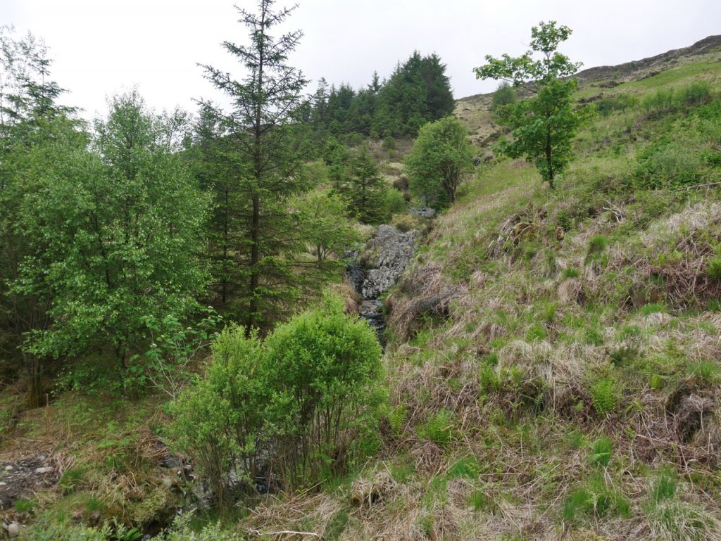
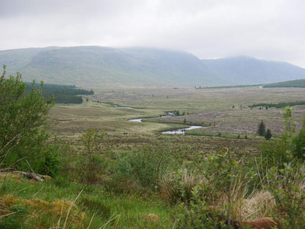
Droughandruie Strand
On the way back we paused to look at the Droughandruie Strand, Drochaidh an druidhe (pron. droghandreehy), meaning the druid’s or magician’s bridge. It’s a wee stream for such a grand name. Wee enough, indeed, that I didn’t notice it on the way out. Perhaps my eye had been drawn to the quarry on the opposite bank of the Dee and the foothills of the Rinns of Kells: Darrou and Little Millyea sitting below the mighty Meikle Millyea (beware, its trig isn’t the summit).
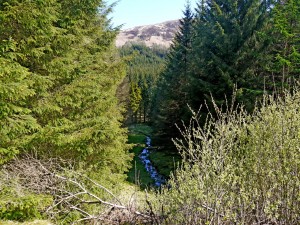
Droughandruie Strand 2015
I didn’t take a photograph looking down the Droughandurie Strand because it was a rather boring view across felled forest, the River Dee and far bank with its quarry clearly visible. But older photos show what it once looked like.
I do enjoy walking this route which is mostly on the Southern Upland Way. It is through wilderness but on an easily walked forest track. I have been down to the loch itself on other occasions but we chose not to do so this time. I do wonder if the old footpath from White Laggan along the Pulnee Burn is still walkable. But that will have to be answered on another walk.
[sgpx gpx=https://www.screel.co.uk/walks/wp-content/uploads/2021/06/RK_gpx-_2021-06-08_1051.gpx]

Hi, please can you help me find the easiest way to the giant axe head stane. I have a photo of my daughter infront of 6 out of the 7 stanes. But we got completely lost Finding this one.
Where should we park, what route, is there possibly a map? We will walk not cycle. Although now I’m thinking it looks like it has a road so if possible could drive to it and just take a forest walk after if that is possible?
Any advice would be appreciated.
It is on the forestry track that runs from Loch Trool to Clatteringshaws reservoir. if you are walking eastwards it is to the left of the track, close enough to step on to. You can park at the Glen Trool (Merrick) car park or drive along the forestry track and park close to Craigencallie House. It is at about NX 4524 7862.
The track is easily walked and suitable for cycling being the No.7 national cycleway. I would walk from Craigencallie, but it is six of one and half a dozen of the other.