
10.68 miles 5h 42min ascent 279m
Part 1: The Mull of Galloway to Myroch Point
It had been quite a while since we had had our walking boots on for anything more than ceremonial purposes, so I had planned a short(ish) section for our return. Just 10 miles. And how pleased I am that I hadn’t thought “way marked trail, no big hills” and gone for a dozen miles or more. The Mull of Galloway Trail has been allowed to mature into its surroundings and has, in places, been suborned by agriculture or reclaimed by nature. It seems to have been way-marked by the sort who look at the map but do not walk the trail they advise.
That said, it was an enjoyable outing. That is not to say that we always enjoyed it in the specious present, though it was agreeable at times. And just as sweetness is better appreciated with a relish of sour, our pleasure was perhaps enhanced by a pinch of adversity. By the time we could glimpse the car and the end of day’s walk was in sight, the sourness was forgotten. Mabel gave up the ghost a hundred metres from the car and had to be carried. Perhaps the dose of joy was just too much for her to carry.
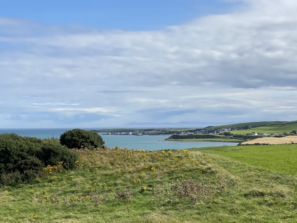
I look back now and remember sunshine, hedgerow flowers, sea birds, rock formations, shingle beaches, cows and sheep on cliff-tops, deer bounding across the fields, the Scare Rocks and views of the Isle of Man, and her calf, across 25 miles of sea. The overgrown, and sometimes elusive path, the fences we had to climb and bramble-laced hedgerows we tramped through are still clear in my memory, but their emotional effects are melting away.
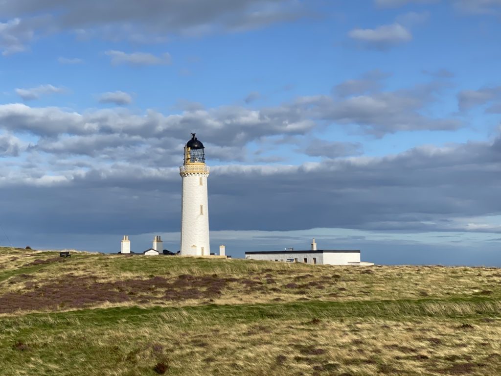
Finding the start was not as straightforward as I had expected and as I stood in the car-park at the Mull of Galloway lighthouse I regretted not bringing an extra T-shirt. The wind wasn’t howling, but it was certainly doing a bit of buffeting. When the dogs looked into the wind, their ears were pushed back as if they had stuck their heads out of a car window. Everyone else seemed to be wearing a jacket, and many had hats. I regretted not bringing an extra T-shirt that could have been an underlayer. The sky was grey, the cloud low and I thought I felt a raindrop on my cheek. The OS map appears to show the Trail starting at the lighthouse just as I might have expected. There is a ‘circular’ path to the lighthouse, and back to the car park park and that seemed a good place to start. We got to Lagvag, the western most point of the wee bootie at the tip of the Mull and tried to follow the cliff edge but there was no decernible path and a wall with no openings other than where it had fallen. There seemed no way to carry on along without falling off the cliffs.
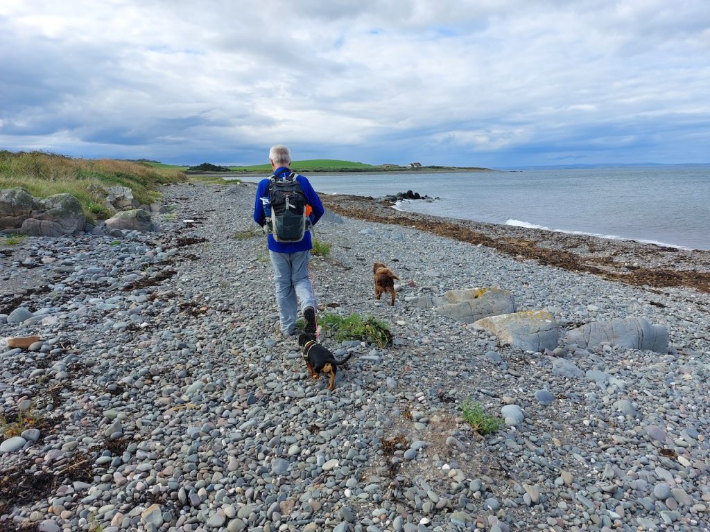
Having the dogs on their leads made me extra cautious as the ground dipped away and Audrey reminding me about coastguard callouts for dogs that had gone over the edge sealed the deal. We decided it would be safer to use the road to East Target and rejoin the trail.
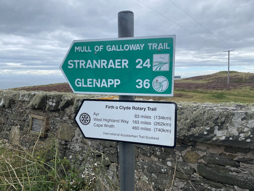
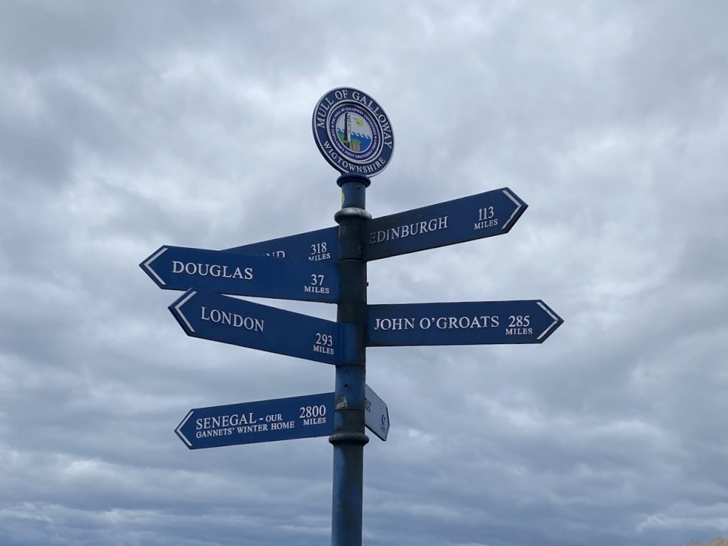
Back at the car-park though we found a sign. Not of the ” Oh God, show me a sign” kind but the more prosaic kind erected by a trail’s sponsors. It pointed through a walking trail style gate to a field and the cliffs. It informed us it was 24 miles to Stranraer and 36 miles to Glenapp.
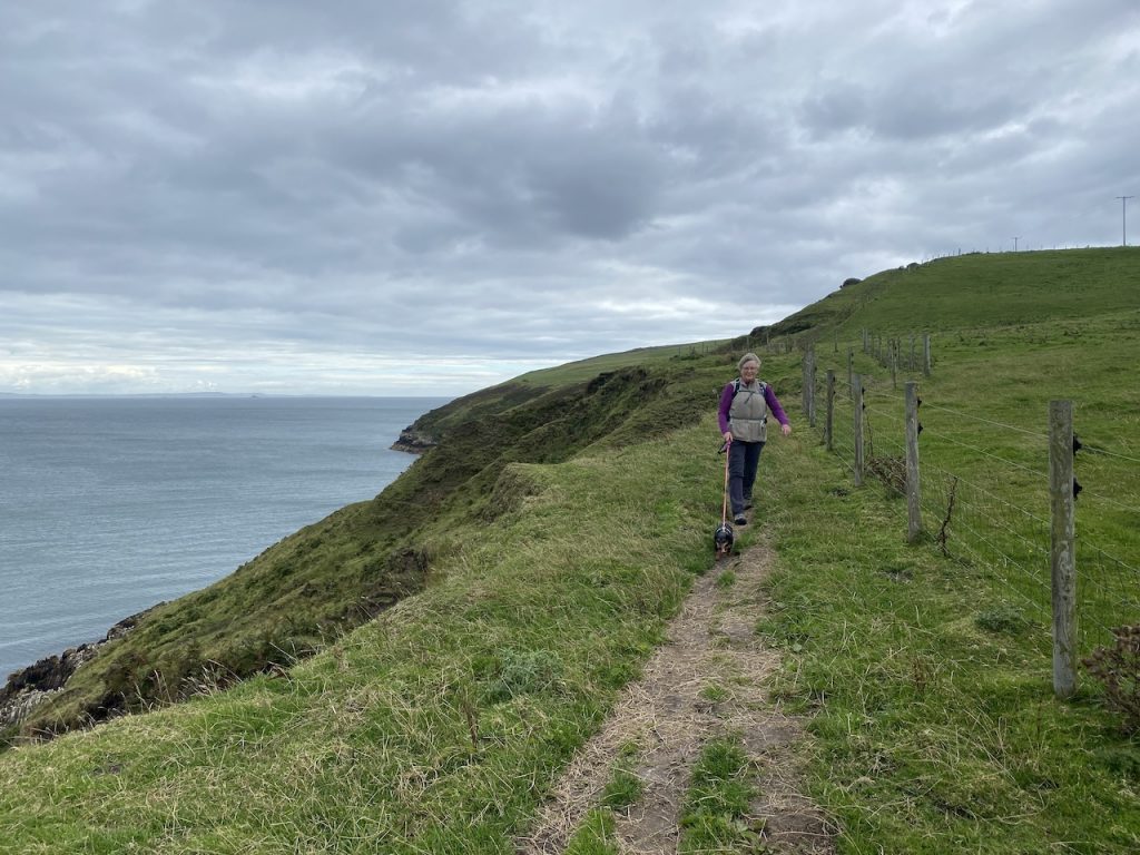
The squeak of an uncoiled gate marked the start of our Mull of Galloway Trail. We were on our way. A short walk down towards the sea and then left along the cliffs, eventually coming onto the worn grass of a walked trail. I was mildly surprised that the trail was on the cliff side of the fence, but it was a wide path.
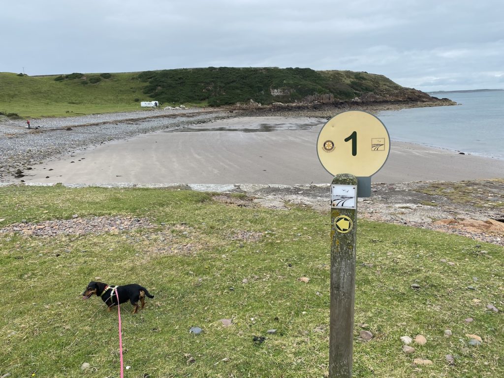
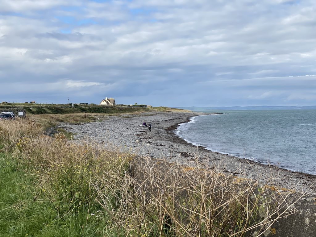
The path ended at the top of the cliffs over the bay at East Tarbet. Or perhaps the actual path had become overgrown. Either way it was quite a steep walk down. I’m pleased it wasn’t muddy. Down in the bay, beside a ruined hut, was a Trail waymarker post with a dinner-plate sized sign. It had a “1” on one side and “25” on the other. I took it to be a mile marker. We had been walking for 1.94 miles.
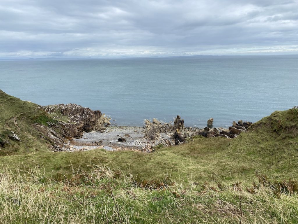
The trail joined the road for a few minutes then, just before a cattle grid, turned back to the clifftop for a kilometre or so. This took us past Portankill, a small bay, and a number of named rock formations: Carrickamurlan, Carrickacoil
The path was wide enough to hold a flock of sheep, at first. But the distance between the fence and the cliff edge gradually narrowed. The path was overgrown. Tufts of grass obscured the ground which was uneven and missing in places. We decided it wasn’t really safe to continue walking that way and manhandled the dogs over the fence into the field on the other side. Fortunately the electric line at the top of the fence wasn’t live.
It was easier walking, both physically and psychologically, on the land side of the fence and soon enough we rejoined the trail when it followed a grassy track down to the pink rocks of the beach at Portalennie.
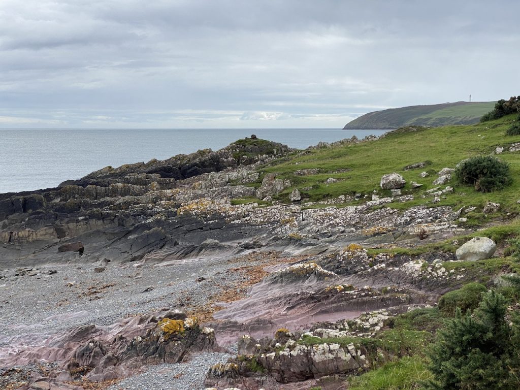
We passed the “3” and “4” mile markers on the way to Maryport. This was mostly easy waking beside the beach with the rocks of Marion’s Isle hosted large numbers of seabirds. The trail passes through the caravan park at Maryport and then along a mowed path beside the beach. Easy walking, nice views, and plenty of wildflowers. By now the grey skies had gone and I was congratulating myself on choosing long sleeves (as protection against sunburn).
Cailiness Point, or at least the approach to it, proved to be what management gurus call a “challenge”. The well worn path we were working along continued onwards beside the beach but the OS map shows the Mull of Galloway Trail turning inland along a track and then along a wee ridge. What’s more, there was a way marker post and an arrow pointing to the left, into what appeared to be an unbroken hedgerow. But on closer inspection there was a much overgrown gap.
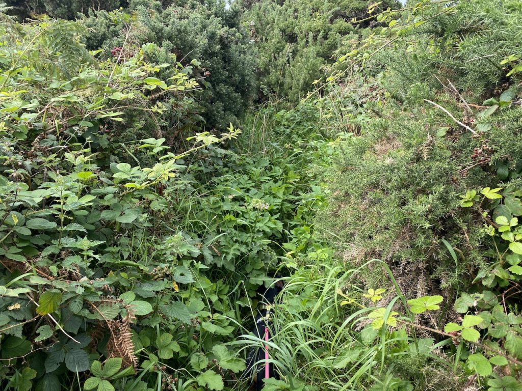
We found the track and followed it but where we ought to have got onto the ridge was dense undergrowth. Instead we walked along the edge of a field of maize. Which strangely, seemed to be growing in sand. The gap between corn and dense undergrowth grew less and eventually disappeared. Just below a small hut we came to a dead end. The only way out was to beat our way over a patch of bramble-strewn undergrowth back to the lovely path we had been on before. Why did the trail’s designers include this detour?
Once back on the path, Drummore was in sight.
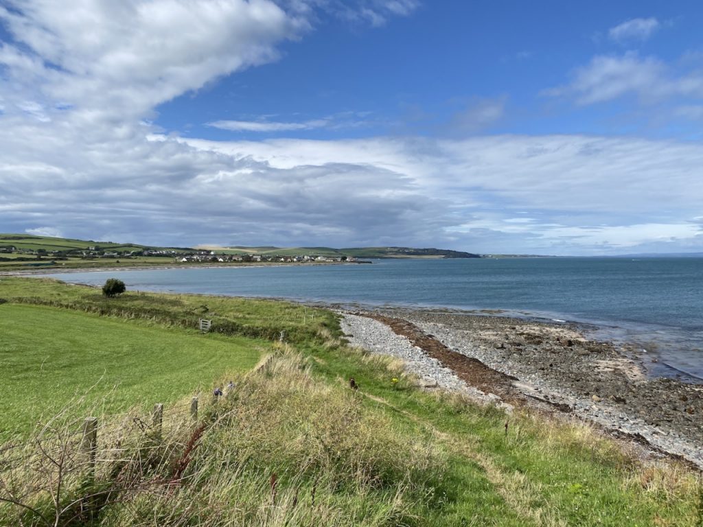
Drummore was pretty in the sunshine. There were palm trees in the gardens and painted stones on an art path. The dogs had a good drink from a water bowl outside the Ship Inn on Shore Street.
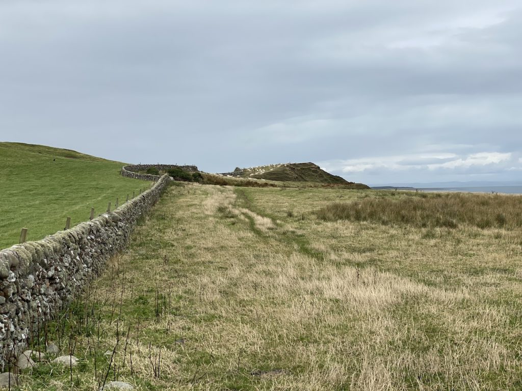
Most of the walk after Drummore was along the main road, or the beach beside it, except for the second “challenge” of the day. The Trail leaves the road and follows a track up towards the Grennan Slate Quarries. Why? Who knows? There are some nice views from the slightly elevated position.
Just after leaving the A716 to walk up towards Grennan, we passed a double gate on our right. Beyond it was a mown track. A large dinner-plate sized circular sign had an arrow pointing that way. It was the same size as the Trail mile marker signs but not quite the same colour. I wondered if it was a change to the route. In retrospect I think it was. But there was a way-marker pointing along the track, where the OS map shows the route, so that’s the way we went, up the hill towards Grennan. The sun was shining. Audrey was calling out her heart rate and Mabel was flagging. We stopped for what our old friend David Wylie used to call ‘morale boosters’, a couple of jelly babies.
Unfortunately, the track ended at someone’s house. Just before that we found a Mull of Galloway trail marker post. It pointed through what had once been a gate, into what had once been a field. Only the gate posts remained of the gate and the field itself had returned to its natural state, a dense tangled mass capable of halting an army (unless it was equipped with large tracked vehicles).
We classed the field as impassable but found a way down to another track. It looked newly laid. We breathed a sigh of relief. The new track soon ended but we did find a grassy track that wound down to another new track (presumably the one that the dinner-plate sized sign had indicated). And then we were back on the A716.
It was about a mile and a half from there to Myroch Point. The OS map shows the trail following the road but there are several trail marker arrows that invite walkers to stroll along the shingle beach. We tried this for a while but it was really hard going. In fact, in places it was impossible: one sign’s arrow would have had us climbing over sea wall blocks. I thought these suggested the route had been planned by someone sat in an office with a map and aerial photos who had not walked the trail they produced, but Audrey thought bad actors had altered the direction of the markers arrows.
Mabel gave up about a hundred metres from the car and had to be carried. To be fair, her breed has the adjective “miniature” not “springer” and she probably had to put in more effort than the rest of us.
Gannets, herons, cormorants. Deer.
Download file for GPS