
4.84 miles 3h 27m ascent 211m boot-wetness: extreme
Nateby Common-Nine Standards Rigg circular
This was day 3 of our Kirkby Stephen walks, and following the previous day’s exhausting outing, called for a straightforward route that wasn’t too demanding. Indeed, since it was to be a short walk we decided not to take lunch. We could eat in comfort after the walk. Can you hear the distant maniacal laughter?
The coast-to-coast route from Kirkby Stephen to the Nine Standards caters for those who like to clock up the miles, but we plumped for the shorter route from Nateby Common. It is half the distance and kicks off at 500m. Less demanding.
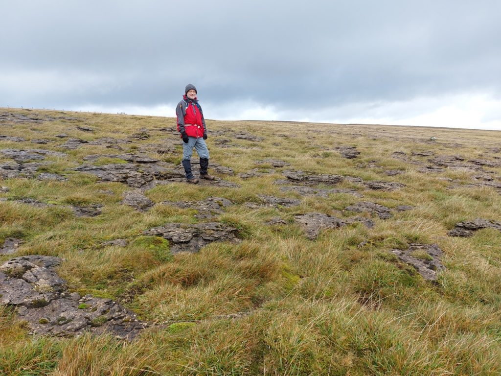
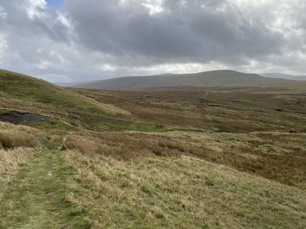
Nateby Common has an extensive limestone pavement, the lighter areas looking a little like clouds taking a rest on the ground. The initial path looked to have been mown and was easy to follow, though it became a little squelchy once we reached the moors. The OS has a great many “shake holes” marked in this area and they were indeed everywhere. Presumably the ground is riddled with underground waterways just waiting to collapse.
My boots hadn’t quite dried out from the previous day and crossing the fords on Rigg Beck and Rollinson Gill got them to 80% wetness. We trudged up the zig-zags and caught our breath in the lee of a wee shelter. The weather forecast had been for rain, but it held off while we were walking. What we did get though was the strong wind that had been forecast for the following day. As we climbed higher it grew stronger.
I tried to estimate the wind speed by reverse engineering the “rule” that every 10 mph of windspeed has the same effect on walking as a pint of beer. We had a three or four pint wind, though a gust that caught me later on the summit and pushed me sideways in the mud may have had a couple of chasers in it.
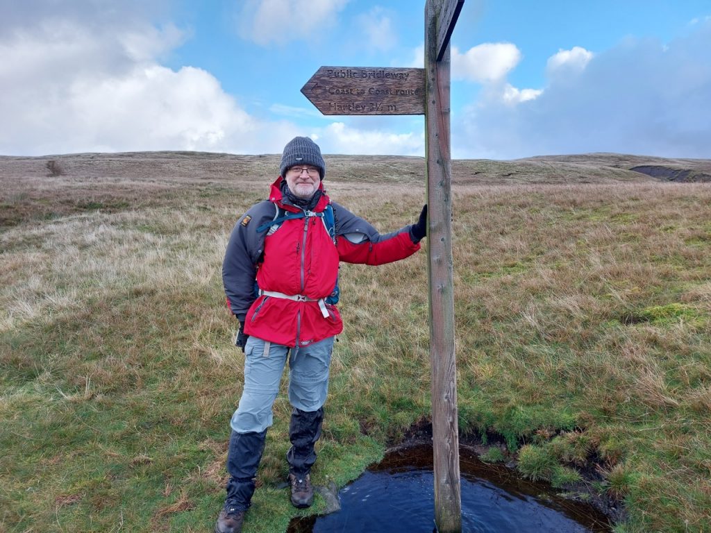
There was a Coast-to-Coast signpost not far from the wee shelter. The way we had come was marked “Nateby” and off to our left was “Hartley”, the way to Kirkby Stephen. Ahead we were faced with two tracks heading up the hill. The one to the right was marked on the OS map and looked well walked, the other was not on the map and looked more like a quad-bike track. I took us right. It was a mistake.
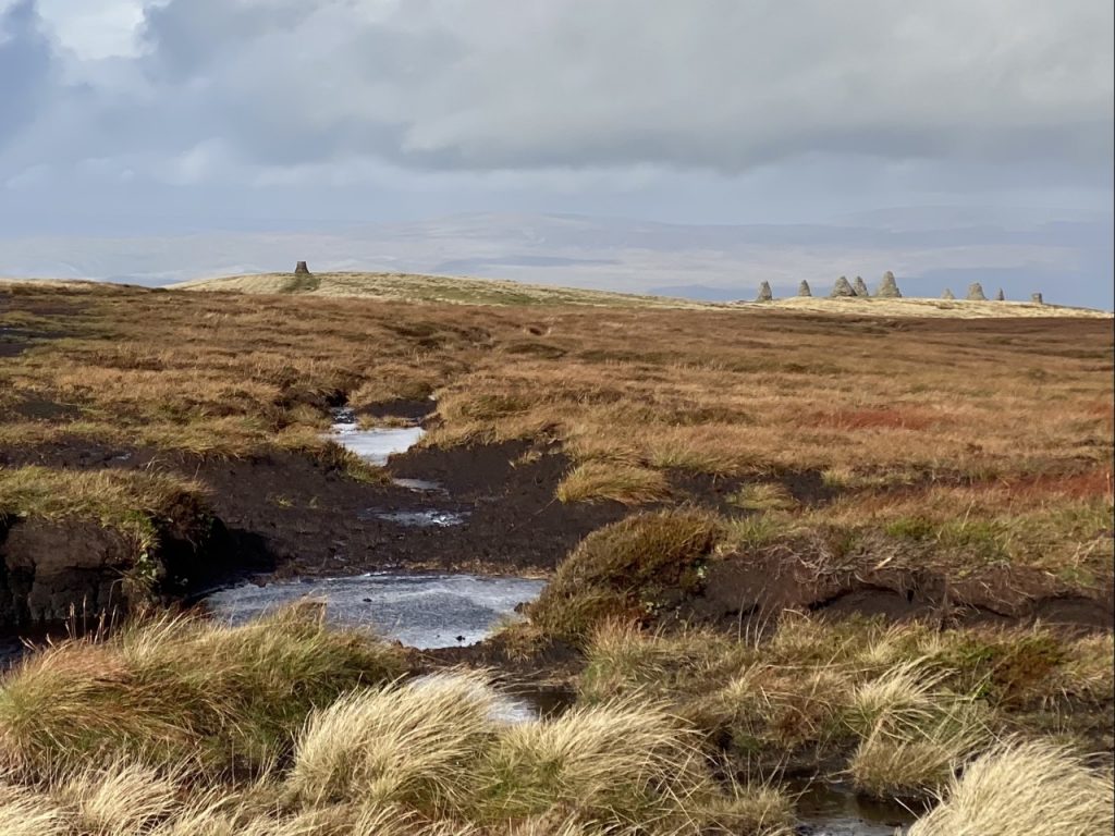
The marked path leads into Rollinson Hags, a collection of peat hags basking in an extensive peat bog. We could see a solitary cairn on Nine Standards, but wading directly through the bog didn’t sit well with the day’s requirement to be “not too demanding”.
We decided to skirt around the bog, staying on hags where we could. I’m pretty sure others had done the same since we sometimes found ourselves on faint tracks in the heather. But there was no way across. It is a sign of how things were going for part of a walk if I look back to find I didn’t take any photos. There were none at Rollinson Hags.
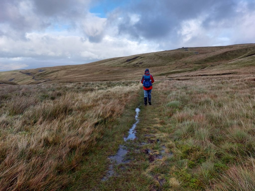
I had a hallelujah moment when we reached the track we should have taken. Somewhat more restrained than a “Fuck yeah!” moment but similar in many ways. Perhaps more relief than accomplishment. It was still pretty boggy but got us up the hill. By then I had 100% wet boots. Walking through pools of waterlogged sphagnum didn’t particularly bother me but I found ways around the pools of black water that might have swallowed a whole leg.
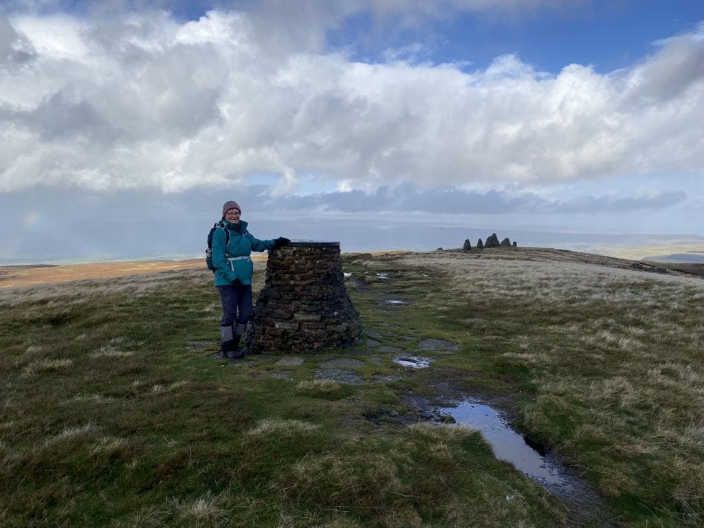
The cairn we had seen is a round affair topped with a metal toposcope. My photo of its top didn’t come out, being obscured by my index finger, but I think it was marked as 658m. The Visit Cumbria website says this cairn was built to commemorate the marriage of Prince Charles to Lady Diana in 1981. So it could probably do with a re-dedication…to the Queen Regent perhaps?
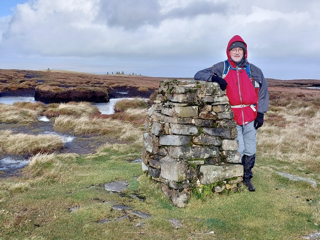
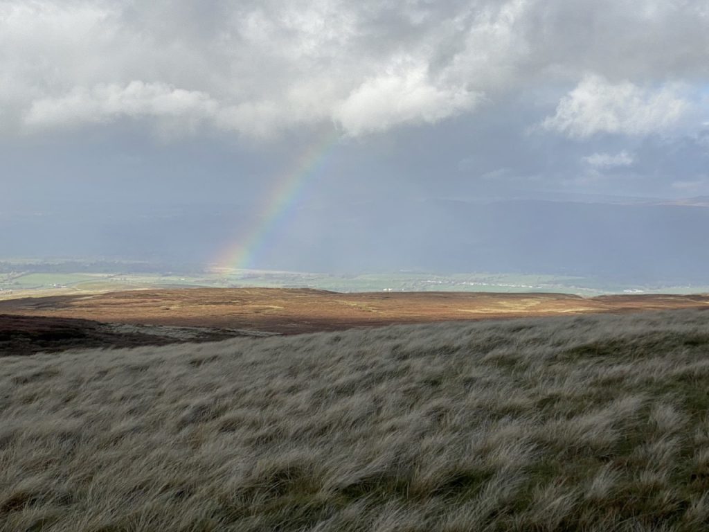
But I could not rest. The siren call of the summit drew me to the trig pillar at 662m. By then the wind was gusting a six-pinter, and what with the thixotropic peat it was quite a walk. Once we got back to the Nine Standards we chose one with a step at seat level and sat in its lee. I have seen this described as the walker’s sofa. Looking north and east there is wilderness. I had never noticed the Nine Standards before but Audrey tells me they are visible from the A66. We could see the sun glinting on cars on the A66, perhaps five or six miles away, but I doubt I would see the cairns from there. I’ll try to remember to look next time I’m a passenger.
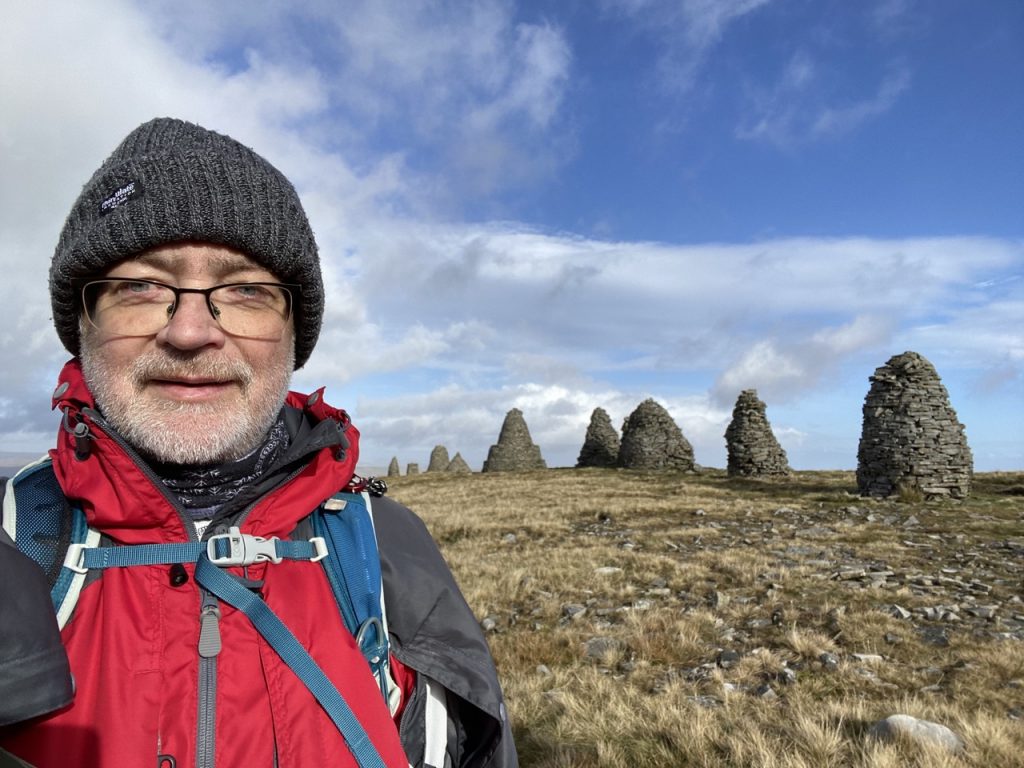
The Nine Standards are in a line 75m long and are between 2m and 4m tall. Most are cylindrical except one at the northern end that is rectangular. They have been rebuilt many times over the years, most recently in 2005, and the more northerly ones look to be in a better state of repair.
No one knows their age or original purpose. Local folklore suggested the cairns might have been built to commemorate a battle or to look like the vanguard of an approaching army, Documents describe them 500 years ago and perhaps as long as 800 years ago and ancient Welsh tale describes a 6th century battle where a Saxon army was defeated in the mountains northwest of York at a place called “toothed mountain”. If this was Nine Standards Rigg it would might suggest the cairns were present 1500 years ago.
Nine Standards Rigg stands on the watershed between the rivers draining to the east and the west and it is the focus of the four main rivers and routes through the area which may explain why the cairns have subsequently become boundary markers.
Studies in the last ten years or so date the cairns to the Neolithic or Bronze age. Aerial photographs have shown an oval enclosure on the ridge, with the cairns lying diagonally across it. This is not typical of a hill fort and more in keeping with a cashel, an enclosure with a ritual rather than defensive purpose. The cairn ridge is also the only hilltop in the area free of peat, suggesting it may have been deliberately cleared. The Eden Valley side of the enclosure may once have been paved, enhancing the visibility of the cairns in that direction.
And why nine cairns? Nine is a magical number in both Celtic and Norse folklore but it is uncertain how many cairns there were in the distant past. Some of the modern cairns stand on mounds that likely mark older versions, and there are mounds without cairns so the original number is unknown. Are the Nine Standards magical? Well they called to me and I trudged over moorland, bog and beck to eat my kit kat and drink coffee among the stone giants. That is power.
There are in fact a few more cairns, at least 12 if you count the wee ones that mark pathways. Three times three, plus three…..[MJM: that’s quite enough numerology].
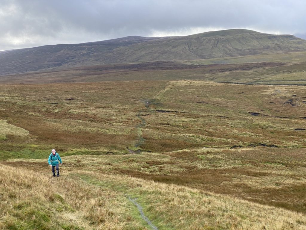
We headed down by the path that is not marked on the OS, leaving the summit’s six-pinter, for a two-pinter and then a completely sober wind.
I’m pleased to say that the torrential rain only arrived once we were back in the car. Unfortunately we were less successful in getting a pub lunch.
My final sighting for the day three outing was the Countess Pillar, by the A66 at Brougham. I wouldn’t have known what it was, but when I was looking for photos of the Lady Pillar on Hugh Seat, it popped up in my google search. Lady Anne Clifford, whose statue stands in Kirkby Stephen, had it erected in 1656 to commemorate her last meeting with her mother in 1616.
When I got home I was able to pour water out of my boots suggested they had been >100% saturated. And five days later they are still not completely dry.
[sgpx gpx=https://www.screel.co.uk/walks/wp-content/uploads/2022/11/RK_gpx-_2022-11-01_1031.gpx]
