
7.35miles 3h 1m ascent 195m
Armathwaite-Old Town-High Hesket-Low Hesket
“The initial idea was to create 19 memorial sites throughout the UK (19 being the significant number relating to Covid 19). The sites will provide an eternal living memorial, a focal point, place of comfort and solace to those grieving for the loss of their loved ones. Places to relax, reflect and remember. I would like to ensure those friends, family members, acquaintances, we have lost are not in vain, they are not just a number or a statistic”.
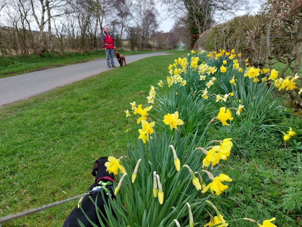
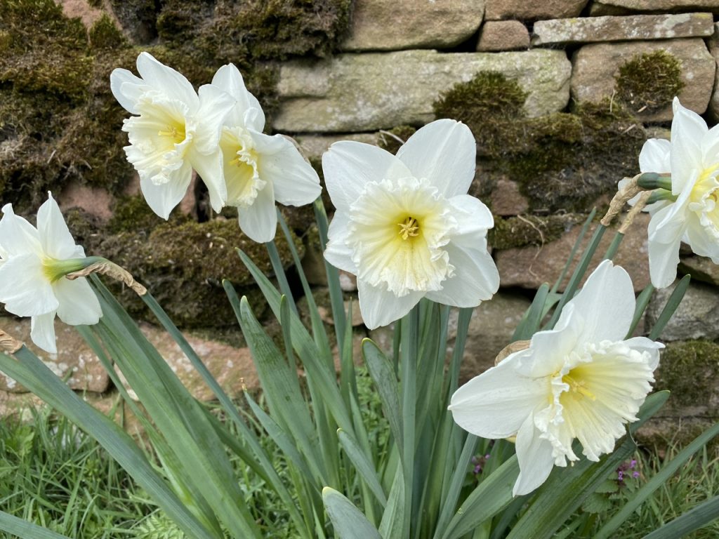
“The route will be approximately six miles long, meandering through several villages and will be marked by several areas of daffodil displays, memorial benches, and sculptures along the way. Whilst this is a stroll it is along country lanes, therefore, will be accessible on foot or by vehicle, and has public transport links at Low Hesket and Armathwaite. Daffodils are symbolic of the time of year when we started ‘Lock Down’ in March 2020. People were coming out of their houses to take their daily exercise along these lanes.” Belinda Fox and David Ryland, 2020.
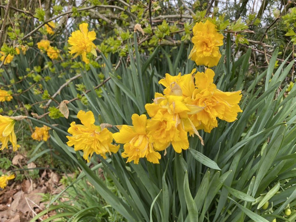
The memorial is still in its early stages. It certainly has plenty of daffodils of many varieties. There are several benches along the way, some dedicated to specific people, others embossed with “2000” and presumably dating back to the millennium celebrations. But no sculptures as yet. The route is mostly on quiet country lanes, with only short sections on the pavement of more major roads. There are local bridleways and pathways that might have been used instead of roads but I understand the aim was to have a route suitable for walkers, cyclists or even drivers.
We started at Armathwaite Bridge, leaving the village to pass under the gothic arched railway bridge. Then past Nunclose, and down to Old Town. Nunclose, as its name suggests, was once a home to nuns, the manor belonging to the prioress and nuns of Ermithwaite. As late as 1847 it “enjoyed the exemption from toll throughout England“. Somehow, I doubt the present farm enjoys that freedom. It is now home to a pet bereavement service.
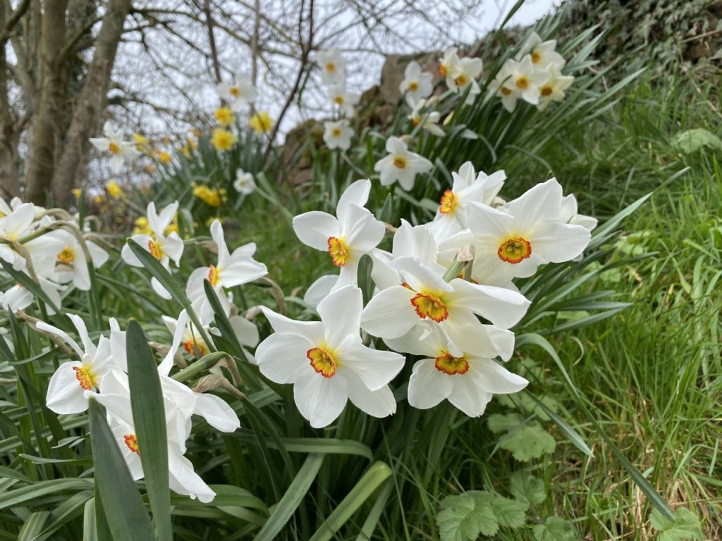
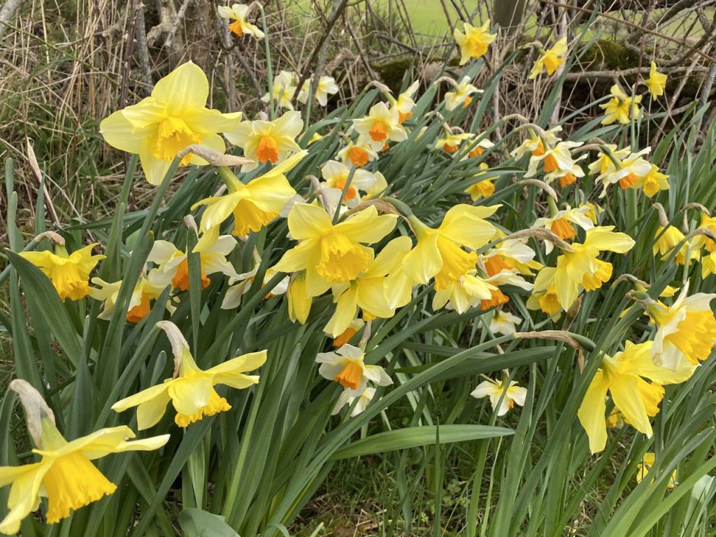
There were daffodils aplenty along the way, but the celandine were giving the verges a pretty good show as well. This being early April, the hedgerows were still mostly bare except for the blackthorn blossom.
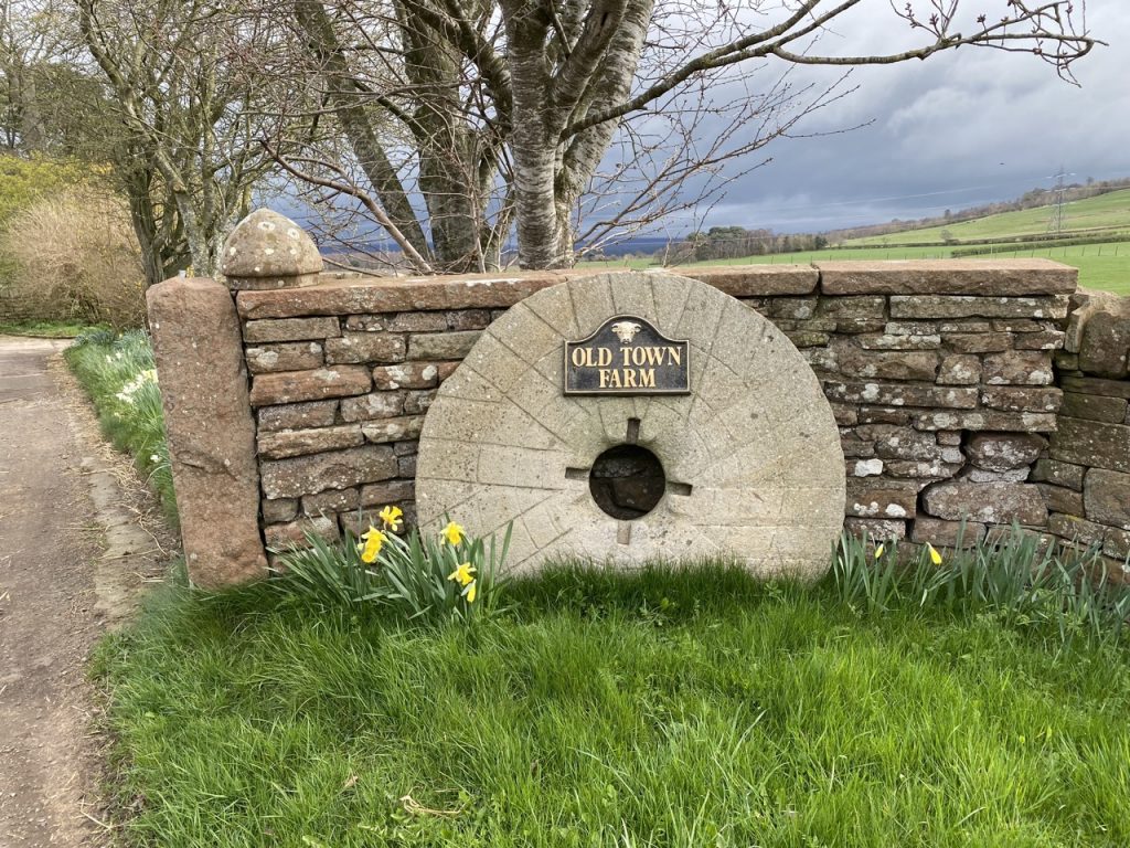
There is not much of a town at Old Town, just a farm with what looks to be a mill-wheel. It looks too detailed to be purely ornamental, but in too good nick to be particularly old. There are no nearby streams. Perhaps the millstone is from further afield, Barrow Mill on the River Petteril perhaps.
We turned up the old road left behind when the A6 bypassed High Hesket. A milestone in the grass beside the road dates back to the Carlisle & Eamont Bridge Turnpike in the 19th century, though its metal plates look more modern. I thought the nine miles would be from Penrith. Audrey thought they would be from Carlisle. Who would be proved right?
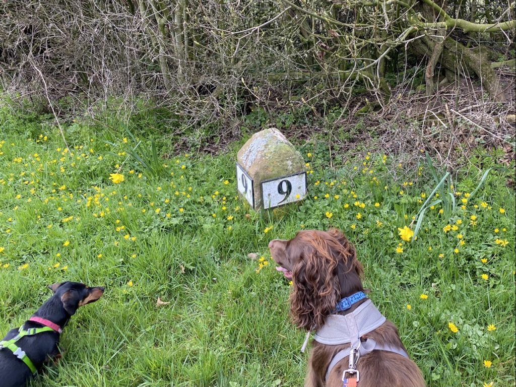
Answer: the 9 on the left is the distance to Penrith, the 9 on the right the distance to Carlisle.
Much of this area would have been forest in ancient times with the Roman Road to Carlisle running through it. There was a Roman fort at Voreda three and a half miles to the south. Hesket’s name is from the Old Norse: hestr, horse and skeið, racecourse. But there is no sign of the racecourse now. Skeið can also be used in the sense of a boundary, especially a boundary road so I wonder if the Viking name referred to the Roman Road rather than a racecourse. High Hesket once had a large tarn to its east, Tarn Wadling, which was said to have the best carp in the kingdom. A claim that sounds a little fishy to me. It was drained in the 19th century and is farmland now.
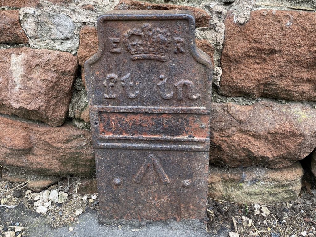
We found this iron post in High Hesket and another a little further along the old A6. It marks an old underground GPO cable network. The ER on the marker refers not to HRH Queen Elizabeth, but to Edwardus Rex (dating the post to the reign of Edward VII, 1901 – 1910). Originally there would have been a plate attached giving the distance to the cable in feet and inches, but the plates were removed during WW2 to frustrate sabotage by the expected German paratroopers.
I mistakenly thought the arrow indicated the direction of the cable and looked upwards to see telephone lines running above it. But this post marks an underground cable. The arrow is actually a government sigil, the “broad arrow”. Originally a heraldic device it has been used since the 14th century to mark government property. You can see it on Ordnance Survey objects, and it was on prison uniforms of old. It is illegal to reproduce the symbol on goods without government permission.
Hesket is supposed to have formerly been a chapelry in the parish of St. Mary, Carlisle, where the inhabitants are said to have taken their dead to be interred, till about the year 1530, when an infectious distemper raging in the country, and the people bringing their dead as usual to be buried within the city, the mayor and citizens shut the gates upon them, and from the walls advised them to carry back the corpse, and bury the same at a place .... and that if they did, they and others would endeavour to prevail with the bishop to have a chapel built and consecrated there, which would be of perpetual use to them and their posterity;" accordingly, after the plague had ceased, a chapel or church was built here, and a burial ground attached to it. The church was dedicated to St. Mary, and appropriated to the prior and convent of Carlisle.
There has been a chapel in High Hesket since at least 1340. A more substantial church built, following the epidemic mentioned above, in 1537 was licensed to have its own burial ground and act as a parochial chapel. The “infectious distemper” was probably an outbreak of “Sweating Sickness”. The cause of the infection remains uncertain but mortality was high and recovery did not confer immunity. The illness began suddenly with rigors, dizziness, headache, joint pains and prostration with either recovery or death occurring within one day. Its features were quite distinct from the plague.
Further reading: A boke, or counseill against the disease commonly called the sweate, or sweatyng sicknesse. Made by Ihon Caius doctour in phisicke. Very necessary for euerye personne, and muche requisite to be had in the handes of al sortes, for their better instruction, preparacion and defence, against the soubdein comyng, and fearful assaultying of the-same disease. John Caius (1552)
For prevention Caius recommended fresh air and clean, sweet smelling clothes Exercise such as hunting, hawking, or tennis (bowls for women) was said to be beneficial. For treatment the most important action was to let out the poison by sweating. This was to be provoked by gentle rubbing and warm drinks. Herbs, such as “wilde tansy, mogwort or feverfew” could be used. And the patient’s nose and ears were to be pulled to prevent sleep. (Oh, to have requested that on a care plan!) Caius doesn’t discount supernatural causes but these he would “leve to the divines to serche”.
But back to the 21 century. Two years into our own pandemic we stood in the churchyard of St Mary the Virgin. I couldn’t help thinking that its involvement with a previous plague gave it a particular relevance for a walk designed to “provide…comfort and solace to those grieving for the loss of their loved ones” in a pandemic.
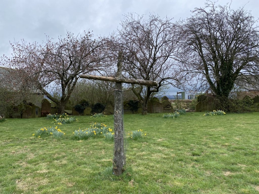
The churchyard has several interesting features. Where I would have expected a graveyard there is a single wooden cross. Headstones line the edge of the churchyard, as if they had been asked to move aside, leaving grass bare save for a few stands of daffodils. There is an eery emptiness but it is eased by the headstones standing like a guard of honour. It is a place to pause, a space to reflect.
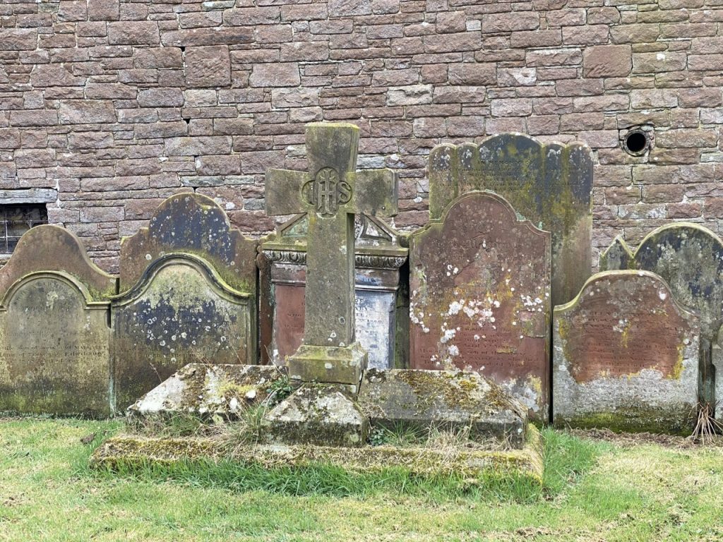
I haven’t been able to find out why these headstones were moved but it seems to have been done in the 1960s. It certainly has the feel of an unfinished project. I couldn’t make out the topic of the stained glass window from outside and we didn’t go into the church itself.
The eighteenth century sundial from the church’s south wall had not stood the test of time and has been moved inside the church. A replica, installed in 2005, now hangs on the wall. Unfortunately the replica wasn’t working for want of sunshine so I can’t comment on its accuracy. Although it could not tell us the time, its inscription did warn us against squandering our own time.
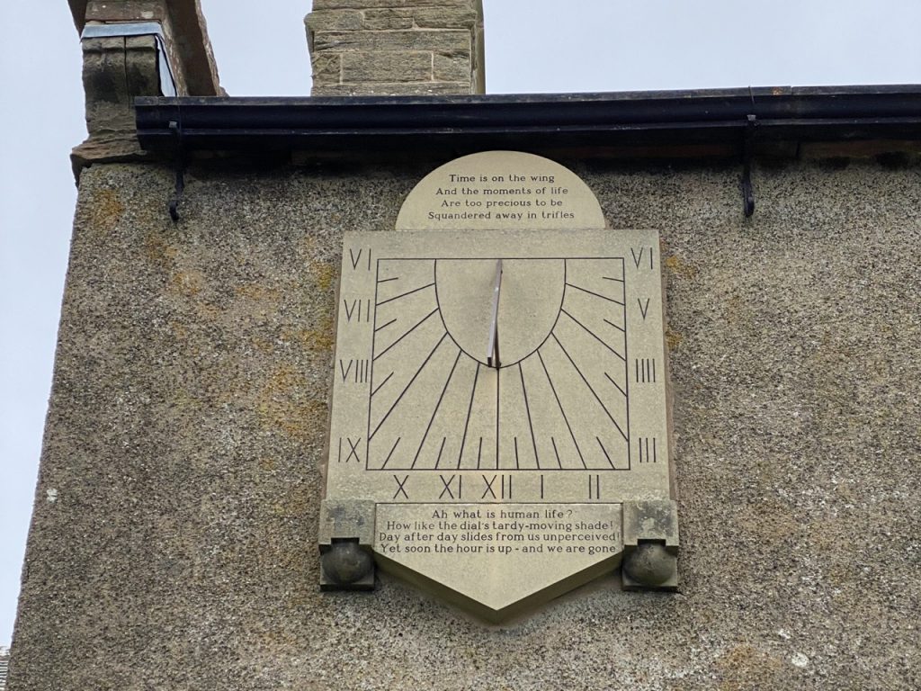
Time is on the wing
Source uncertain
And the moments of life
Are too precious to be
Squandered away in trifles
from Busiris, Edward Young, 1719
Ah what is human life?
How like the dial’s tardy-moving shade!
Day after day slides from us unperceived!
Yet soon the hour is up – and we are gone
The lower stanza is an extract from Edward Young’s 1719 play, Busiris but I’m not so sure about upper stanza. I cannot find its source but the phrases certainly have a recognisable ring. ‘Squandered away in trifles’ is so common, I suspect it is in a classical work.
Alexander Pope’s had said of Edward Young “He had much of a sublime genius, though without common sense; so that his genius, having no guide, was perpetually liable to degenerate into bombast. This made him pass a foolish youth, the sport of peers and poets; but his having a very good heart enabled him to support the clerical character when he assumed it, first with decency and afterwards with honour”. It sounds as though he was writing from experience.
Perhaps the churchyard could have a small plaque engraved with more uplifting advice for those pausing to reflect on lost friends and family. My suggestion: “Memories.. Let them fill your mind, warm your heart, and lead you through” (Anonymous).
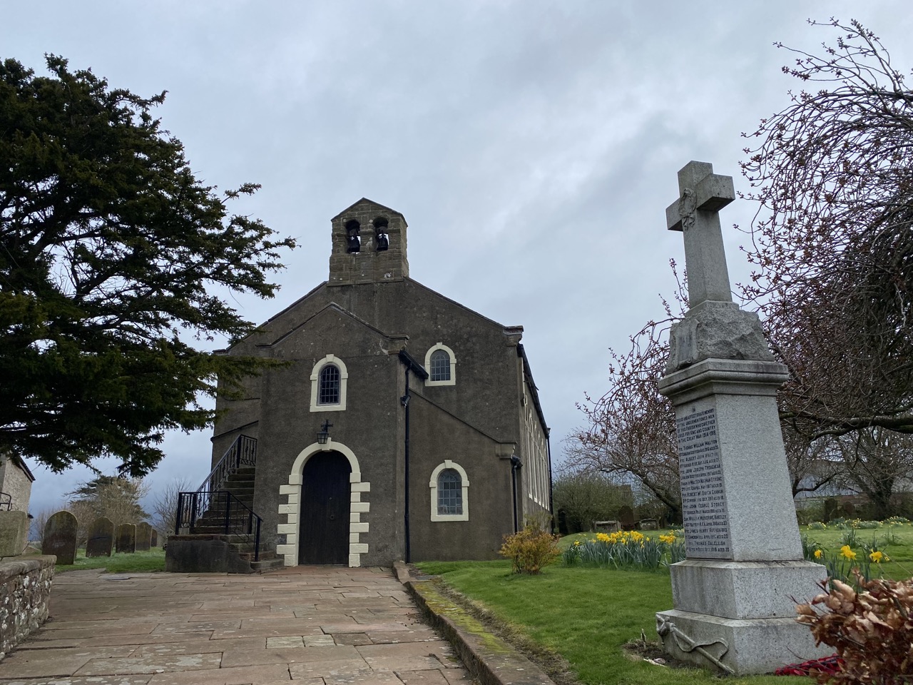
High Hesket’s War memorial stands by the churchyard entrance. It lists killed in man made the man-made catastrophes of the world wars. The oldest listed was just 25. When the memorial was erected in 1920 it would have been visible to all those travelling the main Penrith to Carlisle road and was the only memorial for these soldier’s families. The website Cumbrian characters has gathered a little more information about each of them and is well worth a look.
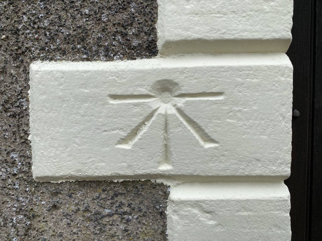
Turning from the spiritual to the temporal, the church’s doorway has a benchmark cut for the Ordnance Survey of 1841/4. ‘No. 433. Bolt in North-west jamb of door of High Hesket Church; 4.33 ft. above flag pavement at door’. For the nerds, it is 488.104 feet above the Liverpool Datum (mean sea level as recorded in the Victoria Dock, Liverpool during 1844). [488.104 seems an unrealistically accurate measure to me.] Can you see the broad arrow in the OS benchmark?
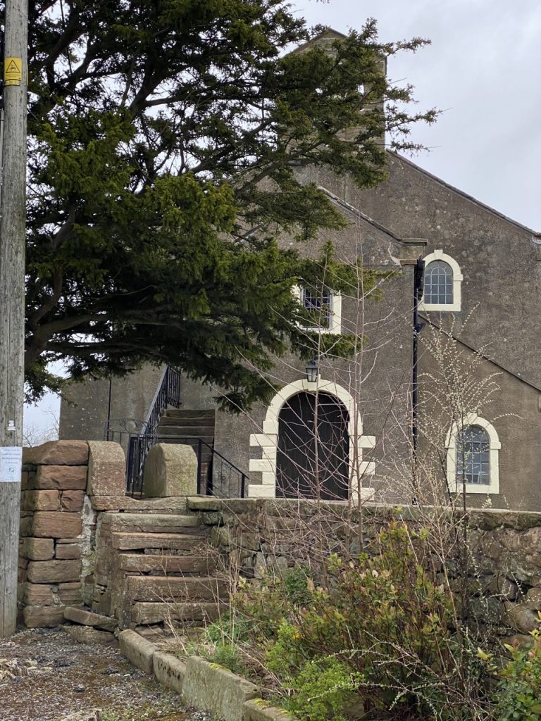
I’m not sure what purpose these steps serve.
The wee Southwaite road was closed. I thought we would have to walk along the A6 to Low Hesket but it was only closed to vehicles and we were able to walk past the lorries. The last section of the walk is a circuit from Low Hesket up by Barrock Fell and back along the A6 (but on a pavement). This took us past several places with “castle” in their names, but there is no castle here now. Castle Hewin is the likely source of the names. I stood on the high ground near Aiketgate. There were some years ago, on the crown of the lofty eminence on the north east side of the lake, the remains of a very strong and ancient building, 233 feet by 147, called Castle Hewin, but no traces of it are now left (‘Beauties of England & Wales or deliniations 1802).
Our walk finished outside the Rose & Crown in Low Hesket (Not open unfortunately). The A6 is not a great place to sit for sandwiches so we drove back to Armathwaite to eat sandwiches with the Eden and Armathwaite Castle in view.
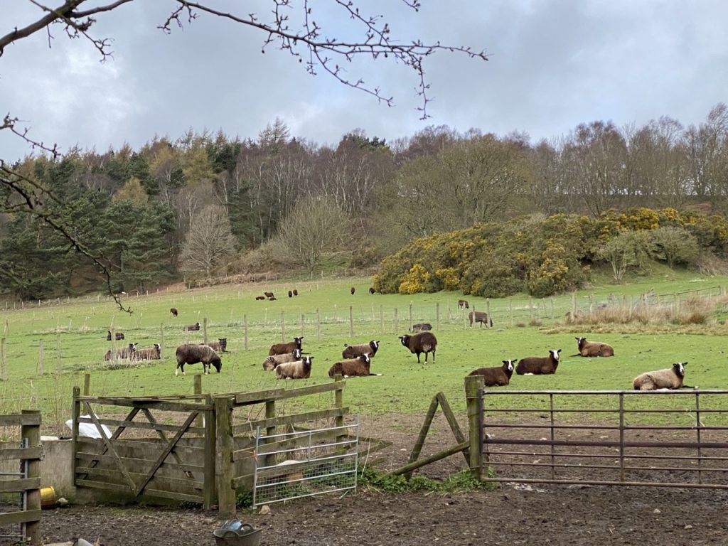
This walk is not particularly wild but is in the countryside and at this time of year there are daffodils on the verges, lambs in the fields and cuckoos calling in the air. The route is long enough to clear one’s mind, there are benches along the way to rest and a churchyard in which one might reflect. It is high enough for extensive views of the Lake district hills but we were walking on a grey day so these were lost cloud. But we could see Criffel and for Doonhamers that’s a special view. And of course there were a few other interesting bits and bobs along the way.
It is perhaps appropriate that my first blogged walk after two years of COVID-19 work should be a memorial to those times. So here’s to …
[sgpx gpx=https://www.screel.co.uk/walks/wp-content/uploads/2022/04/RK_gpx-_2022-04-04_1037.gpx]
