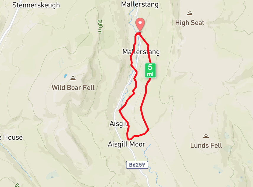
6.30 miles 3h 53m ascent 247m
Thrang-Hellgill Bridge circular
And still of a winter’s night, they say, when the wind is in the trees,
The Highwayman. Alfred Noyes
When the moon is a ghostly galleon tossed upon cloudy seas,
When the road is a ribbon of moonlight over the purple moor,
A highwayman comes riding—riding—riding—
A highwayman comes riding, up to the old inn-door.
Over the cobbles he clatters and clangs in the dark inn-yard.
He taps with his whip on the shutters, but all is locked and barred.
He whistles a tune to the window, and who should be waiting there
But the landlord’s black-eyed daughter, Bess, the landlord’s daughter,
Plaiting a dark red love-knot into her long black hair.
The Eden Way guide offers two routes from Thrang to Hell Gill Bridge, one is closer to the river but more rustic, and one further from the river but on a better path and passing the Watercut Eden Benchmark. I had always intended walking both of these routes but probably as part of separate walks, but a last minute hiccough left us with only one car and a need for a shorter walk. Making these two routes into a circular walk allowed us to go ahead. This took us by origin of the River Eden as a named waterway, as well as the final, and most impressive, benchmark sculpture. I had not realised we would have to ford Hell Gill above its waterfall but that just added to the experience.
We parked at Thrang, where a couple of ancient Americans pulled up in a tank car and asked if we “were at the restaurant last night”. Having heard that we were not among the people “at the restaurant” they asked how to get down to the bottom of the valley. Since we were going that way we pointed out the footpath but they didn’t follow. I wonder if they would have followed us if we had been at the restaurant?
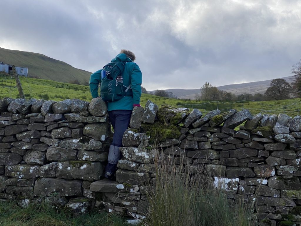
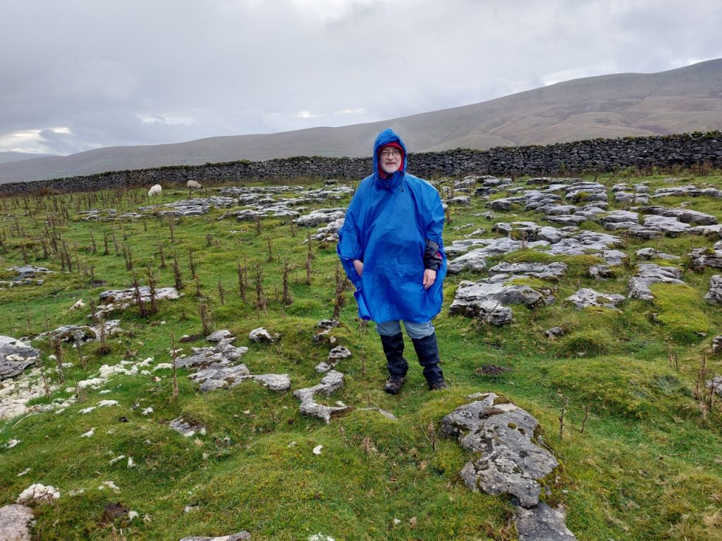
We expected wet terrain and remembered to bring our gaiters. Mine are an odd pair, one blue that fastens at the back, the other black that fastens at the front. I actually own three pairs but each pair has only one useable gaiter – one is lost, one badly chewed, and one with a busted zip. It was a walk for gaiters as it turned out.
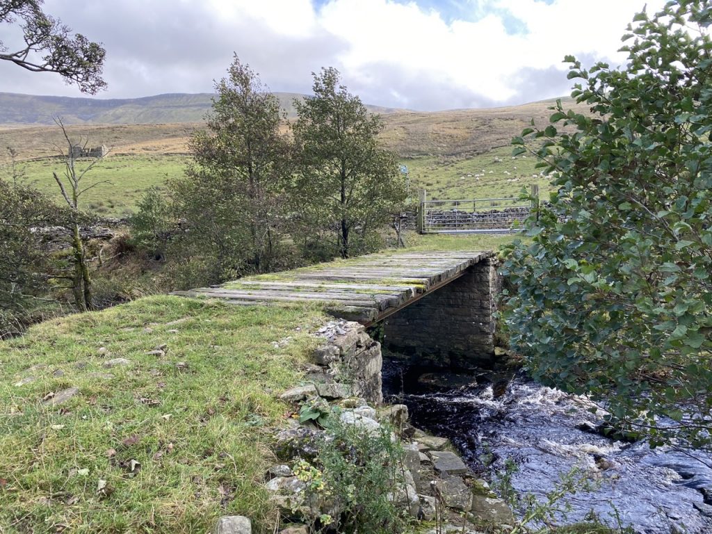
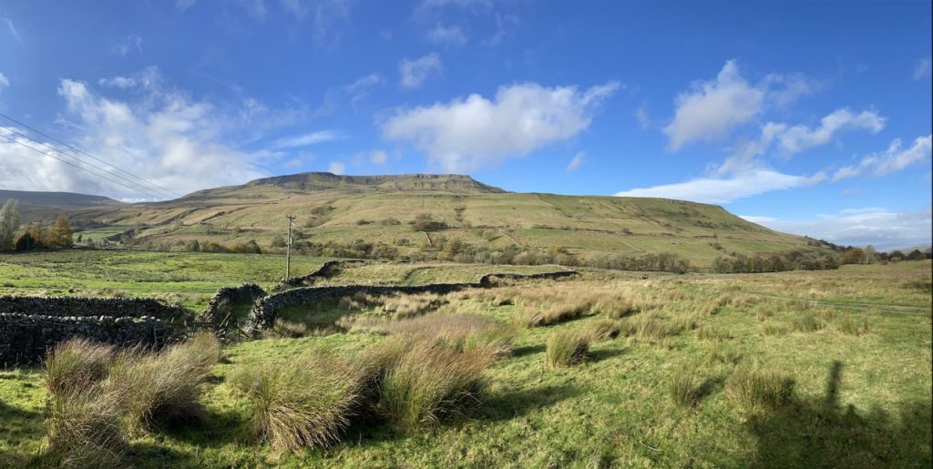
The outward leg (by which I mean section rather than lower limb) took us over Eden on a the packhorse bridge then over Deep Gill on a plank bridge before giving up any pretence of a visible track. The Watercut Benchmark Sculpture was soon visible on the ridge opposite. We crossed fields guided by where we could get over their walls. The steps of the gap stiles were tricky, the wet limestone very slippery, and as ever they were at the height of a horse’s stirrup.
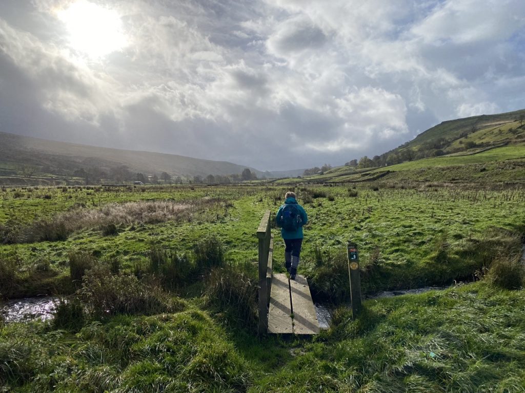
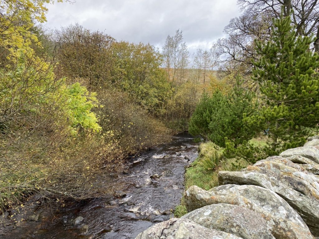
A small wooden bridge allowed us across the diminutive Eden and the B6259. After that the ground was much boggier. At one point we were forced to clamber along a moss-covered dyke only to find the going even worse further along. So we scrambled back along the wall and chose a different field to cross. The deep ravine of Ais Gill with its waterfall and viaduct gave us a direction. We eventually reached the river where Aisgill beck meets Hell Gill.
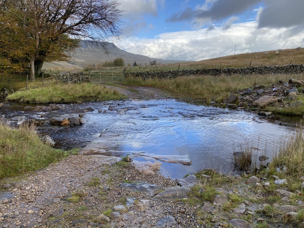
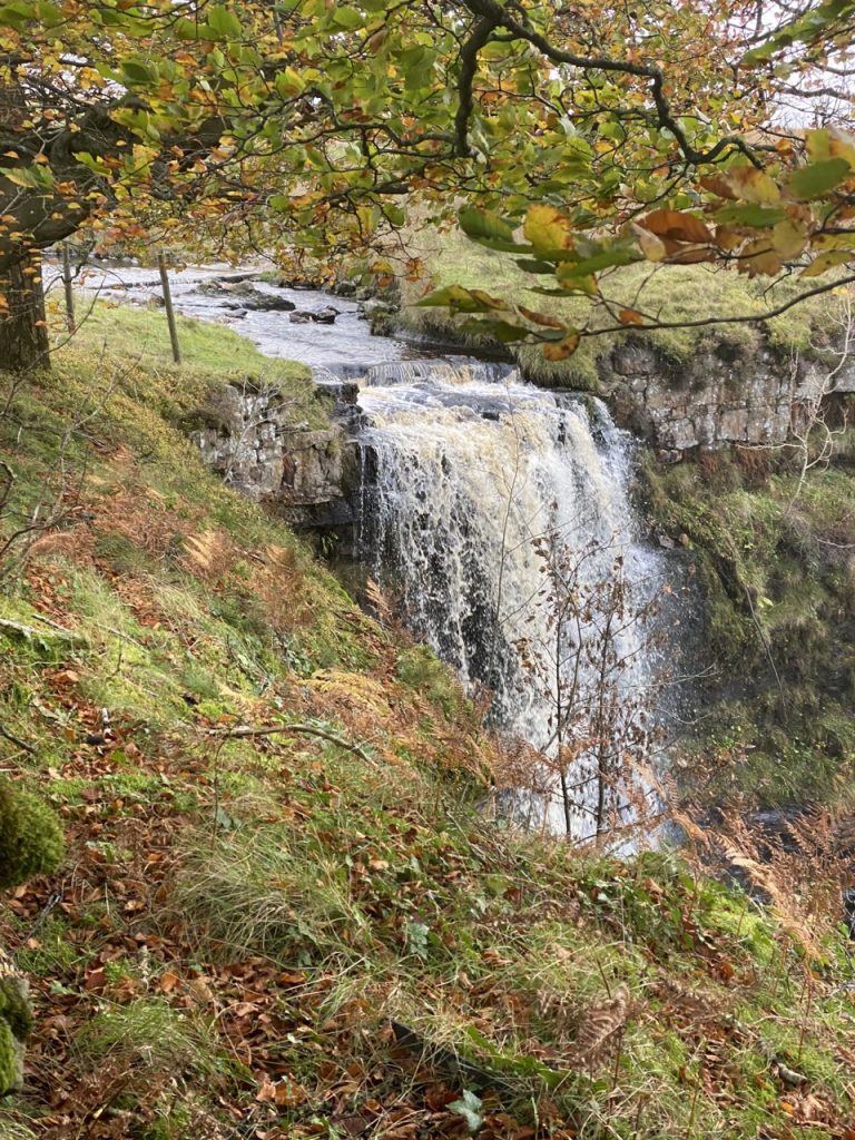
The River Eden begins here, at the confluence of Aisgill Beck and Hell Gill. Reaching this point raised our spirits but the fates weren’t happy. The rain, which had been light enough to ignore, became heavier and I donned my rain-cape. Then we reached Hell Gill force. A pretty waterfall, the tallest on the Eden. But where I expected a bridge over Hell Gill was a ford, and the beck was quite full. There are stones which I imagine are stepping stones, but they were underwater.
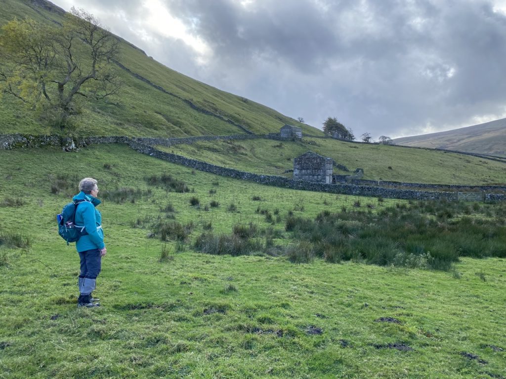
We stopped at Hell Gill farm for lunch, huddled in the near lee of a wall, in our rain capes, with water in our boots. It was interesting taking off a rucksack while remaining in a rain cape.
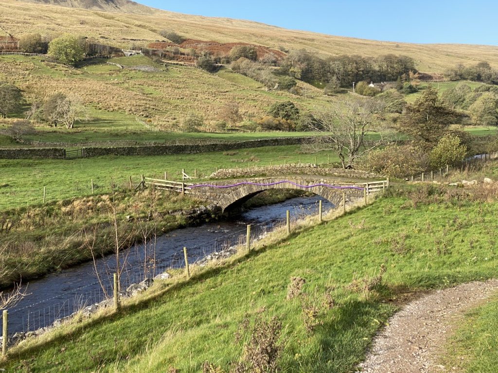
The Pennine bridleway, a green road, was our route back to Thrang. It was the main road from Wensleydale to Westmorland until the nineteenth century and crosses the ravine of Hell Gill on a narrow bridge. Legend has it that the highwayman Dick Turpin was being chased along this road and found the bridge had been washed away in a violent storm. He leapt the ravine on his trusty horse Black Bess to escape his pursuers.
None of it true, of course.
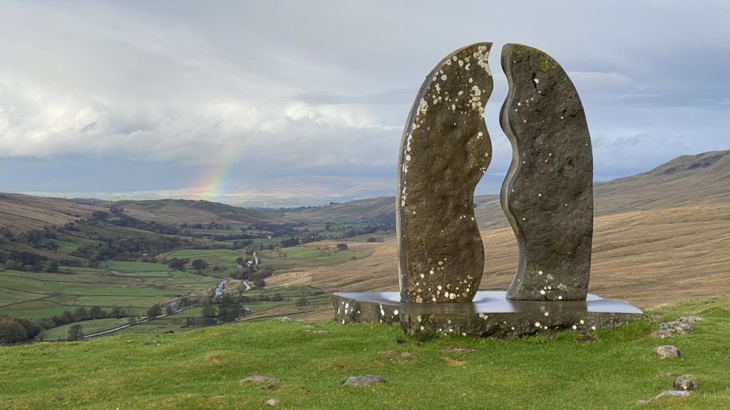
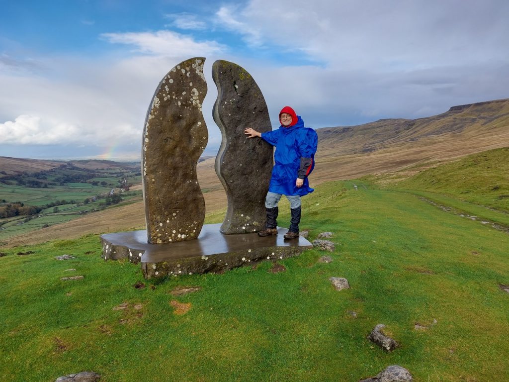
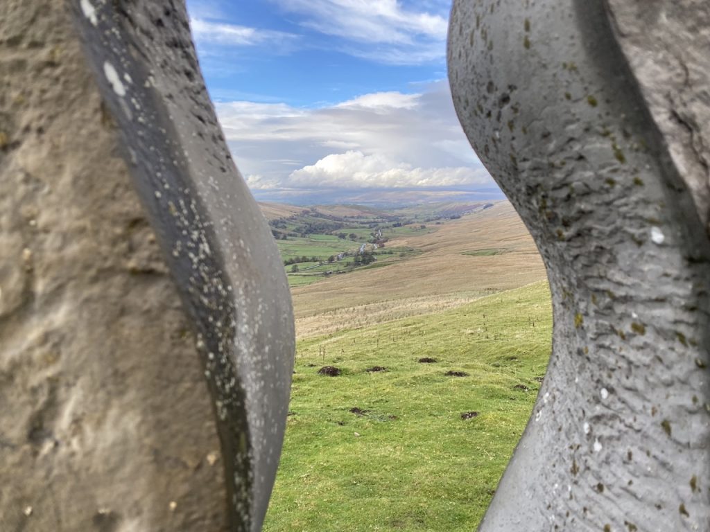
The Old Road took us past an extensive area of limestone pavement and several shake holes. I was surprised how long it was before we could see Watercut but the wait was worth it. The sculpture stood overlooking the Mallerstang Valley, with a rainbow behind it.
Watercut is either the last or first Eden Benchmark depending on your perspective. Produced by the sculptor Mary Bourne it is made from Salterwath Limestone, taken from a quarry near Shap. When it was first installed the two halves looked different, since one had been exposed to weather for longer prior to carving but now they have weathered down to match each other. Its shape is said to reflect the gate posts and stiles of local drystone walls, whilst it’s outer curve makes reference to the viaduct arches on the nearby Settle-Carlisle railway. The space between the vertical pillars produces a meandering river in the sky and a window onto the actual river in the valley below.
From there the Old Road was an easy downhill stroll with a couple more becks to ford. But when your feet are already wet its easy enough to stride through streams.
This section of the Eden Way took us to where the River Eden gains its name at the confluence of Aisgill Beck and Hell Gill and also to our final Eden Benchmark. We were overlooked by Mallerstang’s Watercut on the way south and the cairns of Wild Boar Fell on the walk north. The going was relatively* easy though there wasn’t much of a path on the outward leg. Wearing gaiters was wise.
*relatively – compared with the next day this was a doddle.