
8.31 miles 4h 15m ascent 87m
Clayshant Bridge to Agnew Park
This should have been an easy stroll from Luce Bay to Loch Ryan. Not too far, indeed perhaps too short a leg. The weather forecast promised a hot sunny day, and was spot on. I expected an enjoyable walk with little in the way of challenges but the section between mile-markers 22 and 23 was the jalapeño lurking unsuspected in my sandwich.
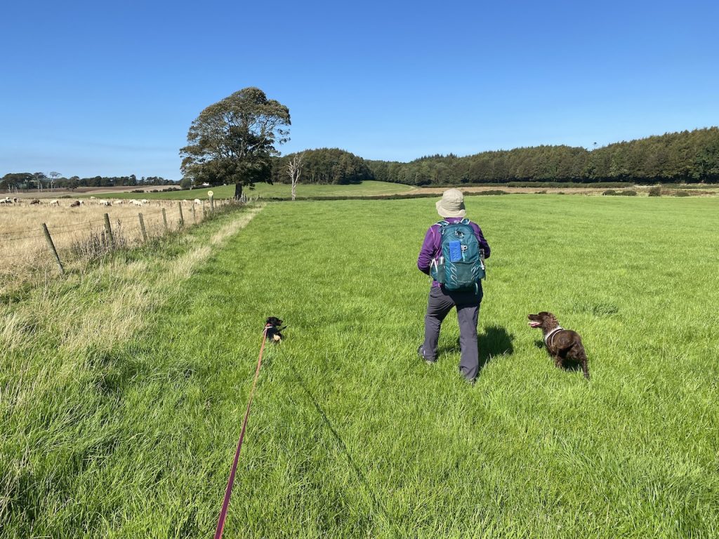
We set out from Clayshant Bridge along the minor road skirting the airfield at West Freugh. This was about three miles of road walking but it was a quiet road. I think we saw more cyclists than cars. The sun was out and the hedgerows in bloom.
There was not much to see at West Freugh but an MOGT information board showed photographs aircraft from when it had been an active airfield. There had been a large hangar for airships during WW1, and played host to several bombing squadrons, including the famous 617 Dambusters, during WW2. Today West Freugh is the UK part of a world wide satellite tracking system.
There is a bench with a sign “Take a Rest” at the cottages near the Allivolie Burn. (Allt na bhuaile, stream of the cattle fold.).
After crossing the B7077, we had some of the very few metres of ascent we would have in the day. The road gradually took on the features of a farm track, but after Barnultoch it ran in an avenue of trees and gave us some welcome shade. Barr an Ultaich, means the Ulsterman’s hill.
We paused to photograph the 22 mile-marker. Unbeknownst to us, we had the jalapeño between our teeth.
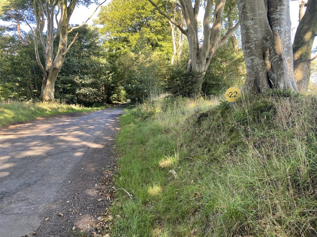
We bit the chilli at High Barnalultoch.
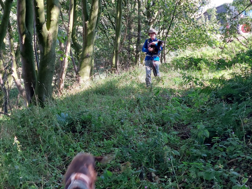
The road had become a track, and the track had been communing with nature. There was green underfoot and the hedgerows would have given armoured vehicles cause to think twice. At the end of the track was a farmhouse and a yard where sheep wandered, cars decomposed and an unseen dog barked. If it had been in a film, I would have expected someone to walk out holding a shotgun or perhaps a lonely voice from inside to call something like “Elijah, is that you?”.
Neither happened.
Our way was obstructed by a gate. Locked. But a handwritten sign pointed to the left and in a script styled on that of a six year old, indicated the way to “STRANRAER”. We looked but there were only brambles and tangled undergrowth. But there is part of the human mind that can see pin pricks of light in the night sky and see a hunter or a charging bull. It looked at the greenery and saw a path. I think there probably had been a path there once, a way past the farm without intruding on its house and yard, but brambles had snaked across it and taken hold, the first step in morphing from path to briar.
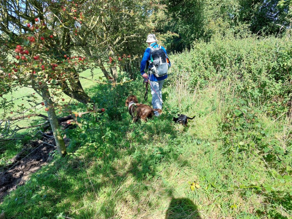
It was only a short way but there were a couple of ‘desire paths’ heading into the farmyard. [I came across the term desire path last week in this blog and I’m sure I’ll be using it in future.] These suggested that others have bailed out before we did.
Anyway, once passed the farmyard we did find a “track”, of sorts, an area longer that it was wide and enclosed by fences. There was a kissing gate leading into the field beyond, but there was a young bullock in the kissing gate – he, or one of his field-mates, had smashed the swinging part. There was a newly constructed cattle pen between us and the obstructed gate, and a bullock in there too. Hmmm.
Options: climb into the pen with a bullock, then wrestle the bullock out of the smashed kissing gate – dismissed on safety grounds; go through the gate on our left and find a way through the fence into the field we were aiming for – dismissed since there was a new barbed wire fence; go through the gate on our right – it had the same problem of barbed wire, but there was a log we might have used as a makeshift stile, had the bullocks not wandered over and crowded around it.
The direction of the trail was roughly north but we were forced to strike out eastwards towards the track leading to High Boreland farm. I hoped there would be access to that track because there was a desire path leading that way. There was indeed a gate. Our hmmm changed to an aaah of relief as we turned left up the track.
The OS map shows a track, parallel to the MoGT, heading northwest from High Boreland to Culhorn Mains. Unfortunately our sigh of relief was premature. The path shown on the OS map is long gone. Where it should have been there was a steep slope of discarded rubble, grass cuttings and manure leading down to a dense patch of brambles and nettles. Other ways down looked to have been used to discard quantities of old barbed wire and broken fences.
If we didn’t find a way onwards we would have been looking at a three mile detour. So we pressed on, down the unstable rubble and into the nettles. I was held up a short while since Mabel, still on her lead, chose to stop on the rocks I needed to step down onto. She would not go any further since she would have been jumping into brambles. I eventually managed to pick her up and carry her down.
We did find what must have been the old track in the woods. It was overgrown but relatively easy walking. This brought us to a rusting gate, partially fallen – so it would not open, and too unstable to climb – making getting the dogs over a bit tricky. Beyond it we could see the buildings of Culhorn Mains. We decided to turn left and head SW through Boreland Wood. The MoGT was about 300m away that way. The only worry was that we would be faced with more barbed wire.
And there was indeed barbed wire between us and the adjacent field as well as a drop of about a metre between the wood and the fence. This was not too big a drop but it was mostly covered in brambles. I kept looking for places where we might get into the field and was surprised to find a stile, at least what was left of one, but more importantly there was plastic wrapped around the top of the barbed wire. And the drop here was bracken rather than brambles.
I suspect that the MoGT runs along the far side of the fence to our left but had crossed into our field at some point. Indeed there were three stiles over the fence within 200m, and the ’23’ mile-marker confirmed we were back on the trail.
We left the field at a kissing gate and found ourselves walking along a minor road. The MoGT and the Southern Upland Way come together here for about a third of a mile. Both Audrey and I have walked the SUW, but neither of us recalled this short section. It would have been on our first SUW outing, a decade earlier. But then we passed a tumbled down brick hut. It had a standpipe and I remembered I had seen it before. Unfortunately I didn’t take any photographs of this part of the SUW back then.
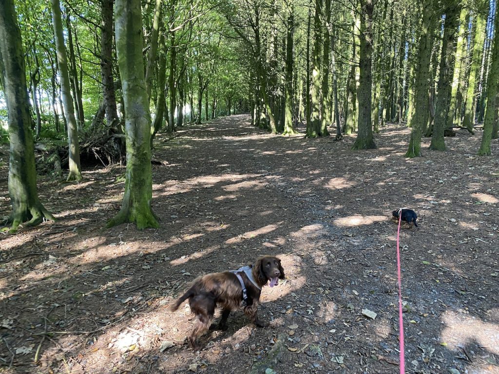
Anyway it was good to be back on the trail. The trees of the unimaginatively named Big Plantation provided relief from the sunshine and Witches’ Howe had logs we could sit on for our lunch break.
The trail crosses a minor road (without any cars), a railway (on a wee bridge), and then passes through a housing estate to reach the A75 (which wasn’t too busy). Ladies Walk brought us to coast. My English teacher would be proud that my main thought as we walked along was that there were no apostrophes on the signs.
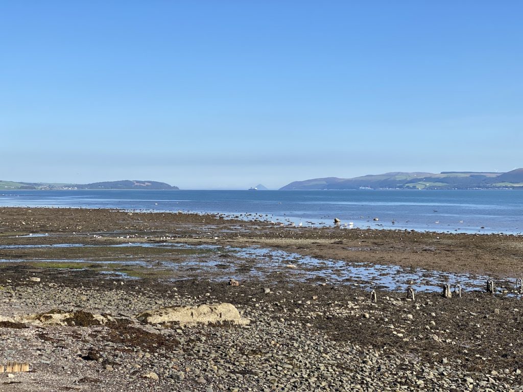
We turned left here, whereas the MoGT goes right. We had some pavement walking with views out to the mouth of Loch Ryan where we could see Arran beyond Ailsa Craig.
Once we were past the old port, there was a pleasant walk along to Agnew Park. It had been a hot day and Audrey had been tempting me with talk of having an ice-cream. And there was a cafe in the park…as we walked towards it, we were deciding which flavour to have.
Did you guess the outcome? They didn’t have any ice-cream. But we did get to watch a pair of swans waddling out into water followed by their cygnets.
This had seemed a short walk when I planned it, but given how it turned out I’m pleased it wasn’t longer. The day was much warmer than I had expected and our bullock-induced detour had been quite trying.
That’s the Mull of Galloway to Stranraer bit done.
Download file for GPS