
Distance: we walked 65.4 miles in total, but each section was walked out and back, some legs overlapped and we walked along the forestry track opposite the Raiders Road which is an extra. The route itself is about 26.7 miles.
This is just what it says, a route from Mossdale to Merrick mostly on forestry tracks, with short sections on quiet country roads. It arose from a subtle combination of happenstance and alliteration and kept us amused when we could meet outside but not share cars.
How we came to walk the route.
Sections:
I have given the times and distances for each section but included an estimate of the progress along the route if it was walked just one way.
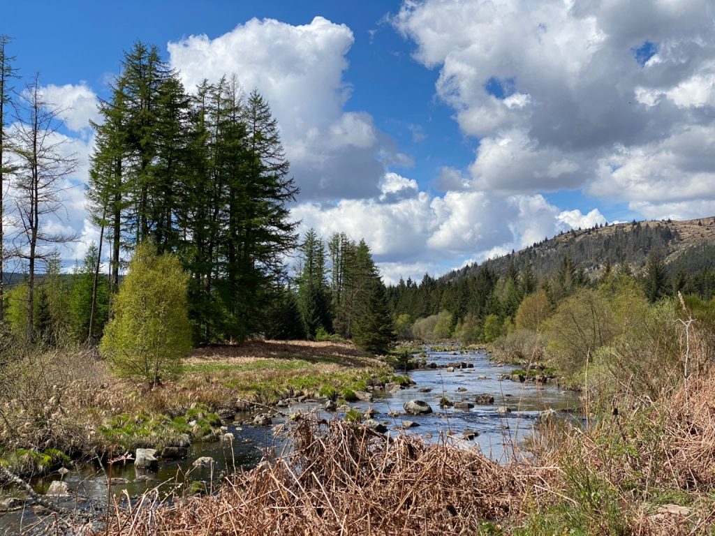
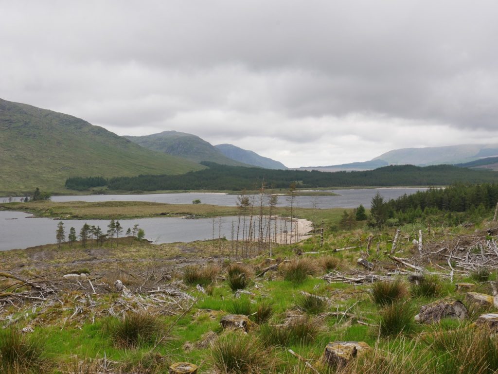
The Black Water of Dee
Mossdale to the Otter Pool
11.4 miles 5h 9m ascent 221m progress 5.6 miles
Forestry Road. No difficult bits. Nice views. Picnic tables at the Otter Pool and a couple of Rosnes Benches. Paddling possible.
The Labyrinth
The Otter Pool to the A712
8.0 miles 4h 1m ascent 293m progress 3.7 miles
Forestry Road. No difficult bits. Nice views. The Labyrinth. Picnic tables at the Otter Pool and a couple of Rosnes Benches. Paddling possible.
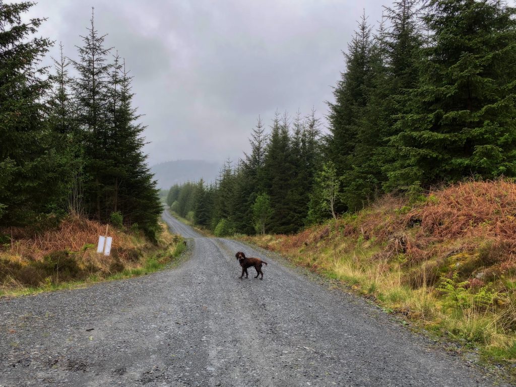
The other Raiders Road
The other Raiders road
9.7 miles 4h 25m ascent 242m progress 0 miles
Forestry Track. Different views. It might be possible to ford the Dee at the Gairloch Ford and walk back along the actual Raiders Road. The Black Water of Dee was black and deep when we were there so we didn’t attempt it. The bridge at Barney water is a further mile and a half a way, a mile of which would be along firebreaks rather than tracks. If you stay on forestry tracks it is an extra 4 miles.
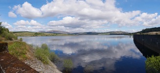
Clatteringshaws and dam
A712 to Craigencallie
10.7 miles 5h 5m ascent 243m progress 5.2 miles
A short stint along an A road (300m) then farm roads or forestry track. Look out for a millennium cycleway signs
Loch Dee looking north
Craigencallie to The Axe Head Stane
8.9miles 4h 28m ascent 217m progress 4.5 miles
Forestry tracks, the Southern Upland Way, Borthwick memorial bench, sandy beaches of Loch Dee, Rosnes Benches, a saltire on the White Laggan Bothy, another millennium cycleway sign and the Axe Head Stane. Views of the Rhinns of Kells and Dungeon Hills and if the conditions are right you might see the Silver Flowe twinkling.
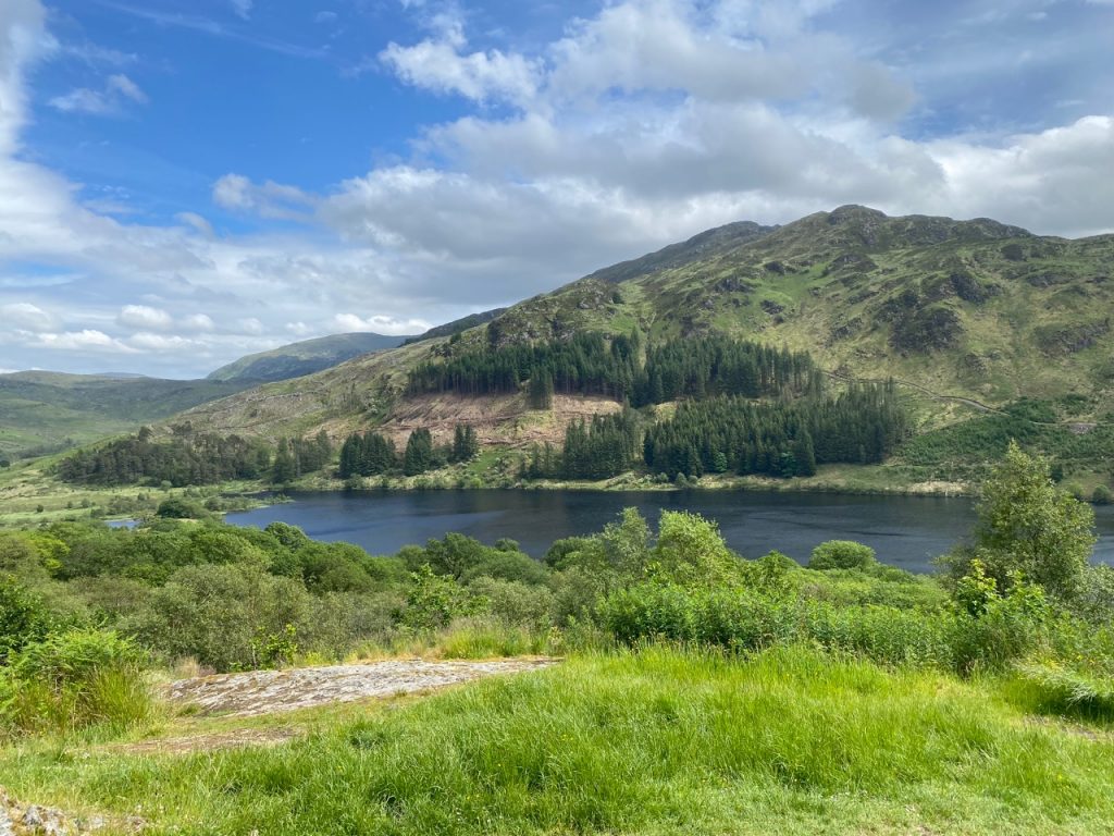
Loch Trool
The Axe Head Stane to Loch Trool
7.9 miles 4h 24m ascent 322m progress 3.4 miles
Forestry tracks then a quiet minor road. Two different lochs, several waterfalls and Bruce’s stone above Loch Trool.
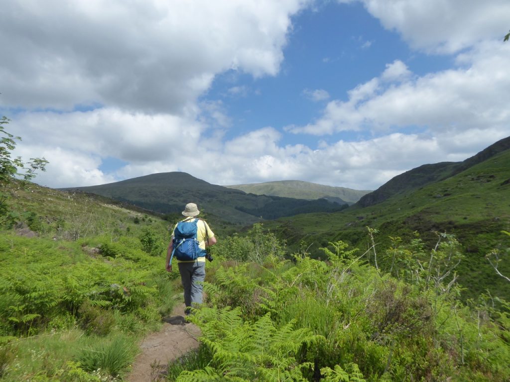
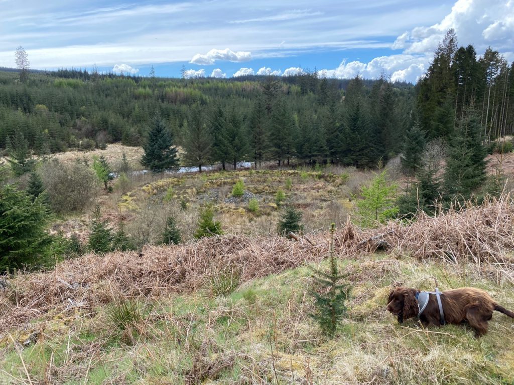
By the Buchan Burn
Merrick by the Merrick trail
8.8 miles 6h 40m ascent 865m progress 4.4 miles
The tourist route up Merrick. Spectacular views of the Galloway Hills. On a good day you can see Ireland.
How we came to walk the route:
Because of coronavirus restrictions we were limited to routes that returned to their starting place, since there was no car sharing, and which stayed within the county. I read that the Raiders road was closed to cars but open to walkers and cyclists and thought we could use the opportunity to walk along the Raiders Road safe from drivers who found the dirt track brought out their inner Colin McCrae. But…it’s about 10 miles and the twenty-mile round trip would be too much for wee Mabel – my goto excuse nowadays. So…we could park at the A712 end, walk down to the Otter Pool, have lunch then walk back. And do the other half next time. But there is no parking at the A762 end so we started at Mossdale instead, and used the old railway line to get to Stroan Loch and the Raiders Road.
And that would have been that. But I got to wondering why the Raiders Road was called the Raiders Road. Was it an age-old name, or something modern? It turns out it is a relatively modern name, chosen to give the old drove road a tinge of excitement while memorialising a local writer, Samuel Crockett, who was born at Duchrae Farm near Mossdale.
Crockett produced over seventy works but his best known is “The Raiders” published in 1894. It is the middle story of a trilogy but stands well on its own. It is set “In the graceless, unhallowed days after the Great Killing, when the saints of God had disappeared from the hills of Galloway and Carrick, and when the fastness of the utmost hills were held by a set of wild cairds – cattle reivers and murderers, worse than the tinted savages of whom navigators to the far seas bring us word.”
The raiders of the title appear in the first line of the first chapter ‘It was upon Rathan Head that I first heard their bridle-reins jingling clear’ and these raiders that the book’s young hero, Patrick Heron tracks to save a kidnapped girl. This took him along the drovers’ road that is now the Raiders Road.
I thought it would be interesting to take the book along on our walk and read a passage relating to his adventures aloud when we stopped for lunch. When we had done both ends of the Raiders Road, it seemed natural for us to continue along the raiders’ route, but with a little poetic licence.
Patrick climbs along the moorland above the raiders road, crosses the Silver Flow and climbs to Loch Enoch by the Wolf Slock. I’ve walked those places in the past and they were ‘once in a lifetime’ routes for me. See The Silver Flowe for more details. The route taken by the Raiders isn’t clear but after crossing Clatteringshaws (a valley then, rather than a loch) they presumably went over to Glentrool and up the valley of the Gairland Burn. I suspected Mabel’s legs wouldn’t have been long enough for the bog up there (that’s my excuse anyway). I thought it would be easier to climb Merrick and look down on Loch Enoch. And “Mossdale to Merrick” had a poetic ring to it.
The Mossdale to Merrick Trail was born. We walked each section as separate out-and-back walks, and I convinced myself that there was something gained from rewalking a route facing the opposite way.
