
14.61 miles 8h 37m ascent 688m

Well, here’s another nice mess you’ve gotten me into!
The comedy way is a 30.5 mile semi circular walk around Moham Bay. It begins in Ulverston at the statues of Laurel and Hardy and ends in Morecambe at the statue of Eric Morecambe.
The weather was good; mostly cloudy, a little breezy but warm enough for t-shirts and the sun did shine at times. The official guide book gives the length of this section as 12.9 miles, but as you can see above it was a good mile and half further. We hadn’t strayed from the route. I suspect that the author made an error in this first section and the 12.9 miles is to the summit of Hampsfell leaving something like a mile and a half still to walk to Grange-over-Sands. This would become obvious as our mileage gradually clocked up.
We used local trains to get to the beginning of each section of the Comedy Way and began this day’s walk at Ulverston railway station which is about a third of a mile away from the wall’s official start.
Stan Laurel, of Laurel & Hardy fame, was born in Ulverston in 1890 and his first theatre experience was at the town’s Hippodrome Theatre (which unfortunately burnt down in 1910.)
We took our photographs by the statue and readied ourselves for the day ahead. The official guidebook told us that the section would be 12.9 miles long but that was not true.


It was Ulverston’s Flag Fortnight and its shops were decked out with flags. I can’t remember. We walked up Theatre Road, Queen Street and then King Street passing the old market cross and a mural giving the history of John Barrow whose monument stands on Hoad Hill. He was famous enough to appear as a character in one of the Hornblower novels.
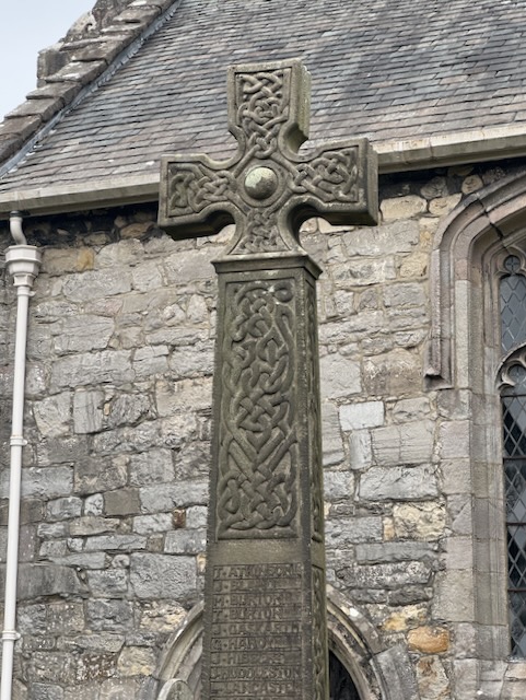
Looking along Church Walk we could see the parish church and beyond it the Barrow monument, looking very much like a lighthouse, on Hoad Hill. The church had a rather overgrown graveyard which gave the impression of neglect. But a sign informed us the graveyard had been left to allow its wildflowers to bloom. A purposeful choice rather than neglect. And certainly the church yard was filled with wildflowers between the old gravestones.
A little way after the church we left the tarmac for a well signed path onto Hoad Hill. At least a dozen benches were scattered along the way. We left the monument’s path when a gate allowed us onto some rough pasture watched by sheep and lambs. I imagine that most of this area is limestone since there were small outcroppings and the ground was relatively dry. It was only a short walk to the top of the hill and a gap stile through the wall. We had our first views of the Estuary but visibility wasn’t as good as it might have been.


The walking down to Newland Bottom was easy going taking us past blackthorn in flower and our first unusual “fruit”. A child’s mitten hanging from a branch.
The guidebook warned that we would meet another public footpath heading off to the left but we were to ignore this and turn right to head down to the buildings of Newland Bottom. We crossed Newland Beck and joined a minor road. The next couple of niles were on minor roads but there was hardly any traffic.
It was a gentle uphill stroll to Bowstead Gates and just a little steeper after that. The hedgerows to our left had been cut to a lower level, so we had good views over the fields that way. The hedges had been repaired with horizontal cut branches. I’m sure there must be a name for this but I haven’t been able to find it yet. [edit: I’m told this it is called pleaching].


At Bowstead Gates we had the unnerving experience of finding ourselves confronted with a ‘Road Closed’ sign. We took the view that this was information aimed at vehicle users and even if the road itself was completely closed we walkers could step into the nearby fields and find a way around any obstructions. as it turned out the road wasn’t closed.
Though we were walking on roads, the hedgerows were filled with spring wildflowers and the fields with young lambs. The gradient up the slope was enough to warm us up and once over the rise, the descent was steep enough to warrant an arrow on the OS map (between 14% and 20%). But being on tarmac we were making great time.
At Smithy Green we reached a road junction. A public pathway continued directly ahead and would have been a shortcut of sorts but I recalled the guide book had warned against using it so we kept tp the road until St Mary’s Church. The lychgate let us into another wildflower filled churchyard.

The far corner of St Mary’s Church triggered a memory of the haunted church in Banjo-Kazooie. I could even recall the music that went with it. Strange.
The pathway took us back to the road at Penny Bridge and down to Greenodd. I had hoped for some benches in the village, but remembered that the benches had all congregated on Hoad Hill. We had done about 4.5 miles so were ready for a break, but decided to press on in the hope of finding something to sit on.
We needed to cross the River Crake to get to the footbridge over the River Leven. The OS map seems to show the public pathway crossing the River Crake but the map did not match reality. We could see the footbridge across the Leven but our path didn’t cross the Crake. Luckily a dog walker was passing so we asked him. He showed us a path up to the A590 and crossed the Crake on its pavement. From there it was easy enough to get to the footbridge over the Leven.


Unfortunately there were no handy benches or seat sized tree trunks after the river either but we did find a couple of rocks to sit on. Audrey’s rock was quite seat-like whereas mine was a sharp jutting shape more misericord than seat. But we had a chance to rest our legs and have a coffee.
The walk changed its character after that. We had escaped the roads but still had a firm farm track beneath our feet. The track ran along a slightly elevated bank across what must be water meadows. Roudsea Wood was off to our right and would have been a more direct route but is closed to public access.
From the map I thought we would be walking alongside the River Leven here but we only really came close to the bank after passing the site of the old Fish House (which is no longer there). We left the farm track to walk through fields beside the river. There were steps and ladders down to the water, which I presume are used by anglers. a short walk along the riverbank brought us out of the bridge of Low Wood.


We didn’t cross the bridge but instead turned south along the B5278. There was not much traffic and there was enough verge to stand on when traffic did pass. I’ve noticed that drivers of Range Rovers are able to drive especially close when passing pedestrians.
We were only on the road for a couple of hundred metres before a gate gave us entry into Bigland Woods and what would be quite a climb up to Bigland tarn. A moss covered sign told us we were on the Cumbria Coastal Way
The well walked path, which can be a little wet in places, climbs steadily through the delightful wood. In late spring wonderful drifts of bluebells cascade down the woodland banks. Whilst the path is not excessively steep the long climb is the second most strenuous of the entire walk.
The Comedy Way. John Coppack. 2021
I imagine the pathway becomes a waterway when it rains. Most of the smaller particles which would once have made the path had long since been washed away leaving a pathway of irregular rocks and pebbles. Care was needed chasing where to step making the climb a little bit more arduous. I walked slowly but still found I needed to stop to catch my breath more than once. But the woodland was pleasant enough and there were indeed bluebell-filled hollows. The bluebells by the path were joined by stitchwort, a combination I find particularly pleasing.

The path was dry on the steeper sections but there the gradient eased the ground became quite boggy but was crossed by a short boardwalk. As we emerged from the trees we passed some ruined buildings with turf roofs.


Escaping from the trees we climbed the final few metres to Bigland Tarn just as a large group of walkers passed. We were warm from the climb but were no longer sheltered from the cool wind so sought the lee of a wall to have our lunch.
Sitting by the tarn I looked at the GPS and saw we had walked a little under eight miles, which came as a shock since I had thought we had come about half way.


A short walk over the moorland of Bigland Heights gave us views, albeit hazy, across Morecambe Bay. The path through High Stribers Wood was a gradual downhill stroll along a good woodland path with bluebells, primroses and the scent of wild garlic.

We passed the houses at Grassgarth then crossed the moorland of Stribers Allotment. The route was obvious though I imagine it would be easy enough to go astray in misty weather. All that remained of the waymarker posts were stumps. I presume these once marked the old Cumbrian Way. Then it was mostly downhill through a variety of minor roads, pasture and woodland until we emerged at Cartmel racecourse.

The OS map shows the path crossing directly through the racecourse but the guidebook warned we would need to follow the diversion signs if the races were on. By this time we were quite tired and the idea of having to divert around the racecourse wasn’t a happy thought.
From the woodland above the racecourse I heard cheering. My heart sank at the thought of walking around the course but the cheering was from a football match (Cartmel versus Ambleside). Cartmel would win 4-0. The only diversion was walking round the football pitch.
Cartel was well provided with small coffee shops and we treated ourselves to cake and hot chocolate. On comfy seats.


Rejuvenated and rested we set off past the old priory and then across the farmland near Pit Farm. Hampsfell stood before us.
Now take a deep breath before climbing the steep fellside on a left diagonal path.
The Comedy Way. John Coppack
The climb drew deeply on my store of enthusiasm. We were walking the Comedy way but we weren’t laughing. We eventually reached the summit and found the ‘Hospice”, built in 1846 by Rev. George Remington for “the shelter and entertainment travellers over the fell.” We had walked 13.25 miles. Subtracting the 0.36 miles between the Ulverston station and the Laurel and Hardy Statues leaves 12.9 miles. So the guidebook has the wrong distance for the Ulverston to Grange section.


From the hospice we made our way down towards Grange over Sands. Unfortunately our path brought us to a steep drop over some crags and we had to retrace our steps a little to find a more manageable way down. There was a little more walking through woodland which eventually brought us to a farm track that morphed into a minor road. By then we were probably only half a mile from Grange over Sands but we were quite tired and the road seemed to go on forever. Not only that, we couldn’t see any sign of Grange over Sands until we emerged close to the ornamental gardens.
Quite a walk. A mile and a half further than we had expected but enjoyable nonetheless.
Download file for GPS