
4.8 miles 2h 12m ascent 273m
I would be an exaggeration to say Marthrown Hill has been a thorn in my side but it has been a bit of a prickle. Walking around it these last few weeks brought that price to the fore. It had foiled my attempts to uncover its etymology and nine years ago, with a spaniel and a border terrier I failed to reach its lowly top. The terrain, particularly some new fell, was too much for us.
I decided that this time I would have to do it without the dogs. Christy might manage but I doubted Mabel could. I had several possible routes in mind but remained undecided. Since I had two dogs with me (though not the same two as nine years ago), this was just going to be a recce. I would see which direction looked most appealing.
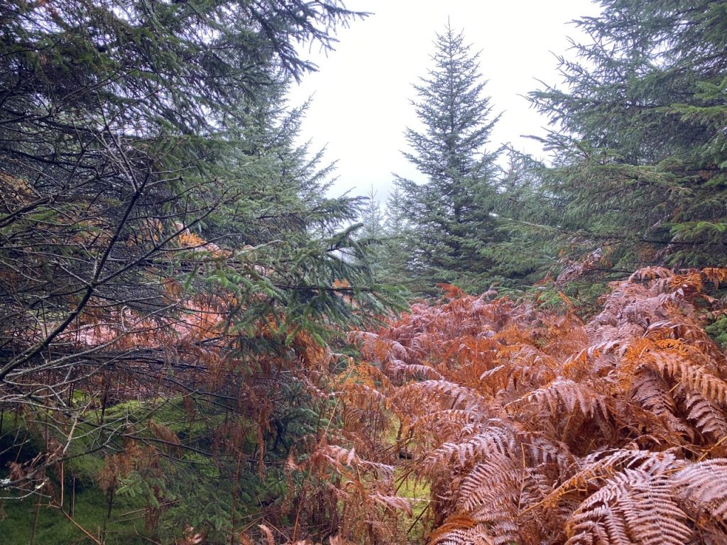
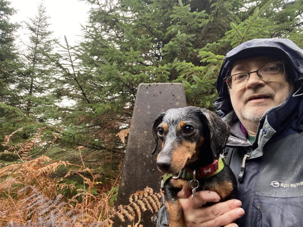
But one thing led to another and all three of us reached the top. The miniature dachshund put in a sterling effort while the spaniel regarded it as a warm-up. We tramped up Dalshinnie Glen, up the steep ‘brown’ route on Marthrown’s lower slopes and then along the defunct ‘orange’ route that joined the yellow and brown walk routes in the olden days. I don’t know when the orange route was deactivated, but it can’t have been that long ago, perhaps during the big lockdown. The path is overgrown but the route still distinct. It contours the hill for about 150m and where it turns downhill, we turned to look uphill.
There was an area of increased light in the forest, just a few metres away. The firebreak running parallel to our path. We headed towards the light. Worn vegetation gave the impression that others had used the same route. But were those ‘others’ humans or deer? There were no footprints.
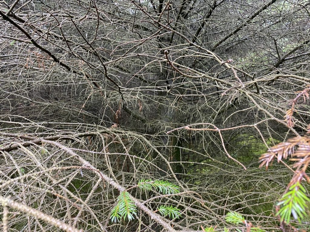
The firebreak was not easy going. It was either boggy with sphagnum moss and heather hiding standing water, or overgrown with chest-high bracken. Three generations of trees laid claim to the break: piles of broken branches from the last fell cycle, windthrow from the present growth and naturally seeded saplings. Write-ups on hill-bagging.co.uk include comments like “I expected a stinker and certainly wasn’t disappointed” and “A real bugger this one“.
We were often forced to leave the firebreak and force a way through the forest. I should have worn ski-goggles but had to make do with my coat’s hood and my glasses. Christy found it a great adventure. Mabel being only six inches tall was unconcerned by the tree’s low branches but she can’t be trusted to run free and often caught her lead on the tangled branches littering the forest floor.
Nearer the top I left the firebreak and headed in the direction that seemed most uphill. The trees’ branches were sometimes impenetrable, forcing me to change direction and I soon lost all sense of direction. Getting to a place a few metres away could take several attempts in different directions. I don’t think I could have found my way had I not used GPS. I stumbled along to wherever looked slightly higher.
But we got there [PS I’m not so sure, see below]. Feet wet, face scratched and my jacket looking as though I had been dirt-biking. Looking down at my muddy chest I realised too late that I should have zipped-up the jacket.
I was then faced with finding a way out of the jungle. I headed for a patch of sunlight, presuming it to be a firebreak, and looked at the mass of bracken ahead of me. It had to be done. With my feet already soaked I didn’t care about the boggy sections now. The bracken caught my foot a couple of times and contrived to unfasten my laces but I stayed upright. We tried going back in amongst the trees but that was even worse.
The forest breaks all look much the same but I did begin to think that we were back in the lower part of the same firebreak we had used on the way up. Unfortunately it looked completely overgrown lower down. I needed to get back to the orange track we had used on the way in. But I doubted I would be able to find it. Everywhere looked the same.
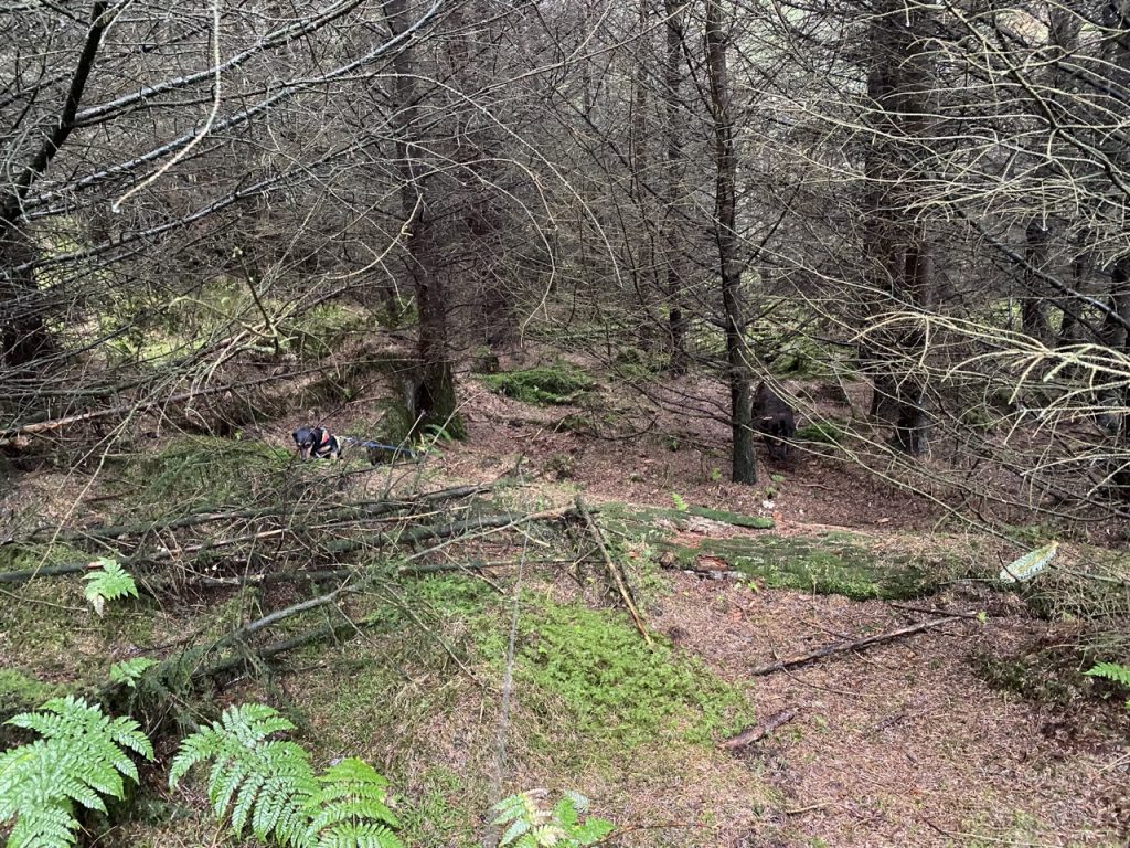
All hail, Christy. He remembered where we came into the firebreak and ran to it, then stopped tail-wagging. The doggy way of saying “are we going this way?”
Back on the orange path I decided to continue along it, downhill, rather than retracing my steps. I can see why Mabie decided to close it. The lower sections are very muddy and the steeper bits quite slippery, the kind of path that is OK to climb but a challenge to descend (without ending up on your arse).
Well. I’m glad to have got to the top of Marthrown Hill but I don’t think I’ll do it again.
And as a bonus I found that Marthrown comes from the Norse, myrr-tjorn, the moor (or mire) with the pool of water (tarn). The names Marthrown of Mabie and Marthrown of Woodhead make more sense now, the swampy moors with pools at Mabie and Woodhead.
[sgpx gpx=https://www.screel.co.uk/walks/wp-content/uploads/2022/11/route_2022-11-08_12.50pm.gpx]
Post Scriptum (10/11/2022):
I realised that I hadn’t visited the trig pillar on Marthrown Hill on the 8th. So despite my assertion two days ago that I would probably not re-climb Marthrown Hill, I have been up it again.
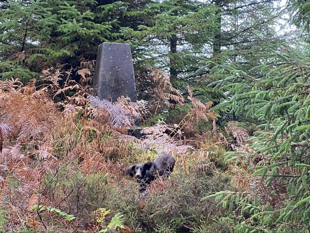
I would guess this hilltop was once mildly undulating moorland without a very clear summit. One old description describes Marthrown’s trig as “standing on the northernmost of several knolls” but the hilltop is now a densely forested maze of intertwined branches with limited visibility.
But the summit has to be inside the 245m contour line which, by my reckoning, is about a hectare. “What’s that in old money?” You might ask. But would it help to know it is about two and a half acres? An acre – the land a man and a team of oxen can plough in one day – field a furlong by a chain. Still not seeing it? Try these: an acre is about 16 tennis courts or half of a football field. Walking at at 3 mph gets you along one side of a square containing an acre in 50 seconds. Back to the hectare, SI units are simpler. A hectare is a square with sides of 100m. That’s a 75 second walk at 3 mph.
The summit is a knoll somewhere in that hectare. I had fought my way from one minor rise to another on the 8th, always moving to any area that looked higher. I eventually found what seemed to be the highest and the GPS read 250m so I thought I was at the top. On the 10th I found the trig pillar and got the same reading, 250m. The trig does stand on a wee mound, which might be natural or concrete-enhanced. Its hard to tell now it is so overgrown.
When I was floundering about Marthrown Hill on the 8th I was pretty sure I had found the highest point. I can say the same for the 10th but with the added benefit of visiting the trig pillar. The GPS suggested I had walked by the old fire-tower on the 8th but I didn’t see any remains.
This time I had gone up from close to the viewpoint on a spur of the brown route. It took half an hour of tramping uphill, in the rain, to get to the view point. A viewpoint, by the way, from which there is not much of a view since the trees have grown up in front of it.
From there it was an easy not too difficult walk up a firebreak to the ‘wall’. I couldn’t actually see a wall but had the impression that it had once been there. After that I just headed in the direction of the summit trig as best I could. I would often find my way blocked but would see a trail a few metres away and fight my way through to it, with several stops to untangle Mabel’s lead.
At first I felt good about using these trails. Others must have used this route, it must be the way. But it dawned on me that whoever made this trail had not broken the branches that stood in my way. These were animal trails. I couldn’t expect them to lead me to the summit.
Eventually I was at the top, or so it seemed to both me and the GPS. But there was no trig pillar. The woods were quite dark and I couldn’t see much when peering into the trees. It was a FFS moment. I am here, the GPS shows me standing at the trig point, but there is no sign of the trig. I turned slowly through 360o. No trig. I rechecked the GPS. Yes, it had me standing where the trig should be.
One step sideways. And there it was, a biscuit-toss away. It had been hidden by a tree.
A faint trail led away from it. Its general direction looked as if it would take me to the firebreak that runs SE. I could follow that to the wall and down to the MTB tracks. It was not easy to follow and wound about disconcertingly. Actually I don’t think I was following a trail, just what my brain thought was a trail.
We eventually came to a bracken filled firebreak that looked very similar to the one I had descended westwards a couple of days earlier. I was walking in the opposite direction to that I had thought. Change of plan. I would go NE along the firebreak and come off the hill to the north.
It wasn’t too difficult at first, the firebreak ended but walking in the trees was easy enough. But once I reached the edge of the trees it was unpleasant going, steep, uneven, and wet, with dense bracken, felling debris and wide bands of impenetrable brambles. I could see the forest track 250m away and knew there must be an MTB track within 100m.
I had to carry Mabel because of the brambles and had a couple of difficult climbs down to where I could see the MTB track. So close, but the brambles were dense and wide. I twice had to climb back up and move further along to find a break in the wall of thorns.
Finding my break in the wall of brambles I paused, put Mabel down, and stepped onto the MTB track. An unseen demon swept my feet away and I crunched onto my left arm. Shaken but no serious injury.
Oh, the joy of walking on a real path. The yellow walk route was close but I really didn’t fancy any more tussocks and bracken. So we walked along the track until a muddy track let us escape onto the forestry track, and back to the car. Wow.
[sgpx gpx=https://www.screel.co.uk/walks/wp-content/uploads/2022/11/route_2022-11-10_1.44pm.gpx]

Hello, I was wondering where you found the origin of the word “marthrown”, is there a source or record you found? Very keen to find out more. Thanks!
“Marthrown is the only other name to be mentioned. It is from the Norse, myrr-tjorn, the moor with the pool of water.” from “History of the lands and their owners in Galloway” by P H M’Kerlie (on-line via Google). No official documents etc, so it’s possibly a folk etymology.
Thanks, appreciate the response.