
These were our penultimate and final sections of the Hadrian’s Wall Trail, the official trail ending at Segudunum, the alternate, unofficial, finish at Arbeia, and our own extension to make it into a coast to coast walk.
Day IX: Completing the Official Trail
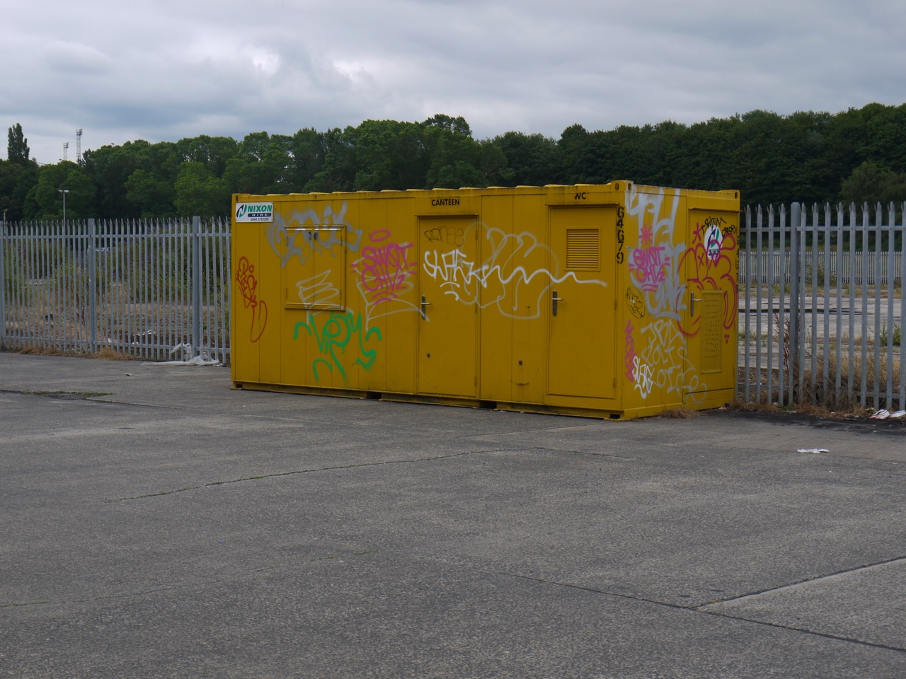
12.9 miles 5h 39m ascent 153m; Newburn to Segedunum
 Newburn-Newcastle-Wallsend-North Shields-South Shields
After a few weeks of heatwave unconducive to enjoyable hiking we had chosen a couple of pleasantly warm days, with temperatures of 23° and 26°, a light easterly breeze and sunshine enough to catch me out on the first day and reminded me to use sunscreen the next.
We set out from the the green and monument marking the site of the Battle of Newburn Ford in 1640. The River Tyne must have changed since those days and I wouldn’t want to try fording it here now.
We crossed a wee footbridge over the Reigh Burn and were back on cycleway 72 walking along what would once have been a waggonway. In places we strolled in the shadow of mature trees, while in others the path was surrounded by what I can only think to call urban meadow, with tall grasses and a wealth of wild flowers growing on land that would once have been factories. There was teasel in abundance with yarrow, knapweed, thistle, ragweed, wild parsley and scabious. The route took us by the Tyne Rowing Club with its figurehead of Old Father Tyne, the Boathouse pub (handy for the rowers, but not open for business when we passed), and the suburb of Lemington where an information board with old photos showed us just how industrial the area had once been.
The A1 is quite an obstacle for the HW walkers trail and cycleway, but the trail copes by leaving the old waggonway at Neptune Road, heading through the parkland of Bell’s Close and crossing the Great North Road by way of a footbridge. This took us into Denton Dene which isn’t so much a narrow wooded valley as its name suggests but a series of football pitches with youngsters’ teams giving us our first sight of a Newcastle Football top in its native land. Surprisingly this was one of only three we were to see in two days walking through Newcastle. Whereas I saw nine actual (corvid) magpies in that time. Depending on which rhyme I read I am either looking forward to a kiss or meeting the Devil himself.
One for sorrow,
Two for joy,
Three for a girl,
Four for a boy,
Five for silver,
Six for gold,
Seven for a secret,
Never to be told.
Eight for a wish,
Nine for a kiss,
Ten a surprise you should be careful not to miss
Eleven for health
Twelve for wealth
Thirteen beware it’s the devil himself.
Or
One’s sorrow,
Two’s mirth,
Three’s a wedding,
Four’s a birth,
Five’s a christening,
Six a dearth,
Seven’s heaven,
Eight is hell,
And nine’s the devil his own sel’.
Oh dear! I looked up Devil’s kiss in urban dictionary. That’s given me a shudder.
To be fair I think these refer to total numbers seen at the same time, in which case I was to expect joy or mirth. Both were to come at the end of day one, as you will hear.
The trail dumped us onto Denton Road and we turned back towards the river, passing the rather intriguingly named “Da’Wah Invitation Restaurant”. This left us mulling over whether locals sit in their homes waiting for an invitation, and whether this would be a good business model. A little Google Fu enlightened me, Da’Wah means invitation in Arabic.
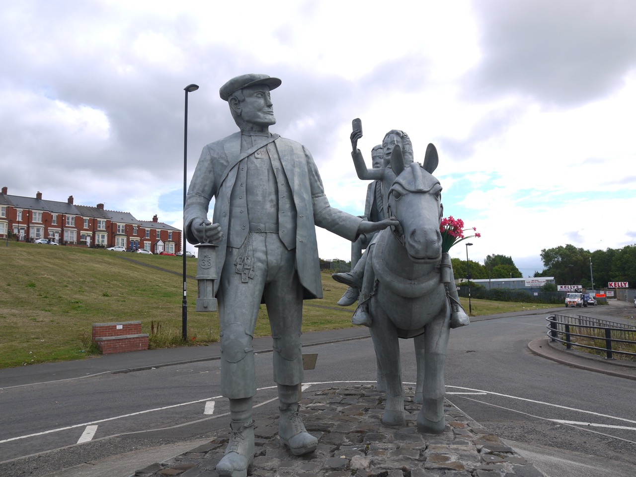
Our musings on invitation-only dining were brought to an end when we noticed a statue by the next road junction. A man in old-fashioned working man’s attire led a pony ridden by a boy who from a distance looked like Pinocchio and a girl lifting a mobile phone as if to take a selfie.
A nearby plaque informed us that this was:
In memory of the 38 mean and boys who tragically lost their lives in the Montagu View Pit Disaster on 30th March 1925, when an inrush of water from a burst seam flooded the mine shaft. The pit finally closed on 13th November 1959.
The pitman, pony and tank depict our past heritage. The house represents the regeneration of our community. The children are our future.
The sculpture was made by Exceptional designs.
In Remembrance of Men of Steel.
I pondered on the tank and the house. Where were they? I found the house in the boy’s right hand and I presume the tank is what they they are standing on. The lamp the miner carries is inscribed No.38 representing those who died and I only noticed when looking at my photos that there are flowers in the pony’s bridle. Reading the sculpter’s website, the piece is said to show a miner on his day off taking his children to the Blaydon Races, so recalling happier days. Why does the girl have a mobile phone?
The HW trail rejoined the old waggonway and took us through more post-industrial urban meadows to Paradise, and as the song Blaydon Races says “Noo when we gat to Paradise thor wes bonny gam begun“. Walking on the HW trail one would not have noticed Paradise were it not for road signs and the Paradise Gardens are long since gone. I found a modern version of Blaydon Races’ lyrics which contrasts the emotions in passing through Paradise then with those of today (or ten years ago).
We went further on the journeyBut before the bridge was crossedWe tried to visit ParadiseBut Paradise was lostThe pubs ‘n’ clubs the shops ‘n’ aalThe streets the bairns had played inIt’s like the middle o’ neewhereWhen you’re on the road to Blaydon
That said Newcastle does seem to be regenerating, new growth spreading over the lost industrial landscape, especially around the quayside.
For the first time on the trail we had a walk along a length of a major road. The pavement of the A695 perhaps allowed us to clear our minds for the next section which followed the old quayside. The sound of traffic is not new to me, but it washed through my mind, the weeds of the roadside adding a little colour to the grey of road and paving. I took a deep sniff hoping to notice the flora amidst the cars and lorries and found myself nothing a different smell. My mind immediately said “petrol” but then corrected itself to “like petrol but sweeter”. Neither Audrey nor I could place it, but when we turned off the road and passed a sign proclaiming “JP Ltd Asphalt Plant” we knew the smell.
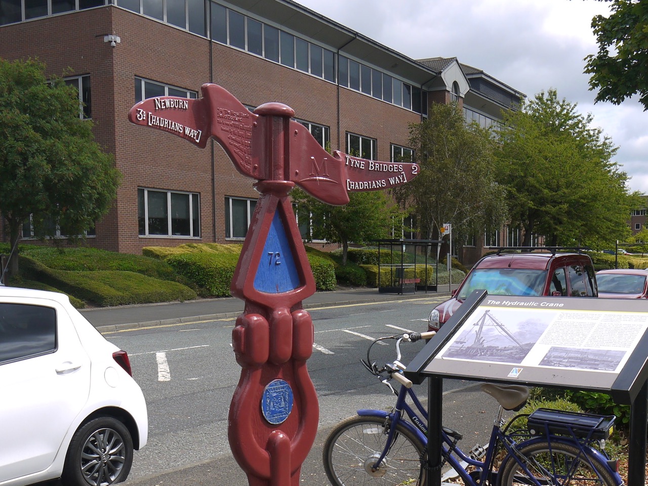
Two miles to the Tyne Bridges
The Quayside has been renewed, old piers have been repaired repainted and now sport artwork and anglers, the footpaths are decorated with a variety of art, millennium cycleway signs and information boards describing the industrial heritage of the area. Apparently almost all the warships involved in the 1905 Russo-Japanese war were built here (which you may interpret as good or ill as you see fit).
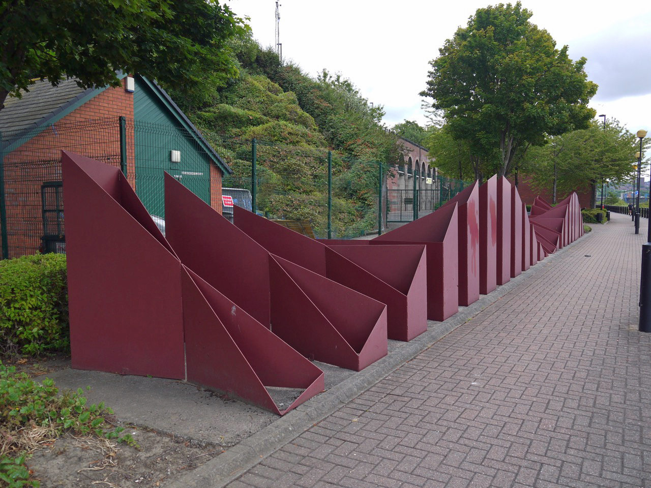
Sculpture by David McMillan 1990.
This piece looked like waves to me but it is said to represent the undulations of the Northumberland hills.
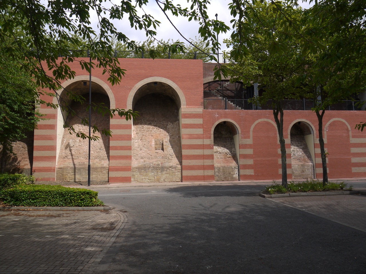
Armstrong’s Arches
The Armstrong works which once covered 230 acres would have dominated this part of the riverside are gone, replaced by new businesses, expensive dwellings, statues and recreation spaces. These arches are all that remains of the Armstrong Works.
Elswick Pier
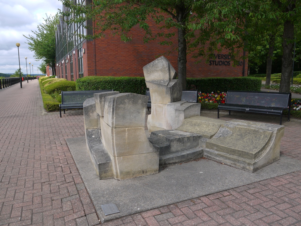
Lintzford. Nick Lloyd 1990.
Lintzford is constructed from Ancaster hard white limestone. The title refers to the place in the Derwent Valley where the artist lives and works. The work looks as if it is made up of the remains of a building.but the artist describes the work as portraying the countryside of Northumberland and Durham.
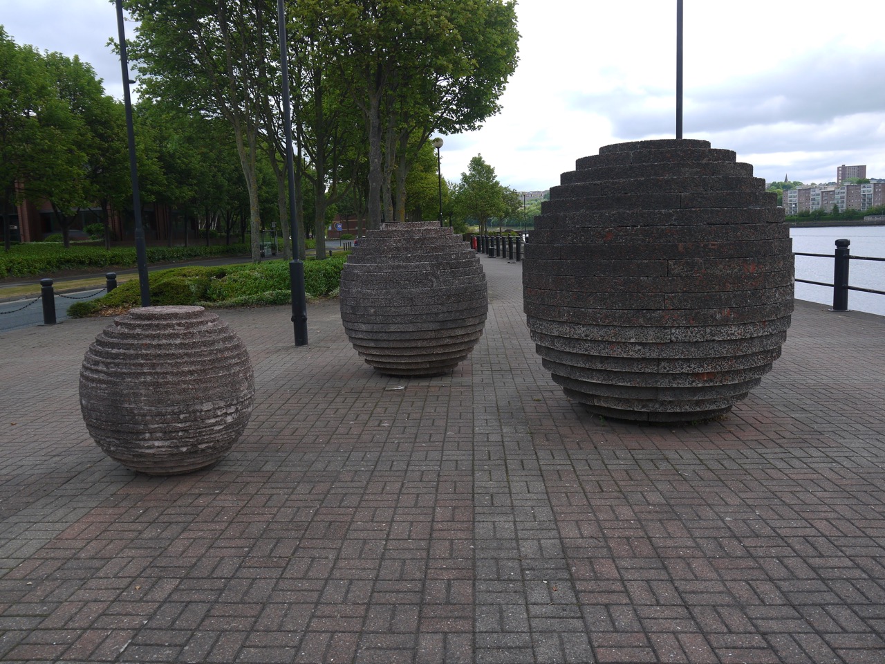
Spheres by Richard Cole
There are several giant spheres made up of concrete rings of varying sizes at three different places along the walkway.

I hadn’t noticed we were in blue and pink
We made use of the seats here to have a rest, take a selfie and look across the river. We could see the Angel of the North on the distance and the Tyne bridges, which in my mind marked Newcastle proper, a little further downriver. Once we reached the bridges we found Newcastle’s quayside busy with people walking, resting and filling the seats outside pubs and cafés. A real promenade.
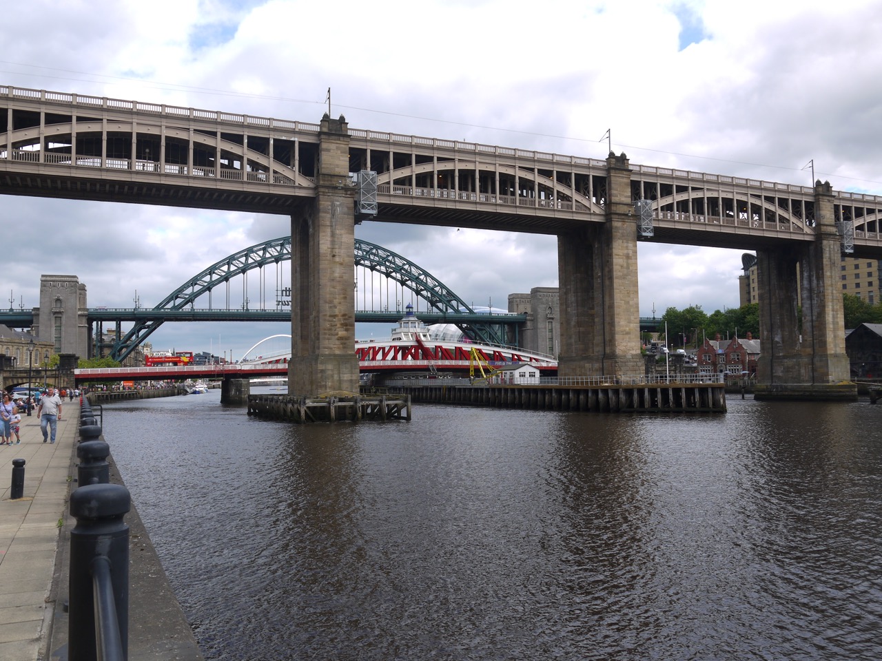
Tyne Bridges
The city has several bridges squeezed close together. (Edit: autocorrect tried to make that into “togither”. It must be turning Geordie). The old Fish Market, topped with a statue of Neptune himself, had obviously changed its purpose, since it sported a neon sign “Hot Tramp I Love You So” and was surrounded by teenage girls in going out gear (not quite party gear but not just everyday gear). Perhaps they saw themselves as Rebel Rebels.
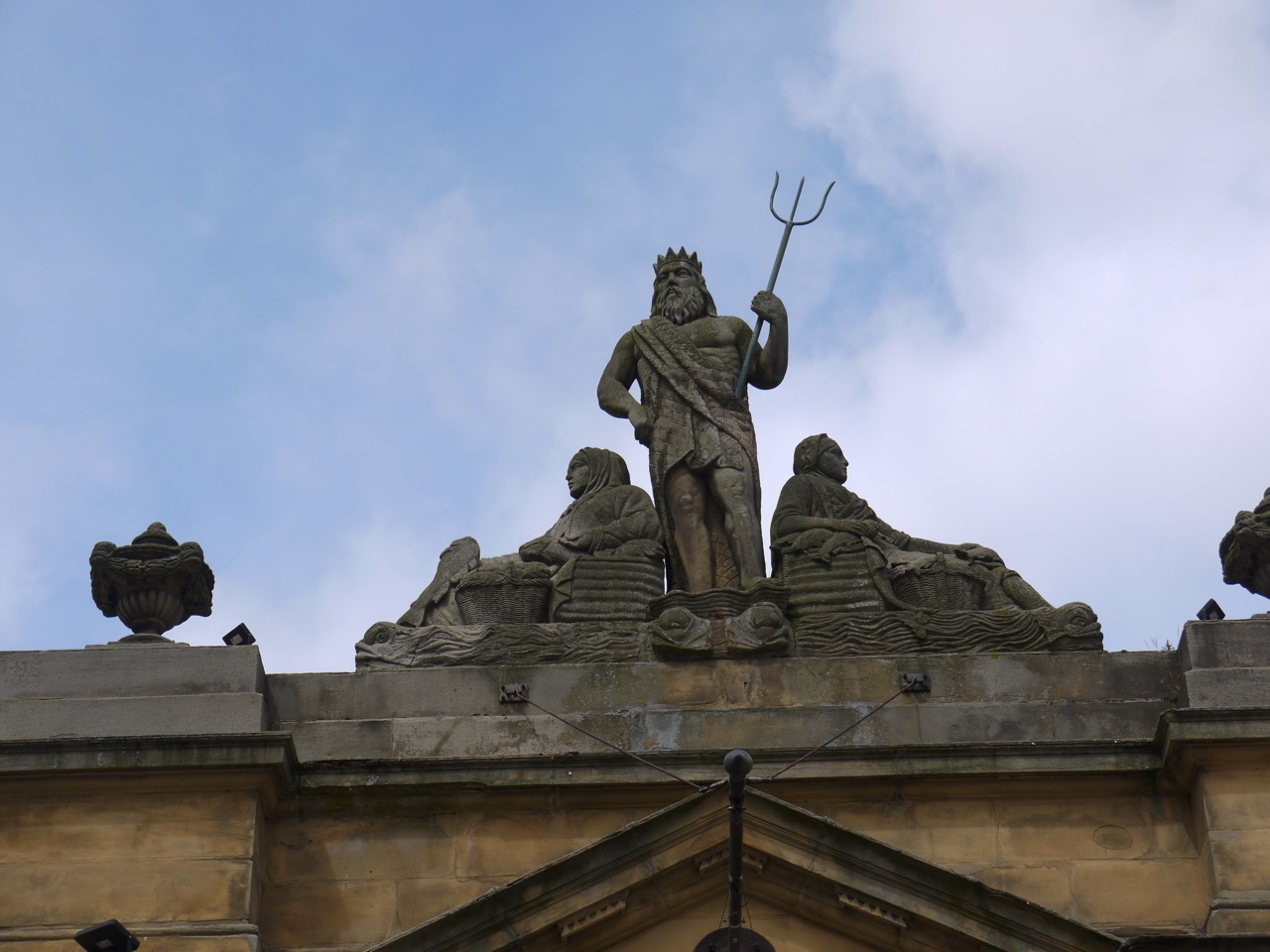
The Fish Market’s Neptune
Wow. I just looked it up. That song was released 44 years ago. I pause, and look up, my mind wandering, the world becoming monochrome. The cadence of my rocking chair slows, disturbing the old hound who lifts his head, looks at me with milky eyes and sniffs the air. I murmur “don’t worry boy, that was long ago. The diamond dog will be as grey as me and his joints stiffer than yours.” He rests his head back down and I turn my gaze back to the laptop as the nostalgia passes and colour refills my perceptions.
Bringing me back to earth, my laptop shows me that the Fish Market is now described as “a high class ale house for the booze sodden partygoers that make the nightly pilgrimage to this centre of revelry.” There’s a sentence fit to spawn an entire sociology lecture.
By now we were looking for a place to sit and eat our sandwiches, but Newcastle seems to have taken a decision to only provide public seats without backs. We soft north-westerners searched for an elusive backed-bench, but had to make do with a low wall topped with a wrought iron fence (against which we could rest our weary backs).
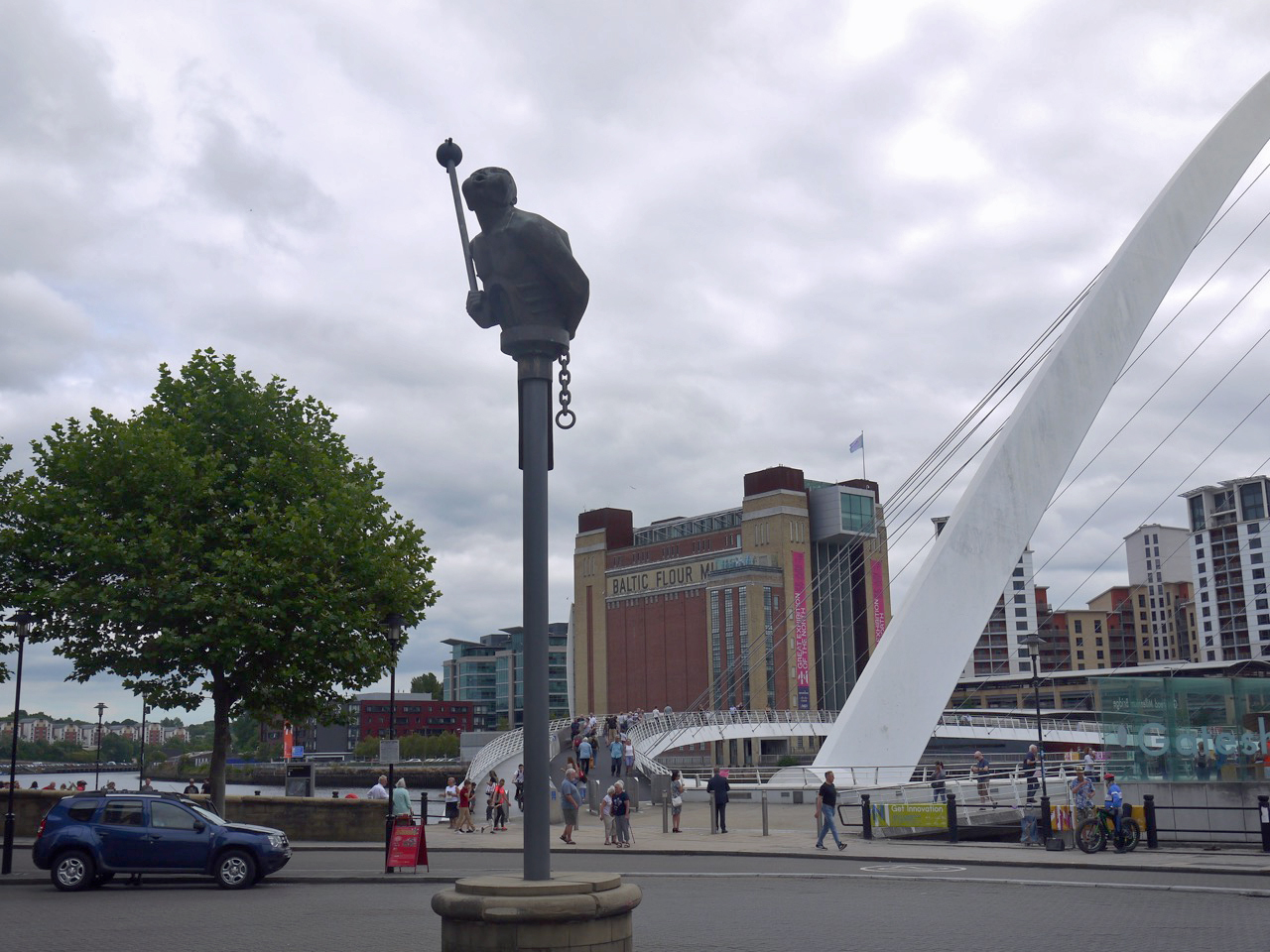
River God
I sat eating my ham and mustard sandwich on Sandgate, the Millennium bridge framing the Baltic Flour Building, a busker singing the works of Dire Straits and a bronze figure, The River God, looming above me. The River god, atop a steel column, holds a mace and chain and appears to be blowing at the Siren, another statue.

Siren
The Siren had her effect on me. I climbed the steps to reach her (for a photo) and while there a local woman, identified as such by her accent, mumbled about her husband being back where we had come from. At first I thought she was talking about her own husband but she meant the Siren’s husband, the River God.
The wall beneath the Siren was inscribed:
As Aa cam thro Sandgit
A hard a lassie sing
Weel may the keel row
That ma laddie’s in
This is a traditional song Keel Row. It is not a poem by Kipling as several internet sites claim – presumably someone has made a mistake and others have copied it. Audrey recognised it and broke into song, but I had not heard of the song. It certainly wasn’t one of the traditional songs such as “The big ship sails through the Alley Alley O” that I sang at primary school. I did intend linking to a version of Keel Row but boy do the recorded versions sound dire.
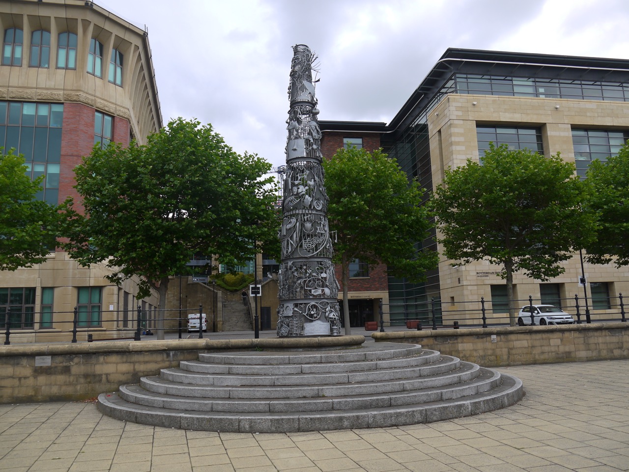
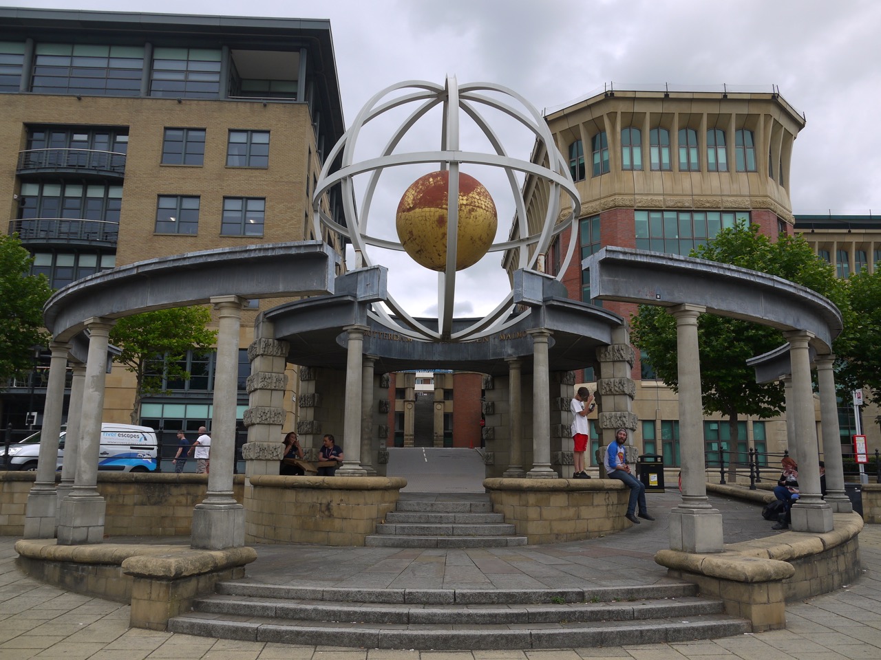
So after a brief chat about sirens and school songs we set off along the quayside once more. There were several more art installations each of which I paused to contemplate, and one that I thought was a corporate logo for a hotel, and ignored. What does that say about my appreciation of art? (Authorial intent does not art make…repeat one hundred times).
Rudder – Andrew Burton (1996)
Blacksmith’s Needle (1996)
This needle has six sections each relating to one of the six senses.
Swirl Pavilion (Raf Fulcher 1998)
This is described as a folly for the Quayside. It has the names of destinations carved around the inner rim, which the artist found on a faded sign for a local shipping company. The Swirl takes its name from is a hidden stream that joins the Tyne nearby.
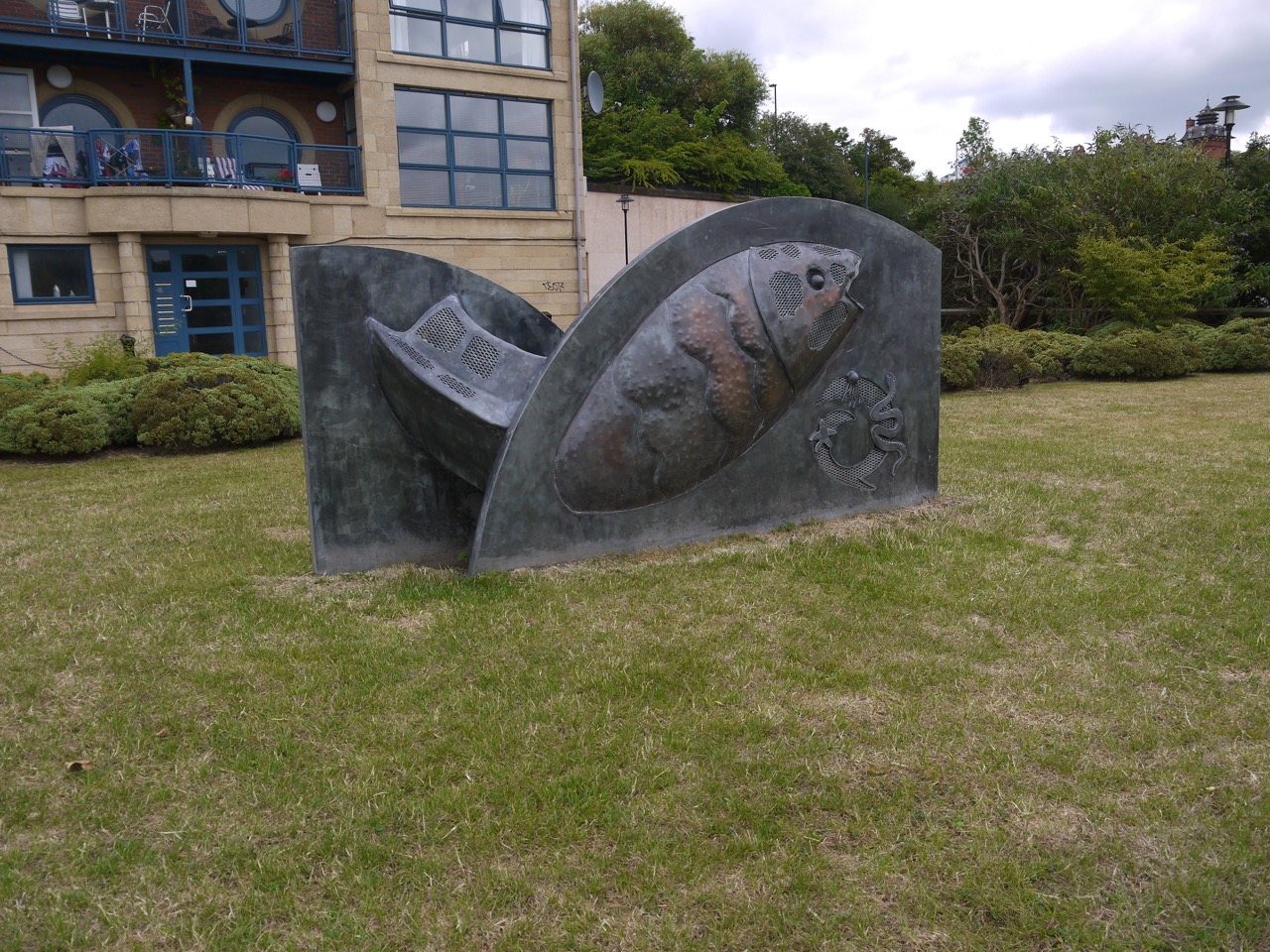
?
I’m not sure what to make of this fish
As we had strolled along the quayside promenade at Elswick, a walker resting on a bench called to us asking if we were on the Hadrian’s Wall Trail. when we admitted we were he said he had begun just that day and warned us that the way ahead was industrial. After the nnnamed fish statue we crossed the Ouse Burn and left the regenerated quayside and passed into an post-industrial landscape of concrete, where sharp topped fences surrounded abandoned and neglected plots of land and To Let signs provided the brightest colours. Even the pavements were overgrown.
Beyond the Ouse Burn
And then amid the dire colours was an oasis of colour and regeneration at St Peter’s Marina.
St Peter’s Marina
The HW trail then took us back to the riverside towards St Anthony’s Point, passing a small shipwreck in the tidal mud and more artwork (its artistic effect unsullied by knowledge of authorial intent).
Artwork at Walker Riverside
As we walked we looked across the river to a large factory each of us trying to read the name on its sign. It eventually revealed itself as AKZO Nobel, a manufacturer of paints and coatings and not explosives as I had guessed from the name.
The final mile to Segudunum was along a cycleway between houses to our left and what were once shipyards to our right. As we walked we mused on how we would mark the end of the official Hadrian’s Wall Trail. We agreed photos would be in order, and given the temperature we decided that ice-cream would be our “champagne”.
Joy at reaching Segudunum
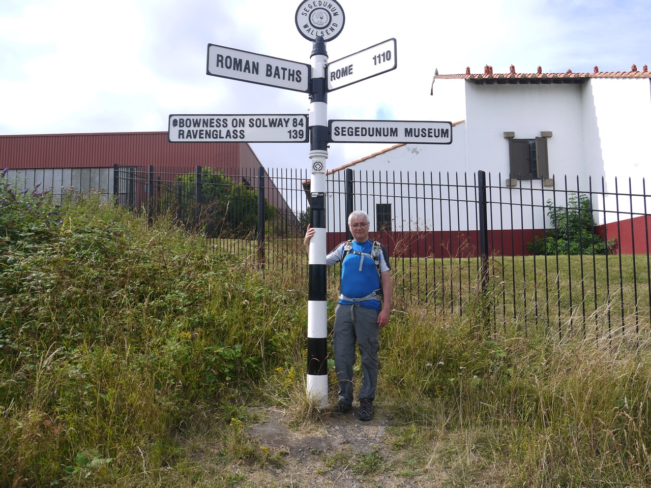
Segudunum has a rather imposing, and somewhat out of character tower, which from a distance I had presumed was some sort of coastguard building. We knew we had reached the fort when we found the signpost.
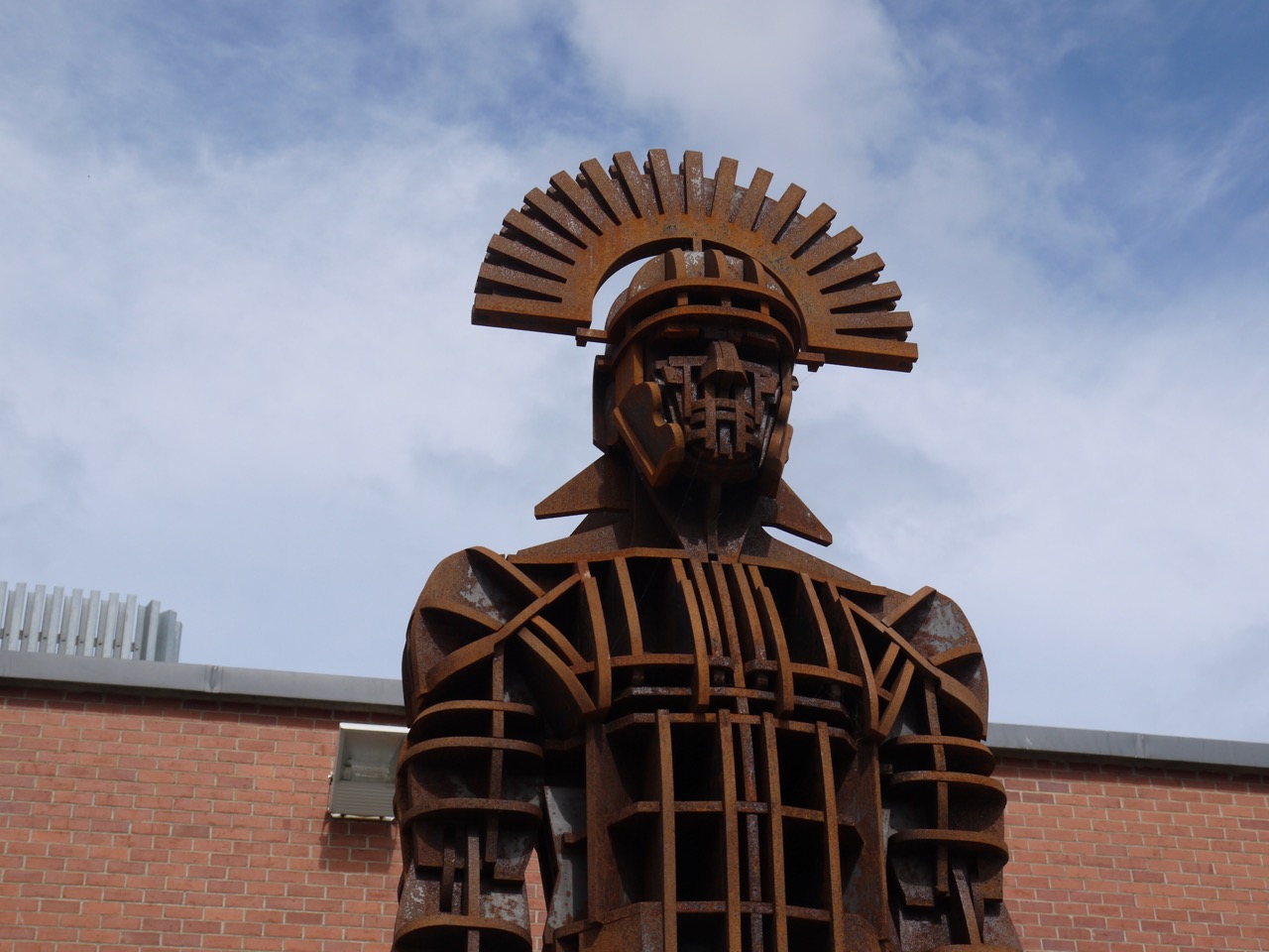
Statue at Segudunum
After that we walked into the fort museum ready for our ice-creams. I mentioned to the lady on reception that we had walked for 12 miles in the sun and were now ready for ice-cream. Her face fell a little and she told us they had no ice-cream. Inwardly I sighed thinking I had been looking forward to ice-cream but I could make do with an ice-lolly. Then the truth hit home as she told us that the Café wasn’t open. She obviously saw our disappointment and offered to make us a cup of tea, but we didn’t think that was what we needed.
We headed across the road to ASDA and got our celebratory ice creams there. It wasn’t funny then, but it is now (mirth).
Segudunum marks the end of the official Hadrian’s Wall trail which is listed as 84 miles, and the wall itself was 73 miles long. We had clocked up 86 miles getting from Bowness at the start of the trail to here, but had already decided to carry on our trek to Arbeia fort in South Shields, and then on to the coast, so we returned to Newcastle for R&R before the final day’s walk.
Download file for GPS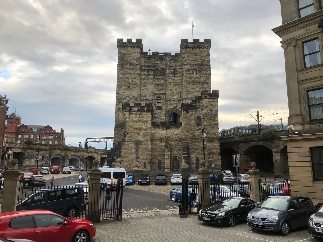
Newcastle Castle
Day X: Across the Tyne to the Arab Fort
7.61 miles 3h 31m ascent 87m
Segedunum to Arbeia and the coast
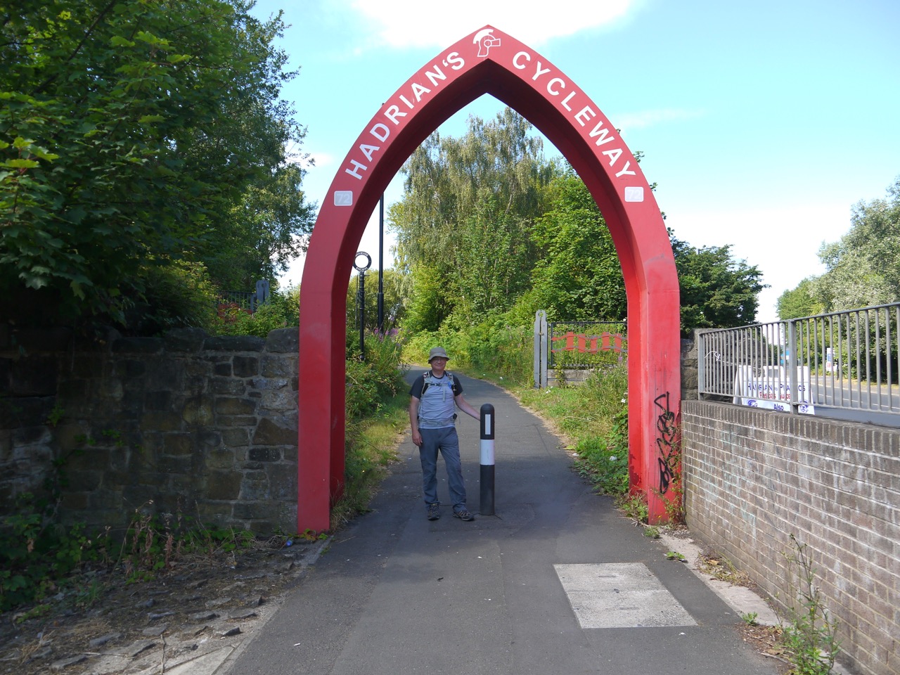
Our second day proved hotter than the first, with more blue sky than cloud, and sharp shadows dogging our steps. Having learnt from the previous day I applied sunscreen at Segedunum Fort, quod praesidio sine glacies crepito, then strode east along Hadrian’s cycleway through a post industrial landscape between old shipyards and corrugated fences. The end of this part of the cycleway was marked by an arch, painted to blend subtlety into its surroundings. Our route was the No.72 national cycleway and it was signs for that route that would guide our way through the day.

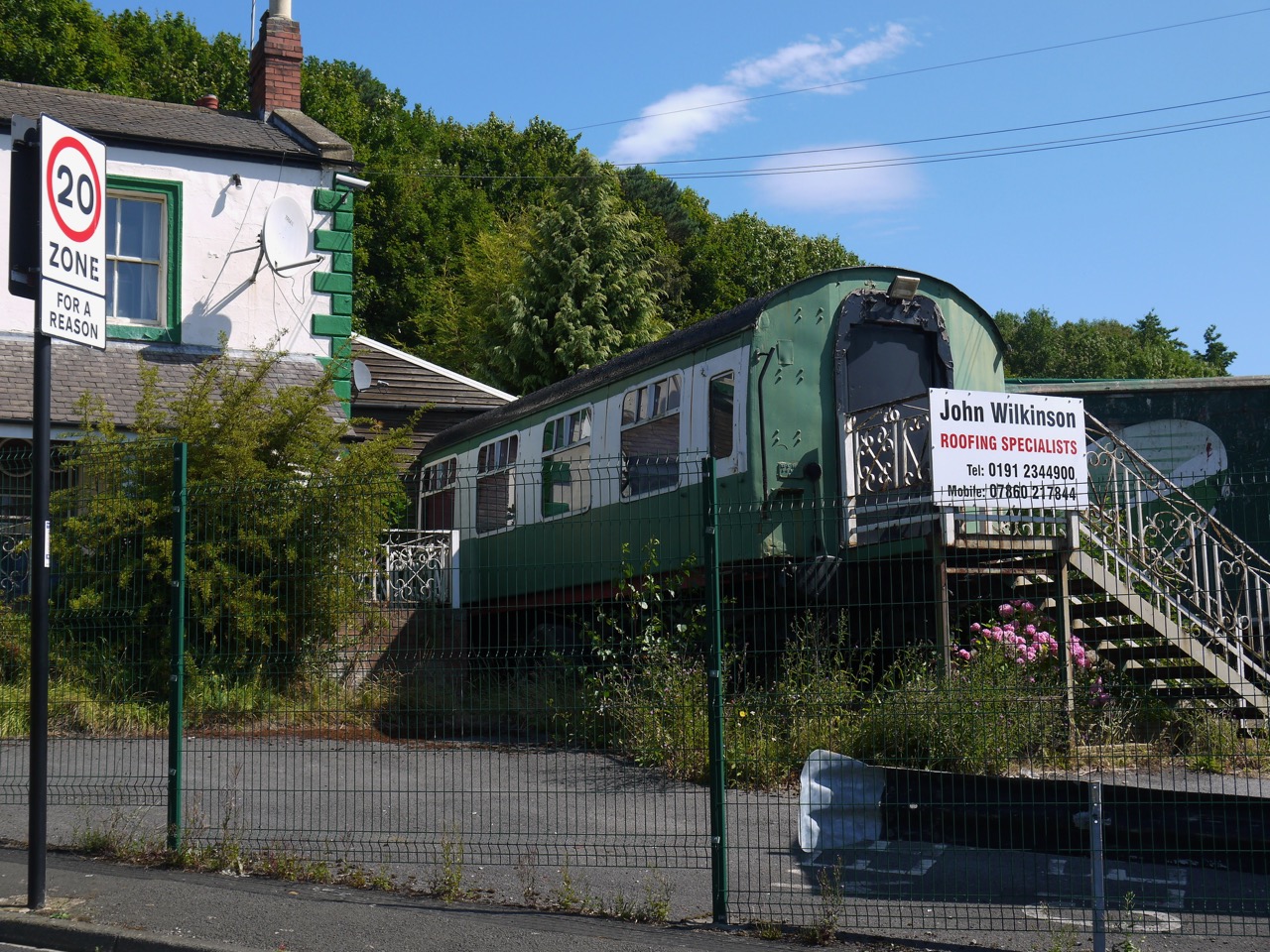
The Hadrian’s Wall Hotel once stood here
After Hadrian’s Cycleway we stepped onto Hadrian’s Road for a few hundred metres then left the road to cross Willington Gut by footbridge. The impressive viaduct looked newly painted and as we stood admiring the structure a local chap asked if we had seen the date stone on the viaduct. Since we had not he told us where to find it. He told us the viaduct dated from 1839 (as the stone inscription said) and then asked if we knew how old the footbridge we had crossed was. Eight years he told us, chortling. Info on the net says it was designed by John and Benjamin Green who were also responsible for Grey’s Monument and the Theatre Royal in Newcastle. The viaduct was originally built in wood and stone, the present ironworks added in the 1860s. It now carries the Tyne and Wear Metro line.
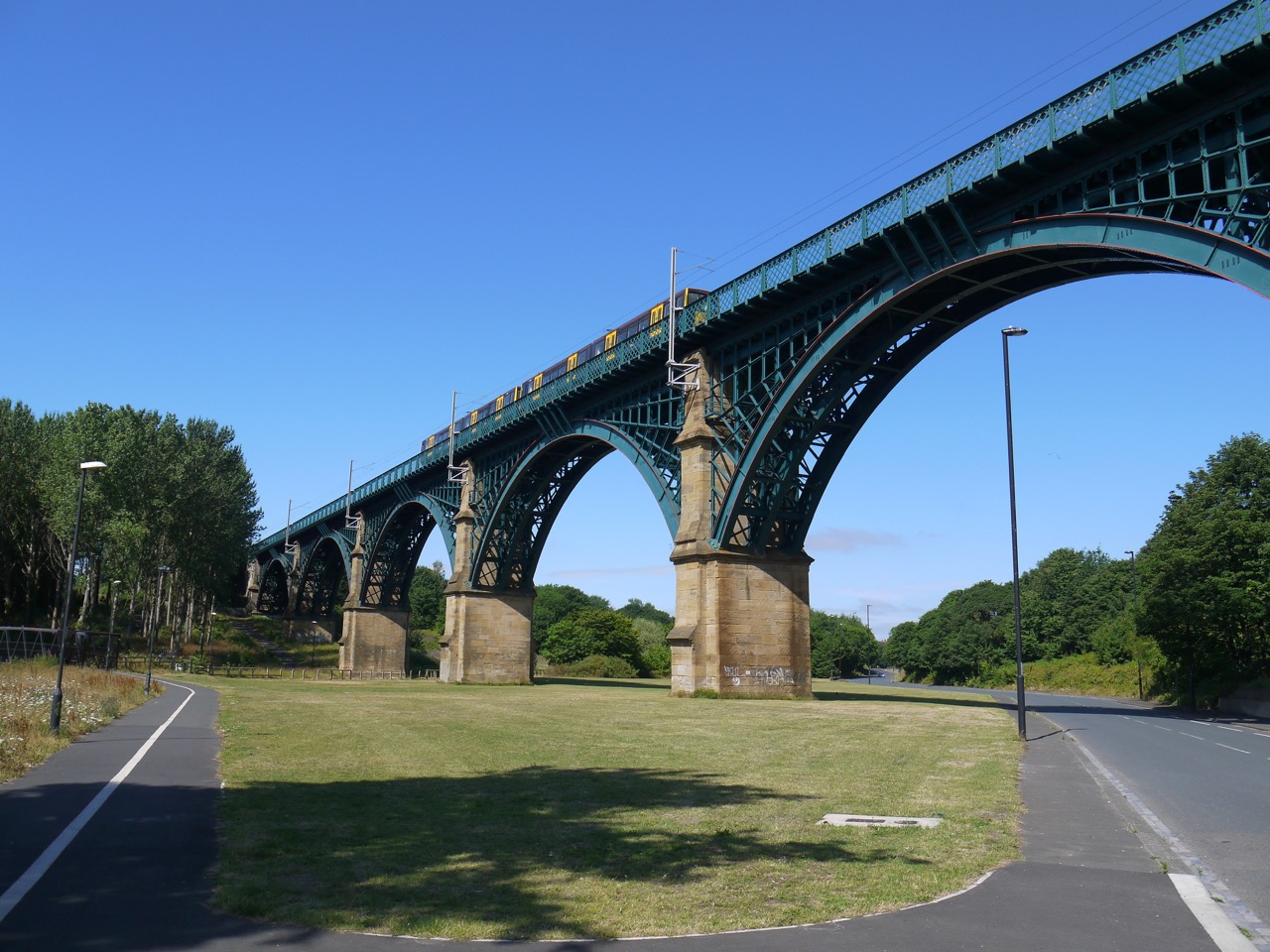
Willington Dene Viaduct
From the viaduct we headed along Western Road, past the derelict Bogie Chain pub, with a railway carriage built into it, and on to the Old Albion Inn. I liked the road speed sign that emphasised the speed limit was “for a reason” but didn’t tell us what.
We then reached a route conundrum and wandered about for a few minutes trying to find our way. The map and a cycleway sign suggested a particular direction but there did not appear to be a way through. Just a factory.
With a reason
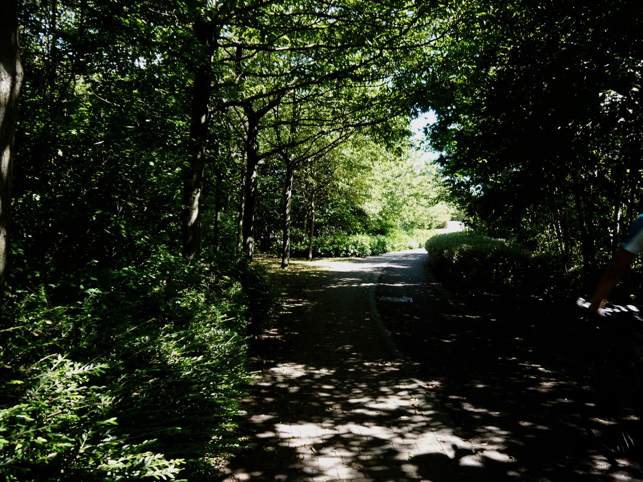
There is in fact a path but its entrance was hidden by branches and overgrown hedgerows. This took us to a Coronation Street type road then through more industrial meadows, across the A19 on a footbridge near the Tyne tunnel tolls, and on to a cycleway beside a dual carriageway.
We saw a number of repeated graffiti tags, the name Rogers, unadorned with drawing and the more artistic one below.
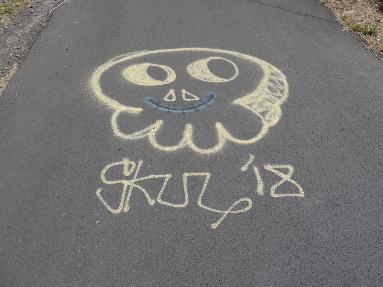
Tag on the footpath
The A19 proved to be a border between a neighbourhood in the Autumn of its economic existence, where land abandoned by industry was being steadily reclaimed by nature and another in its economic Spring with newly built roads, modern buildings and parkland. Each area has its own aesthetic.
We could see the slides of Wet ‘n’ Wild, and as tempting as it might have been in that heat to cool off there, we still had miles to go (more than we thought) and neither of us had thought to bring a swimming costume.
Path into Redburn Dene
There is a landscaped park at Redburn Dene. A quite unexpected find. Reclaimed Groynes stand beside the path and a henge atop a low hill (perhaps just a grassy knoll).
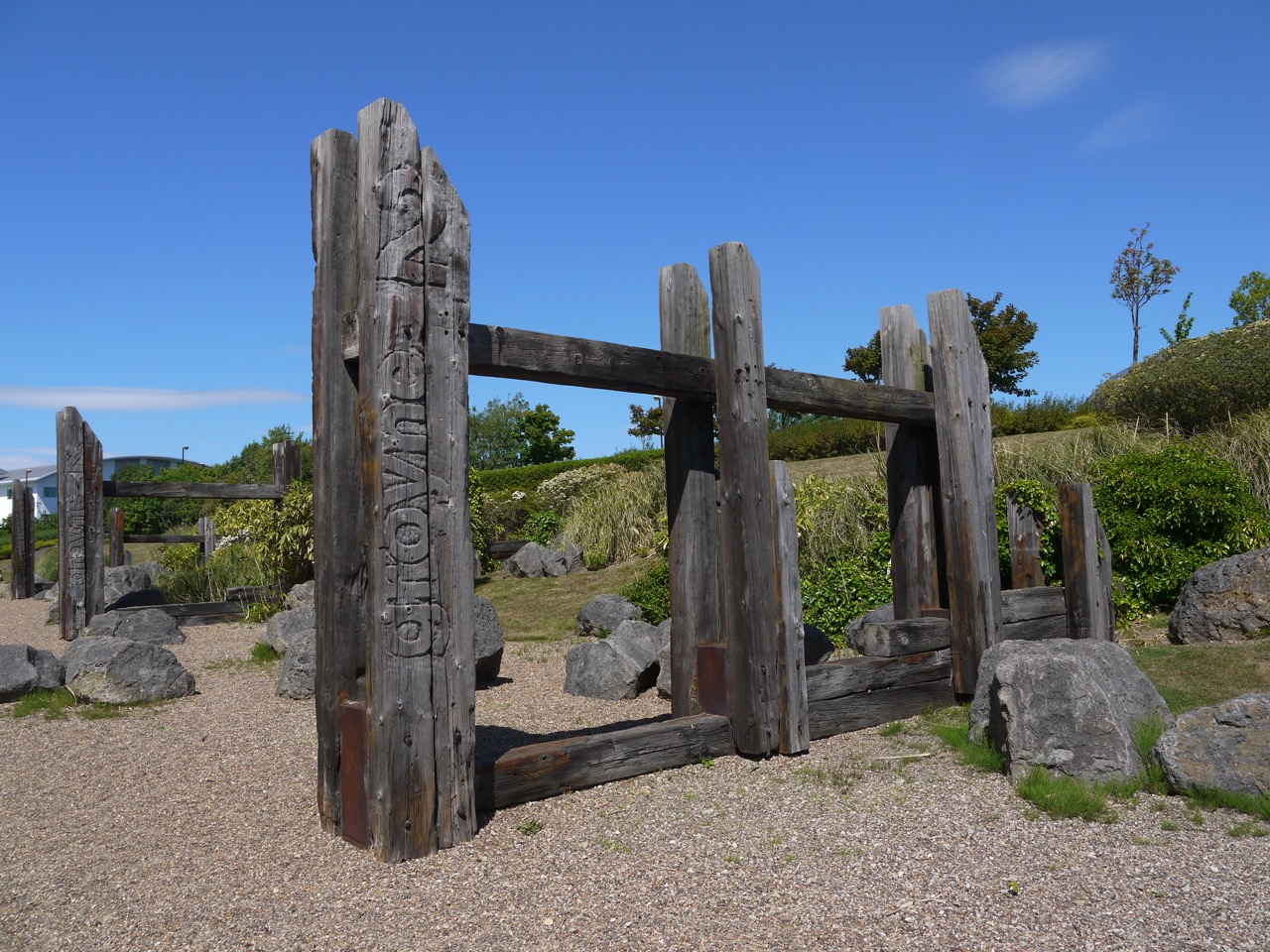
Groynes
I recognised these as groynes when we came to them and was pleased to find I was correct on finding the name written on them. It is a testament to serendipity that I should come across such a construction so soon after learning about groynes, and their use in preventing coastal erosion, during an impromptu tutorial from a civil engineer at my son’s stag party. And let that be a lesson to you all. Don’t mix alcoholic drinks and civil engineers.
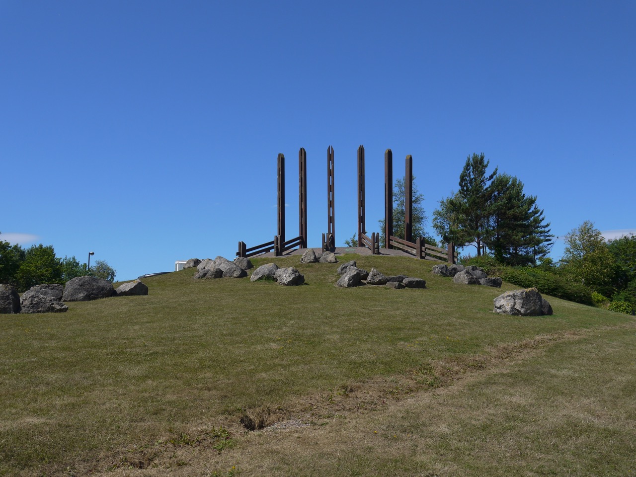
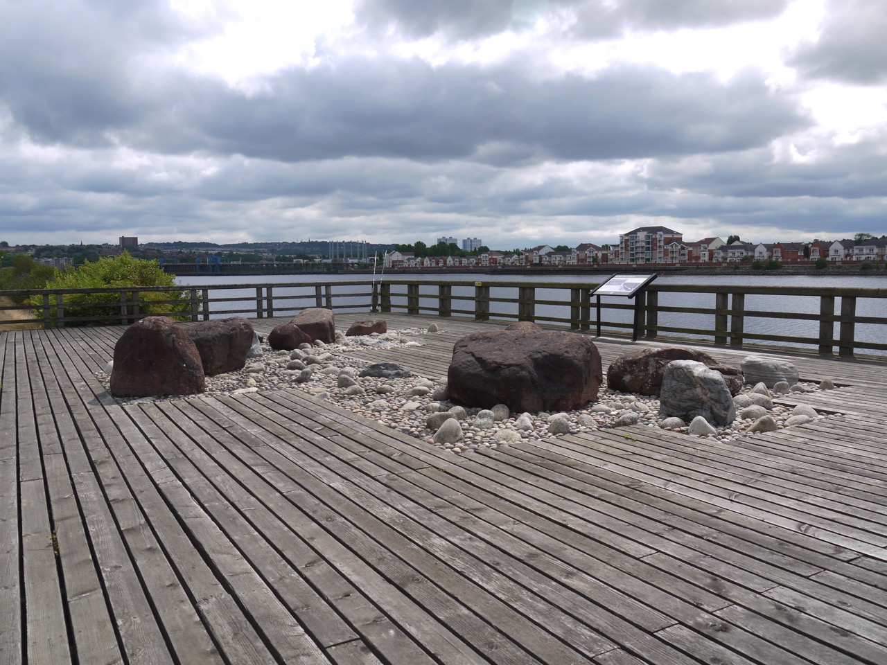
Henge overlooking Redburn Dene
The henge affords excellent views of the Tyne and the nearby Marina. Within the henge itself is a mosaic of the British Isles made with pebbles.
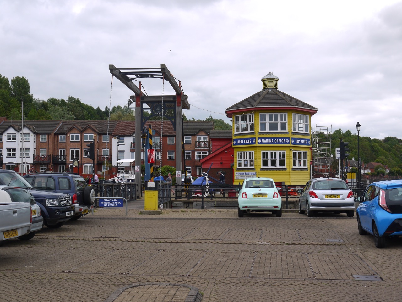
At this point we both thought that we were almost at the ferry, a belief that had been supported by the various signs we had passed each suggesting a gradually lessening distance to said ferry. So we were surprised on reaching the Marina to find a sign informing us we were still two and bit miles from the foot ferry.
I saw Audrey pass through the five stages of loss: denial (“it can’t be two more miles, the sign two miles back said two miles”), anger (facial expression became a scowl), bargaining (did not help), depression ( “Oh Hell”) and then acceptance. I think I skipped straight to acceptance when I had looked at the map and realised the signs we had seen earlier had been for the vehicle ferries.
Just to rub salt into our open (psychological) wounds, the road we should have walked along was closed and the poorly signed diversion added both a little extra distance and some unnecessary backtracking. But at least we could look forward to refreshments and amenities (toilets) at the ferry terminal.
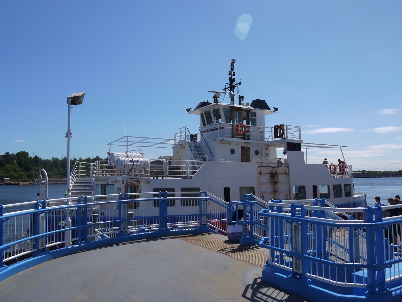
Tyne ferry -Pride of the Tyne
With regard to the refreshments and amenities, we were at least well versed in denial, anger, bargaining, depression and were able to move quickly to acceptance that we would not be enjoying these.
We had a 15 minute wait for the ferry and a chance to have a seat for the journey across to South Shields. The shorefront here has newish apartment buildings either overlooking the river or overlooking water filled pools that were once docks I imagine.
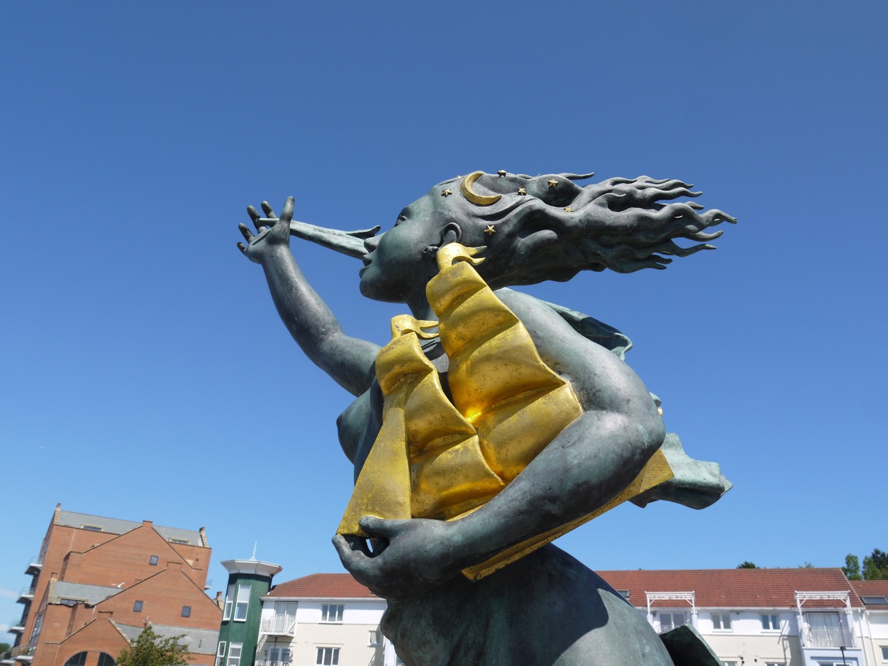
Spirit of South Shields – by Irene Brown
This wee girl ‘The Spirit of South Shields’ stands on the shorefront, a protector guiding ships through the seas safely, holding a sailing ship in one arm while raising the other in greeting. She stands on a plinth which shows a contour map of South Shields with several local features: the Groyne, Arbeia Fort, the Old Town Hall and Westoe Colliery.
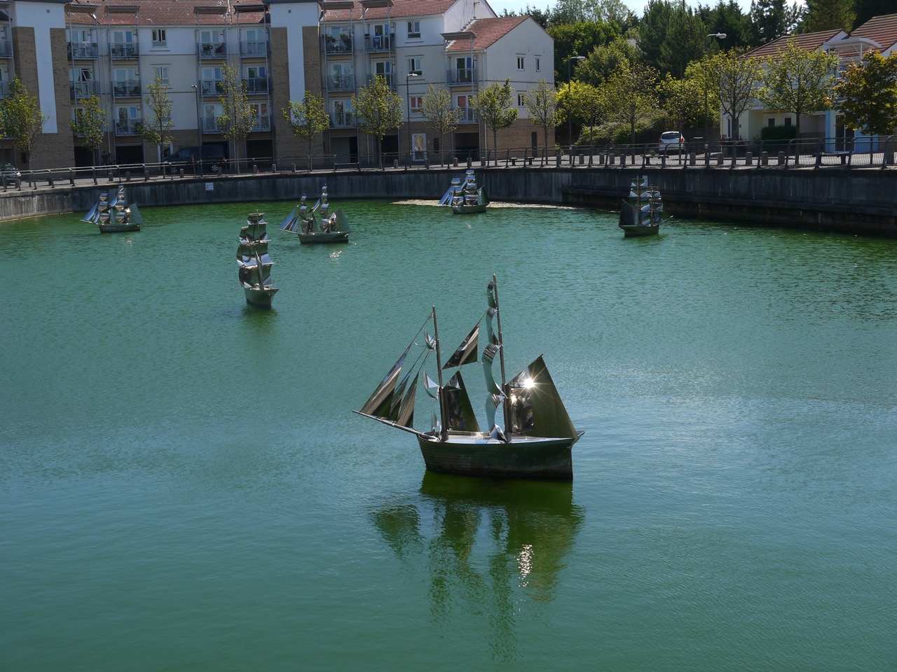
The Fleet
Nearby, one of the enclosed pools of water has these steel ships, an installation by Irene Brown. “The Fleet” is made up of seven Collier Brigs floating in an old dry dock. They are said to give the impression of a fleet heading out to sea, but they each seem to heading in their own direction.
I stopped to look at a road name “Comical Corner” and a local couple told us that it was so called because the South Shields sea cadets building here used to be a theatre where comedies were performed. They also told us that this is where the original ferry landing had been which is directly opposite the Ferry terminal we had left on the river’s opposite bank.
At little googling suggests another explanation for the name Comical Corner, that ships would often misjudge the bend in the river here. I prefer the theatre story but can’t verify either. While researching it though I did come across this titbit:
May 27 1856. A woman, living at Comical-corner, South Shields, was cleaning a haddock for dinner, when she found a pair of gold ear-rings in the intestines of the fish. (from Historical Register of Remarkable events …. Newcastle 1833-1866 by T Fordyce. Which sounds like the sort of book Arthur Bryant would have on his bookshelf. He was reading “Diseases and Treatments of Congolese Tribal Elders 1870–1914” in Strange Tide, the last Bryant and May book I read.)

Arbeia
From Comical Corner we walked a little further along the road then climbed several flights of steps up to The Lawe, and Arbeia Fort. Arbeia is said to be a Latinised form of the Aramaic for ‘the place of the Arabs’, because the last known unit stationed there was a company of bargemen from the region around the mouth of the Tigris. But its strange that its name reflects the last garrison there. Others think Arbeia might mean ‘the stream where wild turnips grow’, but that seems an awfully large amount of information in a word with six letters.
An inscription on a stone at the fort reads:
To the gods the Preservers for the welfare of the Emperor Caesar Marcus Aurelius Antoninus Augustus, Most Great Conqueror of Britain, [and of the Emperor Caesar Publius Septimius Geta Augustus, conqueror of Britain], the military unit at Lugudunum paid it vow for their safe return.
Perhaps Lugudunum was its real name, perhaps the locals started calling it the Arab Fort when the Mesopotamian marine unit was there. There is also a suggestion that it was called Horrea Classis.
The fort, dates from AD120, and both protected the sea approaches to Hadrian’s Wall and served as a supply station. There is a reconstructed gatehouse and the usual Roman ruin foundations as well as a small museum. Interestingly the word ‘museum’ above its entrance is written in uncial letters which might look “old” but are several centuries younger than the Roman Capitals seen on inscriptions at the site. I suppose Roman capitals look too modern despite being a couple of thousand years old. Enough musing.
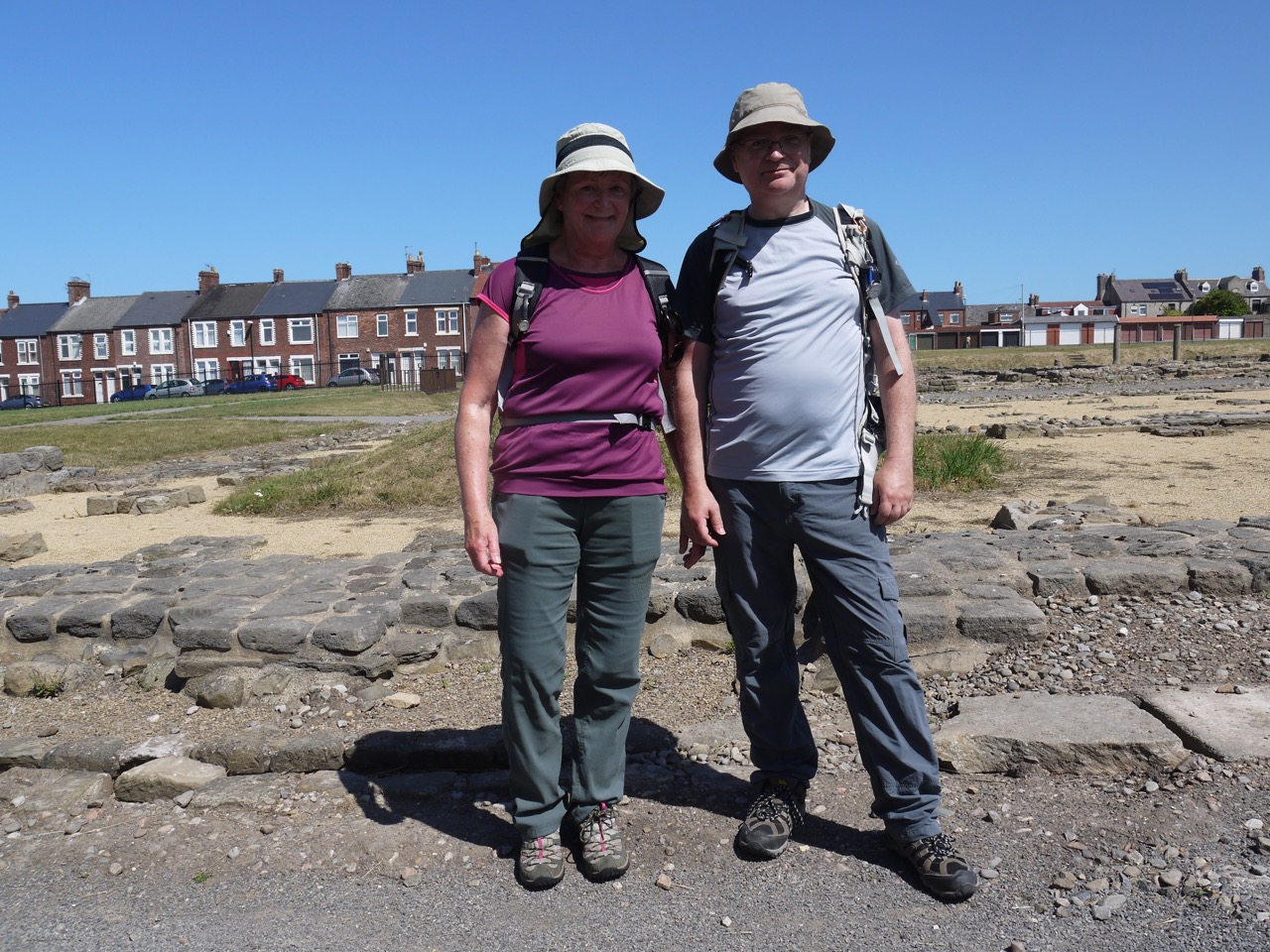
Walkers at Arbeia
This was the completion of our Hadrian’s Trail, so it seemed fitting to pause and reflect on our achievement as we looked across the remains of this ancient Roman Fort. The camera was then called into action from a celebratory photo before we packed up and set off for the coast just a few minutes walk away.
Our last artwork was Conversation Piece, a 1998 sculpture of 22 life sized bronze figures by Juan Munoz known locally as “The Weebles” .

Once we had crossed the beach and stepped into the waves I turned off the GPS and considered the walk over.
Ice-cream was again called for, and yet again we had to go without. But to make up for that we called in at Twice Brewed on the way back for some refreshment, and to say we had been there. Nothing exciting happened while we were there.
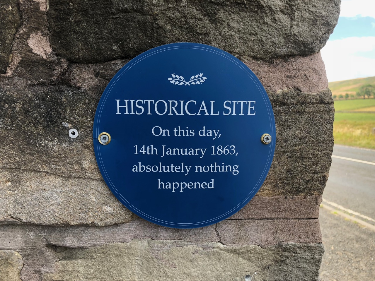
At Twice Brewed
Our Hadrian’s Wall Walk Statistics:
Total miles 101 (plus 9.5 miles we repeated in better weather)
Ascent 1884m (plus 394m repeated)
Time 50h 42m (plus 6h 15m repeated)
Average speed 2 mph
Longest walk 12.9 miles
Shortest walk 7.6 miles
Weathers: dry, wet, hail, snow, fog, winds on our back, wind from the side, wind in our face, and every temperature from bitterly cold to heatwave.
Highest point: Winshield Crags
Lowest Point: no ice-cream
Longest Duration 7h 10m
Shortest Duration 3h 31m
Number of times lost: None!
Falls 3
