11.71 miles 6h 16m ascent 45m
…and that the dark flat wilderness ..
Marshes of Glynn, Sidney Lanier
intersected with dykes and mounds and
A league and a league of marsh-grass, waist-high, broad in the blade,
Green, and all of a height, and unflecked with a light or a shade,
Stretch leisurely off, in a pleasant plain,
This was a walk of several distinct areas each with its own charms and challenges. But for me this was the marshes walk. The salt marshes were only part of this day’s effort, but they had worried me more than any other section when planning the route. I had paid very close attention to the weather and tides, and though my escape routes were planned, I was still not sure I would cross the marshland when we started walking that morning. I am pleased we did. The day’s walk left me with a feeling of accomplishment but it was not without its challenges.
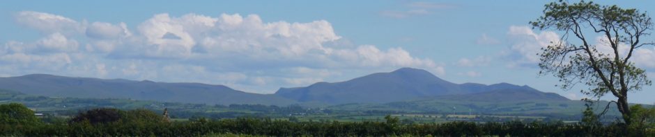
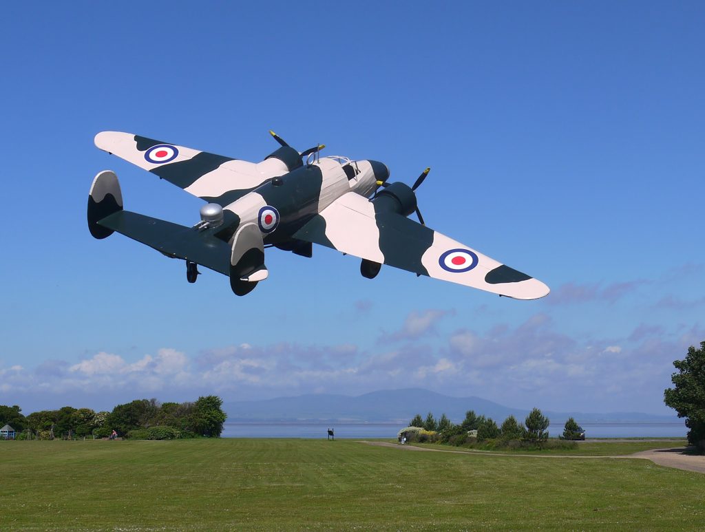
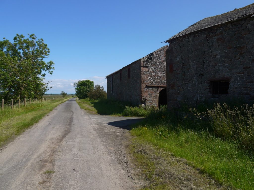
The walk started at Silloth Green, where we visited the anchor by the RNLI building, the model of a Lockheed Hudson bomber (in memory of RAF Silloth), and the Edwardian toilets, then walked along the promenade with its wee lighthouse. We thought we could make out the lighthouse across the water at Southerness. The chimneys at Chapelcross were definitely visible.
The promenade gave way to stepped sea defences as we approached Skinburness. And a sign warned that it was not suitable for wheelchairs. I couldn’t see why that was at first but then we reached a section too narrow to accommodate a wheelchair and narrow enough to force us to take greater care as we went.
Skinburness
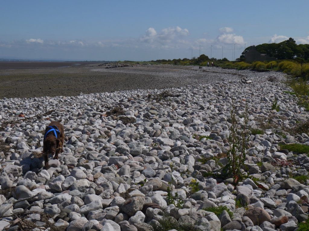
As we walked along to Grune Point, the sea defences gave way to a grassy path. Further along the original path has been lost to erosion and we were forced onto a beach of pebbles the size of ostrich eggs, then goose eggs, then sand, before returning to a broad green path with scattered pink carpets of thrift. The Anthorn Radio Aerials stood ahead of us across Moricambe Bay, but their name escaped me at the time. I was conflating them with the Robin Rig Wind Farm. Had you been walking by you would have heard me mumbling “it’s Robin something, I’m sure”, as the skylarks sang overhead.
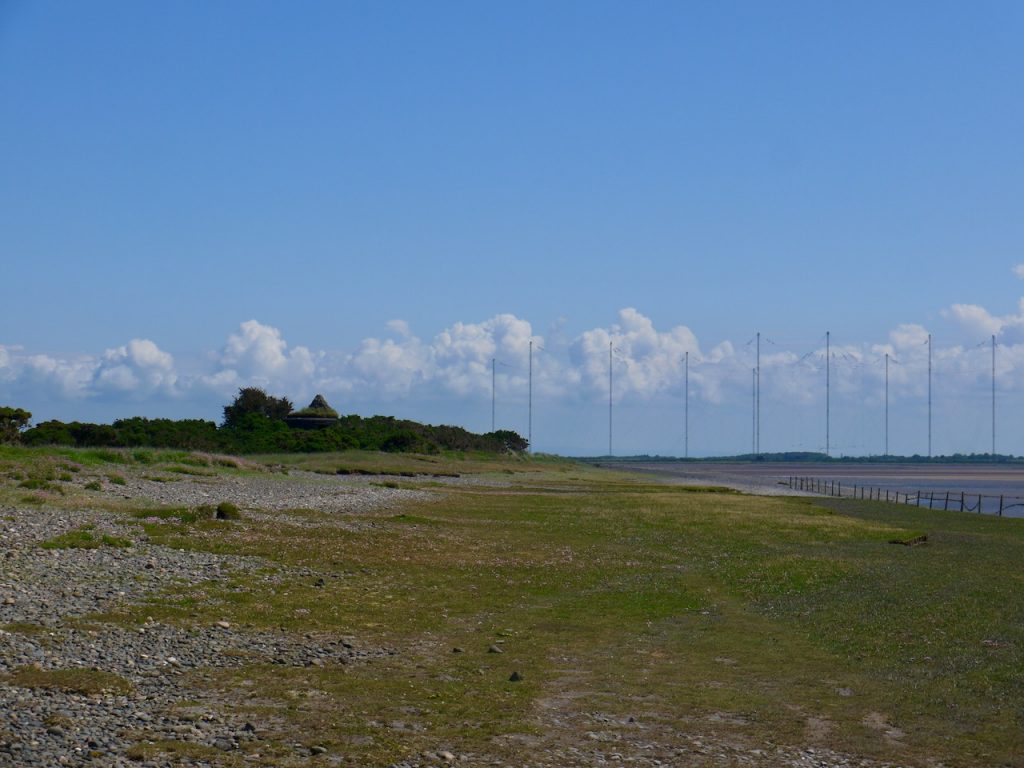
The Pillbox and Anthorn Antenna Array
There is a connecting path about two hundred metres short of Grune Point, but enough people must walk on that there is a worn path along to the end. And that is the way we went. There is an unusually shaped pillbox, a ‘Cumberland Machine-Gun and Anti-Tank Rifle Emplacement”, hidden amongst large gorse bushes near Grune Point. It has an unusual appearance being constructed of slabs of concrete which have set in bags, so it looks to be made of sandbags. It has a central pillar inside and stone seats. A cairn on its roof is a memorial to four Silloth firemen who drowned in rough seas while trying to rescue a wildfowler on 10th December 1956.
Moricambe Bay
The return was along the windward side of the spit, the ground covered with blue-green sea spurrey leaves, carpets of pink thrift, and golden lichen covered rocks. The dog amused himself jumping in pools of water and we gazed across at the salt marshes we would soon be crossing. Some large rocks, remnants of wartime defences, served as seats for our coffee break.
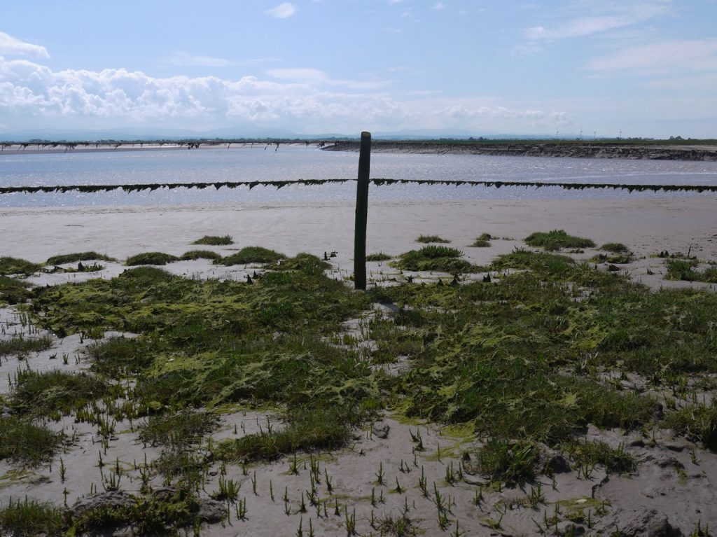
I had worried about venturing on to the salt marshes, but one has to face ones fears, so we crossed the dilapidated bridge spanning Great Gutter and walked into the marsh. I had worked out the bearing we should walk on but soon enough we spotted the rotted remains of way marker posts to follow. The going was surprisingly firm, the dog was running free at until he jumped into a deep gutter and could not get out. I had to lie down, reach for his collar as he jumped up, and yank him out. My thanks were a spattering with mud as he shook himself. Further into the marsh the gutters had steep undercut sides, and were too deep to allow me to reach down as I had just done. I could not be sure their muddy bottoms would hold my weight, so the dog had to go on a lead.
On the marshes
This appeared to be a flat wilderness but we would suddenly come upon a previously unseen water channel. I would not want to be out here in mist or at night. Though there were some waymarkers, it was not possible to walk directly from one to the next, the way being barred either by deep gutters or wide drainage ditches of unknown depth and many were missing.
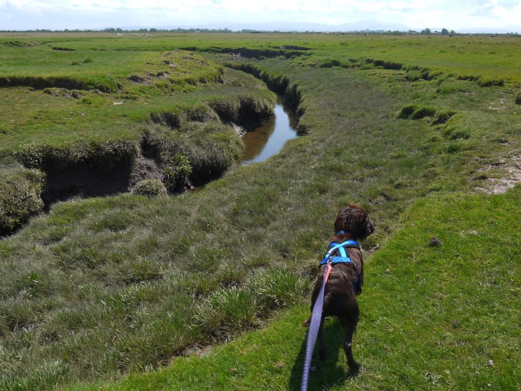
I estimate it was at NY151549 that we passed our last marker post. I feel if I was handwriting this I would now change to a darker ink. The character of the walk changed. Less charm, more challenge.
The short grasses of the salt marsh gave way to tall, tufted marsh grass ahead of us. But the more immediate difficulty was the deep gutter blocking our way. A bridge had once stood nearby. There were uprights either side of the chasm and a large piece of the span lay in the mud at the bottom of the gutter several metres away. There was no safe way across. If the dog fell in I doubted I would have been able to get him out, and I was not sure I would be able to get myself out. Audrey had fallen at an earlier crossing and either of us could have been unlucky. It would be one thing to fall in a burn and get wet, another break a leg and be stuck in mud waiting for the tide to come in. We explored along the gutter but could not find a place to cross.
ex-bridge
Eventually I turned my attention to the fence on our landward side. Why it needed three lines of barbed wire at its top I do not know. But it had a weakness. Where the fence crossed the gutter a lower section of fence had been added to fill the gap. The sections overlapped but were not fastened together. Indeed a closer look suggested that we may not have been the first to breach this barrier. We slid between the two sections, though not easily. Getting the dog through added smears of mud to the spatters I had already collected. Somehow Audrey managed to lift the dog without getting muddy. How?
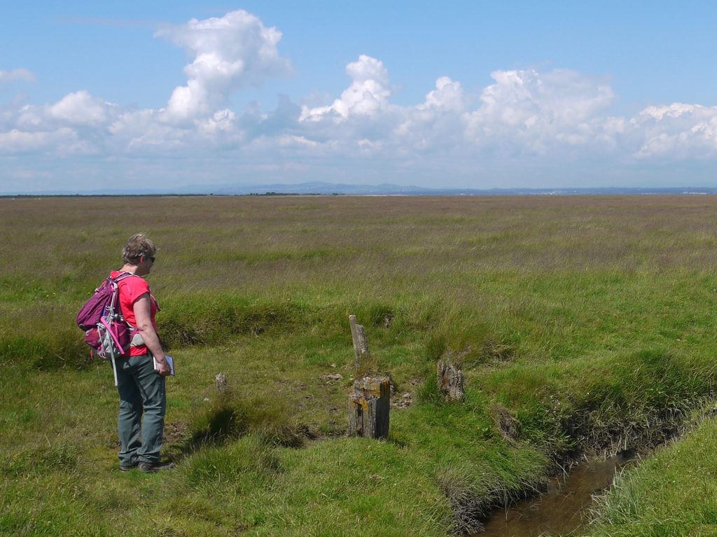
Once past the fence we found a way across the gutter and found we had crossed a border between salt marsh and wetland, between ankle length grasses and waist high tufts. The going quickly became difficult. There was no clear track. If any way markers still existed they would have been hidden by the tall grass and we certainly saw no more. Walking in tussocks drains my soul. Dangers to legs and feet lurk unseen beneath the grass. Hidden Jabberwocks with “jaws that bite and claws that catch” caught unsuspecting feet causing many a stumble. The only saving grace was that the land was unusually dry, so the hidden holes were not filled with water.
Doesn’t look too bad? Can you see the dog?
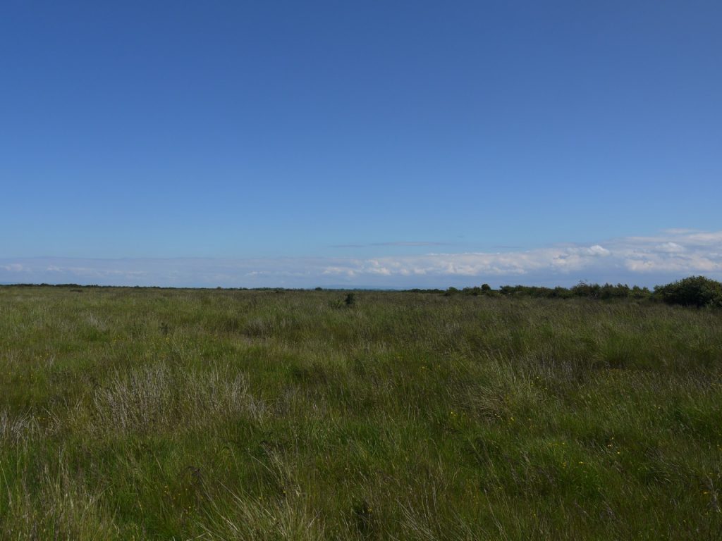
Then it got worse. The grass was now at chest level and the ground more uneven. There were more ditches to cross. Lunchtime came and went with nowhere to stop.
Then we came to a pond, but there are several on the map and we could not be sure which it was. We battled our way to a nearby gate in the dense hedgerow hoping that there might be easier walking on the far side. It was not to be, there was a very overgrown track heading south, to Whinclose I think. But that was the wrong direction, and did not look as it would have been easy walking.
So I climbed back and we pressed on, wondering which of the farms inland of us corresponded to which on the map. After another kilometre of unpleasantness we paused to reassess the situation. We could not see ourselves continuing through the same terrain and decided to see if we could get onto the farm track between Seaville and Border. We found a gate (near West Border) and then crossed another field that I can only think was part of a secret military program to develop fields impassable to tanks and personnel. As a final touch, the next gate we reached, though not locked, was rusted shut.
Terra firma at last
We were now on a paved farm road. I felt like falling to my knees and kissing it. Despite being tired our leisurely pace was twice that on the marsh. We turned down the road to Broadrigg and when we reached a roadsign informing us we were just one mile from Abbeytown we breathed a sigh of relief and we stopped for a brief rest. Standing there looking at the map we even had a good samaritan stop to ask if we were lost.
We rejoined the Cumbria Coastal Way where the road reaches the River Waver. Steps led down to the river bank and an overgrown but discernible way forward beside the river. A small footbridge carried us across a stream which I took as confirmation that we were still on track. At some point along here we needed to turn right and head towards Abbeytown. We were on the home straight.
No landmark marked where should turn. Presumably the Cumbria Coastal Way would once have had a direction marker here but there is nothing now. We carried on along the river bank but came eventually to fenced off fields with cows. If the way had continued this far along the river it has either since been fenced off or the path between the river and the fenced animals has been eroded away. We backtracked to the footbridge and decided to make our turn there. There was a gate, unlocked but unmoving. Over we went.
Tired, we tramped uphill through fields of dock, giving the cows over in the far corner a wide berth. Dense hawthorn surrounded the field but we could see a gap in the hedgerow ahead, and through that an identical field. The roof of the Abbey could just be glimpsed. The end was in sight.
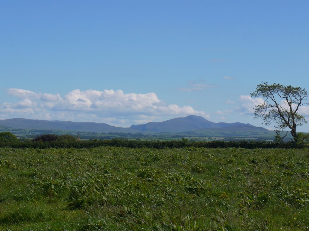
Field of dock, Skiddaw, and the Abbey is just visible above the impassable hedge
The thought of rest, and water, drew us towards the Abbey, but our way was blocked by the hawthorn. I thought I had spied a gap, and perhaps a gate in the corner. There was worn grass leading to it. My perception had already built a gate in the shadows. Audrey was less certain and I was about to shout “Oh, ye of little faith” to her when I saw that the worn grass led nowhere. There was no gate, just dense impassable hawthorn. With hindsight I know we needed to be in the field to the east of that we were in, but there had not been a gate that way.
We walked along the southern side of the field, but found no openings. Then the western side, and again no openings. Then to the barn at the northwest corner, no access. Then through a quagmire of slurry, over a couple of gates which like a priest embracing celibacy had renounced their ability to open. We found ourselves then in a farmyard where I would not have been surprised to find a Deliverance-style local grinning as he played his banjo.
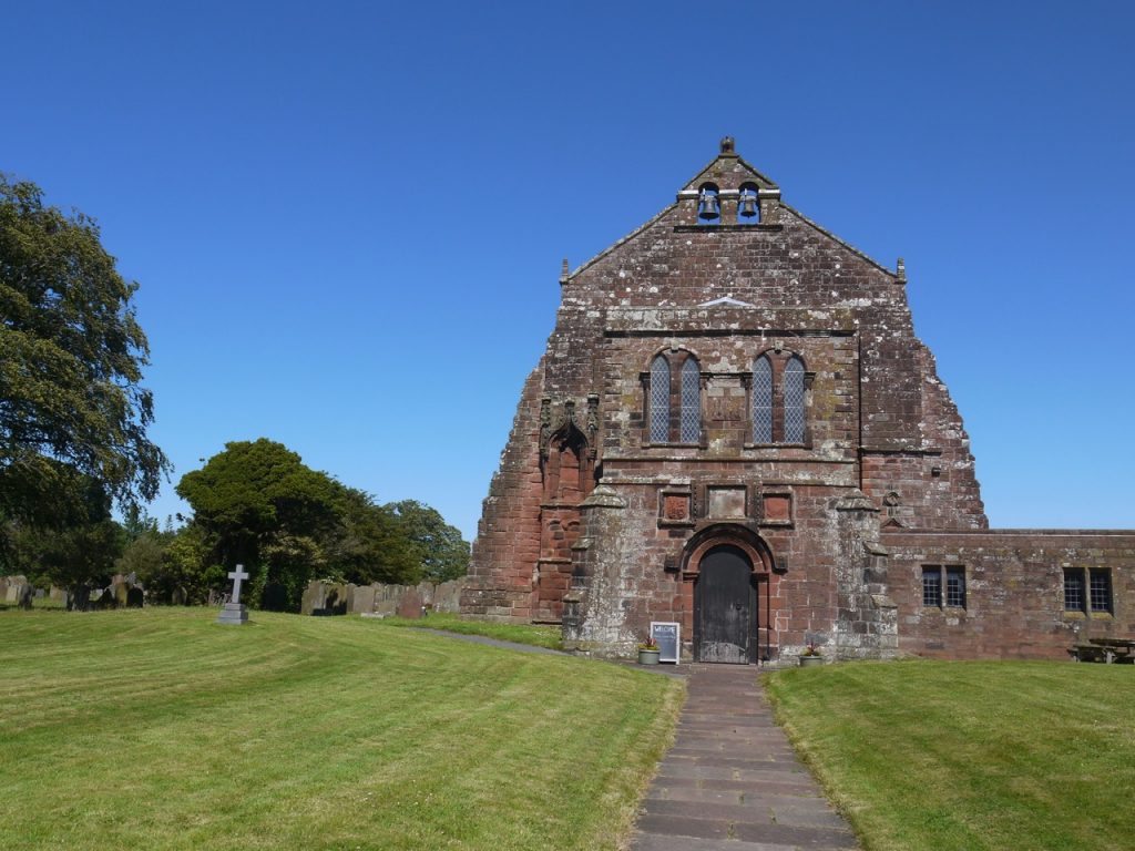
Holme Cultram Abbey
From the farm we followed the road down into Abbeytown and through the village to the old Abbey. I divested myself of the rucksack, fed and watered the dog and enjoyed slug of tepid but refreshing water then walked to the seats in the Abbey grounds and swapped my walking boots for cool shoes. (That’s cool from the point of view of temperature rather than fashion.)
And finally a short drive and then – Ice-cream on Silloth Green.
[sgpx gpx=https://www.screel.co.uk/walks/wp-content/uploads/2019/06/RK_gpx-_2019-06-19_1003.gpx]
I don’t think my description of the salt marsh or my photos fully capture its wildness so I have provided a link to a video here. The words are a poem about RAF Silloth.
