
12.96 miles 6h 15m 430m ascent
Beckermet-St Bees-Whitehaven
But like not unto any one of these
Thomas Edward Brown
Is that tall crag, that northward guards the bay,
And stands, a watchful sentry, night and day
Above the pleasant downs of old St. Bee’s.
This proved to be a slightly longer walk than expected. (I had originally ended that sentence with the word predicted rather than expected, but suspect my walking companion does not expect that which I have predict). This was no great burden the excess being but a few minutes stroll but such was the delay we found the ice cream shop at the Beacon closed. But it was a glorious day nevertheless.
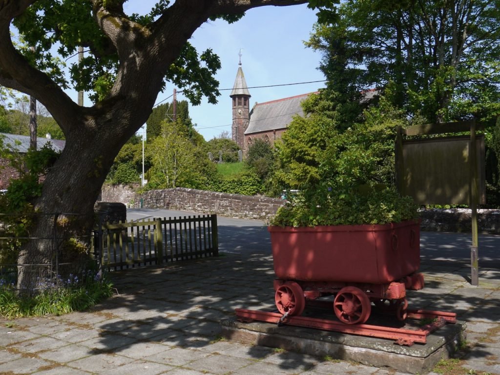
The car took us back to sleepy Beckermet, which it appears I have been mispronouncing along with Torpenhow, and Aspatria. Beckermet carries its stress on the middle syllable and has appeared in older documents as Beck Armett. Thankfully none of the “cruel of heart” or “bloody of hand” were about to put me to the shibboleth. An old mine railcar stands in the village overlooked by St John’s church. Sellafield which can be seen looming over the village as one approaches is hidden from sight while in the village itself.
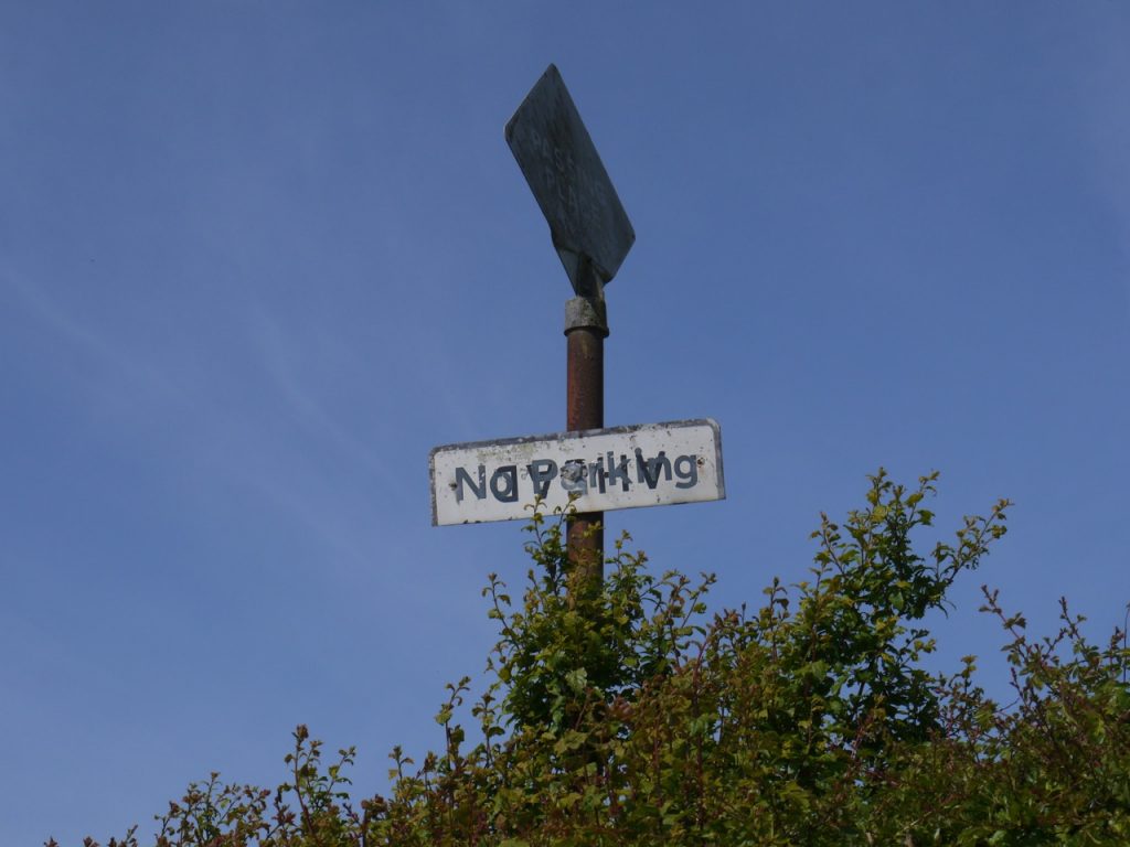
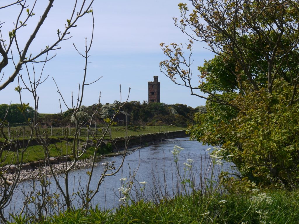
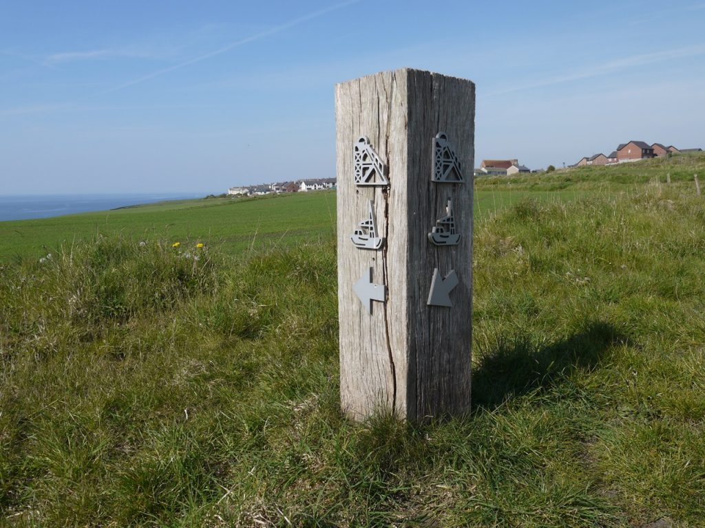
The road crosses the Kirk Beck, and we turned left along the wee road towards Braystones. The old railway, now disused would once have crossed our road but the railway bridge is no more. Once out of the village we had a view down to the Jubilee Tower, and Sellafield came back into view. The hedgerows were in full bloom and the smell of flowers ever present. We paused to inspect a roadsign which was at first unintelligible but didn’t actually take much deciphering once we looked carefully. The road wound about a little and took us along the across the River Ehen, whose name is proving a sticking point with my laptop’s autocorrect. The tower we had seen earlier has stood by the river here since 1897 when it was built to commemorate Queen Victoria’s Diamond Jubilee.
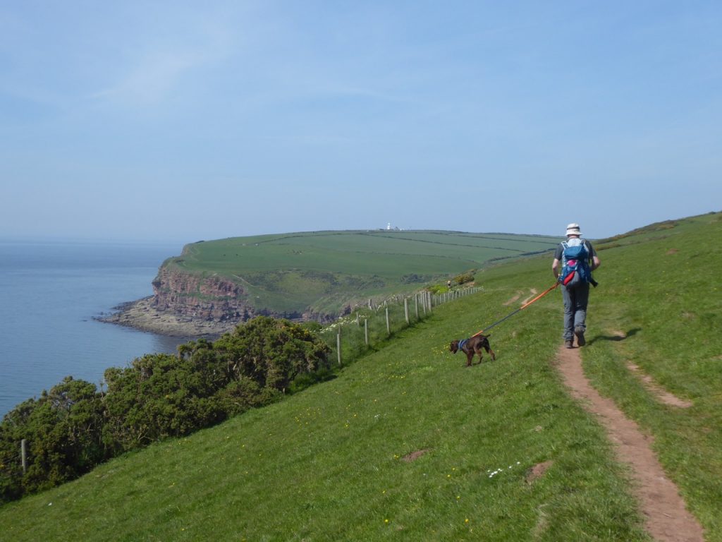
The road was quiet but with enough traffic to have us climbing unto the hedges every few minutes. This road was likely a supply road for the coastal defences in Roman times and on reflection it seems a good idea to have it sheltered/hidden from the sea. There was more up and down and less sight of the sea than I had expected.
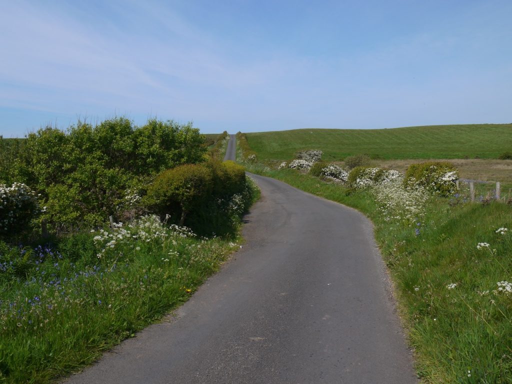
We walked on and a little after Nethertown had our first glimpse of St Bees Head. The hedgerows were my main interest with so many flowers to see. The name of some pink flowers eluded both of us until we got back home. Thrift.
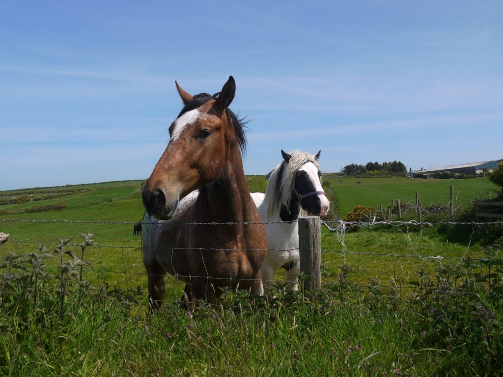
We did meet some curious cows and horses, saw some highland cows down here in Cumbria and plenty of lambs, including some black ones.
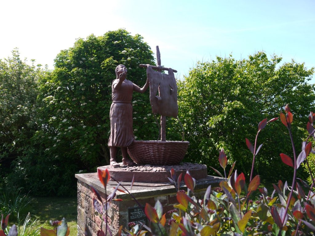
As we drew closer to St Bees the road climbed a little more. I decided not to take an over grown footpath beside a field, which might have taken us to the beach, but might have been a dead end, and we found ourselves walking into St Bees itself. We used the level crossing at the railway station and turned left where a road sign read “beach”. There is a statue to St. Bega. More about her here [http://stbees.org.uk/history/essays/bega_todd.html]. A playing field here had the broadest bank of brambles I have ever seen.
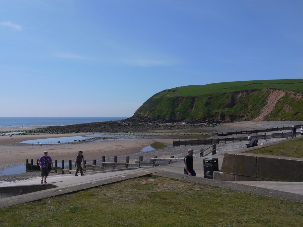
Soon we were at St. Bees beach. There were picnic tables to sit at and eat our sandwiches and grass there we could play fetch. I couldn’t find the ball at one point and had choruses of other picnickers howling “BEHIND YOU” at me as though I was Widow Twanky. You might gather that playing fetch with Christy is a more egalitarian game than the traditional version, in that both he and I have to do our share of fetching. We wondered about ice-cream at this stage but I decided to wait until the end. Work up more of an appetite for it and all that.
The stanza at the start of this post did not suit the mood at St Bees, and as we sat in the warm sun, smiling folk about, a nearby chap with his old dog, me with a younger one, I thought of this verse.
If life were slumber on a bed of down,
Wordsworth
Toil unimposed, vicissitude unknown,
Sad were our lot: no hunter of the hare
Exults like him whose javelin from the lair
Has roused the lion; no one plucks the rose,
Whose proffered beauty in safe shelter blows
‘Mid a trim garden’s summer luxuries,
With joy like his who climbs, on hands and knees,
For some rare plant, yon Headland of St. Bees.
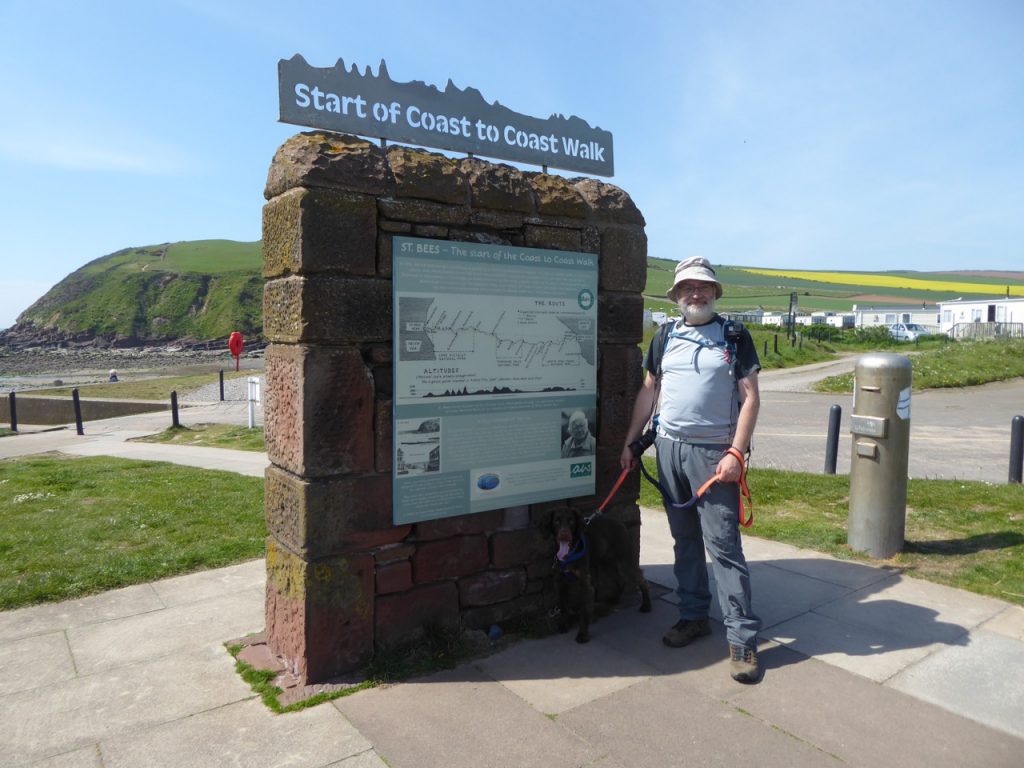
Fed and watered, sandwiches for the bipedals, gravy bones for the quadruped and our water bottles refilled, we donned our rucksacks and set off for the climb up to St, Bees Head. This took us past the start point for the Coast to Coast walk.
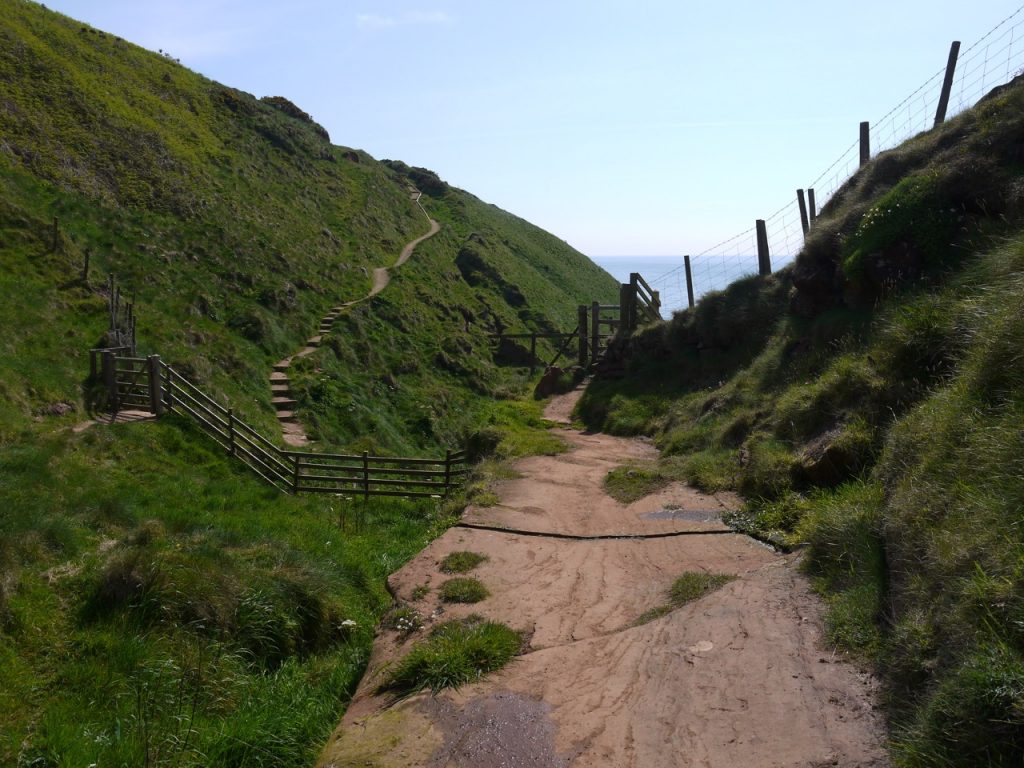
It’s a bit of a slog up the path and quite close to the edge at times so the dog was straining on a short leash as I huffed and puffed my way up. Once up we were on a clifftop path with views out across an empty sea. The Isle of Man, previously visible on the horizon, was now lost in the haze, but close enough that I received a text message from O2 roaming, welcoming me to the Isle of Man and assuring me that my calls and texts would be taken from my usual allowance.
At the lighthouse there was a sign indicating that the coast to coast walk turned inland, but we continued along the clifftop path past a white building that I now know is a foghorn station. A little later we did here what sounded like a foghorn but it sounded more distant. There were some other strange noises along the way including one that sounded like an elephant and another like a couple of cats fighting. Presumably these were seabirds on cliffs below us. Detailed research (fwr two minutes with google) has not identified likely culprits as yet.
Several “gates to nowhere” allowed access to clifftop areas with views of the cliffs/birds. The only nesting birds I saw though were gulls. The rocks beneath the cliffs had a flatened appearance a little like the Giant’s Causeway, if the giants had been drunk and short sighted when doing the building. I’m not one for steep drops, especially with the pup in tow so I was happier when we were a few metres from the edge and especially when there was a fence between us and the edge. At one point we had a choice between walking cliff-side or field side of a fence and chose the field side. We met a couple of walkers who had chosen cliff side and were looking for an escape to our side. I offered to use my OS map as a cover for the barbed wire, which I have done many times, but from their facial expressions once they had checked I had said “ my map” and not “my mat”, it was clearly not something they considered reasonable. That had me recalling my encounter astride an electrified fence on the SUW, well perhaps I was a little off the SUW at the time.
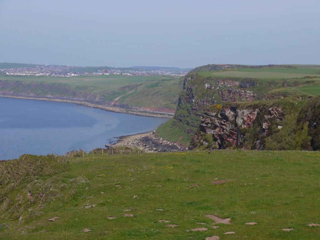
The cliffs and rugged beaches beneath them were very pretty indeed, those as we approached Whitehaven sporting several colours. The paths were easy to follow. We stopped for a rest at a bench by the path. It was new and dedicated to a couple who had both died in 2017. I had thought I had taken a photo of the plaque but have not and sadly I don’t recall their names, Corwen perhaps. A bench a little further along the path was very dilapidated indeed. At one place we passed a much carved rock, mostly graffiti but one area looks as if it might once have been something more.There are several quarries on OS map, all marked as disused, but Birkhams Quarry is definitely in use. An info board listed various places their sandstone was used, including Caerlaverock Castle.
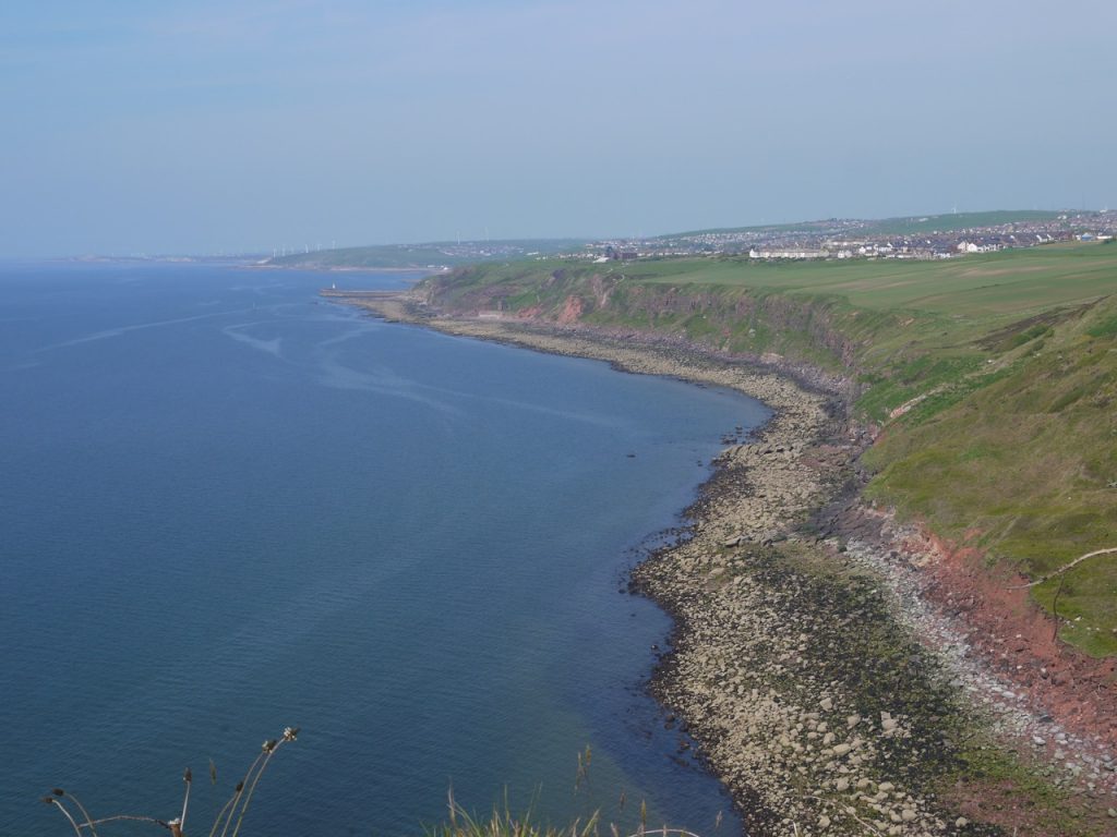
At last we came to the outskirts of Whitehaven and began to meet folk walking their dogs, and Christy had a brief run about on the fields. There were ideogram signs which we interpreted as “colliery” and “harbour”, and though the direction appeared to be going a little back we followed along and it brought us to a footpath. This took us past the Haig Mining Museum, which had been visible for some time but seemed to be defying the usual laws of perspective in that it hadn’t appeared to be getting any larger despite us walking towards it. Eventually though our perseverance was reward and the building grew noticeably larger (closer).
We had a glimpse of Saltom colliery down by the sea, and had a look at a cairn marking the King Pit. A plaque reads This shaft was sunk in 1750 by Carlisle Spending the mining agent for the Lowther family By 1793 it had reached a depth of 160 fathoms which at that time made it the deepest pit in the world.
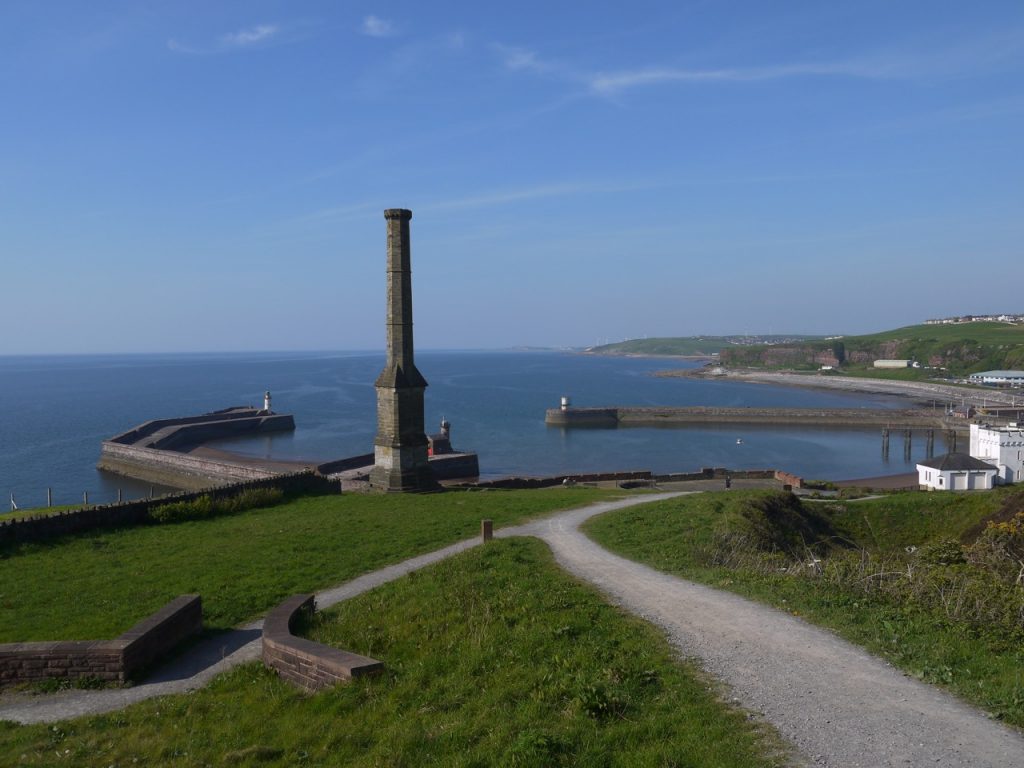
I was surprised how close to Whitehaven we were before we could see the Candlestick. Though it stands high above the harbour it is not at the top of the hill. I had thought the Candlestick was a lighthouse of sorts but it is actually a chimney constructed to vent methane gas from the Wellington pit which extended 4 miles out under the sea.
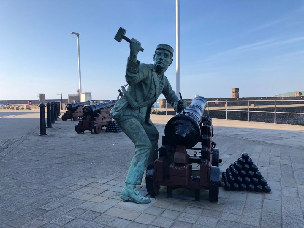
A sign above the Chimney warned of a steep slope and asked cyclists to dismount. The final section of our walk was full of sights. Whitehaven harbour with its boats, the Candlestick and a mosaic beneath it, a memorial to those killed in the collieries, Wellington Lodge, the pit entrance, a mounted pit wheel and a huge anchor rusting where they stood and there presumably to recognise the effects of mining and shipping to the town. Close by are a line of cannon with a statue representing a sailor spiking a gun, when John Paul Jones 1778 raid on the town.
Unfortunately we were too late for ice-cream at the Beacon.
Walking back to the car, sans ice-cream, we paused at the final statue for the day: A Brigadesman, a Screen Lass and a Deputy, erected to remind people of the role that the mining industry played in Whitehaven. A miner is carving the words “end of an era”.

[sgpx gpx=http://www.screel.co.uk/walks/wp-content/uploads/2019/05/RK_gpx-_2019-05-14_1105.gpx]
