
13.8 miles 6h 20m 339m ascent
 Annandale Way: Part 4, Lochmaben to Hoddam
A walk through the dappled light of broadleaved woodland and the untainted sunshine falling on multicoloured meadows. Along country roads with heavy hedgerows. Up steep thistle-clad slopes. Beside lochs, rivers, ponds, and burns. Crossing bridges, fords and boggy moorland. By wheat, oats, barley and crops we could not name. Passing carved beasts and sculpted kings, fungi large enough to suggest enchantment, ancient churches long ruined, a hilltop monument weathering on the site of an iron-age fort, offering views to the hills of both Moffat and the Lake District; colourful murals, covered springs, abandoned houses, wooded avenues and lone trees, oaks with marble galls, curious orange balls embedded in rocks, spent cartridges, and an old log where a princess once rested. Our noses suffused with scent of meadowsweet, honeysuckle and newly mown grass, and a gurgling river named for sweet grass. Watched by beasts of the old world and the new but ignored by butterflies and birds. Warned off from diseased woodland and invited for high tea in Hightae. And at the end, the welcome cold of ice lollies.
The Water of Milk
This was a pleasant walk, though the second half was somewhat spoiled by a mis-remembrance on my part. I like to have an idea of how a walk is progressing by having virtual waypoints in my mind. For this walk Hightae was at about 3 miles, the Graham monument at about 6 miles, Williamwath Bridge at about 9 miles and the bridge over the Water of Milk a mile or so from the end. As we walked, however, my memory became corrupted, and not in a pleasant way. I came to “remember” that the Water of Milk was at about 9 miles, and so marked a place four or five miles from Hoddam. When we crossed Williamwath Bridge, about an hour and a half after leaving the monument, I presumed us to be crossing the Water of Milk, but the evidence against this gradually stacked up and soon I realised it was the River Annan. Believing the Water of Milk to be the 4-miles-to-go marker, and to lie ahead of us, I wondered how I was going to break the bad news to Audrey that we still had a long way to go. I looked at my watch when we had been walking for 5 hours, still climbing, and with no sign of the Water of Milk and sighed with resignation. When we did reach the Water of Milk, I looked at the map, and with not a little relief, discovered my mistake. I should have looked sooner.
This leg of the AW began where the last left off, in Lochmaben, but Audrey parked a little short of our last parking spot so we headed up the main street to make sure our Annandale Way journey was complete. Once there I waved goodbye to Robert Bruce, turned about and began AW part 4.
The Way crosses Mounsey’s Wynd, named for a local Dr James Mounsey whose house at Rammescales we were to pass later in the day, then turns down the road between the Church and War memorial. A stone about a metre tall stands by the pavement here. Had it had holes in it I would have thought it a gatepost but it does not, and actually it seems too slender for a gate post. It looks more like a gravestone but its surface is so weathered any inscriptions would have been destroyed, and it isn’t mentioned on Canmore.
Castle Loch
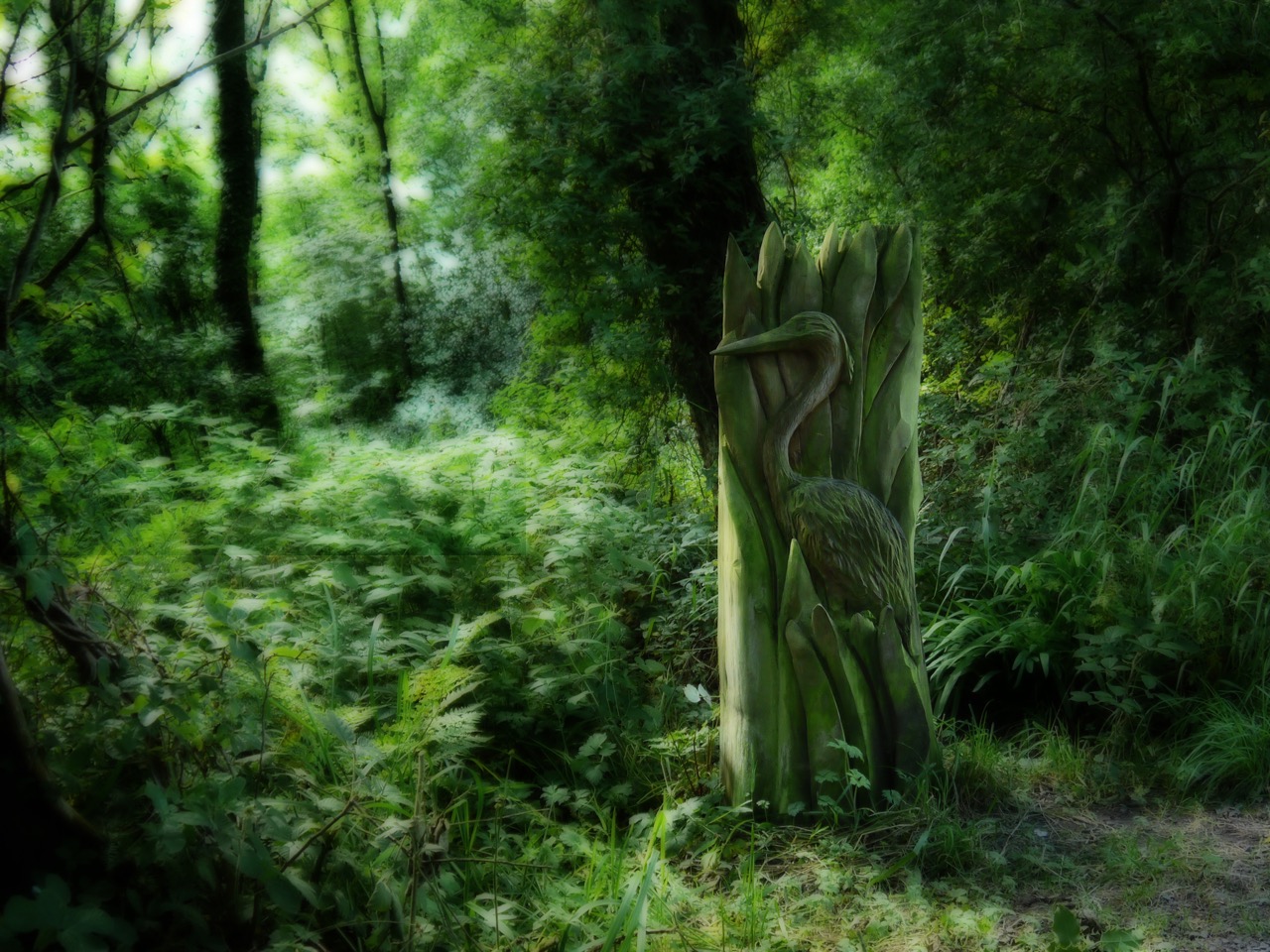
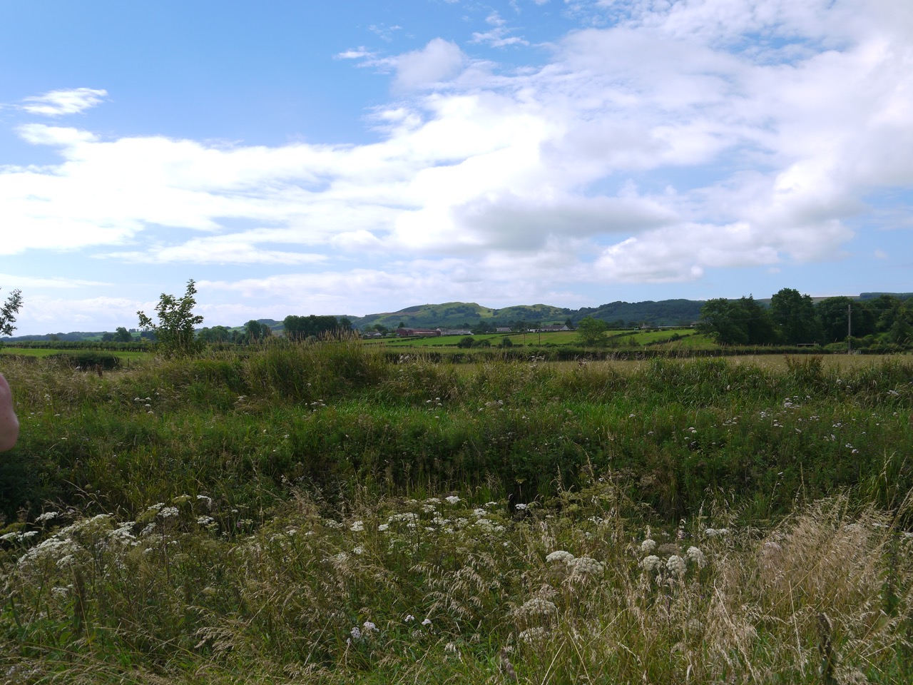
The road passes Lochmaben’s Tennis courts and the bowling green, with views over Castle Loch, before entering the woodlands of Castle Loch Nature reserve. There are mostly young trees here and I suspect planted rather than natural. We passed several wooden carvings along the way: a heron, otter, dragonfly, woodpecker, squirrel, fish (Vendace) and canoe, but the tawny owl has been removed. An old tree trunk just off the footpath seems to have been used either for carving practice or is perhaps a failed sculpture project. It had several wings carved on to its surface and spider webs inits crevices. There are a number of short paths to the loch itself and one of these has an board with information about crannogs and warns against coming into contact with scum on the water.
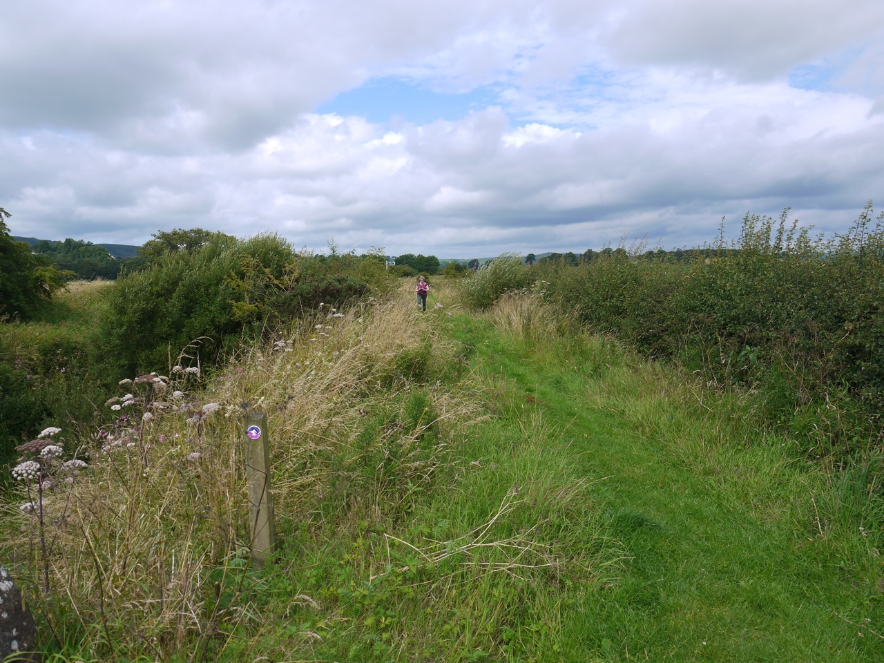
After briefly returning to the road we turned left at some cottages to walk along a farm track. I had intended walking off the AW to visit Lochmaben castle, but the sign said it was half a mile away and we didn’t fancy adding an extra mile to an already longish walk, so it was set aside for another day. We turned left instead and walked through first a farmyard, then fields of wheat, barley and a small copse to reach a minor road at Parkend Farm. A metal kissing gate allowed us back into the fields which we crossed to reach the levee beside the Mill Burn. There is a narrow mown path atop the levee. Audrey thought I was using an American term in calling this a levee, saying she would have called it a bank/dike. But I’m sure we called these levees in Geography when I was at school (in England). The OS symbol representing it is described as an earthwork, but that has a more archeological feel to it in my mind. Embankment sounds a little too grand, and dyke a little too Dutch. Well it was “levee” that came to my mind when I looked across to it, so I’ll stick with that.
Looking across to the levee
The levee had several dips which would surely undermine its purpose and erosion beyond these sections suggests that the nearby fields do flood. When last I walked along here it had been overgrown with nettles but the path is now mown grass, with nettles at the side. Knapweed, creeping thistle, marsh woundwort and hop trefoil crowded the path and the pinks of himalayan balsam and rosebay willowherb filled the far bank. A narrow AW bench here was well placed for a brief rest and a slug of water. We could see the Monument up on Almagill Hill and Audrey found an SUW badge on the bench. If this had been a fairy tail, that badge would be enchanted. We’ll see how it effects her.
Almagill Hill, from the bench
The signpost for “Heck, half mile”, marked the end of the levee near Calf Lake Bridge. We were then on the minor road for Hightae, the hedgerows hanging with tufted vetch past its best with both meadowsweet and honeysuckle sweetening the air. The brambles were not yet in fruit but the wild raspberries were ripening. As we strolled along, a car pulled up and a recognisable voice said “Hello”. We were invited for a cup of tea since we would be walking past her house but time constraints prevented us up taking up the offer.
The Levee by Calf Lake
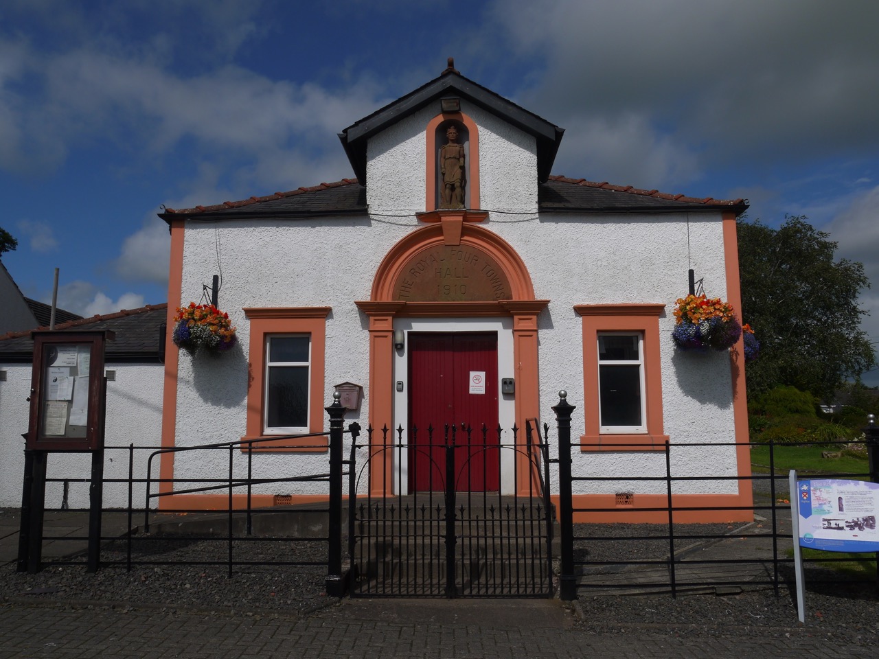
There is an impressive children’s playground on the edge of Hightae and some colourful gardens in the village itself. An information board beside the “Royal Four Towns Hall” answered the obvious question: the four towns being Hightae, Greenhill, Heck and Smallholm, founded by King Robert Bruce, whose statue stands in the hall’s frontage.
 Hedgerows with goldenrod, bindweed, honeysuckle and more unripe raspberries accompanied us back to the B7020. In the field beside the road I watched a large grey and white bird flying low between the cows before dipping down to some water. Too big for a gull, a heron perhaps from its wing shape as it landed.
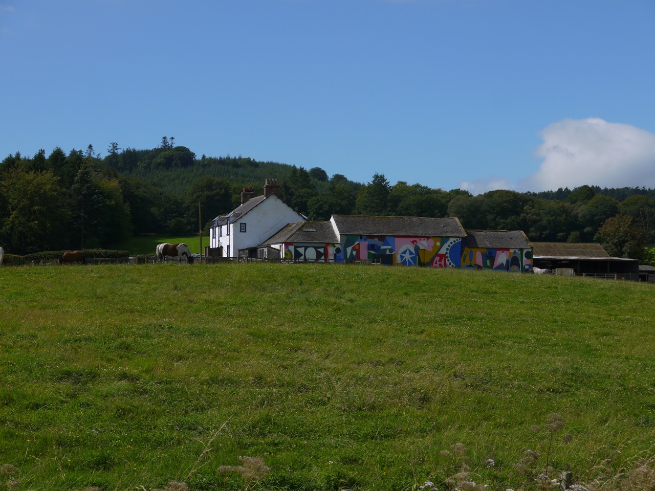 The Way passes the Mossburn Community Farm, its walls covered in abstract murals and horses grazing in its adjacent fields. The road then begins to climb gentlely. We noticed a rather long sheep in the field as we walked and both Audrey and I must have registered it as a little unusual since we were both looking at when it raised its long neck to reveal itself as a llama. That left us wondering what llamas were used for. Wool presumably, since I’ve not seen llama meat or cheese on sale.
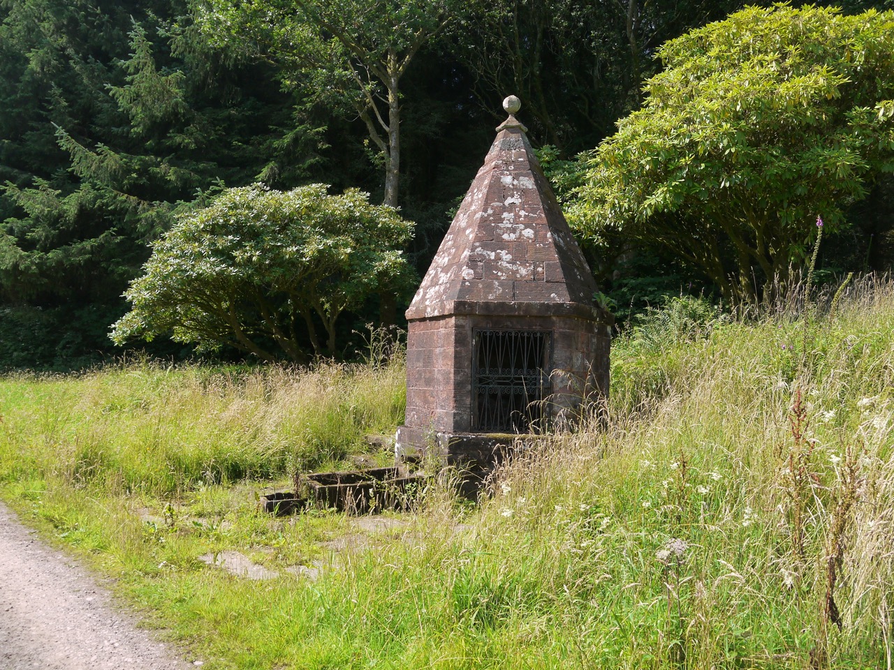
Once we entered Rammerscales wood, still on the road, the gradient steepened at little more, but the shade of the trees gave us respite from the warm sun and allowed enchanter’s nightshade to thrive in the hedgerows. An unusual construction just beyond Rammerscales house looks to be built over a spring. I had a close look around this but we gave a nearby house-in-the-woods a wider berth.
 The road beyond Rammerscales House becomes a rough unmetalled track and after a short time we turned left off this track at an AW sign. We were then on a woodland footpath pocked with pools of water and muddy in places. The burn running in Routing Clench flows across the path but stepping stones kept us dry. A little further on we found ourselves facing a large pool of muddy water completely obstructing the path. This caused me to pause, and while looking around I noticed, almost hidden in the trees, an AW signpost pointing up a narrow path that had escaped my attention. So we were spared crossing the pool.

Hidden signpost
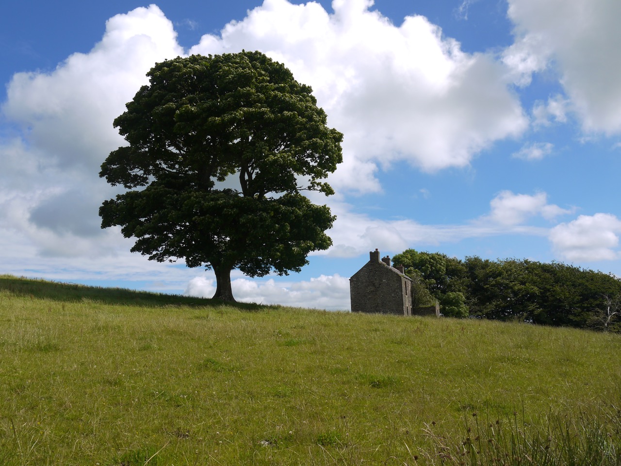
This narrow path was uneven, muddy and had been churned by the passage of walkers and riders. The path such as it was ended with the trees and we found ourselves facing the boggy ground of Holmains Moor. The actual AW route here differs slightly from that on the OS map. The map’s route follows the edge of the woods around its SW corner whereas the signage indicates leaving the trees at that corner. There was no obvious track to follow onto the moor so we took our direction from a wee AW arrow on the gatepost. This proved true since we soon found a way marker and were guided along the line of a fallen wall with one surviving lunky hole and a more modern fence now usurping the wall’s role. An imposing Oak stands above the abandoned Holman House, the tree crying out for a makeshift swing. It was easy to imagine ghostly children playing near that tree.
Holmain’s Oak
The OS shows the site of Holmains tower close to some extant farm buildings and we must have walked by it without noticing. I have photographs looking across the area with no sign of ruins but you can make it out on satellite photos. After Holmains the ground was less churned and walking became easier until we reached the steeper ground of Moss Castle, and beyond the gate we had no discernible path or track again.
We decided to just head directly up, albeit with a little zig-zagging. The climb was not easy, the ground was uneven where natural subsidence had left soft gullies and had been further churned by animals. The thigh-high creeping thistle was particularly dense on the slope. Once atop Moss Castle we were away from the thistles, in a beautiful hill meadow of knee high grass, the blue harebells nodding in the wind alongside the steadier white and pink of yarrow and eyebright, and yellow hawkweed and tormentil. In a film, walkers would have frolicked through this as if the vegetation were a mown lawn, but in real life, walking through it, though a joy to the visual and olfactory cortices, was tiring for legs already flagging after the preceding climb.
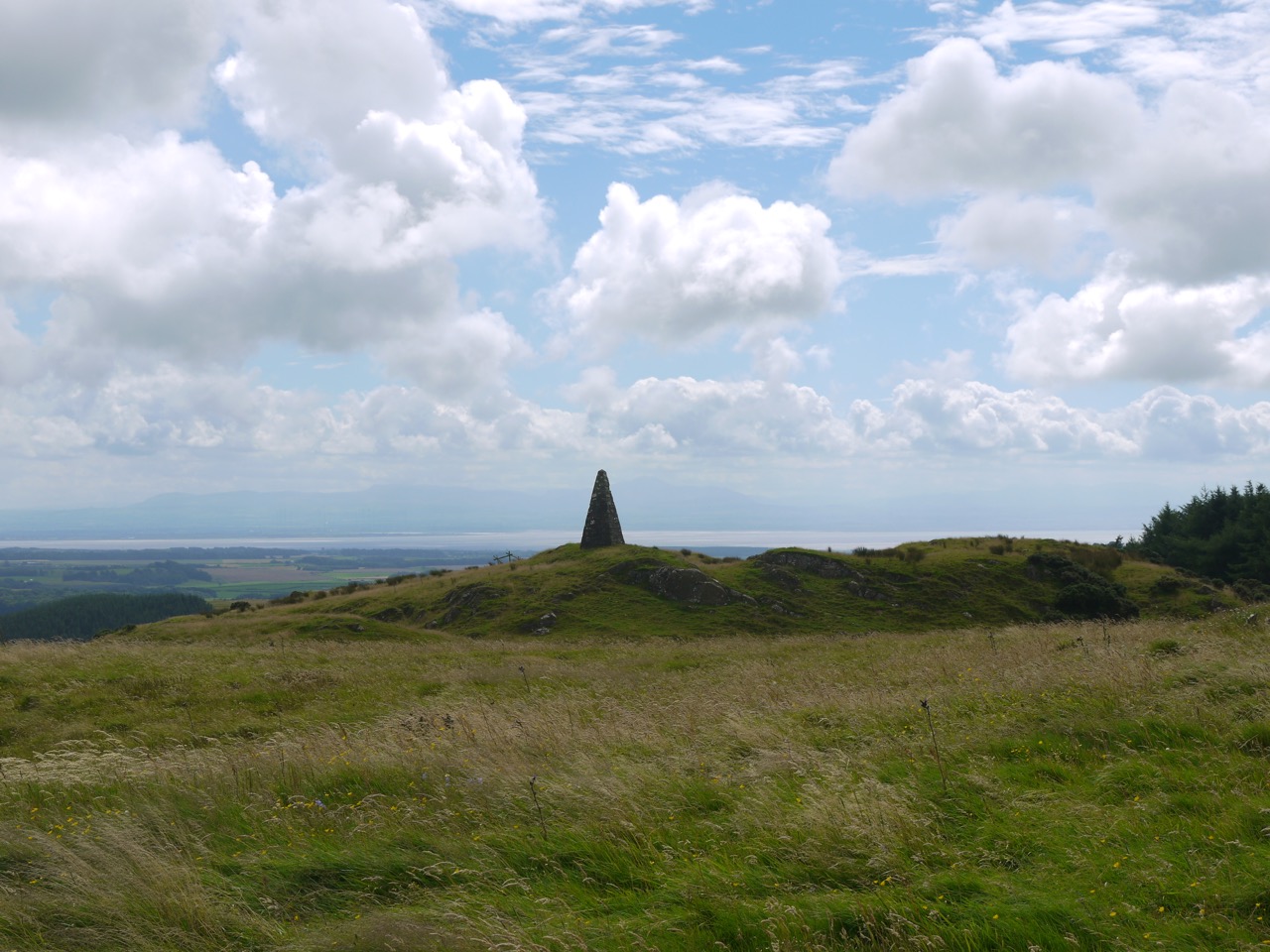
Almagill Hill with the Lake District as backdrop
I worried that the dip between Moss Castle and Almagill hill would prove my decision to head straight up the hill, rather than around it, to be ill judged but it wasn’t. Moss Castle was once topped by a fort but gave no clues of this at least to my uneducated archeological eye. Satellite views show where its walls once stood.
The Monument on Almagill hill came into view with the Solway and hills of the Lake District in the background. From here one could see the whole of Annandale. Their recognisable shapes allowed us to pick out Skiddaw to the south, Burnswark to the east and Saddle Yoke to the north.
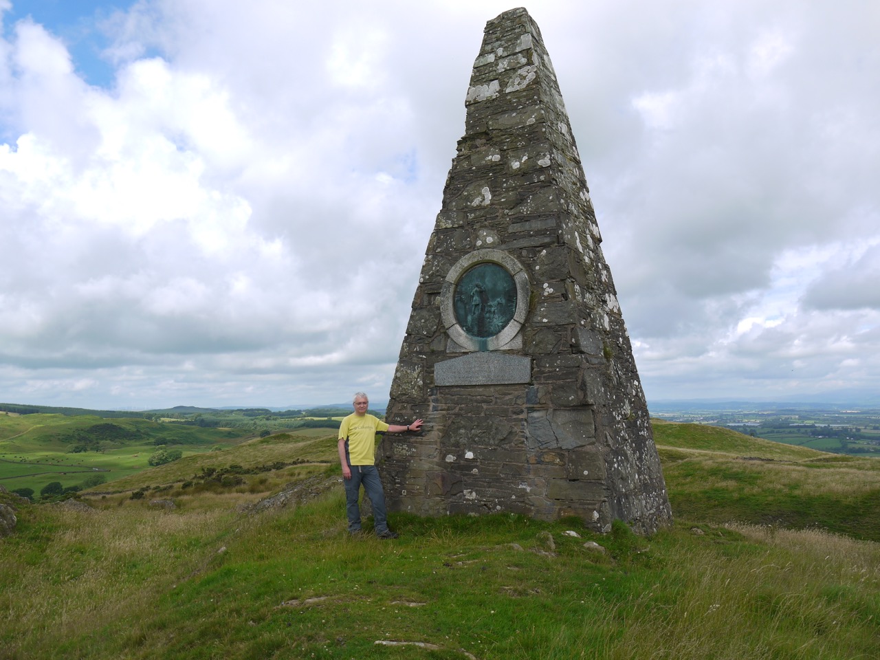 Almagill Hill is topped with Joe Graham’s Monument, a 6m pyramid with the inscription:
“In Memory of Joe Graham for many years huntsman of the Dumfries Shire fox hounds who died in 1893 at the age of 80 and now he has gone far far away we shall never hear his voice in the morning”
A nearby trig point is a useful stand if photos are needed. The monument was a little short of the halfway point of our walk and it would have been nice to sit on the hilltop and enjoy the views while we had lunch, but the wind was picking up so we sat on the rocks in a wee dip beside the monument.
Rested, and refuelled with sandwiches and coffee, we stood once more, hefted our rucksacks, remembered to pack away our cushioned seats, and readied ourselves for the second half.
The way down was unclear so we headed south. I recalled DW spotting an AW plaque on a distant fence post back in 2010 and we managed to find it too, though I doubt I would have seen it had I not known where to look. We followed its arrow and found a marker post then some wear in the grass that one could call a track.
An AW gate funnelled us onto a fenced track between the field’s dyke and a parallel fence. The field to our right had been ploughed/turned over and was soil except for a small grass topped bank, where some sheep were making the most of their meagre grass. The fenced track led us to a well maintained farm track which we followed down to a minor road. A signpost inscribed “Joe Graham’s Monument, 1650m approx” pointed back the way we had come. Approximately 1650m? I wondered how accurate it needs to be?
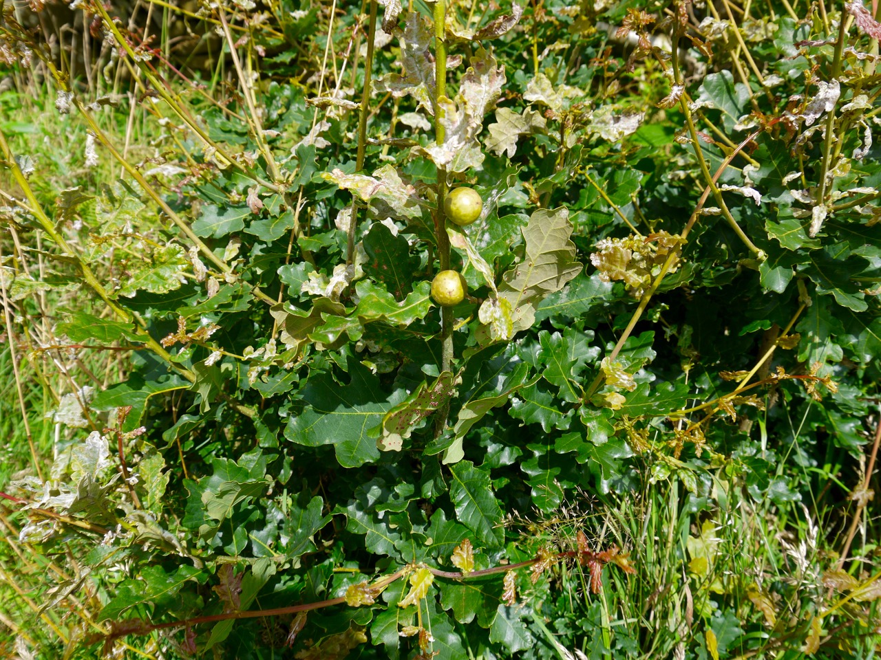
Oak Marble Galls (wasp larvae)
The next hour and a half or so was spent on minor roads but we saw very few vehicles. We walked a little way on the B7020 again and avoided the woodlands with a sign warning they were diseased. Passing through Dormant we decided not to go in search of the alternative route up to the river, continuing instead on the road, the way marked route, a pleasant walk beside woodland and fields of crops. Some of the trees had been felled giving more open views across the desolation.
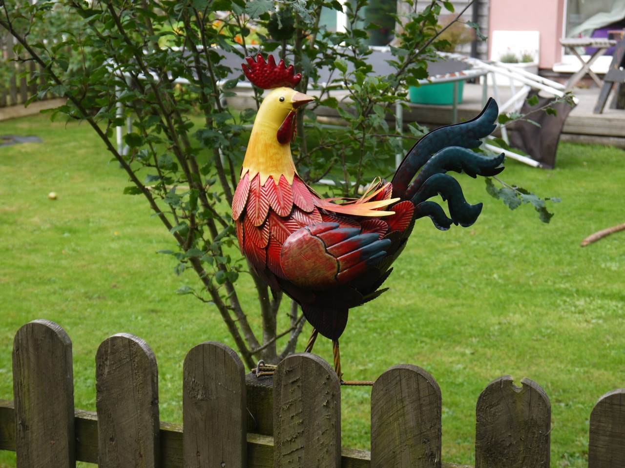
Dormont Cock
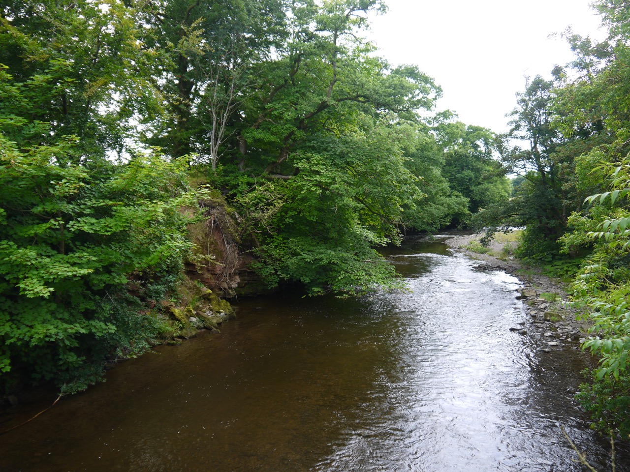
And then we reached Williamwath Bridge where my confusion with our position began. Audrey managed to convince me, correctly, that the river we had crossed was too big to be the Water of Milk, but having accepted my mistake in recognising the river I held on to the unfounded belief that the Water of Milk was at 9 miles rather than 13 miles.
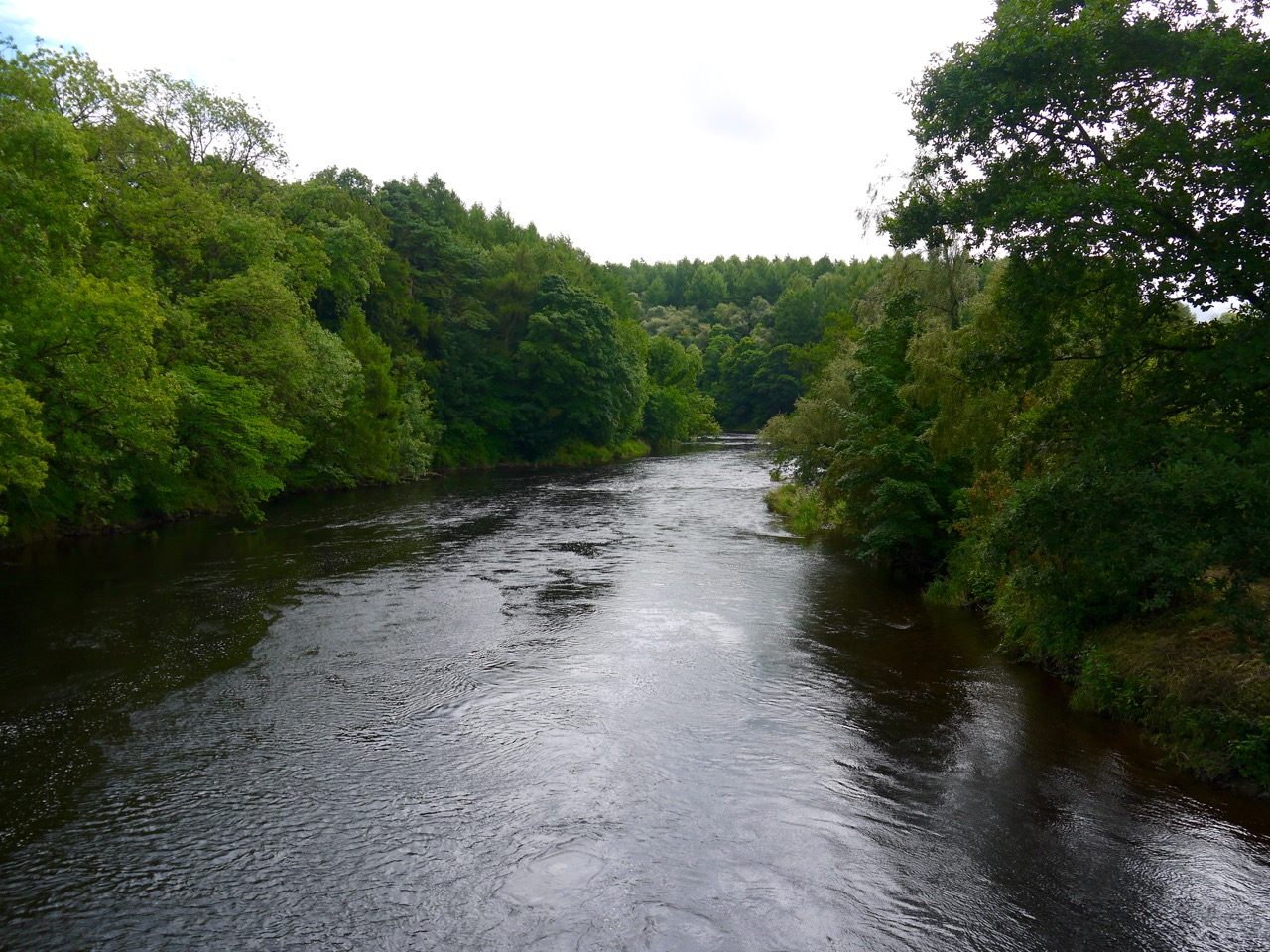
River Annan at Williamwath
After Williamwath we climbed some wooden steps, crossed fields high above the river then had a pleasant riverside stroll in young woodland. We found several commemorative benches and a rather splendid fishing hut, The Beild (shelter, Scots). One bench was inscribed “To cast a line and have a dram”, another “Sheena’s rest”.
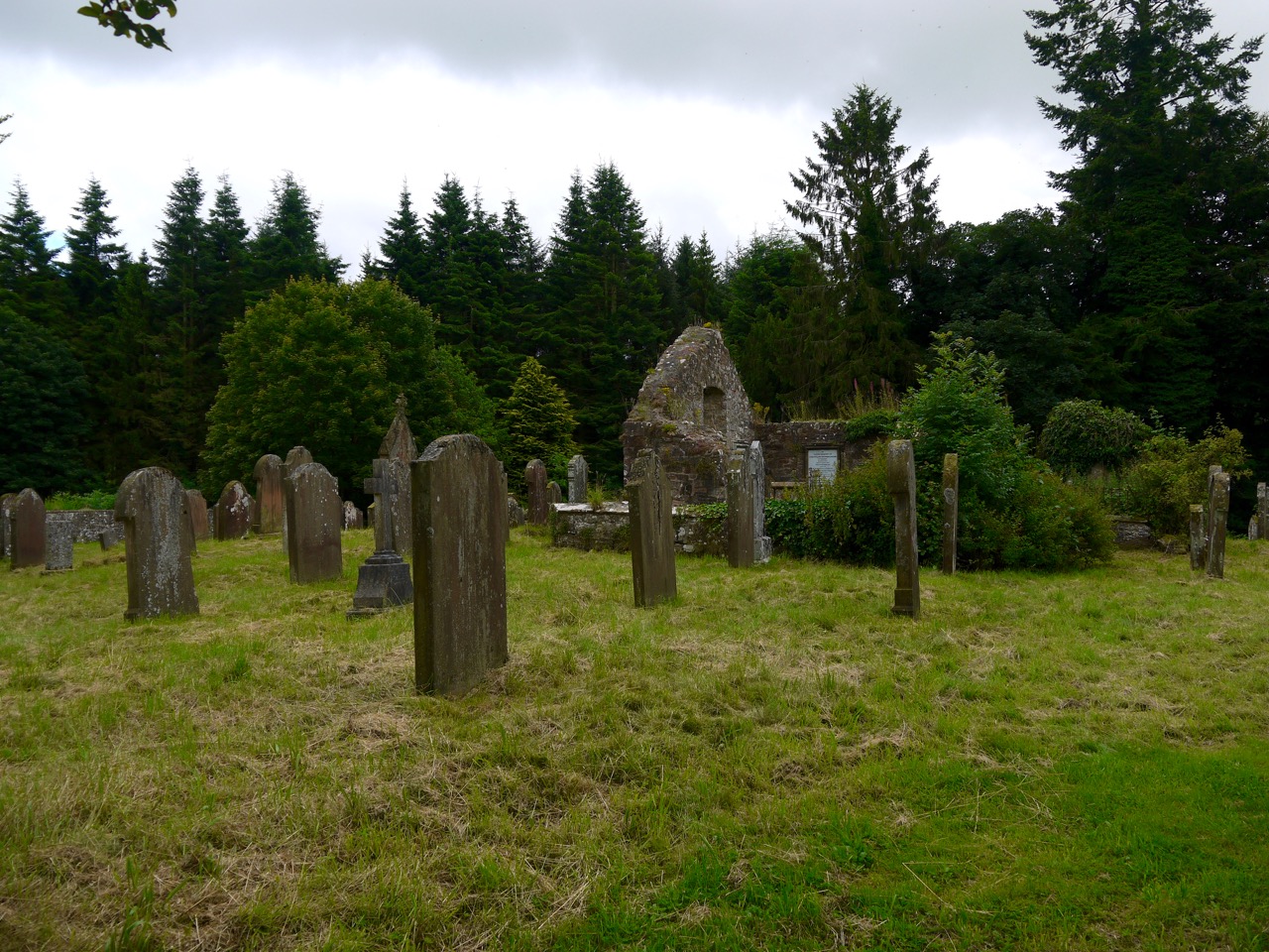
St Mungo’s Church
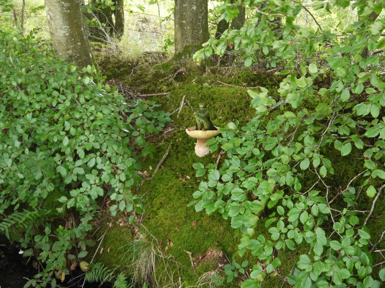
We reemerged onto a minor road which took us down past the well maintained ruins of St Mungo’s Church. St Mungo, also known as Kentigern, was Bishop of Hoddam in the 6th century. He is the patron saint of Glasgow, is said to have converted Merlin to Christianity and his name is remembered in the St. Mungo’s Hospital for Magical Maladies and Injuries from the Harry Potter books. Masses of fungi grew beneath a tree opposite the church, so much that in another time one might have inferred a magical cause.
Across the road from the old graveyard surrounding the ruined church is a new one which looks to still be in use. Past here the road begins to climb. It wasn’t much ascent but coming towards the end of the walk it seemed steeper than it was and it was a welcome change when at last we started to descend. We found ourselves walking past fields of oats and more giant toadstools beside the track.
Toadstool
Our path became less road and more track as we walked through the young woodland of Sorrysike Moor. When we reached the junction with the Lockerbie section of the AW I paused a memory bubbling into my consciousness, and turned around to see a log at the edge of the trees. I recall Vivienne resting there when we walked this route in 2010.

Winter Rape
The crops in the next fields were not ones we recognised at the time. One was Winter Rape in its pod stage, the second I thought looked a little like corn, but Audrey thought not. We then left the fields, joining the minor road at Brocklerigg Farm which brought us to the long awaited Water of Milk. The water of the river is clear with a rusty brown tint from the rocks on its bed, so its name does not reflect its colour. The name apparently derives from milleach meaning “flowery or sweet grass”, and is also found in the names Castlemilk and Abermilk.
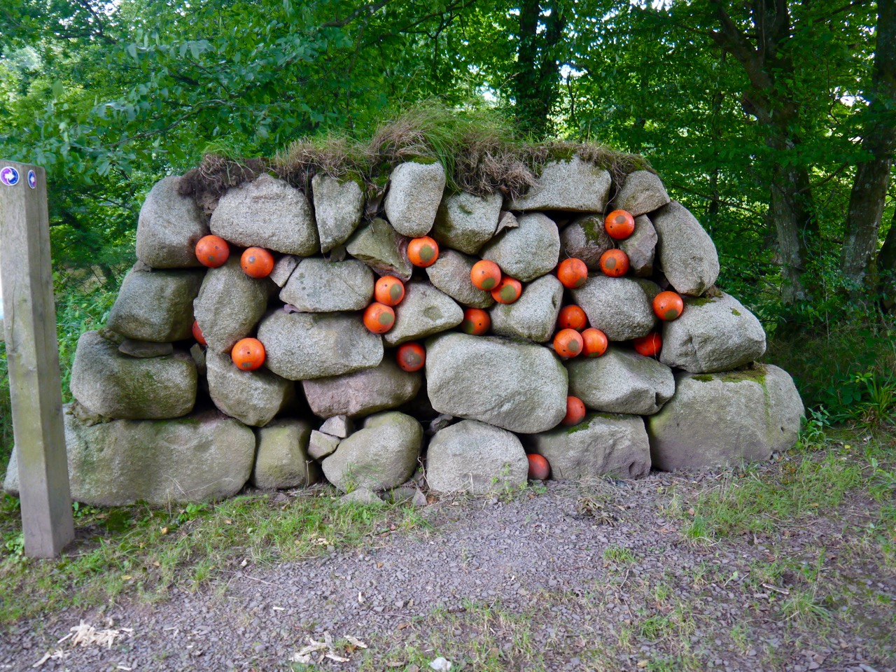
Eggs in the gravel wall
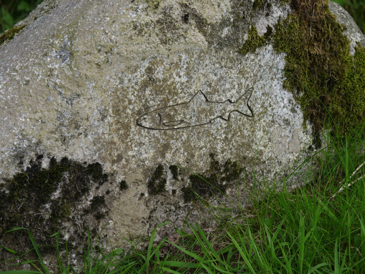
The Annandale way runs beside the Water of Milk and then the River Annan and an information board with a visual poem marks where the waters join. There is a strange construction beside the river, a wall of grey rocks interspersed with orange floats. I have spent many hours trying to find what it represents and, like the Water of Milk, I have now stumbled on an explanation. It is the first part of the “Salmon Trail”, the “Egg in Gravel Wall” representing salmon eggs which are tiny orange balls in the gravel of the river bed. Next is the “Hungry Fry Picnic Bench”, then the “Exploring Parr Boulders” a group of boulders with tiny salmon carved onto them, and finally the “Off to sea finger post”, a tall totem pole like carving. There are also several other carvings along the way and quite a profusion of blue cranesbill.
 We left the Annandale Way at the footbridge to Hoddam Castle and made our way, past some Belted Galloways, then through Hoddam Woods, to the car, pausing briefly to buy ice lollies from the castle shop.
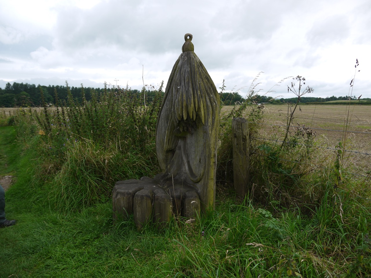
Carved seat
On reflection this section of the AW had quite a variety of walking and plenty to keep the boredom away. The weather held up well, though it did get a little windy later in the day and we had one brief hint of rain. And I remembered to put on sunscreen.
Download file for GPS