
6.69 miles 5h 3m ascent 332m
Aisgill Moor-Eden Springs circular
Between two sister moorland rills
There is a spot that seems to lie
Sacred to flow’rets of the hills,
And sacred to the sky.
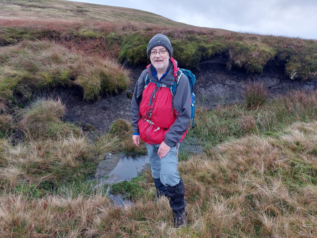
We had slightly damp boots but the weather was decent. It was neither a particularly long walk, nor much of a climb but… Du lieber Gott! … it was a grind. I slept for 12 hours that night. That said, I think it was my favourite section of the Eden Way. There is something atmospheric about a wild moorland walk.
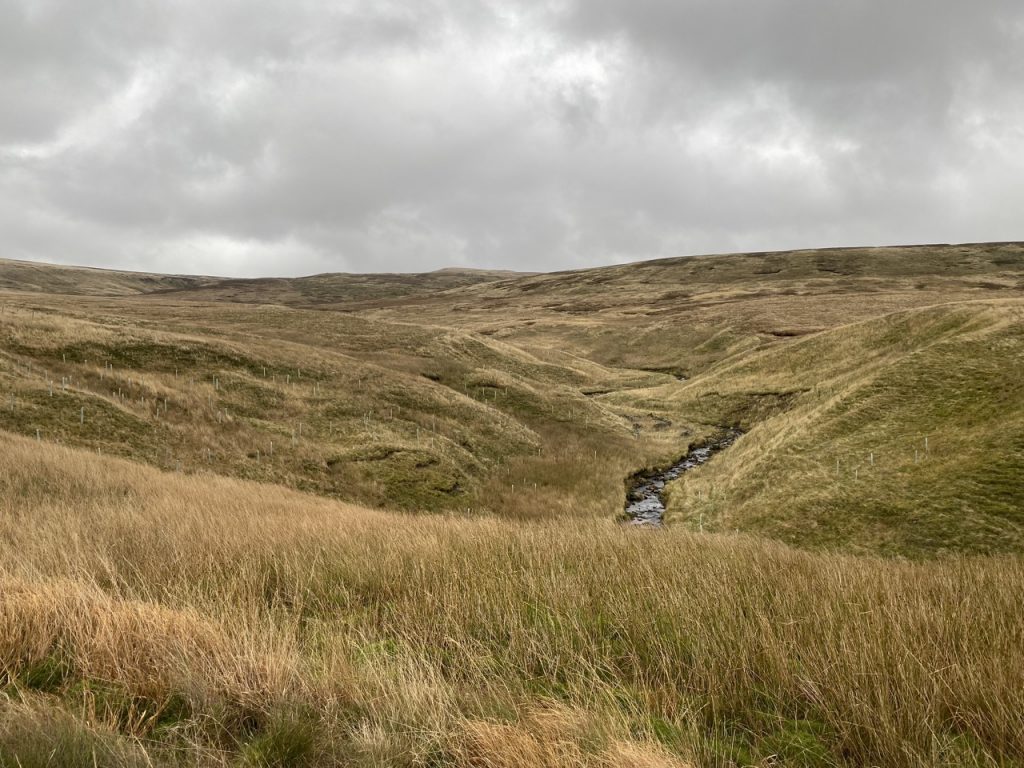
The sound of water was never far away, whether splashing in waterfalls, washing over rocks, or burbling beneath our feet. And the squelch beneath my feet gradually became a squelch within my boots. Grouse rising out of the moor startled us at first but we soon grew used the ruffle of wing beats followed by a warning call, part goose-honk and part duck-quack to ‘Go-Back, Back, Back’. Added to these, the wind picked up as we climbed, rustling the grass and stealing away our words.
This was actually a straightforward route, though it didn’t seem so at the time. There is a good farm track from the B6259 up to Hellgill Bridge farmhouse, a substantial bridge that could carry a two lane road over the railway, and a good footbridge over Hell Gill. There was no need to wade through the ford over Hell Gill, but our wet boots were a reminder of the previous day’s crossing.
There is some do-it-yourself crazy paving at the farm buildings. Old bricks tossed haphazardly into concrete. Quite out of character given that the buildings look to have been renovated recently. Perhaps the track will be the next improvement.
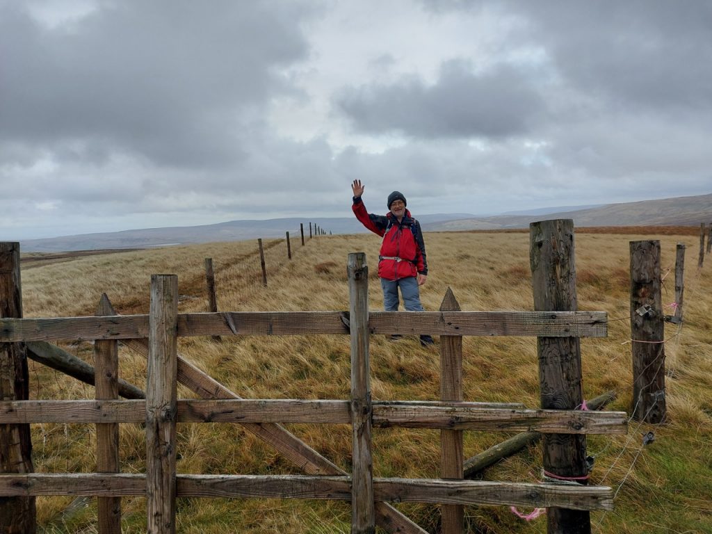
A very stiff gate, or more accurately, a very tightly sprung one allowed us onto the “old road” while preventing the black-faced sheep from escaping. This is the place where Dick Turpin/Black Bess allegedly made their escape (see yesterday’s write-up).
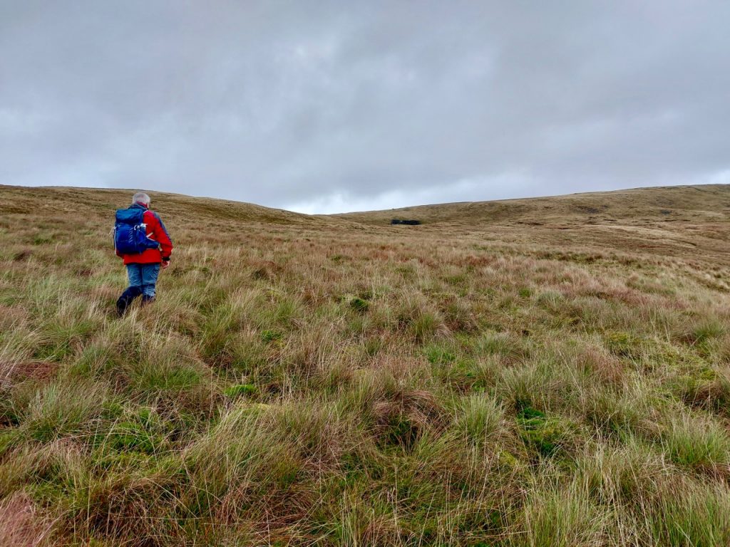
We followed a fence, walking on a squelchy quad-bike track that seemed friendly enough but would bite both of us on the way down. Across the beck was Yorkshire which we gazed at “baht ‘at”. It seemed appropriate.
A little above 500m the fence turns to run across the gill. The squelchy track ends. The guide book offers two options: follow the beck as best you can (which didn’t sound especially promising) or strike out across the moor to a sheep shieling that isn’t marked on the OS map. I didn’t think I could see it but we aimed for a cairn above a hollow almost directly north of us.
In fact, the shieling is marked on the 1:25k OS map but you need bionic eyes to differentiate it from the many erratics marked with slightly fainter lines. And what’s more, I could actually see it. The dark area I thought was a hollow in the slope was actually the large shelter. It’s the black thing in the photograph below.
Had I known I was heading in the right direction the walk would have been easier. Walking with uncertainty burns more mental calories. A small waterway leads much the same way and could help if it was misty. But in bad visibility you would be better sticking to the edge of Hell Gill (taking care not to fall down its ravine!).
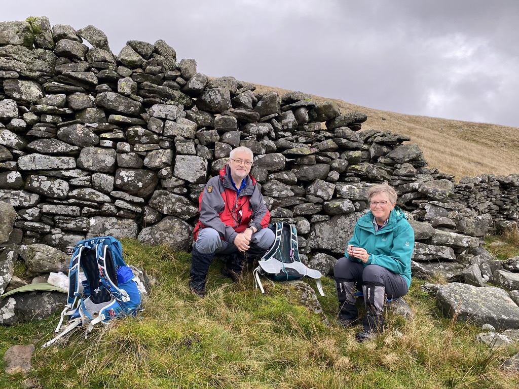
The sheiling is quite large. There is a protruding wall for directing sheep into the shelter and three separate ‘rooms’ within. Two seem too small for anything but a couple of beasts and I take it these were for shepherds. It certainly sheltered us. Once I found a seat that didn’t wobble (my first choice having rudely rejected me) I settled down to enjoy my Cornish pasty.
The cairn on the ridge above the sheiling may itself have been a shelter, but it has fared less well than its larger neighbour. But it is a good waymarker for the faint track through the heather we needed to follow. It would disappear at times but most walkers must take the same general route so it would re-form a little further on. We reached the beck while it was still in a bit of a ravine but soon enough the stream was beside us and narrow enough to cross. From there it was trackless moorland.
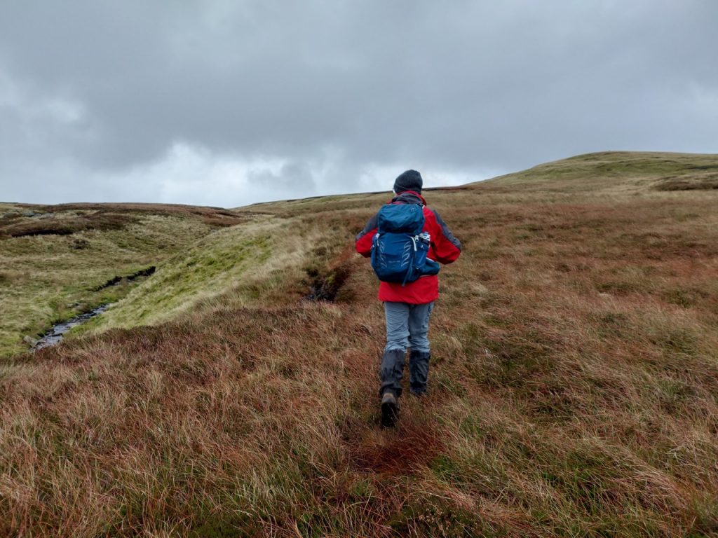
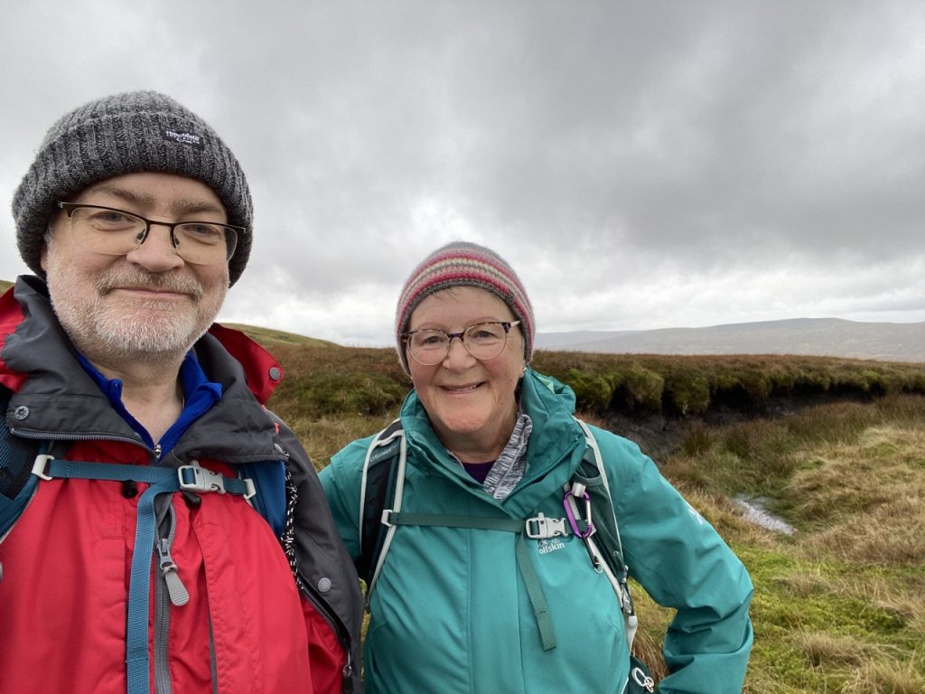
We followed the beck uphill picking our way around peat hags. The beck became smaller and the ground boggier. We had reached the conclusion of our River Eden quest, Eden Springs. Fifteen months had brought us from the Solway to the Eden’s source.
Having posed for our photos we trudged up to the fence line and then up to Hugh Seat which at 689m it is the highest point of our Eden Way walk. The fell was once called Hugh Seat Morvil after Sir Hugh de Morville, the Lord of the Manor of Mallerstang.
In 1170 an exasperated King Henry II berated his retinue “What miserable drones and traitors have I nourished and brought up in my household, who let their lord be treated with such shameful contempt by a low-born cleric?” Four of the knights responded to their lord’s chiding by riding to Canterbury and murdering the meddlesome priest, Archbishop Thomas Becket. Hugh de Morville was one the four.
Henry advised the knights to take refuge in Scotland and Hugh subsequently sheltered the other three at his castle in Knaresborough for some time. The four were excommunicated but not stripped of their lands. They tried to make amends by building a new church and then sought an audience with the Pope. He was not impressed and decreed they should be exiled and fight “in knightly arms in The Temple for 14 years” (in Jerusalem) then they were to visit the holy places barefoot and in hair shirts and to live alone for the rest of their lives on the Black Mountain near Antioch, spending their time in vigil, prayer, and lamentation.
When we reached Hugh Seat’s summit I climbed the fence into Yorkshire but after a couple of minutes my inner Red Rose began to wilt and I had to climb back.
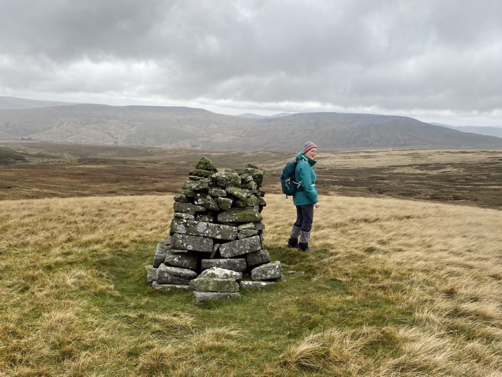
This section of the Eden Way didn’t include a Benchmark sculpture but I had decided to regard the Lady Pillar as an unofficial 11th benchmark. The problem was, we couldn’t see it. We stood by the cairn on Hugh Seat (in the photograph above) perplexed, examining the map and gazing across the hill. Where the OS map read “Lady’s Pillar (BS)”. there was just moorland.
As it turns out, the OS has the position marked incorrectly. The cairn we were stood beside is the “Lady Pillar”. The “(BS)” is not a comment on veracity but an abbreviation of boundary stone. Given where the pillar is, that certainly makes sense, though the modern boundary fence is a few metres away.
The guidebook suggests heading west from the summit but there was a walked track heading away slightly more northwest that got us back to the beck. Unfortunately we couldn’t find the track we had used on the ascent and had quite a bit of walking across pathless moorland, following the beck. We were then faced with a rather unpleasant looking low lying area. My instinct told me it would be very boggy indeed so we decided to walk around it, heading for a cairn visible in the distance.
Luckily we picked up the trail that we had used earlier and found ourselves back at the shelter we had used for lunch. From there, freshly re-caffeinated, we could see the fence line that runs beside the ‘easy’ quad bike track. With that in our sights, crossing the moor didn’t seem quite so bad.
I mentioned that the quad-bike track wasn’t as tame as it seemed. It suddenly swallowed my left foot – only luck keeping me upright. Audrey wasn’t so lucky and ended up horizontal. But we made it back down the hill, albeit a bit tired and wet.
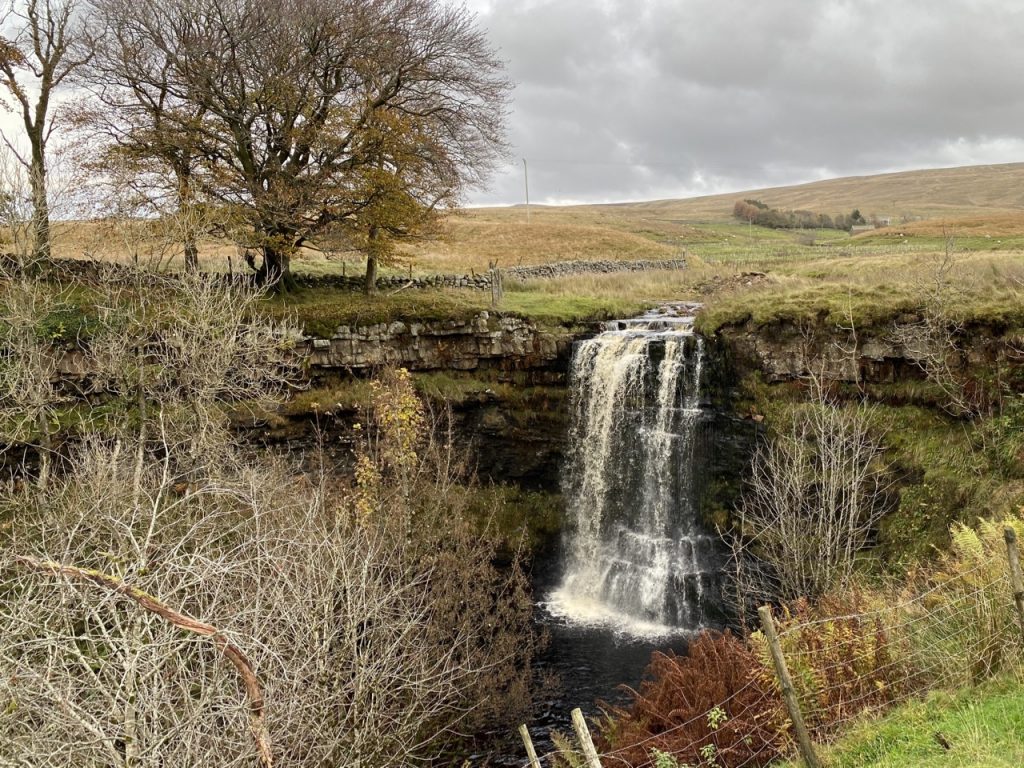
Our final task was to have a look at Hellgill Force from this side (its better side).
That was our trek from the Solway to the Eden’s source almost complete (save a five mile gap that we will have to plug sometime – done on 22/11/2022). Along the way we have seen benchmark sculptures, castles and caves, pavements of ceramics and limestone, cliffs of sandstone, woodland, moorland, stone circles and ancient cairns, bridges and fords, waterfalls, … and more.
[sgpx gpx=https://www.screel.co.uk/walks/wp-content/uploads/2022/11/RK_gpx-_2022-10-31_1018.gpx]
