
10.81 miles 4h 57m ascent 114m
Whitehaven-Workington
No folk fled the flood,
“Cockermouth and Workington”, Carol Ann Duffy
no flags furled or spirits failed –
one brave soul felled.
I don’t recall having been to Workington before and having friends in Whitehaven has perhaps skewed my views about the town. So it was, as we drove into Workington I would not have been surprised to find it to be in black and white, with men in flat caps leading starving pit ponies to knacker’s yards, beshawled women scrubbing steps of coal dust and barefoot urchins begging for jam sandwiches, all partially hidden in the swirling smog. But the town was in full colour, the road signs bright and cheery, the sky blue, the children shod and ne’er a flat cap or pony to be seen.
This section was to take us from town to town so were able to mange with just one car, parking in Workington and taking the train back to Whitehaven. we had a few minutes to kill at the station, so I walked the dog up and down the platform. On my way in I passed two workers looking at the automatic doors, one telling the other that she was “goin’ to work on these doors, but they kept orpenin’ an’ clawsin’”. I am sure there is a context that makes the exchange reasonable, but to me it sounded like something out of a sitcom.
The train ride was Christy’s first, and he took it in his stride, alternately bored, lying down, and curious, sticking his head between the seats or peering down the carriage. He ignored the inspector when she passed by. It was certainly an easier ride than that with my son Harry many years ago when he pointed down the carriage at a large, obese, leather clad Hell’s Angel with a ZZ-top beard, walking towards us and shouted “look, the Fat Controller”.
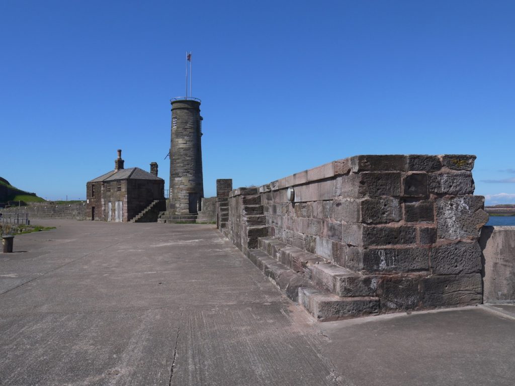
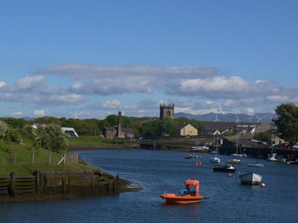
Being somewhat picky about joining up each section, I had us walk the half mile back to the Beacon centre and then back to the station, but we made it a circular route crossing the harbour footbridge, then along the Old Quay past the Watchtower and the “End of an Era” statue, bringing us to the West Strand.
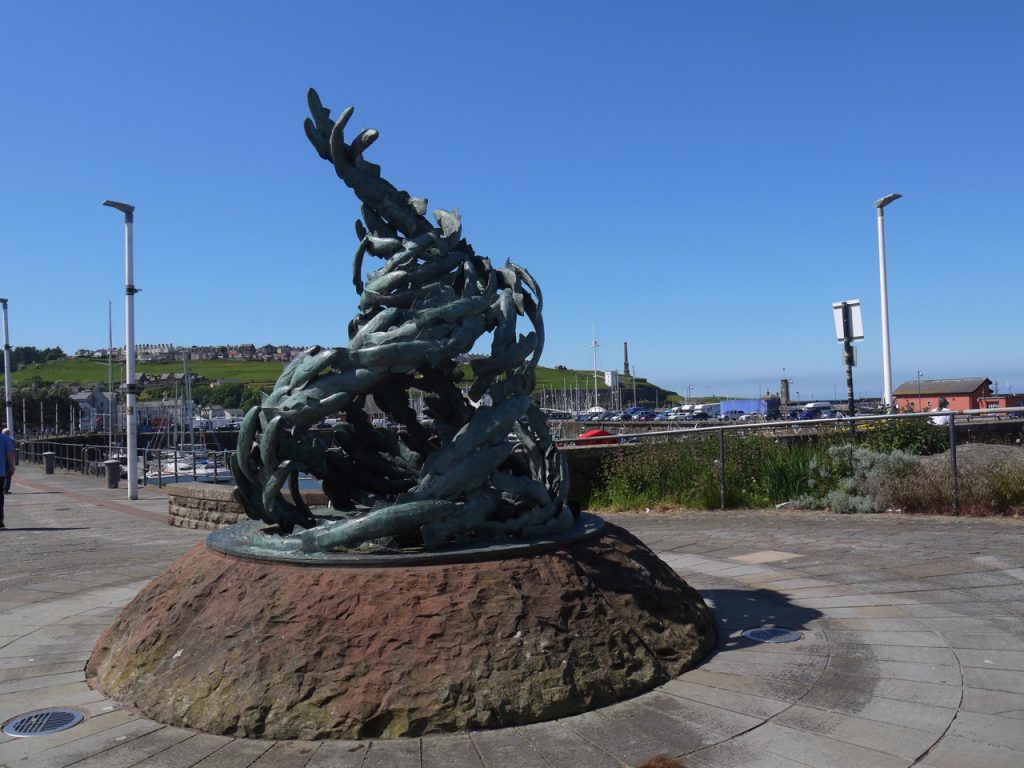
I am sure one could spend half a day exploring Whitehaven Harbour and one local seeing us looking at the information about Sugar Tongue encouraged us to do so, but we had miles to go so we pressed on past the Sugar Tongue and Lime Tongue, fish shaped cycle parking, the start of the C2C cycleway, several bollards in the shape of knots and the Fish Shoal Sculpture
Benches shaped like fishes tails along the quayside are engraved with a brief history of the harbour.
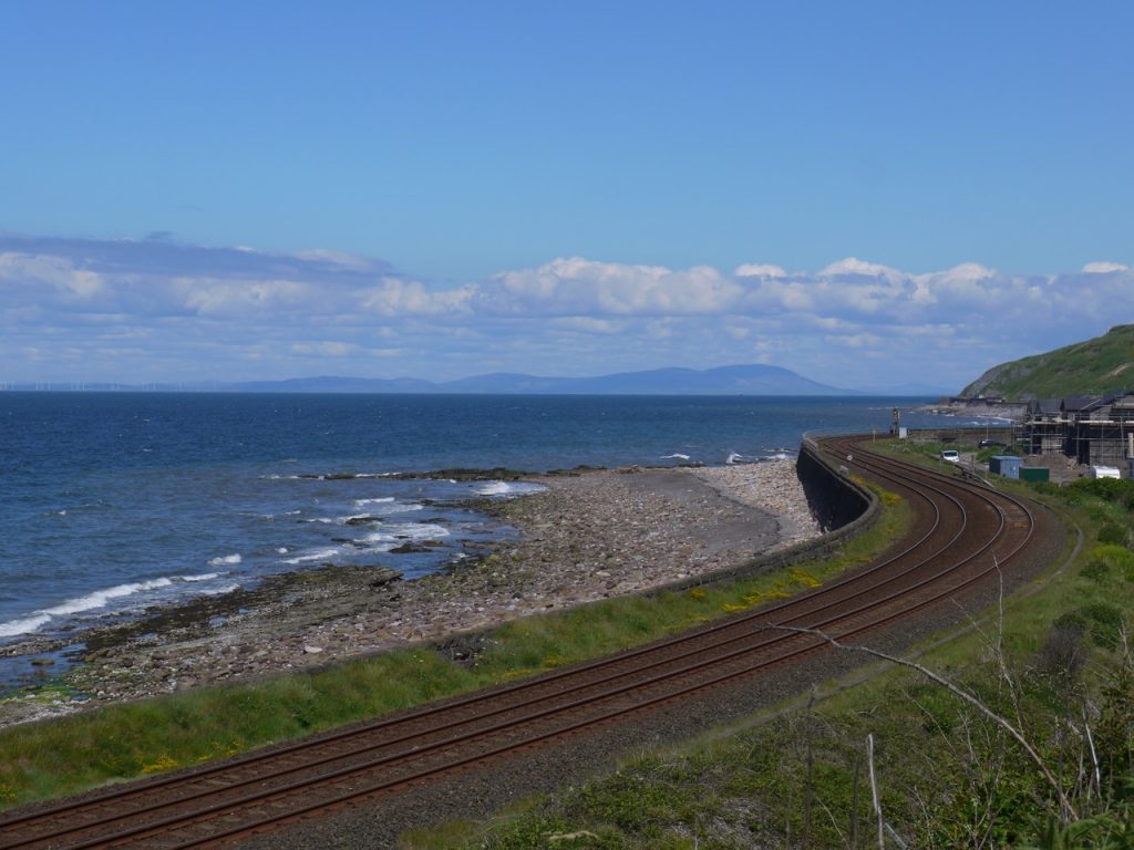
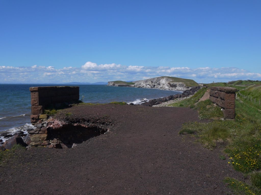
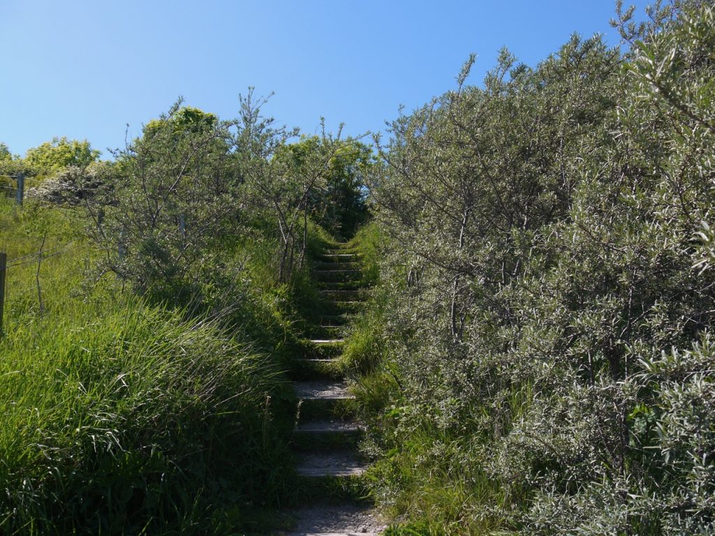
Hadrian’s Coastal Route takes a minor road above the Railway Station, slowly climbing to give views back across the harbour, the road then giving way to a tarmac path signed “Access for residents and cyclists only”. Of course, we were neither, but decided to stick it to the man and stroll on ignoring the official order. The track runs beside the railway and beneath the Bransty cliffs.
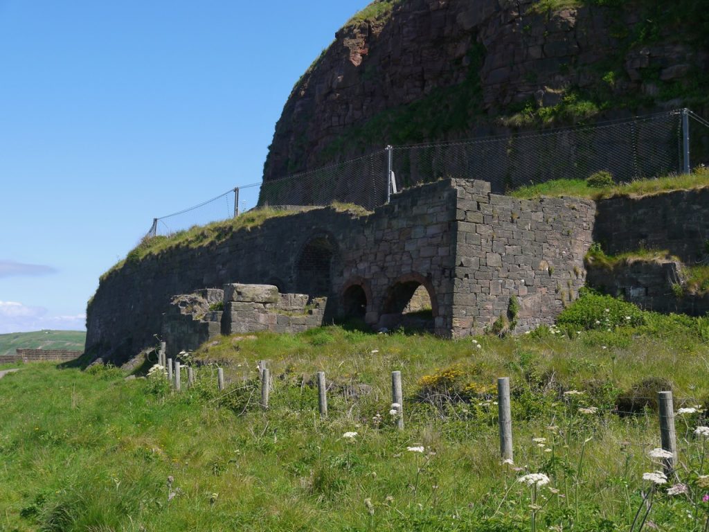
A ruin between the railway and cliffs near Redness Point was apparently related to the Lonsdale Ironworks.
Beyond the ruins we came to a chap standing beside a camera with a truly massive lens. He pointed out a peregrine falcon and its nest on the cliffs. It looked little more than a white speck on the cliff to me but he was good enough to take a photo and show us the bird.
It was a very clear day and we could clearly see the Isle of Man and the Galloway Hills, Cairsmore of Fleet, Bengairn/Screel, and Criffel recognisable by their shapes. The Mull of Galloway became visible a little later.
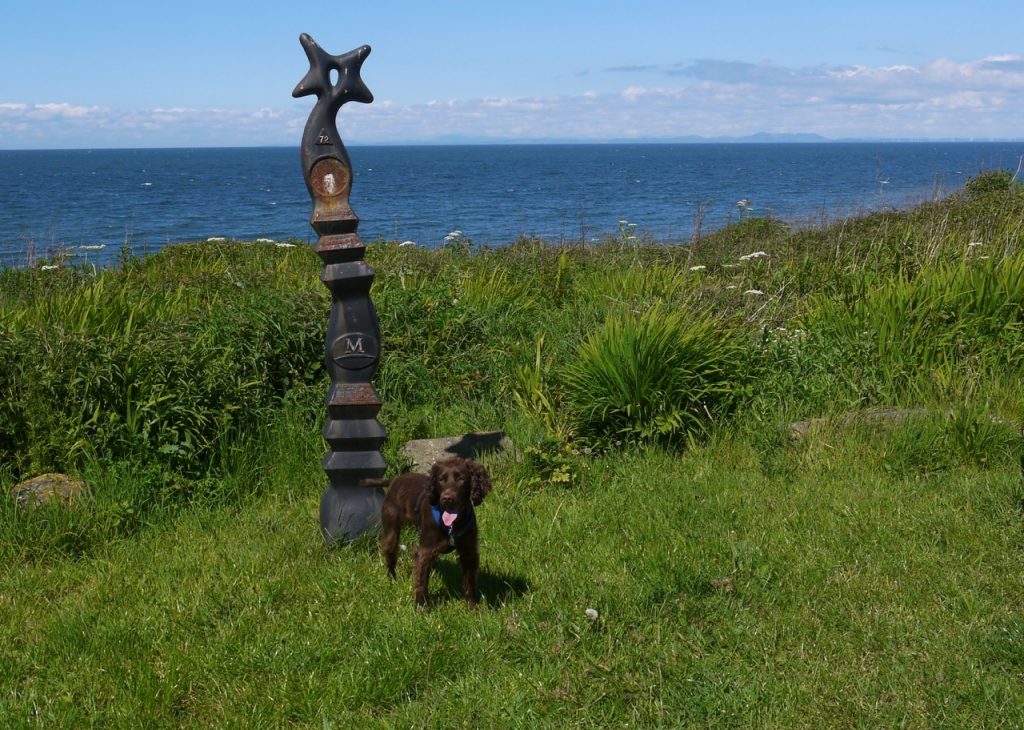
A cycleway marker, one of the Millenium waymarkers for route 72, reminded us that we were on the cycleway, but we probably saw no more than half a dozen cyclists all day.
We were to pass several archways along the route, each giving us a view on to the beach and the sea beyond, and we met the first just after our tarmac path ended at the road into Parton. An English Coastal Path sign by the War memorial indicated we should cross under the railway.
Its peaceful now, and on the walk I did jest at the unlikeliness of Germans attacking here. How wrong I was.
The Bombardment of the Cumberland Coast
Joseph Holmes (1859-1930, then a stationmaster on the Lowca line), who promised “Proceeds of sale (of the poem) will be given to the Soldiers’ Tobacco Fund”
On August Sixteenth, old Kaiser Bill
Said to his men, “Now prove your skill,
And try and reach the Cumberland coast,
The feat of which I’d like to boast.
“The Kaiser’s word they did obey,
And fired away in Parton Bay,
With shot and shell they did their best
To put the Lowca works to rest.
The damage done was not so much,
The Benzol plant they did not touch,
One shell fell here, another there
Which gave the workmen quite a scare.
The inhabitants too grew quite alarmed,
Because this port is still unarmed,
This opportunity the enemy seized,
And rained the shells just where he pleased.
Two shells went through a cottage home,
The father shouts “A German Bomb,”
The children then ran out like bees,
And joined the Lowca refugees.
The submarine then made its way
Across the dub from Parton Bay,
To find some other defenceless port
Where German fiends could have their sport.
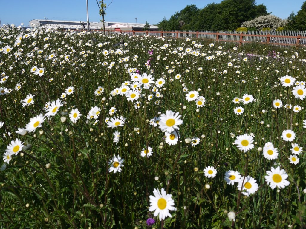
This brought us to a car park with beautiful views of the sea along several picnic benches. We felt it was a little too early for lunch though so we walked along the sandy path above the beach passing a variety of flowers including large clumps of sea kale, some thrift and wild roses in full flower.
A small footbridge allowed us across Lowca Beck and then a short gentle climb onto the higher ground above the cliffs and a group hang gliding. It was seeing this that made me notice the gulls were hovering, or more accurately, flying into the wind and making no headway. I hadn’t noticed the wind until then, but became aware that the breeze had gusts of some very warm air indeed. I began to wish I had remembered to put on suncream.
There were signs that this area once had quite extensive building on the high ground, and of an industrial nature since there are old rail tracks running through the concrete. Another ironworks perhaps? The modern rail track lay between us and the sea but a raised are just inland looked to have once been a railway.
Signs posted here told us that the English Coastal Way was incomplete and rather than follow the route marked on OS maps we should instead use a bridleway which was actually a slightly more direct route and rejoined the masked coast path after half a mile or so. The bridleway took us through fields of sheep rather than the turbines of Lowca Wind Farm.
The path soon began to descend towards Harrington and having climbed over the higher ground we could see ahead to Workington. The wind farm to the north of the town was now visible, as was the Mull of Galloway. With the end of the walk in sight, albeit still a few hours away, we walked down into Harrington, passing fields with highland (and lowland) cows, and a ruined barn before crossing the railway and descending steps to the seafront grass. There was a path stretching back up the coast but Harrington was the first opportunity to cross the railway.
I had hoped we could have lunch on the grass, or at least sat on a boulder beside the grass, which would allow Christy to play fetch but the wind was pretty cool with no sign of the warm gusts of earlier, so after a look at the man and fish statue we walked on looking for a more sheltered lunch spot.
The large expanse of grass was once the site of a huge Magnesium Works. Im sorry not to have taken a photo of the area for comparison but old photos can be found here. All the buildings are now gone with just recreational grassland remaining. My picture of the sandstone man and fish is looking in the opposite direction. I don’t know what the statue is supposed to represent but it is a man with a large fish. he is reaching in to its tooth lined mouth.
We found a sheltered spot by a small railway arch after just five minutes or so. I had my sandwiches and played fetch with the dog while a variety of locals sauntered past.
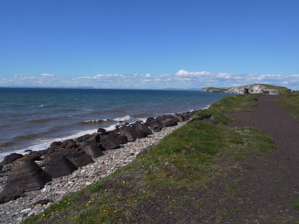
The Coastal path heads out of Harrington, between the railway and the coast until Salterbeck where it crosses the railway again. There is a firm path along what must once have been a railway. We noticed unusual rocks on the beach which looked volcanic rather than sedimentary, and quite out of place, but further on there were many, obviously man-made rocky features which are presumably placed to reduce tidal erosion. The volcanic looking rocks must have been eroded parts of these.
The raised path had fallen prey to the elements and we moved down to the dip between the railways old and new. Once out of the dip we were obviously in the outskirts of town. Christy seemed unmoved by the ducks on the pond at Moss Bay.
We mused as to the original use of the post industrial site that lay between the railway and the coast here. It was huge, though at the time we did not realise just how extensive it was, this being the southern end of the Ironworks that once stretch all the way to the harbour in Workington.
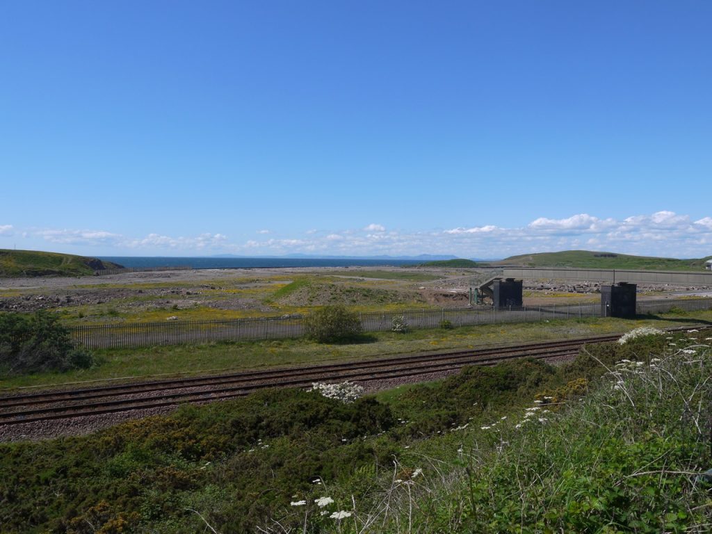
The path along from here had an industrial feel to it. We were hemmed in by tall fences either side. Occasional gaps in the fencing allowed us onto more remnant industrial foundations, one sporting a large concrete block which looked impressive enough to suggest it might carry a memorial. We went to investigate. it did not. There where however plenty of flowers including viper’s bugloss, white dead nettle (yes, I checked), and what appears to be a cut leaved storks bill with white flowers. Unfortunately all my flower pics from the day are blurred since I had the aperture control setting in manual focus mode without realising. I couldn’t see the focus point but thought it was me not seeing it as opposed to it not being there. Well, you live and learn.
Eventually the path disgorged us onto a main road and we crossed back over the railway following the road around. A blue sign her indicated that the English Coastal Way went left, so we crossed the road and walked along a footpath that brought us out in the car park of a shopping centre, beside Halfords. It did not look a likely route for the ECW and there were neither signs nor pavements. The map was consulted and was at odds with the sign.
We turned back and seeing the sign from this direction showed us another arm to it pointing where there was no place to go. Some joker must have moved the sign around. The way however was still not clear. there were roads on the ground not on the map. I would have continued along the road but Audrey spotted some walkers up on a rise and we headed after them. I’ll have to say I was not 100% convinced and a big gate with several signs blocked our way. Luckily, before I had a chance to berate Audrey for leading me on a wild goose chase, we spotted a Coastal way sign.
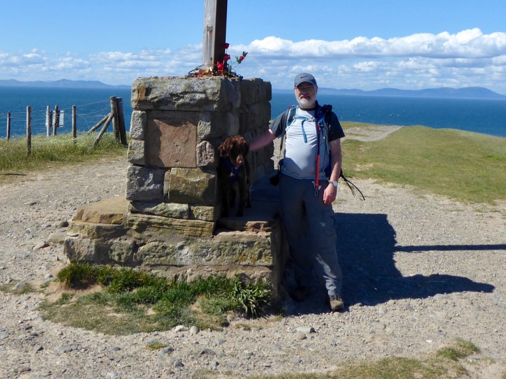
A few steps brought us out on a field with tracks in the grass either ahead or to the left. We could see a signpost at the top of the hill so we headed towards it. I thought the signpost looked like a crucifix from the bottom of the hill, and Audrey wondered if it was a mini angel of the north. But to my surprise it actually is a crucifix.
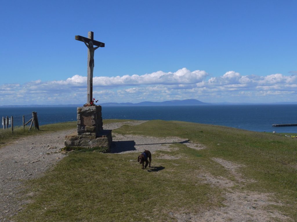
A local out walking his dog told us that the hill we were walking along, The Howe, was in fact a huge slag heap and pointed out to us where the extensive ironworks had once stood. He warned us we would have to walk up the river to the road bridge, the footbridge having been washed away in the floods ten years ago.
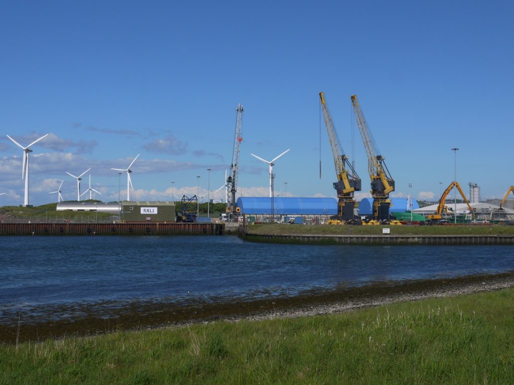
There were great views of D&G from the Howe. Then the ECW goes down to the point before turning back along the river bank. Most of the active harbour seems to be on the far bank, and the south shore has been rejuvenated for recreational use. We passed a small structure, Billy Bumley’s Hut, and several benches made with iron frames, a nod to the past industry of the town.
One of the small marinas by the pathway had a sign that seemed very generous, and had my sweet tooth on alert. But the advertised free cake was not to be. “Free Parkin” rather than an invitation to eat cake was an incomplete traffic sign, missing its final “g”.
By the riverside a plaque at what presumably was once a dock informed us that Marie Stuart, Queen of Scots landed there at 7pm Sunday 16th May 1568. That struck me as unnecessarily exact to the point that it spoiled the historical ambience. Rather than stopping to consider the queen landing there I was wondering if it was 7pm or that had rounded to the nearest hour, and how accurately time could be measured in 1568. And then wasted my time finding out.
1530 – The oldest surviving mechanical clock.
1540 – Screws became used for clocks, enabling much smaller designs that kept time much better than first models.
1541 – First public tower clock fixed on one of the towers in Hampton Court Palace, England.
1577 – Jost Burgi invented the minute hand, even though 16th century clocks were very inaccurate.
1581 – Italian astronomer and physicist Galileo discovered the properties of pendulum.1
The end was almost in sight. We were not far from the station, and walked the last few minutes looking towards an old industrial looking building while pondering what it was. I still don’t know.
The walk over Audrey was sent for ice-cream but returned empty handed, again. One day we will have our ice cream and eat it.
[sgpx gpx=http://www.screel.co.uk/walks/wp-content/uploads/2019/05/RK_gpx-_2019-05-21_1122.gpx]

Thanks for this article. I’ve recently moved to Workington and started exploring the coastal path. I wasn’t sure where to go once we were on Bessemer Way (near Halfords), but now I have better idea.
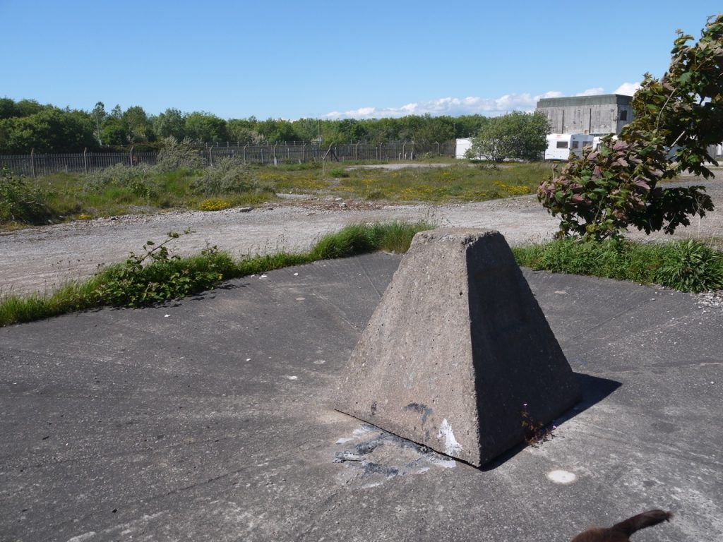
I can tell you that, according to a neighbour and a couple of old maps, the ‘curious block’ is an old capped mine shaft. There’s an identical one a couple of hundred feet away just next to Reedlands Road.
The giant cross on the top of Slag Bank was erected in 2014 by a local man in memory of his wife.
Thanks for the extra info Anne. We found the coastal walk great fun. I hope you enjoy your explorations. Mike