9.5 miles 6h 15m ascent 394m
 Walltown-Housesteads
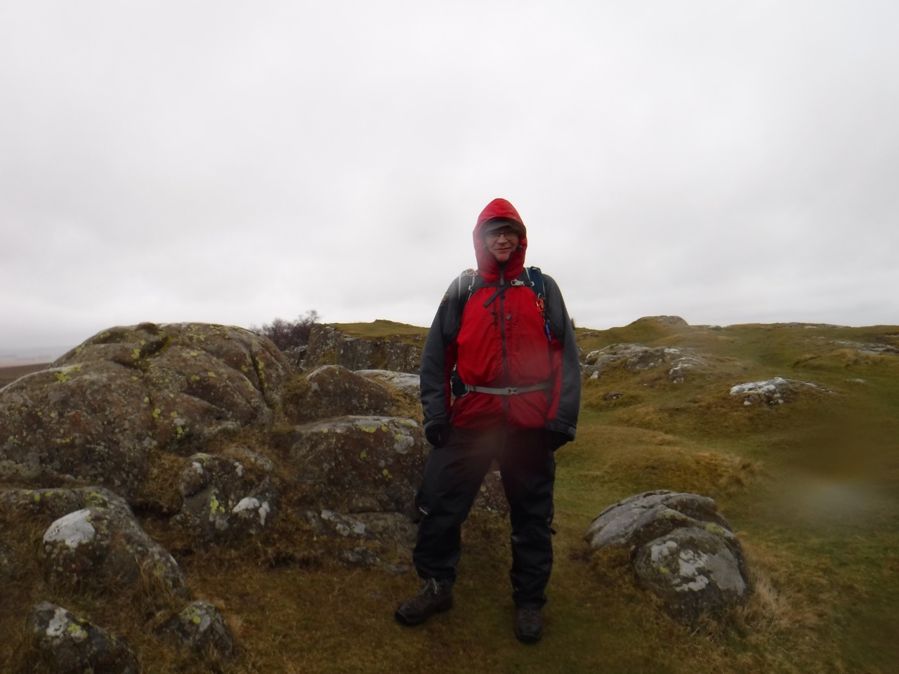
Well this was a different walk from the same route a month earlier. We returned to this section of ridges between Walton and Houseteads, which we had walked in rain, mist and a strong headwind last month. Now with a sunny day forecast, and a gentle breeze at our backs we were looking forward to an easier walk with a chance to see the views.
The wet weather camera was left in the boot of the car, but I was less optimistic than Audrey when it came to waterproofs. I took my jacket whereas she left hers. She hinted that she might play the chivalry card if we found ourselves in a storm. Little did she realise that behind my blank expression my mind was doing the equivalent of laughing maniacally and wringing may hands as I considered her likelihood of getting the jacket.
We took the AD122 bus from Housesteads car-park to the Roman Army Museum near Walltown, though had I not been restrained I would have boarded the earlier bus (going the wrong way). I just thought the bus I wanted had come earlier. I have
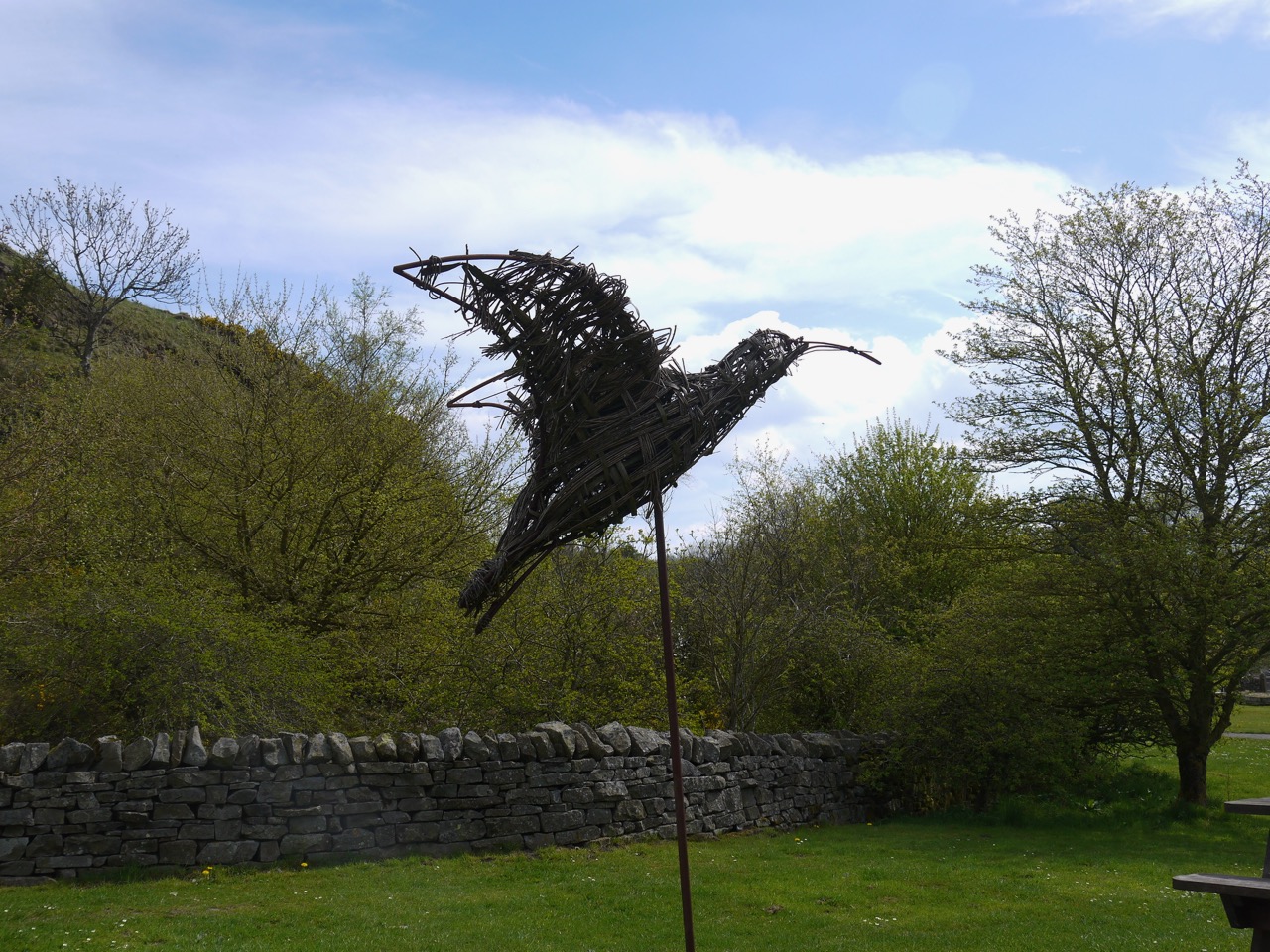
Bird at Walltown quarry
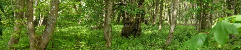
There were no frogs on the path this time in Walltown Quarry. And no deer this time. We did though have swathes of cuckooflower and trees in blossom this time.
A month earlier
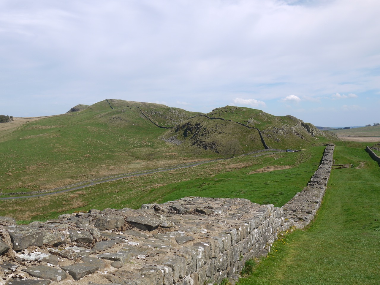
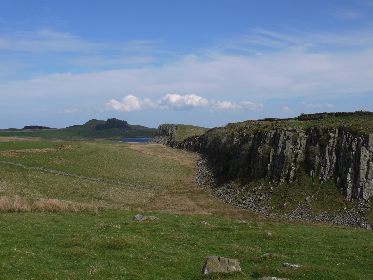
The visibility was good enough that we could see Criffel and Burnswark from the top of Walltown Crags.
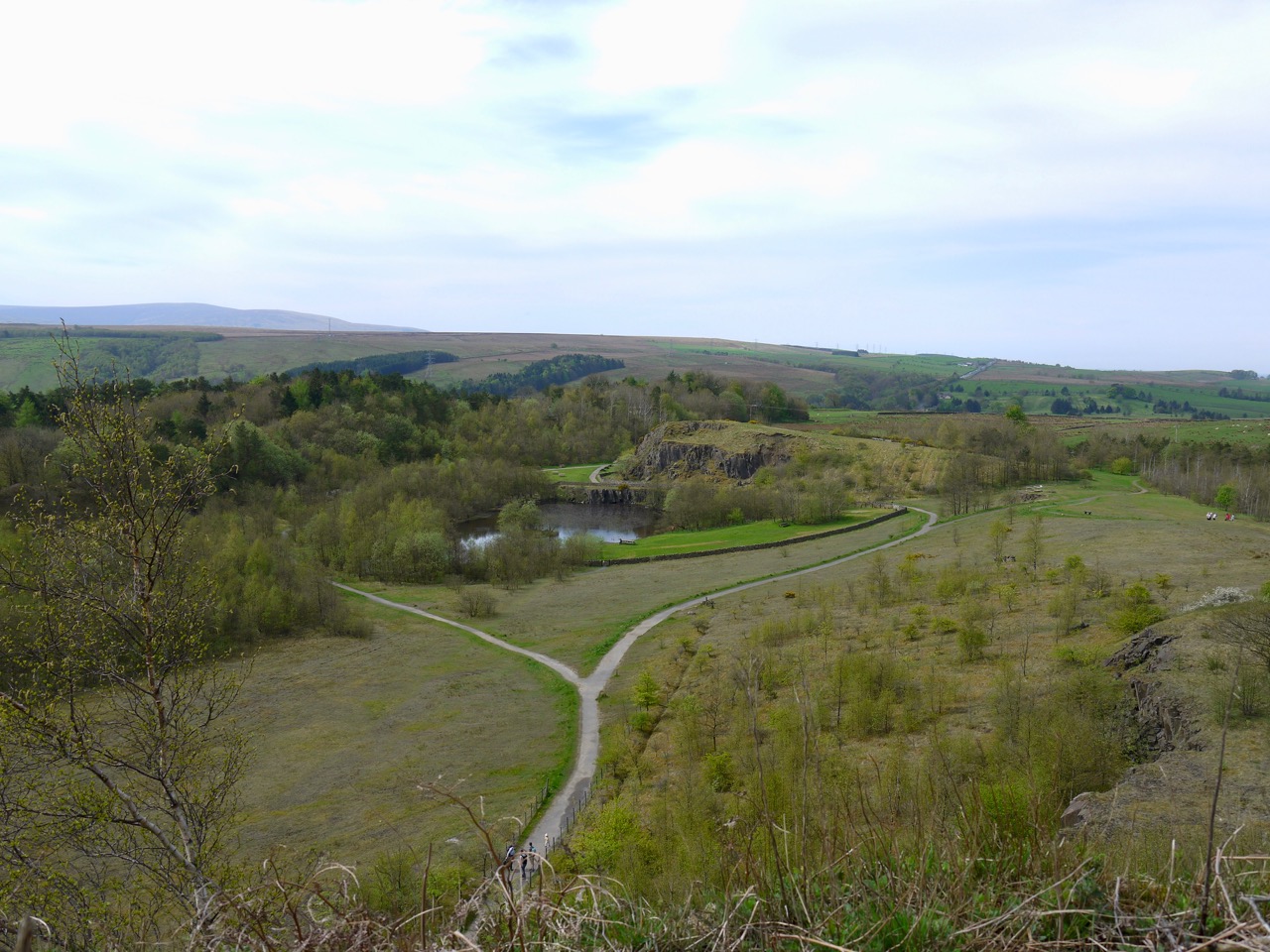
Walltown Quarry
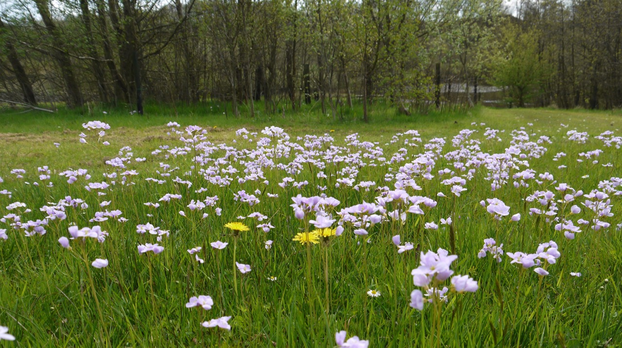
Cuckoo flowers
Walltown Crags
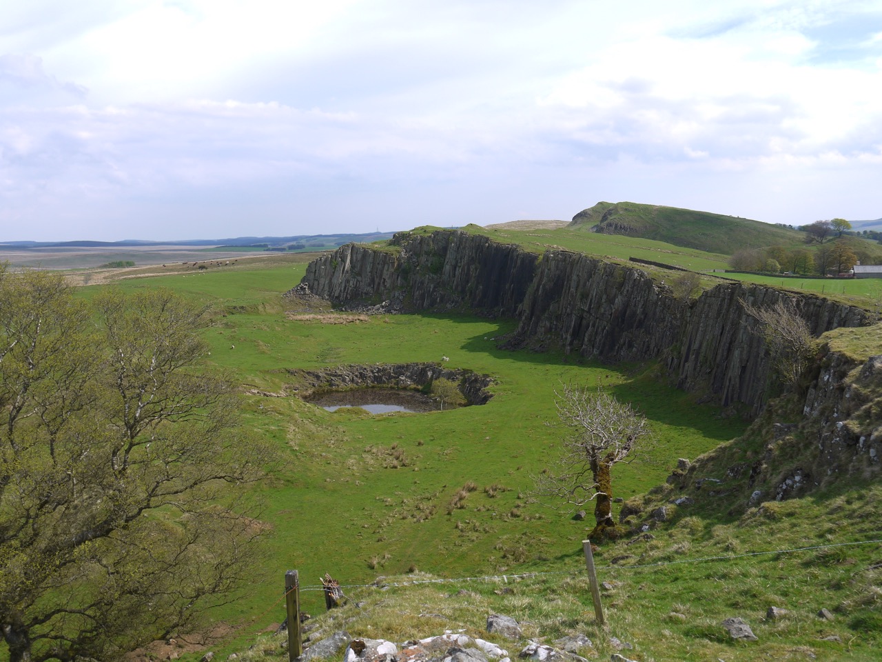
Cawfield Quarry from Milecastle 42
The visibility was good enough that we could see Criffel and Burnswark from Walltown Crags. I had been reading about the Nine Nicks of Thirlwall, but my research had been incomplete. I hadn’t been able to work out which hills were the Nine Nicks. Apparently there are only seven nicks now due to extensive quarrying. So we spent some time looking back later in the walk and trying to count the nicks. We presumed a nick to be gap rather than a summit and we were looking westwards from Cawfields Crags. I now wonder if the picture below, looking east, is actually the nine nicks.
Nine Nicks?
Green Slack Trig
Peel Crags
Postscript November 24, 2024
This was a surprisingly sparse write-up given that I took 164 photos, and this probably being the most iconic ten miles of the Hadrian’s Wall Trail. The blog post looks as though I pressed the publish button before I had finished writing it. I took 164 photos that day yet the only topic I mentioned was the question of the Nine Nicks.
I thought I should try to reconstruct a write-up from my photos and memory.
As a brief summary I could say…
Hadrian’s Wall throws up something of interest wherever you walk but this is probably the most iconic section of the trail. The climb onto Whin Sill heralds a wilder terrain and longer sections of surviving Wall
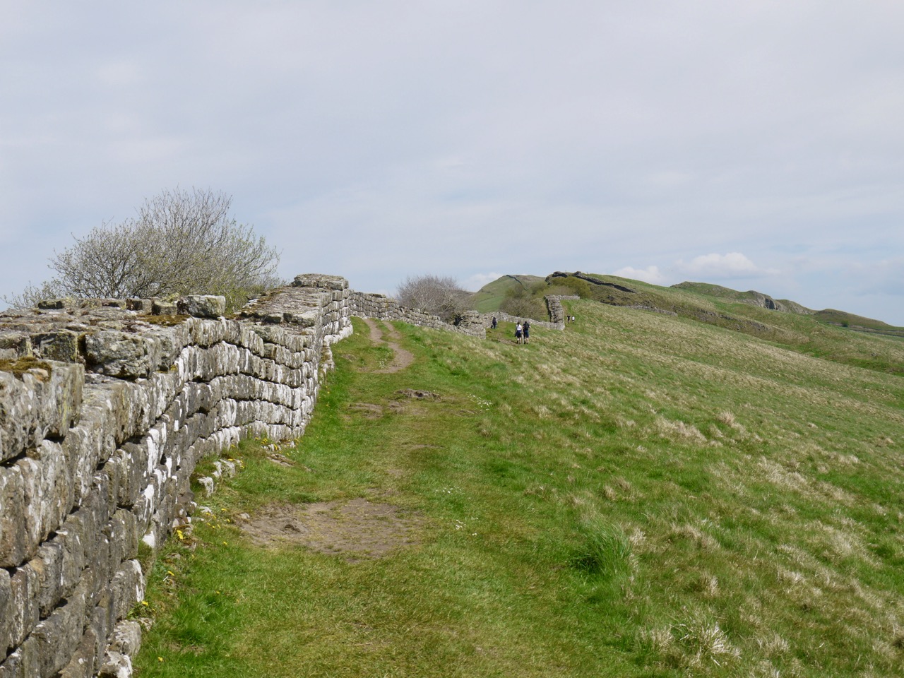
There were milecastles and military roads, forts and gateways, trigs and turrets. The loughs are pronounced loff and the becks are called burns. It’s a place where low places are named and tops nameless. We tramped down and then up a miscellany of dips in the ridges: the Nine Nicks of Thirlwall (well, there are only seven), Walltown Nick (which sounds more like like a gaol), Hole Gap, Thorny Doors, Bloody Gap, Caw Gap, Bogle Hole (a bogle is a ghost), Lodham’s Slack, Green Slack, Peel Gap, two Castle Nicks, the famous Sycamore Gap, Milking Gap, Rapishaw Gap and many without names.
Looking along the ridges you would might expect a gently undulating stroll but glacial spillways have left surprisingly steep sided gaps.
I remember looking north across what the Romans would have known as Caledonia and thinking that this section of Wall would have been quite a substantial defence both physically and emotionally.
I tried to pull Excalibur from a wall only to find it was a ‘steadying handle’ for a stone stile and failed to find King Arthur’s Well, though we walked where it once was. J. Collingwood Bruce in his book “The Roman Wall” (1863, page 155) says that “the true story of the well, like its water, is now lost”
Walltown Quarry to Walltown Gap
We began this section at Carvoran Roman Museum from where it was only a short walk to Walltown Quarry, a country park with information boards, picnic tables, and ‘ornaments’ such as a wire bird that looks rather like a hummingbird and a wood burning oven of all things. The grass was short and dotted with cuckooflower, occasional primrose and a stand of something we couldn’t identify on the day but turned out to be common cudweed.
The path was dry so we didn’t have to dodge frogs this time but the park was busier so we didn’t see the deer either. We passed several ‘artistic’ collections of stones. I presumed these were examples from the Hard Rock Trail each had a number beside it but we didn’t see a list anywhere..
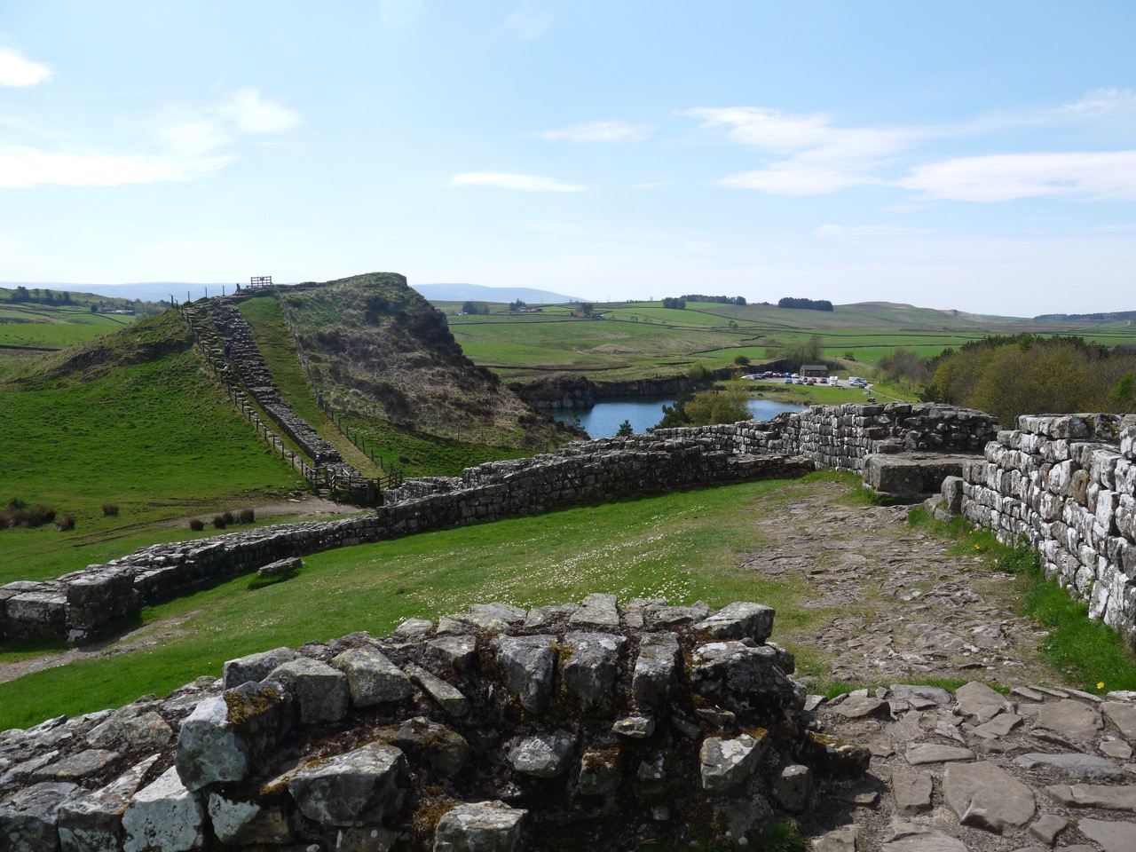
A path led past boulders, which I presumed to be the local whinstone, and took us by a bench with ‘Walltown” carved into it. From there we climbed up onto Walltown Crags and were rewarded with views back over the quarry. By rewarded I mean given an excuse to stop and catch our breath.
We took photos to compare with our rainy walk then set off to walk the nine nicks, past milecastles and turrets, the Wall beside us. There were great views along the crags. Photo
Walltown Gap to Aesica
Walltown Gaps has King Arthur’s Well marked on the OS map and I made a point of looking for it. It is no longer there. All I have to show for my search is a photo of some rough marshy ground where the well was said to be. There are reports of the well being there in 1989 but also a report from 1863 saying it could not be found.
The ground there is so marshy that a flagged path was laid across it in 2008. There had been water running down this path when we were here in April. Before the path was laid an archeological investigation was conducted. A report dated 2020 is available on-line.
They had found the remains of a building with a hearth and a small altar stone. From its characteristics and dating of materials found it was Roman, though different in style of construction to the Wall or its attached buildings. Its purpose was unclear but there was no evidence of it being a well. The building had either collapsed or been demolished. I wonder if a pile of stones in marshy ground might have accumulated water and come to be known as a well.
As to its association with royalty, the archeologists wrote that “the tradition that Paulinus undertook a royal baptism at King Arthur’s Well during the seventh century is unlikely to have any basis in fact”, and “associations with King Arthur” were described as “fanciful”.
On the day I looked back down from turret 44B and thought I could make out a rectangular shape in the ground. But that was north of the Wall on higher ground and likely to be something else.
This section of the Hadrian’s Wall Trail is also the Pennine Way so there was a national trail acorn carved into a stone on a dyke. As we came down towards a small woodland, the Wall gave way to a traditional dry stone wall though I imagine it was built with stones scavenged from the old Wall. Indeed, the wall itself has been ‘consolidated’ with fallen stones in decades past which is why it has a rectangular cross-section rather than a naturally ruinous appearance. The modern walls, which I imagine are themselves several hundred years old have lunky holes, and stones sticking out halfway up. I don’t know if these are structural “through stones” or purely ornamental.
Before entering the trees I paused to reflect on my fall on our wet April walk. Friction had returned.
The woodland is Cockmounthill Plantation. I recall thinkinging that neither it nor the Cockmounthill Farm were on a hill. But looking back at my photographs, it is on a wee rise.
Ahead were the farm buildings of Great Chesters, and the Roman walls at Æesica. This fort which is a little larger than two football pitches, kept a small force to defend the gap where the Haltwhistle Burn crossed the Wall. Its name may be derived from Æsus, a Celtic god of water and rivers.
My attention though was drawn to a pair of ponies. One standing, looking dejected (if you will pardon the anthropomorphism) and the other lying on the ground. Which I found somewhat worrying. WE drew closer trying to see, from afar, if it was breathing, but it got up and seemed to walk about normally.
There was a military road the soldiers could use to get to Caw Gap, but we followed the line of the wall, which here is a dry stone dyke rather than roman Wall. Wooden ladder stiles took us over the crossing walls. Approaching an old bathtub with green stagnant water, I had to ask. Audrey declined but said I could take a dip if I really wanted, The spaniel would have been right in there.
There is a bridge over Haltwhistle Burn but the water was low enough to reveal natural stepping stones that had been under white water a month earlier. We sat in the small woodland opposite the quarry. A small footbridge taking us back to the other side of the burn.
Fed and watered we crossed into Cawfield quarry, the quarried end of Cawfield Crags standing like a a pyramid that has been split open. A little more climbing brought us onto the top of the crags to reunite with the Wall and the substantial remains of milecastle 42.
The view along Cawfield Crags was the typical undulation whereas the walk included some steep gaps, with rock steps taking us up from Thorny Doors. The next gap is not named on modern maps but was once called the Bloody Gap. After that we walked down into Caw Gap and crossed the road. A lone tree stood to the north, a National Trust sign announcing “Shield on the Wall” by the road. We looked up the imposing slope ahead, took a breath and set off.
Caw Gap to Crag Lough
The way to Shield Crags is a steep walk out of Caw Gap and another out of Bogle Hole. The ladder stiles we had met earlier in the day were replaced with stones jutting from the wall wooden grabs that looked like Excalibur jutting from the rock. I tried but I am not “the once and future king”.
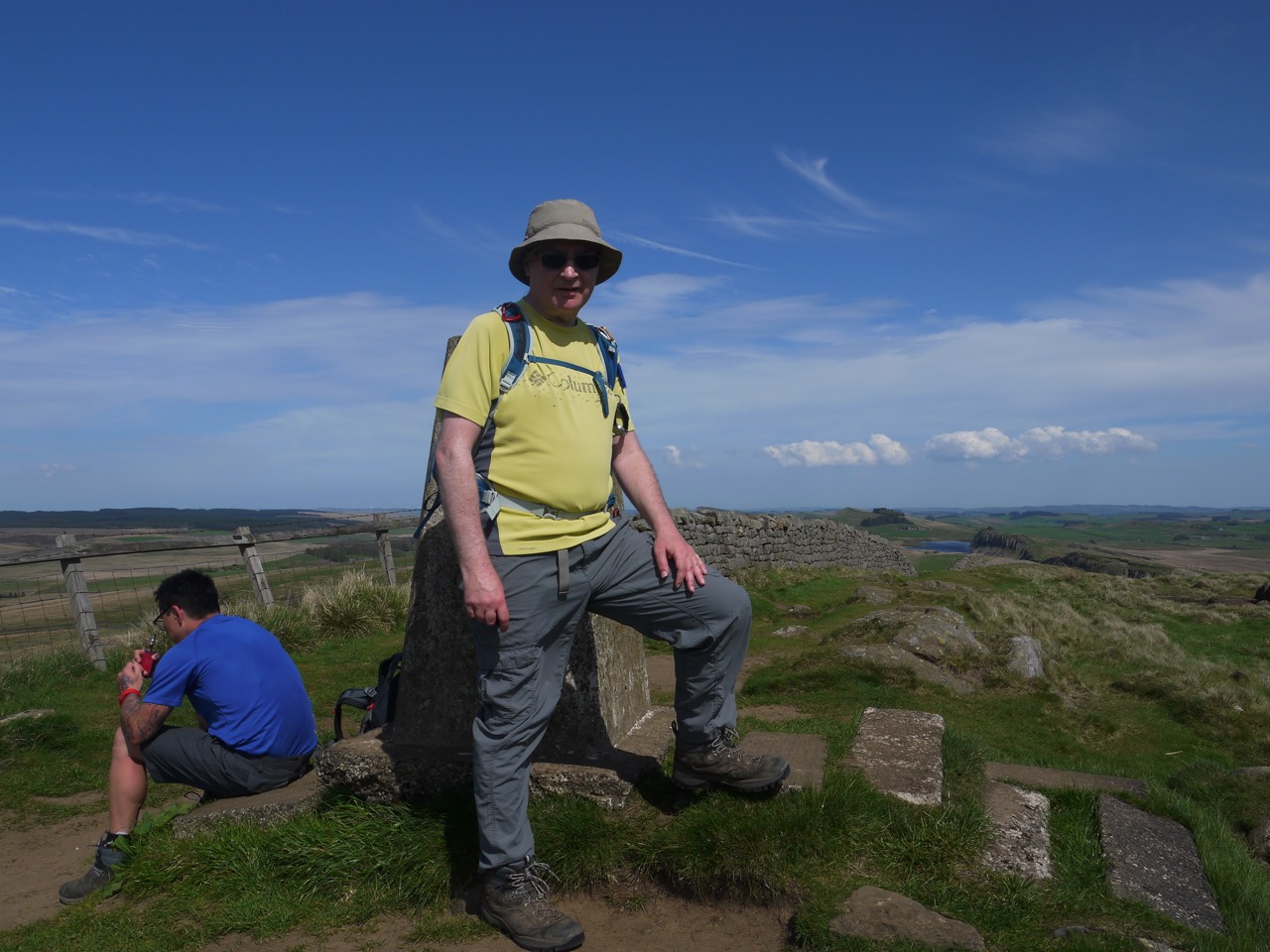
I have a photo of some rough ground which from the GPS I presume is Lodham’s Slack. Why I took the photo I don’t know but it was just before the final push up to the Trig on Winshield Crag, the highest point on the Hadrian’s Wall Trail.
Beyond here the walk is just what you would want from the HW trail. Stunning views along the Wall, well preserved milecastle and turret sites, crags towering over still water, and it was now mostly downhill.
After crossing a wee road near Peel Gap we briefly walked along a broad earthwork beside the wall, the old Roman Military Road. Signs on the wall itself warned against walking on the Wall, which itself was topped with grass.
A gate let us join to a path that at first sight looked to be heading down to Crag Lough but took us to a paved path across Peel Gap and its small turret foundation and steps up to the top of Peel Crags. A paved section led around milecastle 39, and into Sycamore Gap.
For some reason I have a photo of a jelly baby lying in the dirt on Highshield Crags. Was it a chance finding? Did one of us drop it? Or was it an offering? I don’t remember.
When the path above the lough entered trees we had only an hour or so to go. The woodland slopes were flush with small white flowers. From a distance I thought it would be wood anemone but turned out to be wood sorrel. The trees with serpentine markings were still there. My money is on deer eating lichen and taking the bark with it.
Crag Lough to Housesteads
We had a breather on some rocks near turret 37B on Hotbank Crags before taking on some more rollercoaster ridge-top walking beside the Wall.
We parted way with the Pennine Way below Cuddy’s Crags, The path takes a roundabout route rather than resorting to scrambling. Broomlea Lough was now visible.
Milecastle 37 was slightly unusual in that it must have been a way through the Wall. Its gateway is still there.
Approaching Housteads Fort there is a short section where the path is raised. One of the few places where the trail is on the Wall rather than beside it.
It had been a long day but we had a wee look around We Housesteads before walking down to the car park
