8.99 miles 4h 46m ascent 92m
A great day with good weather and easy walking along the KC3 England Coast Path.
Land of singing waters,
And winds from off the sea,
God bring me to Northumberland,
The land where I would be.
— Wilfred Gibson
The causeway at Holy Island was the starting point:from there we looked north along the coast, our way marked by an avenue of anti-tank cubes. To our left, an RAF A400 flew by, slowly losing altitude. It must have come down to a couple of hundred feet. I thought at first that it was landing which was really strange since there were no nearby airfields. As is required I said “look, a C-17” because it’s always a C-17. The modern military aircraft was an interesting counterpoint to the WW2 beach defences.
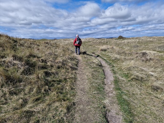
To our right were the sand flats, revealed by low tide, and Lindisfarne. The causeway was quite busy. Pretty soon we faced a choice: continue walking on the lower ground, still very wet from a spring tide; or take to a foot worn track beside the fence about two metres higher. Our boots were sinking in the glistening ground so we took the higher, drier route. This was obviously well walked; the grass worn to dirt but not muddy.
Unfortunately the gap between fence and two metres higher drop grew steadily narrower such that I found myself holding on to the fence. Only the top strand was barbed and my diminutive stature meant that a lower, unbarbed, strand was the one that my hand most naturally found. It was lucky that I did hold it because the ground gave way beneath my right foot at one point. From then on we were looking for a way back down but all we had on offer was vertical drops guarded by brambles. Eventually those brambles blocked the way forward as well and we had to find a way down. [Looking at the OS online map at home, a couple of days later, there was a small note at this place: “Not passable”.]
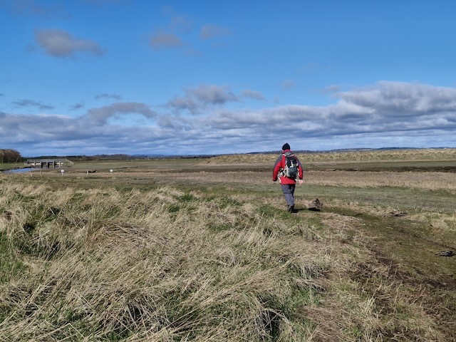
While my attention had been focussed on placing my feet and avoiding getting snagged on the barbed wire, the land to our right had changed from sands to salt marsh. There was a channel perhaps three cars wide, quite full despite it being low tide. The OS map names the channel “South Low”. The lower, wet, ground was not too difficult and we soon climbed on to a levee. The “bridge” over South Low is along the top of the Beal Sluice. The path remained on the levee but turned southwards, so for a short while we had the castles of Lindisfarne and Bamburgh ahead of us, giving the impression we were walking the wrong way. But soon enough the path turned east, then north and finally northwest and we walked into the dunes of Goswick beach. A pair of swans sailed along the waterway, a stand of egrets nearby.
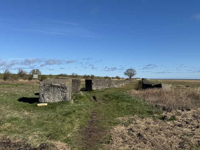
A head we saw a tower, which from a distance looked like it might be the remains of an ancient battlement but as we drew closer was obviously WW2 vintage. We were looking to find a sheltered spot for “elevenses “ but it didn’t look particularly inviting, and it was up a wee rise. It was next to Beachcomber House and I did wonder how the folk in the nearby house might have felt when it was built—if a German cruiser fired at it, their house would have had a good chance of being hit.

Most of the waymarker posts we had seen up until this point held circles of white plastic, any words or symbols they might once have carried long faded to white. But at Beachcomber House the waymarker signs really bossomed: Coast Path; Sandstone Way; England Coast Path; National Cycle Route 1.
A small footbridge, Goswick Sluice, took us over North Low. Ahead we could see what at first sight looked to be two or three walkers. With my naturalists eye though, I noticed some subtleties in their movements and posture suggesting they were not hikers, but one of the other common variants of walker: golfers —they were shuffling about, heads bowed as if in prayer, and swinging their clubs somewhat haphazardly—the lost ball ritual. As we drew closer I could discern they were males, though not juveniles. Audrey thought it more more likely they were the common or garden retired variety but I couldn’t tell if they were greys or baldies.
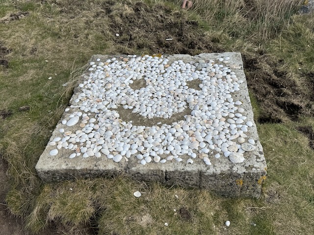
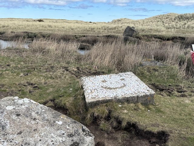

We kept off the links winding our way through the dunes which were still, occasionally, cut by channels of water. Lines of anti-tank cubes ensured there would be no easy way for an invading army. One was topped with sea-shells and formed into a smiley face. The dunes were covered with innumerable mole hills which I found quite surprising. The molehills themselves seemed more dirt or soil than sand so I imagine the ground had become compacted enough to allow their burrows to hold up.
The great number of molehills had us wondering what the collective noun for moles might be and since were walking in the tendrils of 5G we soon had an answer. A Labour of moles. Some websites suggested a Company of moles but we both preferred Labour. One source mentioned a fortress of molehills.
Our next naturalist spot was a walker, a male, “examining” a gorse bush. His partner, a female, emerged from behind the gorse adjusting her rucksack. Presumably she had been “examining the gorse” on its inland side. It was the rucksacks that allowed us to identify them as hikers rather than golfers. Unfortunately we must have startled them because they scurried away when they noticed us.
We found a small bank to sit on for our elevenses. And the day took a dark turn. I offered my walking companion some jelly babies. She took two, which is right and proper, but then said “I’ve taken a black one.” I was stunned. How could she do such a thing. To take a black jelly baby by chance, that’s something I could accept. But to say it out loud, gloating, while pretending to be mentioning it nonchalantly. If a man had done such a thing, honour would have demanded satisfaction by duelling. I took the darkness into my heart, fashioned it into a poisoned barb and said…
“Are those oyster catchers?” Pointing to a hundred or more wheeling over the dunes.
“Yes, I think so.”
“Mmmm, I wonder what the collective noun for oyster catchers is. Flotilla? Fleet?”
I looked it up: a Parcel of oyster catchers, or possibly a Stew. But we both preferred flotilla.
I felt the jelly baby incident had been settled satisfactorily with that.
The sound effect for the walk had to be the excited chattering of skylarks. We heard them even when they could not be seen and they were there for almost all of the time we were walking the dunes. We saw single birds in the sky, a couple of birds having what looked like a scrap but was presumably seduction, and even some skylarks on the ground. It was the first time I had noticed a skylark’s crest. But the skylark’s song was with us most of the day. I understand now why we talk of an exultation of skylarks.
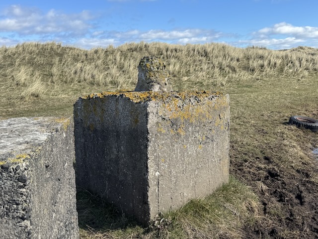
The dunes were easier walking than I had expected. The ground was quite firm, only rarely breaking to reveal actual sand. I imagine they must be quite a way along their transformation from mounds of sand into hillocks of soil. The ‘harbours’ were often surrounded by tank-traps. We found a couple of the concrete cubes had been rolled over to allow access and this revealed their underside which has a large post or nipple protrusion which presumably makes it more difficult for a tank to push them out of the way.
More information on anti-tank cubes.
In places there were flatter areas surrounded by dunes. I looked at these and the word that sprung to mind was “harbour”. They were covered in short grass but driftwood at their edges told that they must flood with higher tides. The longer grass on the dunes themselves rippled in the wind looking very much like waves at sea. The tussocks themselves look similar to the “dougals” one sees in the uplands except their “hair” sticks up whereas dougals look like Cousin Itt from the Addam’s Family.
Sea waves are green and wet,
But up from where they die,
Rise others vaster yet,
And those are brown and dry.
They are the sea made land
To come at the fisher town,
And bury in solid sand,
The men she could not drown.
— Robert Frost
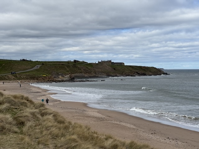
The dunes gave way to a more rock coastline and we walked along the wide cliff top having only occasional glimpses of the cliff faces themselves. Cocklawburn beach was still open enough that there were folk walking on it and even a couple of surfers, but the Skerr rocks were mostly submerged by the rising tide so we could only see the tallest rocks above the water. The buildings at Seahouse loomed on a small headland, looking like something from the pages of Emily Brontë or Daphne du Maurier.
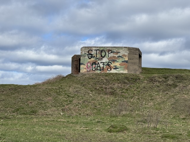
Before we reached the big house though there was a gun-emplacement pill-box on a wee rise. As we approached it we could see words painted on it.
“Stop oats?”
“Stop goats?”
It actually read “Stop the Goats”. Presumably the local anti-caprine league had hijacked the original political statement. Learning point: if you see tank traps look around for the covering gun emplacements. We had lunch sat on a grassy bank with views all along the coast.
There was metalled road between the gun emplacement and Sea House, then more of a farm track. The old house dates from the eighteenth century and looks to have been extended several times which has left it with a rather unusual appearance— with a stepped roof and misaligned windows of varying sizes. “The Lodge” beside the big house had a small walled garden, one half was filled with lesser celandine (the most common wildflower we had seen throughout the day), the other half a mass of what I first thought was a strangely late stand of snowdrops but was actually three-cornered garlic, confirmed by its scent.
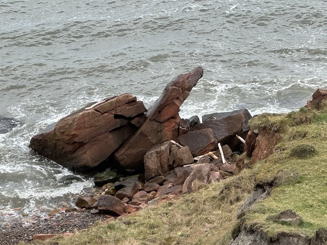
Berwick, or at least its lighthouse and pier were visible and the curve of the coast gave us good views of the reclining cliffs stretching between Cocklawburn and Spittal. One group of rocks looked very much like a spaniel to me.
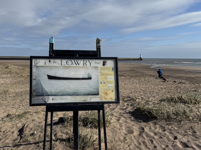
The final section of the walk was along the promenade in Spittal. The Lowry Trail has a tail along here and we passed three of its viewpoints. These have information boards showing reproductions of Lowry’s work sketched at those places. We took up the rest of the trail the following day.
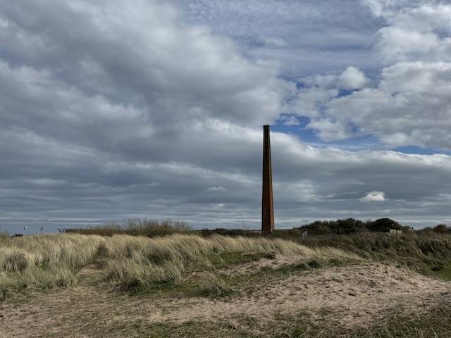
We took this walk as far as the chimney on the south side of the Tweed estuary. On our way back to the car we were accosted by a friendly local. I stood there thinking we were meeting the Berwick version of the Ancient Mariner. “Now wherefore stopp’st thou me?” He told us it was impossible to see a doctor in Berwick, and almost as difficult to speak to a nurse. I wondered if it would have blown his mind to tell him he was actually speaking to a doctor and a nurse.
P.S. an interesting day all in all. I had thought of taking a bus from Berwick to Holy Island but the service only runs during certain phases of the moon (actually it is when the tides align), so we took an Uber. I was very surprised that Uber operated in Berwick.
Download file for GPS