
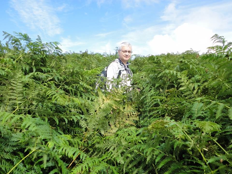
The 212.6 miles of the southern upland way include coastal cliffs, upland moors, hills and mountains, meadows, riverbanks, loch side paths, farmland, parkland, woodland, country estates, paths across dams, farm tracks, drove roads, roman roads, ancient trade routes, and coffin routes. There are numerous stiles, kissing gates, and many bridges to cross both literal and metaphorical. The trail visits neolithic burial sites, cairns old and new, lead mines, ruined farms, pele towers, ancient earthworks, modern sculptures, fairy wells, castles, standing stones, covenanter memorials, one of the seven stanes, and the world’s oldest post office. Nature is all around, deciduous and coniferous woodland, numerous plants, farm animals as well as rabbits, hares (in both winter and summer coats), deer, mice, squirrels, foxes, and various birds both large and small. We walked in all weathers and trod upon dirt, mud, rock, grass, tussocks, heather, sand and even seaweed.
Our lunch spots were grassy knolls, tree stumps, sylvan glades, hillsides, a bus shelter, dense forest, moors (bleak and less bleak), ruined buildings (twice), deserted sheds, stiles (twice), sheep shielings, benches, dips, logs, and mossy banks.
According to the official guide the SUW is 212.6 miles long , but our GPS logged 230.2 miles. 6.8 miles were diversions off the official route either to visit interesting places or get to/from our cars, so our SUW distance was 10.8 miles longer than the official distance. 11.1 miles were above 500m and our highest point was at 725m on Lowther Hill. The SUW misses the top by 2m but we went the extra 2m.
The official guide splits the walk into 16 sections, varying in length from 7.75 miles to 20.5 miles. I split the walk into 19 sections, varying in length from 8.7 miles to 15.2 miles. The longest walks whether in distance or time were not the most arduous and in retrospect I think we were right to keep the distances below 15 miles for each day. We had more time to stop and stare.
The plan had been that a group of us would walk the complete Southern Upland Way one day at a time. I had foreseen that we would not all be available to walk each section together so some members of the group might walk some sections on different days, but I hoped we would resynchronise every so often. The first such synchronisation was to be at Beattock. I expected to re-walk some sections and thought the whole thing might take us 18 months.
Audrey and I have now completed the walk (between August 2013 and July 2014), but we were joined on several sections by other friends: David, Elaine, Joanna, Derek and Gwyneth. The company was a great help and everyone did their bit providing humour, stoicism, knowledge, encouragement, navigational advice, sweeties (both natural and processed), transport, eagle-eyes, and sunscreen when needed.
My recurring fantasy was of sitting with my feet in cool running water at the end of a hot day’s walking, and at Abbey St Bathans I sat in the sun, at the end of a 12 mile walk with my feet in the cool waters of the Whiteadder. Living the dream.
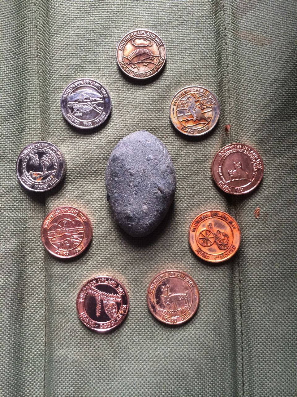
I carried a pebble from the west coast to the east coast. Hidden along the way are thirteen kists, hordes of specially minted coins called 13ths hidden in individually sculpted containers. The word “Ultreia” is found on way-markers to give clues that the kists are nearby. We have come away with nine. (PS we subsequently found a tenth)
There are two sections with alternative routes. Between Cogshead and Wanlock Water there is the standard SUW route which takes a direct line across the upland moors and the longer alternative which I imagine exists to provide a detour if the moors are in use for grouse shooting. It winds north along forestry tracks through what is mostly forest on the map but is much more open now after felling. This track joins the “Set in Stone” geology trail for the last 2.8 miles into Wanlockhead. We returned to walk the alternative route in August and found the coin horde we had missed before.
We walked the other alternative route in October. It offers a choice between a high level route over Croft Head (637m) or a low level route beside Wamphray Water. I can only presume this is to offer a detour if the lower level route is closed for forestry operations or the weather makes the high level route too dangerous.
A few more stats:
- Average mileage 12.1
- Average climb 542m
- Average time 5h 45m
- Average mph 2.2
- Average in excess of Naismith’s predicted time 30 minutes
- Maximum elevation – Mount Lowther 725m
- Minimum elevation – The North Channel and the North Sea sea level
- Maximum climb – Beattock to Potburn 881m
- Smallest climb – Tannylaggie to Caldons 263m
- Total Net Climb – minus 39m (yes it is possible)
- Shortest walk – Sanquhar to Wanlockhead 3h 45m (also shortest distance 8.7 miles)
- Longest walk – Clenrie to Stroanfreggan 6h 37m (flooded fields etc)
- Quickest pace 2.6 mph (Galashiels toLauder and Lauder to Watch Water)
- Slowest pace 1.8 mph (Beattock to Potburn, steep climbs and trudging through snow)
- Percentage of walks in waterproofs 37%
- Walks requiring insect repellant – 2
- Miles walked between the car and the SUW 2.9
- Most people on a walk – 6
- Least people on a walk – 2
- Miles walked on major roads – 1.2
- Miles walked on B roads – 1.5
- Miles on OS yellow roads – 36
- Wandered off the route – who’s counting?
The Sections are described in:
Some photos from the way
