
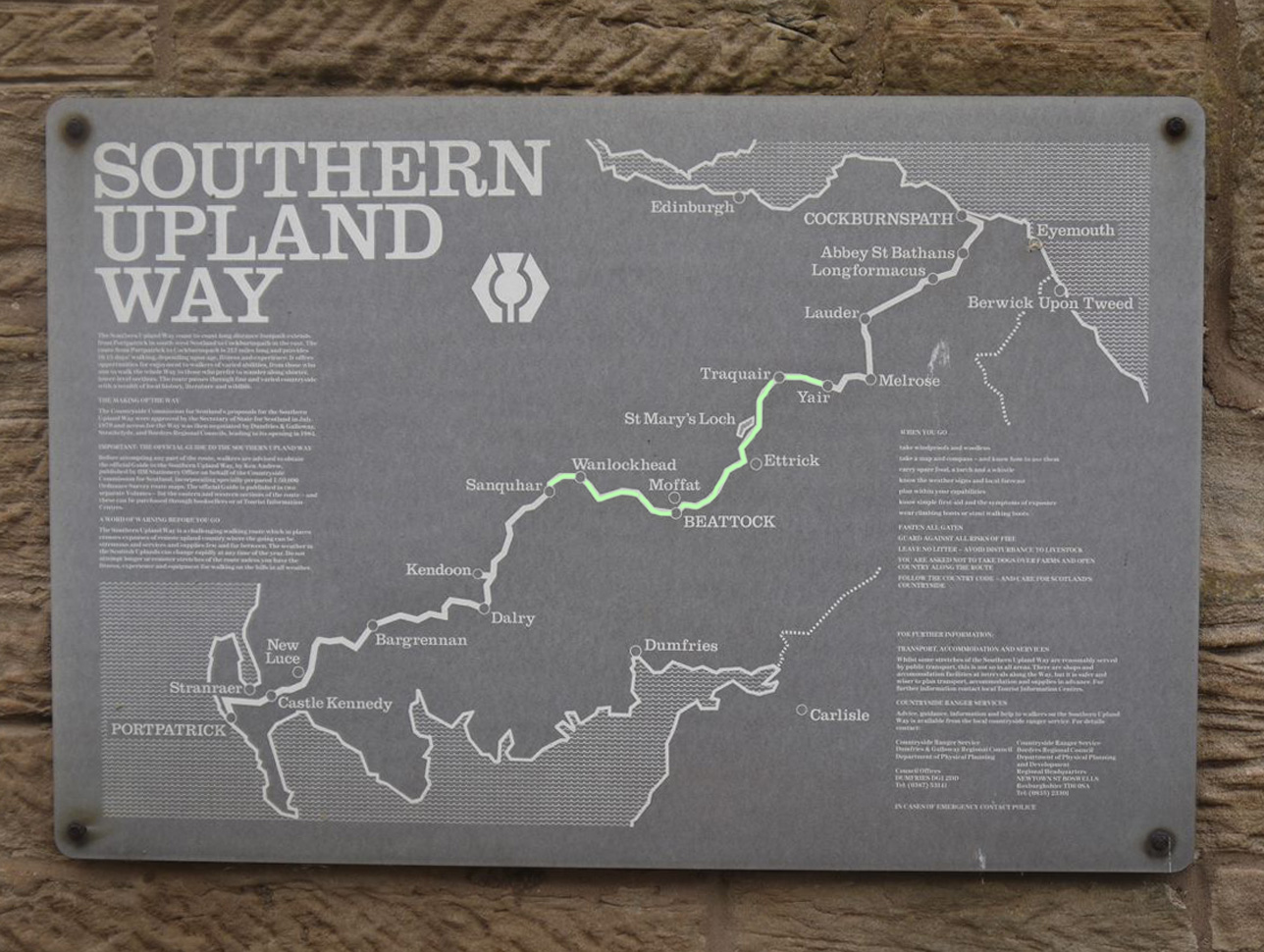
 The central section of the SUW, from the River Nith at Sanquhar to the River Tweed at Yair Bridge is 70.4 of the SUW’s 212 miles, though our journey clocked up 76.5 miles with 4403m ascent. This took us from Nithsdale, over the Lowther Hills, across the waters of the Potrail and Daer before they join to form the River Clyde, through Annandale, over the Ettrick Hills to the hills of Tweedsmuir and over the Minchmuir to the River Tweed at Yair.
Walking from the Nith to the Tweed took us out of Dumfries and Galloway and into the Scottish Borders. We crossed the watershed from where the rivers flow into the Irish sea and met those destined for the North Sea, while exchanging the ruggedness of the western marches for the more gentle landscapes of the east. The elements graced us with rain, snow, fog and sunshine; there were days when leaves did not stir and others when the winds made walking difficult. We were sometimes in wooly hats, gloves and multiple layers, sometimes in tee-shirts when suncream was an essential piece of equipment. There were days of fine visibility and others when we became lost in the mist. We have climbed over trees (felled by the wind and blocking our route), waded through mud, and taken our rests in the pouring rain, but on others days gazed at the scenery with the sun on our faces and skipped merrily along firm springy grass. And since we descended from a height of 132m at Blackaddie Bridge on the Nith to 118m at Yair bridge on the Tweed it was, overall, downhill. We found 4 kists and missed one.
See also the Western and Eastern Marches.
We split this into the following sections:
- Sanquhar to Wanlockhead
- Wanlockhead to Daer
- Daer to Beattock
- Beattock to Potburn
- Potburn to Tibbie Shiels
- Tibbie Shiels to Traquair
- Traquair to Galashiels
For the previous sections see: The Western Marches
Sanquhar to Wanlockhead 8.7 miles 3h 45m ascent 596m
Easy walking on paths climbing out of Sanquhar, then two possible SUW routes across the hills to reach the valley of Wanlock Water: a lower level track through forest or an upland moorland route. We chose the latter. The alternative route is described in SUW 9.2: Cogshead again. Black Loch is 410m off the SUW and not particularly exciting.
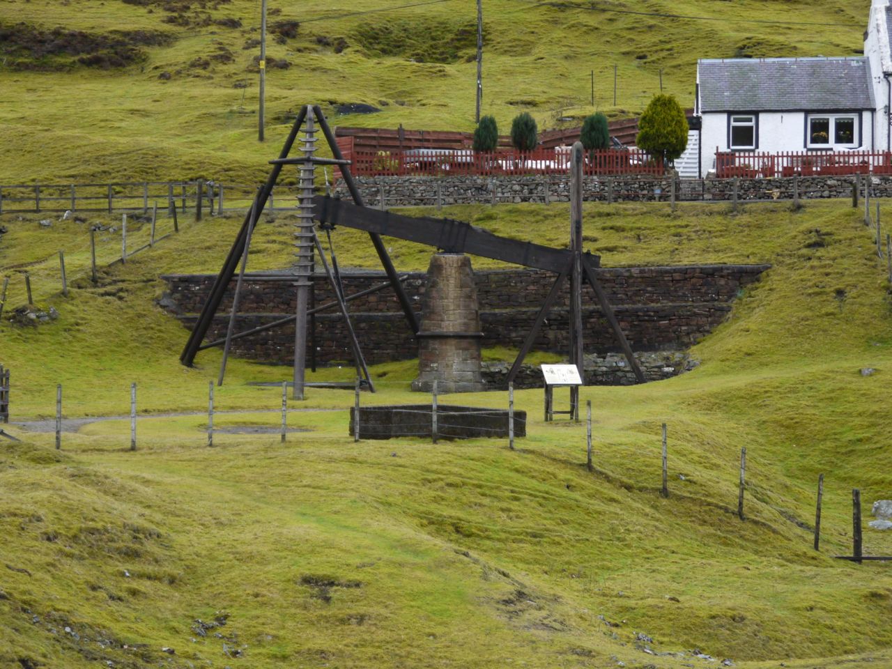
Look out for: Matthew’s Folly, the extensive mineworkings at Wanlockhead (and a mining museum), the lead mining museum, views to Criffel, Kist
************************
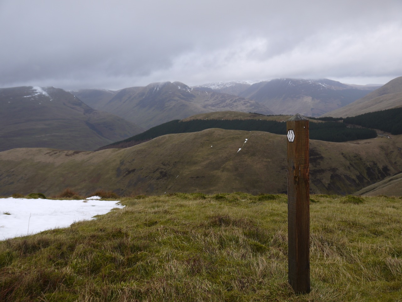
Wanlockhead to Daer 11.1 miles 676m ascent 5h 17m
Moorland walking sometimes without tracks, where I lost my way in the mist. Quite a bit of up as well as down between Lowther Hill (723m) and the valley of Potrail Water, where the Clyde is born, then forestry tracks for the rest of the section.
Look out for: Lowther’s golfball, the SUW’s highest point and halfway point (not the same place), Lanarkshire/D&G boundary, Daer dam, Kist
************************
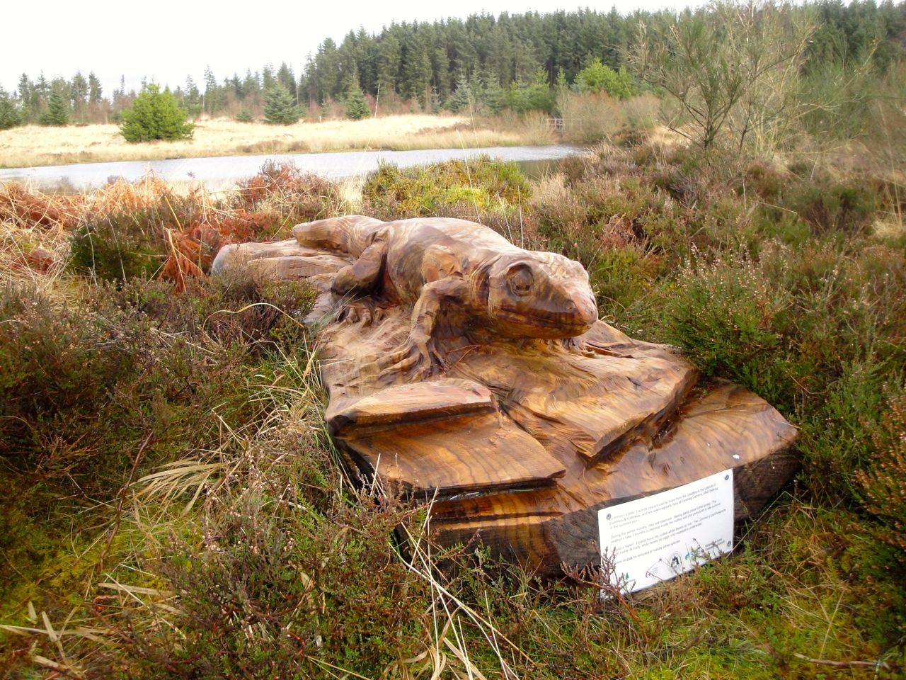
Daer to Beattock 10.6 miles 465m ascent 5h 59m
Trackless hillside, faint tracks in forest breaks and woodland tracks.
Look out for: orange topped pipeline markers, Brattleburn bothy, Foy’s Bridge, lizard and dragonfly carvings, Ben Wilson’s memorial, and the Crooked Road.
************************
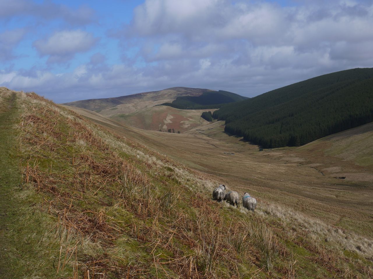
Beattock to Potburn 11 miles 5h 58min 881m ascent
Country roads, woodland paths, riverside walks, and farm/forestry tracks. There is a low level route and a high level route. We took the latter with a steep zig-zag climb up Deep Gutter to Croft Head (637m). Stunning scenery.
Look out for: Craigmichen Scar, the change from west flowing to east flowing waterways, the D&G/Scottish Borders boundary, Over Phawhope bothy, Kist.
************************
Potburn to Tibbie Shiels 11 miles 523m ascent 4h 57m
Quiet country roads to Scabcleuch, then upland moorland and finally farm tracks.
Look out for: Lady John Scott’s poem, James Hogg’s statue, Tibbie Shiels Inn
************************
Tibbie Shiels to Traquair 12.4 miles 607m ascent 5h 34m
Lochside walking then relatively easy upland walking on grassy tracks.
Look out for: Tibbie Shiels Inn and its “weather station”, the Shinglehook sculpture, Dryhope Tower, “Cigarette Hill”, Blackhouse Tower, an Ultreia stone, Weather vane at Traquair.
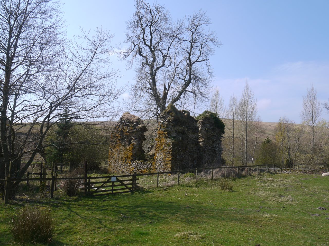
Blackhouse Tower
******************
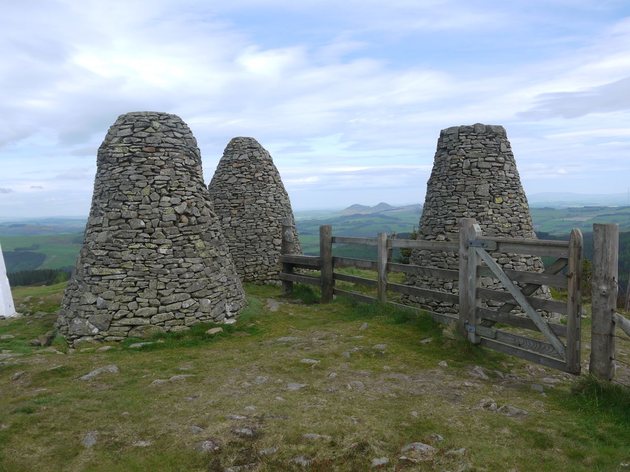
Traquair to Galashiels 13.7 miles 6h 25m ascent 848m
Grassy tracks, some a little muddy, following the route of the old Cross Borders Drove Road and a final woodland section. Minch Moor summit is an additional 1.1km.
Look out for: Minch Moor bothy, Point of Resolution, Cheese Well, Wallace’s Trench, the Three Brethren, kist.
Next: The Eastern Marches Previous: The Western Marches
