
10.6 miles 465m ascent 5h 59m; max elevation 562m Hods Hill
 Route: SUW
We wimped out on Saturday. Sorry, having considered the weather forecast and awoken to howling winds battering hailstones against the windows we rescheduled for Sunday. A good move all in all.
Our start point was the eastern end of Daer Reservoir’s Dam, where we sat in the car, optimistic as ever, waiting for the heavy rain to lessen. The rain did eventually settle and Audrey even spotted a patch of blue sky, but we still got togged up in waterproofs, and that proved to be the right decision.
The stroll up Sweetshaw Brae in windy drizzle proved to be quite an aerobic workout and the creaking of wind turbines to the north added an eerie feel. I couldn’t help thinking that the name Sweetshaw Brae conjured up a picture somewhat different from our experience. About 0.5km up the Brae we came to our first snow and reached a ladder stile over the wall. These are usually a good sign of the SUW route but this was where the old route of the SUW met the newer route we were following. We continued on up the hill, into the mist, following the fence line, picking our way around boggy sections and avoiding the patches of snow in case they had water beneath them.
Daer Reservoir from Hods Hill
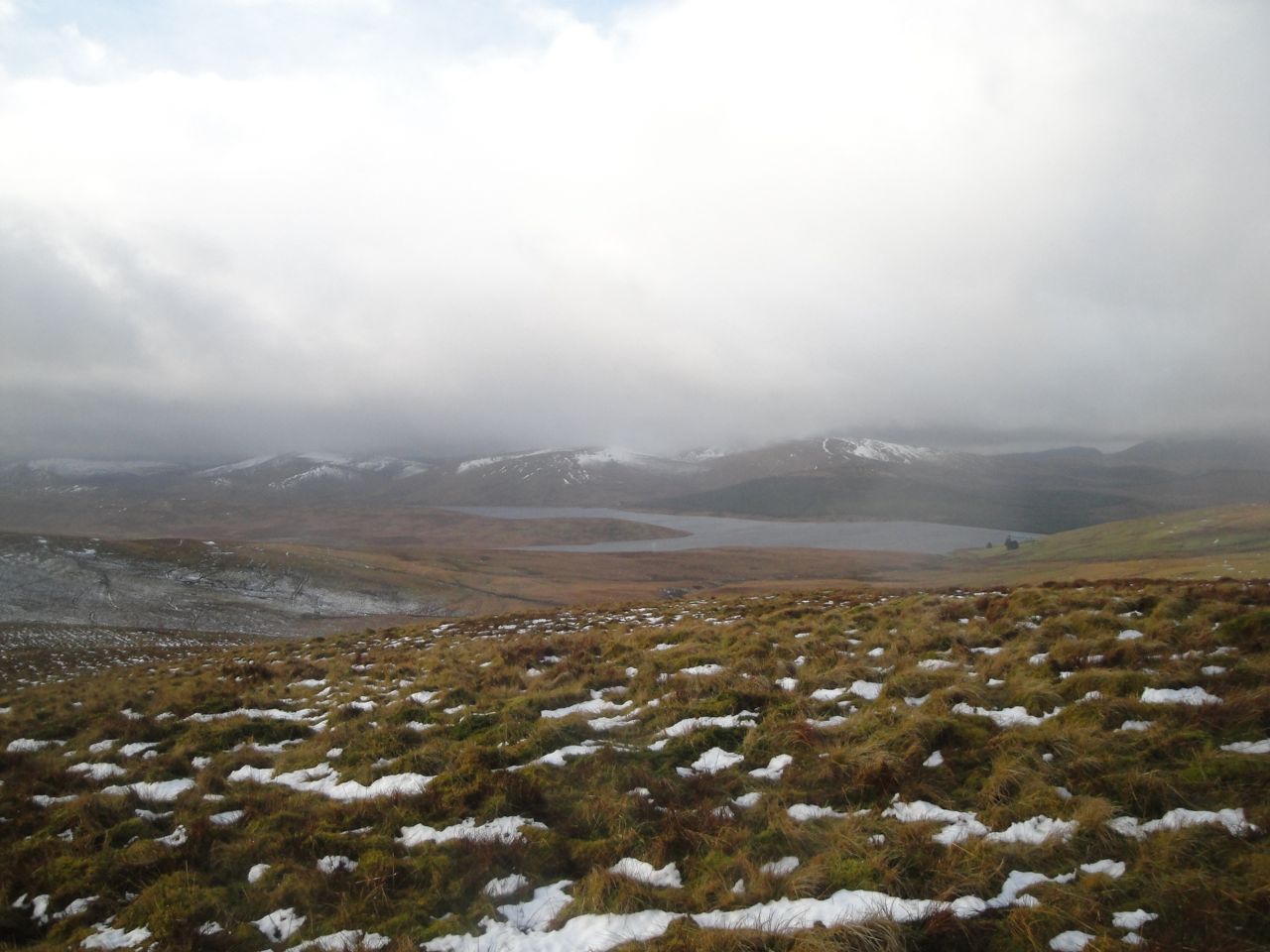
The cloud base rose and fell so we got occasional glimpses of the reservoir and the surrounding snow capped hills. I wish the photos could have captured the views better but the light defeated my camera’s sensor.
Just under an hour had us on Hods Hill (569m), our first SUW Marilyn. It was a traditional Southern Uplands summit, marked only by a fence junction, covered in boggy moss, and clothed in mist. Freezing cold wind and nearly horizontal drizzle completed the experience. But it was the highest point of this walk and using the principle that “once one reaches the highest point of a walk the remainder must all be downhill”, I assured Audrey that the rest of the walk would all be downhill. I know she was paying attention because she was to remind me about my prediction several times.
I suspect that the 1km across the col to Beld Knowe would in better weather be an easy stroll with nice views, but the snow meant we had to take the descent and ascent quite slowly. We had better visibility here with views across to the Daer hills to our right and the mist shrouded forest to our left. The more distant hills though we couldn’t see.
From Beld Knowe the SUW left the wall we had been following and headed off onto open moorland, a lone SUW marker post tempting us away from the wall. Having reached that marker we looked around and saw no more so followed a very faint path which led us to a 2m tall white post with a red top. The sign on the post had faded so all I could read was “HP GA……”. Subsequent posts revealed themselves as marking the High Pressure Gas Pipeline.
This jogged my memory a little but I spent many minutes trying to recall the joke properly so I could tell Audrey. It only bubbled fully back into my memory after getting home… Old Jock is complaining to his wife about the lewd stuff they put in the newspapers nowadays. “It says here that Sarah Pippelini was laid by 600 men. That’s nothing to be proud of. They wouldn’t have put that in the papers in my day” he says. His wife reads the article and snorts as she tells him ” You need new glasses. It says that the Sahara pipeline was laid by 600 men.”
Well that’s that off my chest, now back to the SUW.
The SUW cuts a corner from Beld Knowe and then leaves the hilltop for a forest break. I had been expecting a substantial track in the forest, the OS map showing a double lined track, so at first I thought we had strayed off the SUW. There was though a stile so we crossed the rusting fence and headed down the forest break. There were no SUW markers for quite a while but I knew the SUW followed the pipeline so we followed the big white pipeline markers instead.
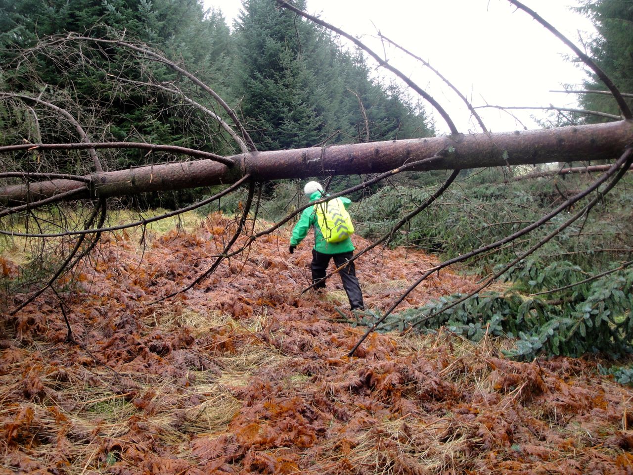
At times I could convince myself that we were on a constructed track but one which was gradually being consumed by nature. At other times there was no sign of track. Unfortunately one on the themes of this walk was fallen trees which often blocked our path and sometimes whole lines of trees had fallen and completely covered the track. We made slower progress with climbing over these trees or walking around them through wild vegetation. At least the ferns weren’t in full bloom and the tussocks were manageable.
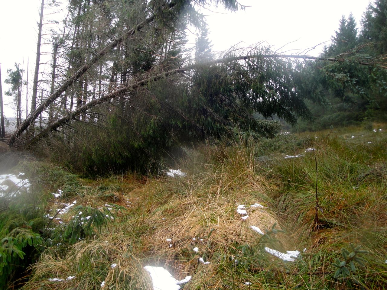
 The recent storms had not only blown over mature trees but we saw some that had been snapped off mid-trunk. To top it all some sections were flooded and we were left to step out onto submerged blades of grass not knowing how deep it would be. But we had luck on our side and I still had dry feet at the end of the day.
I had intended getting to Brattleburn Bothy for lunch but for various reasons decided not to make the 600m detour there. We were a little early for lunch, and didn’t really fancy the extra walk, so pushed on hoping to find a spot for lunch further along. There had not been a sign to the bothy at the forestry road but we did pass a handwritten sign to the bothy pointing along a footpath a little further along. We caught a glimpse of bothy through the trees with smoke coming from its chimney so we would perhaps have been intruding on someone else.
I realised as we started yet another climb, this time up to Craig Hill, that we were now walking up the hill that we had looked across to earlier in the walk. That was when Audrey had asked if we needed to climb that hill and I had laughed “No, of course not”. It didn’t look that steep on the map.
As we gained height we were rewarded with views of the snow topped Ettrick hills, and a little higher still Hart Fell showed itself. Having stopped for photos and jelly babies we began looking for likely rocks or tree trunks that might serve as lunch seats but they proved to be in short supply.
Our grassy trail descended to cross a forestry road and a sign told us that the Rivox Bunkhouse was 400 yards away. The signpost had an footrest near the bottom that at first seemed unusual until I looked at a nearby telegraph pole. The signpost was obviously a recycled telegraph pole that still had one of its footrests.
The road and its environs didn’t have anything seat-like so we went back up to a stile we had just crossed and sat there for a much needed lunch. Soup, fruit, coffee and rocky road made all the difference.
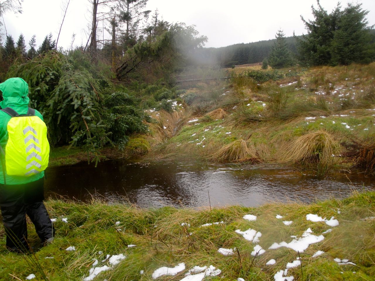
 After lunch we headed along a relatively flat section between the trees. There was a more definite track here but fallen trees again had us scrambling through tussocks and bracken. The OS map has a ford marked over an unnamed burn but we found a footbridge there. The path approaching it was flooded and a fallen tree had just failed to block the bridge but it beat fording a swollen burn. After the bridge we were briefly in farmland. An SUW marker lay just within the field but we could not see any to head for after that. Since the SUW seems straight here we headed in that direction and did find another marker on the far side of the field. We hadn’t seen it because it blended in with fence posts behind it.
Next was Foy’s Bridge, a footbridge over Garpol Water. A small plinth near the bridge tells the story. Vince Foy was a L/Cpl in the Territorial Army and an apprentice at ICI Wilton. He died in a motor accident aged 20 and in September 1982 the bridge was built by fellow TA members and dedicated to him.
Dougals
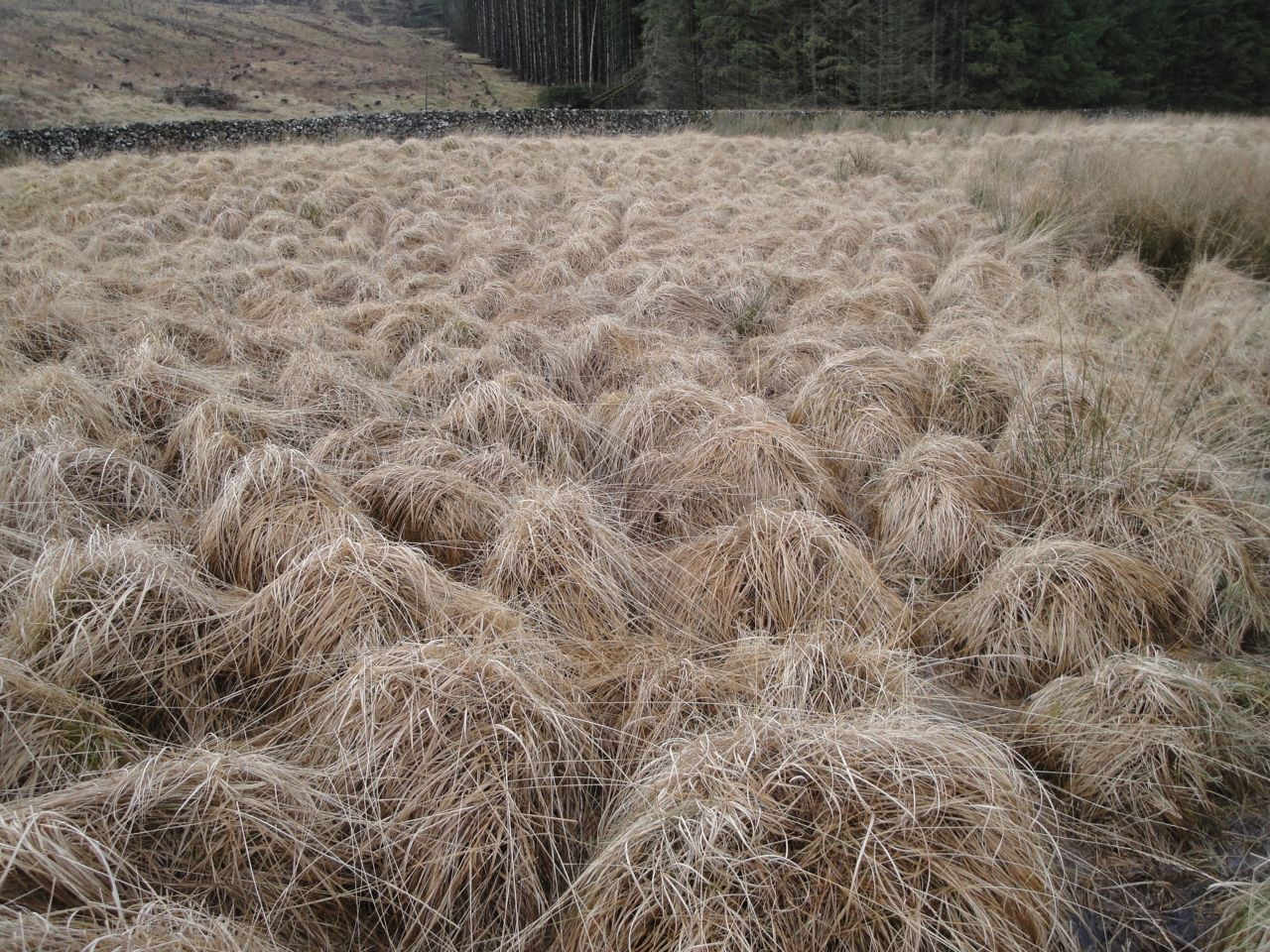
Beyond the bridge the ground was waterlogged and the tussocks looked like a herd of Dougals. We splashed across to a ladder stile over a wall and another section that seemed to be uphill, prompting more remarks about it “all being downhill”.
The SUW takes a dog-leg a little before Easter Earshaig, so when we came to a path going off to the right we decided to go that way even though there was no SUW marker pointing that way. There had been a marker 100m earlier and we had wondered why one would be there when a pointer at the junction might have been more useful.
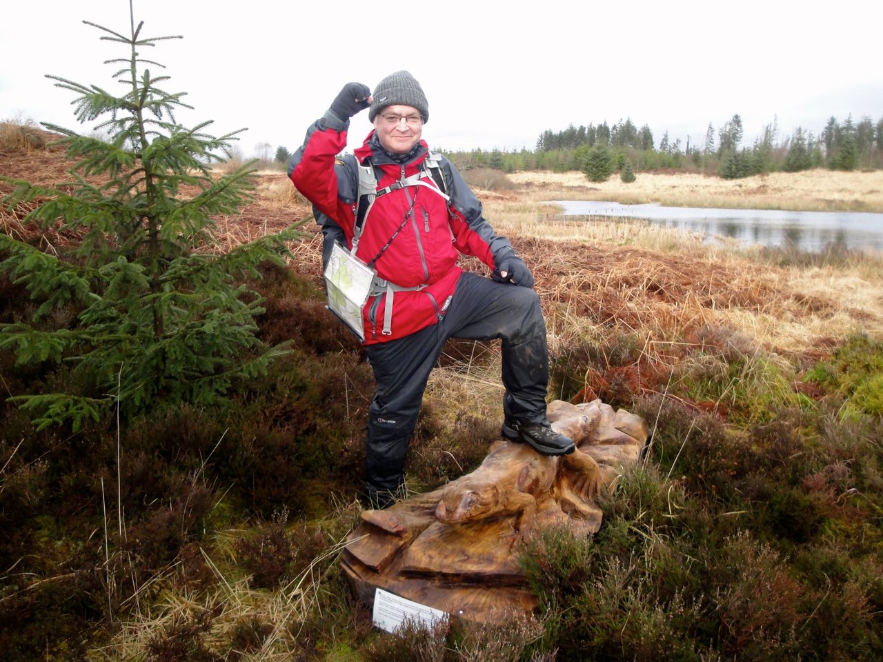
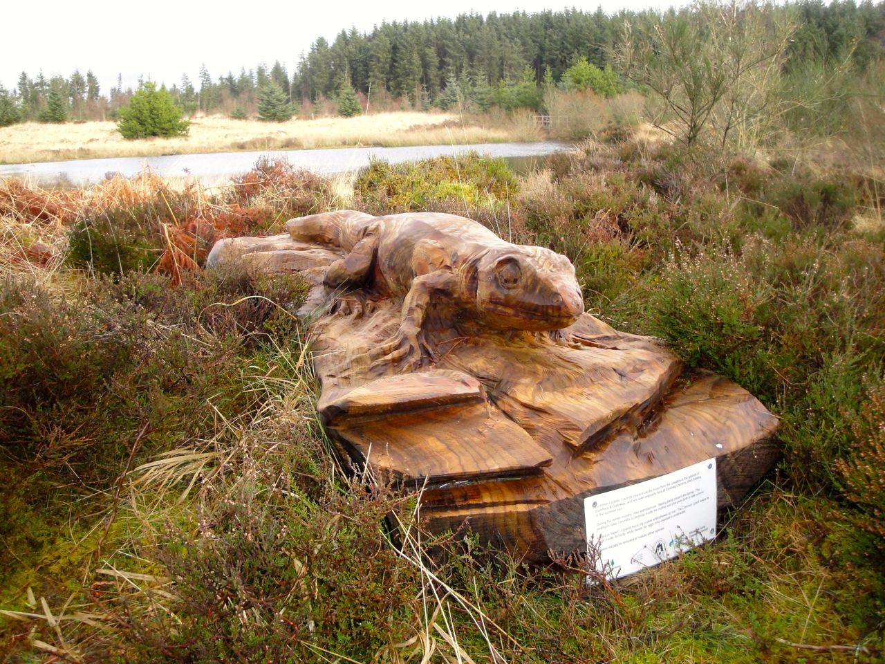
The path we took had “Countryside Walks” posts and took us around a couple of lochans. There were some interesting carvings here. First a common lizard about a metre long that I walked past without noticing. Luckily Audrey spotted it.
 At the second pond what looked like a signpost turned out to be a carved dragonfly. There were plenty of picnic tables and an SUW information board with information about roads and railways in Annandale. It was then just a short stroll through a muddy field to the Crooked road.
A carved stone there informed us we were 2.5 miles from Beattock and 10.5 miles from Ae. Unfortunately there was yet another uphill section through the trees before our final downhill stretch. Where the road leaves the the forest there is a sandstone memorial to Ben Wilson of Holmshaw, killed by lightning in August 1897. The carving is faded but still readable.
Eventually we wound our way downhill along the Crooked road, with Annandale beneath us, stepping aside every now and then to allow cars by, passing a newly built dry stone wall, a passing place sign with bullet holes, then over the railway and back to the car.
I opened the car boot and realised as I gazed at its emptiness that I had put my dry clothes and shoes in the car left at the beginning of the walk. So it was a good job I was dry.
That is another 10 miles of the SUW done, the Lanarkshire section complete and the end of the D&G section in our sights.
[sgpx gpx=”http://www.screel.co.uk/walks/wp-content/uploads/2014/02/RK_gpx-_2014-02-09_0926.gpx”]
