
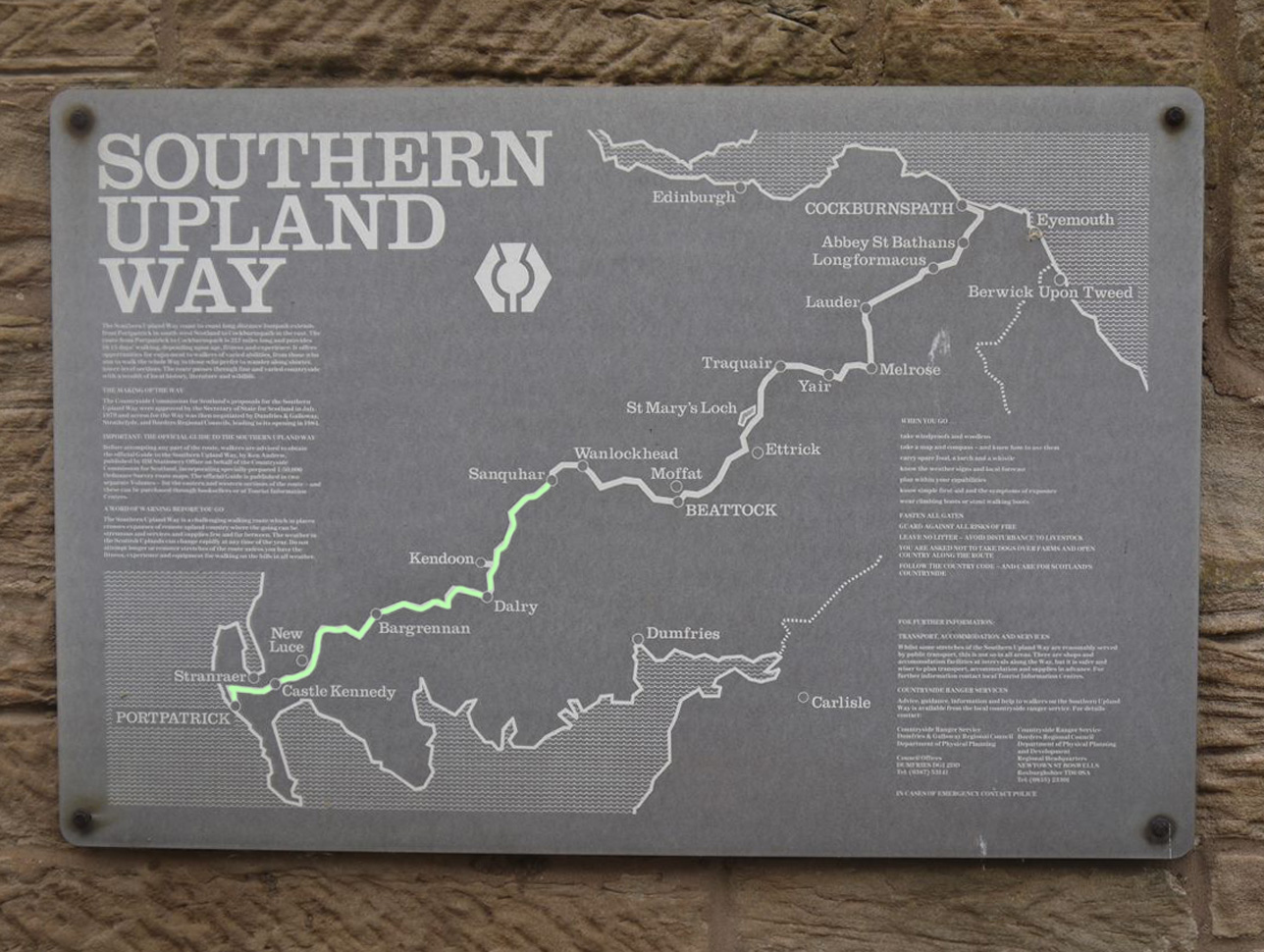
 The western section of the SUW, from the North Channel at Portpatrick to the River Nith at Blackaddie Bridge is 91.5 of the SUW’s 212 miles, though our journey clocked up 99 miles with 3669m ascent.
The SUW took us from the cliffs of the North Channel, over farmland, then rugged Galloway moorland, across the waters of the Luce, Bladnoch, Cree, Dee and Ken, through the battlegrounds of Trool, skirted the Awful Hand and the Rhinns of Kells and across the Scaur valley to the Nith. We experienced sunshine, mist, drizzle and very heavy rain, and walked sometimes in tee-shirts and others in full wet weather gear. Our mettle was tested by an unexpected felled forest at Knowe and on another day the heavy rain had flooded an entire field in our path north of Dalry. We found 3 kists and missed 2. (Update found another in May 2015: found 4 kists, missed one.)
See also the Middle and Eastern Marches.
We split the walk into the following sections:
- Portpatrick to Castle Kennedy
- Castle Kennedy to Dranigower Bridge
- Dranigower Bridge to Tannylaggie Bridge
- Tannylaggie Bridge to Caldons
- Caldons to Drumbuie
- Drumbuie to Stroanpatrick
- Stroanpatrick to Lorg
- Polskeoch to Sanquhar
Portpatrick to Castle Kennedy 14.7 miles 6h 15m 432m ascent
A coastal walk to Killantringan Lighthouse then minor roads or tracks most of the remainder, passing through farmland, moors, woodland and the Castle Kennedy Estate.
Lunch spot: a grassy knoll overlooking Knockquassen reservoir. Fine in good weather.
Look out for: the wreck of Craigantlet in the sea near the lighthouse, the standing stone at Knock and Maize, Ailsa Craig, the ruins of Castle Kennedy.

**********************************
Castle Kennedy to Dranigower Bridge 9.9 miles 4h 45m 292m ascent
Some roads but mostly moorland and woodland walking with some boggy sections.
Look out for: Loup of Barnshangan Waterfall, Caves of Kilhern (both need a minor detours from the SUW), Kist, Castle Kennedy ruins (again).
******************************
Dranigower Bridge to Tannylaggie Bridge 11.8 miles 5h 47m 365m ascent
Mostly moorland and forest walks with some boggy sections. Good views from Craig Airie Fell, Wigtonshire’s highest hill. Care is needed to avoid missing where the SUW leaves the farm tracks after Balmurrie.
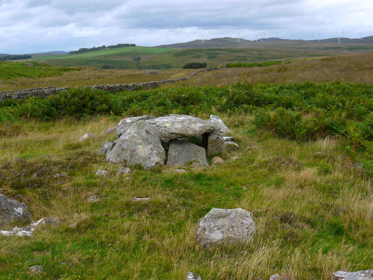
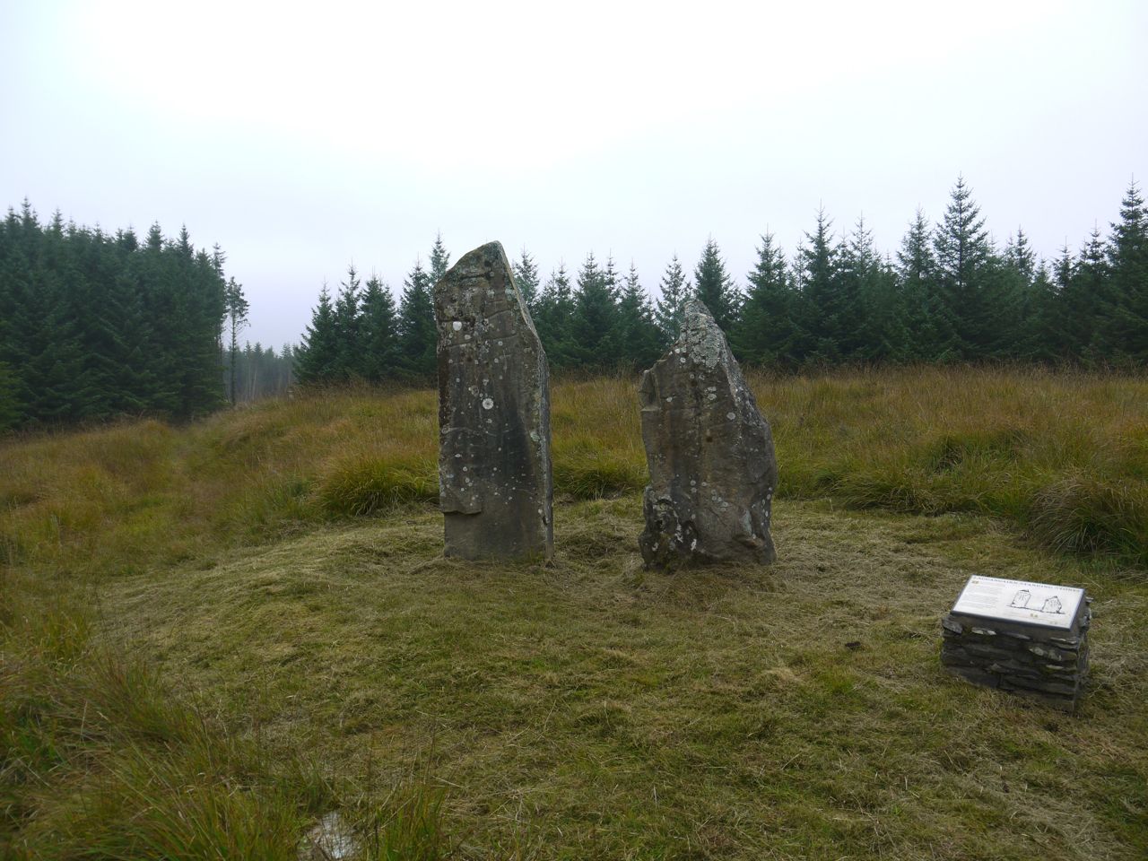
Look out for: Cairn na Gath (neolithic burial cairn), the Purgatory Burn, Laggangarn Standing Stones, Beehive Bothy and Liberland (the old leper colony) across Loch Derry. The Wells of the Rees are 100m off the SUW and Linn’s Tomb about 600m.
***********************
Tannylaggie Bridge to Caldons 12.5 miles 5h 50m 263m ascent
Initially quiet country roads through forestry land, some unpleasant walking in felled forest after Knowe, moorland to Bargrennan then woodland tracks to Caldons. Good views from Ochiltree Hill. Don’t make the mistake of entering the woodland near Garchew.
Look out for: old red phone box, milestone at Knowe, lunky holes, deil’s dyke, hollyoaks, covenanter’s memorial.
*******************************
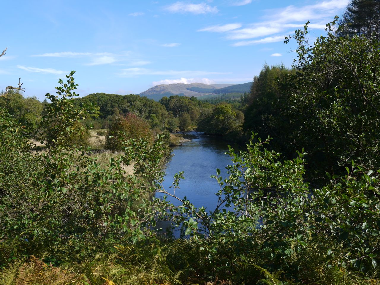
Caldons to Drumbuie 15.23 miles 6h 5m 794m ascent
Woodland tracks by Loch Trool then forestry tracks to Clatteringshaws before entering woodland again. The final section is across the upland moors of Shield Rig where some care is needed in bad visibility.
Look out for: the site of the Battle of Glentrool, Giant’s Axe Head, mermaid cycleway sign, White Laggan Bothy, Kist.
*********************************
Drumbuie to Stroanpatrick 14 miles 6h 37m 509m ascent
Mostly moorland walking, which can be quite boggy, with some sections on quiet roads. Good views from Waterside Hill, apparently. Care is needed where the SUW leaves the road near Garroch and over the moorland section north of Ardoch.
Look out for: Boat Weil, St John’s Seat, Roadsign to Lochinvar, Stroanfreggan Cairn
*************************
Stroanpatrick to Lorg 12.2 miles 6h 5m 648m ascent
Upland moorland which is boggy in places and forestry tracks. Care is needed to stick to the route above Stroanpatrick. Good views from the hilltops.
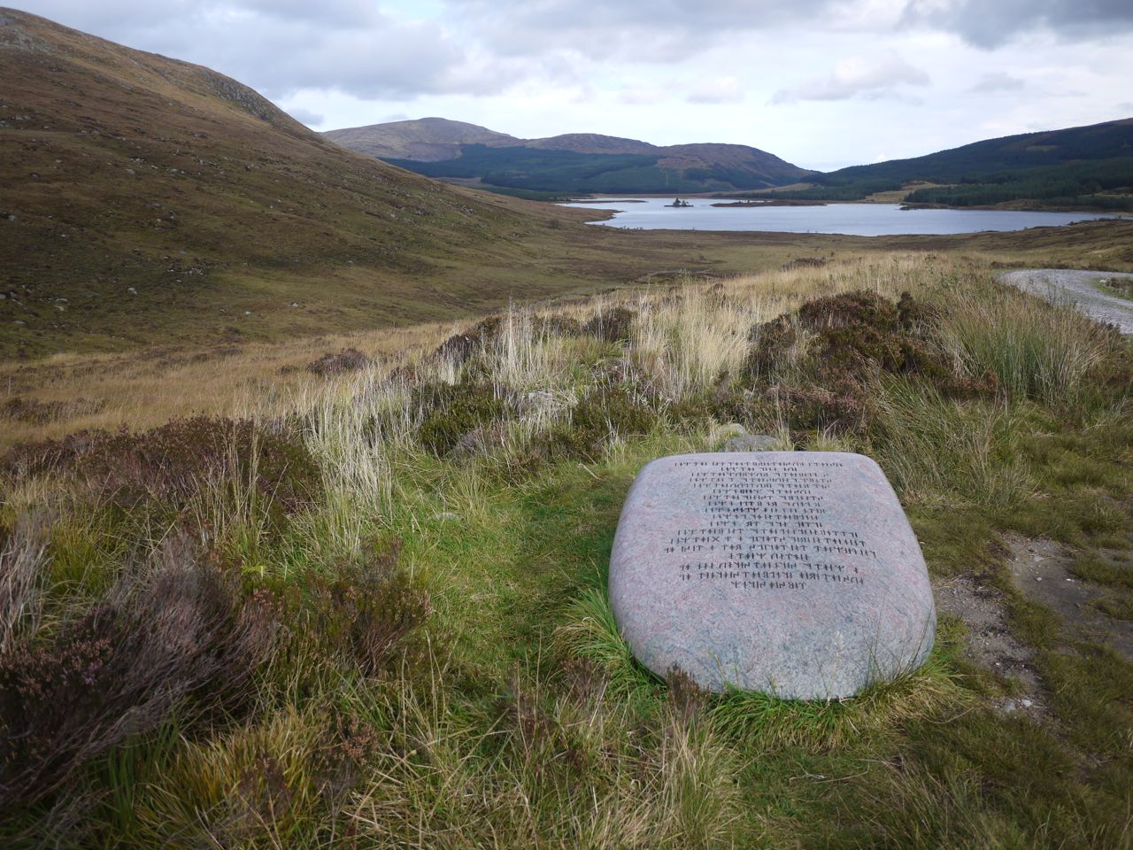
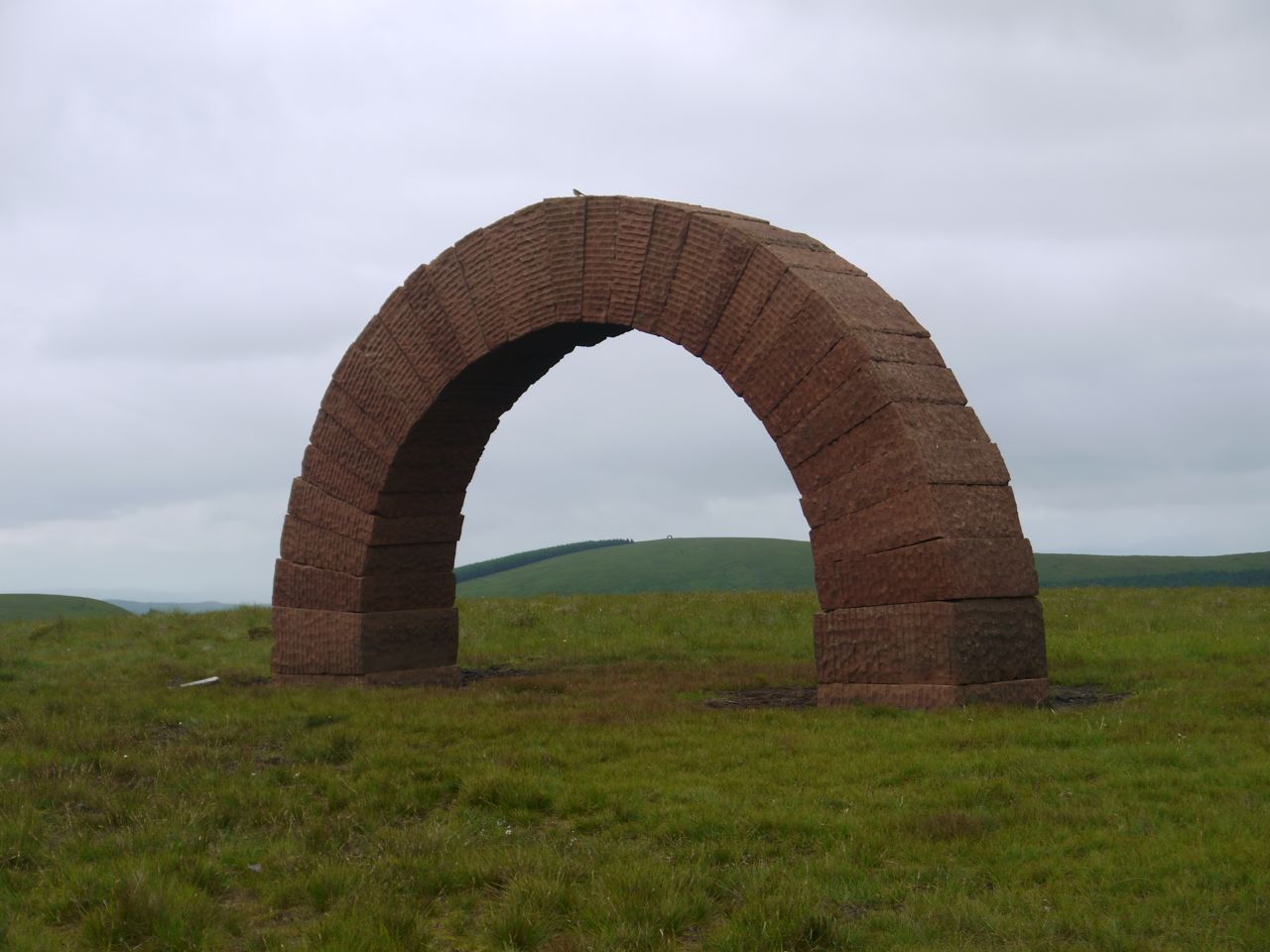
Look out for: Striding Arches, Allan’s Cairn, Chalk Memorial Bothy
**************************
Polskeoch to Sanquhar 10.7 miles 4h 47m 368m ascent (9.1 miles of this in the Western March)
A very quiet country road initially then most of the walk is upland moorland with quite boggy sections on the descent to the Nith. Good views of the Scaur Valley and the Lowthers
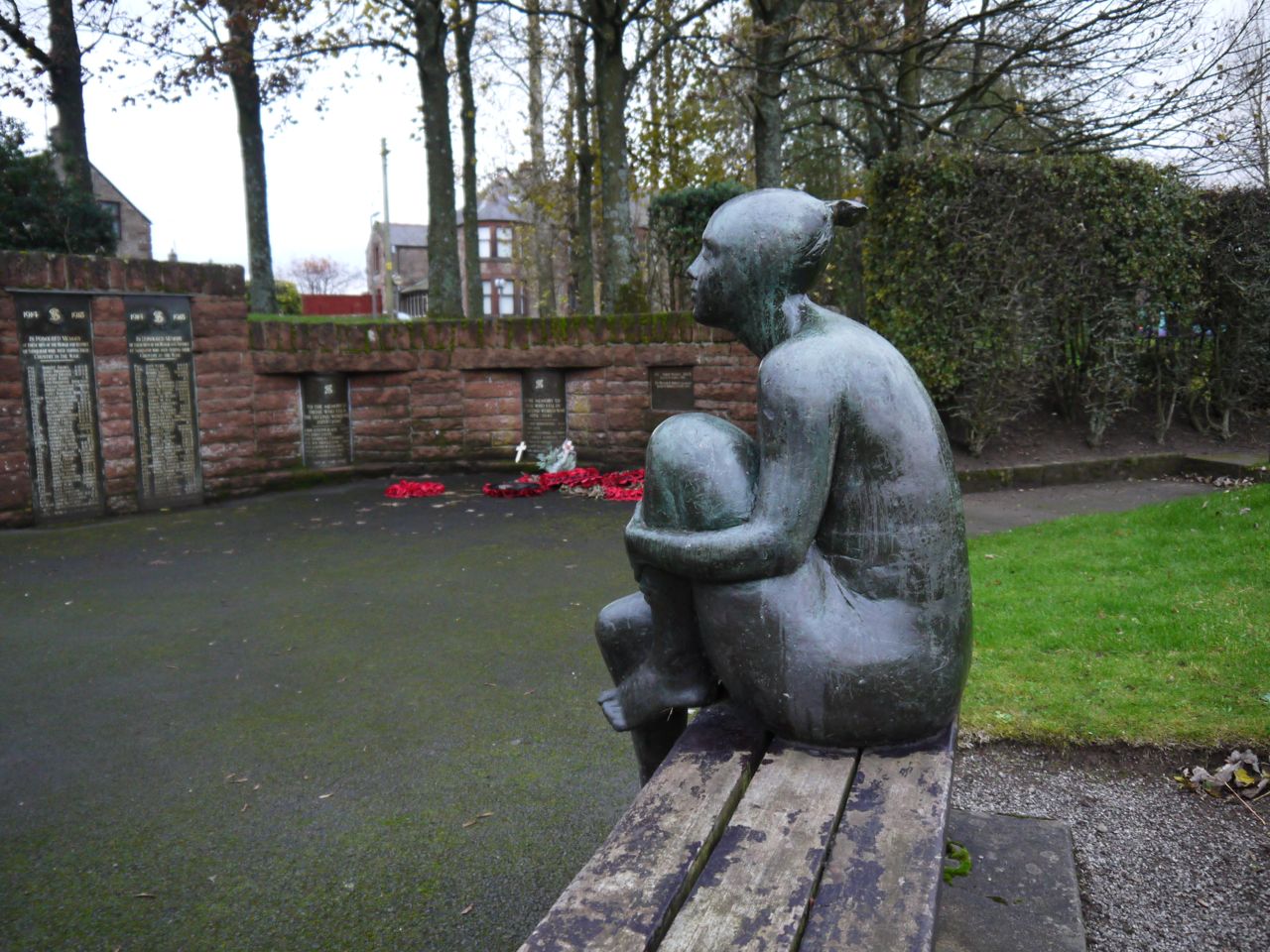
Look out for: Isle of Wight signs, bicycle at Polgown, kist, Glenwhargen Craig, Sanquhar castle, Mantua rock, Deer Dyke, oldest Post Office, Covenanter’s memorial, Ram’s head and, a little way off the SUW, Sanquhar War Memorial.
Next: The Middle Marches
