
12.5 miles 5h 50m 263m ascent; max elevation 184m Ochiltree Hill
 Route: SUW Tannylaggie Bridge to Caldons
We were treated to a beautiful Autumn day, with sunshine to shame a summer’s day, reds and yellows emerging from the greenery and just the right amount of breeze to keep us comfortable.
Tannylaggie Bridge, the end of our last walk, was our starting point for this section. Despite having driven along this road several times, this was the first time that I had noticed we were driving downhill. I sighed at the thought of setting off with an uphill section but it was hardly noticeable with our rested legs.
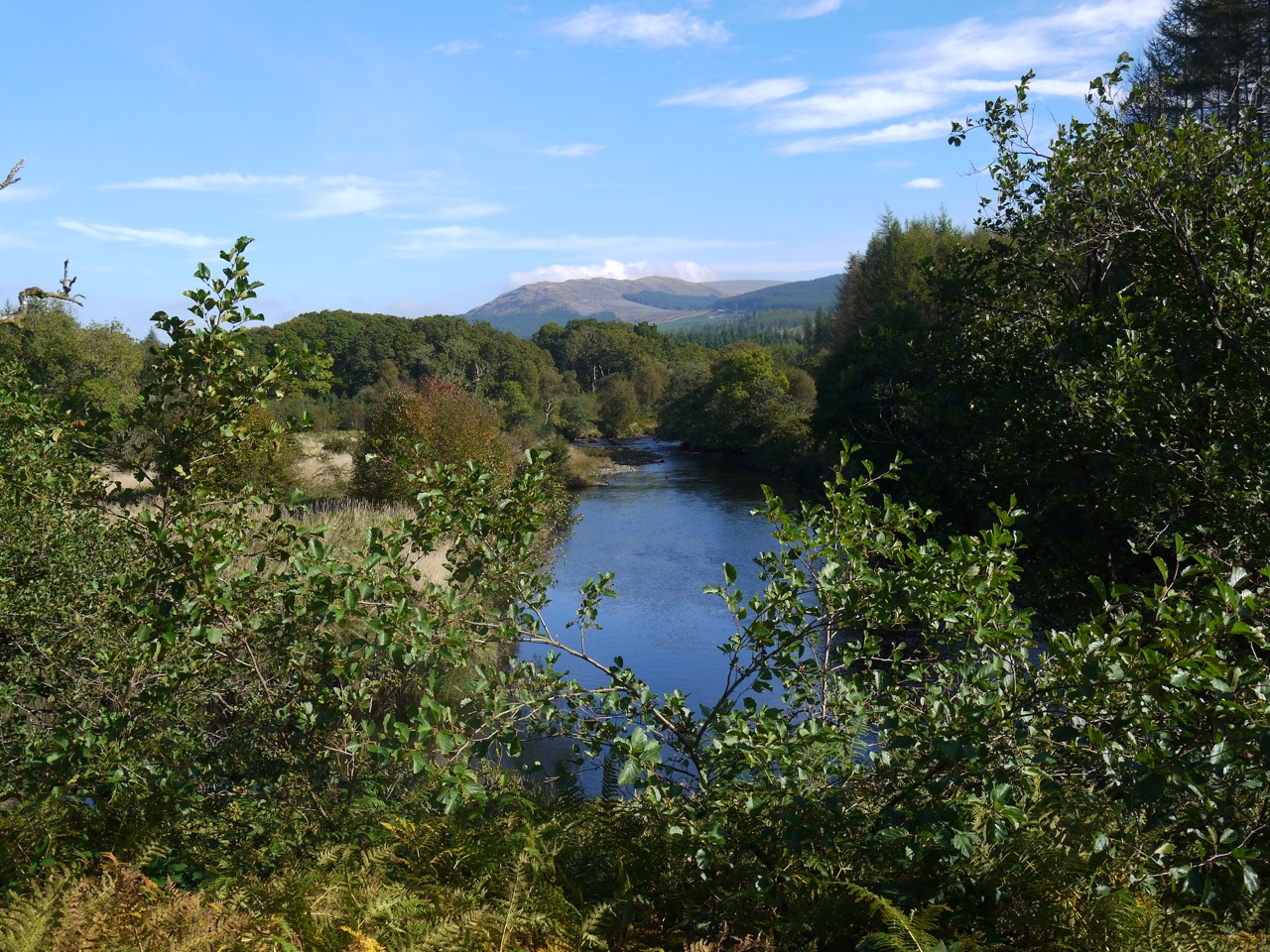
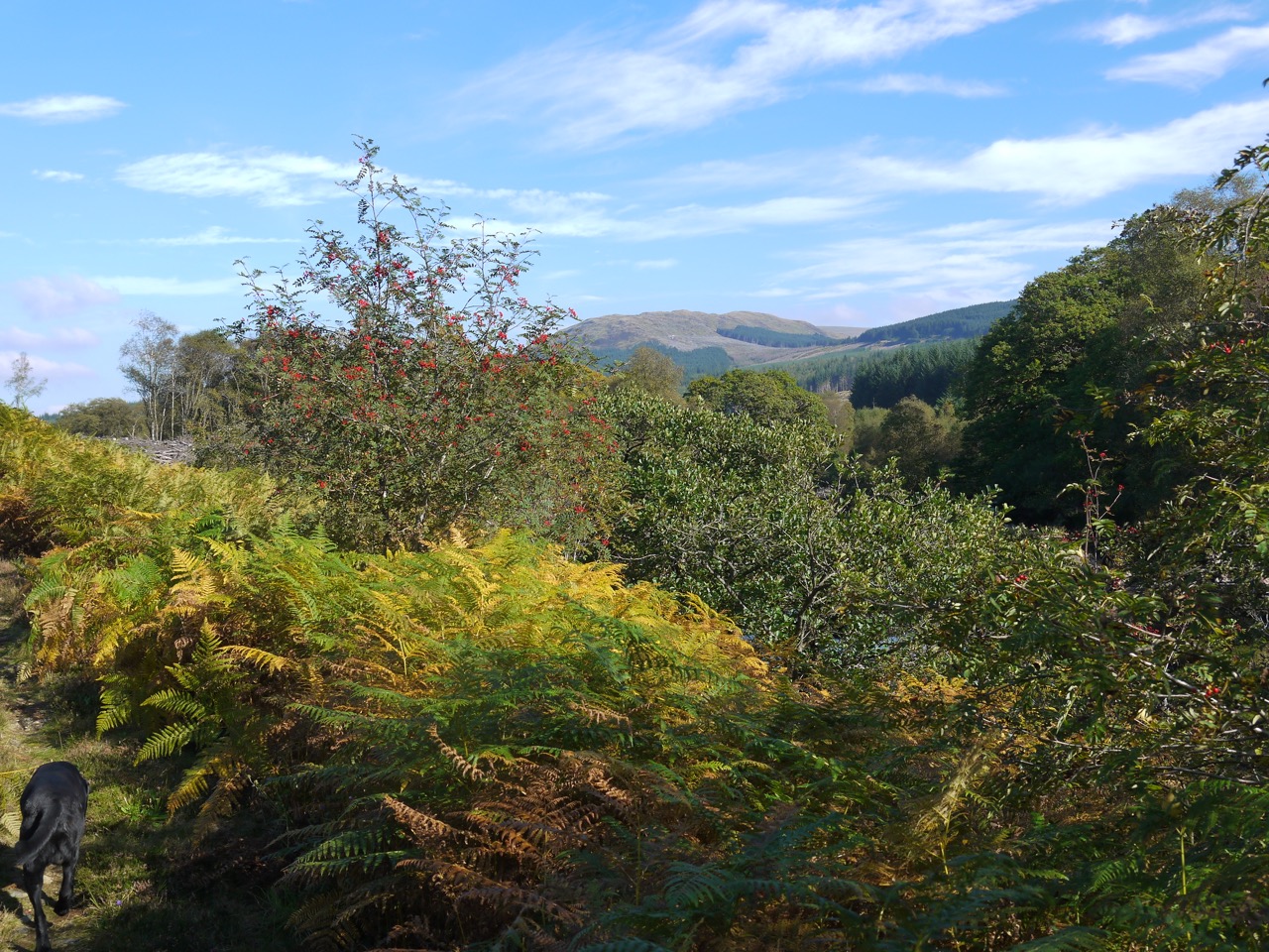
The River Bladnoch meandered along amongst tall grass and conifer plantations and the roadside bracken was still green with only occasional yellowing fronds, quite different from the autumnal colours later in the walk. We seemed to walk further into Autumn as we headed east.
The SUW followed the road we had just driven along but the only traffic we saw was a tractor working in the fields.
A little north of Knowe we spotted a cairn on a wee hummock a couple of hundred metres away, but what it signified I do not know. Knowe itself gave us our first taste of red with red leaves, berries and an old red telephone box. A milestone, opposite an SUW signpost, where the SUW leaves the road is marked G22 on one side and N8 on the other giving the distances to Girvan and Newton Stewart.
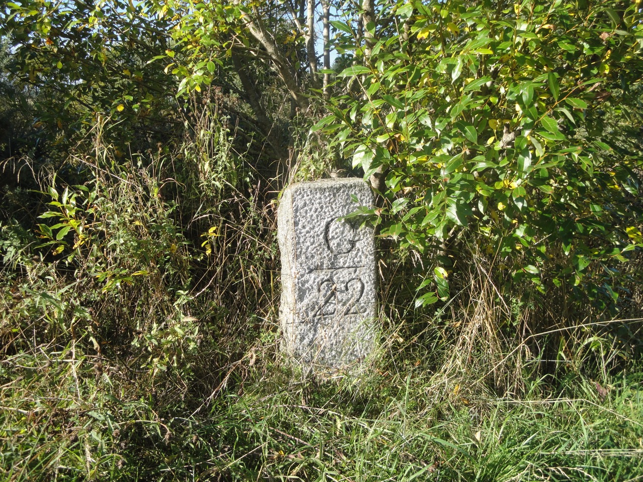
Milepost at Knowe
The next mile of SUW proved more difficult than I had expected. On the OS map it crosses a forest between Knowe and Glenruther Lodge. In reality it is much more exciting. After a brief trek between trees we found ourselves in a wide clearing with occasional trees and tall grass. The track was obvious but the grass hid the ground from view so I didn’t see the hole that got me. The first I knew of it was a sudden change from upright to sprawled. Luckily I was in the company of experienced nurses, though in my shocked state my hearing must having been playing up because I thought I heard “I wish I had had my camera ready”. I took the rest of the section more slowly and carefully.
Unfortunately the eastern half of the forest had been felled and the path of the SUW was lost amongst the debris, pools, and mud. How we decried the lack of direction posts here. The only saving grace was that we could see our target, Glenruther Lodge, so we knew which direction to head as we picked our way through the arboreal devastation and searched for ways around the stinking stagnant pools. It was quite a relief to emerge onto the road at Glenruther Lodge and turn towards Glenruther Farm. The dry stone wall by Glenruther farm has a “lunky hole”, a gap large enough for sheep but not cattle to pass through.
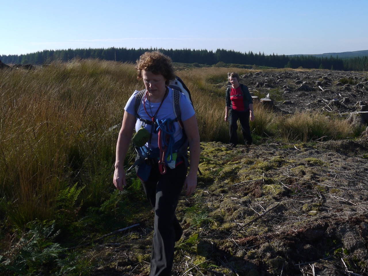
Emerging from the felled forest
Glenruther does not sit in a glen and is Clonryddin on older maps, taking its name from cluain-ridir, knight’s meadow, suggesting a possible link with the Knights Hospitaller of the Order of St John, who have connections with St John’s Town of Dalry. With this history in mind I was in the mood to see the Deil’s Dyke on Ochiltree Hill.
I had seen the Deil’s Dyke on older maps and our route should have crossed it on the slopes of the Ochiltree Hill. Sadly there was nothing to see of it.
The summit of Ochiltree Hill is a lowly 184m but offers excellent views: The three lochs, Ochiltree, Black and Fyntalloch; and the hills, Craig Airie Fell to the west from our previous outing, and the Galloway Hills, where our second car was parked, Merrick and the Awful Hand, Lamachan and Cairnsmore of Fleet, to the east. Later in the walk we would even be able to see the summits of the Rhinns of Kells. Ochiltree with its views was good spot to stop for a rest and a bite to eat and the trig pillar even has enough of a lip at its base to sit on.
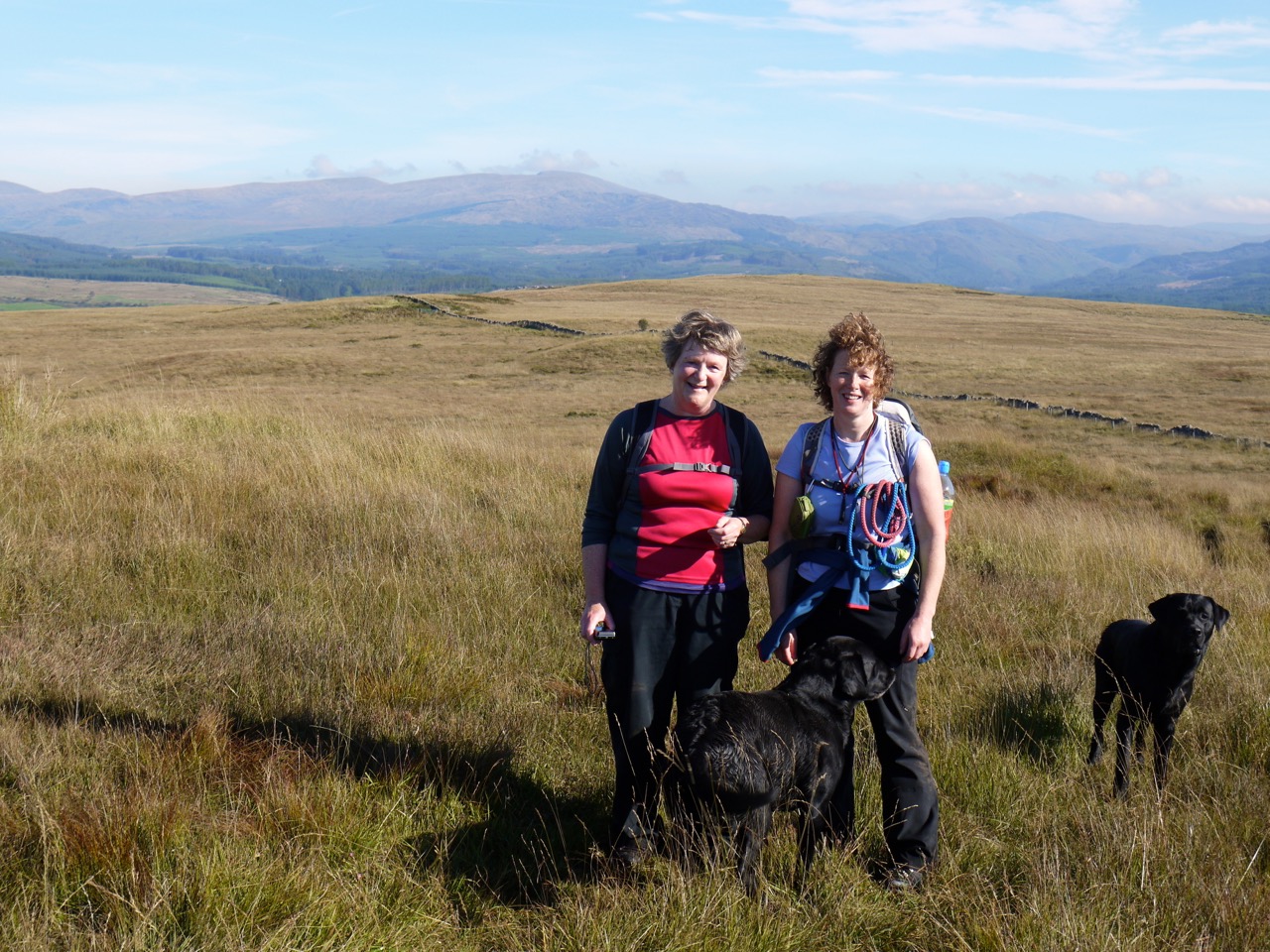
Ochiltree Hill
Having moaned about the lack of marker posts where the forest had been felled, we now looked along the obvious track off Ochiltree Hill with four marker posts visible. The ground here was boggy on places but generally easy going. We passed a gate and then came across some golden mushrooms. They look bronze on the photos but were more golden in real life. Amanita phalloides, death cap, I think. We also saw a grass shoots with red seeds.
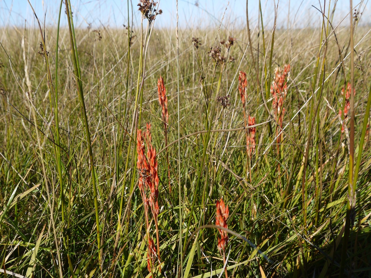
Red grass seeds
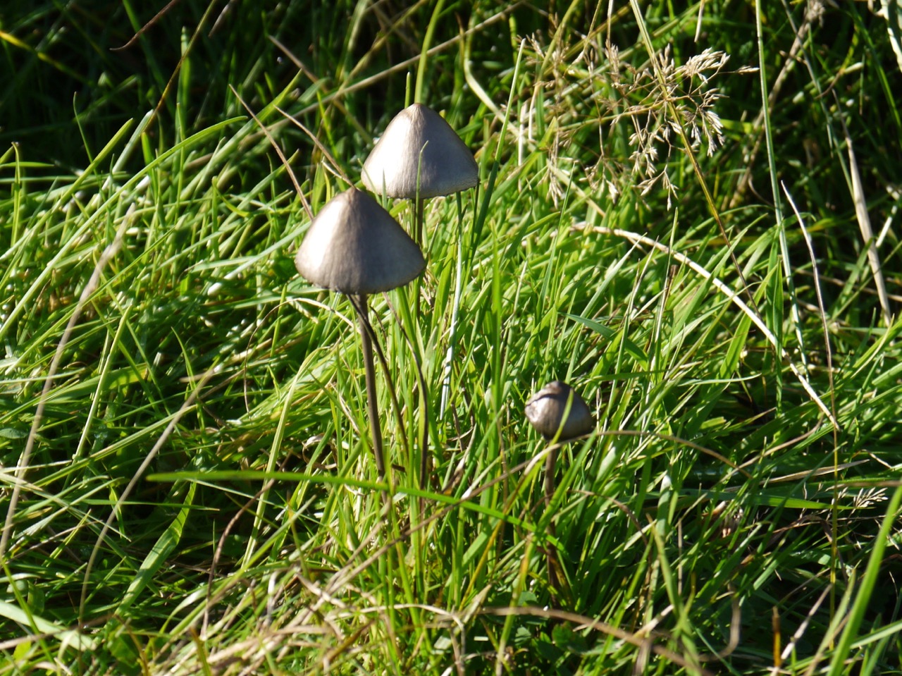
Death Cap?
The path follows a wall for a short while but then bears left towards a broadleaved wood at Garchew. We followed the trodden path into the wood but it soon petered out leaving us in very boggy ground beneath the trees so we headed back to the open ground and eventually found the SUW which skirts around the edge of the trees. There is firm ground to be had here but cows with their calves had taken station there and we thought it best to stick with the more difficult terrain away from the beasts.
After crossing the Bargrennan-Knowe road we headed across a boggy meadow but there were several short footbridges across the stagnant pools leaving just one challenging boggy area to cross on foot.
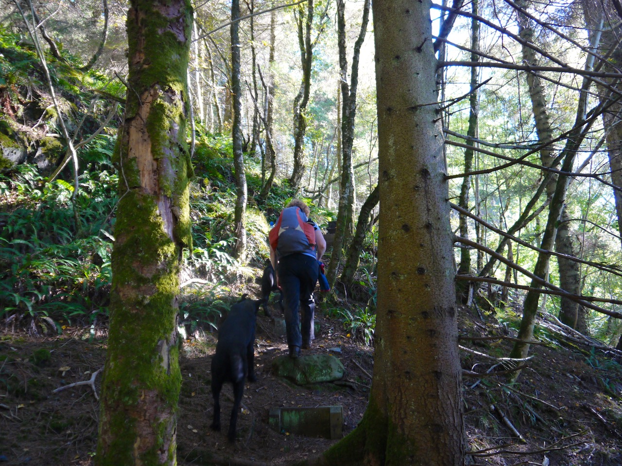
Having climbed out of the meadow and back on firmer ground we could see the forests across the Cree with Merrick in the distance. The path brought us to a step-ladder over a stone wall over which Jo had to man-handle the dogs only to repeat the job 2 minutes later. It did look as though a minimal diversion could have avoided the need to cross the two walls. Ours not to reason why.
Crossing the Cree at Bargrennan marked the half way point of the day’s walk and also the end of the official third section in my guidebook, though of course we have been slicing up the walk in our own way. I had thought the remaining half of the walk would be a riverside amble (no climbing) and looked forward to stopping for lunch dangling my legs in the cool water. I was to be disappointed on both counts.
Cree woods
Despite walking along the Cree in a downstream direction, we climbed, and climbed, and then when I thought we couldn’t climb any more, we climbed. No rocks or fallen trees presented themselves as likely lunch spots and the river fell away beneath us putting more distance between my toes and the cool water. There were a great many purple topped toadstools, all looking past their best and we wondered if this is what becomes of Fly Agaric, but I now wonder if they were primrose brittlegill.
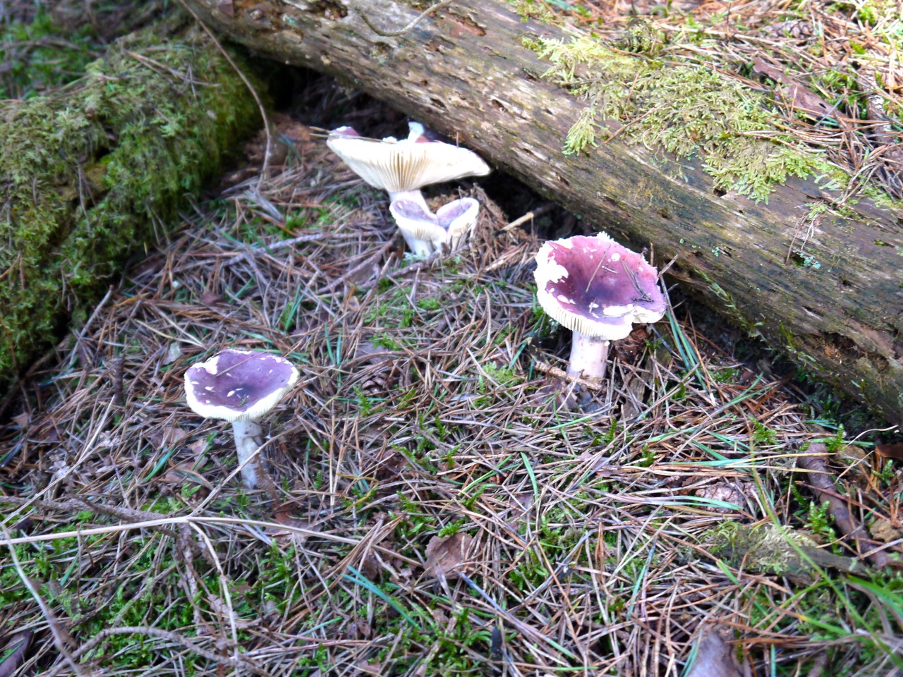
Primrose Brittlegill
After the conifers by the Cree the SUW turned away from the river and crossed the peninsula made by the Cree and Minnoch. This involved a short section on forestry tracks but we were soon back alongside the water, this time the Water of Minnoch and found a pleasant shaded spot for lunch.
There is an oakwood beside the Water of Minnoch, Holm Wood, with numerous mature oaks as well as a great many new oak shoots. Beneath the towering oaks were hazel and holly. Hollyoaks, no less.
At the end of Holm wood we crossed the Minnoch and followed its far bank for half a mile before reaching the final section of the walk beside the Water of Trool. The bracken here was in full autumnal colours.
Cree Woods
Just to confirm that the purple fungi were not Amanita muscaria we came across some of these classic toadstools and their structure was quite different from the purples earlier in the walk.
Beyond Stroan Bridge the SUW is a stone path, a little harder on the feet but better than bog. Our final fungal find was here, some orange peel fungus.
The last mile and a half did seem to drag on a bit but was briefly livened up when we met a fox coming along the path. He seemed as surprised to see us as we were him, but he bounded off before I could snap a picture. The dogs didn’t seem interested.
Eventually we spotted an SUW information sign, looking a little like a bus shelter but in the woods and knew we had reached Caldons and the car.
With: Audrey, Joanna
[sgpx gpx=”http://www.screel.co.uk/walks/wp-content/uploads/2013/09/RK_gpx-_2013-09-29_0943.gpx”]
PS We did not find the kist during this section but subsequently found it in May 2015
