
10.85 miles 5h 48m ascent 227m
– Eden Way: 9.47 miles 4h 50m ascent 201m
– Poetry Path, 1.38 miles 58m ascent 26m
Sandford-Kirkby Stephen-Stenkrith
This section of the Eden Way took us from Sandford Bridge to Stenkrith Park in Kirkby Stephen. It has pleasant riverside paths through fields and woodland, short sections through farmland and pavements through Kirkby Stephen. There are couple of miles of road-walking on quiet country roads. But it was not a vanilla hike. Overgrown paths saw us stung by nettles and snatched by brambles; there were stiles to try the patience of a saint; the odd navigation lapse kept us on our toes; and finding the section’s Eden Benchmark proved challenging. But the weather was good and we had the Kirkby Stephen Poetry Trail as a dessert.
Sandford to Warcop
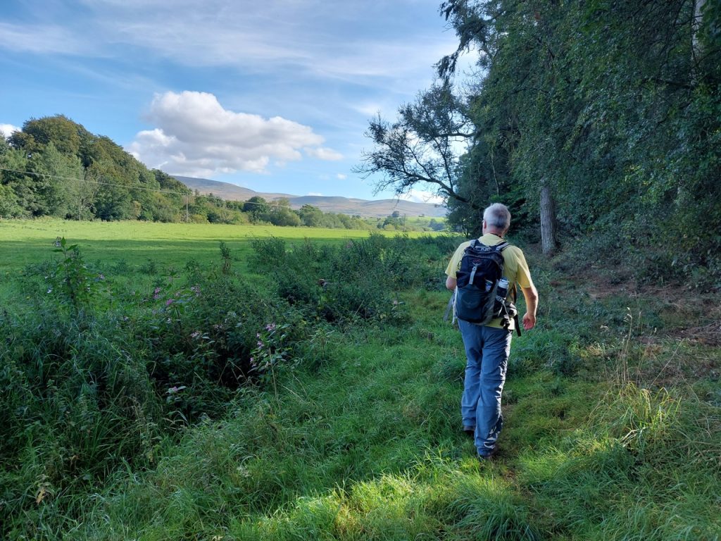
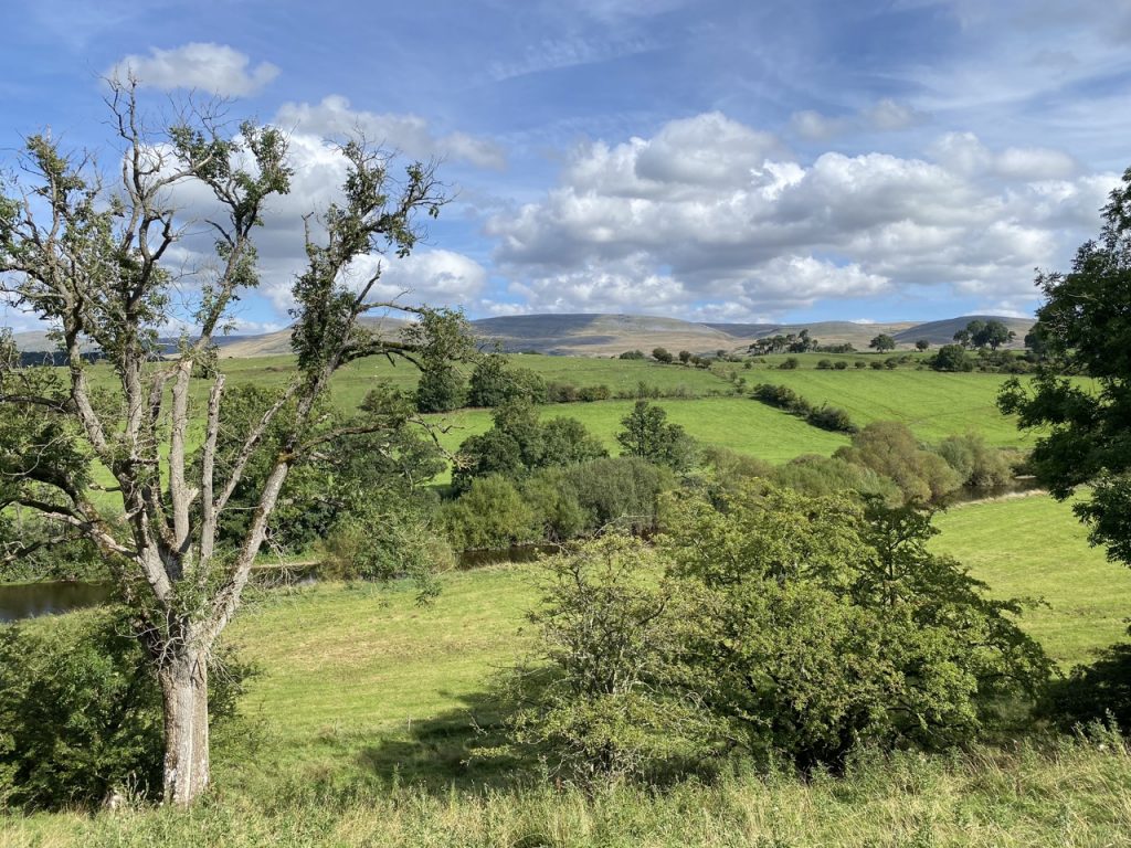
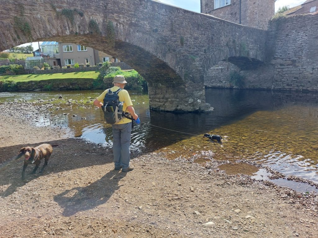
It had looked as if it would be wet all week. I woke to the noise of torrential rain in the night and was expecting to walk in drizzle at best. But we had glorious sunshine. We parked in a little way off the Eden Way, at Sandford, and walked down to rejoin the Way at Sandford Bridge.
The guidebook told us to leave the track at a beck just before Blacksyke cottage, and gives a rather complex description of which stiles to cross and which stiles to ignore. But we found a gate by the bridge. It gave us direct access to the riverbank. A much easier option by the look of it.
Striding along beside the river, basking in the sunshine as the dogs ran about, I checked the map to see when we would leave the riverside. Only to find that we shouldn’t be walking by the riverside here. Should we continue by the riverside? Did the guidebook know something we didn’t? We couldn’t be sure there would be a way through the fences ahead of us so we decided to turn back and follow the guidebook’s instructions.
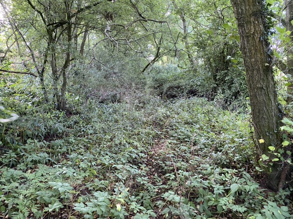
A gate behind the cottage by Sandford Bridge gives access to the wee hill of Arnside. With the benefit of hindsight, we should have walked up the cottage’s drive and through the gate behind it into the fields. But we followed guidebook’s instructions and used the bridleway, as indicated by a fingerpost. I doubt there has been a horse on that bridleway in a generation. Indeed I doubt a human has walked along it for some time. It was overgrown to the extent that I wouldn’t have thought it was a path if it wasn’t for the fingerpost and gate.
We stumbled through it and clambered over a stile but without a machete could go no further. So we lugged the dogs back over the stile and followed a fence to find ourselves at the end of the cottage’s drive, just a few paces from a gate marked with a public footpath sign. It took us out onto open fields, sweating, bramble scratched and nettle-bit having taken 10 minutes to cover what could have been two dozen paces along a drive. I wonder if the guidebook’s round-the-houses route, is a right of way issue.
[All hail the Land Reform (Scotland) Act 2003 – FREEDOM!🏴.]
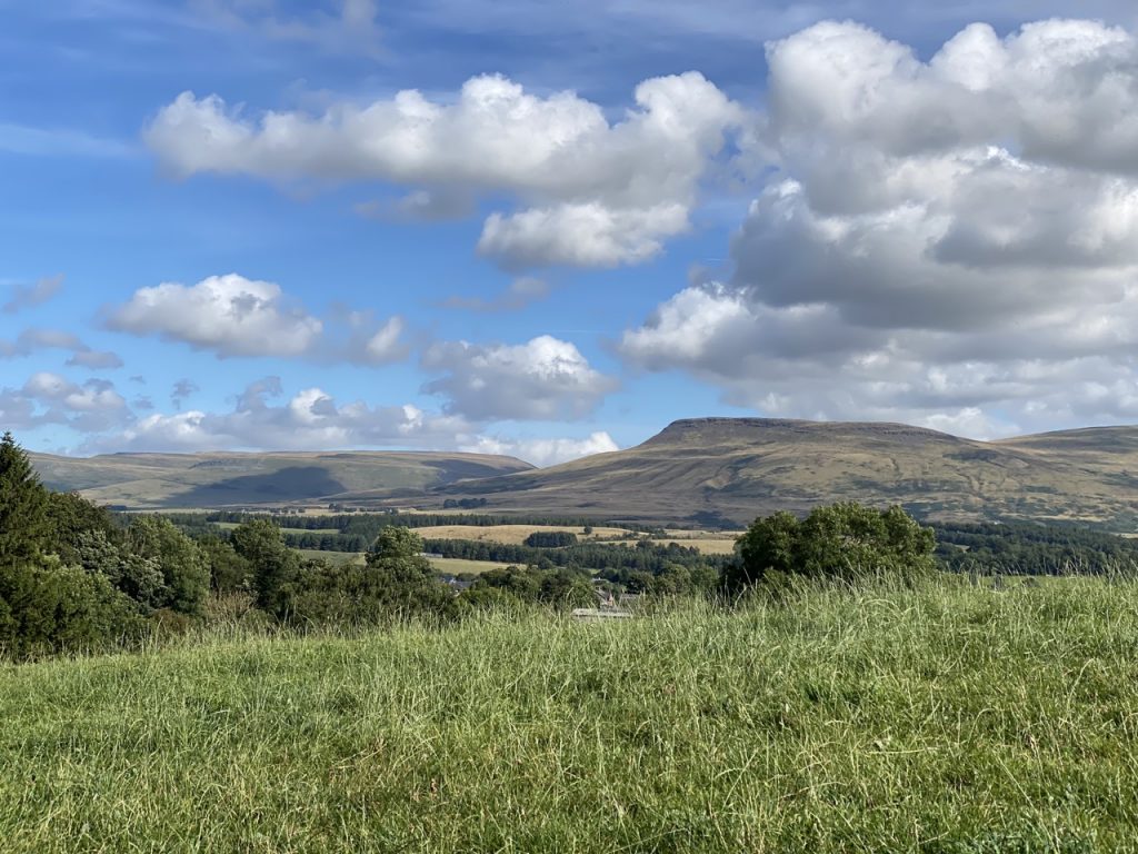
We were on Arnside Hill which ourselves takes its name from Old Norse, Earnwulf’s headland. Like Earnwulf, we had good views across the Eden Valley, the Pennines in one direction, and the Howgills the other, though I suspect the tiered fields of Sourlands Hill weren’t there in Earnwulf’s time.
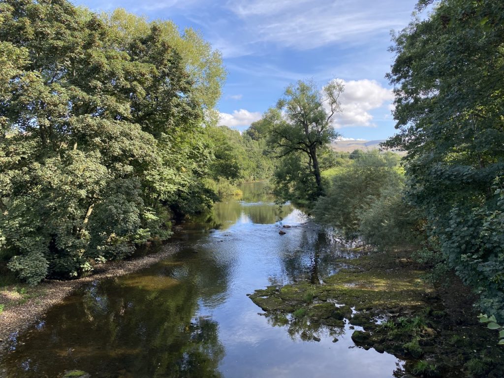
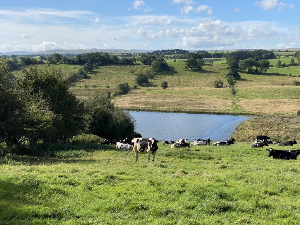
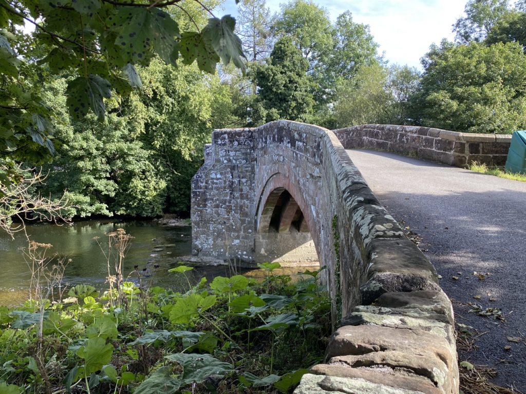
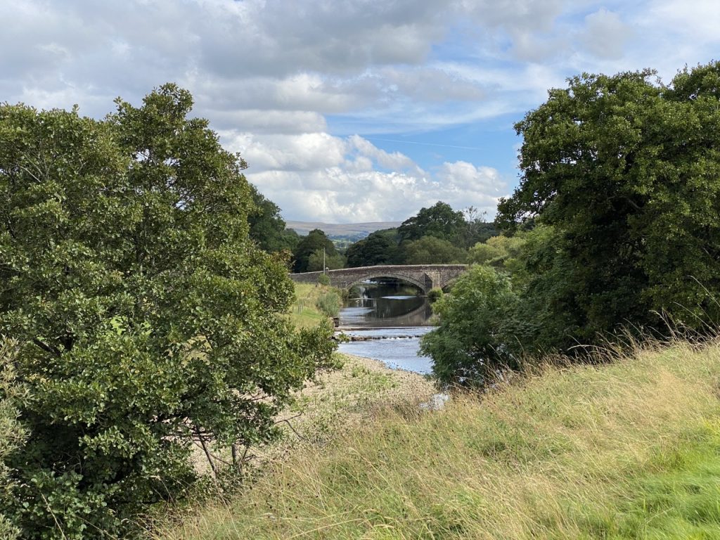
Though there were cows in the fields, they stayed at the bottom of the slope and didn’t give us any problems. There was none of the bovine-guarding of stiles and gates that we had in the previous section. Once over the summit of the hill we joined a farm track that took us back down to the river. We were a little downstream of Warcop Bridge, the oldest surviving bridge on the Eden and its only remaining medieval bridge, built some time before 1374.
Warcop to Little Musgrave
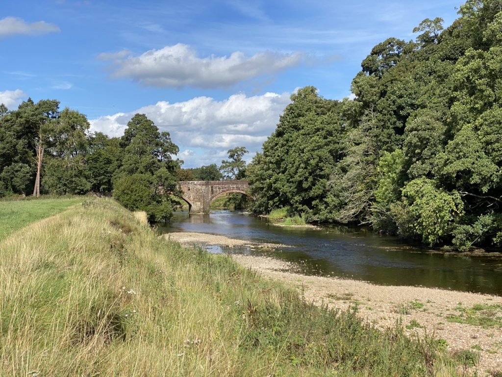
There was a very pleasant riverside walk after Warcop bridge, first in grazed fields and then on woodland paths. The river had become noticeably narrower and the water level was low, almost crying out to be paddled in. It was a little early in the walk for us to be dipping our feet but Christy made the most of it. A wet spaniel is a happy spaniel.
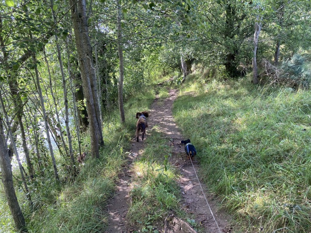
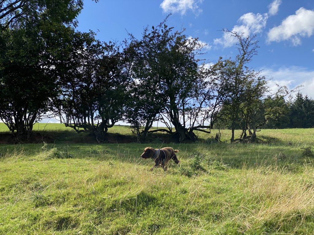
A small rise at Bermer Scar gave us some more good views across the Eden Valley. We followed a farm track until it and the right-of-way parted company. The right of way by-passes the farm buildings at Ploughlands, taking us downhill through a field that was surprisingly well covered in sheep s#!t. I watched where I stepped but had to contend with Mabel as well. She was in dachshund paradise. So much poo to roll in, so little time. So little surface area of fur. The irregular jerks on her lead subtly altered my stride. Twice I almost ended up on my arse, having stepped into ovine lubricant.
After the farm we found ourselves walking along a concrete path. It seemed the only option but a sign beside the path warned, in a somewhat passive aggressive tone, that said path was NOT a public right of way, despite being shown as such on some OS maps. A big arrow pointing towards the actual right of way might have been more useful. The Eden Way and the Pennine Journey pass on the opposite side of the small pond to the concrete path.
Though there is a fingerpost by the pond, it is easily missed from the farm track. It would certainly be better placed closer to where walkers need to leave the farm track. There was no obvious track heading from the concrete path to the finger post but once at it a narrow path of worn grass showed us the way.
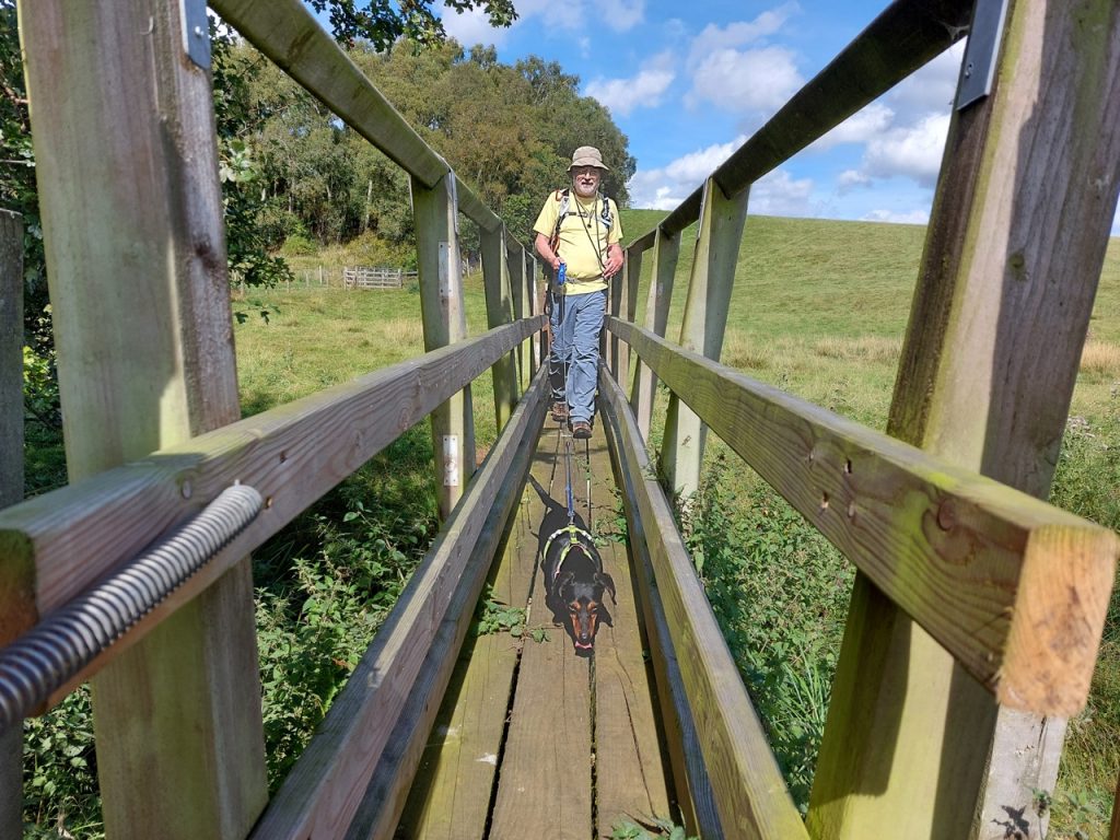
There was a small footbridge over Keldhead Sike and two good stiles, with dog gates, where we needed to cross the fences between fields. Unfortunately the stile between the fields and Swillings Lane was a bit of a bind. There was no dog gate and a dead hare lay just where one would have stepped off the stile. This meant we needed to step directly from the stile onto the footbridge over Blind Beck. This made manhandling the dogs over it a bit tricky. Luckily I had noticed the hare so didn’t step in it and managed to keep the dogs off it.
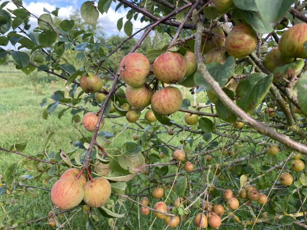
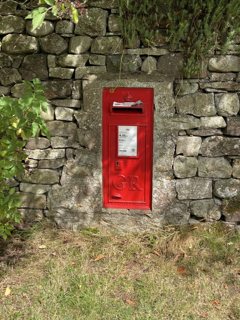
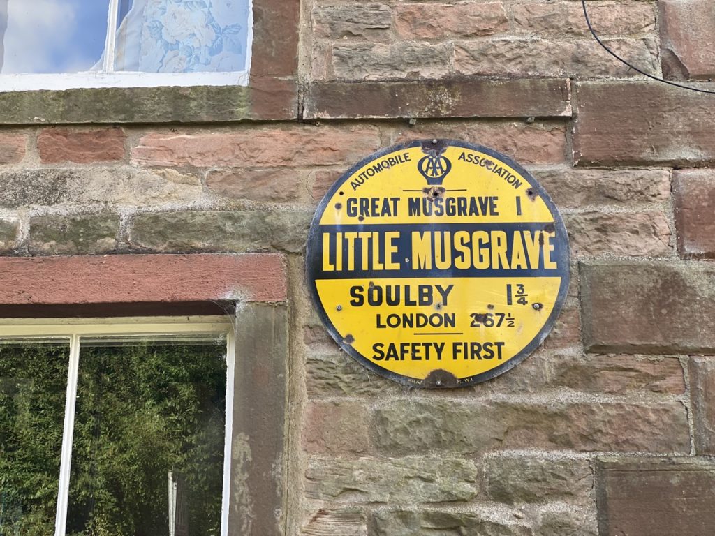
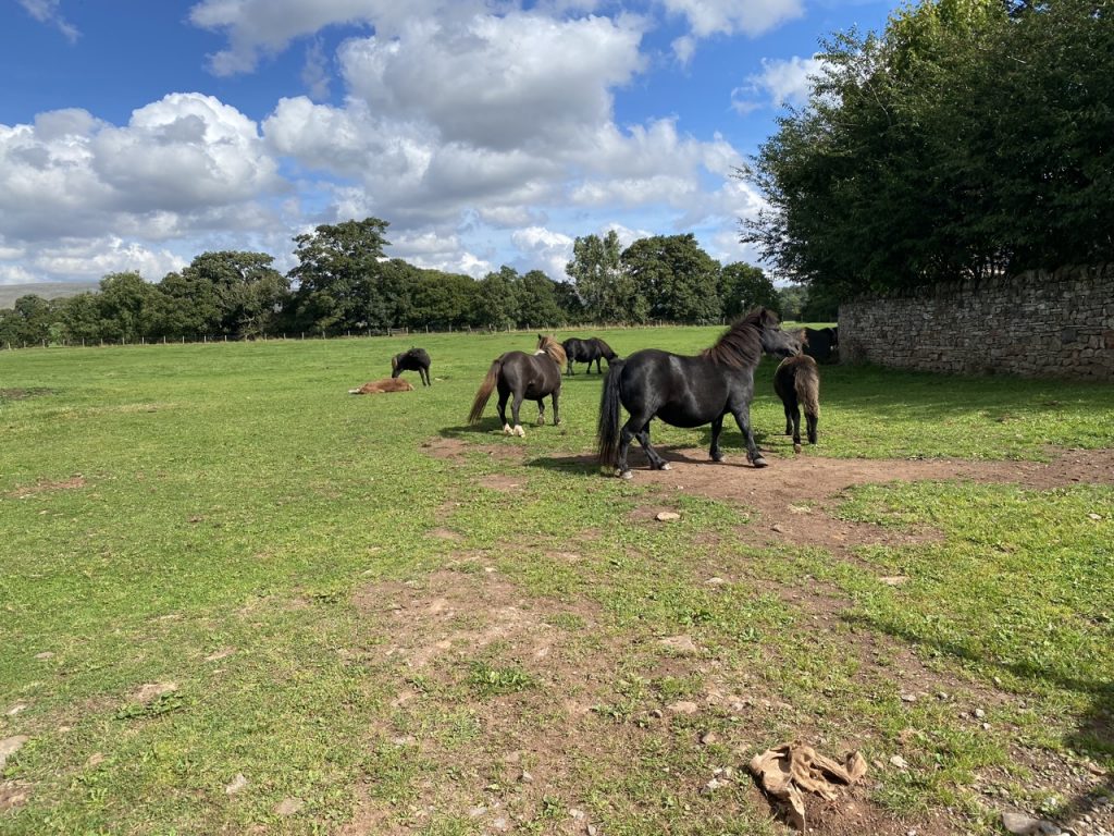
It was then a short 15 minute stroll along the lane, past ponies, apple trees in fruit and a GR post box. One large house even had a lych-gate into its garden. We saw why when we read the sign at the drive, “Wedding Venue”. Little Musgrave is a tiny place but it does have its own defibrillator (on the same wall as the AA sign). After the village, there is a small green of mown grass with a young oak tree, and …just what we needed for lunch…a bench.
Little Musgrave to New Bridge
The Eden Way route leaves Swillings Lane where we had stopped for lunch. It heads down a sunken path to a kissing gate and back to the river a little downstream of the old weir and Musgrave Bridge.
A large stone on the bank has a plaque facing the river. “In loving memory of Raymond Harker, Musgrave Hall died 31st December 2012 aged 89. Sadly Missed.”
At the dismantled railway we prepared to “pick best path you can through the woods” as suggested by the guidebook. Perhaps things have changed since the guide was written but we were unable to find a way through. A steep bank overgrown with brambles, dense stands of nettles and lashings of barbed wire put paid to that. Instead, we walked along the dismantled railway (overgrown but passable) and got out onto Swillings Lane near where it meets the B6259.
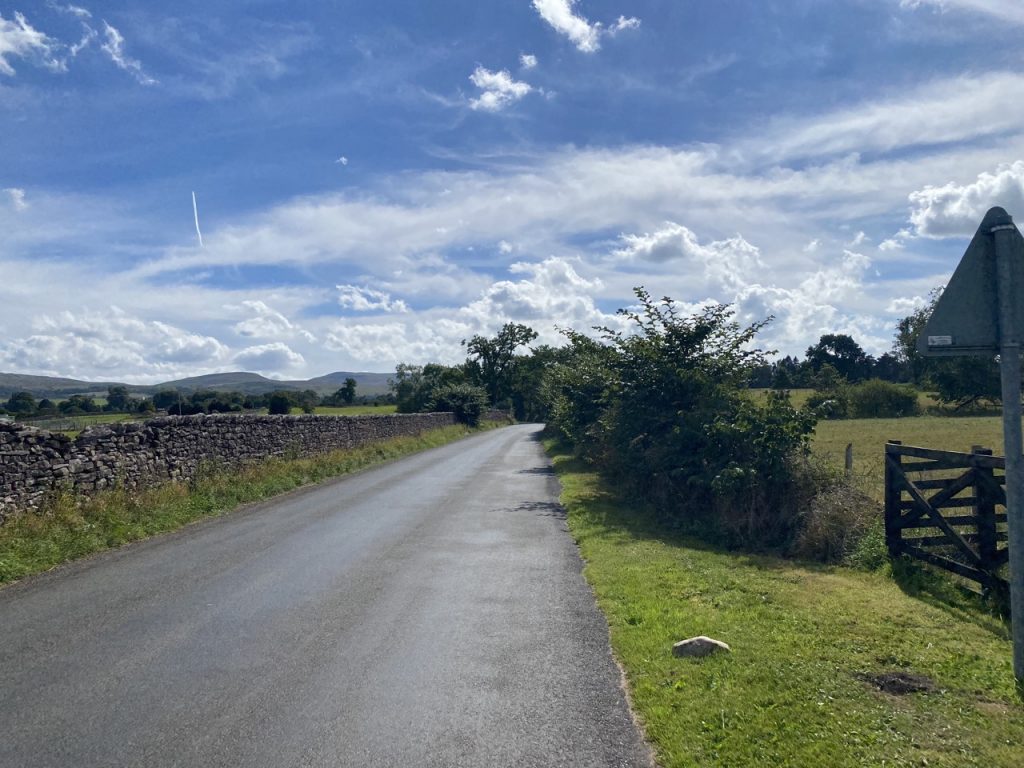
From there we had two and a quarter miles of road-walking ahead of us. I wan’t looking forward to it, but it wasn’t too bad. The day was growing quite warm but we were shaded by the hedgerows and there wasn’t much in the way of traffic. Blandswath Bridge, Dalehouse Lane and then Eastfield Bridge were the quarter, halfway and three quarter way points of our walk along Appleby Road and I ticked them off mentally as we passed them. The last quarter seemed the longest. I don’t remember seeing much to mention along the way: a heron taking flight, some farms, a couple of grand looking houses, a gatehouse built in 1895 and a sewage farm. It felt good to get back to the river as we approached the junction with the A685.
New Bridge to Kirkby Stephen
I had planned to have a rest and rehydration stop at New Bridge, but the A685 was pretty busy so we walked on and had our break by the river, shaded by trees and away from the cars. The Eden was now noticeably smaller.
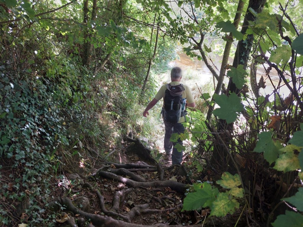
It was a pleasant walk along the riverbank, the air warm but shaded from direct sunlight, and a slightly cooling breeze. A wee bridge took us over Hartley Beck and to the Kirkby Stephen cricket ground. Past that was our way into Kirkby Stephen, Frank’s Bridge.
This seventeenth century stone footbridge was originally part of a ‘corpse lane’, used to bring coffins to St Stephen’s church. There are stones at the end of the bridge where coffins could be rested.
It is said to be named after Frank Birbeck, a local whose brewery stood beside the bridge in the nineteenth century. I wonder if it was named after the place, Frank’s brewery rather than the person, ” The Bridge at Frank’s Brewery” becoming “Frank’s Bridge”, but who knows.
Kirkby Stephen to Stenkrith
Kirkby Stephen was bustling. All its cafes were brimming full, too full for us and the dogs, so we strolled along the main street taking in the sights. There is a statue of Lady Anne Clifford, looking intense, and a little further on, an unnamed figurine surveyed the world from the Temperance Hall.
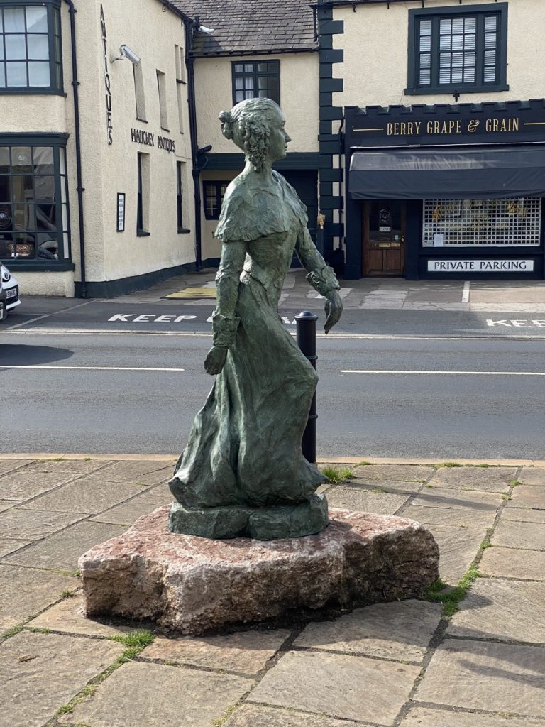
Lady Anne Clifford, Countess of Dorset, Pembroke and Montgomery, 14th Baroness de Clifford and High Sheriff of Westmorland was born at Skipton Castle in 1590, the only surviving child of the Duke of Cumberland when he died. Her father had willed his lands to his brother, who also inherited the title but Anne argued that the family estates had been granted by Edward II under absolute primogeniture, in which sex is irrelevant for inheritance – the oldest surviving child inherits without regard to sex. As wife first of the Earl of Dorset and then the Earl of Pembroke, she lived far from the lands she considered her own but continued to press her case for their return in the courts.
She was eventually successful, regaining her lands in 1643, but the ongoing Civil War meant she was unable to return north until 1649 . Once back she remained on her northern estates for the remaining 27 years of her life. She was a patron of the arts and a philanthropist but is said to have ruled over her tenants as a benevolent despot. She built almshouses, restored several churches and renovated the family castles (Pendragon, Appleby, Brough and Brougham) that had fallen into disrepair. Anne was known to be a staunch Royalist so rebuilding castles did not go unnoticed. When it was suggested to Oliver Cromwell that he should stop her, he is said to have replied: ‘Let her build what she will, she shall not be hindered by me.’ He knew that she had no soldiers, and without them her castles would not be a threat.
The statue, installed in 2020, entitled Lady Anne’s Way is by a local artist Diane Lawrenson. It stands on the route she would have taken walking between Pendragon Castle and Brough Castle. It is actually a couple of hundred metres off the modern Lady Anne’s Way, a long distance walking trail, but I’m sure those walking that trail will be tempted to visit her statue.
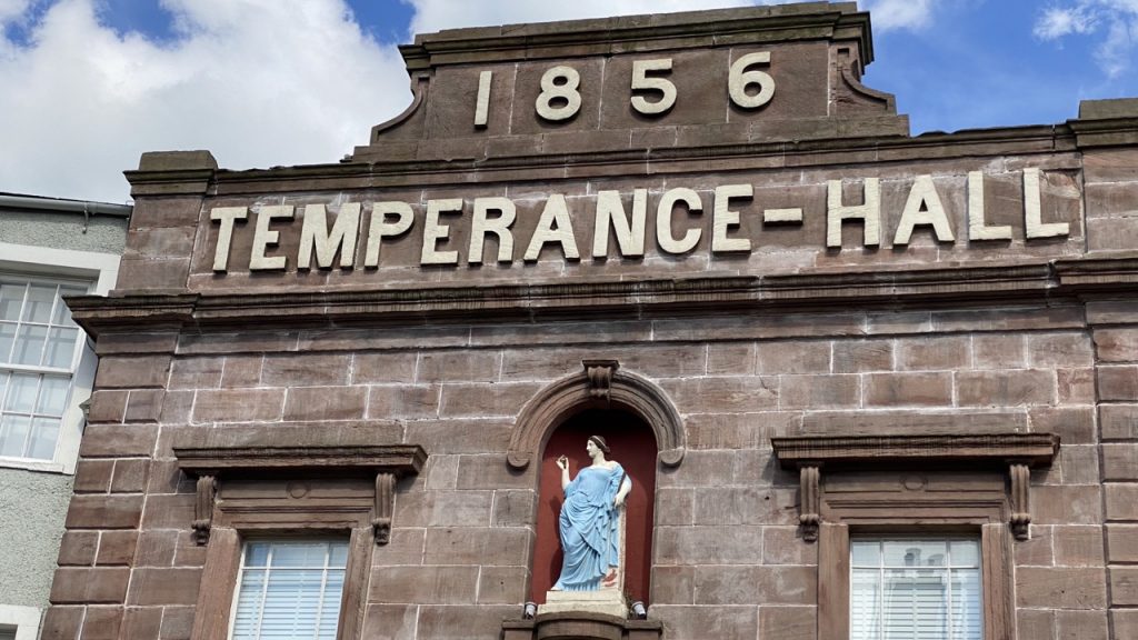
After the centre of Kirkby Stephen we turned onto Nateby Road in an area once known as Saur Pow, sour water. It is where the local tannery once discharged its effluent but it’s all fragrant now, the tannery long gone, a Temperance Hall in its place.
Kirkby Stephen’s had one of the country’s earliest temperance halls. It originally faced a brewery and had its work cut out luring the populace away from the town’s seventeen pubs. Its figurine of “Temperance” didn’t strike me as particularly demure. I presumed the ‘cigar’ in her hand had originally been the handle of something or other (perhaps a mirror), and went looking for what it might have been.
In classical iconography, Temperance is usually depicted as a woman holding two vessels, transferring water from one to another. Perhaps diluting wine with water.
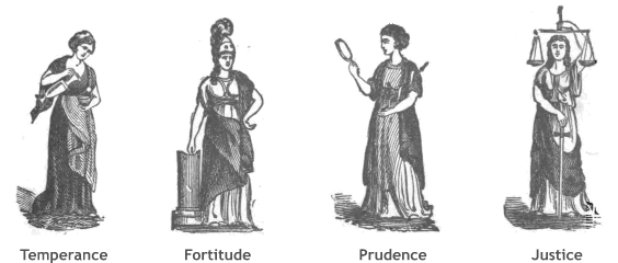
I think the statue on the Hall is not Temperance, but Prudence who typically holds a mirror in her right hand signifying self-knowledge and a serpent in her left (sometimes entwined about a rod) signifying self-control.
We left Prudence (capital P) behind and trudged along the pavement of Nateby Road, baking in the afternoon sun. The Eden Way leaves the road immediately after Bollam Cottage B&B, on a gravel track. It could easily be mistaken for a house drive but a fingerpost confirms it is a public path. But the post isn’t visible until you stand on the gravel and look back.
The track goes down to Swingy Bridge but the Eden Way leaves when the track bends left. There is a gate at the bend and beyond it a path of mown grass leads back to the riverside.
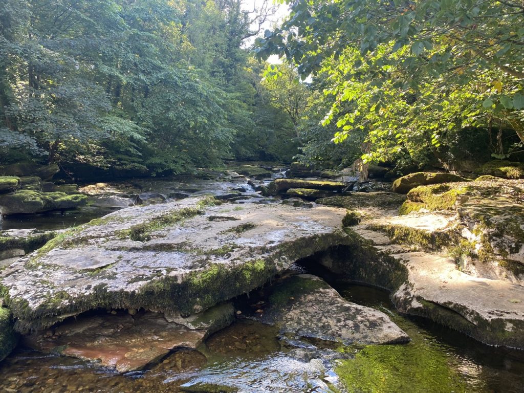
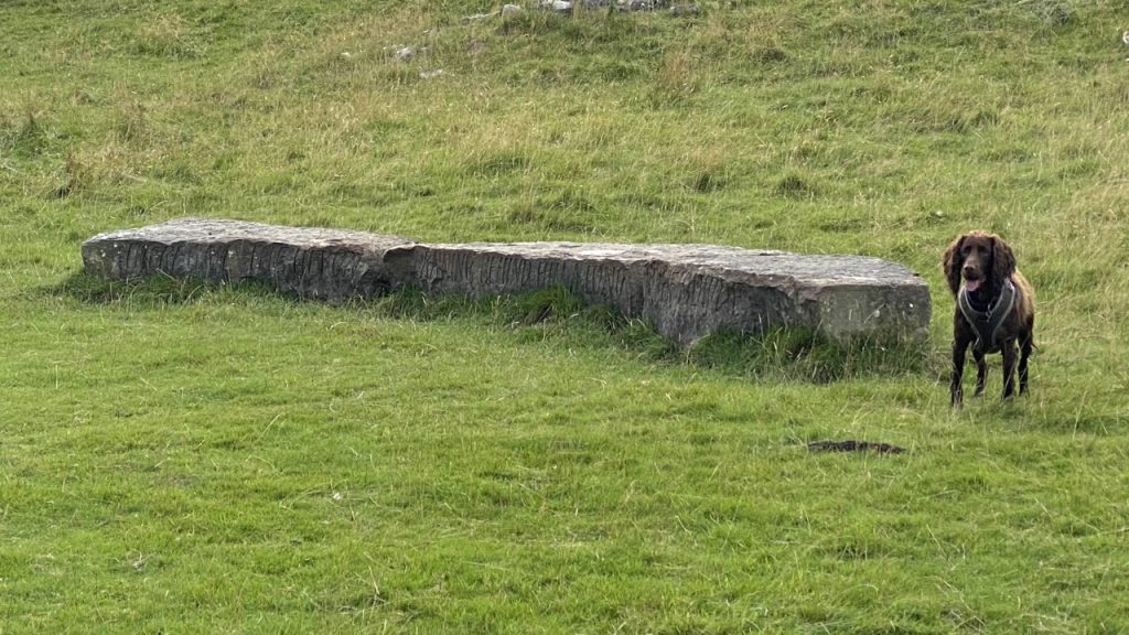
Stenkrith Park was the final leg of this section, a short woodland walk with welcome shade. The river here is often described as having spectacular rapids and whirlpools but the water was low so for us it was a gentle flow around water carved rocks.
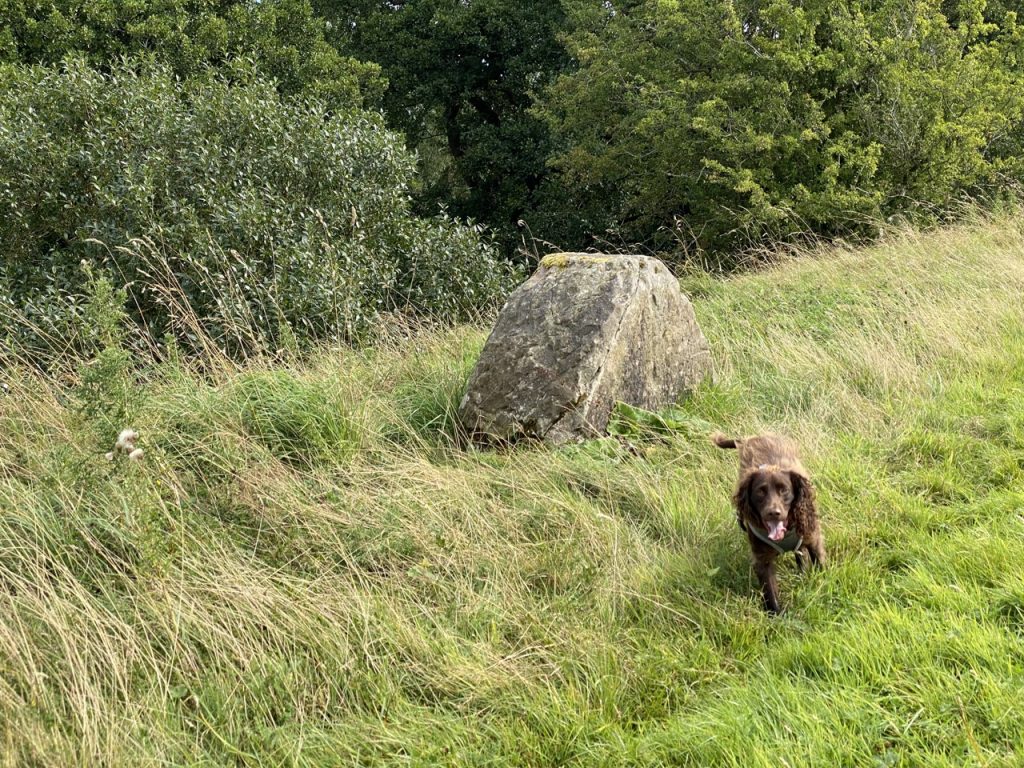
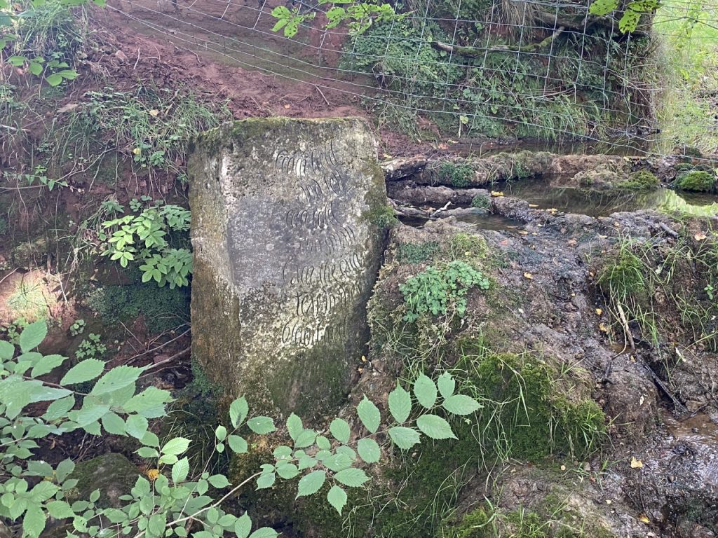
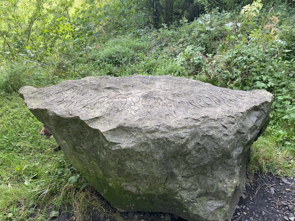
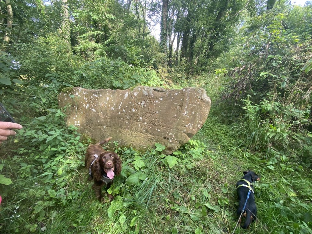
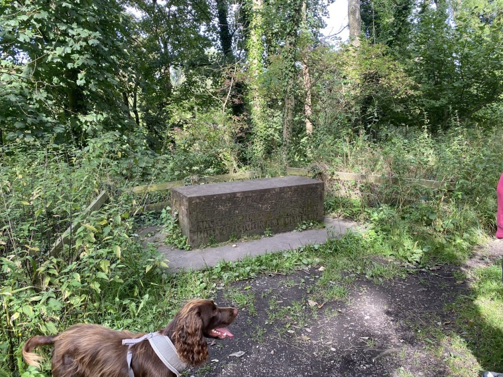
We walked by two sets of the Poetry Path stones (see Poetry Path description below) but we were mainly on the lookout for the Eden Benchmark, “Passage” by Laura White.
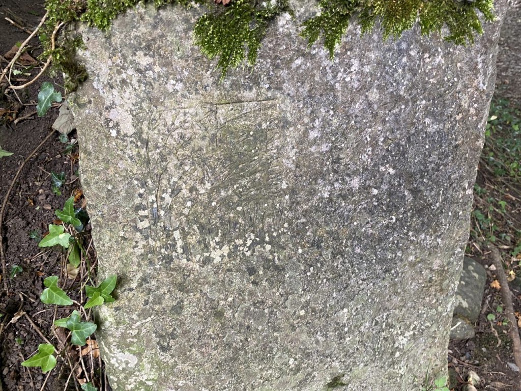
Evocative of the river’s passage through the gorge under Stenkrith Bridge, this sculpture is subtle and unobtrusive but exudes an inner strength that somehow gathers the special ambience of its location. The shapes carved into the stone are clearly derived from the shapes in the river bed rocks but have been refined to activate and compliment the space and provide a focal point for contemplation.
Eden Benchmark website
It is definitely unobtrusive. We couldn’t find it.
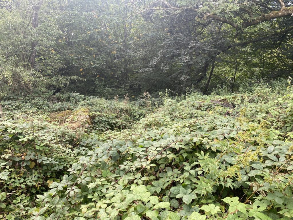
We searched. We went to the OS Map reference, NY 774 075, given on the official website. It wasn’t there – which I found particularly irritating. We searched some more and began to wonder if the stones had perhaps been removed. The guidebook says that this benchmark is the most difficult to find but did give us a clue as to where to look. It suggested starting near a pair of benches and looking for a path towards the river. There was no path, just a mass of brambles but we pretended there was a path.
The Eden Benchmark website has a photo of the stones when they were installed. They are sitting on short grass.
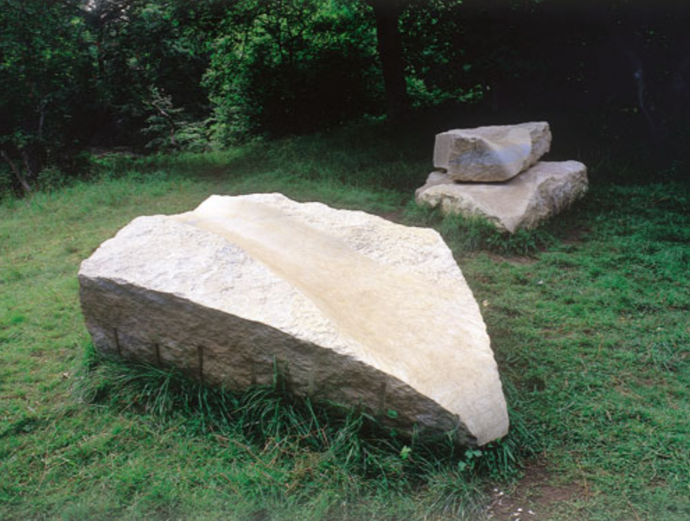
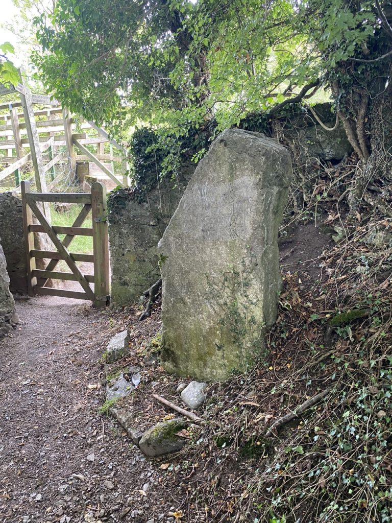
They now sit in a mass of brambles, almost completely covered. Indeed, when I reached them I wasn’t even though sure it was them rather than a couple of random boulders. The arrow shaped sculpture had begun to crumble but its carved channel was still distinct.
My first thought was that it is a great shame that this piece is being lost. I thought that a small sign at the path with a pointer and the word “Passage” or perhaps “Benchmark” would entice the curious to walk that way and so keep a path open. But I have slept on it and changed my mind. I think the ‘benchmark’ is the stones and their surroundings. They should stay as they are. Inconspicuous but not lost.
With Passage found and the day’s section of the Eden Way done we headed for the car, which for once it was parked nearby. The Northern Viaducts Trust Car Park is only 50m from the Eden Way. The dogs had some cold water and a sit down. We had a few minutes rest and finished our coffee. Then we headed for the poetry walk.
Poetry Path
I suppose this was our post walk warm down. We had dumped our rucksacks in the car and it was amazing how much easier it was walking without them. Mabel looked to have gone into full rest mode while we were at the car, so I carried her at first. But that lasted about five minutes. Her curiosity got the better of her and she was soon trotting along beside us. A hound just can’t sniff things properly while being carried.
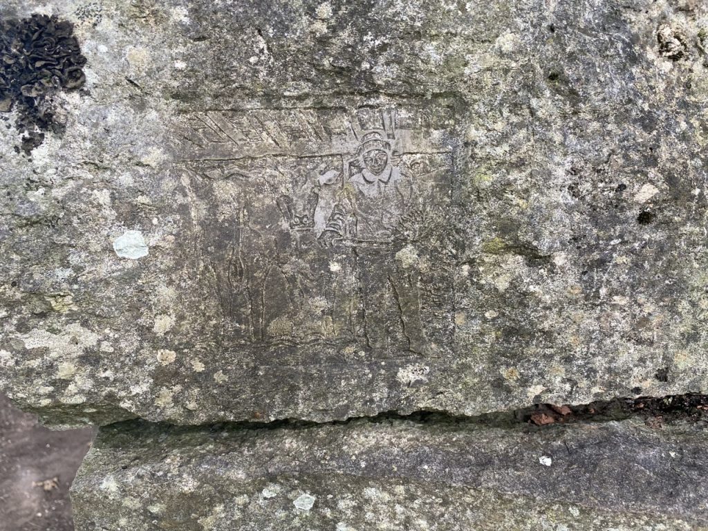
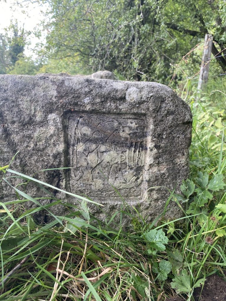
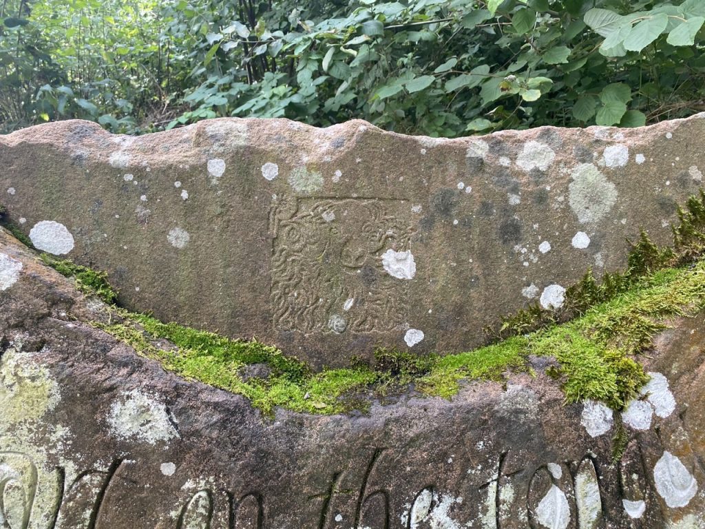
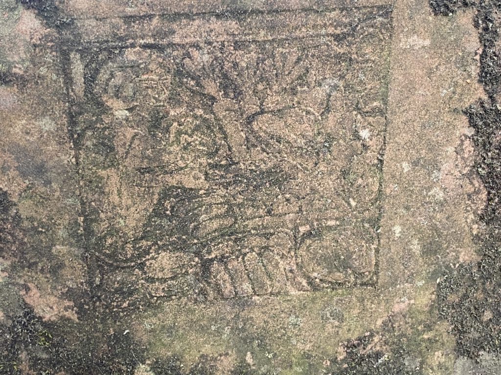
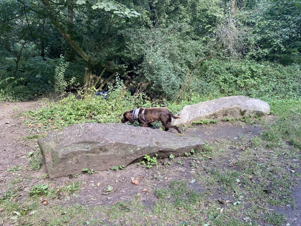
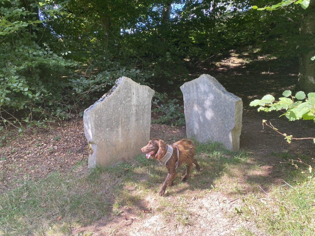
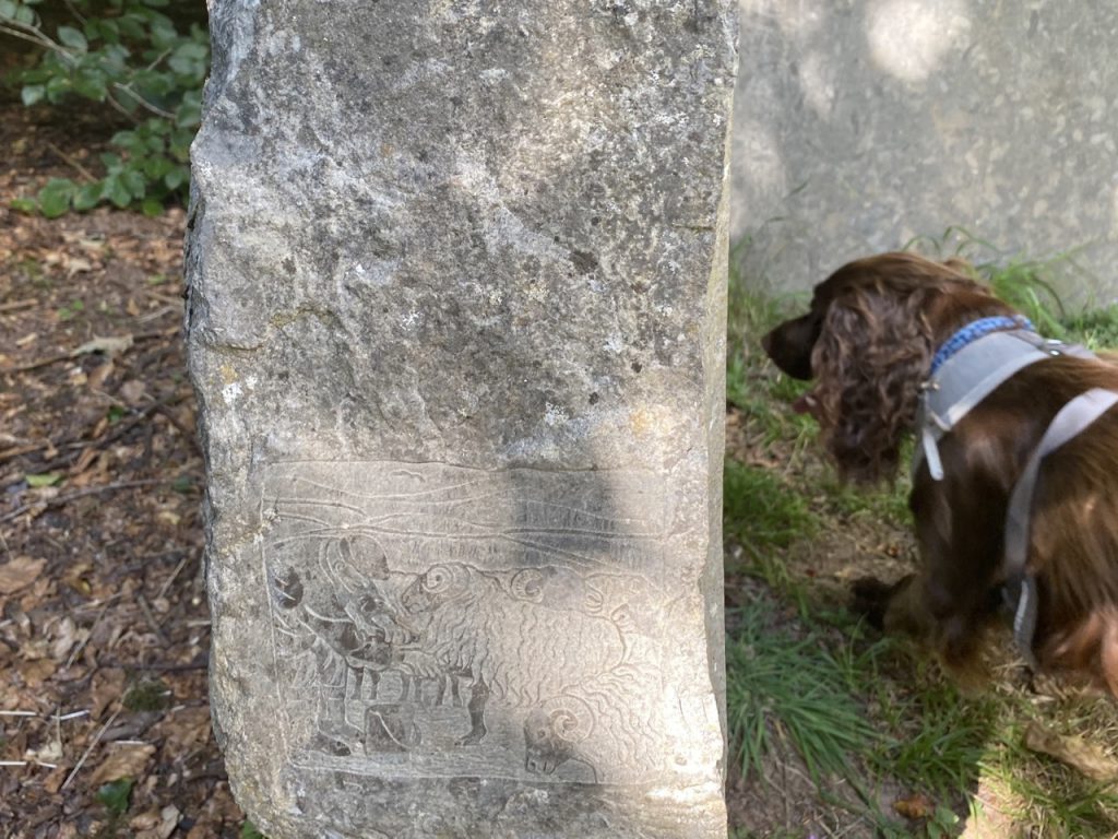
The Poetry Path is only a little over a mile long, there are no stiles and it is all on reasonable paths. Themed ‘A year in the life of a hill farmer’, it is the work of poet Meg Peacocke, lettering artist Pip Hall (she of the Eden Way’s ceramic tiles) and master craftsman Steve Allen (a World Champion Dry Stone Waller). It features a series of poems carved into stones placed beside the path and accompanying carvings which depict aspects of a hill farmer’s year – hedge-laying, walling, lambing, shearing, haymaking, tupping, etc.
The trail officially starts is at Swingy Bridge and walking clockwise passes the carvings in month order. We joined the trail near the ‘September’ carvings and went anti-clockwise, taking the carvings in reverse order. A tarmac path beneath mature trees, runs along the old railway line. There is then a section along the ancient ‘hollow way’, the original path between Kirkby Stephen and Nateby and now part of the Pennine Journey long distance route. We crossed the Eden at Swingy Bridge, which being a fixed wooden footbridge does not live up to its name. Perhaps its predecessor did. Our return leg was then along a mown riverside path to the woods of Stenkrith Park where we had searched for the Eden Benchmark earlier in the day.
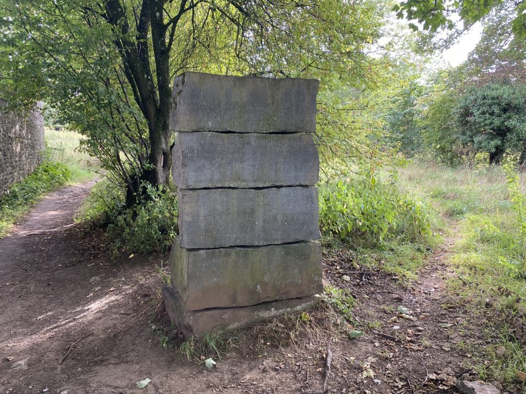
We found eleven of the poems, somehow missing “May”. Most are by the path, except “March” which sits in a small beck and “January”, which we might have missed it being on the other side of a kissing gate. The carved words of the poems were often difficult to read due to a combination of lichen growth and dappled light, but with a little effort they were legible. They were much more easily read from my photographs than they were when I stood beside them. We were less successful with the picture carvings, finding only six of them. And those we did find were often quite indistinct.
Here are the poems and picture carvings…
JANUARY (next to Swingy Bridge)
The sky’s harsh crystal
wind a blade, trees stripped
grass dull with cold. Life
is a kernel hidden
in the stone of winter
Carving – Hedge Laying
FEBRUARY (by an old barn)
Snowlight peers at the byre door
Neither day nor night
Four months ago we fetched the cattle in,
safe from reiving wind and rain
months of standing and shifting, burdened
with patience. When will winter end?Thin strakes of sun on the byre floor
Fork a load of silage out
straighten your back to watch them shove
their muzzles in, and wonder if they crave
the hazy nights when they can roam
among tall summer grasses, sleek and sound and warm.
Carving – Cattle Brought in for the Winter
MARCH (in a beck, picture taken from the bridge)
From field
and fell
run cold
run small.
I am the rain
tear in the eye
blood in the vein
I am the sea.
Carving – Walling (we didn’t find it)
APRIL (in a wall by the path)
Coltsfoot, celandine, earliest daisies
Twin lambs race to the mother baby cries
Mam! Mam! Jolt out of them and now
they jostle the ragged ewe
boosting each split hoof
high off the bitten turf
Pinching jaws and hard curled coats
are braced against these April suns and sleets.
Carving – Lambing Time (we didn’t find it)
MAY (we didn’t find this one)
Carving – Gathering and Marking Sheep (we didn’t find it)
JUNE (near the footbridge over the disused railway)
Light drops like honey from branch to branch. Elders
balance their dishes of cream
while fledgelings try small quivery leaps, testing
the buoyancy of the air.
Carving – Clipping and Shearing
JULY (by the railway track)
Silage. Tractor incises the first
green furrow. Skillful geometrician
the driver judges an arc of weather.
Carving – Haymaking and Silage (we didn’t find it)
AUGUST (by the railway track)
Crabapples tart on the tongue
Hazelnuts milky
Rosehips cool in the hand
Thistledown silky
Squirrel is speaking his mind
Flatweed pimples the banks
For touch, taste, smell, sight, hearing,
give thanks
Carving – Showing Sheep at Shows
SEPTEMBER (by the railway track)
Revetted banks, a concrete post.
Rabbits tunnel the cinder waste.
Angle iron, link of a broken chain.
Listen, and catch the hiss of steam again.
Carving – Farmer’s Markets
OCTOBER (in Stenkrith Park)
Sandstone. A desert wind, grain
by grain, laid down these rocks. How did we trace
a path through ancient dunes?
Limestone. A million million
blanched and compacted shells. How did we swim
through the drift and not perish?
Carving – Sheep Sales (we didn’t find it)
NOVEMBER (in Stenkrith Park)
Through hazels and alders, softly or in spate,
Eden moves in the valley it has hallowed
from Mallerstang to the shifting Solway sands
Long may the dipper be regent here, piping
the full reach of his ground, the only monarch
kingfisher, turquoise jewel, arrowy at dusk
Carving – Tupping Time
DECEMBER (by the river, south of Swingy Bridge)
There sails the heron drawing behind him a long wake of solitude
Carving – Tree Planting (we didn’t find it)
[sgpx gpx=https://www.screel.co.uk/walks/wp-content/uploads/2022/09/RK_gpx-_2022-09-05_1033.gpx]
[sgpx gpx=https://www.screel.co.uk/walks/wp-content/uploads/2022/09/RK_gpx-_2022-09-05_1524.gpx]
