
That doesn’t sound particularly promising, does it? But I enjoyed it. The old adage is that good sailors are not made by smooth seas. And the philosophers suggest that enjoyment is perhaps heightened with a wee dash of adversity thrown into the mix. Certainly, the pain of the latter does seem to fade as the memory of the former blooms.
Our plan had been to continue southwards from the end of the Eden Way at Garsdale, to hook up with the Dales Way, which would carry us through the Dales. But we were dealt a middling hand at the outset, and what cards I had, I played poorly. And to cap it all I had developed a troublesome C5/6 radicular pain. That said: I now know where to find my car’s towing hook; I had a steak and ale pie that will be the one by which all others will be measured; Storm Babet kicked our plans in to touch but made the waterfalls impressive; we saw Swaledale sheep in Swaledale; walked in Wensleydale and ate Wensleydale cheese; crossed moor and dale in sunshine and mist; all while walking parts of the Dales Way, Ribble Way, Three Peaks trail, Pennine Journey, Pennine Way and Pennine Bridleway.
Day 1: Garsdale Station to Gearstones
9.15 miles 4h 54m ascent 337m
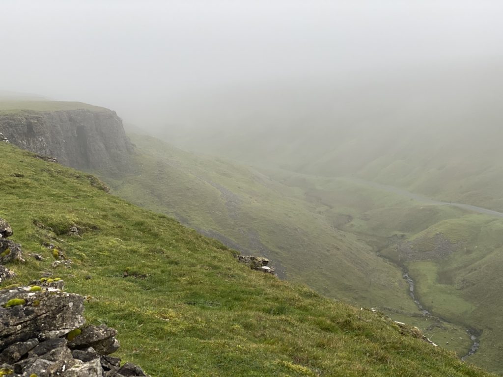
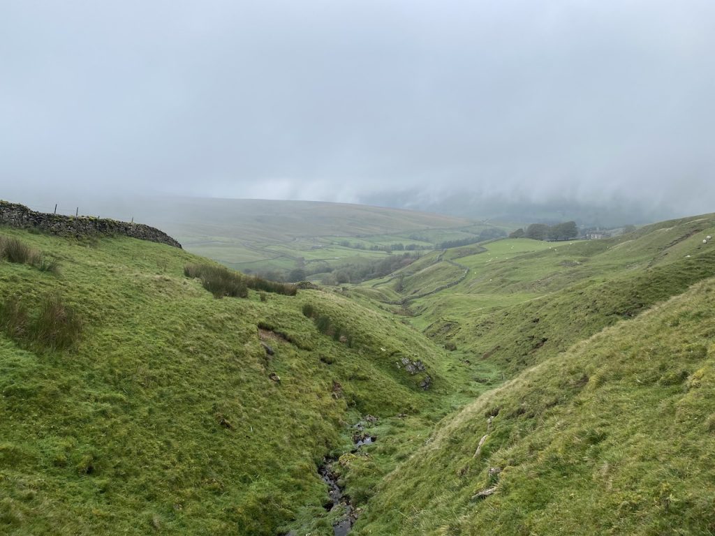
The idea was to pick up from the end of our Eden Way walk at Garsdale Station and walk south to join the Dales Way. The first mile or so was a steep(ish) walk up the single track road to Cowgill Head. With better weather we would have been afforded views into the Mallerstang and Ure valleys but instead we walked into low cloud.
It was a bit chilly but with the climb we soon warmed up. The road is part of the Pennine Bridleway, something we would meet again over the next few days.
By the time we were above 500m, we were well into the clouds and what had been the occasional raindrops became more persistent and heavier rain. By the time we reached Cowgill Beck we had to stop and don foul weather gear. [edit: auto-correct really doesn’t like “Cowgill”, preferring “Cowgirl” – not a word I have much cause to use.]
The OS map names this route “Galloway Gate” and this possible reasons for this were one our our topics of discussion as we trod the tarmac (or stepped aside to allow the TESCO van to pass). “Gate” is easy enough. Both of us grew up where old roads were named gate, from the old norse word, Gata. But what did Galloway have to do with it? The stone dykes beside the road were not Galloway Dykes. So was this a road to Galloway? Once the bridleway left the road it looked very much a drove road with stone dykes either side. Some internet sites claim it was an ancient route to Galloway- but it seemed unlikely. A little more googling has uncovered another possibility.
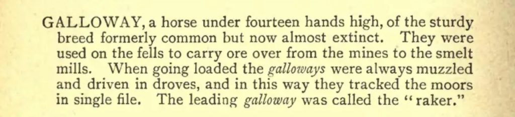
They were said to have “good looks, a wide, deep chest and a tendency to pace rather than trot.” Though originally bred in Galloway, they were used across Scotland and Northern England. They were certainly being used in Swaledale in the 18th century. The word “galloway”, for a horse (1584), is older in print than “pony” (1659). The breed must have been known in London in 1597 since Shakespeare mentions them Henry IV. “Thrust him down stairs! know we not Galloway nags?”. For more information click on Galloways and Fell Galloways as native utility horses.
The OS map shows several disused coal pits on Cowgill Head and where the road turns down towards Dent it is called the Coal Road. So I suspect that the road’s name reflects its use by Galloway fell ponies carrying coal.
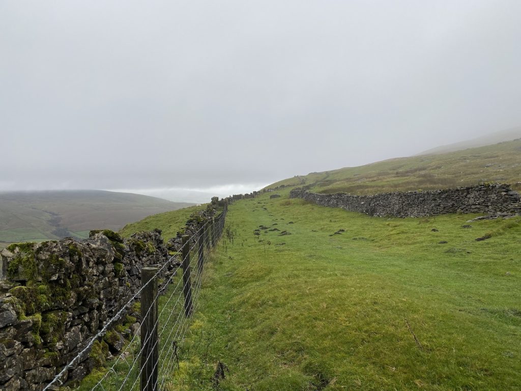
Anyway, back to the walk. I didn’t take any photos on Cowgill Head what with the rain. But it was typical moorland, with stone dykes in the middle of nowhere and scattered shake-holes to remind us that we were in limestone country. There were sheep scattered about and I even spotted a rabbit. Definitely not a hare.
The modern road turns down towards Lea Year while the bridleway leaves the tarmac for a walled grassy path reminiscent of a drove road. This junction is labelled Monkey Corner in the Dales’s Way book. Presumably from the nearby Monkey Beck. I read that ‘monkey’ was a local term for a hare but I can’t find any explanation for this. As an aside, my ‘researches’ turned up the term “a monkey’s birthday” meaning simultaneous rain and sunshine.
The climbing had eased by here and we mostly continued along the 500m contour. The Dales Way book we had showed one of its alternate routes coming up the Coal Road form Dent to Monkey Shoulder so that was where we joined the Dales Way, two and a half miles into our walk.
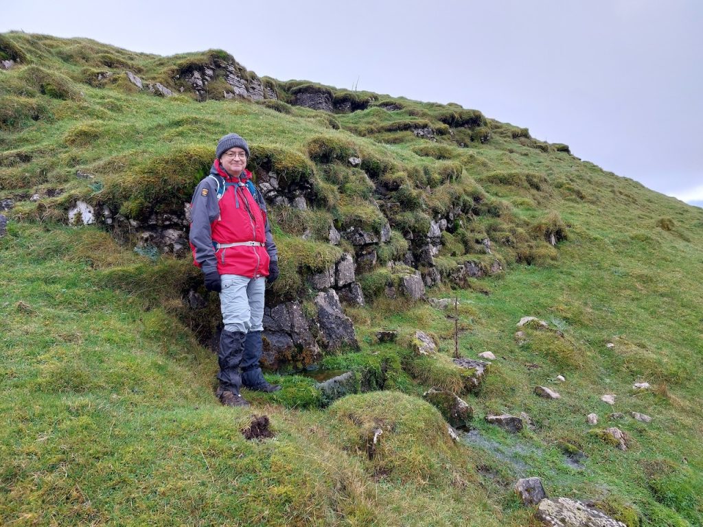
Artengill Beck was a bit of a dip but before the drove road turned to cross it there were several boulders. These looked as if they might have been placed to dissuade vehicles from entering the track but they were probably here long before the drove road. They were probably before the moorland, never mind the drove road. But we put them to use as seats for lunch, the walls giving us a little shelter.
Our route then took us across Artengill Beck, which was trickling over its combined bridge/paved ford. The track took us over the eastern shoulder of Wold Fell, another of those twice named hills, a wold being a flattish hill. Visibility remained poor but we did see some limestone outcrops and occasional glimpses of more distant dales, where the sun was shining. As the week wore on I had cause to wonder if the is a word to describe “being in a dull overcast place but able to see sunlit slopes a couple of miles away”.
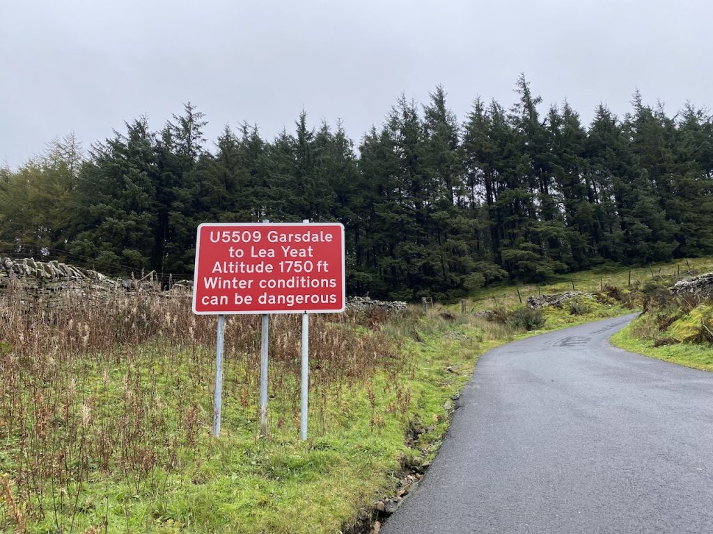
This brought us to what i was calling “Newby Head Road”, but as I would later find is the “Dent Road”. It was strangely pristine with what looked like 20 cm of pretty new tarmac. Not a pot hole to be seen. I didn’t know it but I would be back.
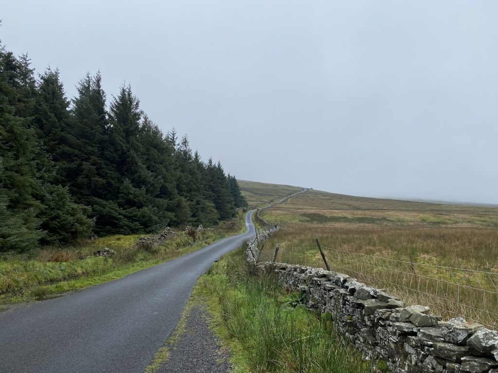
We trudged up the fine tarmac for half a kilometre to pick up the Black Rake Road, a public bridleway unsuitable for vehicles according to the sign – no shit, Sherlock. Other signs told us that we were now walking both the Ribble Way and the Dales Way and that the bridleway led to the B6255 (one and three quarter miles away). A rather dilapidated caravan sat just along the track suggesting that workmen had been here but why we could not tell.
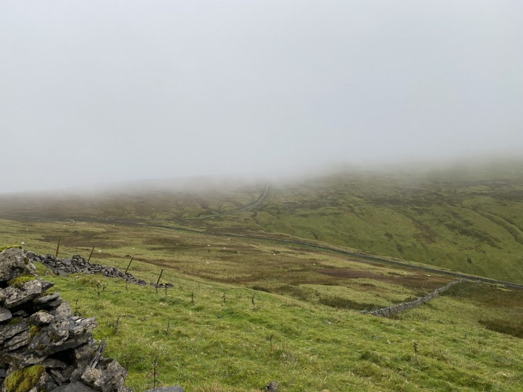
The rain had stopped by now, and we even occasionally had a minute or two of sunshine. But the fates, having drenched us from above, now turned their attention to wetting our feet. The Dent road marked a noticeable change in terrain. I suspect Blea Moor sits on granite rather than limestone. It was much more like the sodden Galloway uplands we know and love. Water doesn’t easily drain away and there was even a lochan (sorry, tarn). We spotted a couple of grouse butts but the only bird we saw looked more like a pheasant.
This was once the main route between Dent and the Turnpike (now the B6255) and older maps show the Black Rake Road as the Old Raky Road. “Rake” comes from the Old Norse, rák, meaning a track or path but has come to mean a rough path in hilly landscape. It is now sometimes applied the pasture ground reached by such a path . Why it has been named “Black” I don’t know.
We trudged on. We might have had muddy boots but there wasn’t far to go. What we didn’t know was that in 1795 a new road had been constructed, joining the Old Raky at High Gayle with the Turnpike (B6255) near Intack. Following this the Black Rake Road between High Gayle and Gearstones had been abandoned/not maintained. You would be surprised how much of a difference that has made.
Between High Gayle and Winshaw the Black Rake Road is lost. A narrow walked track winds its way over the boogy moorland, dipping down and up and leaving you to cross several small streams. During one descent the mud got the better of Audrey, who underwent a sudden non-volitional positional adjustment.
A dose of morale booster had to be dispensed before we could continue (and jump a stream).
The house at Winshaw got us back on a vehicle track and it wasn’t long before we could see the car.
A great time was had by all. My coffee had remained hot in its flask. We had found a seat for lunch. And we had walked from the Eden Way to the Dales Way.
[sgpx gpx=https://www.screel.co.uk/walks/wp-content/uploads/2023/11/RK_gpx-_2023-10-19_1032.gpx]
Day 2: Babet and the Amber Rain
Whitfield Gill and Mill Gill Force
4.08 miles 2h 28m ascent 170m
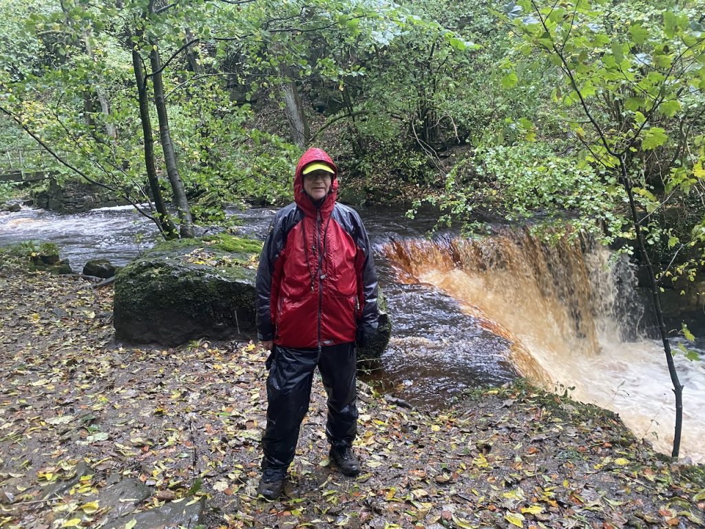
A woman named Babet visited the Koninklijk Nederlands Meteorologisch Instituut during an open day and found they were asking for help naming storms. Since she had been born during a storm she put her own name forward. Well. Storm Babet arrived on our second day with an amber warning for heavy rain.
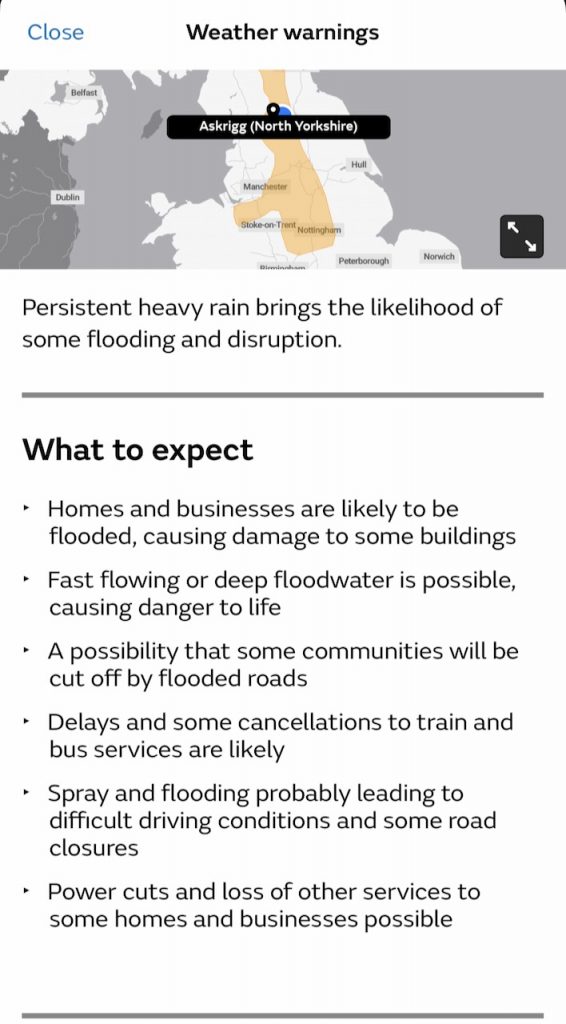

Our planned outing for the day would have involved driving quite a few miles on low lying roads while the walk route crossed several becks, some at fords. This sounded a little reckless with a severe weather warning, so we consulted the internet and found a short local walk. Up to the waterfalls on Whitfield Gill.
We took a footpath over the fields to Newbiggin then a minor road that looped around Horrabank farm. This brought us to the beginning of Low Straight Lane, which the OS describes as a track. Actually most other sources spell it “Straits” but to be fair both it and the nearby High Straits Lane are both Roman Road straight. The “s” at the end makes me think that straits is the correct spelling.
The Lane was flooded in several places, the swollen becks overflowing, but one had a bridge, and the others were easily crossed.

We followed the track until we were close to Whitfield Gill Force and signs indicated a way to the waterfall. There was no obvious footpath, so we made our way through the undergrowth until we found something resembling a footpath.
“Do you think this is the footpath?” “It could be”. It ran high above the stream and just a little downstream of the larger waterfall. There were lots of fallen branches blocking the path and muddy slippery slopes once it turned downhill.
The larger waterfall was mostly hidden behind trees. We might have had better views if we had left the path but that didn’t seem particularly safe. The path took us down to a footbridge and over the stream.

The path had been a tad tricky at first but as we got closer to Askrigg it improved significantly. Our only real problem came when we reached the beck with stepping stones and found them submerged. I was weighing up wading through against trudging over the fields to Helm. Audrey refused the first option. So we set off following the beck upstream. Luckily it became much smaller very quickly and we were able to stopover it and get back down to the footpath in less than ten minutes.
There were several smaller waterfalls to admire (and photograph) further downstream. We only met one other couple out walking. They were heading for Helm and since we had passed a sign for Helm we were able to point them in the right direction.

A signpost guided us to Mill Gill Force, after which we walked back into Askrigg. It had been a very wet day but that meant the waterfalls were roaring.
[sgpx gpx=https://www.screel.co.uk/walks/wp-content/uploads/2023/11/RK_gpx-_2023-10-20_1104.gpx]
Day 3: Finding the Source of the Ribble
4.73 miles 2h 20m ascent 187m
It was a poor start to the day. I managed to get the car stuck in the mud when parking up, and all my attempts at getting it back on firm ground failed. The sunken wheel was not so much stuck as taking the weight off the other wheels. We had no phone signal but were very lucky to find a very helpful farmer who got my car back on the road. I’ve since gone out and bought a tow-rope to keep in the car.
I forget which route we had planned for the day, but after the hassle with the car we decided I needed an easier day. So Plan B: Walk up the Ribble Way to the source and come back the same way.
This was a straightforward moorland walk. On a vehicle track to begin with then a discernible track over the moor. There were a couple of becks to ford but despite the recent storm these weren’t to much trouble.
[sgpx gpx=https://www.screel.co.uk/walks/wp-content/uploads/2023/11/RK_gpx-_2023-10-21_1138.gpx]
Day 4: Gearstones to Horton – Ribble Way
Ribble Way, a bit of the Three Peaks Trail (a very wee bit), some Pennine Way and limestone scars.
6.4 miles 3h 40m ascent 164m
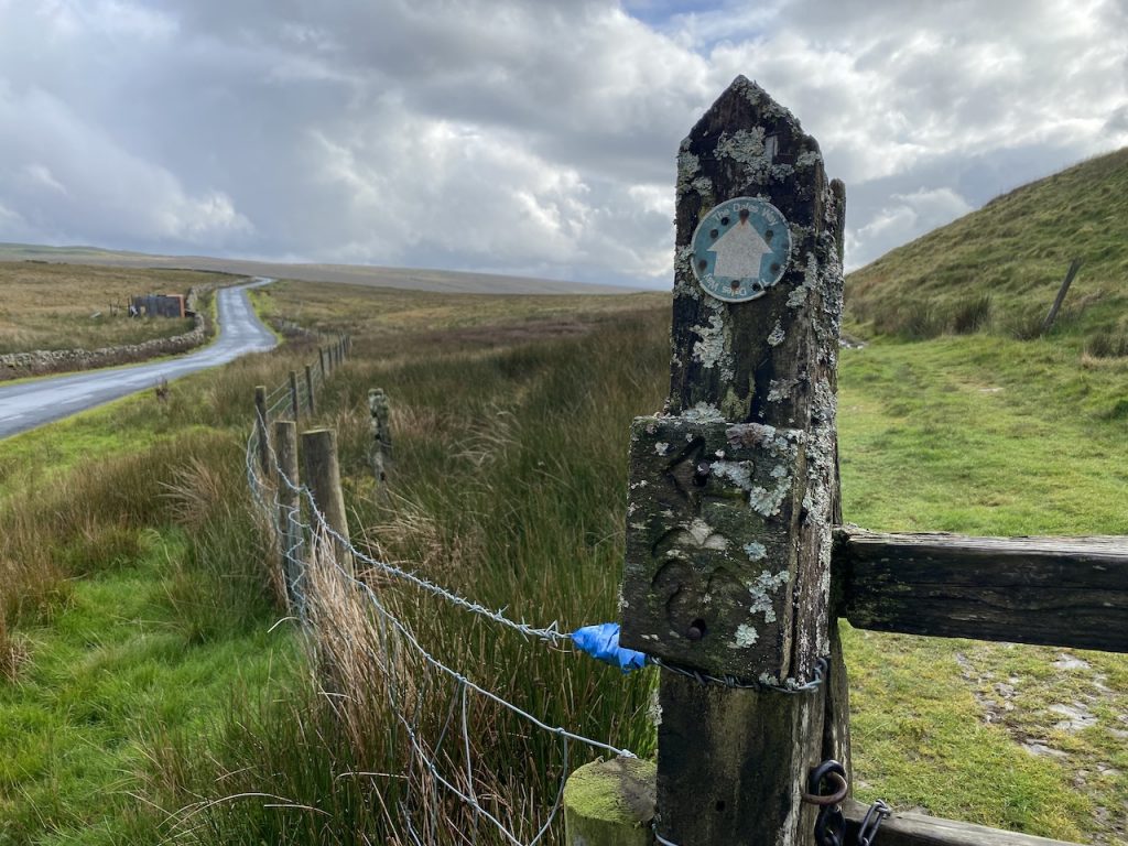
We started the day by dropping off a wee “thank you” to the farmer who had helped us back onto the road the day before. Our previous walks had clocked up the Ribble Way from Gayle Moor to Gearstones, so we decided to continue on with that: Gearstones to Horton-in-Ribblesdale.
The first hour was not easy. Not difficult, but not easy. There are Ribble Way signs at Gearstones Lodge but the route led us to a ford across Gayle Beck. Great for a tractor but less appealing for us. But there was a footbridge a little downstream, but beyond that no visible path.

The ground was soft, boggy and wet. We would occasionally find a track only for it to disappear, presumably since previous walkers had chosen different routes through the marsh grass.


Having trudged through the mire for what seemed an eternity, and while trying to find a way through the bogginess around some ruins, we crossed paths with a group coming the other way. When their tail-end Charlie called out to her friends, “is this the end of the bogginess?”, my heart sank. But as it turned out, we were past the worst of it, while they had a lot more to come.

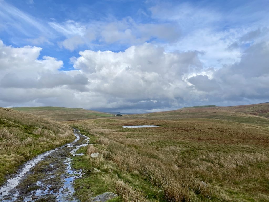
The going became a lot easier when we reached Nether Lodge and joined the Three Peaks Trail: gravel paths, footbridges and clear signs at junctions -that’s the life. Brow Gill Beck has a natural bridge, “God’s Bridge”, where the stream drops through a short natural cave. I hadn’t realised there were so many God’s Bridges until I googled this one.

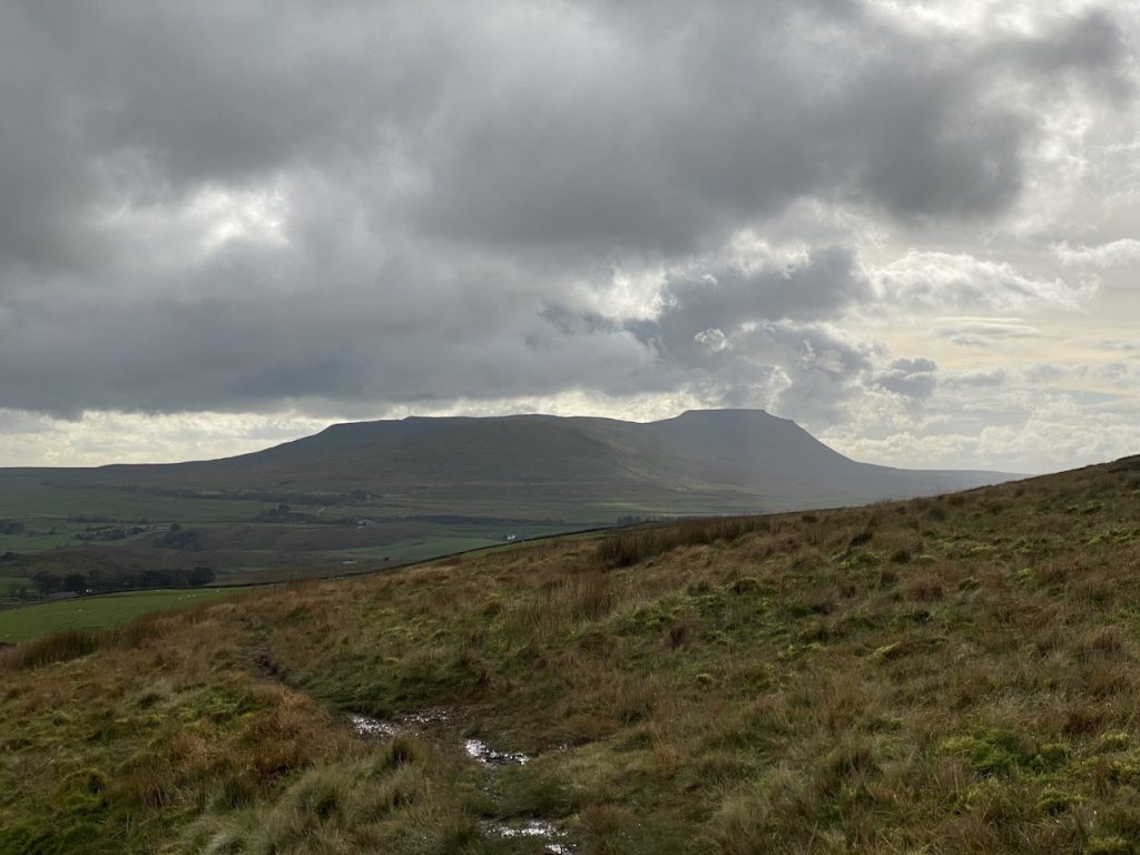
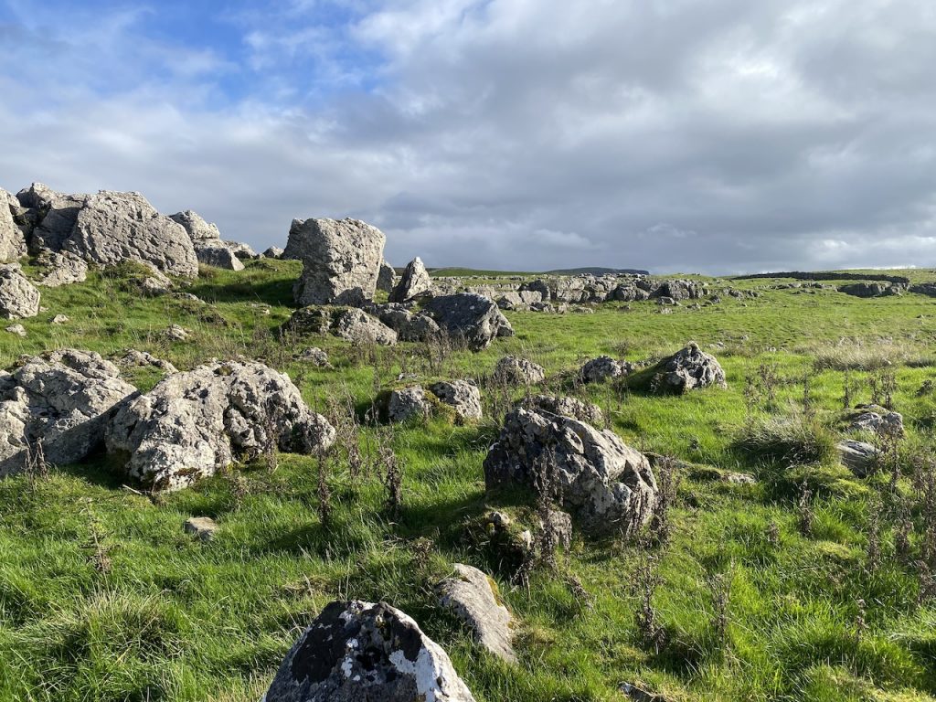
We parted ways with the three peaks trail near High Birkwith,. The Three peaks went SE onto Horton Moor for Pen y Ghent, while we went south over the limestone outcroppings. This was very pleasant walking, the sun on our faces and the limestone shining white.
There was an obvious walked track in the grass but siren like it drew us off course. We went a little higher than we needed to be. There were great views but our track veered off eastwards leaving us looking at a stone wall and the wrong side of a deep gully. An easy mistake since the Ribble Way didn’t have any visible track here. We were only a couple of hundred metres off course though and managed to pick our way back down without resorting to scrambling.

We joined the Pennine Way at the Sell Gill Holes, the beck dropping over 60m into the caverns below. We gazed into the abyss and searched our souls. Neither of us could find any inclination to take up caving.

The last mile or so into Horton was on what looked like an old drove road, now carrying both the Pennine Way and Ribble Way. A little rocky in places and muddy in others but firm ground all the way into Horton. I took a photograph of the River Ribble entering the town but only realised when looking at it that it is actually Brants Gill Beck.
[sgpx gpx=https://www.screel.co.uk/walks/wp-content/uploads/2023/11/RK_gpx-_2023-10-21_1138.gpx]
Day 5: Askrigg Common

Gunnerside to Askrigg (Pennine Journey route)
5.85 miles 2h 55m ascent 305m
This was a section of the “Pennine Journey” from Gunnerside, over Satron Moor and Askrigg Common then down into Askrigg.
We began beside Gunnerside’s Methodist Chapel, where there is a small parking place. A datestone of 1866, means the chapel is a relatively late addition to a very old settlement. The village’s name Gunnarr sætr, meaning Gunnar’s pasture, is from Old Norse.

The B6270 runs alongside Gunnerside Beck, crosses the River Swale on Gunnerside New Bridge (built in 1892) then turns right. It is a very minor road, without verges, so we had to hug the walls when cars passed. Luckily there was a wee corner for us to stand when a herd of cows passed us. The fields in the valley below us were laid out in some very irregular shapes. Half a mile brought us to the houses at Satron, which is also thought to take its name from the Norse, sætr.
A steeper track leaves the road to climb onto Satron Moor. A well placed memorial bench below Heugh was a good place to take a breather admire the view.
The track climbs all the way to the aptly named farm at Hill Top farm then levels out to cross Satron Moor. We passed lime kilns and sinkholes, which I suppose one would find together. (PS I wonder now if the things I thought were limekilns were actually entrances to some of the mineworkings.) Despite the mist we did have some good views along Oxnop Scar, and the Cross Top road opposite us. It’s perhaps ironic that the photographs of me walking across the moor were automatically tagged with “Crackpot”. (Crackpot was actually a couple of miles away). Crackpot takes its name from Kraka, cow and pot, hollow, and is very similar to Oxnop which comes from Oxen and Hope, hollow.)


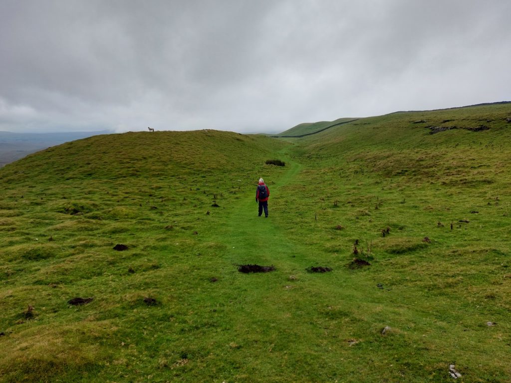
The track took us over the moor, watched by sheep. (Audrey told me what kind they were but I’ve forgotten).
We walked along the top of Oxnop Scar in a suitably misty ambience, and came off the track to find a sheltered hollow for our lunch break.
The track joined up with the Cross Top Road, another single track road but one with actual traffic meaning we had step aside for the occasional car. I can’t say much about Askrigg Common. There were a couple of small quarries and a footpath snaking off to the right with a parking area and a wooden bench.

A cattlegrid marked the beginning of a slighter steeper descent that took us from the moorland through farmland, past the High Straits and Low Straits Lanes and back into the village. I take it that this descent was the original Askrigg, Askr (ash tree) and hryggr (ridge).

A couple of houses on the outskirts of the village had carved owls in their gardens.

