7.19 miles 2h 55m 9m ascent
Anthorn to Bowness-on-Solway
An unco sough i’ the gloamin’
An’ a flaff o’ risin’ win’,
A glisk o’ stoundin’ waters
By the weirdly licht o’ the mune,
An’ the fell dark tide o’ Solway
Comes breengin’, whummlin’ in.

Dorothy Margaret Paulin
This final section of our Ravenglass to Bowness coastal walk was a short stroll around the Cardurnock ‘peninsula’ from Anthorn, where the River Wampool meets Moricambe Bay, along the coastal road to Bowness-on-Solway, completing Hadrian’s Coastal Route where our Hadrian’s Wall walk had begun.
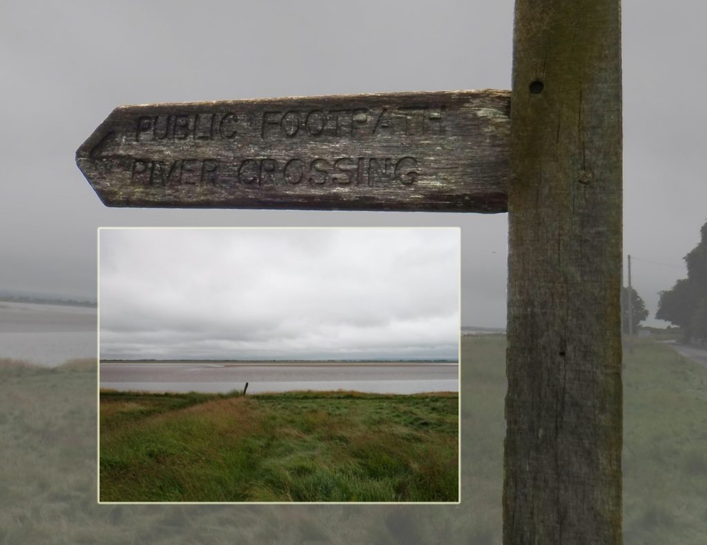
We started a little east of Anthorn, with the the mudflats of Moricamb Bay beside us and the imposing radio masts ahead. The route was entirely on minor roads so, thankfully, did not involve the river crossing shown in this photograph.
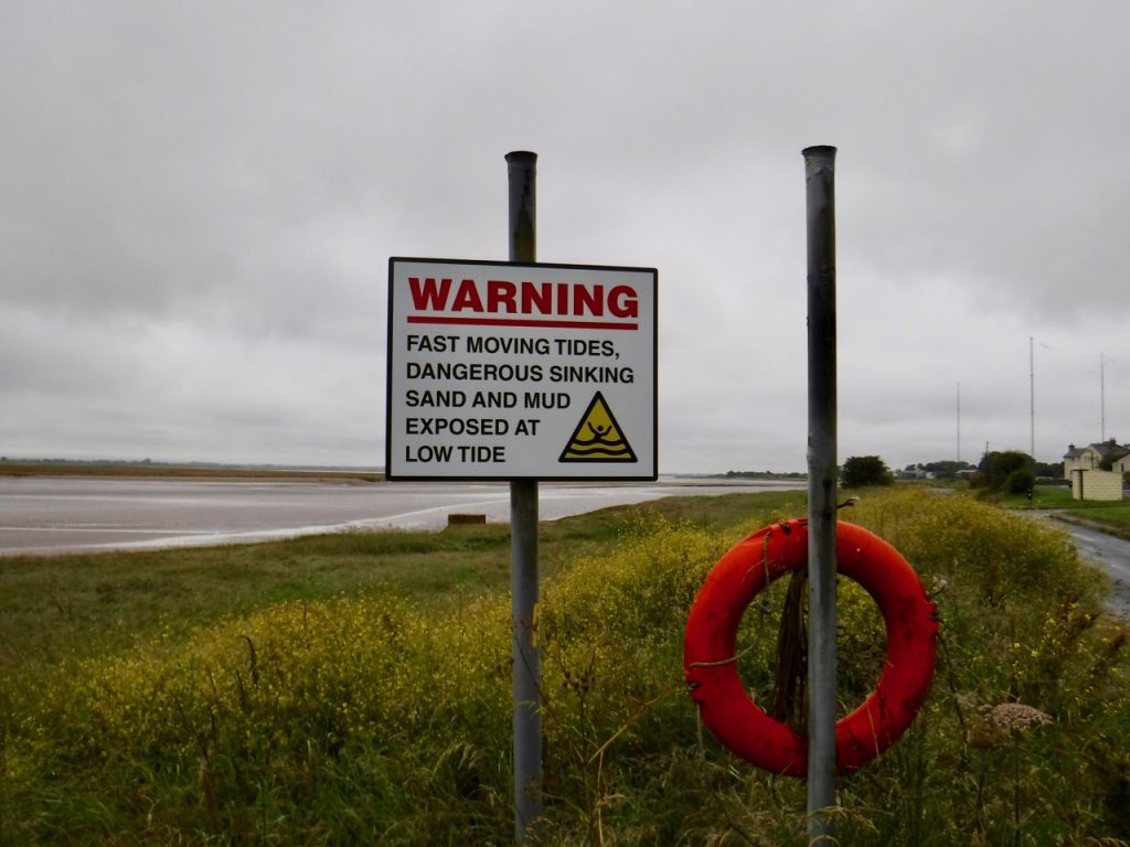
Completing the route was undeniably a satisfying experience both because we had completed another long distance walk, but because we had also joined the two Hadrian walks. We were spared the usual excitements of difficult terrain or navigational challenges and did not need to venture on to mud-flats or marshes. The tides were not a problem and the only water we had to cope with had fallen from the sky. At the start it was raining heavily enough that I donned full waterproofs (and even put a coat on the dog), but the day was warm and when the rain lessened I was quick to shed the ‘not-so-breathable gore-tex.
Across the bay Grune Point was just visible. I found myself thinking that it should perhaps be Grüne Point, but set aside concerns of umlauts when I remembered the area’s grim history. During WW2 these waters came to be known as Hudson Bay because many of the Lockheed Hudson bombers based at RAF Silloth were lost here. The Hudsons tended to sink rapidly after ditching, possibly because their bomb bay doors buckled on impact and the treacherous local tides and shifting sands often made rescue impossible. Research by Ian Tyler shows that a staggering 1,833 men were lost due to their aircraft crashing in the Solway during ww2. At low tide it is still possible to see the remains of some of these aircraft.
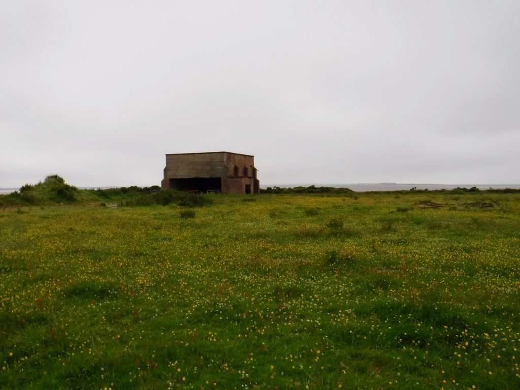
There is not much to Anthorn village itself. Even the old chapel has been taken over by a private house. There are older buildings many looking to have farming origins, a couple with water pumps (defunct, I presume) in their yards, but many of the houses look to be ex-military. Before the radio station was here, Anthorn had an airfield operated by the Fleet Air Arm as HMS Nuthatch. Its name in line with a tradition of naming RNAS air stations after birds – e.g. RNAS Prestwick is HMS Gannet, and some further examples can be found here). I must admit that when I looked at the list I had not realised some of them were birds. I am wiser now. The old runways and taxiways of the airfield are still visible though they are slowly losing their battle with nature. A taxiway beside the road were I paused to remove waterproofs was covered with flowering stonecrop.
Other legacies of the military airfield are several buildings on the airfield’s perimeter. We speculated on their purpose but could not come up with any convincing possibilities. Most are now repurposed into some sort of agricultural use. A little research on returning home has revealed these to be WW2 era “shooting-in butts” which were used to test aircraft mounted machine-guns.
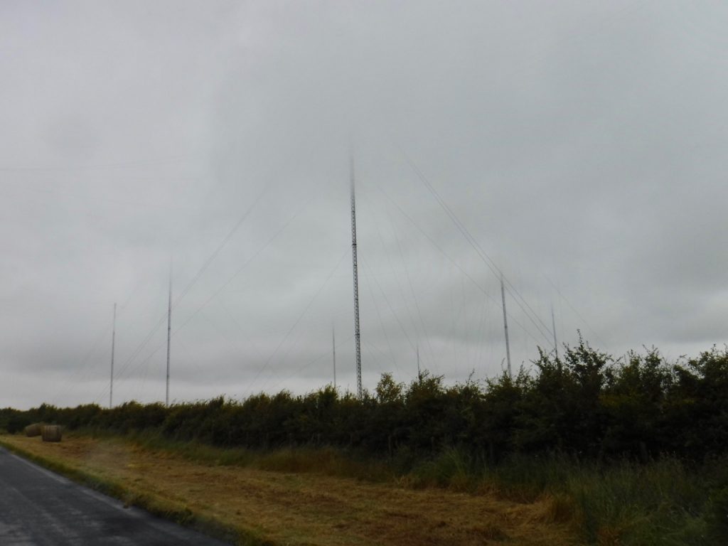
The area is dominated now by the 13 huge radio masts of the Anthorn Radio Station. Its LF transmitters broadcast the National Physical Laboratory’s time signal for the U.K. (the ‘pips’) and support eLORAN navigation systems, while VLF which can penetrate seawater is used for communication with submerged submarines. These ‘very low frequencies’ are ‘long-wave’, so I wonder whether the old tale of our nuclear submarines being able to tell if the country has been destroyed by listening for BBC Radio 4 (on long wave) might have a grain of truth. You might be able to see from the photographs that the tops of the 227m masts were lost in the clouds as we walked by.
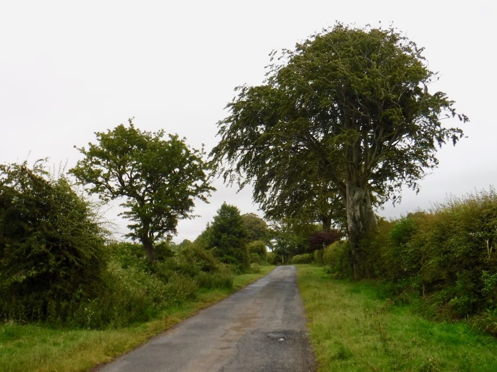
This photograph shows the minor road we were walking along. Despite the appearance there were quite a few cars along the way. The beech tree on the right had a huge trunk and must be several hundred years old.
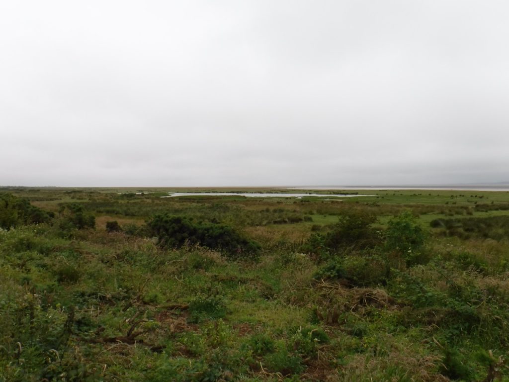
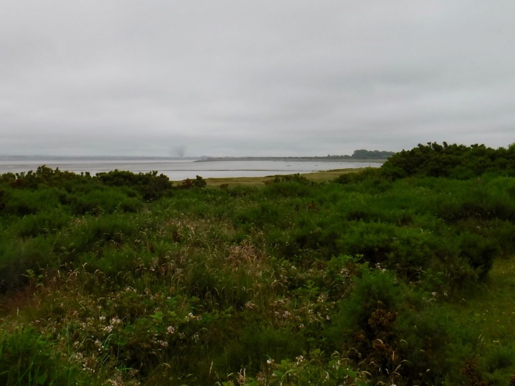
Once we reached the northern part of the peninsula there were larger stretches of salt marsh between us and the Solway mudflats. I still find it strange to think that Edward I’s invading armies would have crossed into Scotland across the Solway. Perhaps the water channels were different then.
As we approached what remains of the railway viaduct we noticed a strange cloud over Annan I think. I only had my wet weather camera which does not have any optical telephoto so the photographs are not especially clear. Presumably it was from a fire but it was shaped like a tornado. I looked about at the nearby terrain and wondered where we might shelter if it was. There was no shelter so I think we would be done for.
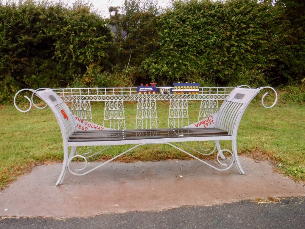
The Solway Rail Viaduct was in use between 1869 and 1915, carrying iron ore from the mines of West Cumberland to foundries in Lanark and Ayrshire. Falling rail traffic forced its closure in 1915 and the viaduct was demolished in 1935. There had been proposals to convert it into a road bridge, but by that time the structure was in poor repair. It is interesting to think how such a road might have altered the areas on both sides of the Solway. The only memorial to the viaduct was this bench back in Anthorn village.
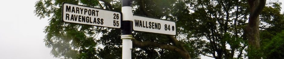
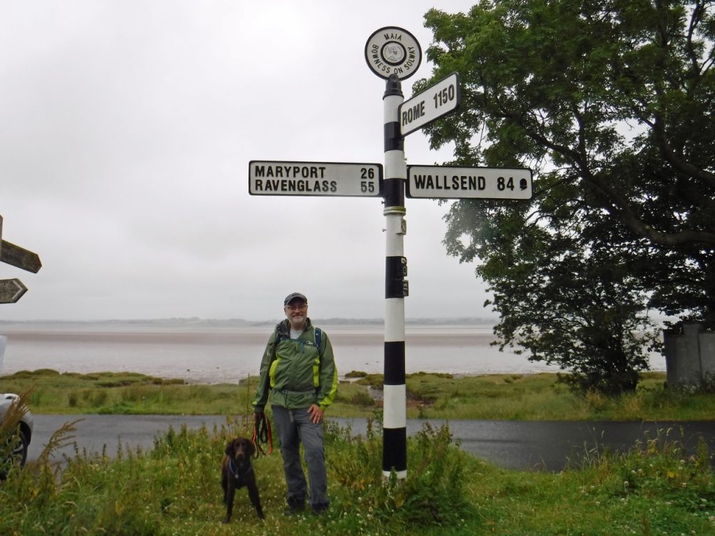
The Road sign where we had begun our Hadrian’s Wall walk in 2017 marked the end of our 2019 Hadrian’s Coastal walk. It seemed fitting to celebrate the accomplishment with a photo.
Overview of Hadrian’s Coastal Route
[sgpx gpx=https://www.screel.co.uk/walks/wp-content/uploads/2019/07/RK_gpx-_2019-07-09_1026.gpx]
