
3.11 miles 1h 57m ascent 94m
Pond Trail-Larch Trail-Burnside Trail
“Corse o’ Slakes, Cross of Rocky Hills – Slakes in Saxon meaning rocky hills or rocky brows. In Galloway there are no roads so wild as the one which leads over the celebrated pass of the above name between Cairnsmoor and Cairnhattie. It is a perfect Alpine pass, and was a haunt of Billy Marshall and his gang in days of yore.”
Gallovidian Encyclopædia 1824, John Mactaggart.
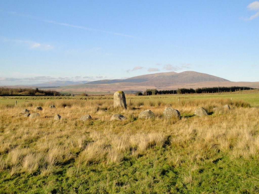
I had intended taking the A75 for most of the way to Balloch Woods but the SatNav had a sudden rethink en route. It suggested I turn off the A75 at Skyreburn Bridge. I pondered, glanced in the mirror, then indicated and turned. A slave to technology. But so it was that we took an old single track road up past Galloway Alpacas and over the Corse o’ Slakes. This route gave some hope of seeing the Glenquicken Stone Circle but only its central pillar was visible from the road.
Here’s a picture from when I tramped over Cambret Moor a few years ago. The central stone is 1.6m tall.
Balloch Wood is only a mile or so from the stone circle and that short drive took us over Englishman’s Burn. Local tradition attributes the name to a battle hereabouts.
About the year of our Lord 1150, it is faid there was a battle fought between the English and Scots, on Glenquicken Moor, wherein the Scots were defeated and their General killed, and that the Bishop of Whithorn being along with him in the engagement, immediately affumed command; but his troops being defeated, immediately fled towards the fhore to their boats, but being overtaken by the enemy at Cairnholy, about half a mile from the fhore, the bifhop, with many other gentlemen, was killed, and was buried here…There is a little rivulet or burn that runs through the place where the battle is faid to have been fought, that ftill retains the name of the Englishman’s Burn.
John Sinclair, The Statistical Account of Scotland, 1795
But this may be just folklore. It’s possible that the many skeletons found in the area gave rise to the idea that a battle was fought here, when in fact the bones were from neolithic burial sites. Dergall seems to have been the stream’s original name, the gall, meaning a freestanding rock, referring to the nearby standing stones. Misinterpretation of Dergall as dobhar gall, the foreigner’s stream, may have supported the tradition of a battle, with Englishman’s Burn a later translation. A more prosaic explanation is that the English built a bridge over the burn when the military road was built in the 1760’s and the Englishman’s Bridge gave name to the burn beneath it.
But in vain do we develope the hiftory of thefe times…a veil is thrown over them which can never be removed.
John Sinclair, The Statistical Account of Scotland, 1795
Balloch Woods has a small car park by the curling ponds. A rather sorry looking information board is losing its battle with gravity and encroaching forest but was still legible. It showed the trails we would walk and warned “stout boots or shoes recommended throughout”.
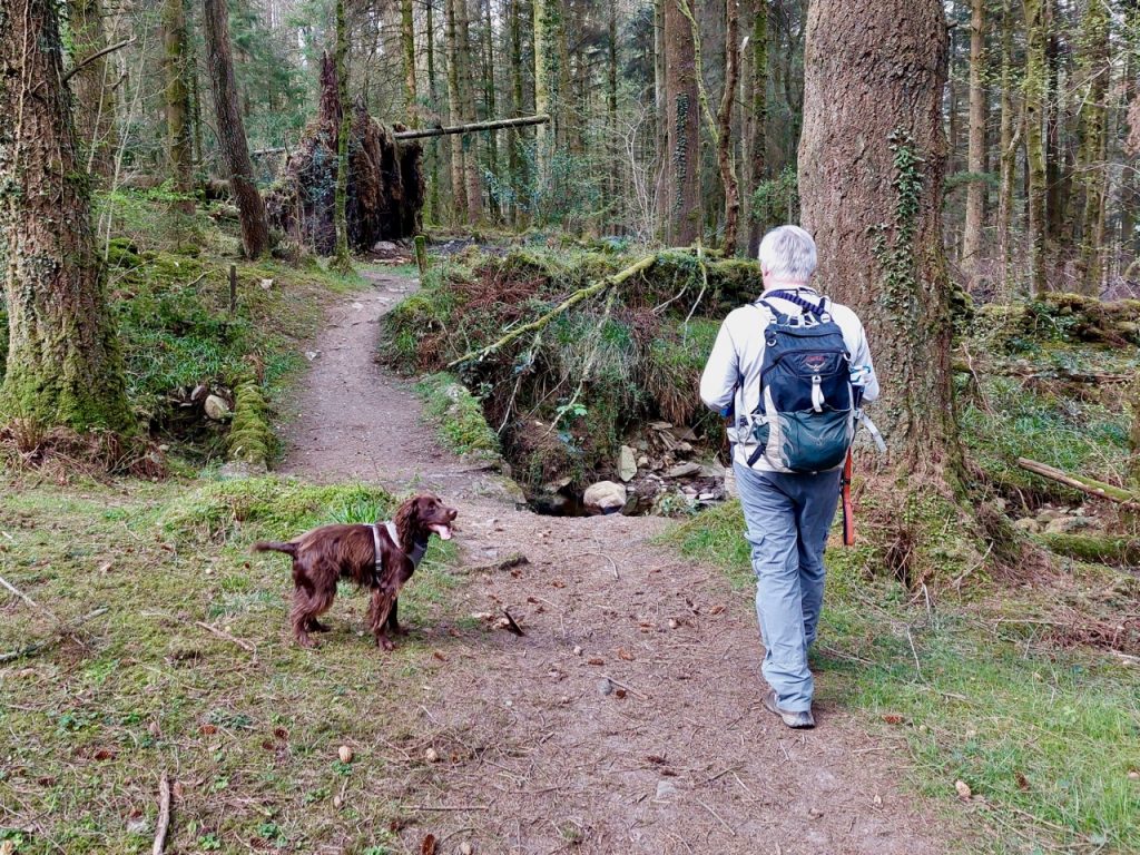
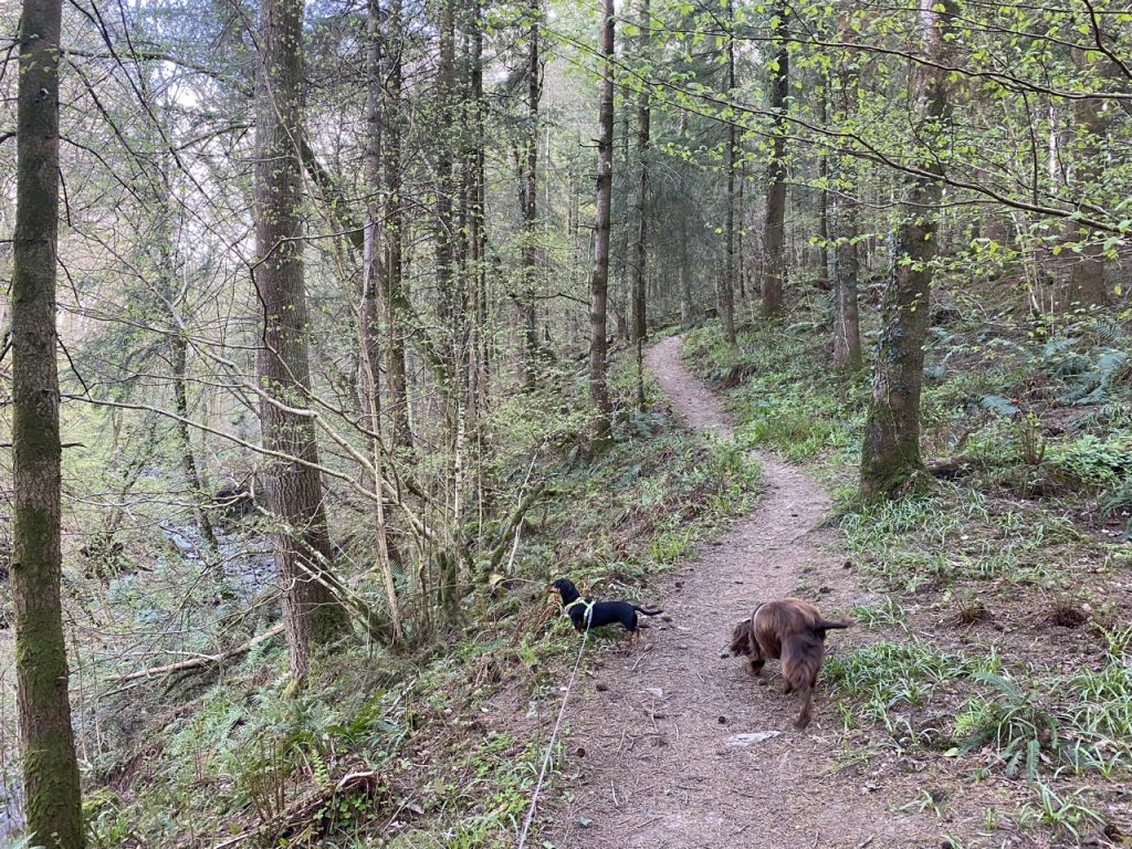
The path from the ponds/car park winds through birch woods and was a little more up and down than I had expected. Enough to add a bit of cardio to the exercise but not particularly steep. The paths were firm underfoot but gave the impression they would happily embrace muddiness given a drop of rain.
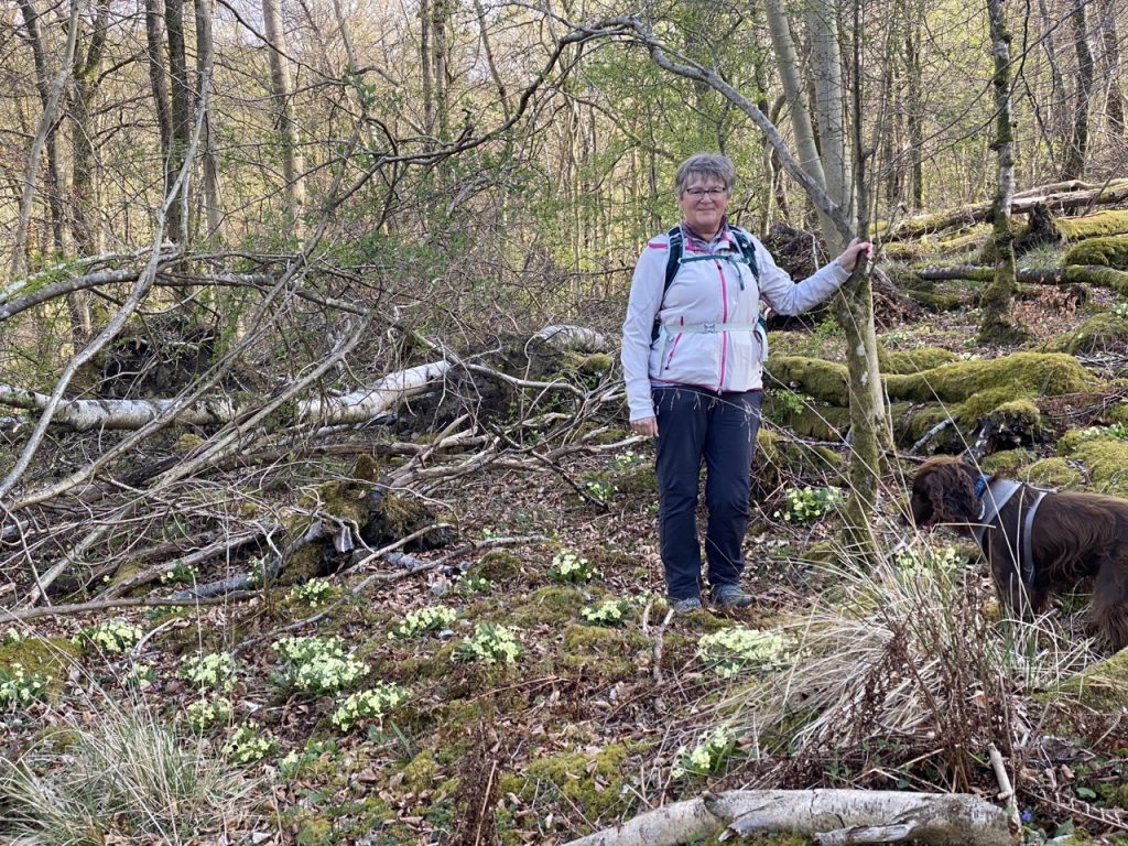
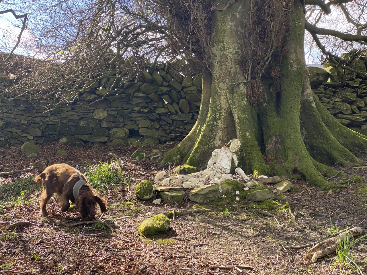
There were violets, bluebells, wood sorrel, daffodils and primroses along the way and crumbling statue leant against an old tree. It’s hard to say what it may have been but it now looks a little like the Recumbent Magdalene. It has not weathered well.
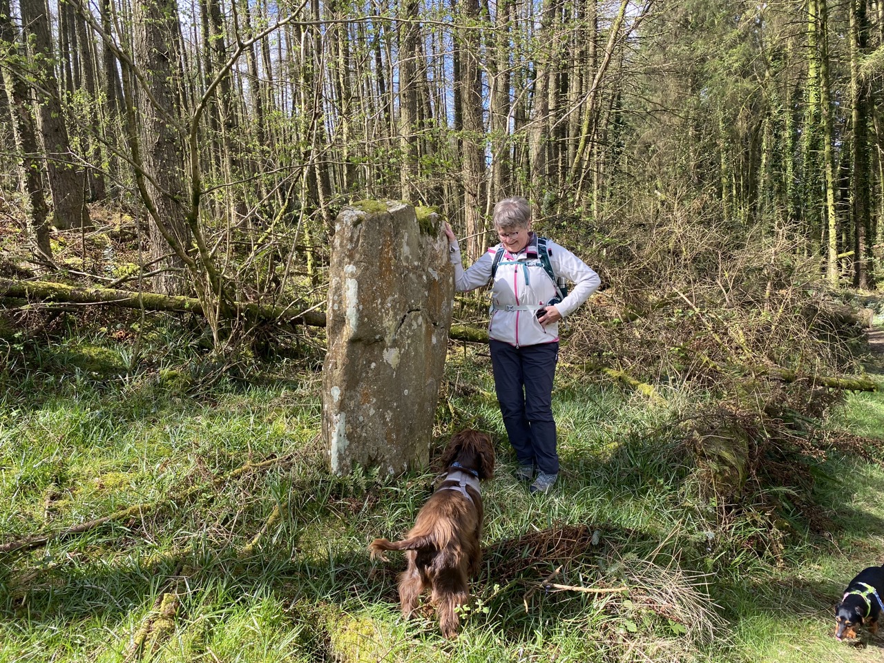
The next find was a standing stone. It’s not marked on the OS maps, or listed in Canmore. It’s too upright for an erratic, strangely placed for a gate or scratching post, and with no discernible marks. A boundary marker perhaps or an ancient standing stone that has eluded the antiquarians?
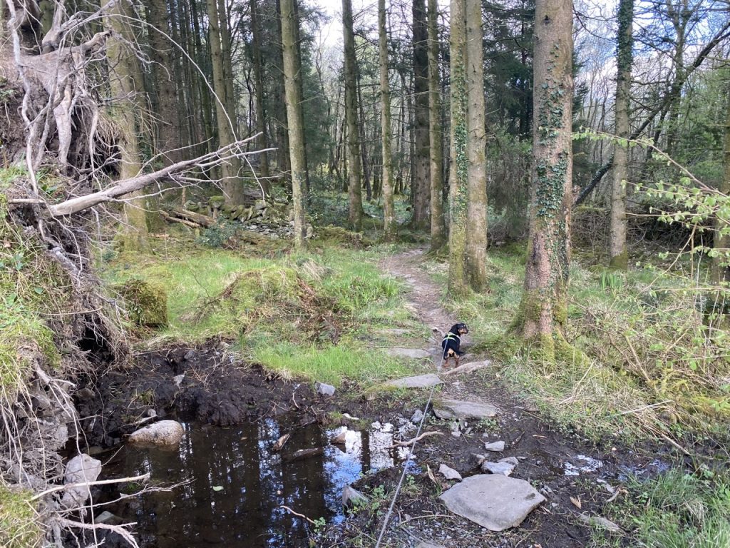
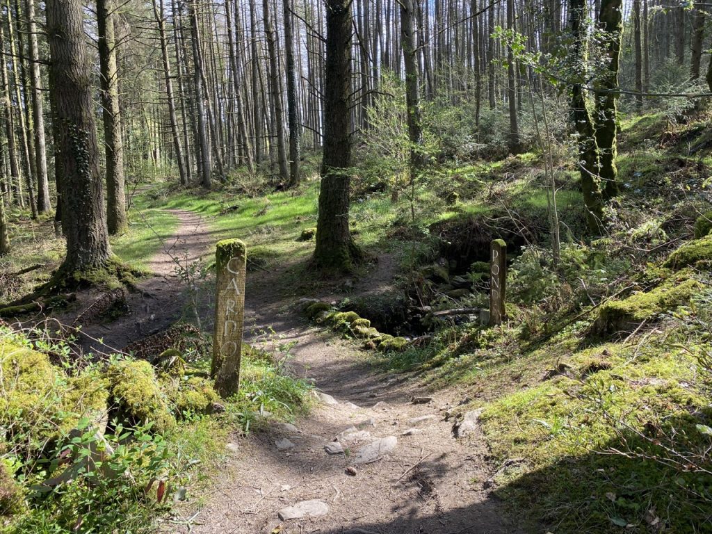
Cardoon Bridge is a little further beyond the standing stone. The crossing is marked with two wooden posts, one inscribed “CARDOON”, the other “PONDS ➔”. I had presumed the burn we were crossing was the Cardoon Burn, but that is several miles away on Cairnsmore of Fleet. The OS gives no name for this burn. Why then is this Cardoon Bridge? Could the rock (carr) in its name carr dubhagain, be the standing stone we had just passed? The dogs checked under the bridge for trolls and given their lack of barking I trip-trapped across.
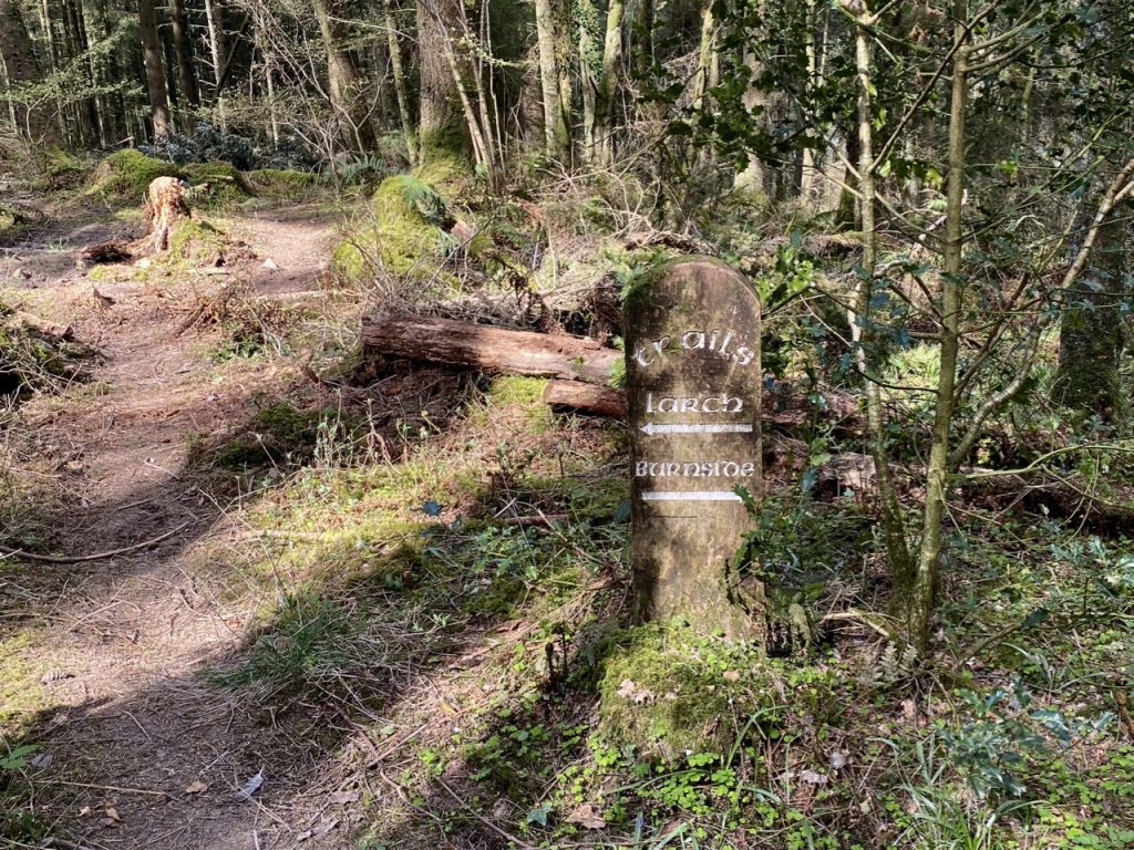
The woods changed after the bridge from mostly birch to mostly conifer. A trail marker indicated that the Larch trail was to the left and the Burnside trail to the right. But there were three paths, two to the left and one to the right. I think that on the far left was the original Larch Trail but has been blocked by fallen trees. The middle trail is the replacement.
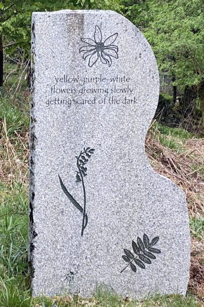
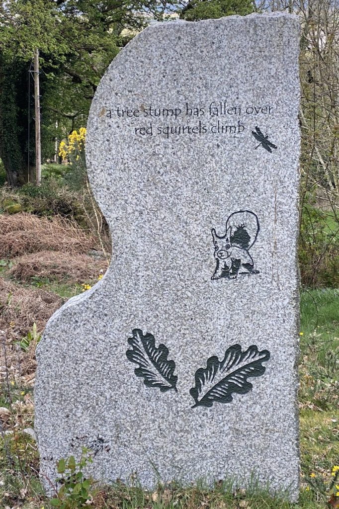
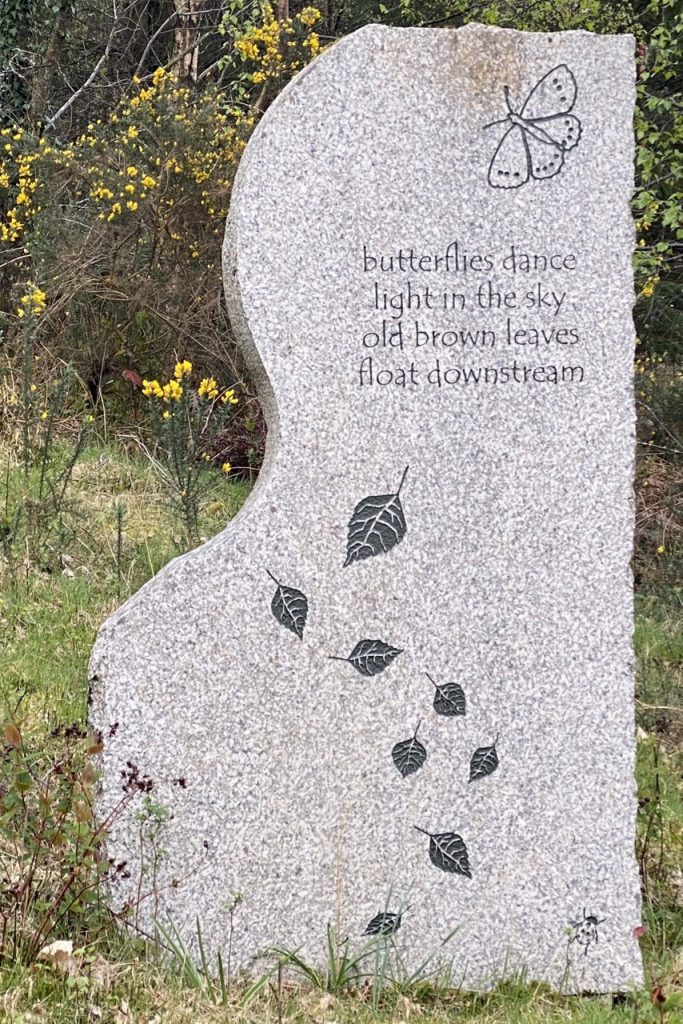
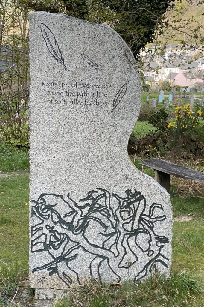
The Larch Trail is a pleasant woodland walk. Banks of bluebells were coming into flower but perhaps still a week or two short of their best. The trails rejoined above Creetown’s church and brought us to the impressive Creehenge, The Poetry Stone Circle.
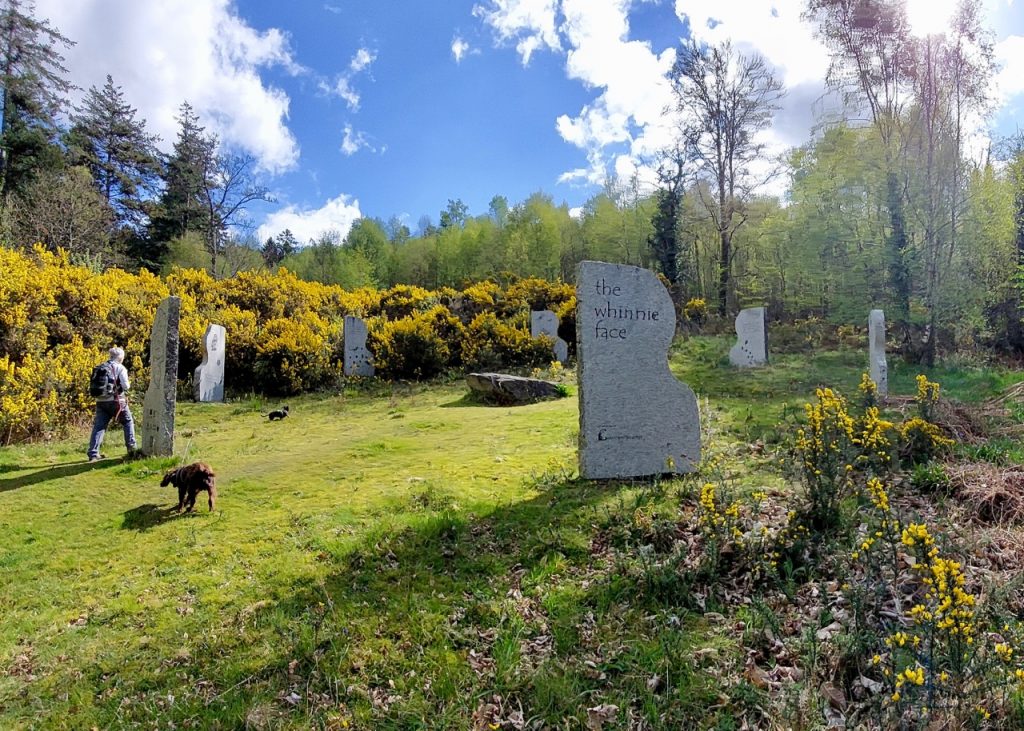
There are seven standing stones arrayed around a central sessile rock. The inscription “the whinnie face“, is a local name for the gorse covered slopes of Balloch Woods. Whin being gorse, from the Old Norse hvein. And the slopes were certainly not short of gorse.
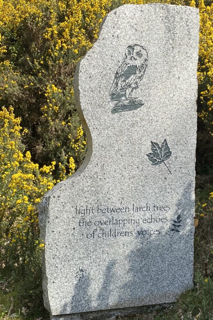
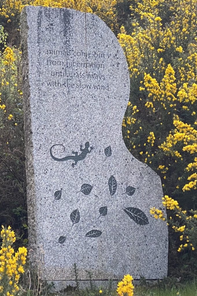
The standing stones are inscribed with pictures and haiku written by the children of Creetown Primary School. They reflect the children’s responses to the woodland. I would certainly recommend reading the complete work which can be accessed at The Whinnie Face. The work was part of a community project in 2009. Granite was chosen to reflect the area’s industrial heritage and geology while the arrangement as a circle echoes the region’s ancient megaliths.
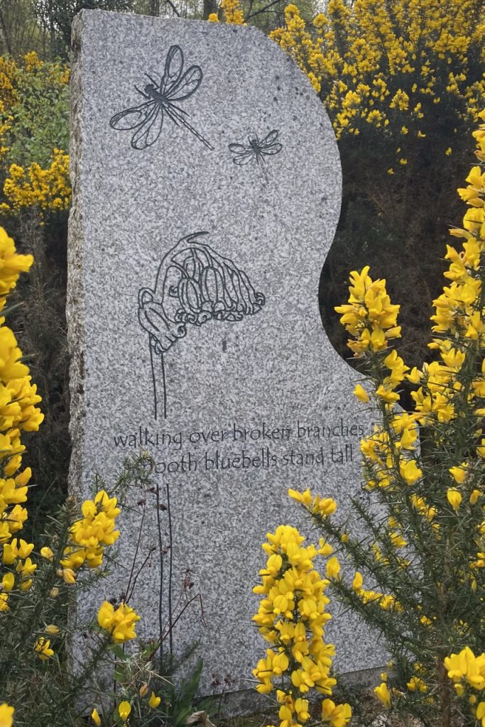
There are photographs online taken when the stones were first put up which show them on a bare grass slope. I’m pleased to see that the gorse is hugging them now. The central uncut stone at just the right height to use as a seat (or as an altar for ancient pagan rites, I suppose). And there are a couple of wooden benches (which would be a little too narrow for use as altars but make nice seats.)
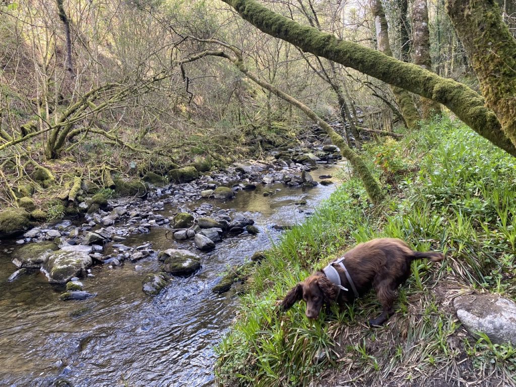
The Burnside Trail runs beside the Balloch Burn which runs in a deep gorge. Older maps give the name as Ballochanamour, Bealach an amuir meaning the pass of the trough. I certainly had to call Christy back from the edge a few times as he went exploring but there were places he could find a way down to wet his feet and have a drink.
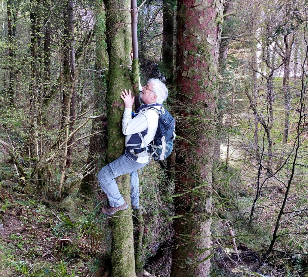
There were a great many fallen trees and another walker we met told us that the paths had only been cleared quite recently. Which explained the sawdust we had seen on the path. I decided to have a go at (photoshopped) tree-climbing.
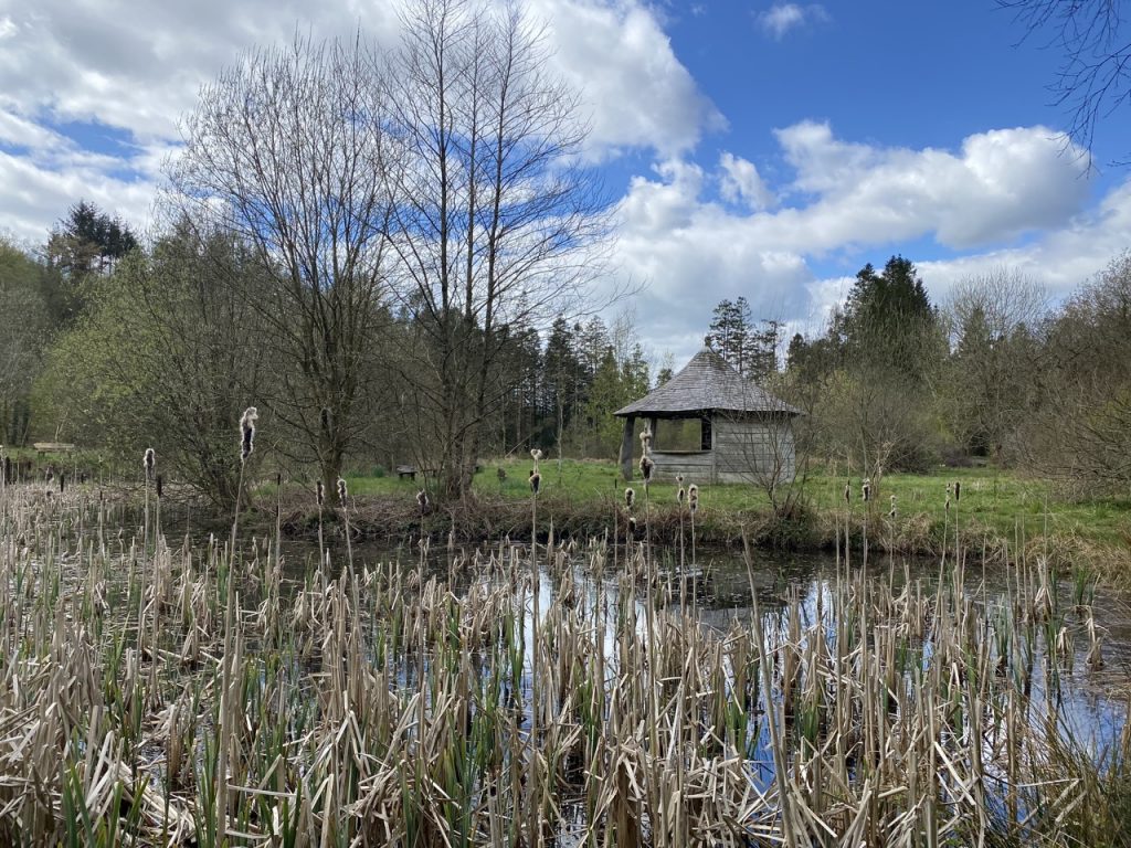
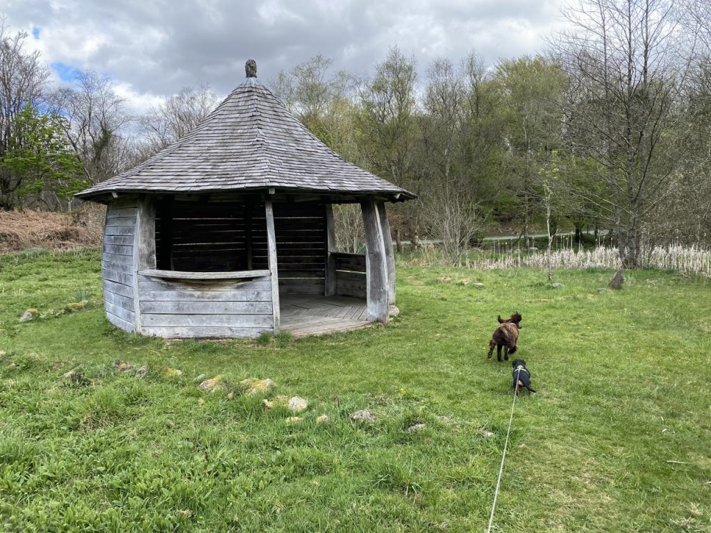
We finished the walk with a stroll around the curling ponds. The Roundhouse, is described as an interpretation shelter and meeting point at the Garrochar Wildlife Pond...built using green oak and traditional techniques in a roundhouse shape.It looked like something from Hobbiton.
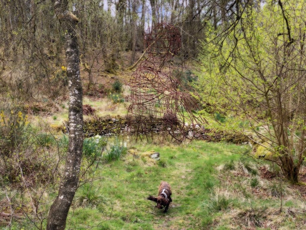
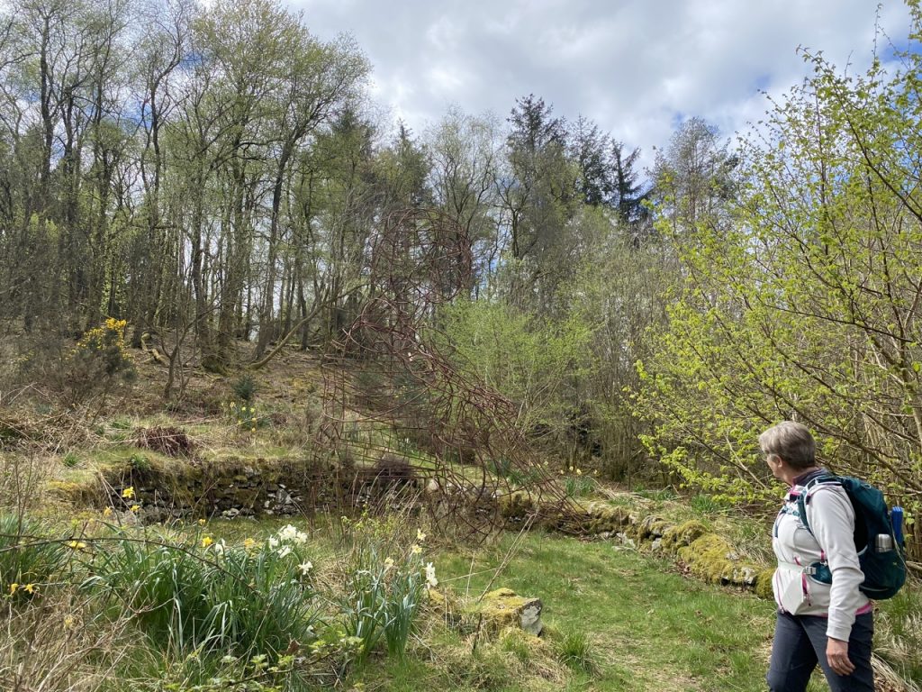
And hidden away in its own wee nook was the Creebaby. A frame sculpture of a sitting child hugging its knees. I reckon it is about 4.5m tall, certainly large enough that it has a doorway at the back to allow people to step inside. When it was installed in 2011 the plan was that roses and clematis would grow to cover the frame. But a decade later it is still bare. It was quite a challenge to photograph. I have enhanced it for the photo below.
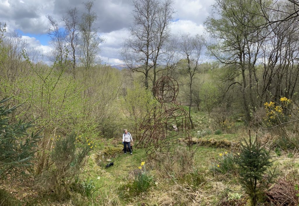
Unenhanced ⬇
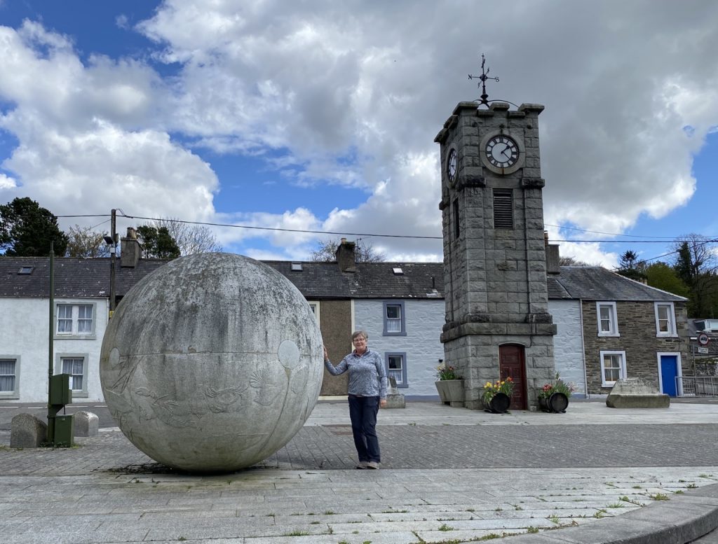
Our return drive took us through Creetown’s Adamson Square with its clock tower and granite sphere. The clock tower was built in 1897 to commemorate Queen Victoria’s Diamond Jubilee. The Sphere, of the same local silver granite was added in 2005. It was produced by Hideo Furuta (1949-2007), a local sculptor, originally from Hiroshima. Various topics important to the village were hand carved onto the sphere and include fishes and people .
[sgpx gpx=https://www.screel.co.uk/walks/wp-content/uploads/2022/04/RK_gpx-_2022-04-25_1024.gpx]
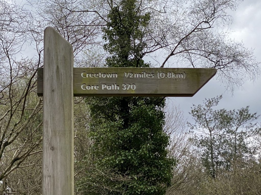
P.S. I can’t ignore the sign at Balloch Woods’ car park. It said Creetown was half a mile (0.8km) away. Even as the crows flies it’s well over a mile.
