Squelch, squelch: onomatopoeia by the Pot of Ae

9.0 miles  5h 29m   552m ascent  max elevation (Queensberry) 697m

Harestane HeightsRoute: Kinnelhead-Blairmark-Harestanes Heights-Mount Glass-Pot of Ae-Lochanhead

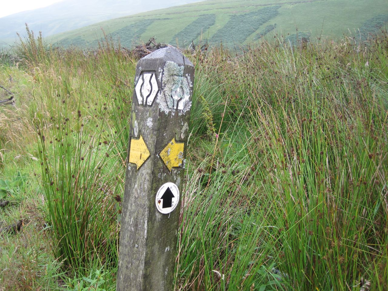
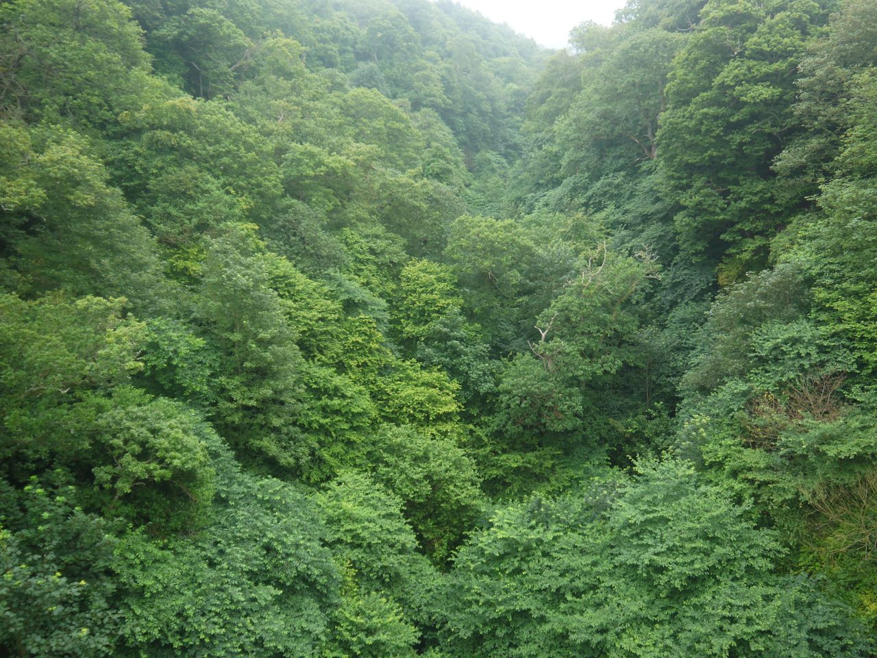
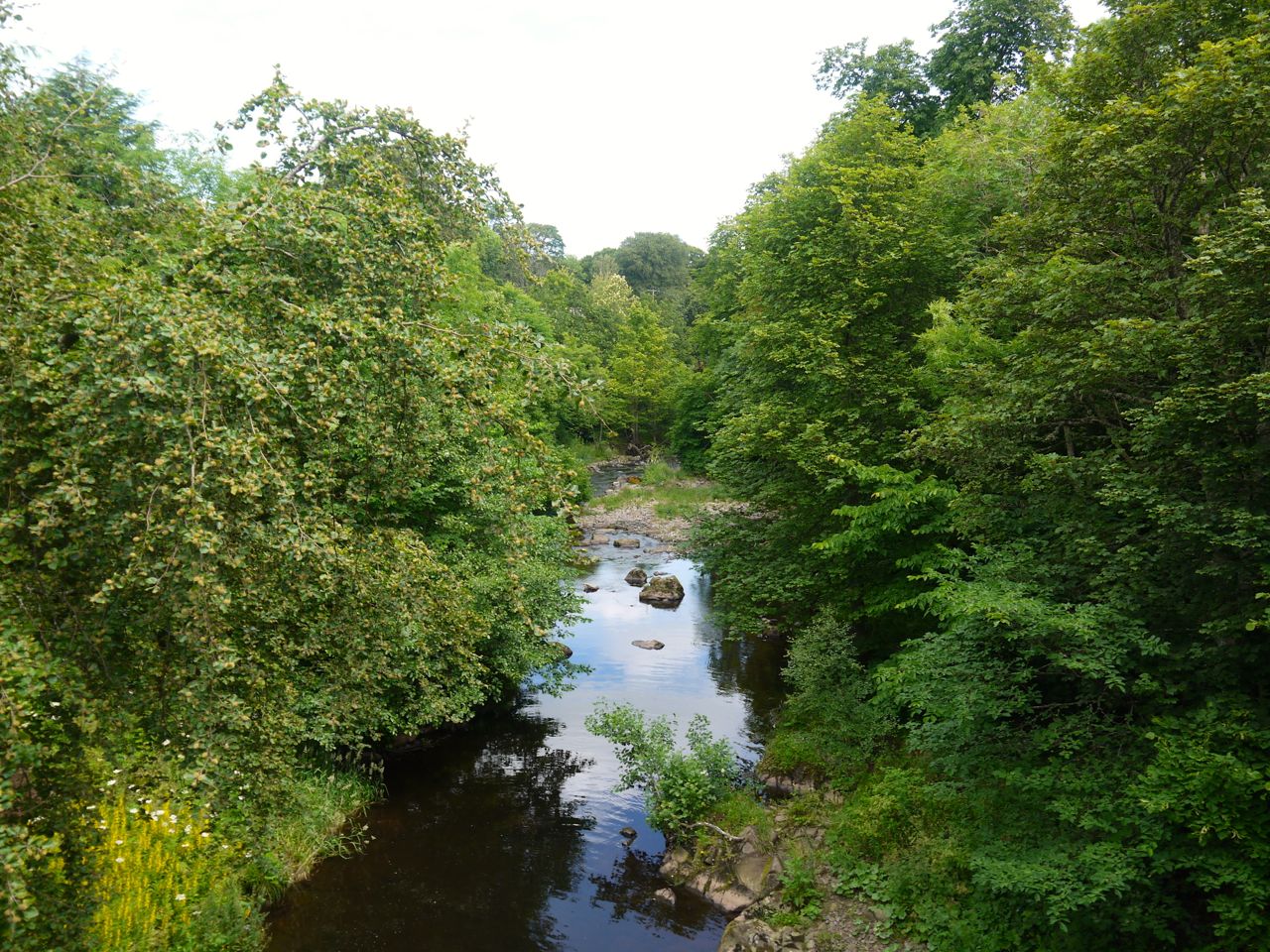
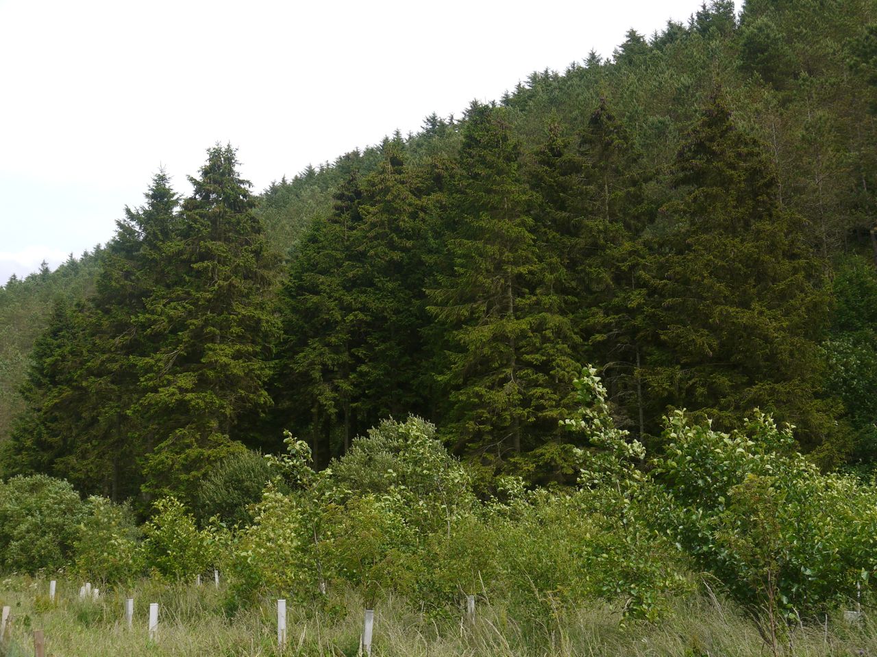
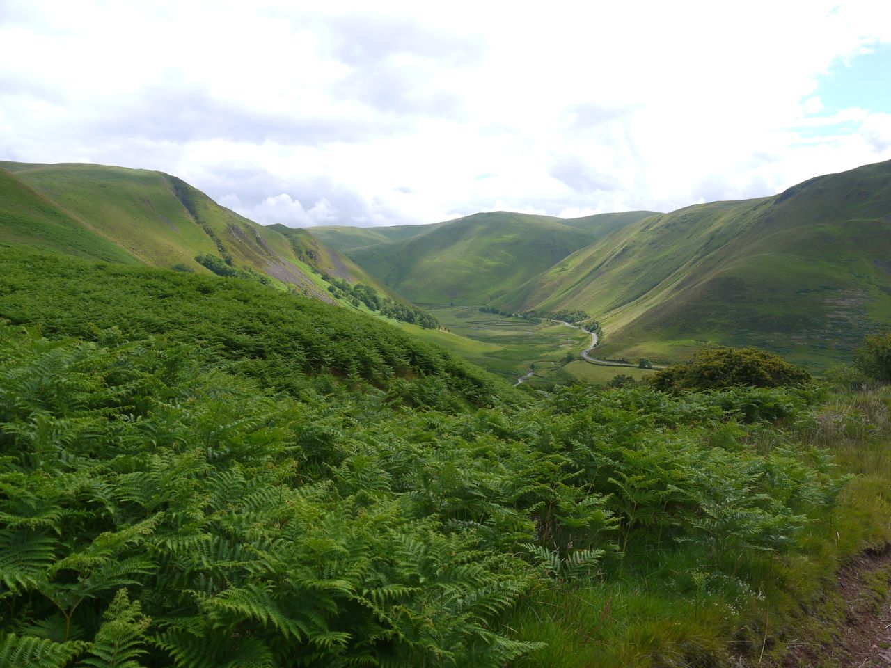
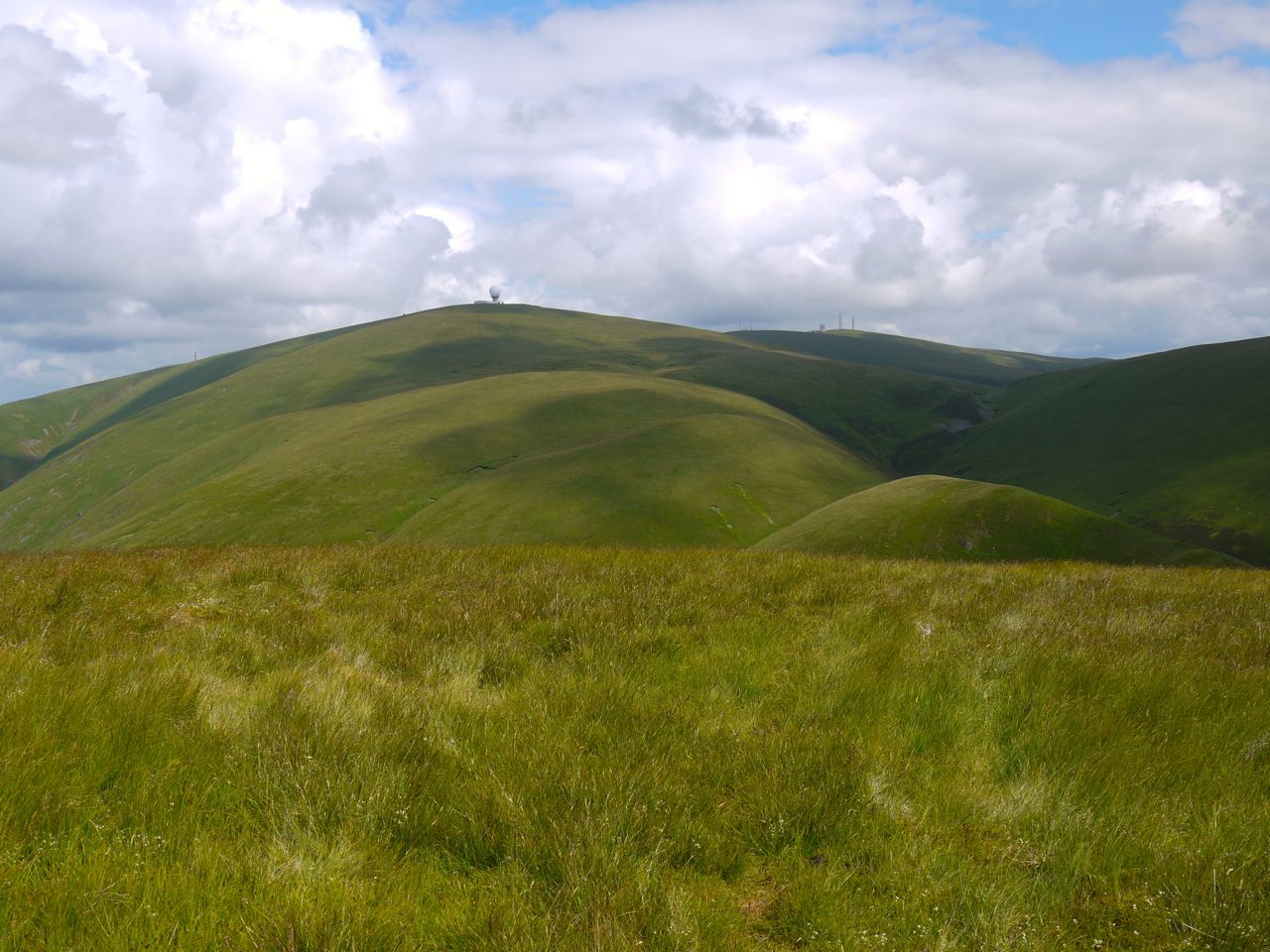
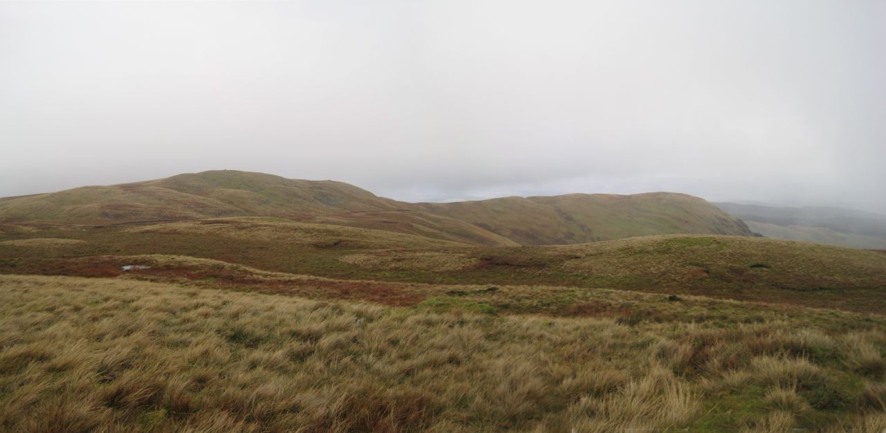
A gentle stroll up Queensberry from the NE, taking in Harestane Heights (picture above). The forecast said that any rain would clear up after lunchtime, but the weather didn’t get the memo.

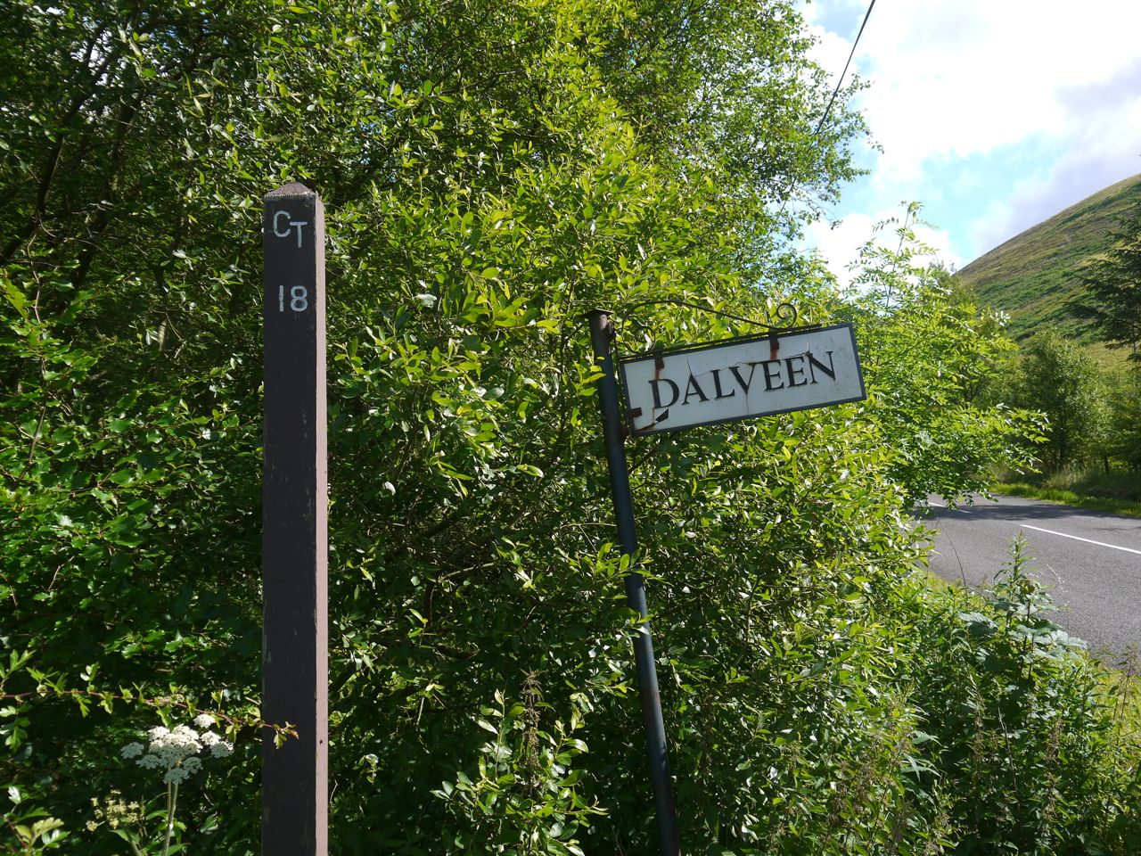
By the time we had driven up the Crooked Road the rain was falling heavily and it was clear we were in for a walk in waterproofs. I had sudden anxiety that I had forgotten my jacket, which would have meant abandoning the walk before it started, but it was there on the back seat so the walk could go on. I had intended to park at a very large cleared area a kilometre short of Kinnelhead but it now has large rocks around it preventing vehicle access. So on we drove but at the bridge over Kinnel Water the road has a “private road” sign so we turned back and parked just off the public part of the road. Getting our waterproofs on in the car was a bit of a challenge but we succeeded and set off with Eddie on his lead (until we were away from livestock).

Craighoar Hill

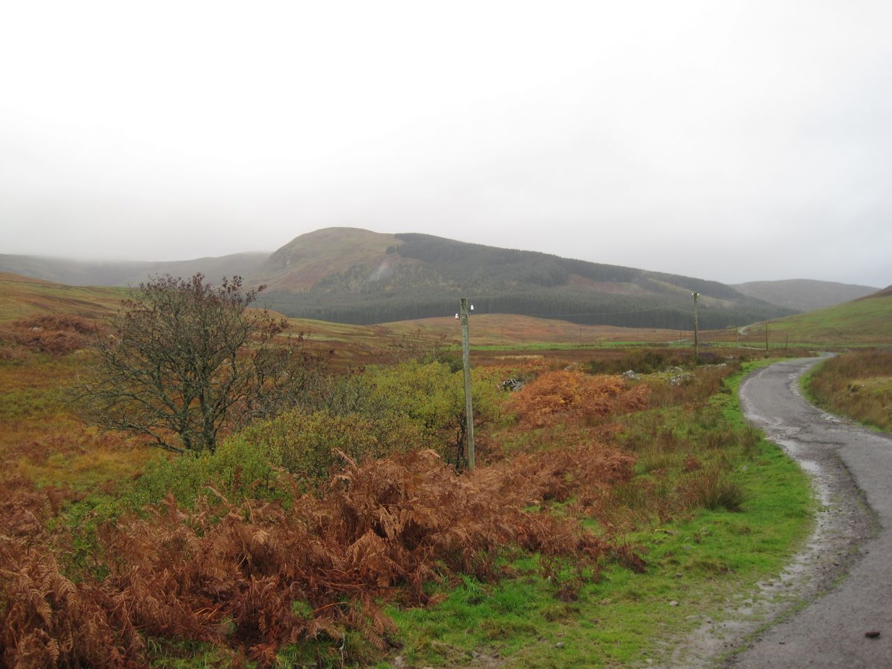
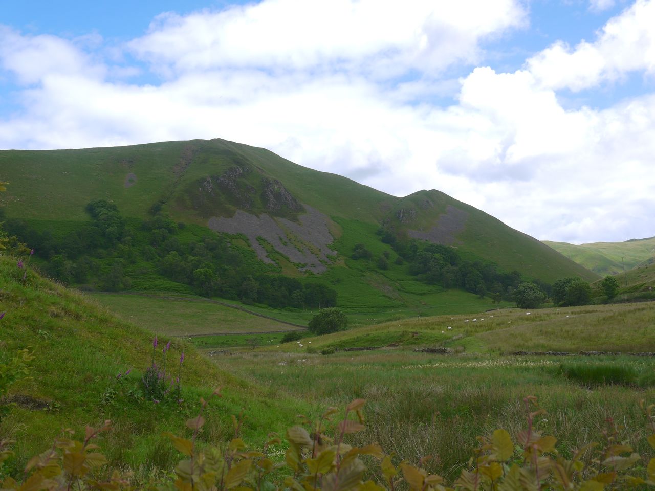
Craighoar Hill from Kinnelhead

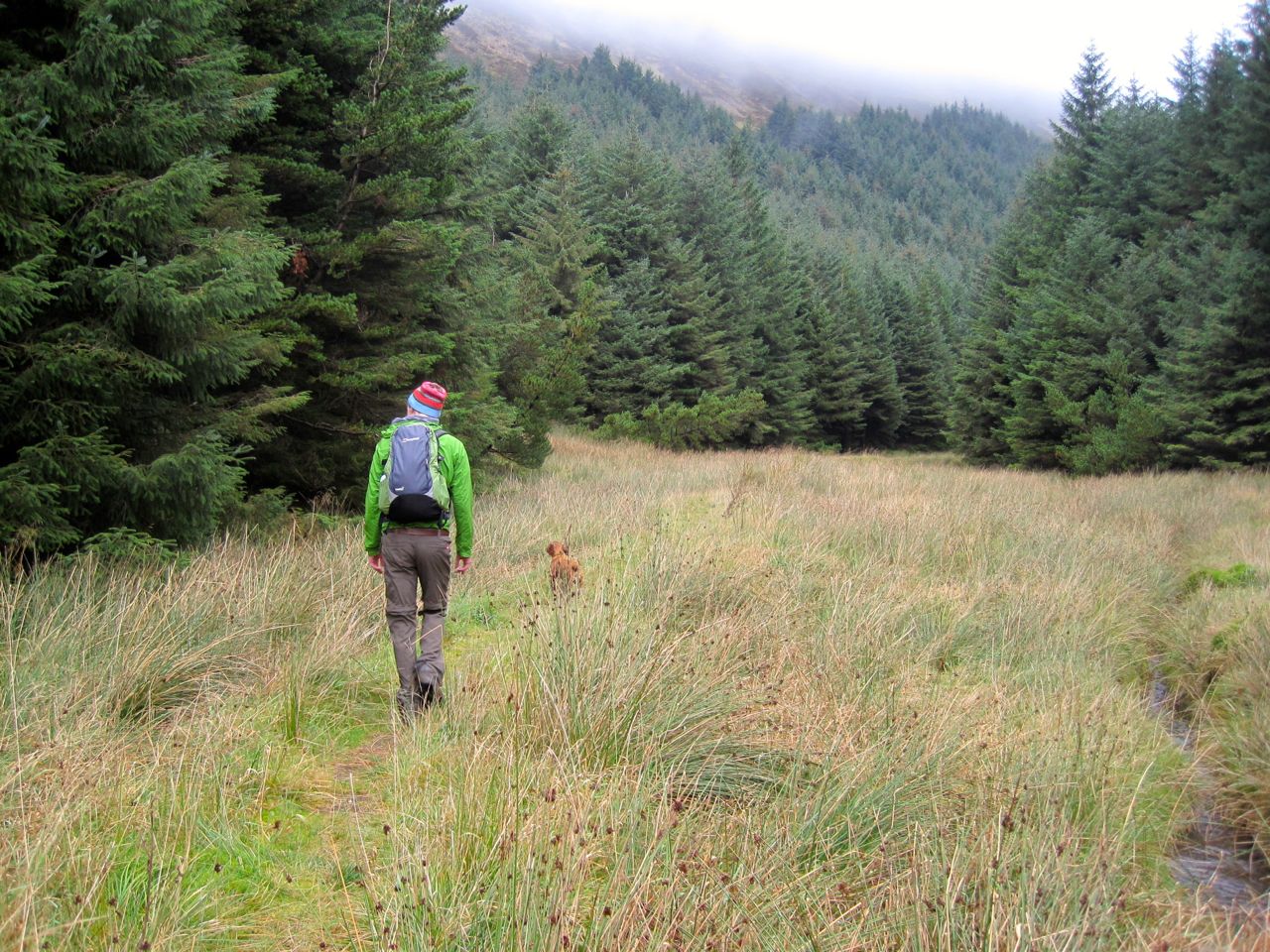
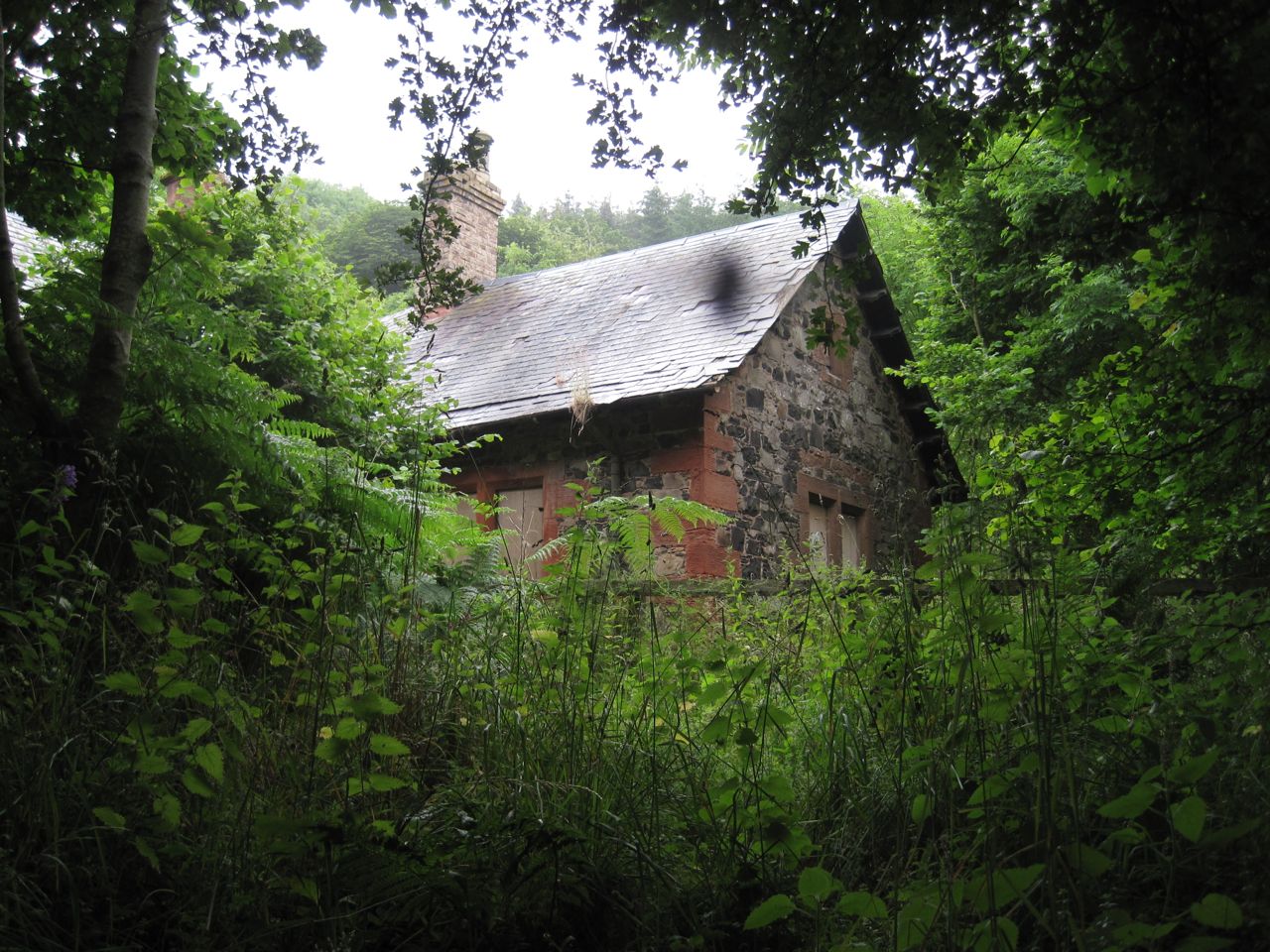
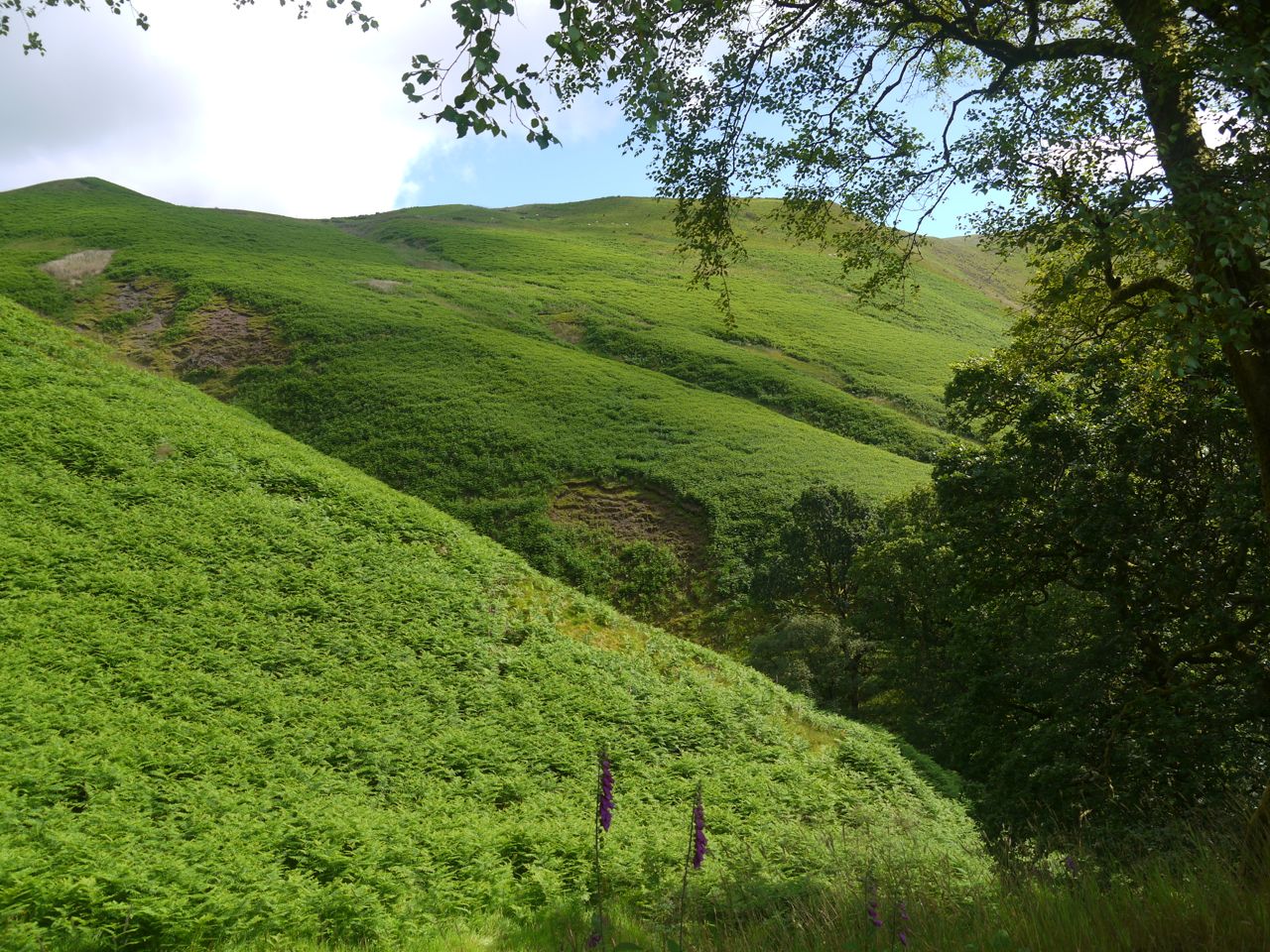
We walked at first along the track following Kinnel Water. One route I had read suggested following Threepenny Burn and then climbing Craighoar Hill but the steep slopes of Craighoar did not look particularly inviting. We walked on past an abandoned cottage at Blairmark and over a small bridge. Then the track started to climb across the northern slopes of Craighoar Hill. Below us a track crossed the burn on a footbridge and would head back to Rivox and the SUW, a good low level circular route for bad weather.

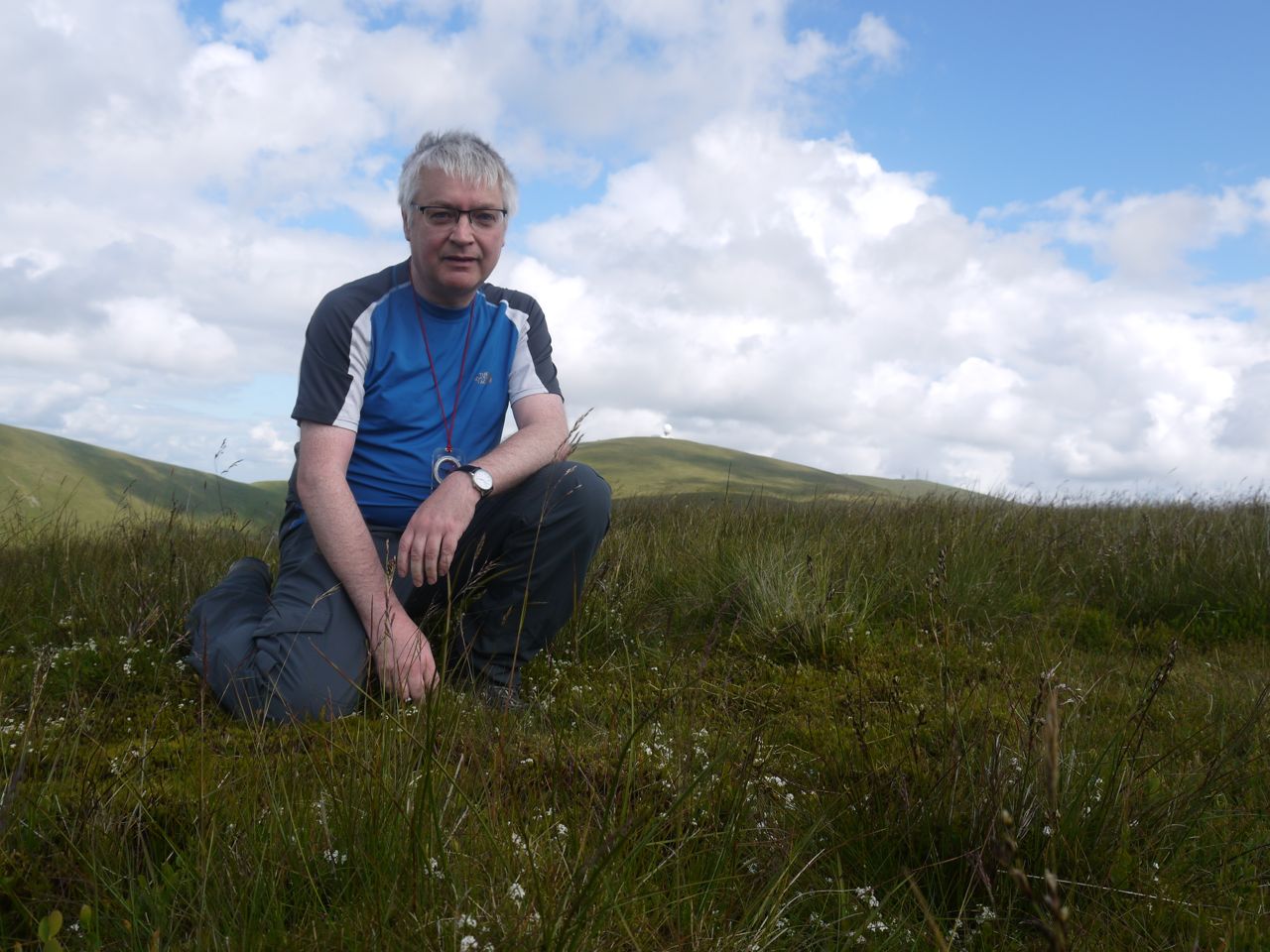
At a crossing of roads we went straight on until we were almost at the heighest point of the track. We paused at a gate here for a breather, much to Eddie’s annoyance, and the photo below is taken from there. Then we struck off directly up the hill and in to the mist.

Kinnel Water

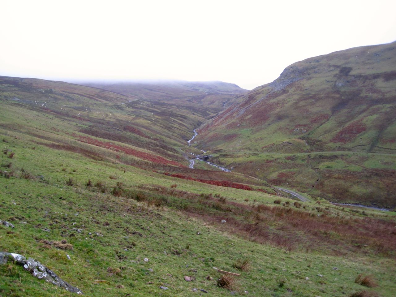
Kinnel Water and footbridge (path to Rivox)

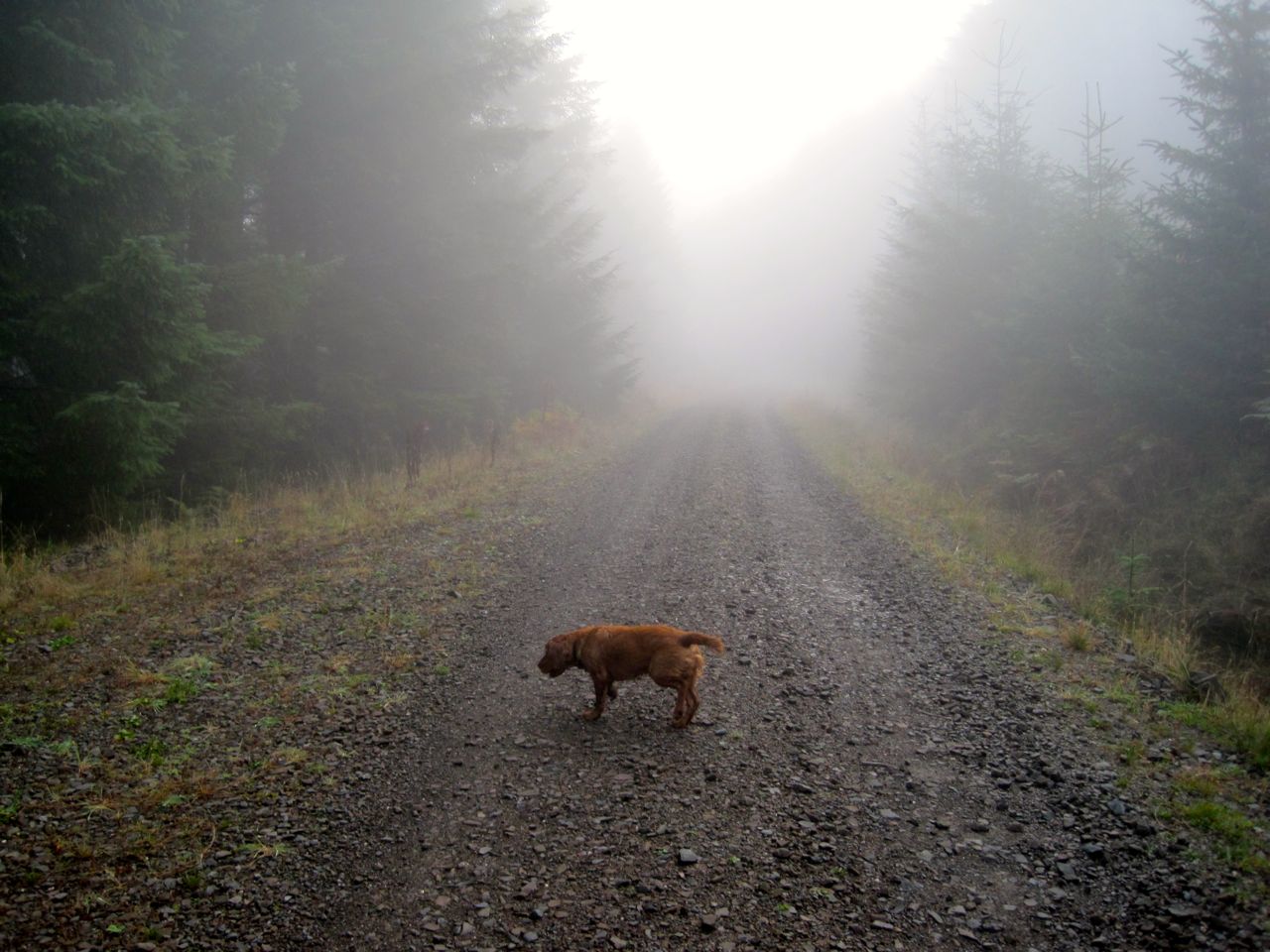
I find climbing slopes in mist quite sapping. It is difficult to gauge how much further there is to go and there isn’t much to see other than the ground. So we just trudged on up. There is a fence not marked on the OS map and I thought it might mean we were close to the top of the ridge. It’s about two thirds of the way up. We needed to divert a wee bit to use a gate next to the tree line so there is little to be gained by heading more directly for Harestanes Heights unless you want to climb a barbed wire topped fence. There might be another gate for all I know, but we couldn’t see far.

Harestane HeightsIn better visibility I would have walked up to the edge of Craighoar Hill for the views but as it was, once we got to the top, we turned right for Harestanes Heights. We were given a brief glimpse of the ridge leading up with a couple of cairns visible. A moment later though they disappeared back into the mist and we pressed on with the wind and rain blowing in our face. It was around here thatI felt water running down my neck.

The two cairns we could see were not far away and when there we had another lifting of the mist for photos. Eventually we reached a sizeable cairn and checked the GPS to check where we were. This was the cairn at the 578m spot height of the unnamed hill between Craighoar Hill and Harestanes Heights. We left there on a compass bearing descending in the mist to a waterlogged col.

Harestane Heights summit

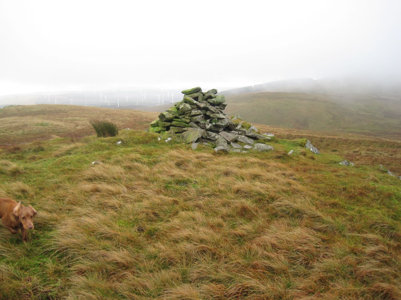
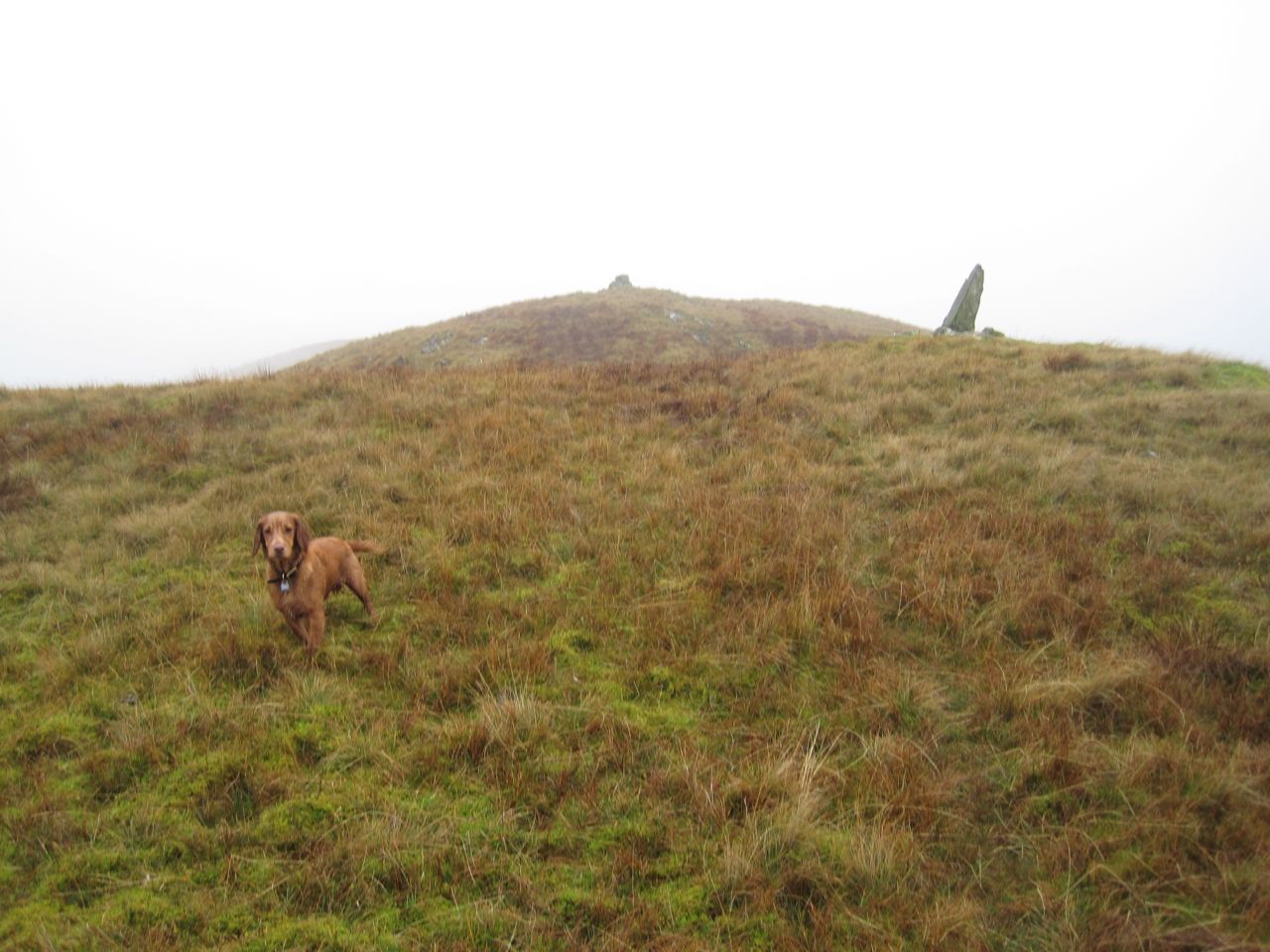
Harestane Heights 566m summit

A drystone dyke barred our way up the further slope. As we drew closer I could see a gate but it seemed to be up against the wall rather than guarding a break in the wall. No photos of this unusual set up I’m afraid since the rain was keeping the camera under cover. I could see a short section of wall that had partially fallen so we headed for that but once there we found a new fence, with unrusted barbed wire running  this side of the wall.

I walked up the the strange gate 75m or so to my right and found we could get between the fence and the wall and walk back to the fallen section of wall where we squeezed between the stones and the remains of an older fence. Why a vehicle sized gate has been put up against a wall escapes me.

Another cairn marks the top of Harestanes Heights but too small to offer much shelter. By then I could have done with a break and some carbohydrate but with the weather we decided to press on until we got better shelter. This meant I was in first gear.
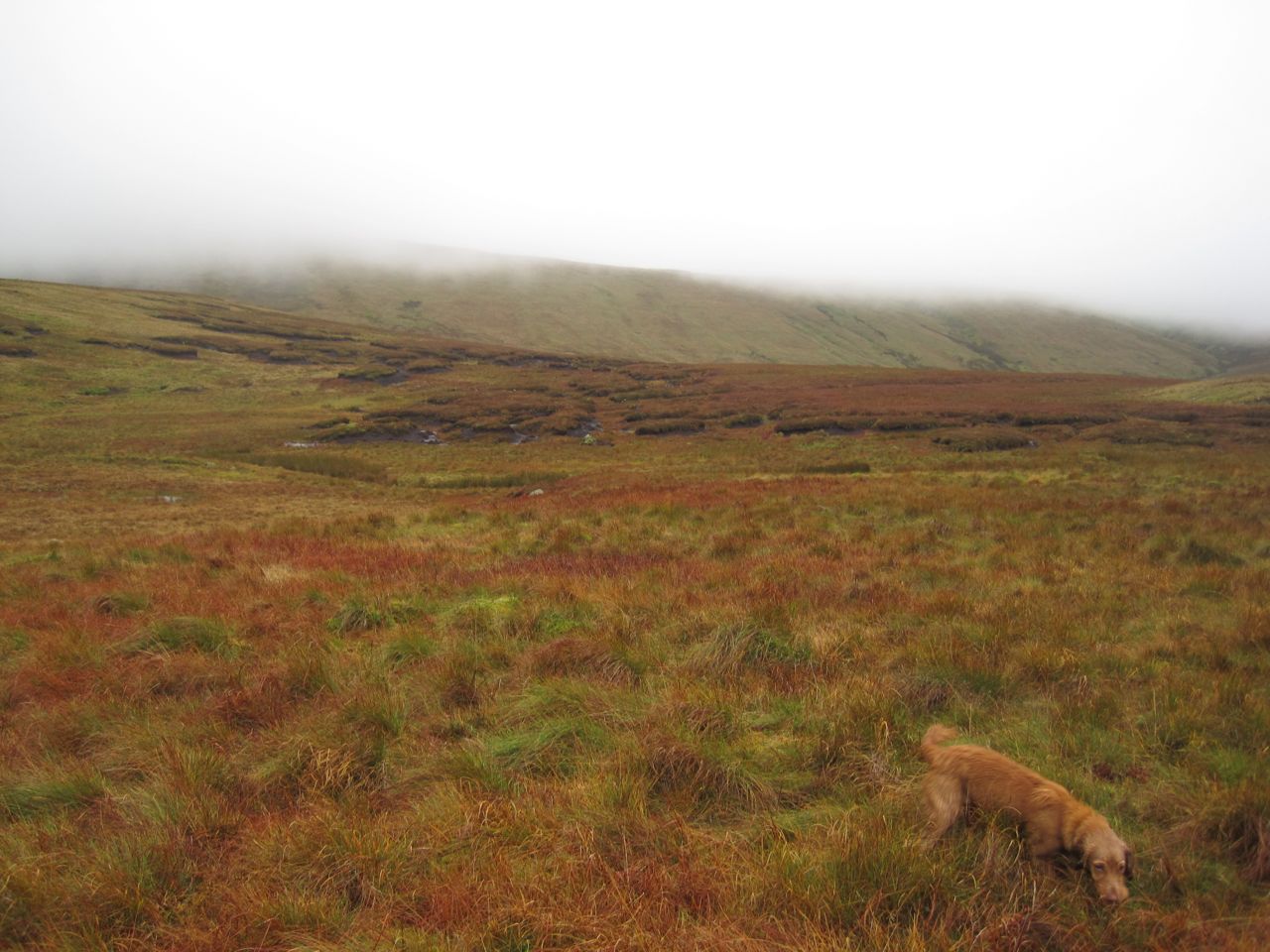
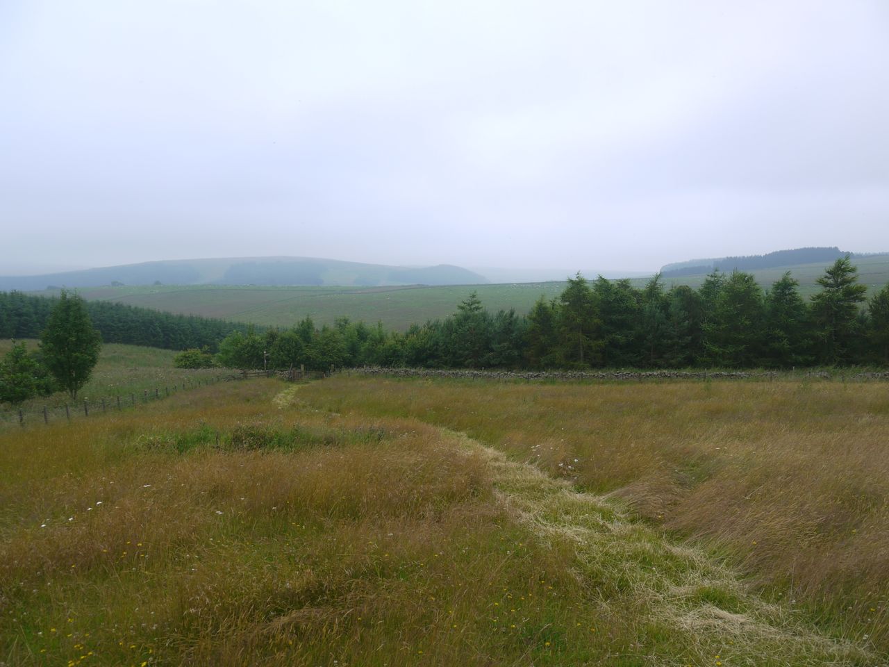
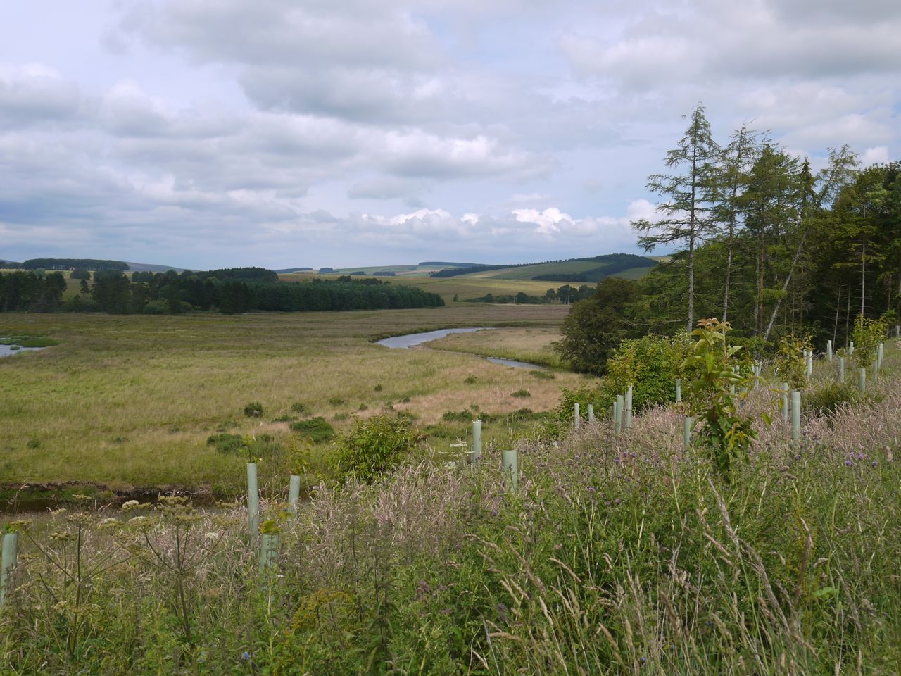
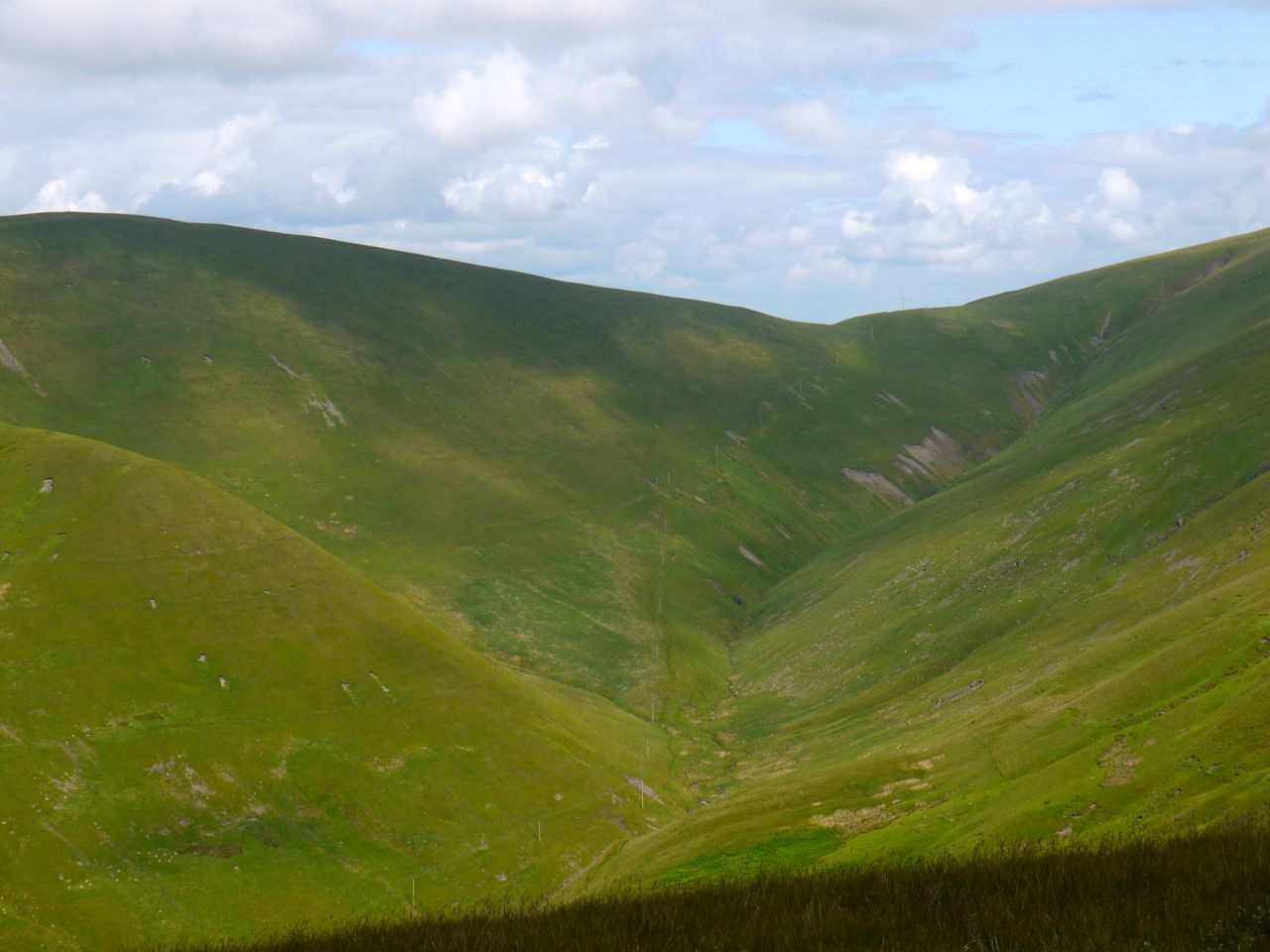
Fortypenny moss

Fortypenny moss

While coming down onto Fortypenny Moss we had occasional glimpses of Queensberry looming before us. Hills do look bigger in the mist so I tried not to get too dispirited. The higher ground of Fortypenny Moss has numerous peat hags so we accepted a little more descent and reascent, avoiding the hags. There was no escaping the marshy ground though.

Mount Glass now stood between us and Queensberry, a little more uphill before getting back into the marshy ground below Queensberry itself. My plan for climbing Queensberry was relatively easy. Head uphill, pass between two burns (Crook Burn and Hangingshaw Linn), walk to the acute angle in the wall/fence and then uphill to the summit. There did seem to be a faint quad bike track initially but that soon disappeared. Amongst the desolation, and lack of paths, there was a single well-defined boot print in the ground, so others had come that way.

The climb up Queensberry was a recurring cycle of seeing what looked like a large cairn at the top of a hill and then finding it was a stand of grass or a lone rock, and certainly not the top. With each disappointment we stopped briefly, gathered our energy, then pressed on. Then came the fence, and relief, since I knew we were now close to the summit.

A hare jumped out ahead of us and ran off with Eddie in pursuit, 12,000 years of domestication having failed to breed the predator out of him. The hare went through the closed gate but Eddie couldn’t follow so the hare lives to run another day. Eddie didn’t notice the vole (I think it was a vole anyway) that scurried across our path on the way down later in the day.

The ground changed becoming more rocky and less mushy and Eddie ran on ahead coming back when called but looking as if he had something on his mind. A few more paces on and I could see the problem. There were sheep on the summit of Queensberry, so poor Eddie went back on his lead until they had wandered off.

Queensberry was shrouded in mist, it wasn’t raining as such but the air itself seemed wet, and worse of all the wind was strong enough to blow Eddie aside and make it difficult for us to stand up without being buffeted to one side. This played havoc with our summit photos and there was no chance of setting up the camera with a timer.
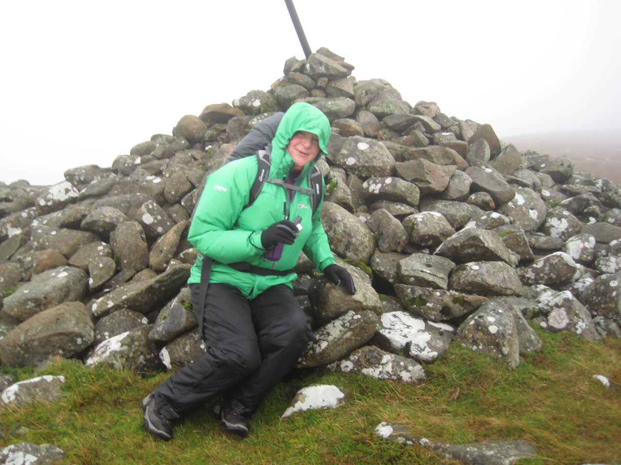
Queensberry

Queensberry summit

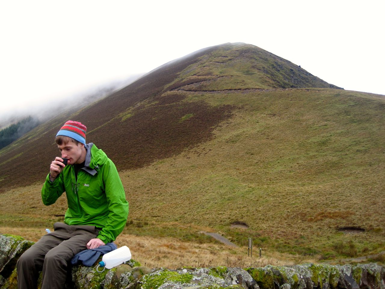
We hunkered down in the stone shelter by the summit cairn, sheltered from the worst of the wind. The sandwiches and coffee were very welcome and we knew the worst was over. Ah, ignorance is bliss.

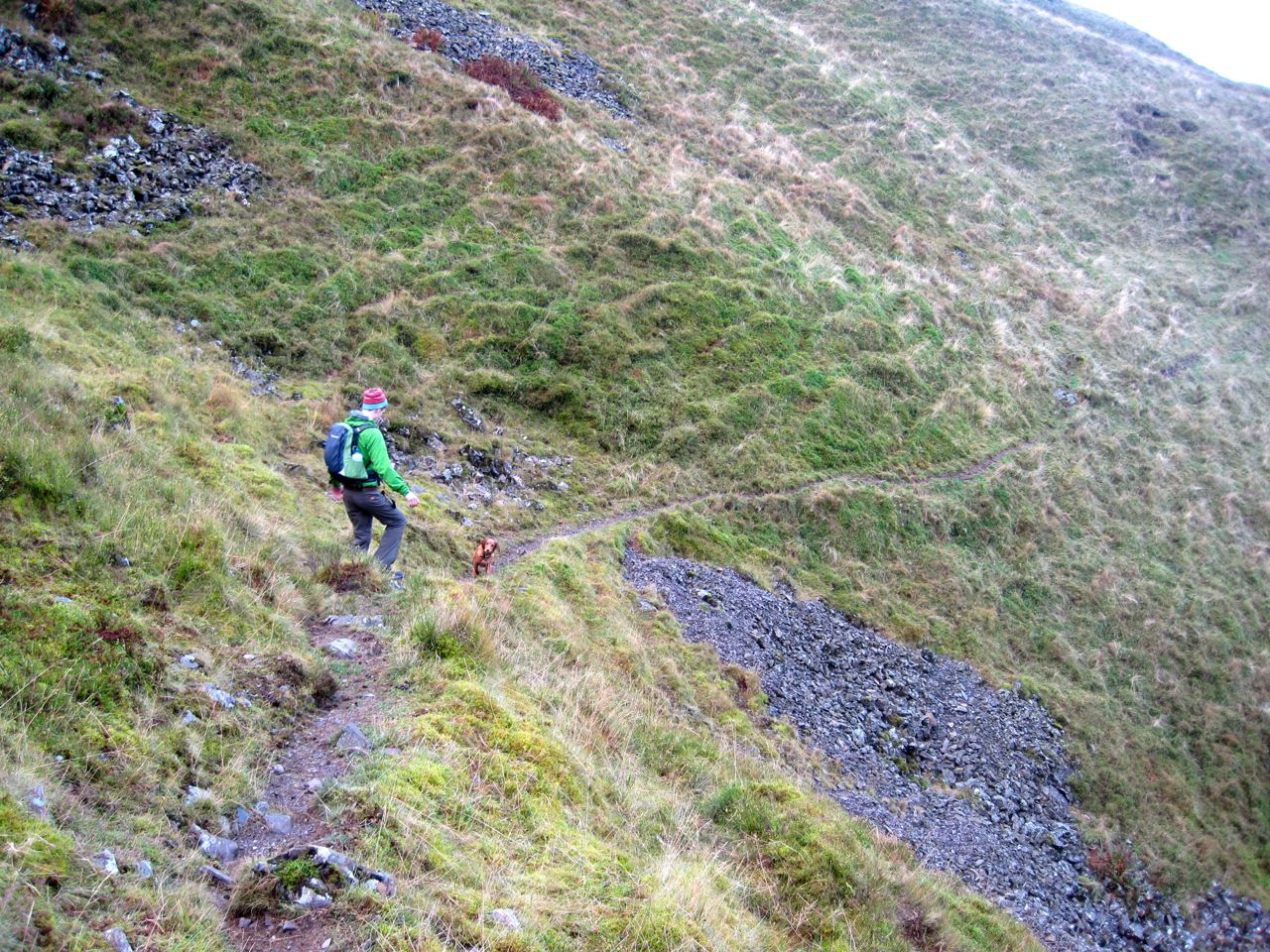
Fed, watered, and rested, we knew that it was all downhill from then on. As I have done on all my visits to Queensberry I took a bearing and we descended in to the mist. We were soon out of the wind and the cloud base was rising so we were soon able to see the way ahead. We followed the fence down to the Pot of Ae. This is a steep descent, not a big problem, except for the knees, but I wouldn’t want to attempt it in snow.

Pot of Ae

Pot of Ae, NT0000 is down there

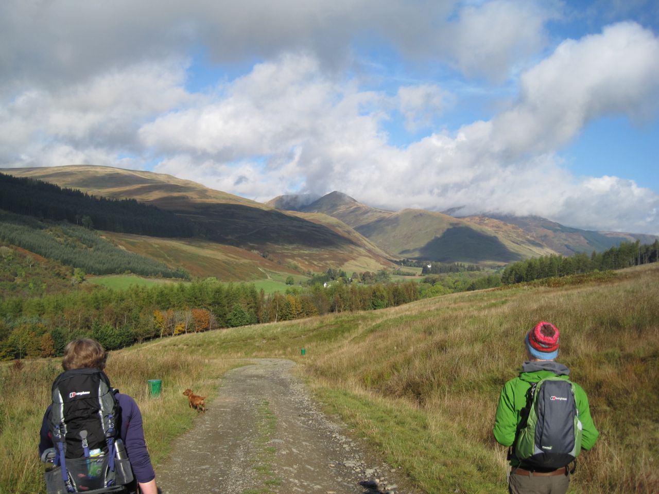
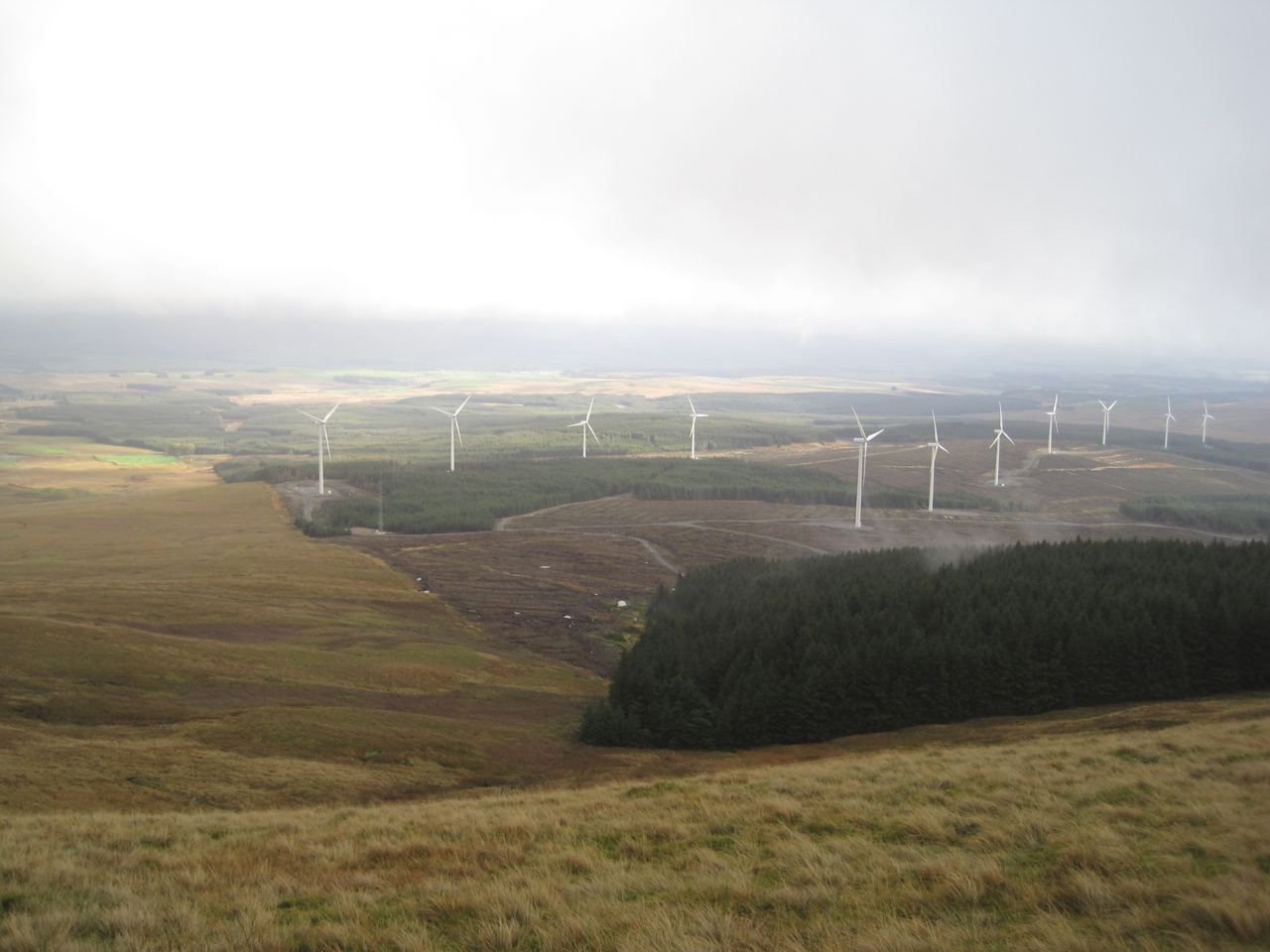
Our route was then along the tree line, though many trees have been cleared for wind turbines. This section of the walk was very boggy in places and there were several small waterways to cross. Eddie was a useful point man, I watched to see how far he sank to gauge whether I should take a particular line through the waterlogged reeds.

This section went on and on and on, the sound of squelching feet mixing with the whoosh of the turbines. The most interesting aspect was walking through square NT0000. There was no sign of Lochanhead and I began wondering if we could be going the wrong way, but there was no mistaking that we were between the tree line and Lochan Burn, just where we were supposed to be.  In actual fact it wasn’t that far, just under a couple of miles, and it didn’t take us particularly long, it just seemed that way.

Eventually we came to Lochanhead. We could see a a nice dry rocky path on the other side of the Lochan Burn but where it came down to the burn there was no way to make a dry crossing. I presume the burn was a little fuller with the recent heavy rains. The south bank of the burn, where we were, was particularly boggy and poor Eddie slipped into a pool and needed help to get out.

Looking ahead we could see cyclists on what turned out to be a newly built road emerging from Ae forest which presumably serves the wind farm. So we headed for the road, climbed onto its firm rocky surface and walked along it to the burn expecting a bridge. The road just ended there. No bridge.

This called for a plan. After a break for a drink we had our options in order. We walked back up the burn a little way. No dry crossings there, and we couldn’t face walking too far back up the hill. Next we tried continuing down along the south bank, but our way was blocked. So we embraced nature, accepted wetness, and decided to wade across. We found a place where it was mostly less than knee deep, got wet feet and climbed out onto the far bank with boots full of water. Eddie can’t cope with moving water yet so he got carried part way across then flung onto the bank.

There was then a maze like walk between parallel fences to get onto the road from Lochanhead to Kinnelhead. The ground between the fences was either waterlogged or flooded, but since we already had wet feet that wasn’t a problem.

I tried lifting my feet to let some water out of my boots, to no avail, and found myself torn between wanting to empty the boots to reduce the sensation that I was walking in  water-filled wellies and the competing  feeling that I couldn’t be bothered with the effort. I decided to try taking one boot off, emptied out water and squished my foot on a rock but that didn’t make much of a difference. Perhaps if I had changed socks it would have helped but since it was only about a mile back to the car we just squelched on.

As we reached the car, the heavens opened again, just to make it more troublesome for us to get changed.

PS That was a strenuous outing. I had some discomfort in my left calf as I walked. I am now limping badly when I move and finding it difficult to keep my eyes open when I sit down. Eddie is asleep at my feet which is usual for him. Even his energy has a limit.
[osmap gpx=”http://www.screel.co.uk/walks/wp-content/uploads/2014/10/RK_gpx-_2014-10-25_0937.gpx”]

Posted in Dumfries & Galloway | Tagged , | Comments Off on Squelch, squelch: onomatopoeia by the Pot of Ae

SUW12.2: the spell lifted

7.8 miles  3h 24m   450m ascent

IMG_0687Route: SUW from near Craigbeck (low level route) then along the Selcoth Burn to Sailfoot

Despite completing the SUW coast to coast in July, I was left feeling that the job wasn’t done until we had walked the two alternative sections. We had been back to walk the alternative route between Cogshead and Wanlock Water, and now we were ready to finish the last remaining section. When walking the Beattock to Potburn section we had previously used the high level route over Croft Head with its stunning views of the Moffat Hills. Now we needed to walk the low level route through Garrogill forest. This low level route is slightly longer by a few hundred metres but with 250m rather than 400m of ascent. Rather than doing the whole Beattock to Potburn section I chose a shorter walk, joining the SUW near Craigbeck and heading back along the Selcoth Burn.

Audrey, Conor, myself and Eddie (the pup on his first 4+ mile walk) set off from the A708 near Craigbeck, along a minor road and joined the SUW after crossing the bridge over Moffat Water. An SUW sign here also sports a Romans and Reivers marker so hopefully that route will have way markers when we come to do it. I took out the camera to get a photo….and it wouldn’t turn on.  I had forgotten to put the battery in it. Luckily the back-up camera was charged and looking on the bright side, I could carry the point and shoot in my pocket rather than having the heavier camera round my neck.

SUW sign with Romas and Reivers marker

SUW sign with Romas and Reivers marker

So with bigger camera stowed, and the wee camera in my pocket, I took Eddie through the gate beside cattle grid and we followed the farm track up a gentle slope. The cows were on the far side of the field and Eddie didn’t notice them being more interested in the nearby cow pats. There is a rather surreal gate here with a “lock the gate” sign and a STOP road sign just beyond it. This gate even if locked, and it was, can be walked or driven around since there is no fence at the side of it.

At the top of the field we came upon some sheep and a long necked black creature that Eddie found frightening. We can now add llama to the list of animals seen during our SUW walks. We past the last livestock here and Eddie was free to roam, taking the strain off my arm.

Misty forest

Misty forest

When we were last here there were good views along the Moffat valley but unfortunately we were walking in mist so there was little to see beyond our immediate surroundings and by the time the sun had burned it away we were in the valleys.

Craigbeck Hope

Craigbeck Hope

The walk was a slow climb along forestry tracks initially enclosed among the trees and then more open once we crossed Cornal Burn. Soon after passing the place where the SUW routes diverge we came to the isolated buildings at Craigbeck Hope with their Lion topped gateposts, a good excuse to stop for photos and a breather.

After a further mile and a half the forestry track dog legs, the Romans and Reivers route continues on the track but the SUW leaves on a narrow path through a forest break beside Wamphray Water. The ground within the dog leg was a profusion of different greens, looking too bright to be real but the point and shoot didn’t do it justice.

IMG_0683Eventually we could see Croft Head above us and Craigmichen Scar ahead. An information board stands where the alternative route join. We stood there, having now completed all of the SUW, “every inch” as Audrey put it. The SUW’s end is rather elusive. I felt I had reached the end when I stood with the sea lapping my feet at Cove Harbour, but later stood beside an information board claiming to be the end and later still, the Mercat Cross in Cockburnspath which the official guide has as the end. But it is done now and I feel the spell that had driven me along the SUW has been lifted. I am released to walk other paths if I choose.

Cat Shoulder

Cat Shoulder

The end of the SUW it may have been, but not the end of this walk. We had a late elevenses/early lunch in the sheep fold below the zig zag path of Cat Shoulder. It was not raining but the stones of the sheepfold suggest that wet is their usual state. The moss growing on them looked like seaweed.

Narrow track above Selcoth Burn

Narrow track above Selcoth Burn

There is a narrow track along the Croft Head side of Selcoth Burn. This crosses a steep scree slope and at times winds along rocky sections that are eroded in places. I wouldn’t want to walk here in bad weather but it soon levels out. We were able to cross the burn and join a farm track on the other side that took us down to Selcoth and then Sailfoot.

IMG_0711By now the mist was gone and the sun shining on the Moffat hills. Eddie had a good time jumping through the bracken, and luckily he didn’t notice the deer on the track ahead of us.

SUW: done.

Posted in Dumfries & Galloway | Tagged | Comments Off on SUW12.2: the spell lifted

SUW9.2: Cogshead again

9.7 miles  3h 24m  624m ascent

Old SUW markerRoute: Crawick Water at Nether Cog to Cogshead then the northern SUW loop to Wanlock water and Wanlockhead

Between Cogshead and Wanlock Water the SUW offers two routes, and when we last came this way in October, walking from Sanquhar to Wanlockhead, we took the route over Glengaber Hill, which is shorter. Having completed the SUW coast to coast I felt drawn to walk the alternative routes as well for completeness. The weather forecast was an amber warning for heavy rain all day, so we had a day in waterproofs. It certainly proved to be a wet day, but sometimes it was only light drizzle.

I presume this longer northern route exists to provide an alternative way across the hills if there is grouse shooting on Glengaber Hill. Descriptions I’ve read don’t exactly sell the Duntercleuch route, suggesting it is a boring trek along forest tracks with nothing to see but trees. And to be honest, there isn’t much evidence at Cogshead that the Duntercleuch route even exists. The SUW signpost at Cogshead only points towards the Glengaber route and gives no clue that there is a second route.

Cogshead is a bit isolated and getting to it offers limited options: The Glengaber SUW route from Wanlockhead, Stood Hill from Wanlockhead, the SUW from Sanquhar, or Nether Cog to Cogshead. Rather than walk routes I had used before I thought I would try something different, so we set off from the minor road near Nether Cog. A small bridge took us over Crawick Water then we followed a farm track that zig-zags up the steeper slopes of the hill. This gave us some views up the Crawick Valley albeit limited by the rain. On the flatter section we were faced with a junction. The main track continued on and another track went off to the left. A weathered signpost indicated that the onward track led to Sanquhar but the other part of the signpost was partially obscured by moss. With a little effort though we could make out “Cogshead 6km”. So that was our route.

This track led into the trees and then wound around the slopes of The Dod, steadily climbing until the cleuch of Glendorch Burn on Conrig Hill. The experience here is of walking uphill hoping each time we approached a bend in the track that we would find the climb was over.

Cogs Burn

Cogs Burn

From the track above Cogshead we could look down on the ruins of Cogshead, the SUW signpost and the rather unusual grassy hillock. Is it a hillock or is it a saddle? Who knows. From this point I stepped up my level of alertness. We had missed one of the SUW’s hidden kists back in November and this was a second chance to find it. We found the Ultreia marker post and knew the secret horde to be somewhere nearby.

The trees beside the path had been felled in the last few seasons and I thought that if the kist had been among the trees it would now be lost. But I kept my eyes peeled for the unusual and spotted something unnatural, the kist. I scrambled to it, pulled it open and retrieved my treasure, a bright coin with a pine cone emblem. I can see how easy it would be to overlook it.

Hidden Kist

Hidden Kist

Now we were back on the SUW and ready to take the alternate route. I had a recollection that the signpost at Cogshead had pointed to both routes when I was there in 2012, but I have since dug out the photos and I was mistaken. The photos do show though that the weather deteriorates with each of my visits to Cogshead.

The track from Cogshead wasn’t the boring forest trek I had been expecting. There has been tree felling but long enough ago that the desolation of the felled forest has been replaced by regenerated growth, heather with its purple flowers, bracken with green and yellow fronds and bright green saplings. And there were open views across the northern reaches of the Lowther Hills.

Kirkconnel's Hills

Kirkconnel’s Hills

I began to wonder if the SUW still considered this trail part of the official Way. We saw no SUW marker posts and there were no stiles or SUW kissing gates, so we had to use the normal gates which though not unheard of is unusual on the SUW. After about 2.5 miles of this forgotten route we reached a T-junction. Just a little while before this I had commented to Audrey that I wasn’t sure what direction the track was heading, having followed a wriggling route for over an hour. My compass was tucked away with the map in my rucksack, sheltering from the rain.

I wasn’t expecting the T-junction and having lost all sense of direction I realised I would need to get the navigation gear out. But then we noticed the SUW marker post with a bright yellow arrow instructing us to turn right. So the SUW hadn’t forgotten this route after all.

The marker post also had a Kirkconnel Paths Project disc, so we were joining the Kirkconnel Geology Trail. So we turned right and continued on our way. After another couple of dips and climbs we were looking down into the valley of Wanlock Water. A cairn above Duntercleuch, associated with the geology trail, informed us we were 14.4 miles from Kirkconnel and 2.8 miles from Wanlockhead. From there it was a welcome downhill stroll to the river.

Set in stoneFrom a distance Duntercleuch looked inhabited but close up it was in serious disrepair, especially the roof, and not fit for habitation. A small weather station stood on the hill nearby.

Wanlock Water

Wanlock Water

At Wanlock Water we had a choice, a bridge or a ford. I chose the bridge after stamping on it to test its firmness. The ford though would be easy to cross with dry feet (in waterproof boots). We then walked along the track, passed the point where the other SUW route rejoined us. The rain became heavier so we pressed on past the lead mining ruins of Sowen Dod, the ruined smelting works and the Beam Engine, into Wanlockhead.  We spotted a heron flying along the river but too far away for photos.

Beam engine

Beam engine

I’ve walked this last section a couple of times before and always thought of it as flat. It was obviously uphill this time. Perhaps in nice weather I didn’t notice the gradient? At least the Visitors Centre gave me a dry place to get changed.

So that’s another 4.8 miles of SUW done.

Posted in Dumfries & Galloway | Tagged | Comments Off on SUW9.2: Cogshead again

The Southern Upland Way: overview

Looking for the wells of the rees

The 212.6 miles of the southern upland way include coastal cliffs, upland moors, hills and mountains, meadows, riverbanks, loch side paths, farmland, parkland, woodland, country estates, paths across dams, farm tracks, drove roads, roman roads, ancient trade routes, and coffin routes. There are numerous stiles, kissing gates, and many bridges to cross both literal and metaphorical. The trail visits neolithic burial sites, cairns old and new, lead mines, ruined farms, pele towers, ancient earthworks, modern sculptures, fairy wells, castles, standing stones, covenanter memorials, one of the seven stanes, and the world’s oldest post office. Nature is all around, deciduous and coniferous woodland, numerous plants, farm animals as well as rabbits, hares (in both winter and summer coats), deer, mice, squirrels, foxes, and various birds both large and small. We walked in all weathers and trod upon dirt, mud, rock, grass, tussocks, heather, sand and even seaweed.

Our lunch spots were grassy knolls, tree stumps, sylvan glades, hillsides, a bus shelter, dense forest, moors (bleak and less bleak), ruined buildings (twice), deserted sheds, stiles (twice), sheep shielings, benches, dips, logs, and mossy banks.

According to the official guide the SUW is 212.6 miles long , but our GPS logged 230.2 miles. 6.8 miles were diversions off the official route either to visit interesting places or get to/from our cars, so our SUW distance was 10.8 miles longer than the official distance. 11.1 miles were above 500m and our highest point was at 725m on Lowther Hill. The SUW misses the top by 2m but we went the extra 2m.

The official guide splits the walk into 16 sections, varying in length from 7.75 miles to 20.5 miles. I split the walk into 19 sections, varying in length from 8.7 miles to 15.2 miles. The longest walks whether in distance or time were not the most arduous and in retrospect I think we were right to keep the distances below 15 miles for each day. We had more time to stop and stare.

The plan had been that a group of us would walk the complete Southern Upland Way one day at a time. I had foreseen that we would not all be available to walk each section together so some members of the group might walk some sections on different days, but I hoped we would resynchronise every so often. The first such synchronisation was to be at Beattock. I expected to re-walk some sections and thought the whole thing might take us 18 months.

Audrey and I have now completed the walk (between August 2013 and July 2014), but we were joined on several sections by other friends: David, Elaine, Joanna, Derek and Gwyneth. The company was a great help and everyone did their bit providing humour, stoicism, knowledge, encouragement, navigational advice, sweeties (both natural and processed), transport, eagle-eyes, and sunscreen when needed.

My recurring fantasy was of sitting with my feet in cool running water at the end of a hot day’s walking, and at Abbey St Bathans I sat in the sun, at the end of a 12 mile walk with my feet in the cool waters of the Whiteadder. Living the dream.

IMG_1152

I carried a pebble from the west coast to the east coast. Hidden along the way are thirteen kists, hordes of specially minted coins called 13ths hidden in individually sculpted containers. The word “Ultreia” is found on way-markers to give clues that the kists are nearby. We have come away with nine. (PS we subsequently found a tenth)

There are two sections with alternative routes. Between Cogshead and Wanlock Water there is the standard SUW route which takes a direct line across the upland moors and the longer alternative which I imagine exists to provide a detour if the moors are in use for grouse shooting. It winds north along forestry tracks through what is mostly forest on the map but is much more open now after felling. This track joins the “Set in Stone” geology trail for the last 2.8 miles into Wanlockhead. We returned to walk the alternative route in August and found the coin horde we had missed before.

We walked the other alternative route in October. It offers a choice between a high level route over Croft Head (637m) or a low level route beside Wamphray Water. I can only presume this is to offer a detour if the lower level route is closed for forestry operations or the weather makes the high level route too dangerous.

A few more stats:

  • Average mileage 12.1
  • Average climb 542m
  • Average time 5h 45m
  • Average mph 2.2
  • Average in excess of Naismith’s predicted time 30 minutes
  • Maximum elevation – Mount Lowther 725m
  • Minimum elevation – The North Channel and the North Sea sea level
  • Maximum climb – Beattock to Potburn 881m
  • Smallest climb – Tannylaggie to Caldons 263m
  • Total Net Climb – minus 39m (yes it is possible)
  • Shortest walk – Sanquhar to Wanlockhead 3h 45m (also shortest distance 8.7 miles)
  • Longest walk – Clenrie to Stroanfreggan 6h 37m (flooded fields etc)
  • Quickest pace 2.6 mph (Galashiels toLauder and Lauder to Watch Water)
  • Slowest pace 1.8 mph (Beattock to Potburn, steep climbs and trudging through snow)
  • Percentage of walks in waterproofs 37%
  • Walks requiring insect repellant – 2
  • Miles walked between the car and the SUW 2.9
  • Most people on a walk – 6
  • Least people on a walk – 2
  • Miles walked on major roads – 1.2
  • Miles walked on B roads – 1.5
  • Miles on OS yellow roads – 36
  • Wandered off the route – who’s counting?

The Sections are described in:

Some photos from the way


Posted in Borders, Dumfries & Galloway, Lanarkshire | Tagged | Comments Off on The Southern Upland Way: overview

Southern Upland Way: the Eastern Marches

ESUWThe eastern section of the SUW, from the River Tweed at Yair to the North Sea is 50.2 of the SUW’s 212 miles, though our journey clocked up 54.1 miles with 2628m ascent. This took us across the Tweed three times, over the Lammermuir Hills, and to the coastal cliffs overlooking the North Sea.

The official end of the walk is at the Mercat Cross in Cockburnspath, but 150m short of that is an information shelter that also claims to be the end of the SUW. For me though, the SUW is a coast to coast walk and ended at the coast as I dipped my feet in the water of Cove Harbour.

The Eastern section of the SUW, from the Tweed to the North Sea, took us along riverbanks, through farmland, woodland and finally a cliff top walk. The ruggedness of the west was now long behind us and we found ourselves walking into summer weather. To be honest I lost my SUW mojo a little in the Lammermuirs but after that the end was in our grasp and I got my energy back. At Twinlaw we looked excitedly for our first glimpse of the North Sea and again each time we reached high ground, but we were denied until within a kilometre of coast. We had found one kist but missed two.

We split this into the following sections:

  1. Galashiels to Lauder
  2. Lauder to Watch Water reservoir
  3. Watch Water to Abbey St Bathans
  4. Abbey St Bathans to Cockburnspath

For the previous sections see: The Western Marches and The Middle Marches

For Yair to Gala see Traquair to Galashiels

Galashiels to Lauder    15 miles  5h 45m  682m ascent

Easy walking on minor roads, an old Roman road, fields and a riverside stroll.

Look out for: The Quin Memorial, The Eildon Hills, kist

White water on the River Tweed-2

                                                           ***************************

Lauder to Watch Water reservoir     13.6 miles  5h 22m  ascent 552m

Easy walking on minor roads, across fields and over the moors of the Lammermuir Hills on the ancient herring road.

Look out for: Thirlestane Castle, the drystane seat at Snawdon, the Herring Road, Twinlaw Cairns, a Kist and possibly a glimpse of the sea.

Thirlestane Castle

                                                    *****************************

Watch Water to Abbey St Bathans     10 miles 4h 35m ascent 332m

Pleasant walking on minor roads, meadow and a final woodland stroll.

Look out for: Ali’s Cairn, views of the Dirrington Laws, Beech woods, Lammermuir Kirk, and the rusty ostrich.

Whiteadder Water

                                         **********************************

Abbey St Bathans to Cockburnspath     12 miles 5h 33m  ascent 414m

Straightforward walks on grassy tracks, minor roads and woodland tracks before a final cliff top walk.

Look out for: that ostrich again, Whiteburn Cairn, cliff top paraphernalia, THE SEA, Cove Harbour

Coast near Cove-2

                                          *************************************

Previous: The Middle Marches

Posted in Borders | Tagged | Comments Off on Southern Upland Way: the Eastern Marches

SUW19: The coast to coast complete

12 miles 5h 33m  ascent 414m

Coast near Cove-2Route: SUW Abbey St Bathans to Cockburnspath, plus Cove Harbour

This was the final leg of our Southern Upland Way trek and the weather forecast was for heavy rain all day, the TV news was warning of bad weather, the met office had issued an amber warning and our drove took us past several signs warning of the heavy rain. But we’ve seen it all before and came prepared with waterproofs and spare clothing.

We set off from the car park at the Riverside Restaurant in Abbey St Bathans, across the Whiteadder ford, having paused to watch some ducks (and a curlew) and rejoined the SUW by the rusty ostrich. The rain seemed to have stopped and it was pretty muggy so the waterproofs stayed in our bags.

Colourful gardenThe first section of this walk is in a valley carrying the Whare Burn. There is a grassy track which passes some cottages with a wide selection of flowers then skirts woodland beside the burn. The Burn itself was covered with small white flowers growing from a plant growing in the water, there were plenty of insects, both the annoying kind and butterflies. Ahead of us we could se birds of prey having a bit of a disagreement.

Path to Whiteburn

Path to Whiteburn

The SUW then left the track and climbed up across a field, the way indicated by a mown track. We walked watched by cows and calves up to an impressive cairn with a red weather cock atop. The cairn looked to be leaning slightly and had a fence around it but with a gate. There looked to be a small plinth that could have held an information board but there is nothing now. The cairn was apparently built to celebrate 100 years of tenure of the Whiteburn Farm by the Cockburn family (1848-1948). After this we passed through some trees and reached a minor road and Whiteburn Farm. A large sign here advertised the ultimate drink experience, but we had to leave that for another day.

Cairn near Whiteburn

Cairn near Whiteburn

The SUW here takes a detour around the farm rejoining the farm track on the far side of the buildings. A deer watched us then bounded away in the adjacent field. The track soon turned left but we struck out across a field, as advised by the SUW markers, and came to a minor road close to a lay-by. I had intended this to be our first drink stop but I must have been distracted and didn’t notice it.

We turned right after a short walk and followed a farm track down towards Blackburn Mill. On the way we passed a black bull lying by the fence. He had a heart on his shoulder which caught our eye. As we were taking some photos the farmer arrived and told us that they needed two bulls because there were so many cows but this rather forlorn beast was the number two bull and had been having a hard time of it in disputes with the other bull. He had a sore foot so was resting here on his own. The heart is apparently a Rawburn mark.

Bull with Heart

Bull with Heart

At the bottom of the slope we crossed Eye Water and turned right. Another bird of prey was active here. The track turned left but a sign asked SUW walkers to follow a route in a field rather than stay on the road. I did wonder who other than walkers could be following the SUW. Anyway an SUW gate invited us onto the grass. Unfortunately I difficulty squeezing through the gate, which would only open wide enough for the most lithe to pass. with some wriggling I passed the litheness test. Audrey and Gwyneth having watched my contortions, diagnosed the problem and opened the gate the other way. I have reflected on this experience and though they may have gained points for observation and intelligence, I did pass the litheness test that they chose to forego.

The field did not have a definite track other than immediately next to a beech hedge. Audrey thought this had been made by cows rather than people and I’m inclined to agree. You could only use the track by leaning out to avoid the hedge poking into your face. The alternative was very uneven ground. I don’t know why but there were lots of butterflies in the field. We left the field by another gate but this was designed to only open the one way.

A farm track led us to Blackburn Farm that was quite extensive with several Yorkshire boarded buildings. there weren’t any animals about though and I thought it looked like the kind of place one sees in gangster films. I didn’t see any film crews though. On the way out we passed a rusting pump that looked to be a piece of industrial sculpture rather than scrap. A minor road from the farm lead down to the A1, and by now we were looking for a spot to stop for a snack. I don’t like stopping near farms because it feels like having a break in someones garden.

There were no obvious places to sit so we took a break where the drive to Blackburn House left the road. Unfortunately about five minutes after our rest, the rain reached us. At first it was the odd spot but soon increased to the point that waterproof jackets were needed non-waterproof stuff was packed away. So we approached the A! in rain. Across the valley were some very tall trees with little foliage except on top suggesting the woods had been more extensive until recently.

The A1

The A1

An SUW sign told us were half-way, since both Abbey St Bathans and Cockburnspath were 5 miles. The A1 was busy but we didn’t have to wait too long before a break in traffic allowed us to cross. I don’t think Audrey was paying attention though because she didn’t cross and we had to wait another couple of minutes for her to get another chance.

There is a grassy path cut through the undergrowth on the far side of the A1 which winds along and reaches a tarmac road, the old A1. Its surprising how narrow this road was, and how quickly nature is beginning to overgrow it. The surface was very slippery, in places it was like walking on ice.

The main east coast railway to to our right. We passed a large concrete structure where the Pease Burn passed under the railway. I think this is some sort of siphon to protect the railway if the burn floods. We crossed the railway on a footbridge with signs asking that any vehicle impact with the bridge be reported to the police.

Penmanshiel Cottage

Penmanshiel Cottage

Once over the Railway we were in Penmanshiel Woods. We passed a derelict Penmanshiel Cottage with some unusual pink flowers. My photos didn’t turn out but perhaps G or A will have photos that allow us to identify it.

We were now walking on a woodland tack covered with pine needles and cones. The path gradually climbed and we were soon high above the burn. The OS map route of the SUW is rather confusing here but the route is well signed and much simpler than the OS map would suggest. In addition to the usual sounds of a forest we could hear shooting off to our left. Luckily it didn’t seem to be particularly close. By now our body clocks were recognising lunchtime but there were no handy logs or rocks to sit on. We decided to sit against a small bank that was relatively, dry being under thick branches and were able to dispense with our jackets.

Lunch in relative dryness, sitting down and sheltered from the elements recharged my batteries, though truth be told I was’t particularly in need of re-charging just then. After lunch we set off. Our waterproofs were packed away which was much more comfortable in the warm humid afternoon and when we later emerged from the trees the rain had stopped. About ten minutes after setting off after lunch we came to a bench that would have done nicely for lunch. I presume it was set where it was for the views but visibility was such that the only view was greyness beyond the trees. I imagine the sea would usually be visible from there.

After a gradual descent on the woodland track there was a steep narrow path down to the road at the bridge over Pease Dean. The bridge looked impressive but we didn’t find a good spot to photograph it. We decided to walk not the bridge for a better look at the deep wooded valley of Pease Dean. I hadn’t noticed it but Eagle-eyed Audrey spotted the sea from there, just visible 1km away. So we had to come to within a kilometre of the coast before we could see the sea. I sniffed for the odour of the sea but smelt Italian restaurant smell instead.

Pease Dean from the bridge

Pease Dean from the bridge

The next leg was through the Pease Dean Nature Reserve. the narrow grassy path here soaked my trousers below the calf. there were several steep descents with wooden steps. though these had chicken-wire on them they were still quite slippery and needed extra care. we crossed Pease Burn on footbridges and came to some newly constructed wooden steps and SUW gates that led us into a builder’s yard. What long distance footpath would be complete without sight of a cement mixer? Outside the builders yard there was a way around it.

Pease Dean Nature Reserve

Pease Dean Nature Reserve

We were now at a large seaside caravan park but there was a sea mist so the sea only 200m away was only just visible. some of the static mobile homes by the road look to be very nice (and I am sure, expensive) with excellent views on a clear day. The very minor road we now stood on had been the main Edinburgh-London coach route until the Pease Bridge was built in 1784. I certainly wouldn’t have fancied riding a coach on that steep narrow road. We walked up the road to a cottage with large bouncing dogs. Woof-woof- head appears above wall-woof-woof-another head appears briefly. It did look as if they were using a trampoline.

Signs indicated we should leave the road and join a cliff-top path. We were also now on the James Hutton Walk, one of the Borders Brains walks apparently.

Tricky gate

Tricky gate

The cliff top walk was straightforward to follow. Most of the time it was on the sea side of the fence but did sometimes cross to the field side where we walked beside a field of barley. There was a kissing gate designed for the slighter walker and there was some smiling as I tried to wriggle through. It was fun to watch the others have the same problem. These gates aren’t designed for people with rucksacks.

Coast near Cove

Coast near Cove

Unfortunately, the sea mist stole the views from us though we could make out some of the rock formations. I gritted my teeth in annoyance when we walked past a sign warning of the dangers of falling off steep cliffs. There were no signs warning that the sea was wet, though.

The cliff top had a few unexplained structures: a white pole with steps like those on a telegraph pole (perhaps and old warning beacon); a pole with two dangling kite like structures (a scarecrow?); and a twisted railway track (some sort of sculpture). We could see Cove Harbour below us and decided that we needed to go down to the sea to have completed the Coast to Coast Walk. So where the SUW turned inland we continued on to the few houses above the harbour. There is a memorial here for those who lost their lives in a fishing disaster in 1881.

Fishing Disaster Memorial

Fishing Disaster Memorial

We then turned down a path leading to the harbour. When the tide is in in would not have been possible to walk from one pier to another and a tunnel has built through the cliffs to allow access. Audrey and I were aware of the tunnel from reading our SUW guidebooks. Gwyneth was unaware and lagging a few paces behind us looking out to sea, so when Audrey and I turned into the tunnel, Gwyneth carried on the path.

So when we got down to the beach and looked around we saw Gwyneth up on the pier. She had though she would need to use a ladder to get down to us but luckily she found the stone steps. Cove harbour is a pretty place even when the surrounding area is shrouded in mist, but I’ll have to admit that my mind was concentrating on reaching the water’s edge to complete the Coast to Coast. As I strode across sea-weed I knew I was at the coast and when I dipped my feet in the North Sea I felt the walk was complete. Audrey did the same and we had a few minutes of exchanging cameras for photos.

Cove Harbour, the end of the coast to coast

Cove Harbour, the end of the coast to coast

That might have been the “end” of the walk in mind but the official end was still a mile away in Cockburnspath. So we walked back up to the cliff top and rejoined the SUW. A track took us past Cove Farm, under the main railway and the A1. By the Cockburnspath War Memorial is a Southern Upland Way information shelter with a sign reading “Cockburnspath – End of the Southern Upland Way”. So we posed for more end of the walk photos.

End of the SUW

End of the SUW

The official end of the SUW though is at the Mercat Cross in Cockburnspath so we walked up (yes, up) the last 150m to the Mercat Cross for more photos.

We celebrated with Ginger Beer and bucket-and-spade cakes courtesy of Audrey.

So that is the SUW completed. It has taken us 19 days. We have walked 230.2 miles with 10,295m of climb (and obviously 10,295m of descent). The official distance is 212 miles and I worked out we walked 6.8 miles off piste so to speak, in walking to the car or visiting places off the SUW, so our SUW walk was 223.4 miles.

The End….except for the alternative sections…


Posted in Borders | Tagged | Comments Off on SUW19: The coast to coast complete

SUW18: Ginger beer by the Whiteadder

10 miles 4h 35m ascent 332m

Whiteadder WaterRoute: SUW Watch Water Reservoir; Highest point 316m on Commonside

It was another long drive in for this walk, and we were held up in traffic on a very minor road near Millburn Bridge. This looked to be a local riding of the marches with a great many horses which came along the road then galloped up Cockburn Law. After this minor hold up we drove on to Abbey St Bathans and parked near the Riverside Gallery. The owner came out and asked us to park on the far side of the track rather than the restaurant car park. She also suggested we might nip in for a drink after our walk. There is an SUW information board here with leaflets and a cist map.

More than three hours after setting off we reached Watch Water and squeezed the car in next to those of the anglers practising their hobby in the reservoir. The sun shone brightly to remind us of the need for sunscreen and was to give us good weather for the whole of our day.

Ali's Cairn, Great Dirrington and Cheviot in the background

Ali’s Cairn, Great Dirrington and Cheviot in the background

We started with a brief uphill walk onto Windy Law, so we were soon warmed up. At the top of the slope is Ali’s Cairn, commemorating a local keeper, Alisdair Thomson who died in 2011 at just 39 years old. From his cairn there are views back across Watch Water to the cairns of Twinlaw and south with The Cheviot and the Dirrington Laws, Great and Little, these last two are ancient volcanic intrusions with man-made cairns visible on their summits. I stood watching a tractor moving through the filed by road, seagulls swarming about it, and saw several hares escaping ahead of it.

Rawburn Farm was very neat with a well tended tree lined avenue leading down from it. After that we walked down the single track road past a Water Treatment plant, with an emergency shower just inside the perimeter fence, over the Watch Water and down through trees alongside the Dye Water into Longformacus. There were plenty of wild- flowers in the hedgerows, including white, pink and purple foxgloves, and even a few bright red poppies. Longformacus has an SUW information board with more leaflets, booklets on walks near the eastern part of the SUW and SUW postcards. As we walked into Longformacus I had been assailed by swarms of insects. I thought I was being selectively targeted but once I got closer to Audrey and Gwyneth I felt a little better to find they had the same problem. Luckily, Audrey had brought insect repellent along and I squirted it on my hat. Gwyneth decided to be the control arm of the study and did without (at first). Once we had shaken off the flies we could have a snack in peace.

Dye Water

Dye Water

Rehydrated and refuelled we set off again. The SUW turned along the road to Ellemford Bridge, initially through trees but then in more open farmland with views along the Dye Water.  Organic material on the road suggested that horses had passed that way before us.

Dye Water

Dye Water

After 3.4 miles of road walking the SUW crossed a stile, left the road behind and headed on to Otterburn Hill (which is not named on modern OS maps). Once over the stile it was not obvious which way to go. A shallow cleugh, if such a thing can exist, with rough ground either side climbed the hill, while an improved field stood across a fence. There was a gate, but that looked as if it would need machinery to open it, so working on the assumption that the SUW usually provides stiles or gates we ignored the gate and headed up the hill beside the red dirt of the cleugh.

As we climbed we could soon make out another stile at the top and once there an SUW marker post was visible on the hilltop beyond. Otterburn Hill has a look of moorland and there is a red dirt track across part of it. This red dirt was the first I recalled on the SUW, so perhaps we had walked into a different geological region. A fallen signpost informed us that Abbey St Bathans was 5.5 miles away oblong the SUW. A mile or so away to the SE on Black Hill stood a wind turbine farm, its blades all turning in unison.

ThistleOn Otterburn Hill, amongst the grasses there were many small wildflowers and numerous thistles just coming into flower. There were several white thistles, which was a first for me.  The remainder of the climb up Commonside was through a wonderful meadow. The grass was at that perfect height that allows you to trail your hands through its tops as you walk. There were a variety of small and large butterflies, which flew ahead of me like the hares that had run before the tractor earlier in the walk. To our left was a beechwood the branches of its trees loaded with nuts. And for extra colour, numerous small bright flowers by my feet.

White ThistleThe meadow ended at at fence with a stile. The SUW here takes a very short dogleg turning left across the stile than immediately right. This immediate right turn, which basically means we are heading in the same direction, could be missed, the only indication that we should head that way was a stile. There was presumably once a fence or gate there but now the stile stands alone. This led us along a short overgrown grassy break that was insect infested. A poor crow that looked none too well was hopping along ahead of us. A right turn, and more stiles took us over the highest point of this walk. I had hoped we might have our first glimpse of the North Sea from here, but it was not to be.

Beech Nuts

Beech Nuts

We had by then entered “lunch-time”, the period during which one looks for suitable spots for lunch…somewhere to sit that is not fly infested. I suppose we could have sat in the grass of the hillside but the flies were still following us. Our trek across untracked fields, following SUW posts, led us to a farm/forestry track that took us through Lodge Wood to the B6355. There were no likely lunch spots in the wood.

We passed Whitchester Lodge, which was a pretty sizeable lodge. We hadn’t sen the big house itself but it must be massive if the lodge was this size. The SUW only used the road for a very short distance and we soon reached the SUW sign pointing us up a track climbing the slopes of Abbey Hill. There was a drystone wall by the road that would have served as a seat but we thought it best to lunch away from the road.

Perhaps it says something about me, or perhaps even my English teacher that when I saw the sign by the road, “no more wind turbines in the Lammermuirs”, my first thought was that the first letter was not capitalised. The sign also gives a URL but it no longer exists so perhaps the battles have already been fought and one side or the other has won through.

Abbey Hill

Abbey Hill

So, still in lunch-search-mode we took the path zig-zagging up the slope. A new signpost pointed to Windy Windshiel and an information board told us a little more. It was 500m off our course and there did not look to be any obvious track so we stuck with the SUW. The track we were on ended at a a gate. I had thought we should awl up to the tree line and follow that but Audrey spotted a signpost lying on the ground. This suggested we should carry straight on, but that would begin to take us down the hill, so we headed up for a short while then started to come down again at which point Gwyneth spotted a marker post below us and we were back on track. We joined a sheep trail that took us across the top of a gully and up to the tree line.

On the OS map the SUW leaves the trees and heads directly down into Robber’s Cleugh and one of my SUW books describes grassy steps descending the steep sides of the cleugh. The SUW marker posts however kept us alongside the trees and down into the cleugh beside the fence. The route then heads along the cleugh, passing through two SUW gates either side of a wee gully, before joining a forestry track where it crosses the burn. This must be an alteration from the route on the OS maps and guidebooks. Older maps have Robbers’ Cleugh rather than Robber’s Cleugh. Was it one, or many?

The forestry track had several large tree trunks beside it that were just what we needed for lunch seating. Comfortable dry seating makes such a difference to a walk.

After lunch we carried on along the track through Roughside Wood which took us past the 200 mile mark from the official SUW distances, but was 216 miles for us. (That would be just 210 miles if we exclude additional distances walked off the SUW such as visiting Minch Moor summit, or walking off SUW to the car.).

This track was high above Whiteadder Water with a steep drop. We couldn’t see the river very well at this stage but there were other things to see. Squirrels ran across the track a couple of times but I wasn’t fast enough with the camera. There were banks of fine grass that looked like green waterfalls and masses of hair-cap moss. After the dry ground of the start of this section, I was surprised to find muddy puddles on this track.

Lammermuir Kirk

Lammermuir Kirk

I wondered how we would get down to the level of the river and if we had a steep descent ahead of us. As it was, though, once we left the trees the the track descended none too steeply and we were soon by the river. We had good views of a heron which then flew off downstream. There were more flowers by the river including some wild geraniums.

Abbey St Bathans was not far away and soon enough we were stood beside the village’s  red phone box, and GR post box. We walked by Lammermuir Kirk and a house with an SUW sign, perhaps a B&B?

Gurkha Bridge

Gurkha Bridge

A footbridge took us across the Whiteadder and into Shannabank Wood. I mentioned that it had been built by Gurkhas in 1987 and Gwyneth was very impressed that I knew this. I did know this before the walk but beside that there was a plaque by the bridge that said the same. The Whiteadder was certainly a pretty river and reminded me of both the Water of Milk and Annan Water from the Annandale Way.

Our final section was a woodland walk, the forget-me-nots had such bright colours that they looked to have been photoshopped into reality. I did begin to have some misgivings in these last minutes of the walk. I should have checked that there was still a bridge back across the Whiteadder to the car. If there wasn’t I might have to use the ford.

We crossed footbridge over a small burn and saw a substantial tree house in a garden nearby and then found ourselves at the ford. I could see my car across the river and there was a footbridge. The ford was there as well, but it was part ford and part bridge and stood dry above the water. An ostrich made of scrap metal watched me as I decided between the bridge and the ford.

Metal OstrichI decided to use the ford and the water flowing beneath it looked so inviting that I did what I had dreamed of all along the SUW. I took off my boots and dangled my bare feet in the cool waters. Joy.

The Riverside Restaurant near which we were parked was too inviting to ignore so we had ginger beer sitting in its courtyard watching swallows darting about. The restaurant looks to have been a saw-mill in its previous life and is both a gallery and a restaurant now. There is a sawmill across the road so I presume that business merely moved to new premises.

I had not particularly enjoyed the last section, but this short section was very pleasant, and we had good weather while walking. The rain came as we drove home.

One more section to go.

Posted in Borders | Tagged | Comments Off on SUW18: Ginger beer by the Whiteadder

Steygail: scaling the sleeping dog

4.7 miles 2h 24m ascent 496m

Dalveen PassRoute: Up on Dalveen Rig, down the western ridge. Highest point Steygail 573m

Steygail means Steep Gable and it stands guarding the Dalveen Pass, a massive steep sided hulk that doesn’t lend itself to being climbed with its adjacent hills being separated from them by steep sided valleys. Its shape is reminiscent of a sleeping dog, but with its tail extended. My route took me up the  steep sides of its hind-quarters, along the top of its curved back, up its neck to the summit at the top of its head, then down its nose. The downside was that I had to climb back over its hind-quarters again on the way back.

Dern Craig

Dern Craig

The forecast had been for rain but that came later so I got sunshine for the walk. There is parking space just off the A702 (a lay-by) with excellent views of Dern Craig. My SMC Southern Uplands book suggests this as a descent route from Steygail. In the photo it seems OK but it looks steeper in real life and definitely wasn’t the way for me. Mountaineers would breeze down it I’m sure, but a hillwalker like me, no thanks.

The track to Dalveen has a sign both for “Dalveen”, but also one of the Covenanter’s Trail signs “CT18”. I had searched for more information on the Covenanters’ Trail signs when I first saw one near Mitchellslacks. After this walk I tried again, and again it was in vain. Somewhere there must be a list.

Dalveen

This area felt the effects of Scotland’s Killing Times in the seventeenth century. A troop of Dragoons escorting prisoners along the Enterkin Pass was ambushed by a group of Covenanters, killing the commander and rescuing some prisoners. A its height the Covenanters had a an army of 30,000 that played a major role in the wars of the three kingdoms (the English Civil War). My day was free of ambushes, and indeed once I left the A702 I didn’t see another soul. Times are more peaceful now.

The farm track descended to cross the Dalveen Burn then began a gradual climb, passing the buildings at Dalveen. I see there is a covenanters memorial nearby, but I only realised that after the walk. A sign on the A702 said there was parking for an art studio, but I didn’t see any obvious sign of the studio.

Past the buildings at Dalveen I took a track up the hillside, which passed through a stand of trees that was infested with flies, but luckily they seemed to like the trees and didn’t follow me when I left the trees. This track zig-zagged a bit and brought me to the col between Dalveen Rig and Nether Dalveen Dod. I had planned to walk to the fence then follow that onto Dalveen Rig but once there I found a quad bike track heading up Dalveen Rig and followed that, saving myself a few metres.

Bracken covered Bught Hass

Bracken covered Bught Hass

This was me on the hind-quarters of the sleeping dog, Nether Dalveen Dod being the tail. I then had a gradual climb along the Rig with Glenvalentine separating me from Steygail’s summit. The hill curls to the left around Glenvalentine and the ATV track I was following took a more direct route, cutting off a corner. I chose to carry on directly up, staying near the fence (which isn’t on the OS25k). With a little more up and down I was soon at the top of Steygail. The hill has a flat boggy top with no summit marker and no obvious summit so I wandered about all the possible highest points then squatted for a drink there being nowhere to sit.

Lowther from Steygail

Lowther from Steygail

Steygail Summit

Steygail Summit

The views from Steygail, and its ridges, included the Lowther Hills with their radar equipment, the Cold Moss-Comb Head ridge from our SUW outings, the Durisdeer Hills, Cairnkinna with its visible cairn, Criffel, the two bigger Cairnsmores, the Enterkin and Dalveen Passes and the Nithsdale valley.

Enterkin Pass

The head of the Enterkin Pass

I choose to descend along the unnamed western ridge, and Cairnkinna was my direction guide. This was not particularly steep but did challenge my knees a little (and my thighs are aching after it). I joined the route along the Enterkin Pass at just about the only place an ambush could be set up. I had read that the ambush was on the steep sides of the pass but that seems unlikely there being no hiding places.

The downside of this way down is that it goes down to Enterkin Pass and requires a 100m climb back out over the Dalveen Rig-Nether Dalveen Dod col. There is however a gravel track that zig-zags up the hill.

Once back up I then followed the track I had used earlier back to the start point.

Track near Dalveen

Track near Dalveen

This was a pleasant walk with good views.There were plenty of summer wildflowers to see on the walk and a couple of hares that were too quick for photos. There were some birds of prey flying about but not close enough that I could identify them.

[osmap gpx=”http://www.screel.co.uk/walks/wp-content/uploads/2014/07/RK_gpx-_2014-07-05_1002.gpx”]

Posted in Dumfries & Galloway | Tagged | Comments Off on Steygail: scaling the sleeping dog