
10 miles 4h 35m ascent 332m
 Route: SUW Watch Water Reservoir; Highest point 316m on Commonside
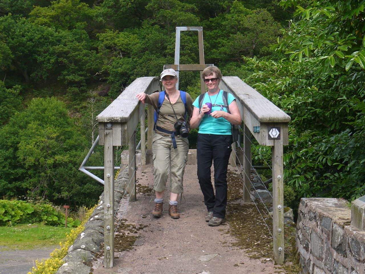
It was another long drive in for this walk, and we were held up in traffic on a very minor road near Millburn Bridge. This looked to be a local riding of the marches with a great many horses which came along the road then galloped up Cockburn Law. After this minor hold up we drove on to Abbey St Bathans and parked near the Riverside Gallery. The owner came out and asked us to park on the far side of the track rather than the restaurant car park. She also suggested we might nip in for a drink after our walk. There is an SUW information board here with leaflets and a cist map.
More than three hours after setting off we reached Watch Water and squeezed the car in next to those of the anglers practising their hobby in the reservoir. The sun shone brightly to remind us of the need for sunscreen and was to give us good weather for the whole of our day.
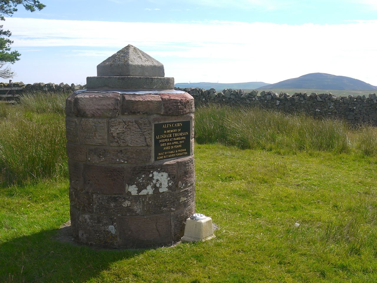
Ali’s Cairn, Great Dirrington and Cheviot in the background
We started with a brief uphill walk onto Windy Law, so we were soon warmed up. At the top of the slope is Ali’s Cairn, commemorating a local keeper, Alisdair Thomson who died in 2011 at just 39 years old. From his cairn there are views back across Watch Water to the cairns of Twinlaw and south with The Cheviot and the Dirrington Laws, Great and Little, these last two are ancient volcanic intrusions with man-made cairns visible on their summits. I stood watching a tractor moving through the filed by road, seagulls swarming about it, and saw several hares escaping ahead of it.
Rawburn Farm was very neat with a well tended tree lined avenue leading down from it. After that we walked down the single track road past a Water Treatment plant, with an emergency shower just inside the perimeter fence, over the Watch Water and down through trees alongside the Dye Water into Longformacus. There were plenty of wild- flowers in the hedgerows, including white, pink and purple foxgloves, and even a few bright red poppies. Longformacus has an SUW information board with more leaflets, booklets on walks near the eastern part of the SUW and SUW postcards. As we walked into Longformacus I had been assailed by swarms of insects. I thought I was being selectively targeted but once I got closer to Audrey and Gwyneth I felt a little better to find they had the same problem. Luckily, Audrey had brought insect repellent along and I squirted it on my hat. Gwyneth decided to be the control arm of the study and did without (at first). Once we had shaken off the flies we could have a snack in peace.
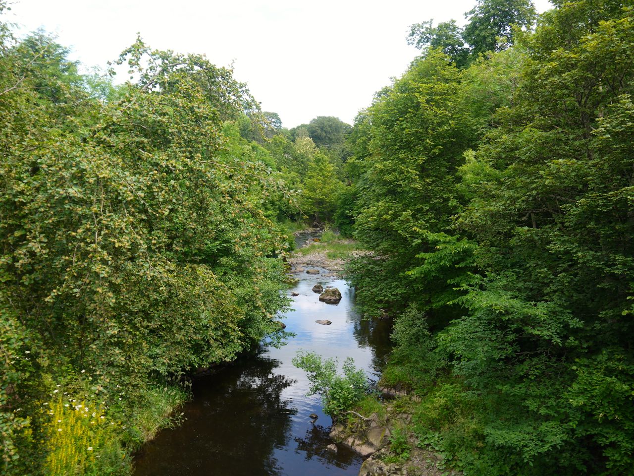
Dye Water
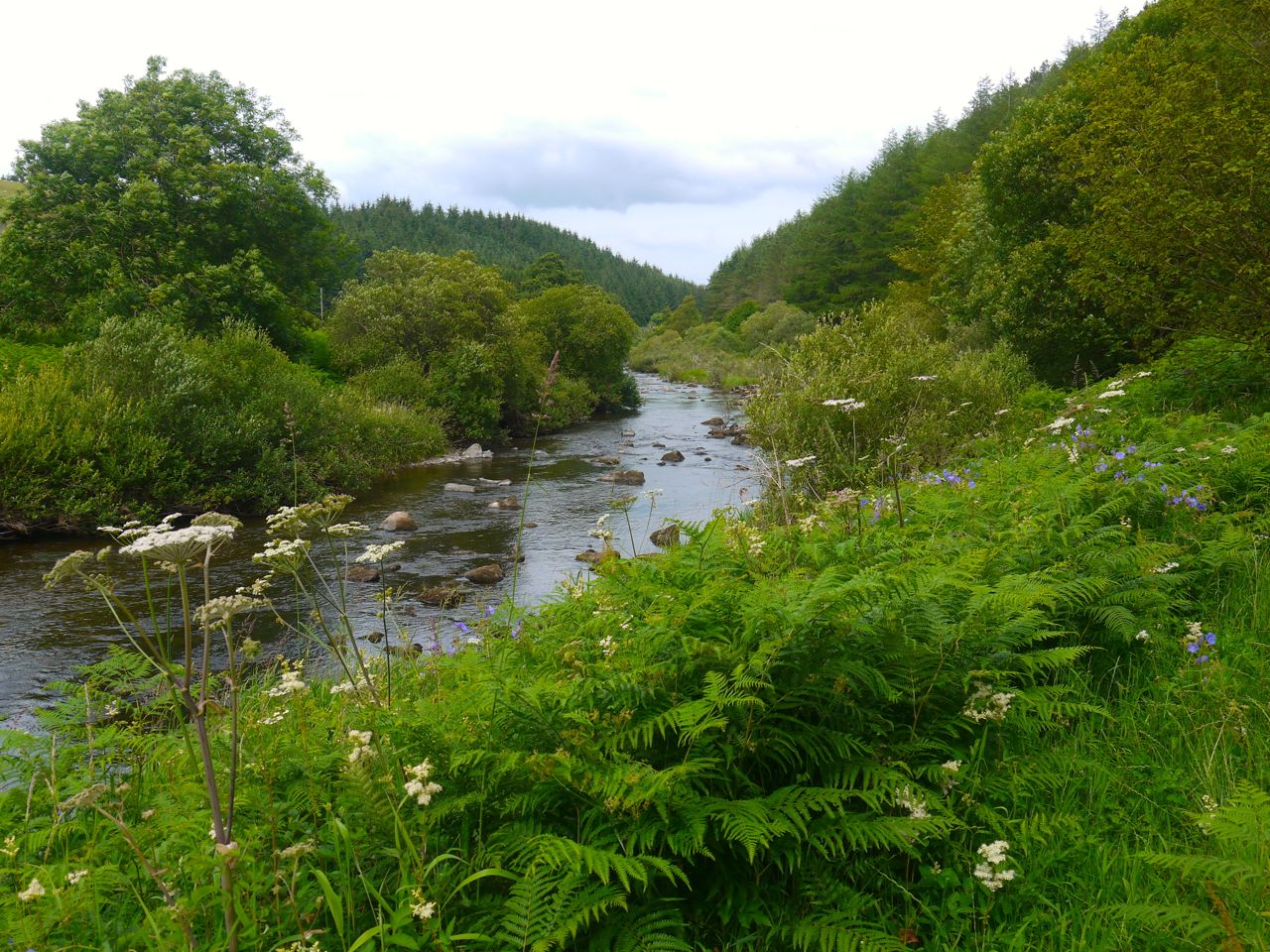
Rehydrated and refuelled we set off again. The SUW turned along the road to Ellemford Bridge, initially through trees but then in more open farmland with views along the Dye Water. Organic material on the road suggested that horses had passed that way before us.
Dye Water
After 3.4 miles of road walking the SUW crossed a stile, left the road behind and headed on to Otterburn Hill (which is not named on modern OS maps). Once over the stile it was not obvious which way to go. A shallow cleugh, if such a thing can exist, with rough ground either side climbed the hill, while an improved field stood across a fence. There was a gate, but that looked as if it would need machinery to open it, so working on the assumption that the SUW usually provides stiles or gates we ignored the gate and headed up the hill beside the red dirt of the cleugh.
As we climbed we could soon make out another stile at the top and once there an SUW marker post was visible on the hilltop beyond. Otterburn Hill has a look of moorland and there is a red dirt track across part of it. This red dirt was the first I recalled on the SUW, so perhaps we had walked into a different geological region. A fallen signpost informed us that Abbey St Bathans was 5.5 miles away oblong the SUW. A mile or so away to the SE on Black Hill stood a wind turbine farm, its blades all turning in unison.
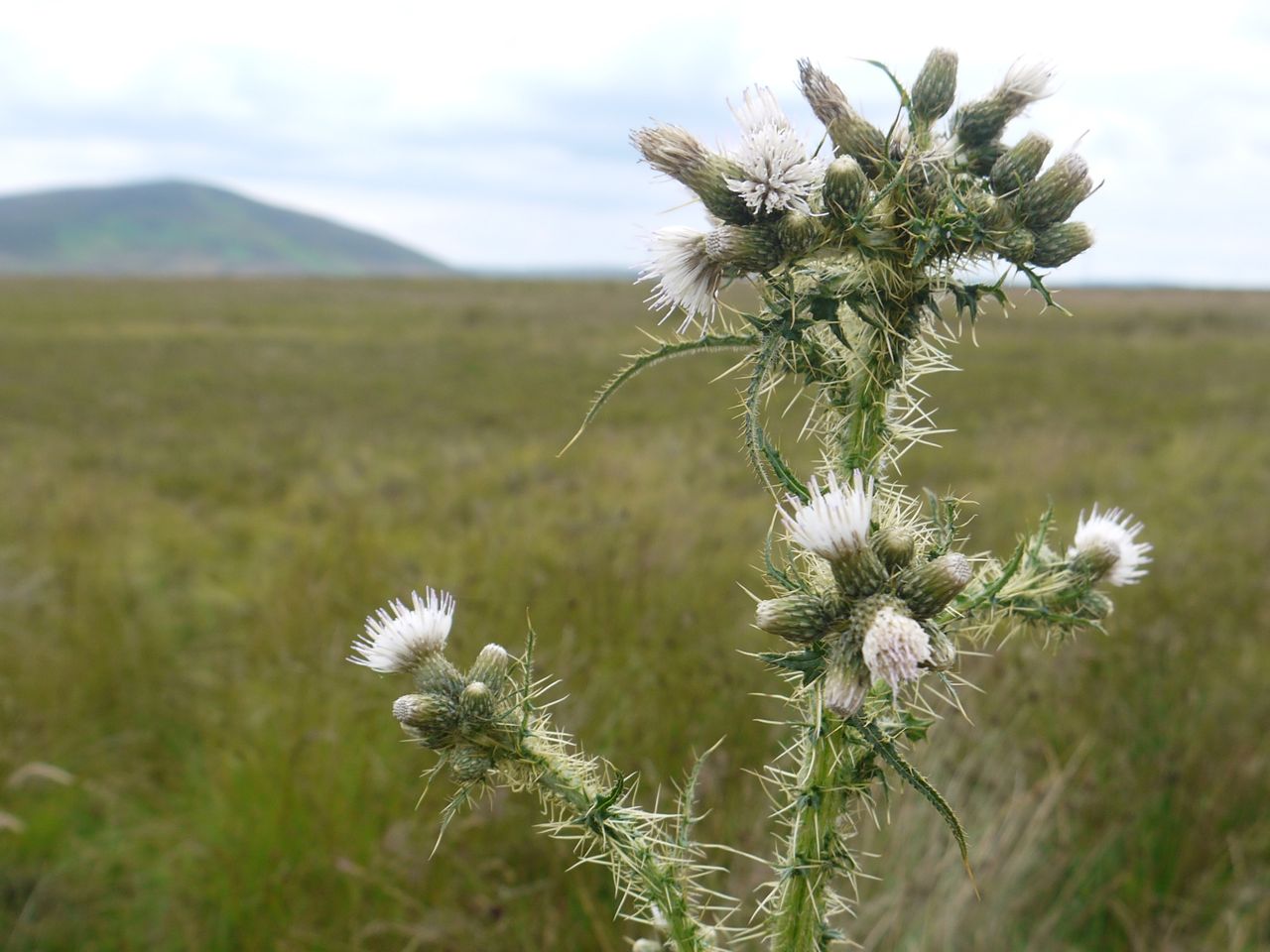
 On Otterburn Hill, amongst the grasses there were many small wildflowers and numerous thistles just coming into flower. There were several white thistles, which was a first for me. The remainder of the climb up Commonside was through a wonderful meadow. The grass was at that perfect height that allows you to trail your hands through its tops as you walk. There were a variety of small and large butterflies, which flew ahead of me like the hares that had run before the tractor earlier in the walk. To our left was a beechwood the branches of its trees loaded with nuts. And for extra colour, numerous small bright flowers by my feet.
 The meadow ended at at fence with a stile. The SUW here takes a very short dogleg turning left across the stile than immediately right. This immediate right turn, which basically means we are heading in the same direction, could be missed, the only indication that we should head that way was a stile. There was presumably once a fence or gate there but now the stile stands alone. This led us along a short overgrown grassy break that was insect infested. A poor crow that looked none too well was hopping along ahead of us. A right turn, and more stiles took us over the highest point of this walk. I had hoped we might have our first glimpse of the North Sea from here, but it was not to be.
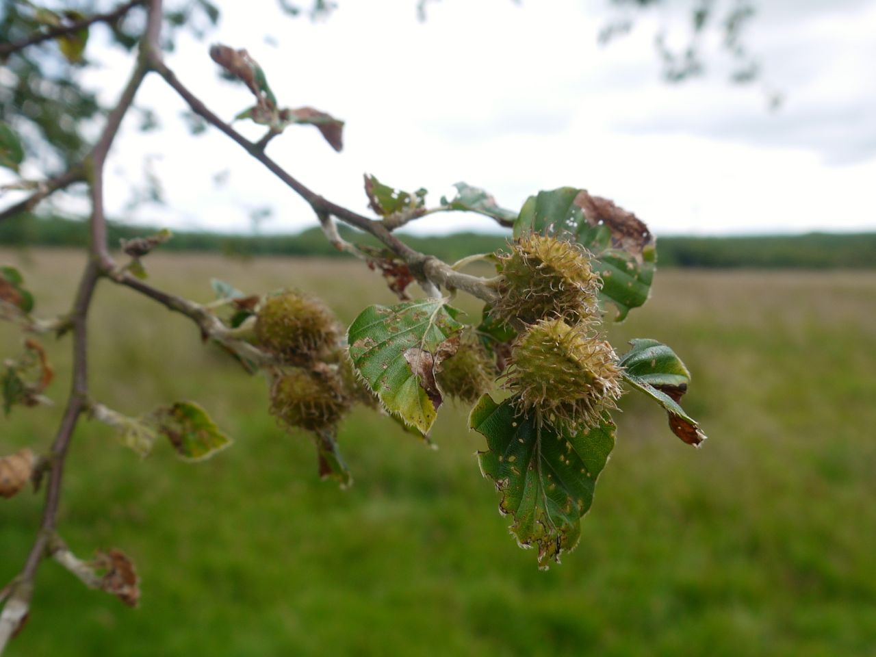
Beech Nuts
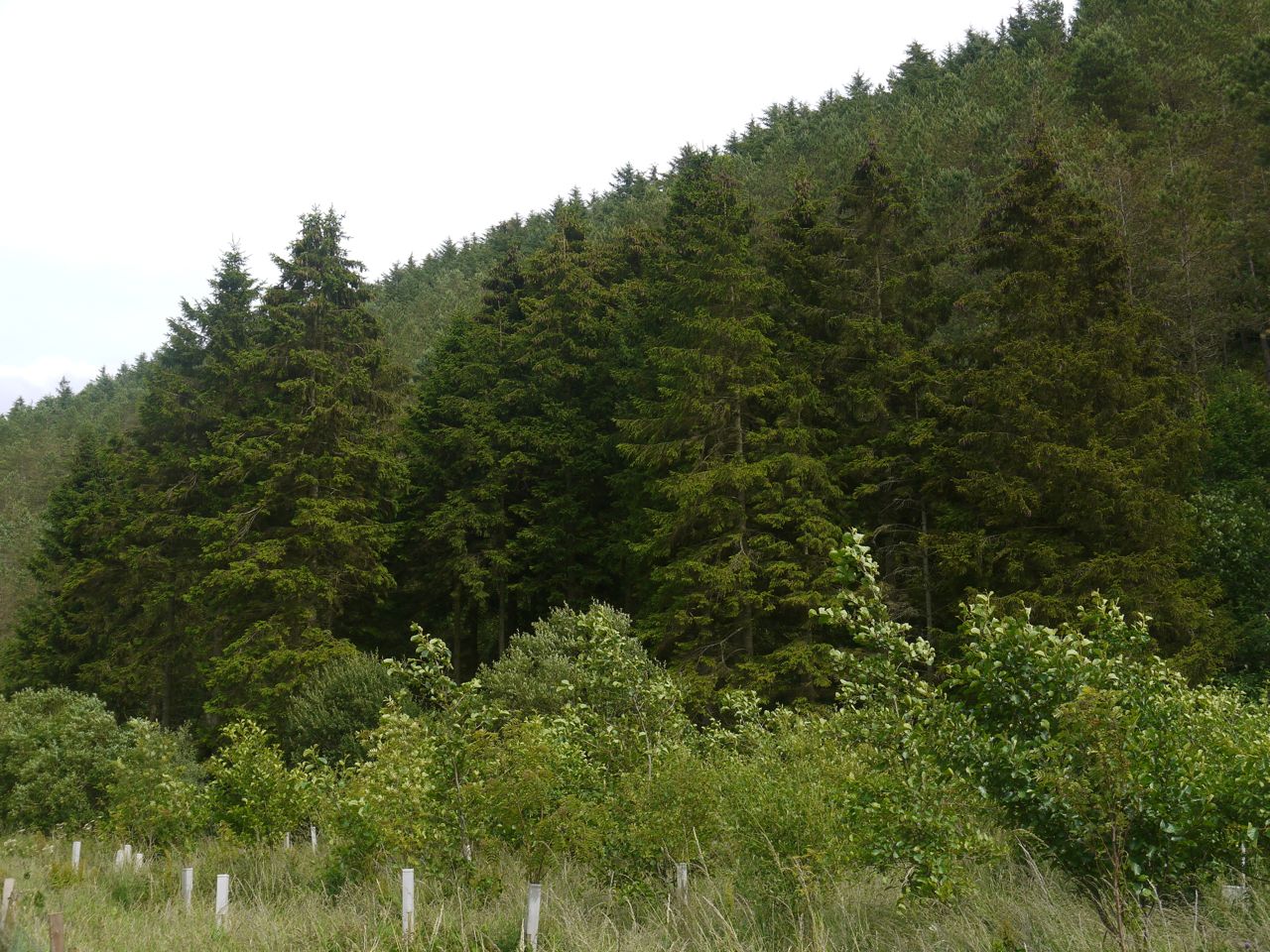
We had by then entered “lunch-time”, the period during which one looks for suitable spots for lunch…somewhere to sit that is not fly infested. I suppose we could have sat in the grass of the hillside but the flies were still following us. Our trek across untracked fields, following SUW posts, led us to a farm/forestry track that took us through Lodge Wood to the B6355. There were no likely lunch spots in the wood.
We passed Whitchester Lodge, which was a pretty sizeable lodge. We hadn’t sen the big house itself but it must be massive if the lodge was this size. The SUW only used the road for a very short distance and we soon reached the SUW sign pointing us up a track climbing the slopes of Abbey Hill. There was a drystone wall by the road that would have served as a seat but we thought it best to lunch away from the road.
Perhaps it says something about me, or perhaps even my English teacher that when I saw the sign by the road, “no more wind turbines in the Lammermuirs”, my first thought was that the first letter was not capitalised. The sign also gives a URL but it no longer exists so perhaps the battles have already been fought and one side or the other has won through.
Abbey Hill
So, still in lunch-search-mode we took the path zig-zagging up the slope. A new signpost pointed to Windy Windshiel and an information board told us a little more. It was 500m off our course and there did not look to be any obvious track so we stuck with the SUW. The track we were on ended at a a gate. I had thought we should awl up to the tree line and follow that but Audrey spotted a signpost lying on the ground. This suggested we should carry straight on, but that would begin to take us down the hill, so we headed up for a short while then started to come down again at which point Gwyneth spotted a marker post below us and we were back on track. We joined a sheep trail that took us across the top of a gully and up to the tree line.
On the OS map the SUW leaves the trees and heads directly down into Robber’s Cleugh and one of my SUW books describes grassy steps descending the steep sides of the cleugh. The SUW marker posts however kept us alongside the trees and down into the cleugh beside the fence. The route then heads along the cleugh, passing through two SUW gates either side of a wee gully, before joining a forestry track where it crosses the burn. This must be an alteration from the route on the OS maps and guidebooks. Older maps have Robbers’ Cleugh rather than Robber’s Cleugh. Was it one, or many?
The forestry track had several large tree trunks beside it that were just what we needed for lunch seating. Comfortable dry seating makes such a difference to a walk.
After lunch we carried on along the track through Roughside Wood which took us past the 200 mile mark from the official SUW distances, but was 216 miles for us. (That would be just 210 miles if we exclude additional distances walked off the SUW such as visiting Minch Moor summit, or walking off SUW to the car.).
This track was high above Whiteadder Water with a steep drop. We couldn’t see the river very well at this stage but there were other things to see. Squirrels ran across the track a couple of times but I wasn’t fast enough with the camera. There were banks of fine grass that looked like green waterfalls and masses of hair-cap moss. After the dry ground of the start of this section, I was surprised to find muddy puddles on this track.
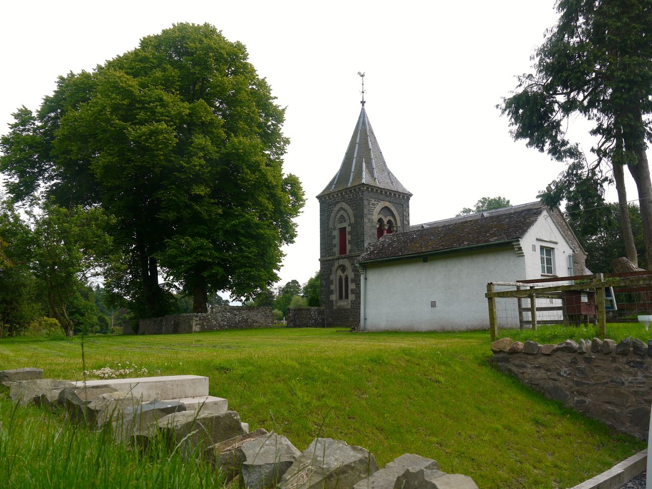
Lammermuir Kirk
I wondered how we would get down to the level of the river and if we had a steep descent ahead of us. As it was, though, once we left the trees the the track descended none too steeply and we were soon by the river. We had good views of a heron which then flew off downstream. There were more flowers by the river including some wild geraniums.
Abbey St Bathans was not far away and soon enough we were stood beside the village’s red phone box, and GR post box. We walked by Lammermuir Kirk and a house with an SUW sign, perhaps a B&B?
Gurkha Bridge
A footbridge took us across the Whiteadder and into Shannabank Wood. I mentioned that it had been built by Gurkhas in 1987 and Gwyneth was very impressed that I knew this. I did know this before the walk but beside that there was a plaque by the bridge that said the same. The Whiteadder was certainly a pretty river and reminded me of both the Water of Milk and Annan Water from the Annandale Way.
Our final section was a woodland walk, the forget-me-nots had such bright colours that they looked to have been photoshopped into reality. I did begin to have some misgivings in these last minutes of the walk. I should have checked that there was still a bridge back across the Whiteadder to the car. If there wasn’t I might have to use the ford.
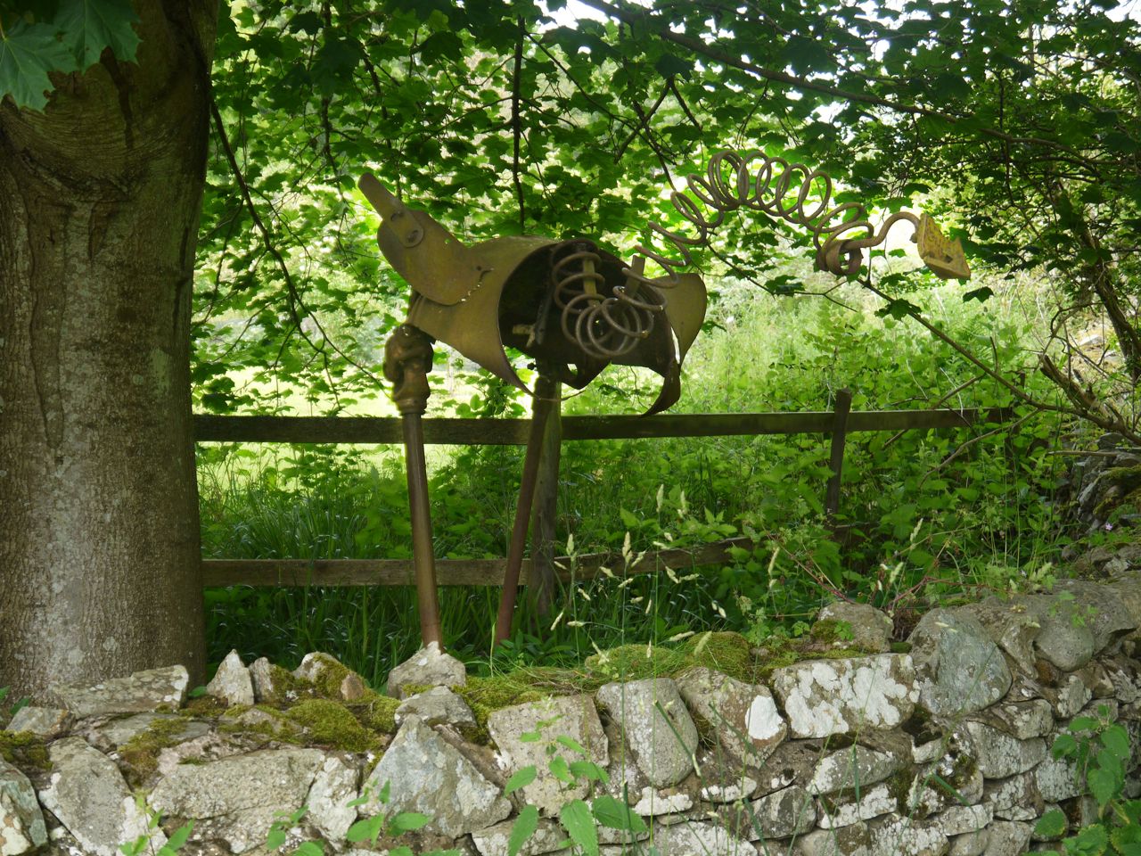
We crossed footbridge over a small burn and saw a substantial tree house in a garden nearby and then found ourselves at the ford. I could see my car across the river and there was a footbridge. The ford was there as well, but it was part ford and part bridge and stood dry above the water. An ostrich made of scrap metal watched me as I decided between the bridge and the ford.
 I decided to use the ford and the water flowing beneath it looked so inviting that I did what I had dreamed of all along the SUW. I took off my boots and dangled my bare feet in the cool waters. Joy.
The Riverside Restaurant near which we were parked was too inviting to ignore so we had ginger beer sitting in its courtyard watching swallows darting about. The restaurant looks to have been a saw-mill in its previous life and is both a gallery and a restaurant now. There is a sawmill across the road so I presume that business merely moved to new premises.
I had not particularly enjoyed the last section, but this short section was very pleasant, and we had good weather while walking. The rain came as we drove home.
One more section to go.
[sgpx gpx=”http://www.screel.co.uk/walks/wp-content/uploads/2014/07/RK_gpx-_2014-07-12_1048.gpx”]
