The Void

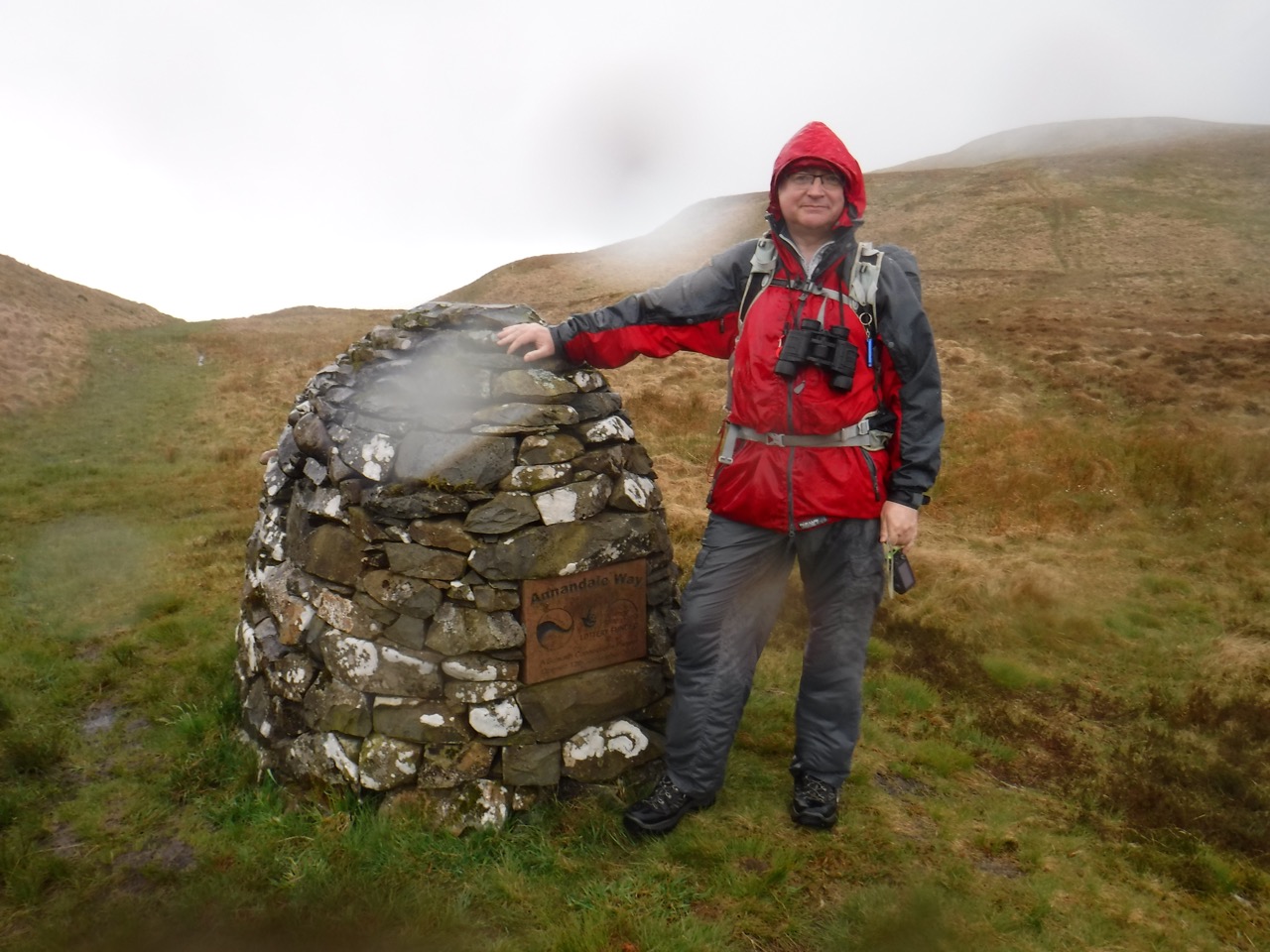
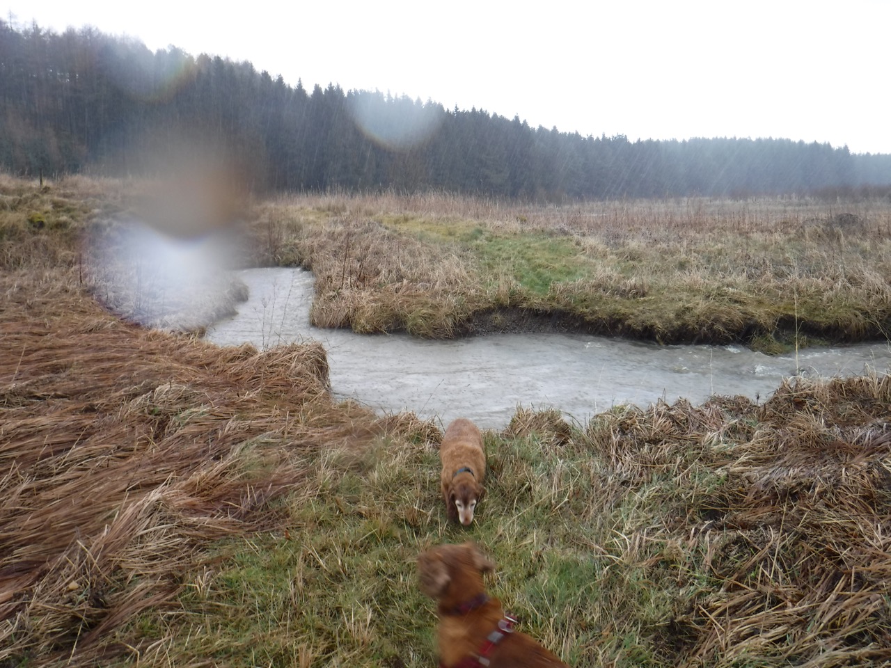
1.9 miles  2h 13m  ascent 88m

P1070870Crawick Multiverse

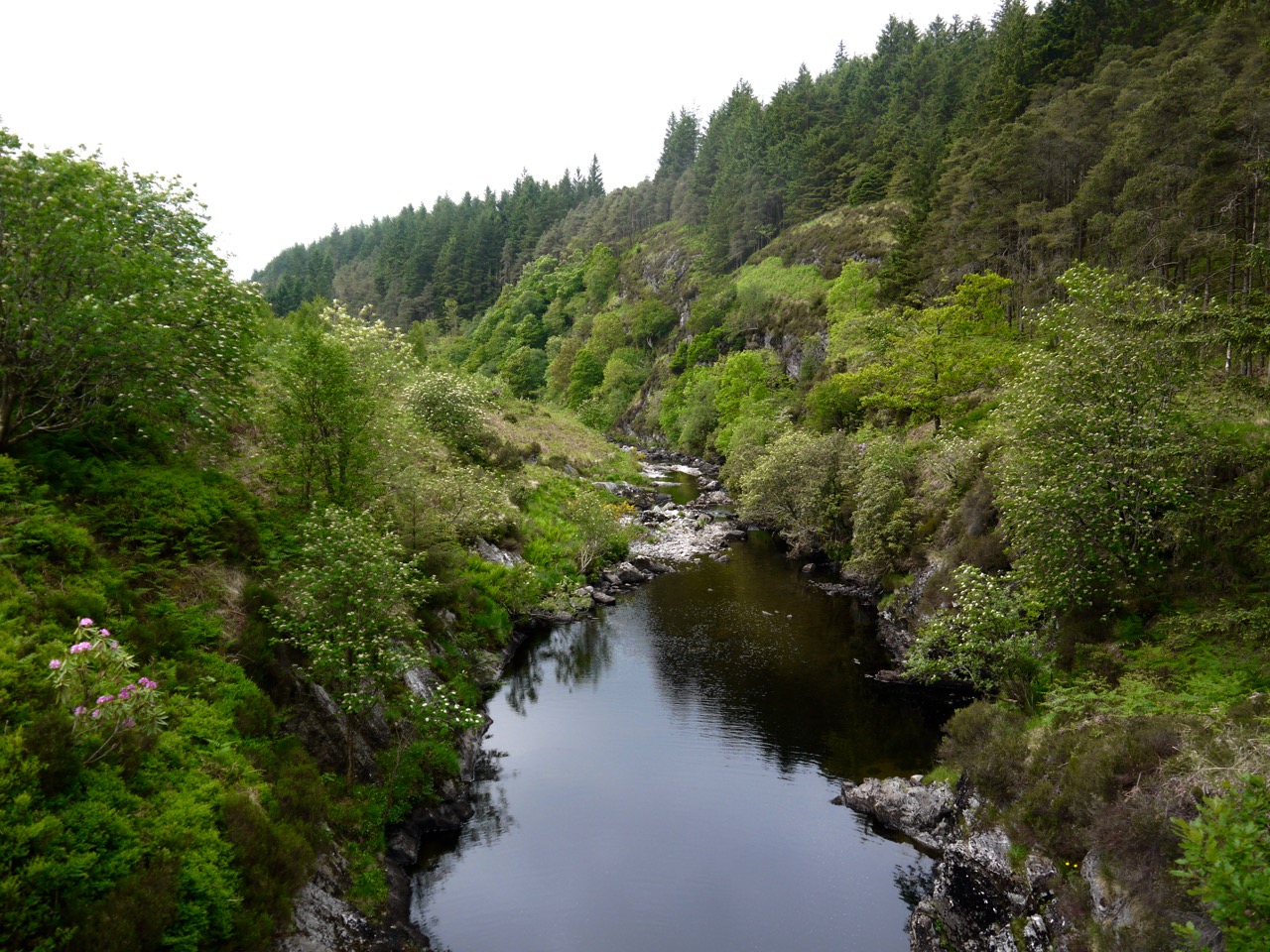
Crawick, Caer Rwyc, is named for Rawic’s fort, and although his name has stayed with the river, the nearby town has lost Rawic’s name and taken instead the epithet “the old fort”, Sean Caer, Sanquhar. Rawic is mentioned in the Book of Taliesin which places him in the time of the old Kingdom of Rheged, between the 5th and 8th centuries AD.

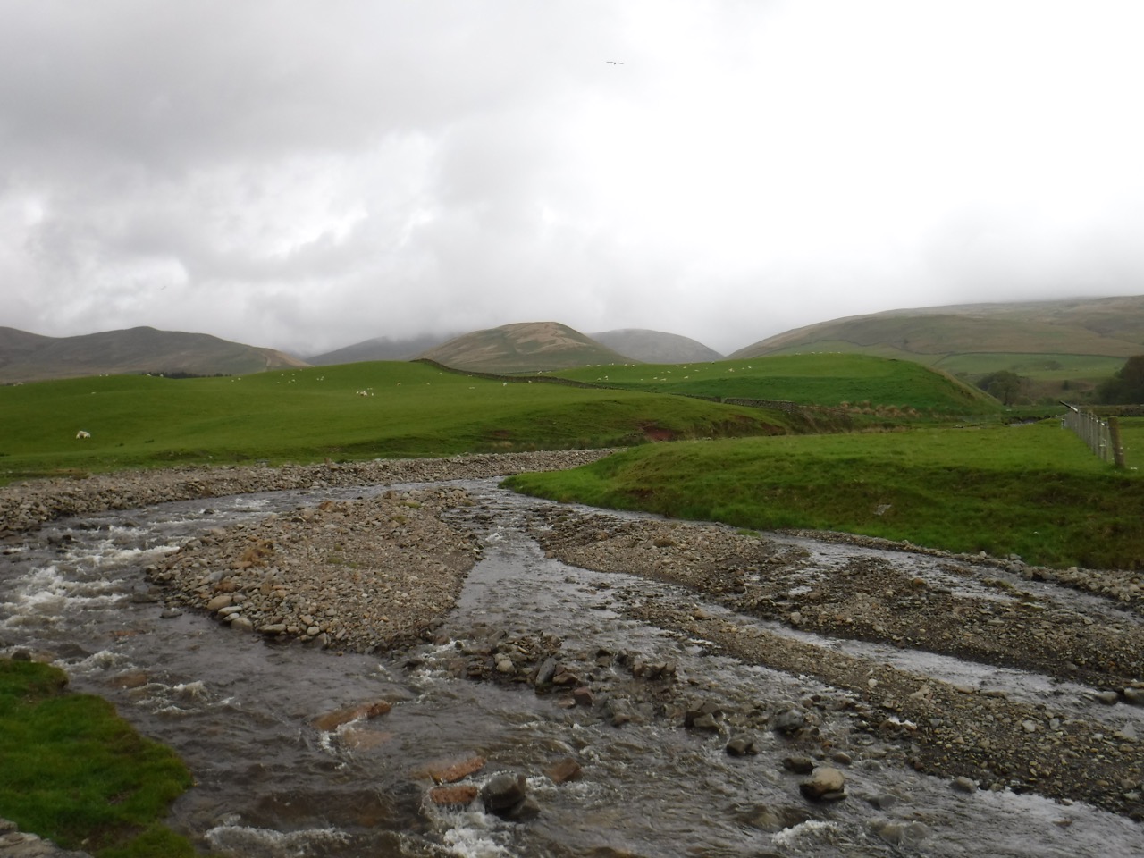
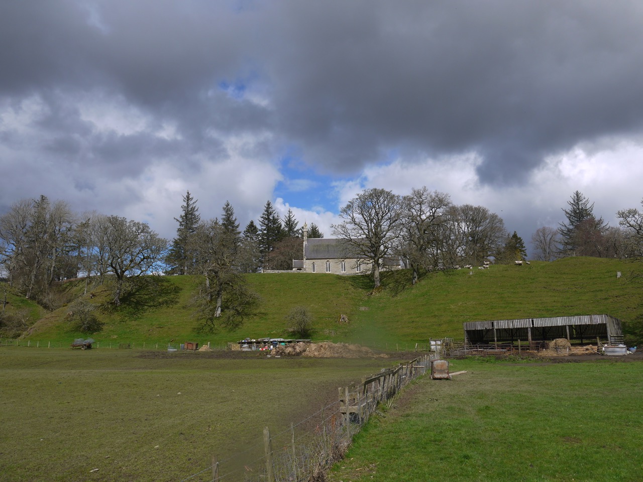
Though Rawic’s people may have mined coal near the surface, and indeed the Romans may have mined lead and gold at nearby Wanlockhead, the area was to be heavily mined for coal in the 19th and 20th centuries. An open cast mine, a kilometre north of the old fort, proved unsuccessful and closed leaving a 55 acre blot the landscape. The Duke of Buccleuch and Charles Jencks  have worked together to make something of the site and it was opened as massive outdoor art installation in 2015. I am surprised though how little it is known locally.

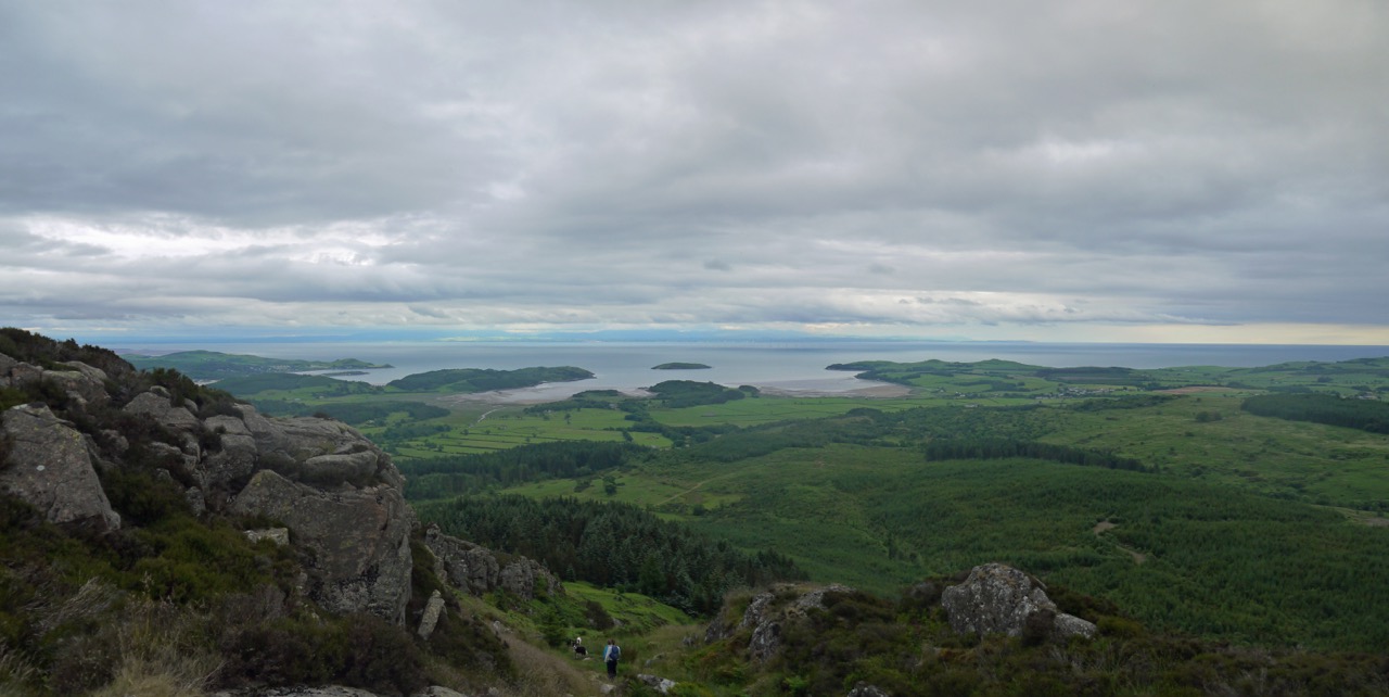
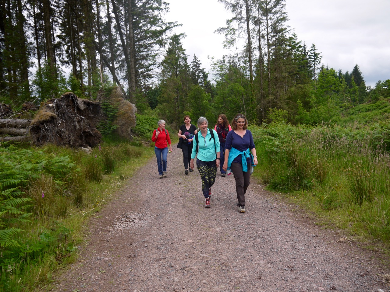
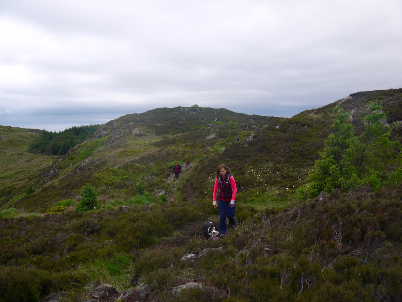
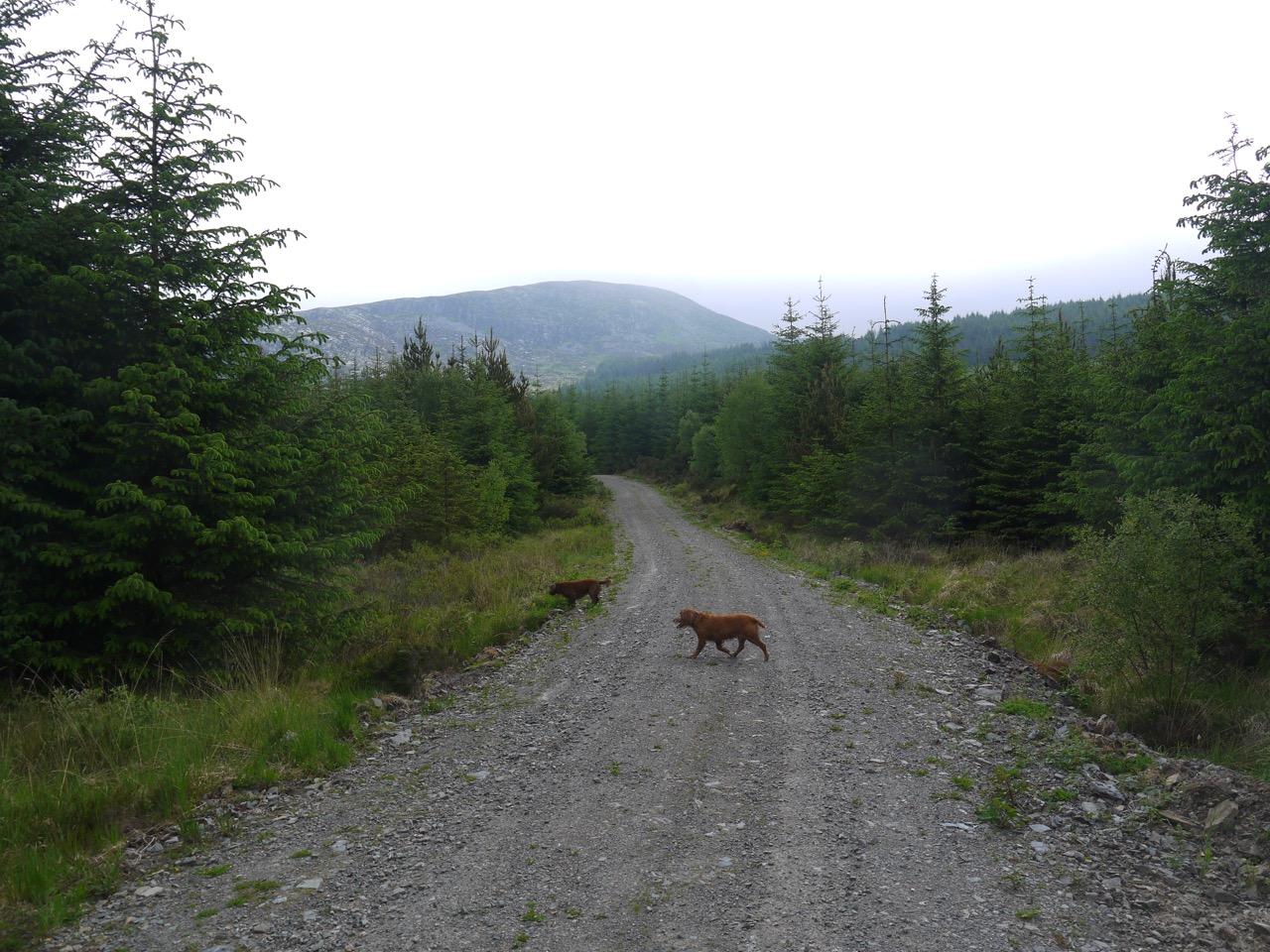
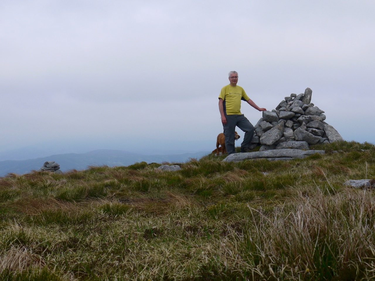
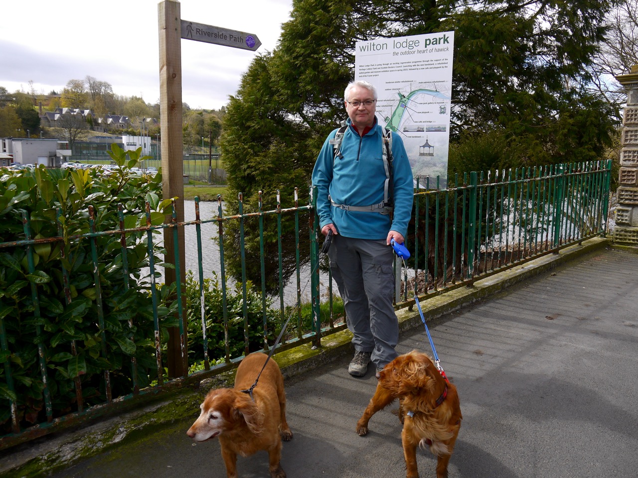
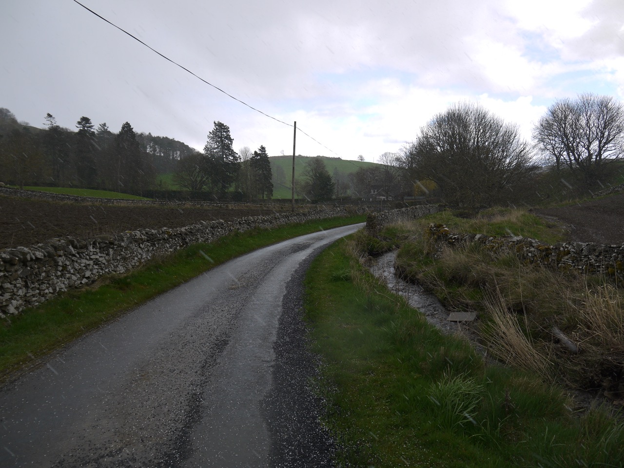
Somewhat exhausted after a weekend’s work I needed an easy stroll not too far away, so the time was right to visit this landscaped site, the Crawick Multiverse. So on a cool grey summer morning we rolled up at the Crawick Multiverse and paid our admission fees. Two tickets. The man at the gate eyed up our walking apparel and suggested we take the longer route, The Comet Path, up to the highest point in the installation then walk back through the main site.

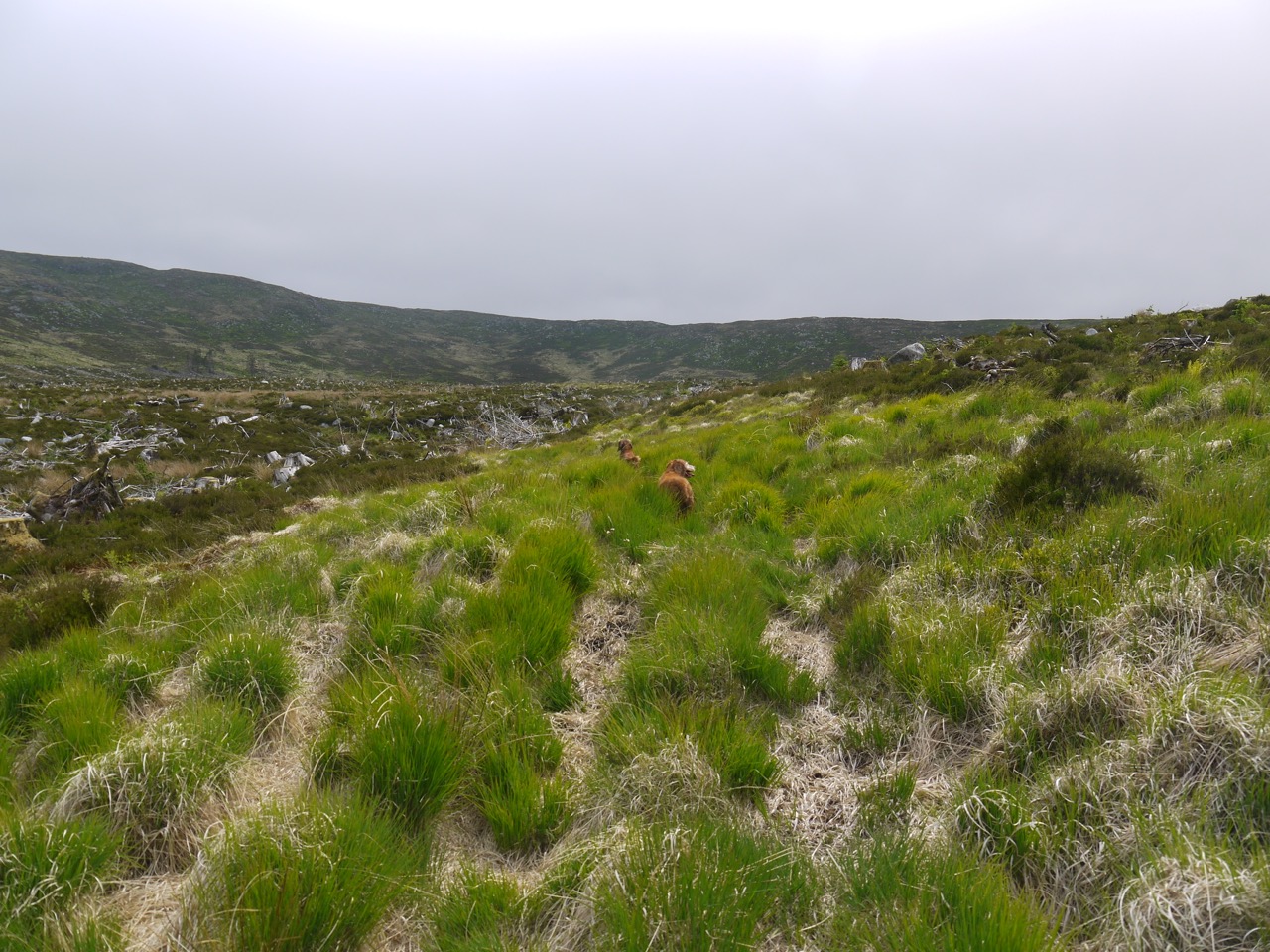
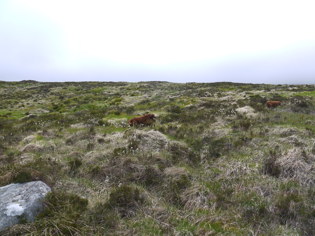
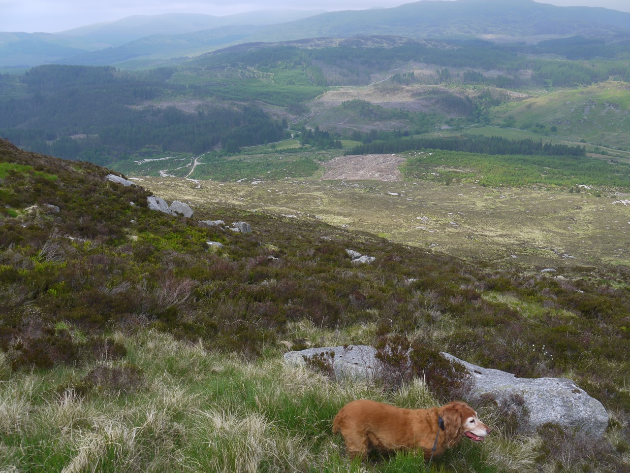
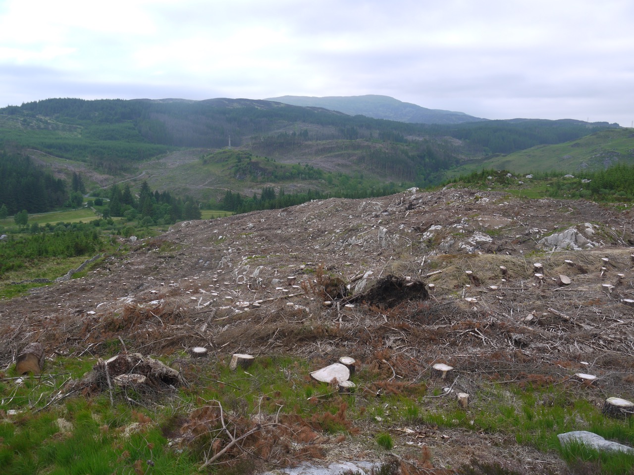
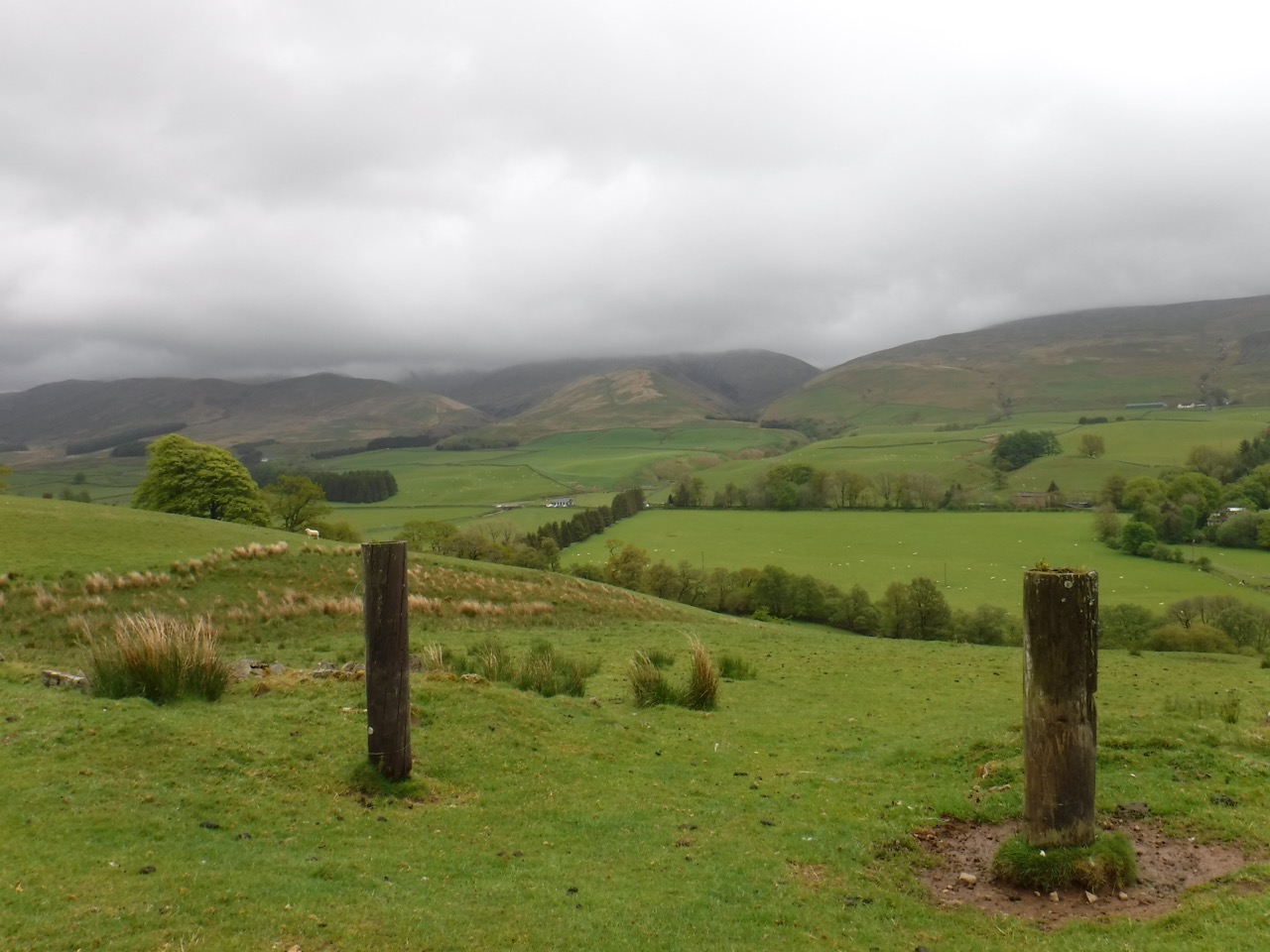
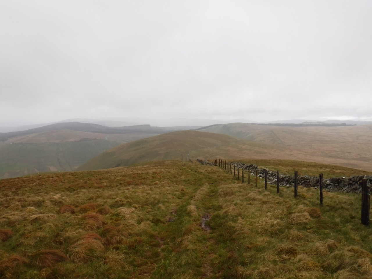
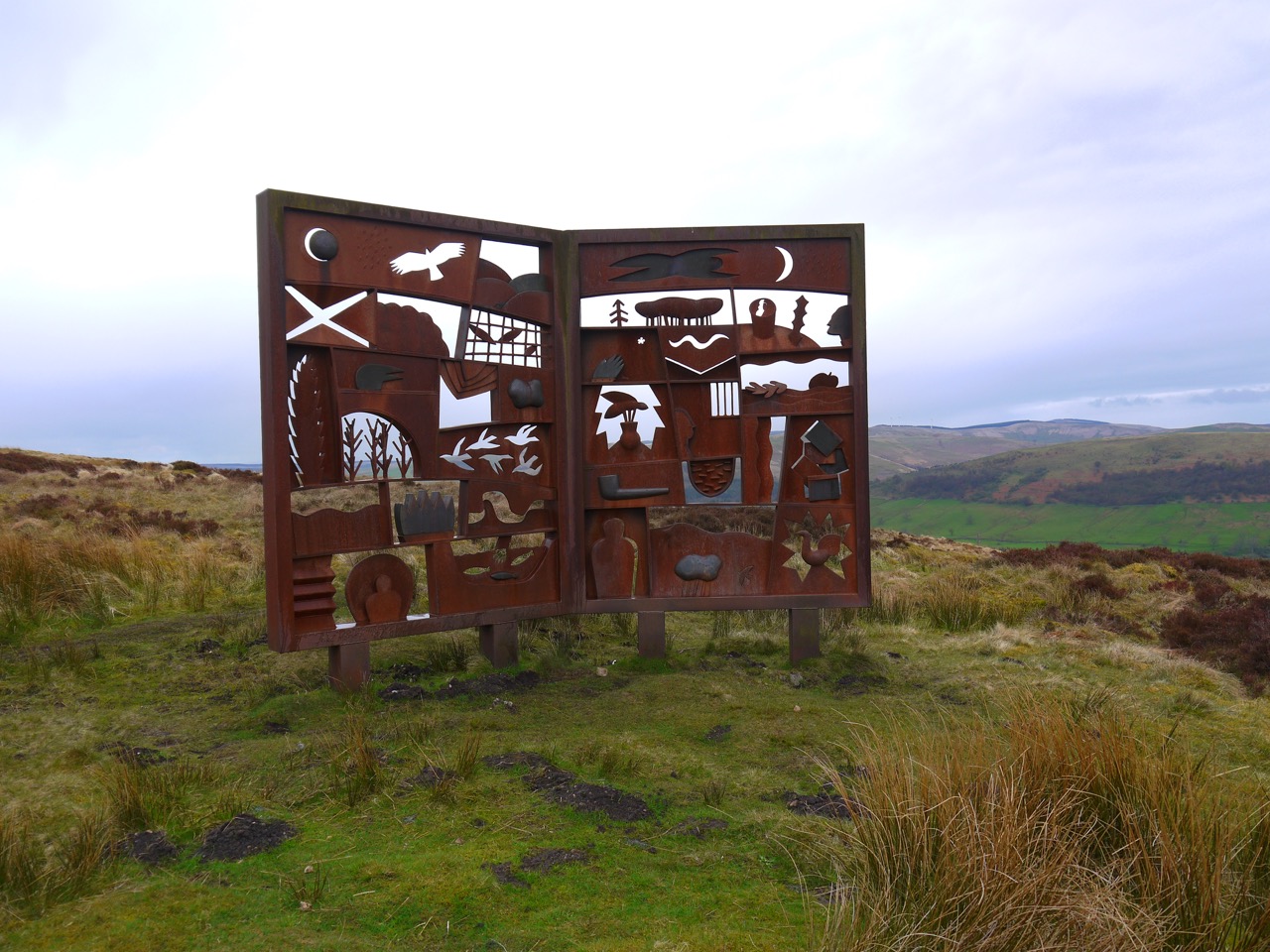
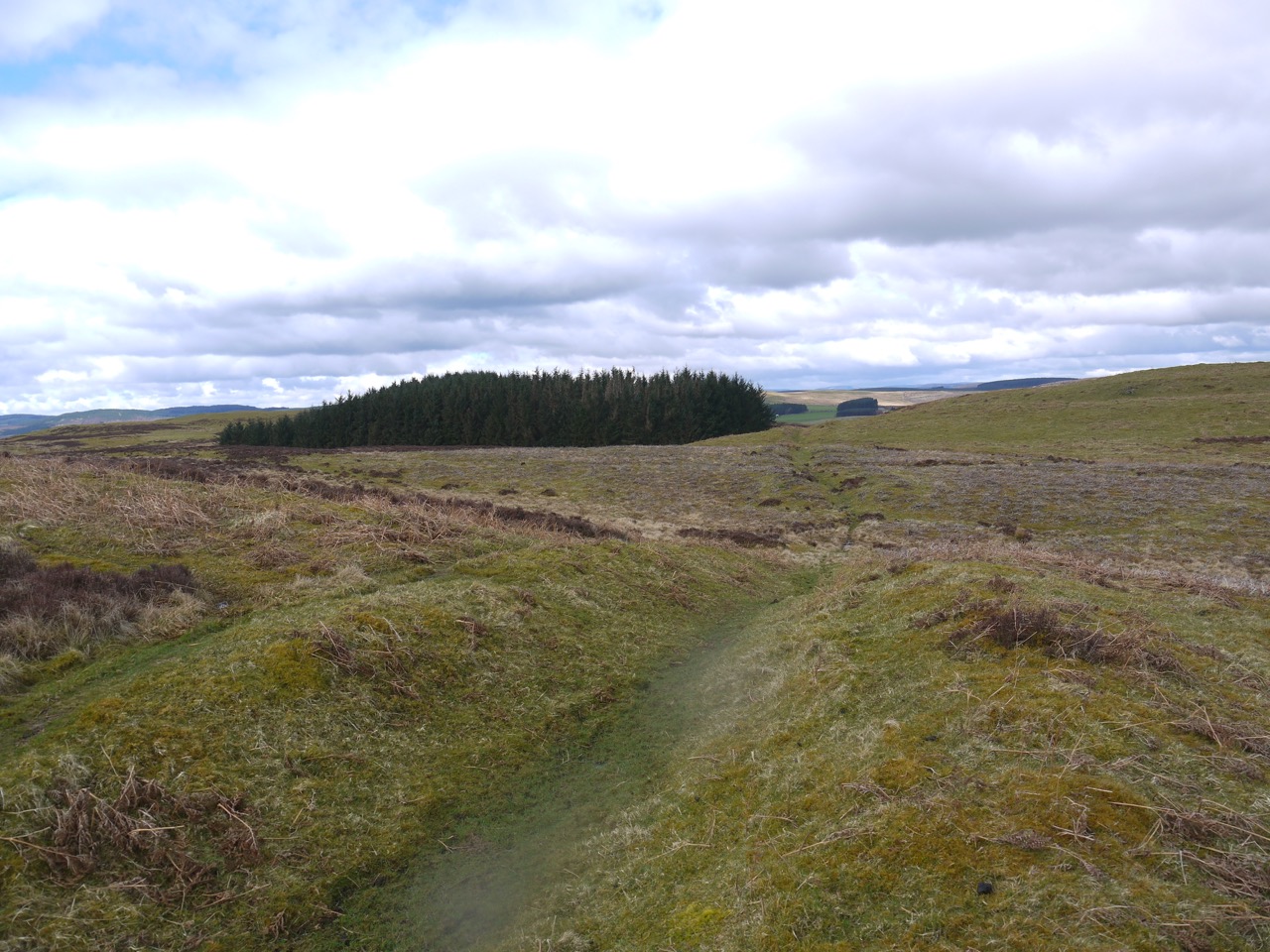
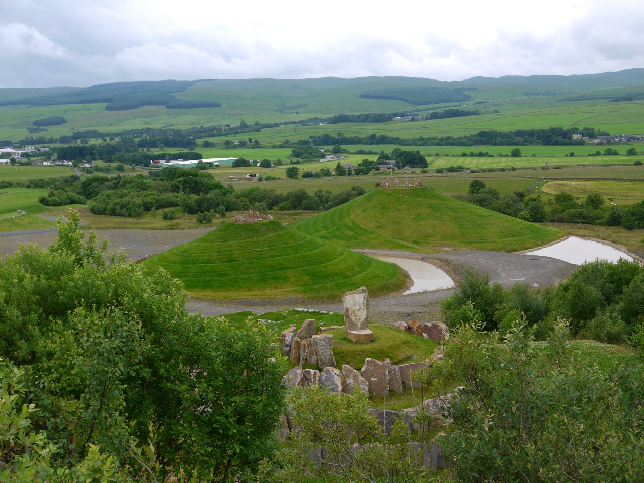
It is difficult to imagine what the area must have been like before the miners came. Old OS maps show the area as a gentle slope rising about 50m in 0.5km. I presume a bite has been taken out of this gentle rise starting in the SW corner and leaving a raised lip along the eastern edge and two large mounds inside. It was along the remaining eastern lip that we walked along the Comet path, after passing a mosaic representation of the area.

Spotted orchid
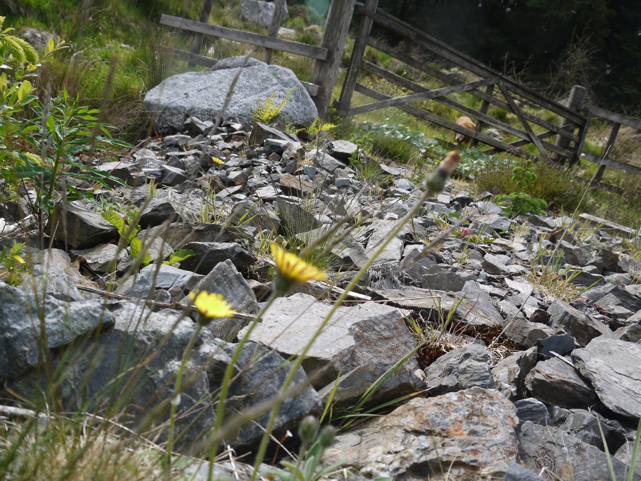
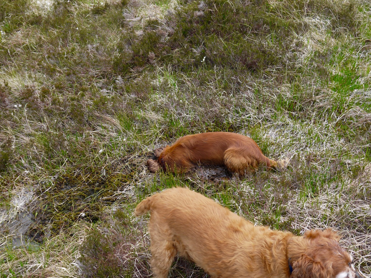
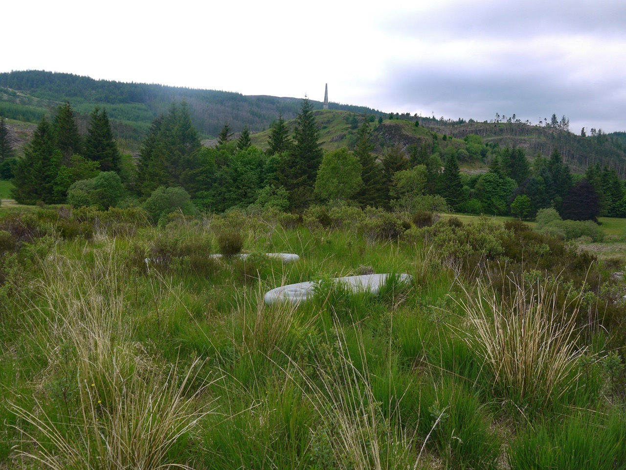
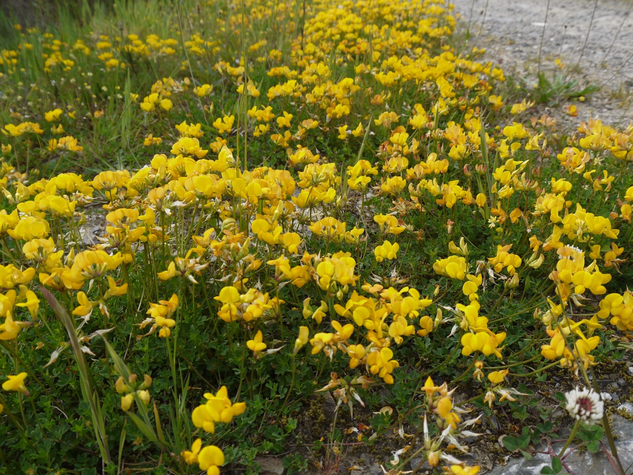
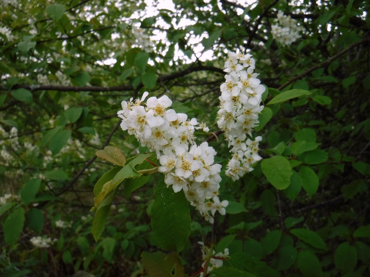
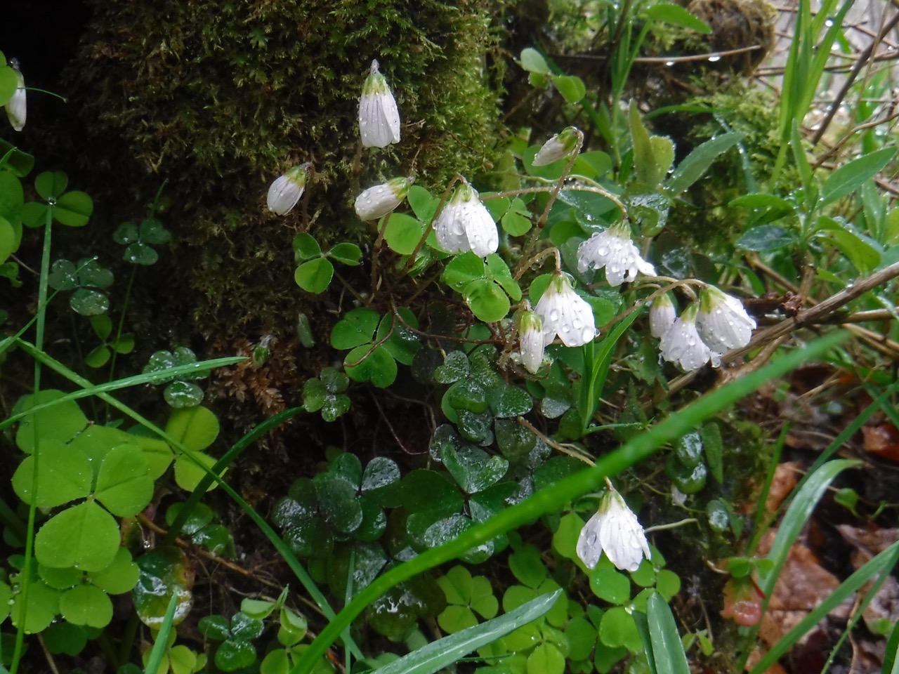
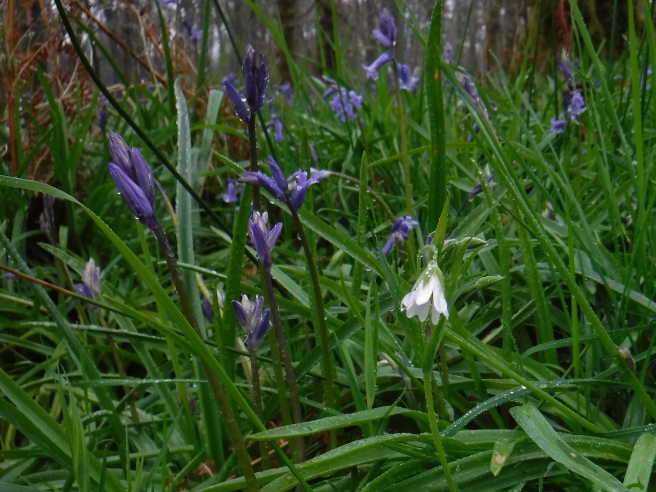
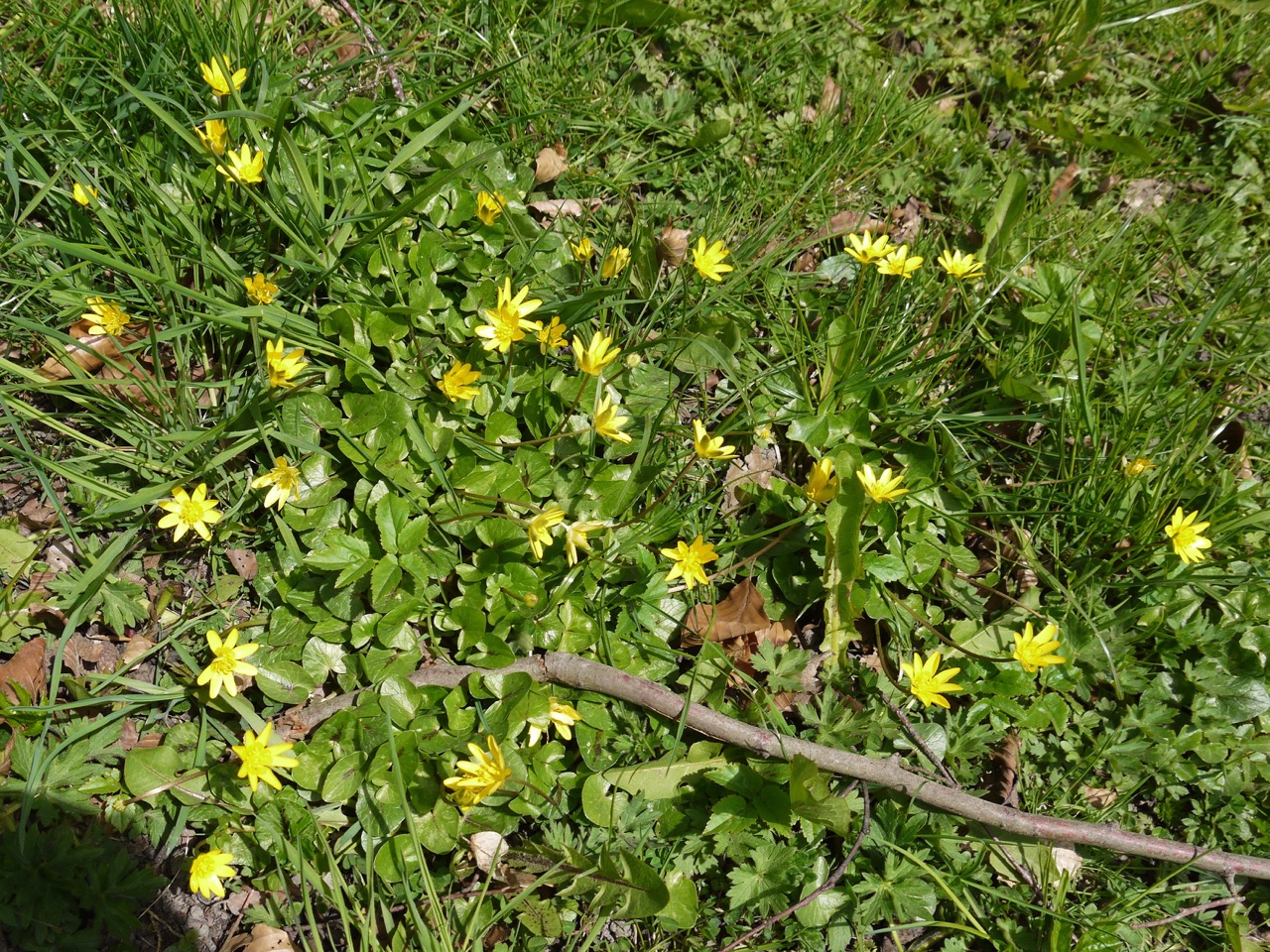
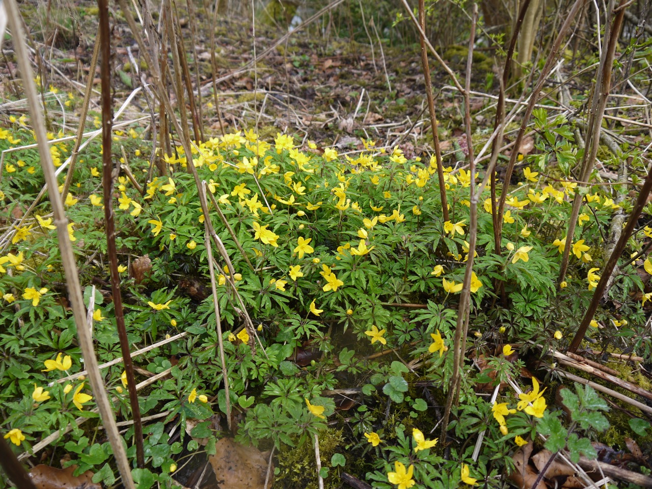
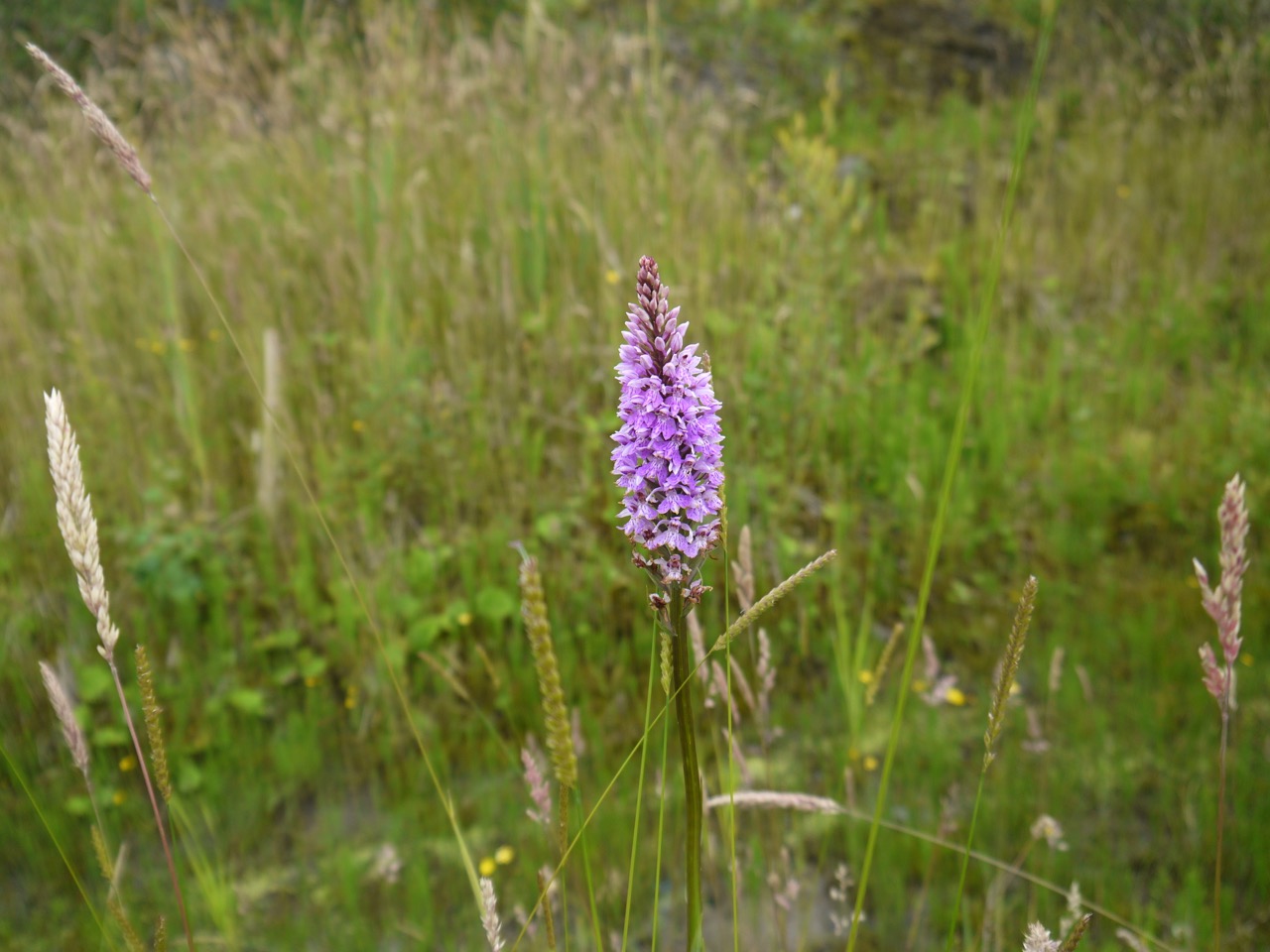
The waste ground at the edge of the site which has been colonised by meadow grasses and wildflowers. White clover predominated but there were were dozens of spotted orchids, along with red clover, and what at first glance looked to be buttercups were in fact spearwort.

P1070819
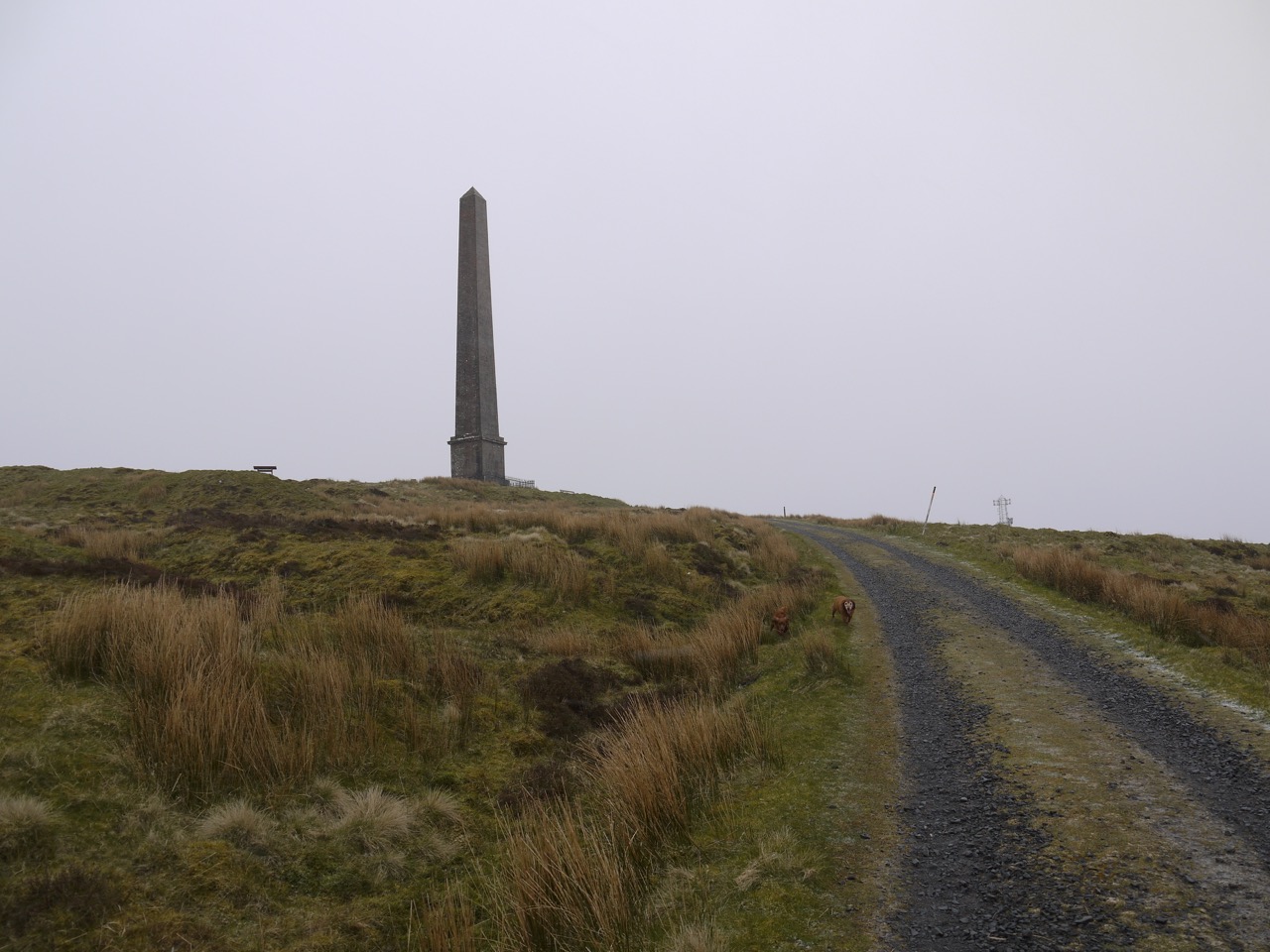
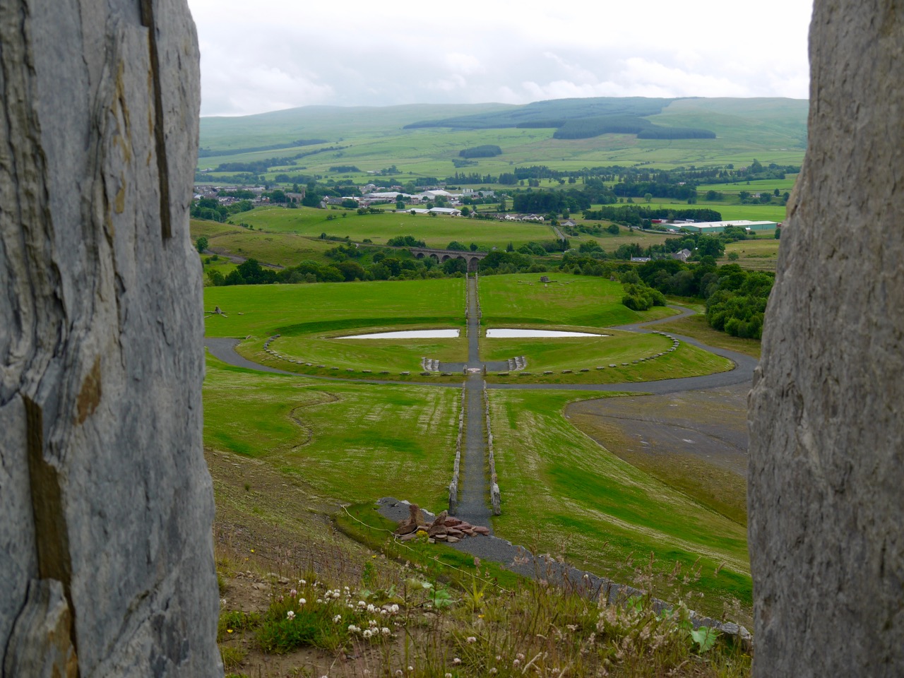
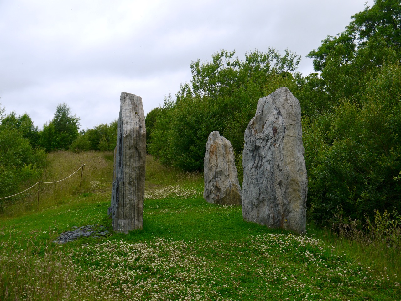
The path took us through a tree lined avenue and passed four large standing stones where a path into the amphitheatre area joined and we had our first glimpse of the interior of the site. Once we left the trees we passed two lines of stones looking like misplaced kerbstones and walked towards what looked like a cross from a distance but proved to be a telescope (requiring 50 pence to use). I hadn’t brought any change.

Orange Hawkweed
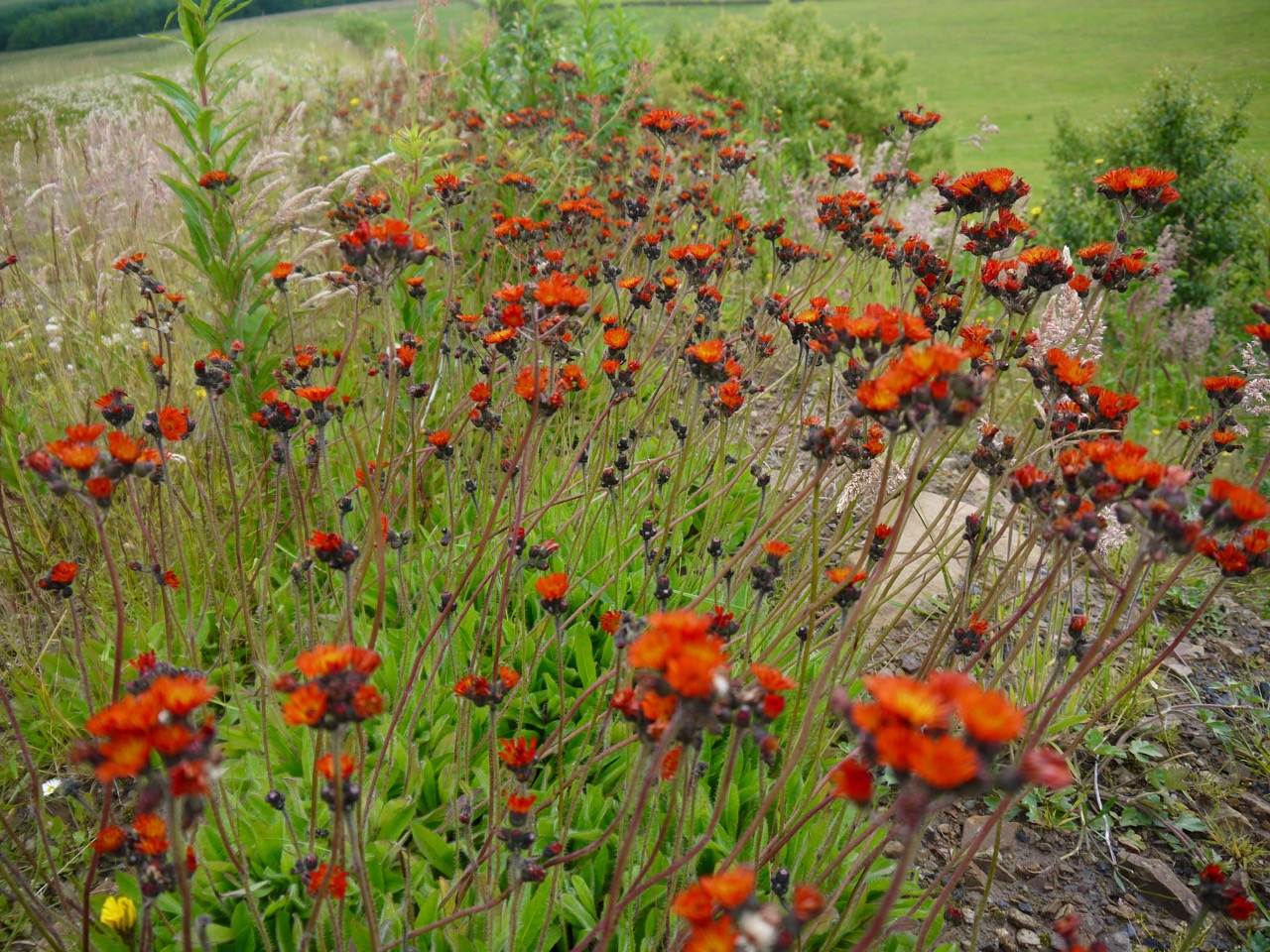
The upper sections here had a great deal of orange hawkweed (or fox and cubs, if you prefer), more than I have seen together anywhere else and I found my eye drawn away from the artificial installations and more towards the wildflowers by the path, all the while mumbling under my breath about a telescope requiring 50 pence. In fact it was the aesthetic inappropriateness of the telescope rather than the price that galled me.

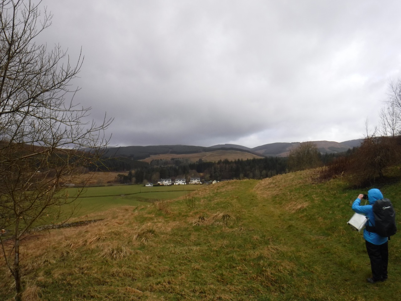
A little further and we reached our first “landforms”, the Belvedere and the Void. The former being a wee knoll with an ascending spiral path up and the latter a hollow with a descending spiral path, the two mirroring each other. A belvedere ( fair view) is an architectural structure sited to take advantage of a fine or scenic view, and in that respect it is well named allowing as it does a view across the whole site as well as the surrounding countryside.

P1070871
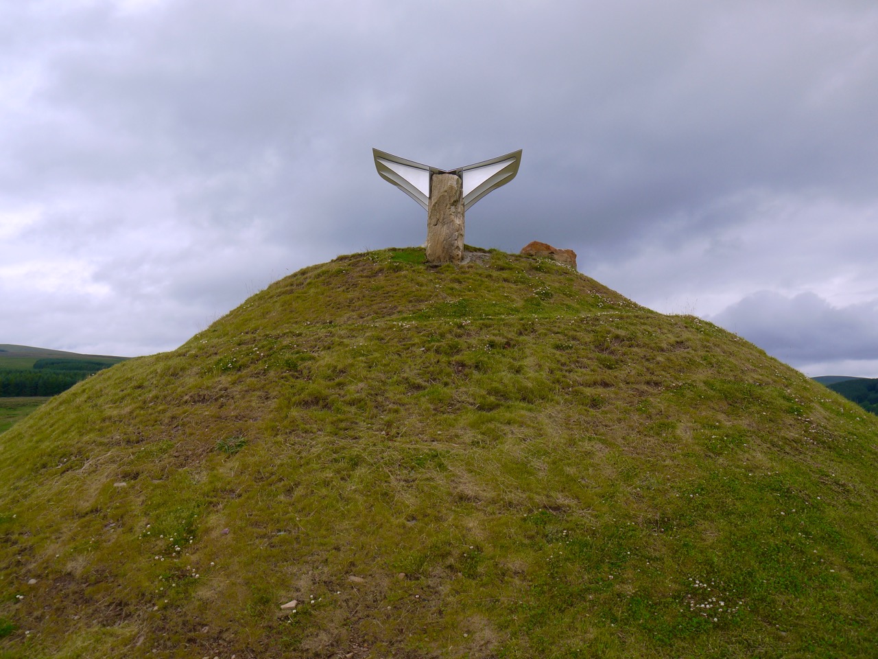
Belvedere has a number of large rocks arranged at its summit and a wing like installation with line drawings and names of the site and surrounding hills. The wing points directly along the North-South path and the stones behind it apparently represent a finger pointing towards the North Star.

I clambered onto the stone finger to get a better view for a photograph but hadn’t noticed that the top was covered in bird-shit. What’s worse this material showed very low avidity for the rock it sat upon but high avidly for hands, cameras, trousers etc. leading to a rapid transfer from the rock to me, my clothes and my equipment.

It will now always be Birdshit Rocks rather than Belvedere to me.

P1070863
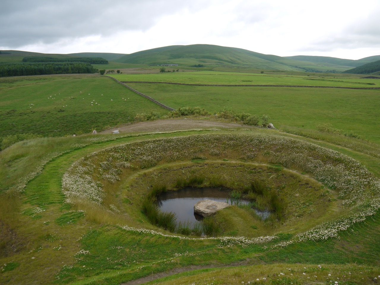
The Void is a hollow with a pond at the bottom and a large rock to stand on. Like Birdshit Rocks it is accessed by a spiral path. The banks of the dip were covered with white clover which was far more impressive from inside than from above for some reason. The water of the pond itself was gently rippling which at first made me think that the rain had arrived, but a closer look showed that the ripples were from waterboatmen. As I leaned in to take a close look the insects dipped below the surface and swam under the water, something I hadn’t noticed before. Audrey hadn’t thought to bring her swimming costume which is probably for the best since I have read that waterboatmen can give a nasty nip.

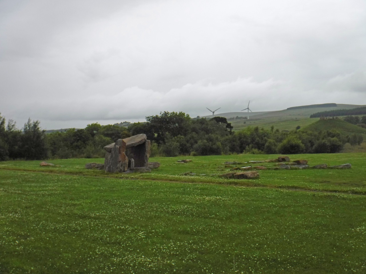
The next landform on our route was a little way beyond the Void, the Northpoint Shelter which I felt was aesthetically spoiled by having a rope around it. Then we headed for the two large Galaxy mounds, Andromeda and Milky Way which had been slag piles that have been landscaped with spiral paths built around each. (PS I thought such things were more correctly called spoil tips.) They are grassy which contrasts with their rather stark surroundings, which are labelled “Desert” on the map. Each mound has a stone circle at its summit.

P1070879
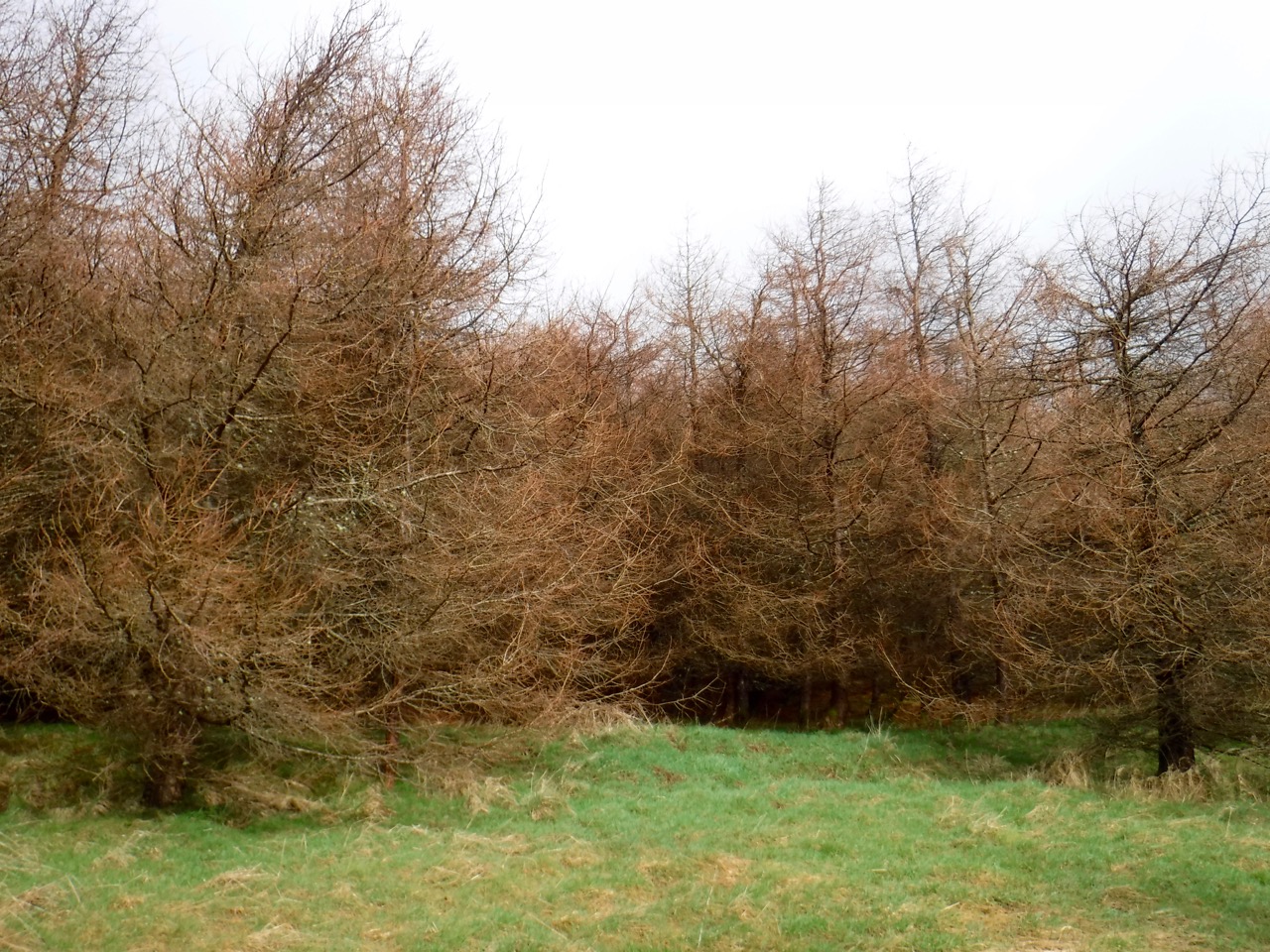
Between these Galaxies we went to explore to remaining mine face on the north wall where I was hoping to find some coal, but the rocks didn’t look as if they could contribute much to a fire.

Our wanderings took us next through “Supercluster” which from a distance had the appearance of a small crazy-golf site, but is said to be a collection of abstract triangles and “gravity rivers” representing the larger collection of galaxies which includes Andromeda and the Milky Way. I cannot say that I would have drawn that conclusion if I hadn’t read it on an info board. From here we walked up to the rock circle that gives its name to the whole area, the Multiverse.

P1070850
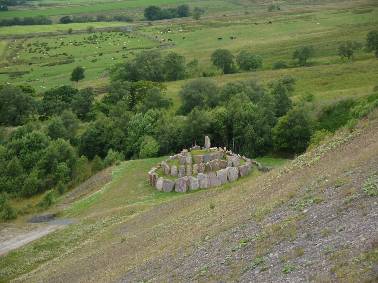
The Multiverse has rocks inscribed with representations of changing gravity levels, complexity and types of universe, but caught me out in that I expected the path, which is described as a corkscrew, to lead in a spiral to the top. The upper stone circles though are complete and one must scramble up between the rocks to reach the top.

The rain which had been forecast reached us while we were experiencing the Multiverse. One person donned a waterproof jacket while the other discovered she had left hers in the car. Luckily it was only light rain.

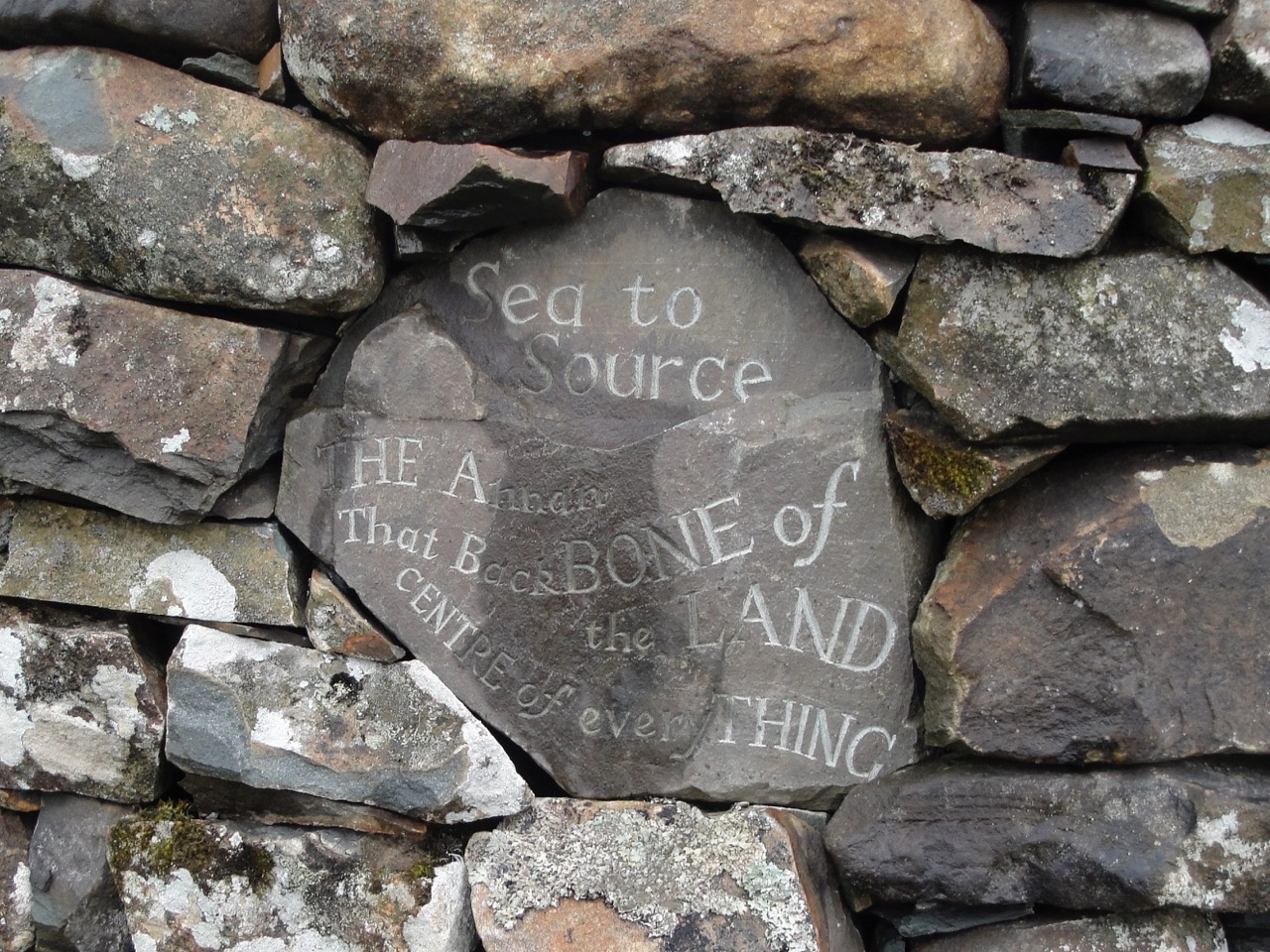
Next, the Omphalos, which given the benefit of a classical education I knew to mean navel. The Crawick website explains “This stone representation features v-shaped silhouettes which frame the cliff scallop overhead, while on the inside, special rocks signify the mythical and actual centre of the Earth.” Bollocks.

DSCF0831
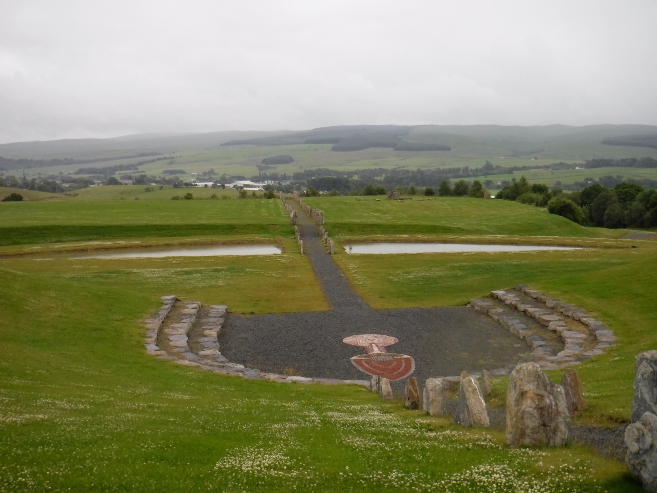
As we stood looking along the North-South path, lined with standing stones, overlooking the amphitheatre and the flat area beyond it with its lagoons and comet shelters, I was forced to reflect that something was missing. I thought of Tolkien’s creation story for dwarfs. They were created in secret by a demigod who wanted children with whom he could share his skills, but they did not have the gift of independent action with which the Creator planned to place within elves and men.  The Creator found out about the dwarfs and ordered they not awake until after elves and men, but offered to give them the spark of life. The multiverse has the feel of a creation which has not yet been imbued with a soul, or if it has such a soul, it is not yet awoken. It felt like a void, especially compared with the area on the eastern and southern edges of the site where wildflowers are carpeting the ground.

DSCF0845a
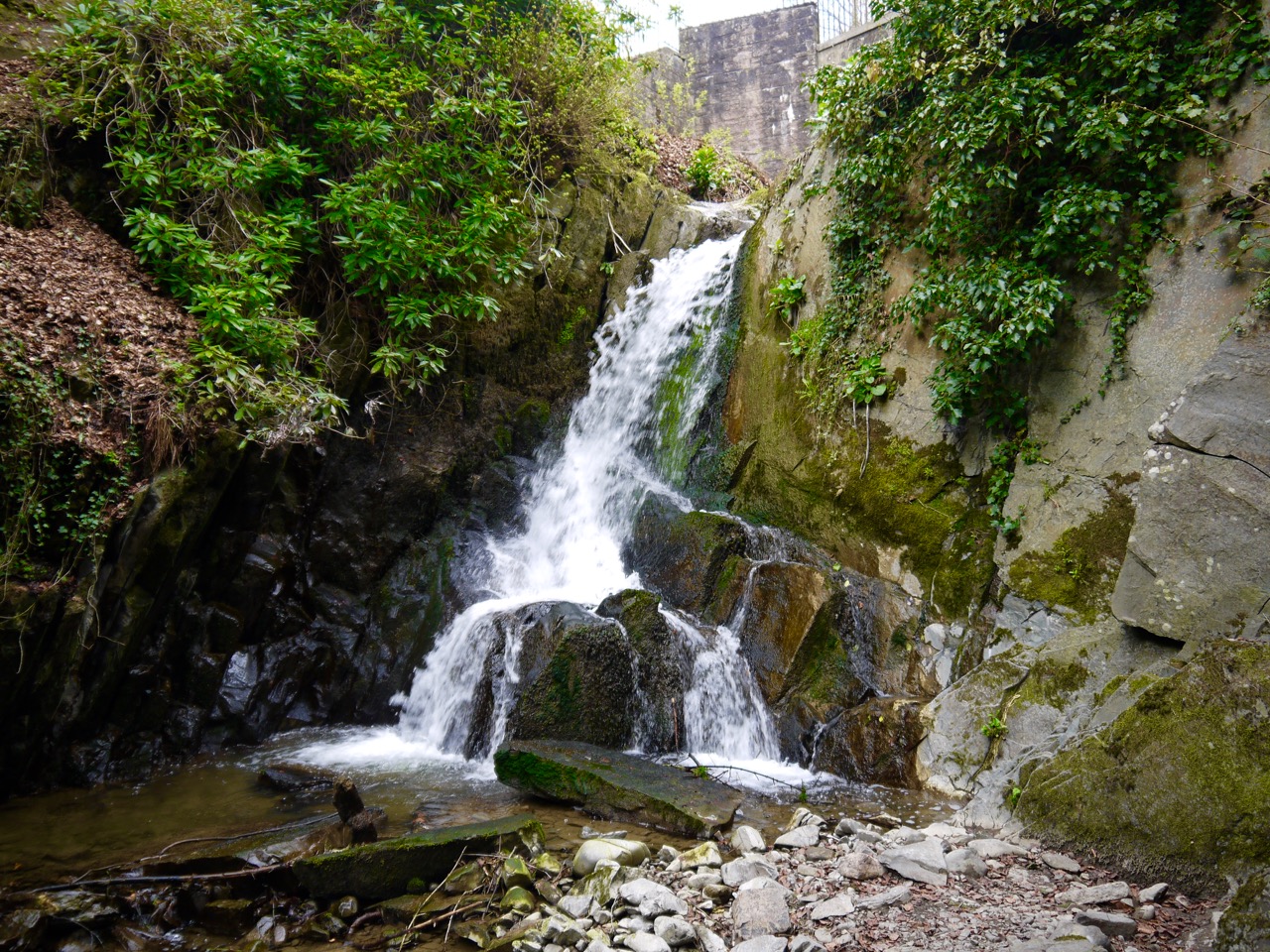
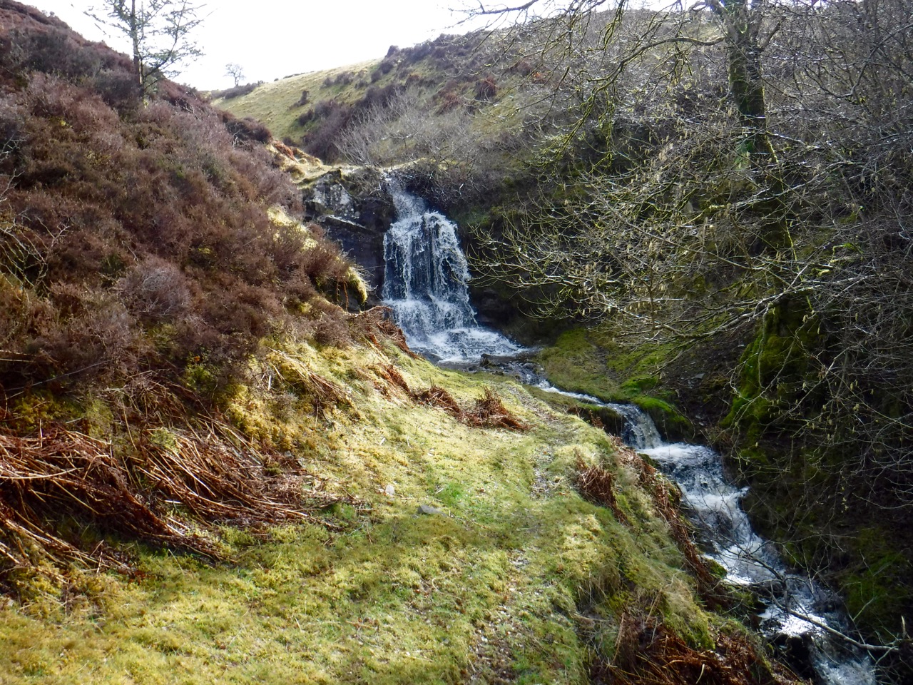
I might perhaps be prejudiced towards wildness since when I visited Charles Jencks Garden of Cosmic Speculation at Portrack, though impressed by the landscaping and installations, I left feeling a deep need to experience something wild. I drove from Portrack to Crichope Linn and was reinvigorated.

All that said, it is an impressive site and should be better known. It perhaps deserves more events or uses. It would be a great place for an outdoor concert except for the fact that it has a tiny car park.

Posted in Dumfries & Galloway | Comments Off on The Void

Larks on Screel

3.4 miles 2h 30min  ascent 335m

P1070757mergeScreel Hill-by the path, clockwise

An evening stroll with the Rheumatology team, ID team, and accompanying dogs. The rheumatology team showed their navigational and logistical skills arriving at the agreed rendezvous in good time, then kicked their heels for what seemed an interminable time waiting for the tardy virus-wranglers.

Our convoy, once assembled, sped (within the legal limits) out to Screel Hill, with the walkers rearranged into fewer cars, so doing our bit for global warming. At the wee car park below Screel we grabbed our walking gear and let the dogs meet each other.  Luckily they were very well behaved…none of that embarrassing humping.

Download file for GPS

An easy start

An easy start

Eddie started as he meant to go on by jumping into some dirty water and the shaking it all over me. I suppose the white top I was wearing was just too much of a temptation. We humans stayed on the forestry track, and after an easy stroll, Anne who had taken the lead, took us off the track and up the slightly steeper and rocky section that would once have been woodland but is now cleared forest. This spread out the group like a serum sample in gel electrophoresis, with name redacted at the front and name redacted at the rear, a pattern that was to recur several times. The dogs ran back and forth along the line, possibly exhibiting a canine desire to herd us back together.

On reaching the forestry track again, those who had sped through the metaphorical gel halted and the long line reformed as a tighter grouping. The paradoxical but rather common behaviour of those finding the going most difficult and therefore bringing up the rear getting the shortest rest for recovery was duly enacted. But unlike a previous work’s outing we didn’t leave anyone behind this time.

Rested, some more than others, the group set off along the Glen of the Screel Burn first on a forestry track and then on a walker’s trail as we climbed further. “Great tits” I exclaimed (stress on ‘great’, and therefore quite innocent), drawing the group’s attention to the characteristic squeaky-pump sound these birds make.

The views gradually improved as we climbed and it became obvious that visibility, at least to the south, was excellent with the English Coast clearly visible out to St Bees Head. We could also see the Isle of Man on the horizon.

Glen of the Screel Burn

Glen of the Screel Burn

After burning a few calories (25 perhaps) we reached the short rocky scramble to the top and made our way up, though some, such as Sweep, needed help with a bit of push on the rump. Having said that, he then ran back down and then seemed able to get up unaided the second time.

First to the top (you can take the girl out of the race but...)

First to the top (you can take the girl out of the race but…)

It would be wrong to reveal who got to the summit first, but the camera never lies.

The summit

The summit

There were good views from the summit with Cairnsmore of Fleet and Moorbrock Hill shapes quite recognisable. We had our photographs taken at the summit cairn then tucked into snacks. I had tried to emulate the famous Dr Jim Lawrence, who had brought an apparently inexhaustible supply of apples and tea for everybody on a previous visit but was probably a little short of the mark since I only had half a dozen apples.

Rheumatology Team

Rheumatology Team

I had a couple of Pink Ladies at the summit, and marked the occasion by adding a stone to the cairn. Our revelry was eventually brought to an end by Eddie transitioning into barking dog mode when some runners arrived with their dog. It was time to move on.

Spread out along the top

Spread out along the top

The bog cotton was out on the hill giving a clue as to its terrain. The path though was less muddy than I have known it. Eddie made the most of what mud remained by jumping into deep pools, only just managing to extricate himself on a couple of occasions. More mud was shaken off but I was able to keep my distance this time.

The sounds, sights and smells were worth fixing in the memory. We were treated to the “sunshine translated into sound” birdsong of a lark circling above us, the green of the bracken seemed especially bright, either a trick of the evening light or the fact that the plants are newly unfurled, and honeysuckle growing in the undergrowth gave the hill its scent.

Descent through the bracken

Descent through the bracken

Having gathered at the southern end of the hill we looked at the views then began to pick our way down the rocky path as it wound down through the bracken, taking extra care with our steps when the dogs were running past.

After the bracken we entered the enchanted forest section, carpeted with pine needles. My tree identification skills were mocked here…and I have updated the grudge database accordingly. (And lest you forget…single needle=spruce, paired needles=pine, lots of needles=larch. New growth like brushes=spruce, new growth like candles=pine.)

New growth: brushes and candles, from last week

New growth: brushes and candles, from last week

Ingrid and Petra were on the lookout for forest fairies, but saw no dryads. I’d have thought the dogs would scare them away anyway. The way through the woods was clearer than the last time I was here and there were only a couple of places where fallen trees blocked the path. Most of us clambered over these sacrificing any attempt to look cool. Wonder-woman, of course, just jumped over.

Jumping the fallen trees

Jumping the fallen trees

We had good weather for walking our local miniature mountain. The hillside was alive with bracken and the bell heather was just starting to flower, I counted 40 species of wildflower if one counts bog cotton as a flower, otherwise it was 39. There were great tits to hear and a call from another bird further up the hill that sounded like a wheatear, as well as the song of a skylark. And great views.  Cairnsmore of Fleet next?

The Aftermath

The Aftermath – post hosing

Posted in Dumfries & Galloway | Tagged | 4 Comments

Millfore Hill…a vanilla slice of a hill

7.9 miles 5h 5m ascent 543m

CraignelderLouran Rig-Coo Lochans-Craignelder-Millfore Hill

This is Millfore Hill (602m) rather than Millfore (656m), a hill 4 miles to the north. I had previously set out intending to climb this in March of last year but we decided to change plans after seeing the terrain we would have to climb through. So back I came with a new and better route planned for a boys’ day out with Sweep and Eddie.

In summary: gentle downhill forestry track; uphill forestry track; tussocky forest break; felled forest; heather and sphagnum uphill; granite pavements, bog and heather; steep descent in dense heather and tussocks; more felled forest; bracken; bog myrtle; forestry track.

Palnure Burn

Palnure Burn

It was a beautiful day, very warm, and bright despite the grey skies, as my sunburn attests. We parked just off the A712, where it is styled the Queen’s Way, and walked across to the Palnure Burn, running in its wee gorge. This took us past the McMoab rocks and the MTB tracks marked with the skull and cross-bones. Our first half hour was a gentle descent along the pleasant forestry track heading towards Corwar. Beside the track were carpets of golden yellow, red-tinged bird’s foot trefoil, with buttercups and wood avens peeping from the denser undergrowth, overshadowed by pines with candle-like new growth, spruce with their bright brushes of growth, and pale green leaved willows.

Craignelder in the distance

Craignelder in the distance

After our easy start we turned left onto the forestry track and put in a bit more effort zig-zagging between the Louran and Crochan Burns as we climbed towards Louran Rig. The lower slopes are wooded but the upper reaches of the forest have been felled so after initially walking in the shade of the trees we emerged into sunshine and stopped for a rest and drink of water by a wooden gate (at about 300m). At my feet were the pale yellow flowers of mouse-eared hawkweed and in the distance the rocky slopes of Craignelder looked a lot further away than they actually were.

The gate I should have taken

The gate I should have taken

A wooden gate behind me at the edge of the trees was one possible route up to Louran Rig. The OS map shows a short path leading from the gate towards the rig. Looking along it however, I couldn’t convince myself the “path” was anything more than a memory but with the wisdom of hindsight I think it might have been a better route than the one I chose.

A rather empty Crochan Burn

A rather empty Crochan Burn

The Crochan Burn was reduced to a trickle of water and I did wonder if walking up the rocky river bed would be easier than the felled forest ahead. I suppose if the rocks were stable it might have been possible but they would almost certainly be unstable and the dogs would have found it difficult, so I dismissed the idea and carried on along the forestry track. It ended just a short distance away among the chaos of felled forest (at about 320m) in the centre of an amphitheatre made by the Big Gairy of Craignelder and the Louran Rig. In planning the route I had intended heading directly up to the Coo Lochans in the middle of the amphitheatre but forestry fell ensured there was no easy route onto the hill that way.

The forest break

The forest break

Looking back down the forestry track there was a ribbon of bright green, the remains of a forest break, that was at least relatively free of fallen branches. That said, it was made of tussock grass on a foundation of bog so the going wasn’t exactly easy. Eddie bounded over the tussocks but poor Sweep was slower, though faster than me.

They say all good things must come to an end, and though I wouldn’t call the boggy tussock filled forest break a good thing, it too came to an end (at about 370m). I decided to take the direction with the least forest fell to cross, even though that would take me up the far side of the amphitheatre. I headed south for the higher ground of Louran Rig, intending to stop for lunch when I got to the cairn there. The ground became a little boggier on the higher ground, which has always surprised me, but the dogs used the opportunity to cool down by jumping into muddy pools, Eddie sticking his head right into the mud and reappearing looking like a canine version of a black and white minstrel.

Climbing on to Louran Rig

Climbing on to Louran Rig

Once on the rig I found I had bypassed the cairn. Other walkers must have headed up from the cairn and worn a faint trail through the heather and that made for easier walking where it existed. At 440m we reached a fence with a rickety gate. As I fiddled with the gate’s bindings, Sweep ran off towards the trees to the south and disappeared. Calling him was counterproductive since my voice echoed back and I worried he would run towards the reflected sound rather than the real sound. I didn’t want Eddie doing a runner while I searched for Sweep, so got Eddie on a lead and took off my rucksack to tie on to the lead. That did the trick. Sweep’s sixth sense must have alerted him that I had taken off my rucksack (and previous experience will have taught him that that can mean dog biscuits are about to be handed out). He reappeared.

Mud glorious mud

Mud glorious mud

The gate would only open a few inches, certainly not enough for me but wide enough for spaniels. The dogs though were not for passing through until I had climbed over. Once we passed the fence the trail petered out. I presume walkers had taken the same route from the Louran cairn to the gate in the fence wearing a trail, but once beyond the fence went in directions different enough that no trail was made.

Continuing the climb

Continuing the climb

I was flagging a bit by then, having missed my planned lunch break and I decided to stop at the next suitable boulder. The dogs went back on leads so I could have a restful lunch break without worrying if one of them was going to run off. It turned out I had forgotten the dog biscuits so the dogs shared my sandwich. I can’t say they savoured it though. Gulp..ready for next offering…gulp…ready for next etc. Then sitting comfortably and taking my enjoying the break, I looked about, taking in the views and the smell of the upland moor, taking cooling sips from my water bottle. I noticed some goats in the distance and decided to keep the dogs on their leads for a while longer.

Coo Lochans

Coo Lochans

Refreshed, we climbed on to the flatter ground and headed towards Craignelder. This area has a great many granite pavements which are easier walking but the ground between them is filled with dry areas with heather, wet sections of boggy sphagnum moss, and areas of standing water, the Coo Lochans. When walking on tracks the dogs tend to follow and return to them but walking across wild ground they have more of a tendency to wander which isn’t a problem if they can be seen but the uneven ground here meant they could easily be out of sight. Having them on leads was a bit of a bind but it was actually easier not having to watch where they went. Unfortunately, many of my photos there have motion blur, from the dogs pulling on their leads at inopportune times.

There was no obvious trail up onto Craignelder and I found our way blocked by another fence. Looking along it I noticed a small cairn on the far side, which I presume is the Brockloch Cairn mentioned on the OS map. Brockloch here doesn’t refer to a loch, but is a mutation of “Brocklach”, Brock is a badger and brocklach has the sense of badger-y. But there were no badgers to see. Heading towards the cairn I found a wooden construction which looked like a cross between a gate and a stile but functioned as neither. It would not open and could not be used as a stile. Luckily there was a section nearby where I could lift the bottom of the fence enough for the dogs to squeeze under.

As ever though they wouldn’t squeeze through until I had climbed across. The goats were now far away (in fact quite close to where we had stopped for lunch) and since we were on the other side of what seemed a robust fence, I felt the dogs could run free again, freeing up my arms.

Millfore Hill cairn

Millfore Hill cairn

Craignelder’s summit is marked by a small cairn, and from there I headed across to  Millfore Hill which stands a whole 1m higher than Craignelder but requires a bit of descent to a lochan before a short gentle climb. Millfore Hill has a large and a small cairn. I doubt either is at the summit, so after my photo by the cairn I did the usual wandering about the various little knolls that might be the highest point, then headed back to Craignelder. From there we walked along to another cairn closer to the edge of the steep Gairy. This cairn marked the beginning of our descent and I presume those who built it intended it be read as “turn right here if you don’t want to fall over the cliff “.

The options for descent, other than retracing my steps, included heading for Dunkitterick, for Sleekit Knowes, or along the top of the Fleshmarket. I choose the latter since it initially offered a more gentle descent and even though it was difficult, I decided to have the dogs on leads since the ground was very uneven and I couldn’t see where they were when only a short distance away. Sweep had already wandered a bit too far for my liking as we headed down, and the birds were tempting Eddie away.

We made very slow progress through steep heather mixed with tussocks, holes, rocks and slippery mud. One slip put me on my backside and closer to the ground I could see numerous small blue and white flowers of milkwort (heath milkwort), including what looked like (and was) pink milkwort among the usual blue flowers. There was much zig-zagging to avoid steeper sections that I would have been able to manage alone but wouldn’t attempt while holding the dogs leads.

Once over lip of summit and able to see the descent I decided to head for a wall at the western end of Sleekit Knowe. The going was tiring and when I stopped for a rest and drink at a rock, even the dogs just lay down and rested. I gave them the last of my water  but Sweep wouldn’t drink out of my hand, and would only have the water as it came from the bottle.

I could tell Sweep was finding the deep heather and tussocks hard going. He usually walks ahead of me but when he is tiring, he tends to walk behind, as he now did. I slowed down considerably (for his benefit, of course) and found the slower pace much better for me as well.

When the slopes eased

When the slopes eased

As the gradient eased, even though the terrain was the same, walking became easier and since I could see further the dogs could run free again. Our next hurdle was a rusty but robust fence topped with barbed wire, which we followed looking for a likely crossing. A section missing a fence-post allowed me to stand on the fence and let the dogs across. It sprang back as soon as I stepped off it though so I left the fence as I found it.

Wall to the left, Murray's Monument in the distance

Wall to the left, Murray’s Monument in the distance

The wall I had been heading for was now very close, perhaps 100m away, but crossing the fence took us from upland moorland (difficult going in tussocks) into felled forest, a morass of fallen trees, branches, holes and steep sections, some of which Sweep couldn’t manage without help.  The old boy’s back legs were working hard getting over trunks, but with a bit of effort we reached the wall that had been our target.

But which side of it to choose?  Satellite photos are out of date and show trees to the east of the wall and clear ground to the west, but the forest is now felled to the east and there are densely planted trees to the west. I choose the felled ground to the east side of the wall as the lesser of the two evils and we picked our way along slowly but found ourselves criss-crossing the burn there several times. After beating through some dense bracken, our way was eventually blocked by fallen branches. Here we had to cross the wall, Eddie jumping up easily but Sweep needing a lift up. We then walked through bog myrtle, and the usual tussocks, and the forestry track with its promise of easy walking came into sight.

Rosnes Benches

Rosnes Benches

Rather than continuing to follow the wall we crossed it at a fallen section and struck out directly for the track. Ah, the joy of a forestry track, footfalls on firm ground that neither slips away nor gives way. We had joined the track close to the Rosnes benches, which were quite overgrown, so much so that at first I thought they might have been removed, but they were still there.

The last few minutes of the walk we were back with the yellow wildflowers, bird’s foot trefoil, catsear, mouse-eared and common hawkweed, buttercups, lesser trefoil, and dandelions. Sweep still dawdled behind me at first but soon got his mojo back and stepped ahead of me.

Bird's foot trefoilQuite a walk. I wouldn’t recommend the descent I chose but the ascent was reasonable and would have perhaps been a little easier if I had left the forestry track at the wooden gate and joined Louran Rig lower down.

I’ll finish by mentioning that I remain uncertain as to the etymology of Millfore. I have read that it arises from meall mhor, great hill, or perhaps meall fhuar, cold hill, but can’t see why a hill that is clearly not the tallest of its near neighbours would be the great hill, or why two close hills would both be called great hill. And surely all these hills are equally cold. For all I know it could be from mille-feuille, a fancy vanilla slice?

[sgpx gpx=”http://www.screel.co.uk/walks/wp-content/uploads/2016/06/RK_gpx-_2016-06-04_0959.gpx”]

Posted in Dumfries & Galloway | Tagged , | Comments Off on Millfore Hill…a vanilla slice of a hill

Annandale Way 2016: AW1 – Another drenching

14.2 miles  6h 42m  579m ascent

DSCF0774Annandale Way 1: the Moffat circular

This, the first section of the Annandale Way, starts and ends as Riverside walk, beneath trees and with a wildflowers all around. There were mallards walking in the car park and pied wagtails darting about.

River Annan in Moffat

River Annan in Moffat

Given my interest in wildflowers we made slow progress beside the river checking out the various flowers, which included yellow archangel, orange and yellow Welsh poppies and White Comfrey. The way passes under the A701 and a sign under the bridge told us we were on Dr Watties’ Walk, restored in 2008 and dedicated to the late Dr W J Gillies.

Eventually we left the riverside walk at a kissing gate near Adamsholme, and followed the AW sign to cross a field and join the minor road. If you reach the footbridge on the river you have missed this turn off.

Orphan gateposts

Orphan gateposts

We stopped at the turn off to Gardenholme to check the map then continued on to fork left at an Annandale way sign crossing the river and heading for Meikleholmside. The track gradually climbs up the slope beside a wall, through fields full of ewes and their lambs, each numbered such that the lamb with 57 on its back was running alongside the ewe marked with the same number. we forded several small burns, then a more substantial one where the only good stepping stones were right on the edge of  drop, forcing us to choose between good stones where a slip would tumble you down a rocky gully for broken bones or submerged stepping stones where a slip would leave one sat in the stream. An easy call. After this ford the fields became less grass and more moorland, but with cuckooflowers growing in the boggier bits.

DSCF0739We had seen the clouds rising and falling, sometimes revealing the misnamed Chalk Ridge, but never deigning to show us the summit of Hart Fell. As we climbed towards the road though, the cloud descended and we walked into blowing wisps of mist. The precipitation that had been an occasional raindrop could now definitely be termed rain.

Ginger grass on Ericstane Hill

Ginger grass on Ericstane Hill

We crossed the A701 and continued a slow climb up Ericstane Hill with billowing mist blowing through the nearby trees. The route teased us with several false summits. “Almost there”, I would think, then a few steps on I would realise that I wasn’t there, but I was almost there, then realise that I wasn’t there, etc. We decided not to walk up to the actual summit of Ericstane Hill, though we might have done if the weather was going to offer better views. Another time perhaps.

The walk back down to the A701 was much boggier than the ascent. Grass was replaced by sphagnum moss and the trail was wet enough to allow several inches of submersion for footfalls, so we walked on the less boggy moss a little way off the trail.

At the Beeftub, in a lull in the rain

At the Beeftub, in a lull in the rain

At the A701 we had a look down into the Devil’s Beef Tub, described by Scott as looking “as if four hills were laying their heads together, to shut out daylight from the dark hollow space between them. A damned deep, black, blackguard-looking abyss of a hole it is”.  We were wishing that the weather could have been better for our photos, but perhaps the cold and mist added to the atmosphere and might even have enhanced our experience?

I had thought we might have a break for coffee here but we decided instead to press on, get the climb up Annandale Hill under our belts, and then have a rest. So on we went. The lower section of the climb was very waterlogged requiring some minor detours until the gradient increased. The section beside the trees is the steeper so I was looking to the top of the tree line as a sign as to where the gradient would ease. The rain returned as we climbed but not enough to seriously need waterproof trousers.

Annandale Hill

Annandale Hill

The top of Annandale hill has an old trig pillar and a newer wooden bench inscribed with “Annandale Way Viewpoints”. The ground was less waterlogged here but as you can see from the picture, that doesn’t mean it was dry. Despite the rain we decided it was time for a break, so we got out our waterproof seats and sat in the rain, enjoying the views which were admittedly both limited by the weather but also annoying in that we could see sunshine in the valley we had walked up in rain, sunshine in the bowl of Tweed’s Well and sunshine on the wind turbines north of Daer.

We were now on upland moor and had left the profusion of wildflowers in the valley. But the Deer Grass was in flower on he ridge, cotton grass could be seen in the wetter sections and tormentil added a little colour. Small birds were flying along ahead of us, flashing a white bum then swooping into the grass, making a noise like an old modem, and usually too far away for definite identification But eventually a pair did stay close enough for a good look with the binoculars. Wheatears.

Looking west along Chalk Rig

Looking west along Chalk Rig

After Annandale Hill we had a small climb over the northern slopes of Great Hill and then another over Chalk Rig Edge, which is the highest point of the walk at 500m. I had a slight navigational miscalculation and forgot the number of climbs before we would reach the cairn. Because of this I told Audrey that our climbs were all done once we had crossed Great Hill. I was expecting to see the cairn marking the source of the Annan, but we came down the hill and the cupboard was bare so to speak. No cairn… “this isn’t the droid col you’re looking for”.

So I had to explain that when I had said “it’s all downhill from here” what I had actually meant was “it’s all downhill once we’re over that hill there”. On we climbed and eventually we walked down into the valley between Chalk Rig Edge and Whitehope Heights, the cairn below us and streams draining into both the Tweed and the Annan rivers visible in the same view. Then the rain came, in such a way as to disabuse us of the view that it had “rained” earlier. The deluge was so sudden and heavy that we were totally soaked within a minute or two. I looked down at my sodden trousers and realised that donning waterproof trousers was useless.

As we approached the cairn, through the boggy ground that fed the headwaters of the Annan River, I felt my feet becoming wet, presumably from water entering the top of my boots. By the cairn, my wetness increased as capillary action carried water up from my wet thighs, to my nether regions. Eventually I was left with just a tabard shaped area of dryness on my torso.

Inscription

With the rain there was flowing water beside the cairn, which I would have to regard as the source of the Annan river, so I stood in it. When I was last here the cairn had an inscribed stone which wasn’t legible now. I don’t know if this was due to my rain covered glasses or because the inscription is fading beneath the lichen.

The weather wasn’t exactly conducive to hanging about, so we headed off down the valley. This is part of the Corehead native woodlands project and the hillsides were covered with newly planted saplings. Apparently 230,000 oak, ash, aspen, juniper, rowan, alder, willow, birch and cherry saplings have been planted here. Alder seemed to predominate in the valley, and I presume that the unusual evergreen saplings are juniper. Despite having a waterproof camera for this outing, photos were still limited by raindrops on the lens.

Saplings in the Tweedhope valley

Saplings in the Tweedhope valley

One of the new Sikorsky S-92 search and rescue helicopters flew overhead, the first I’ve seen since bristols took over the SAR from the RN. Hopefully it was on a training exercise.

Embankment at Broad Tae

Embankment at Broad Tae

On the path, with no nearby junctions, or indeed any alternative ways one might walk, we came upon one of those why-did-they-put-that-there, unnecessary Annandale Way signposts. Whereas, close by is a section which deserves better waymarking. There is a long embankment, which might be the remains of an older wall, and way waymarkers point along it then off across a nearby field without any definite track to follow, nor any obvious target such as a gate. Following the general direction of the sign, however, does lead to other way markers in the field, including one on a pair of gateposts standing alone like the remains of Ozymandias’ statue. So if you are not sure which way to go, look out for these orphan gateposts.

There is a gate, though a normal field-gate rather than one of the fancy Annandale Way metal jobs. The route then crosses a small footbridge and travels beside a wood before eventually reaching a farm track and crossing the River Annan on a vehicle bridge. An information board here titled Voice of the River reads:

Have you seen my secret start?Ten thousand years after ice I’m still making marsh up there. Five valleys open like the fingers of a hand to bring my waters tumbling down the hills, tickling silt from the rocks. I gather as one here.

There are good views from this section into the Beeftub itself, and pleasantly contrasting variations of green in the trees.

Auchencat Burn, close to where it joins the River Annan

Auchencat Burn, close to where it joins the River Annan

The farm track took us through the farmyard of Ericstane and then onto the minor road which we followed back to the junction where we had left the road heading for Meikleholmside. We stopped for a late lunch sitting on the steps of the community hall beside the Auchencat Burn.

Bird cherry

Bird cherry

We were now back amongst the wildflowers of the hedgerows, and a variety of trees, the bird cherry blossom was at its best so its many trees stood out. Bluebells were past there best in the woods but still putting on a good show on banks here and there. It was the wild garlic though that was having its day. Following the rain there was a heavy scent of garlic where the damsons were flowering.

Wild garlic

Wild garlic

As we walked on, we crossed several burns giving us the impression of winding across the River Annan, whereas in fact we were crossing its tributaries. A swallow swooped by giving me an opportunity to remind Audrey that “one swallow does not a summer make”, just before the next one flew by. We then wondered if it had been the same one and looked about to see if we could see the two at the same time. At that point four flew by.

Having been completely soaked through on the hill, the wind on the return leg of the walk managed to dry out my trousers though I may have looked slightly unusual walking along with my pockets turned inside out.

We had an impressive show of wildflowers on the walk: dandelion, daisy, buttercup, celandine, red campion, bluebell, solomon’s seal, yellow archangel, double anemone, wild garlic, garlic mustard, pignut, cow parsley, golden saxifrage, forgetmenot, speedwell, woodruff, violet, lady’s mantle, Welsh poppy, wintercress, pink purslane, common comfrey, common sorrel, wood sorrel, wood avens, ribwort plantain, pheasant’s eye, yellow rattle, pyrenean valerian, herb robert, greater stitchwort, butterwort, cuckooflower, primrose, daffodil, blaeberry, gorse, bugle, and a couple we couldn’t identify, which are probably garden escapees.

Download file for GPS

Posted in Dumfries & Galloway | Tagged | Comments Off on Annandale Way 2016: AW1 – Another drenching

Carstramon Wood

2.3 miles 1h 30m ascent 113m

A brief walk, in pouring rain, through this broad-leafed wood. The wood is famous for its bluebells, but we were a week or two early for the full show. Some of the trees must be ancient judging by their girth.

BluebellsThe one drawback is that the bluebells seem to squeezed all the other wildflowers out. That said their was wood sorrel, growing mainly from moss covered street stumps, shrinking violets easily overlooked, stitchworts, anemones and opposite leaved golden saxifrage.

Wood SorrelI made the school-boy error of not looking at the information board and its map so we walked back along a minor road. The footpath through the forest has several junctions each marked with a numbered post. We passed all from one to six. Perhaps there is a seventh?

Stitchwort

Stitchwort

On the way home we stopped at the Knocktinkle view point and admired the mist.

Poem at Knocktinkle

Poem at Knocktinkle

Download file for GPS
Posted in Dumfries & Galloway | Comments Off on Carstramon Wood

Romans and Reivers: 8 – The tribute of a grateful tear

Whita Hill: 1.5 miles 33mins 87m ascent
R&R Wilton Dean 2.9 miles  1h 28min  89m ascent

P1070104a

On our previous R&R outing we reached the place we had thought was the end of the trail only to find R&R signposts pointing onwards. We had followed the signs, but uncertain how far we had to walk, had turned back for the car. This outing was our foray to find the actual End. Unbeknownst to us, we had only been 1.2 miles from the end of the trail when we turned back.

Because this section of the walk was to start in a park, I thought the dogs might have to be on leads when we got out of the car so decided a short walk somewhere a bit wilder, off their leads, would let them blow off a little steam and make the lead walking a little easier. Since we had to drive through Langholm I though it would be an opportunity to walk on Whita Hill and visit the MacDairmid Memorial and the Malcolm Monument.

The MacDairmid Memorial, a steel and bronze structure in the shape of a giant book, recalls the poet Hugh MacDairmid, born in Langholm, who was a joint founder of the National Party of Scotland (a forerunner of the SNP, for whom he stood as a candidate). A nearby cairn has a plaque inscribed with some of the his verse and  explains that the memorial shows representations from his poetical works.

MacDairmid Memorial

MacDairmid Memorial

In looking through some of his poetry I came across this piece, “Scotland, small?” which I had read before without realising it was MacDairmid’s:

Scotland small? Our multiform, our infinite Scotland small?
Only as a patch of hillside may be a cliché corner
To a fool who cries ‘Nothing but heather!’ where in September another
Sitting there and resting and gazing around
Sees not only the heather but blaeberries
With bright green leaves and leaves already turned scarlet,
Hiding ripe blue berries; and amongst the sage-green leaves
Of the bog-myrtle the golden flowers of the tormentil shining;
And on the small bare places, where the little Blackface sheep
Found grazing, milkworts blue as summer skies;
And down in neglected peat-hags, not worked
Within living memory, sphagnum moss in pastel shades
Of yellow, green, and pink; sundew and butterwort
Waiting with wide-open sticky leaves for their tiny winged prey;
And nodding harebells vying in their colour
With the blue butterflies that poise themselves delicately upon them;
And stunted rowans with harsh dry leaves of glorious colour.
‘Nothing but heather!’ ̶ How marvellously descriptive! And incomplete!
– Hugh MacDiarmid

So true. There is much to see on the moors, and much so easily overlooked.

From the giant book we looked northwards where a bank of rain stood across the valley of Ewes Water, then set off along the track towards the Obelisk hoping the rain wasn’t coming our way. But within five minutes it was upon us and, rather than rain, it was hail in a freezing wind. I’d like to be dramatic and say the hail was horizontal, but it was a good third of a radian off the horizontal. The direction was just right for Audrey’s pockets which, left open, filled with hail. I trudged on, head down, but the dogs didn’t seem to mind the weather.

Malcolm Monument

Malcolm Monument, Whita Hill

There were benches for rest, and contemplation of the views, on the way up and near the monument itself but the freezing hail limited the views and kept us moving. The Malcolm Monument is a hundred foot obelisk, described in some reports as granite and in others as white sandstone. It commemorates General Sir John Malcolm and had another famous local, Thomas Telford, involved in its construction. Given the weather our examination of the monument was necessarily rather brisk.

By the time we had walked back down to the car the hail had passed so I presume our timing had been particularly unlucky to have us walking just when the hail was falling.

Having packed the dogs back into the car we set off for Hawick and found a place to park  in Wilton Lodge Park. We headed back to the western entrance where we had seen our last Romans and Reivers signpost and walked along the riverside path, the dogs dipping down into the river at times. The grassy banks here were spotted with bright yellow lesser celandine, easily outnumbering the dandelions. There were daisies as ever but the wood anemones were also doing their bit for white petals.

Cala Burn Waterfall

Cala Burn Waterfall

We reached the bench dedicated to the Dunlops, which was as far as we went on our last visit, and set off into the unknown. This took us further along the riverside path until we took a brief detour into the ornamental gardens of Wilton Lodge. There are a few things to see in the park: a bandstand, ornamental water fountains, statutes to Steve Hislop (1962-2003), and Jimmy Guthrie (1897-1937), two locally born motorcycle stars, a waterfall on the Cala Burn and a War Memorial.

Steve Hislop's statute

Steve Hislop’s statute

The War Memorial is well placed to allow quiet contemplation, and its stark inscription “The Glorious Dead” invites the classically read to shed a tear.

Still in short intervals of pleasing woe.
Regardful of the friendly dues I owe,
I to the glorious dead, for ever dear!
Indulge the tribute of a grateful tear.
– Alexander Pope’s translation of the Odyssey

Beyond the gardens we came back to the riverside path, the park narrowing to the iron gates at its entrance. The banks here were filled with flowers, primroses, bluebells of various hues, grape hyacinth, lesser periwinkle, daffodil and narcissus. Photographs made somewhat difficult by the dogs inclination to check out (read “run all over”) anything we give any attention to

Beyond the park entrance we found a Romans and Reivers sign pointing back the way we had come and not pointing onwards. We took this to be the end of the trail and posed for our photos.

The end of the R&R

The end of the R&R

We made our way back walking through Violet Wood, but saw no violets in the wood. (Though we did notice some beside the A7 when driving home.)

Lesser Celandine

Lesser Celandine

So that is the Romans and Reivers Trail completed. 57.7 miles on the trail and 75.4 miles altogether. We walked in sunshine, snow, hail, mist and rain; on tarmac, grass, rock, heather, mud, and slurry; from the season of the snowdrop to that of the celandine; from Ae in Dumfries and Galloway over the watershed to Hawick in the Scottish Borders; through the haunts of centurions, infamous reivers, famous poets, and long dead covenanters; buzzed by swans, we encountered ancient burial barrows, pre-historic earthworks, broad leafed and conifer forests, a cave of sorrows, snow-covered moors, hares, deer, ponies, lambs, stone lions, sheep skulls, rainbows, giant carved newts, Roman roads, Symbol stones, Buddhist prayers; memorials to lives lost to lightning, plane crashes, helicopter crashes, motorcycle accidents and in wars; we crossed the Witch’s Wate without mishap, walked the Crooked Road without twisting an ankle, and found a very welcome footbridge across Borthwick Water where we thought we might need to go a-wading. 

The Romans and Reivers team 2016: Mike, Audrey, Sweep, and Eddie
[sgpx gpx=”http://www.screel.co.uk/walks/wp-content/uploads/2016/04/RK_gpx-_2016-04-25_1120.gpx”]

Posted in Borders | Tagged | Comments Off on Romans and Reivers: 8 – The tribute of a grateful tear

Romans and Reivers: 7 – towards the end

10.9 miles 5h 1m  ascent 361m

Hawick MilestoneThe quarry near Camp Burn to the Dunlop bench in Hawick

“It is good to have an end to journey toward; but it is the journey that matters, in the end.”
― Ernest Hemingway

This was to be the final leg of our Romans and Reivers walk. The sky was blue and cloudless when I left home, 6° according to the car, but by the time we started to walk, the clouds had gathered and the wind was cold enough to freeze the rain as it fell. In the minutes it took to get the dogs out of the car and pull the rucksack onto my back, the cold had numbed my fingers despite gloves, and it would be 45 minutes before I had my extremities warm again. I blame the numb fingers for not replacing my lens cap properly, losing it twice, and the smears on the lower part of my photos.

In the cold wind which, little did we know, was to become much colder, we headed along the Roberton road, with Borthwick Water to our left, watched by sheep that trotted off with their lambs in tow as we drew nearer, and the dogs criss-crossing their paths to tangle their leads. A milestone indicated 8 miles to Hawick but our route was to add another couple of miles to that number.

The lens cap replaced after the milestone was missing by the time we left the road at Muselee so we retraced our steps. Audrey’s eyes must be better than mine because she spotted the lost cap that I didn’t see on the way back to or from the milestone.

At Muselee the R&R leaves the road to climb onto the hill beside Muselee Burn. A recurring theme of this section was to be gates set across churned mud, and this was our first example. I suspect, had we not had dogs with us, we could have avoided the worst of the mud by climbing the gates, but dogs we had, so muddy we got.

Looking back to Muselee Bridge

Looking back to Muselee Bridge

The initial climb was along a walled muddy track and we were faced with a flock of sheep being driven down toward us. We stood with the dogs on short leashes while they passed. The sheep-dog, however, was too interested, came along to have a sniff, and wasn’t for returning to the farmer, who had to get out of his vehicle to retrieve his dog.

The climb up Muselee Hill, gentle as it was, heated me enough to improve the circulation to my hands but also overheated me enough to require the shedding of some layers. When Broadlea Loch came into view we knew that we would be turning left. So when we came upon a faint track we took it, and for once there wasn’t an R&R sign to guide us. A little further along the track seemed to fork and we chose the right (but incorrect) path which soon looked less like a path and more like the earthwork it actually was.

Ancient earthwork

Ancient earthwork

This earthwork is 500m long, 3.5m wide and 0.6m deep, its age and purpose unknown. It is thought to be a prehistoric boundary marker of some kind since it is not substantial enough to be used for defensive purposes. From the vantage point of the earthwork we consulted to map and compass and then made our way back to the moorland track which we should have followed.

The squelchy moss of the track was temporarily replaced by a more substantial metalled path, presumably because the original had become too boggy. We were buzzed by a swan from a loch to our right (not marked on the OS map). Its wing beats were eerily audible, and its flight was presumably aimed at warning us off. It was nice to see it in flight.

At the low point of the moorland we forded the Wood Burn, a helpfully situated rock allowing us to keep our feet dry, and then began a gentle climb. The metalled track petered out and we continued on what appeared to be the right route which took us to a fence line with Branxholme Wester Loch about 0.5km beyond it.

We followed the fence line over Birnie Knowe with its low cairn (more like a campfire than a cairn actually) and then down to the minor road. The R&R route apparently only stays with the fence for 100m or so, then forks left and joins the minor road about 100m further along from us. There was no visible track along there at least as far as we could see and there hadn’t been any R&R signs where we parted company from the route, though there was a sign on the minor road.

We were back in sunshine as we walked down this minor road, passing the entrance for the Chisholm Institute, and bemoaning the loss of elevation that would have to be repaid in effort later. I stopped briefly to photograph some daffodils only to have Eddie demonstrate his jumping prowess by leaping atop the wall, requiring some care in getting him off without getting tangled in the wire fence hanging below the wall.

Chisholm beech wood

Chisholm beech wood

There is a gate and signpost where the R&R leaves the road to climb through a young beech wood. Having gained much of the lost height we emerged from the wood to join the Chisholm Institute’s driveway near a carved bench.

The driveway took us past the imposing buildings and continued along a minor road with fields to the left and woodland to the right. Near the big house I had noticed a carpet of blue flowers beneath the trees and thought at first these were bluebells, but the flowers seemed too small and it was a little early yet for bluebells (we have some not yet fully open at home). These flowers were something I hadn’t seen before, and took some effort to identify. They were glory-of-the-snow.

Glory-in-the-snow

Glory-of-the-snow

A post office van (HK9) passed us as we crossed Churnton Burn. It can only have been going to Parkhill Farm and it passed us again as it escaped. At the farm it was unclear which way we should go but we then spotted an R&R plaque on one of the gates. This gate and several that followed it gave our boots a good muddying as we passed from one sheep and lamb filled field into another.

My plan had been to stop for a break above Roberton and read Ogilvy’s poem, “Road to Roberton” but the weather changed, after a few snow flakes the wind picked up, the temperature dropped and then we were pelted with hail. So rather than a pause for poetic outpourings I put my jacket and hat back on and walked along head down.

A definite, well “just discernible” would be more accurate, path wound around the descent to Borthwick Water, but we continued directly on, as does the R&R. The changeable weather changed back to sunshine as we approached the river and I developed a growing concern that there would not be a bridge.

At the river was an R&R sign pointing directly across it, and a gate on the far side. A yellow arrow, presumably a riding route indicator, pointed right. I looked that way and there was no bridge to be seen. The river was calm enough and not too deep to wade but it would be five or six miles further walking soaked from boot to thigh. Perhaps we could cross barefoot and keep our boots dry? I remembered having to carry Eddie for a previous water crossing and wondered how he would manage this time. Oh dear.

At the river, having pondered while looking right, I looked left. A rusty contraption, which I took to be a pipeline, crossed the river. Could we cross on that? My eyes ran along the ground towards it and it looked to have been walked by others. I looked at the pipeline again and realised it was in fact a footbridge. Our dry river crossing was secured.

Footbridge over Borthwick Water

Footbridge over Borthwick Water

The bridge has narrow entrances each end, such that only the svelte may pass, but we proved svelte enough. I paused on the Roberton side of the bridge to take off my jacket and take some photos. And somehow managed to lose a lens cap yet again.

Across the boggy field and we had the Glen Burn to cross. Here I noticed my lens cap was missing again so we squelched back and found it. The burn ford was too deep and wide for a dry crossing, so we walked up towards the church, across a field dotted with the yellow stars of lesser celandine, looking for another way out of the field. Unfortunately we were walled in, so we headed back and found a narrower section of the stream with some stones to step on. The humans crossed dry and the dogs splashed through the water.

Roberto Kirk

Roberto Kirk

Above the field we found one of the rare gates without mud and stepped through and onto the B711. A signpost here included such places as Blawearie so I felt obliged to get the poem out and read it, the atmosphere slightly spoiled by the whining of dogs unhappy because we had stopped walking.

The hill road to Roberton: Ale Water at our feet,
And grey hills and blue hills that melt away and meet,
With cotton-flowers that wave to us and lone whaups that call,
And over all the Border mist – the soft mist over all.

When Scotland married England long, long ago,
The winds spun a wedding-veil of moonlight and snow,
A veil of filmy silver that sun and rain had kissed,
And she left it to the Border in a soft grey mist.

And now the dreary distance doth wear it like a bride,
Out beyond the Langhope Burn and over Essenside,
By Borthwick Wa’s and Redfordgreen and on to wild Buccleuch
And up the Ettrick Water, till it fades into the blue.

The winding road to Roberton is little marked of wheels,
And lonely past Blawearie runs the track to Borthwickshiels,
Whitslade is slumbering undisturbed and down in Harden Glen
The tall trees murmur in their dreams of Wat’s mosstrooping men.

A distant glint of silver, that is Ale’s last goodbye,
Then Greatmoor and Windburgh against a purple sky,
The long line of the Carter, Teviotdale flung wide,
And a slight stir in the heather – a wind from the English side.

The hill road to Roberton’s a steep road to climb,
But where your foot has crushed it you can smell the scented thyme,
And if your heart’s a Border heart, look down to Harden Glen,
And hear the blue hills ringing with the restless hoofs again.
 ― William H. Ogilvie

Mosstroopers are reivers and Wat who is referred to was the infamous reiver, Walter Scott of Harden. I have mentioned him before in the blog when writing about Dryhope Tower, which was where his wife Mary, the flower of Yarrow was from. She is said to have served him a pair of spurs on a plate for his supper as a way of telling him he should get out and steal some more cows if he wanted to eat. More on Auld Watt here.

The word “mosstrooper” had been playing on my mind since reading that poem, and at last I have realised why. When I was a whippersnapper, sitting at home, at a bit of a loose end, I received a phone call from an ex-girlfriend’s older sister, a budding matchmaker, to suggest I go out for a drink that evening. She recommended a particular pub. You guessed it, The Moss Trooper. My mind can now stop its search for mosstrooper associations.

B711

B711

The B711 proved to be quite a busy road and we found ourselves gathering up the dogs and stepping off the road many times as vehicles passed. It must be a local tradition to maintain maximum speed when driving past a a group of people with dogs cowering by the roadside. A post office van passed us but it was not the one from Parkhill (HK4 this time).

I had read that a 1m, 6th or 7th century symbol stone stood near the buildings at Borthwickmains, so we took special care to look for it. We were able to spot it through the hedge but it looked to be in a private garden so we couldn’t inspect it any more closely.

As we passed the road to Harden Glen I recalled some of the stories about Wat of Harden, and mused that the R&R could do with some information boards about characters such as this. Though I also wonder how much time must pass for a murderous thieving bastard to morph into a “colourful” historical character and whether we should be glorifying such people’s antics.

The R&R leaves the B711 at a cottage a little beyond Highchesters. After a short stretch of track, the route entered fields and we endured a few more gates through mud. We could see the track we were to join, but a recently ploughed field stood between us and it, as well as a dry-stone dyke topped with an electric wire.

Gorse covered Wiltonburn hill

Gorse covered Wiltonburn hill

Things were not as bad as they seemed though. A gate (more mud) took us to a strip of unploughed lad crossing the ploughed field. Here we could use a stile (minimal mud) or gate (much mud), but the dogs don’t do stiles particularly well so mud it was. This though took us to a firm farm track which we followed to Wiltonburn.

This was were I thought the R&R finished, so we had our “end of walk” photoshoot, by the Wiltonburn signs. I also considered it possible that the R&R ended where the Borders Drove road route branched off 300m further along the track so photos there might be needed. As we walked on the weather changed back to bitingly cold wind with hail, which somewhat reduced the photo possibilities.

Not the end

Not the end

At the junction, we found a R&R sign pointing on further, so it would appear that the R&R has been extended. We followed the signs which took us along beside the River Teviot. This had us walking away from the car parked which we had parked near Martin’s Bridge, without any certainty as to how far we would need to walk. Perhaps on a nice day we would have pressed on.

Hail

Hail

So it was that our “last section” of the Romans and Reivers Way didn’t take us to its end. At a riverside bench dedicated to Jim and Sheila Dunlop we turned about and headed back towards the car. The final walk along the minor road beside the river gave us some additional flowers to see. There were clumps of opened lesser celandine, carpets of wild garlic (not yet in flower) below the trees, numerous butterbur (which was new for me), as well as dandelion, daisy, wood anemone, daffodils and primrose. If Snowdrops were the flower of the start of this route, lesser celandine were the theme at the end.

Lesser Celandine

Lesser Celandine

I would like to think that that is the R&R completed, and that is certainly how Audrey sees it, but it looks as though number 13 of Paths around Hawick, “The Teviot, Wilton Lodge Park, and Violet Woods”, has been annexed to the R&R and I know that sooner or later I will have to walk those last few miles, whatever Hemingway may say.


[sgpx gpx=”http://www.screel.co.uk/walks/wp-content/uploads/2016/04/RK_gpx-_2016-04-16_1037.gpx”]

Posted in Borders | Tagged | Comments Off on Romans and Reivers: 7 – towards the end

Romans and Reivers: 6 – Larches and Hail

7.8 miles 3h 10m ascent 320m

Craik forest circular via the quarry near Camp Burn

Lesser celandine, primrose, daisy, larches, Borthwick Water, wee dog, hail and wind.

This is a short straightforward section. We had 13 miles of the R&R left and decided to split it, so this was a little under 4 miles of R&R walked eastwards and then westwards.

There were heavy rain showers requiring waterproofs and on the way back we were walking into hail filled wind. We hadn’t realised how cold the wind was until we had it in our faces.

Houses at Craik

Houses at Craik

We started at the Craik Forest car park and followed the R&R signs which took across a full Aithouse Burn. The OS map has the R&R turning left here but it actually continues straight ahead on a farm track between some houses. there is a gate directly ahead but the route skirts around rather than crossing this field.

The track then climbed a little to give us views back along Borthwick Water’s valley before reaching the trees. Much of the walk is lined by larches, which are orange with new growth but have buds that will soon turn green as they sprout new needles.

Young Larches

Young Larches

The route undulates a little as it climbs from lower ground and burns before climbing up the next, but never steeply. The Dirthope Burn was full and prevented us following the signed route, but a footbridge allowed us across with dry feet and only a minor detour. I suspect the footbridge is the “new” route.

Where the R&R meets the Dirthope Burn

Where the R&R meets the Dirthope Burn

Once out of the forests the dogs went back on leads and we crossed Borthwick Water to walk along the Craik Road as far as the small quarry, passing the waterfall on Camp Burn.

Camp Burn waterfall

Camp Burn waterfall

Retraced as steps back along the same route, but returning was a different experience with the wind and hail in our face. We noticed some flowers that we had missed on the outward leg, some unopened lesser celandine (a harbinger of Spring according to A), a single clump  of primroses and, close by the car park, a single, rather bedraggled daisy.

[sgpx gpx=”http://www.screel.co.uk/walks/wp-content/uploads/2016/03/RK_gpx-_2016-03-27_1025.gpx”]

Posted in Borders | Tagged | Comments Off on Romans and Reivers: 6 – Larches and Hail