 10.1 miles 3h 3min 285m ascent
Stroan Loch-Airie-Loch Skerrow-Auchencloy-Barney Water-Raider’s Road-Stroan Loch.
The forecast was a cloud base at 250m, so I decided to stick to a low level walk. As it turned out I was in cloud at 150m so low level was the right choice. On the plus side the drizzle was only occasional spots of rain and it was quite warm. Just a shame about the poor visibility.
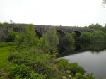
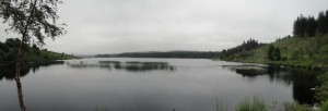
I parked in a car park at Stroan Loch just by the disused viaduct and spent a little time gazing across the loch. The picture above is Stroan Loch from the car park. I was to start my walk by crossing Black Water of Dee on the viaduct. There was my first problem. How to get onto the viaduct? A steep overgrown bank and fence stood between me and my goal.
However, my eagle eye spotted a path going under the viaduct. Perhaps that would lead onto the bridge? I followed the path and whenever it forked I chose that leading up and to the left. The epithet “path” became less appropriate with each fork. I was eventually climbing through chest high bushes and ferns with the occasional feeling that others had been this way where there was crushed fern.
I then found myself on a bank looking down onto a path. Indeed it had the appearance of a railway cutting. I had climbed a little too high, so I fought my way down the embankment and climbed a fence. Once on the path, immediately opposite me was a well maintained path. It led to the car park. Looking on the bright side I had worked up some warmth and was able to stick my coat in the rucksack.
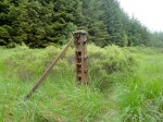
Once across the viaduct the path was in good nick, for now, and there were plenty of wild flowers as well as flocks of butterflies. (PS I’ve looked up the appropriate collective noun and it should be a flight or a rabble of butterflies). These would flap about me as I walked along but if I stopped to take a photo they landed on plants, so I gave up trying to catch them with the camera. The path was the old railway line and there were many rusting fence posts off to the side. They stayed still for their photos.
At Airie Farm (Airie is from Airidh, a hill-pasture) I ignored the sign to the viewpoint since it was unlikely I would see much and carried on along the old railway instead, past the private road sign. My return route was undecided at this point. One option was to return along the railway but take a path up over Airie Hill, but since I didn’t see any path on the way out, that return journey was removed from the options.
Once out of the trees I passed a waterfall on Airee Burn and then crossed a wooden bridge over Grobdale Lane. I presume in better weather I would have been able to see the hills of Cairnsmore of Dee, or even Airie Hill which was within a kilometre.
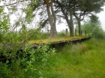
The path began to be more waterlogged as I caught my first glimpse of Loch Skerrow and then reached the ruins of Skerrow Halt. There was once a rail stop here where trains would take on water. I believe the few buildings associated with this activity were demolished by the army (blown up as an exercise) once the line was closed. I would love to be able to say I could see evidence of this but my CSI skills clearly aren’t up to it. It’s hard to believe what this station once looked like. Sad in some ways, but impressive to see how swiftly nature can erase man’s handiwork.
Sadly the views across Loch Skerrow were obscured by mist, but some geese that had been hiding by the bank made a run for it as I went to take some photos (as you will see in the gallery). I decided to press on returning via the forestry track on the far side of the loch rather than retracing my steps, because I thought it would be too boring to just turn around, even if it was shorter.
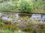
After Skerrow Halt the path was clearly losing the battle with nature. It was overgrown in places, but passable. Unfortunately there were long stretches in which it was flooded. I made a schoolboy error at one point, choosing to step on some ironwork I could see below the surface, only to find it was much deeper than it looked. (Damn refraction.) At one point the path was just impassable with deep water and I had to climb onto the higher ground. Here I regretted my decision to not wear gaiters, since I was walking through knee high wet grass in the usual tussock arrangement and had to negotiate several water channels. The last of these was too wide to cross so I made my way back down to the railway, which was less waterlogged here.
I soon spotted the forestry track that would be my way home, just 100m across some low lying tussock strewn bog. There was no obvious track across so I just went for it. There was one particularly wide water channel but fortuitously it had a rail sleeper laid across it. Once on the forestry track I did a quick damage report. I was soaking wet from the knees down, but hoped I might dry out before reaching the car. The trousers are supposed to be quick drying.
The track led along the north bank of Loch Skerrow for a while then contoured around Auchencloy Hill, the top of which, at 209m, remained lost in cloud. This section was not particularly exciting since I couldn’t see much. There were some interesting sights though. A deer bounding along just off the track, a toad hiding in the grass, a beetle scurrying across my path and then, of all things, a red Kite.
I took a photo of a small stream, just because I thought it was Barney Water and liked the name. It turns out that Barney Water is a farm further on and my photo was of Glengainoch Burn. At Barney Water there was a stone circle that looked too regular to be natural, but I can’t find any report of a stone circle here. The rather strange name is thought to be a corruption of bearna uachdar, upper pass.
Once over the Black Water of Dee, with its truly black water, I was back on the Raider’s Road. Here was my first sighting of other people. I stopped at an information sign that informed me that the annual rainfall at the coast is about 750mm but at Clatteringshaws it is 2200mm. No wonder the ground is always wet.
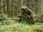
I wasn’t sure how far I had to walk on the Raider’s Road and couldn’t be bothered to get the map out to see. There was just over 2 miles to go. Along the road I spotted a Galloway forest monster, distant relative of the wild haggis, in the woods. Probably just baby since its invisibility wasn’t working yet.
My heart rose when I caught a glint of water through the trees and thought it was Stroan Loch, but it was just the Black Water of Dee. Eventually Stroan Loch with the viaduct on its far side came into view and the end was close. The rain started just after I got back into the car. How’s that for timing?
Route: Stroan Loch-Airie-Loch Skerrow-Auchencloy-Barney Water-Raider’s Road-Stroan Loch.

