East Lodge to New Abbey

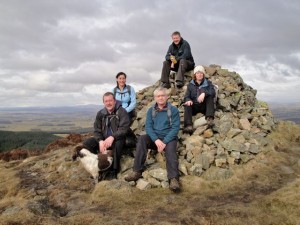
Margaret sits on the log bench she had, minutes before, destroyed. Luckily no one was physically injured, though Mike was forced to move more quickly than he is usually does.

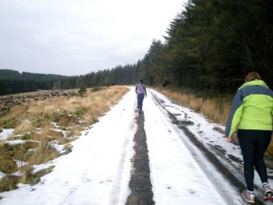
A good walk. It was on good forest paths and then roads for the last mile or so. I was surprised to find so much snow still lying about given how warm it felt when we set off. We didn’t see another soul on the way. I thought the views were quite good but the pictures are a bit boring I’m afraid. The windfarm out to sea doesn’t show up in my pictures.

I managed to complete the walk having been stretched by Margaret (many thanks). Elaine says she was sorely tempted to use my camera to record the torture, sorry, stretching. Even poor Blue was limping towards the end. I hope he is recovering from his sore paw now.

The coffee shop at New Abbey is a good excuse for finishing the walk there.

11 miles      3h 30mins     Ascent 379m
Posted in Dumfries & Galloway | Tagged , | Comments Off on East Lodge to New Abbey

Screel

4.79 miles,  2hr 8min,      326m
Nice weather (no rain), but a little wet underfoot….but this is D&G.

We set off with the aim following the forest track up and coming back through the “enchanted forest” section. I would normally have gone up the steep bit and down the less steep Glen of Screel Burn. This time we did it clockwise so to speak. The Glen was pretty mushy following forestry work and felling but not enough to wet our feet. I do like Screel. You feel that you have achieved something getting up it and the views, particularly over towards Almoress are worth a couple of hours walking. See above.

Then coffee in The Glenisle Inn, Palnackie (thank you, Jo)

Posted in Dumfries & Galloway | Tagged , , | Comments Off on Screel

New abbey to mabie forest

12.4 miles     Total Ascent 388m     Time 3:32:18 walking, 20 mins resting.

Sun, snow, blue then grey foreboding skies, but no rain. Another interesting walk. It was nice to expand beyond Mabie. I have no idea why I got shin splints at the beginning….and why they eased off when I re-laced one boot. Spooky.

This walk took us up through Shambellie wood and on to Mabie Forest via Trostan wood. You don’t realise how steep the climb out of Shambellie is until walking back down on the way back. If you look in the picture gallery you will see me standing next to the “killer climb” sign. But we didn’t go that way. At Mabie we took in the Brown walk around Craigbill hill, with a pause for sandwiches and photos at the tree with seats.

The after walk refreshments were certainly of high quality, except the butter was too hard. There are photos from the walk here.

Route

Posted in Dumfries & Galloway | Tagged , | Comments Off on New abbey to mabie forest

Glenmidge

7.74 miles, 315m ascent,      2h 18m.

I thought the pace was just too fast for comfort, but Elaine informed me it couldn’t have been too fast.. because I could still talk. Good walking weather, but too misty for proper photos.

I found this a strange walk when we did it last year. It was hard to know exactly where we had been and I am glad we were led around again.

It is a combination of country road, path, fields (and rusting gates) with some steep (or perhaps sustained rather than steep) parts. Amazing really that it exists so close to home.

The after walk hospitality was top notch. Route Map, Speed etc can be seen here.

Posted in Dumfries & Galloway | Tagged , , | Comments Off on Glenmidge

Mabie Forest (Dreaded Brown Walk)

6.67 miles     total ascent 290m             2 hours

The dreaded brown walk, not particularly long but enough to work up a thirst.

Despite being a bit steep in one part, the brown walk has always been my favourite because it is the quietest of the way marked paths in Mabie. As you will see the snowdrops were out.


Download file for GPS
Posted in Dumfries & Galloway | Tagged , | Comments Off on Mabie Forest (Dreaded Brown Walk)

Cairnsmore of Carsphairn

7.4 miles 3h 45m 690m ascent

This started as a clear, blue skied slightly frosty day. It seemed ideal for walking. The field with cows that two months earlier had been a quagmire of mud and excrement was now frozen. Unfortunately the paths were also frozen further up. Indeed it looked as though they had flooded and then frozen. Once off the paths and on open fields the going was easier. I had left the path just past a gate, and headed up Willieanna to join the dyke. There is quite a drop between Willieanna and Dunool and the descent is much steeper than the OS contours would have you believe. It would probably be easier to continue along the path to the west of Willieanna and head directly up Dunool.

Frozen path looking down to the Water of Deugh

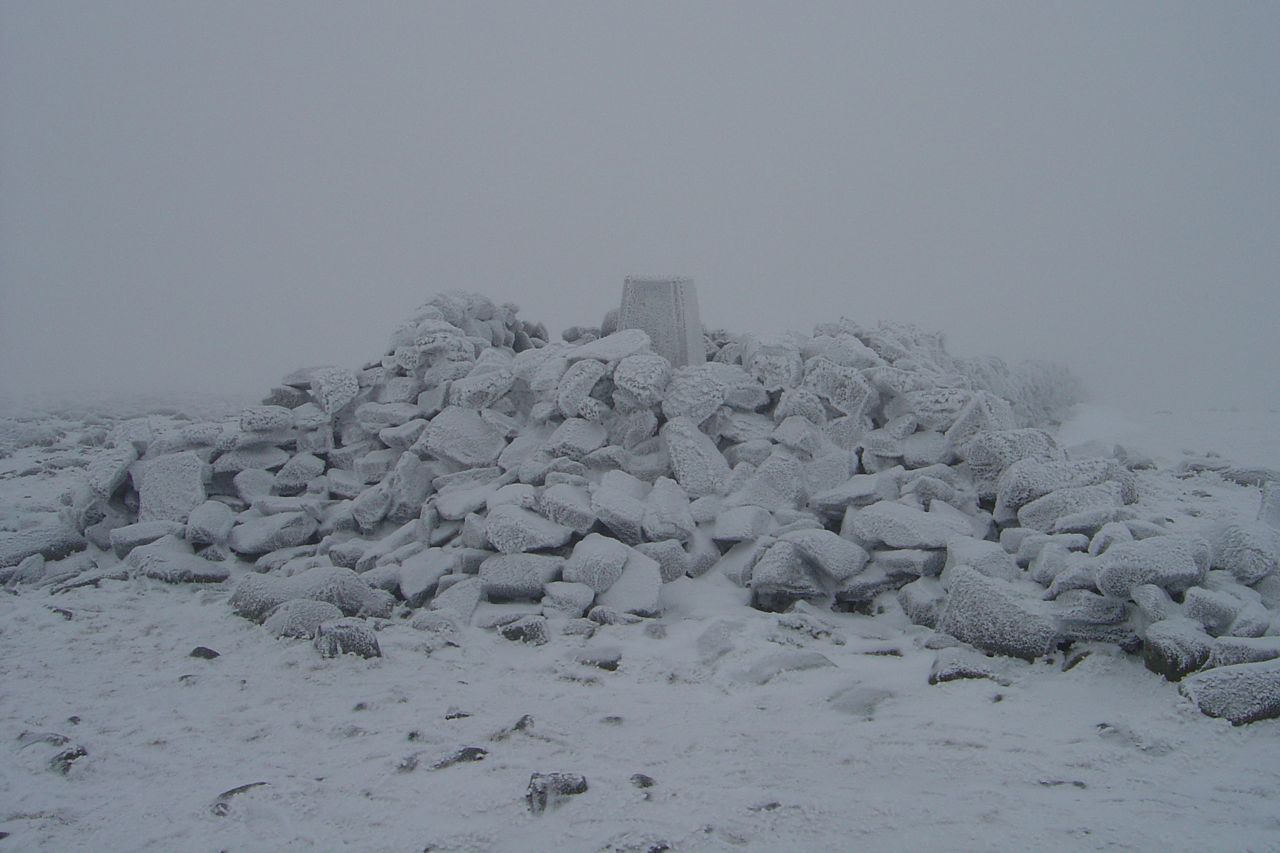
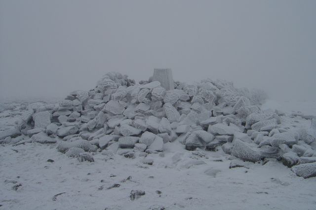
The ridge across to Cairnsmore was covered in light snow and visibility slightly poor but not dangerously so. The drystone dyke ends at Black Shoulder and compass was required to find the right direction. There were some footprints in the snow, but heading in the opposite direction. Eventually the large cairn at the summit of Cairnsmore of Carsphairn loomed out of the mist.

The trig point on Cairnsmore of Carsphairn

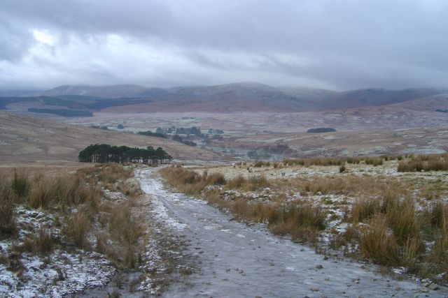
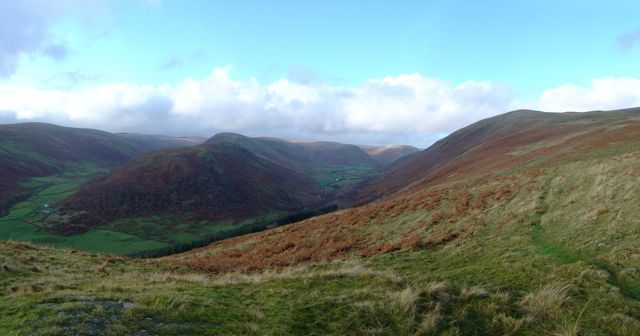
There is another dyke to guide the descent. The photo above is the view as I came out of the cloud; Dunool is on the left. There is a small burn to cross at the bottom then it’s only a few metres to the path. Unfortunately the path was very icy and there were three areas where it had flooded then frozen, but with thin ice overlying the icy water. I had to climb around these.

Fording the Benloch Burn on the way up, and down, proved tricky because the stepping stones were slippy with ice. After this walk I was in no doubt that my boots were no longer waterproof.

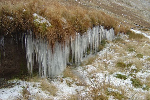
Icicles on the slopes of Dunool


Posted in Dumfries & Galloway | Tagged , | Comments Off on Cairnsmore of Carsphairn

Cairnkinna

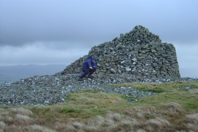
This walk started with blue sky and became gradually more overcast, but I managed to be off the hill before the heavens fully opened. The route was easy enough to follow. Firstly up the path towards Woodend Farmhouse, then up onto Woodend Craig. I stopped just a little further up from where this picture was taken to have a drink of water and it was so windy that my rucksack was blown away (I did catch it though).

Mike takes a dive on Cairnkinna

There were several tracks to follow, some probably sheep tracks but also some vehicle tracks. None seemed to go all the way and I would lose tracks for a while only to come accross others after a few minutes. The views of Scaur valley were pretty impressive.

There is a massive cairn at the summit of Cairnkinna. I decided to use the camera’s self timer to get a shot of myself at the cairn, but tripped just as the shutter fired.

Earthwork:fort with Merkland Hill, from Mote Hill

There is a fence to follow down over Mote Hill heading towards the remains of an earthwork at Druidhill Burn. There were also the remains of sheep, one whole skeleton and various scattered bones. Once off the hill there is a farm track back to the road.

Posted in Dumfries & Galloway | Tagged | Comments Off on Cairnkinna

Bishop Forest Hill

The day started at Mabie forest car park. No one else had turned up. Then my phone rang. Everyone else was at Ae forest. Chinese whispers had corrupted my message. It was too late to join them at Ae so I drove up to Glenkiln to have a go at Bishop Forest hill.

This hill was in a book of walks I have had for 15 years or so. I have tried getting up it a couple of times when the boys were younger but could not find a path through the unpleasant tussucks and marshy ground. Same again this time, so I skirted round to the east about half way up and came across a faint track which would have been my way down according to the book. It was easy enough to follow it up to the top. My attempts to find a way down where I had expected to come up were unsuccessful (very wet ground) so I came back up and followed the track down.

Despite this being a small hill the views were good.

Retrospective:

I parked near the statue of John the Baptist in air guitar pose, then followed the path over the Marglolly burn towards Cornlee farmhouse turning up to the hill just before the pink farm. The first section was difficult. I stepped on some old wood which proved to have been rendered frictionless by moss and drizzle, and fell flat on my back. This must have made me stronger (since it didn’t kill me), but did not make me happier.

I imagine I had chosen the wrong path since I had to climb over two walls, one with barbed wire to get out onto the hillside. This lacked any easy path and the waterlogged ground was hard going. I eventually contoured to my left and found a faint quad bike track that I was able to follow most of the way to the top.


Posted in Dumfries & Galloway | Tagged | Comments Off on Bishop Forest Hill