
5.8 miles 3h 10m ascent 285m
“I was born on Sunday, the 22d of October 1775, (I ascertained these points in 1805,— I did not exactly know my age in 1794) and baptized a fortnight after, on Tuesday 7th November — stated in the register of baptisms to be the 27th, but the old style is understood, (in the register.) The place where my father then lived is called Dunkitterick, or commonly Kitterick; in Earse, Dun-cheatharaiach, — the know of the cattle. It is on the burn of Palneur, on the south side, about a quarter of a mile from the burn, and on a rivulet that flows from the high hills above on the south. The hills of Craigneildar, Milfore, and others, quite overshadow the spot, and hide it from the sun for three of the winter and spring months. The cottage has been in ruins for more than twenty years, as the farm is herded from the house of Tenotrie, the tenant of which holds both Tenotrie and Kitterick. This place, now laid open by a road, was, when my father lived there, in a completely wild glen, which was traversed by no strangers but smugglers.” Alexander Murray, Manse of Urr, July 20, 1812.
This outing began as an ascent of Craignelder from McMoab but a taste of the terrain we would need to cross in getting onto the hill drained my enthusiasm and it was decided that Craignelder would be better approached from Cairnsmore of Fleet as a linear walk, on another day.
I had read there was parking off the forestry track before the bridge near McMoab, but on arrival we found that Mr Forestry had been hard at work stacking logs there. So we drove back to the wee car park on the A712 where the western path from Murray’s Monument emerges then re-traced our steps with the dogs on leads until we were away from the road.
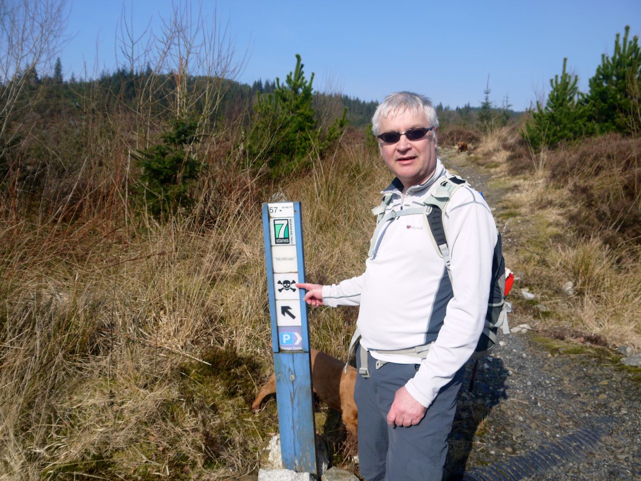
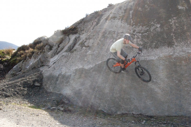
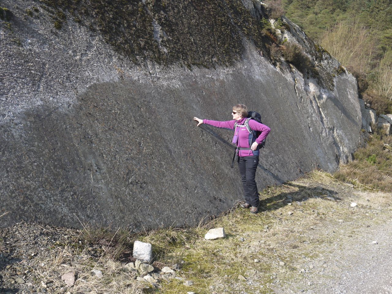 The McMoab slabs are used by mountain bikers and the skull and cross bones warning signs give some indication of the difficulty I presume. There are tyre marks at head height on the steepest parts of the rock and I wondered if they might instead be geological. Back home I have had a look on google and they are tyre tracks. See here.
Craignelder from McMoab
Our first challenge was to find the Rosnes Benches at McMoab. We walked up over the granite slabs using the height to look for the benches, but they were no where near so we came down and explored the rough ground opposite the McMoab slabs, again in vain. I had read the benches were about 100 yards away so we walked along the forestry track, climbed onto higher ground for a better view but still could not find them. I had looked up the OS grid reference the previous evening but could only recall the first 2 digits (of 8) and regretted not writing them down.
On McMoab: note the logs in the car parking space
 Eventually we gave up our search for the benches and indeed I began to wonder if they were described on the web-site but not yet actually installed. So we gave up on the benches and headed south along a forestry track looking for a way up the slopes to a wall which would take us to the top of the tree line. The ground, however, looked uninviting to put it mildly. This was a sore blow for the Craignelder route. We then headed back to McMoab and along the track that heads towards (but does not reach) Dunkitterick. This gave the possibility of following another wall that crosses the track and leads to the tree line. The terrain there was equally uninviting (and I did give it a go). The Craignelder walk was set aside with a half hearted proviso that we could resurrect it if there was a way up across Sleekit Knowe. Once we could see the rough ground and felled forest of the inappropriately named smooth (sleekit) slope, Craignelder was finally set aside for another day, and an alternative route.
On the positive side though we did find the paired Rosnes Benches quite a bit further than the stated 100 yards away from McMoab. This gave us a chance to lie down/sit down/take photos/enjoy the views. The views included Murray’s Monument on Big Doon, the Glen of Palnure (poll n-iubhar, stream of the yews), Craigdews (creag dubh, black crag), and Craignelder (creag na eilte, hind’s crag).
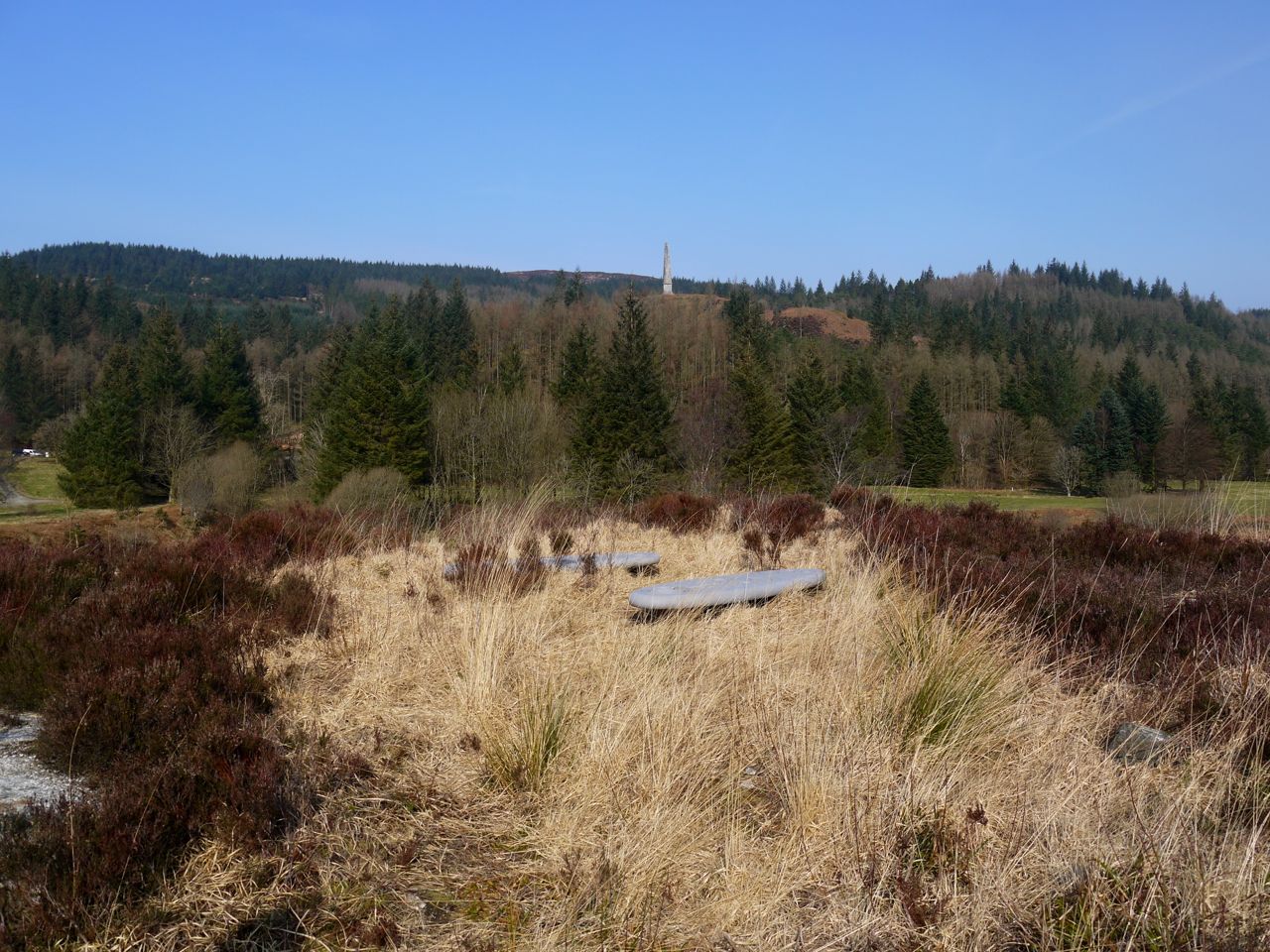
McMoab Rosnes Benches
If you look at the photograph above you will see Murray’s Monument on the hillock called Big Doon. To the right is a tree covered hill, Garmel (Gar Meall, near hill), whose jungle-like steep slopes we would be crossing later in the day.
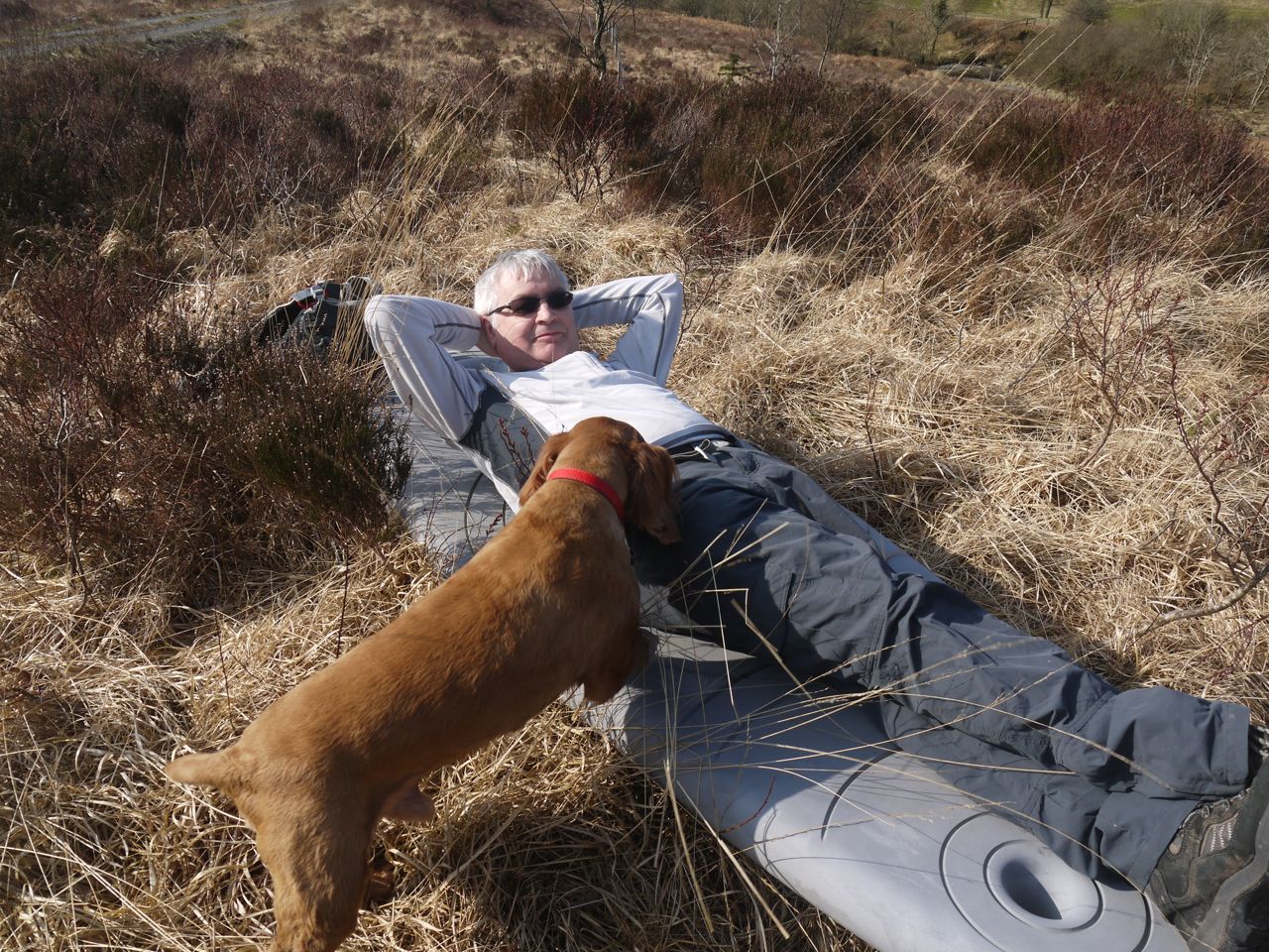
I spent a little time on the benches during which I tried to “experience existing in the moment, not thinking forward or looking back, but fully part of and immersed in the complex and multi faceted relationships we have with nature and the vibrant ecology we are a vital part off” as suggested by the bench’s creators, but Sweep knew which pocket I had the dog treats in.
Every walk needs an achievement, and finding the benches ticked that box. Rested and filled with achievement we continued along the forestry track through Sleekit Knowes. As I mentioned there was no obvious way up the slopes, though I was tempted by what may once have been forestry access but it was now over grown with young trees and Audrey’s facial expression told me that I was mistaken in thinking of it as a forestry break.
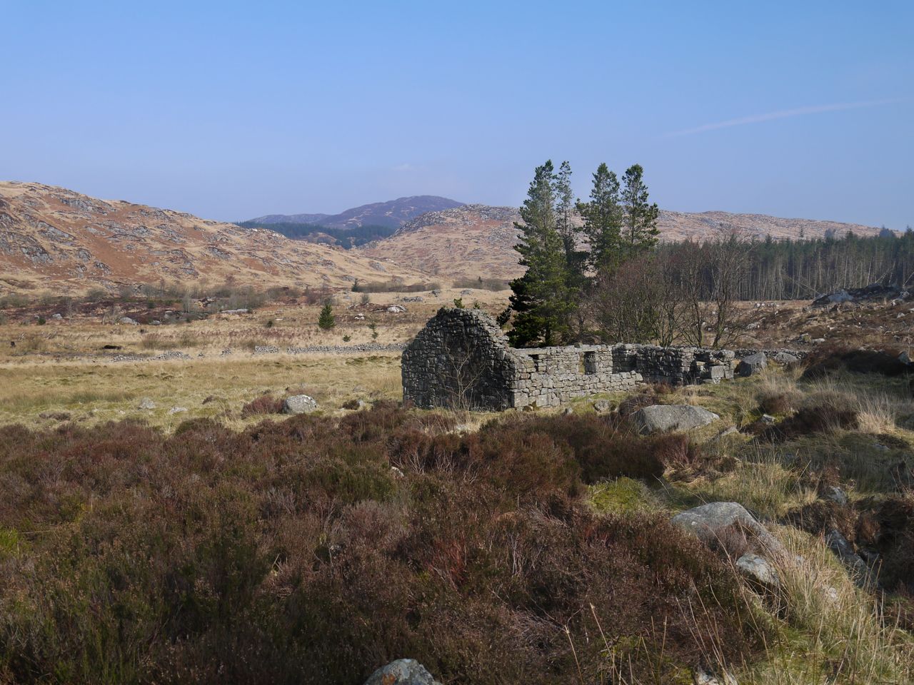
Dunkitterick
The track ends a hundred metres shy of the Dunkitterick ruins and we were faced with 100m of forest or skirting the trees through boggy tussocks. I gave the forest a go but fallen trees made it impassable without a chainsaw, and neither of us had brought one, so we skirted the edge of the trees and crossed a unnamed burn to reach the ruins.
The last time I was here the burn was much fuller and more difficult to cross (indeed one of the group had a dunking). Now it was much lower and easily crossed. The ruins here are the birthplace of Alexander Murray, a shepherd’s son who became Professor of Oriental Languages at Edinburgh University and the 80 foot granite obelisk built on Big Doon, a mile a way, is a memorial to him. You will see from his description at the beginning of this post that the place was referred to as Kitterick by his father, and is so named on older OS maps (and on the map of Galloway on the wall at home.
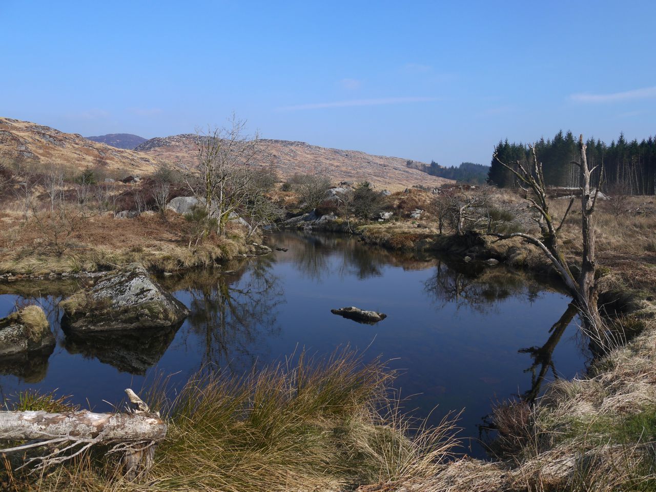
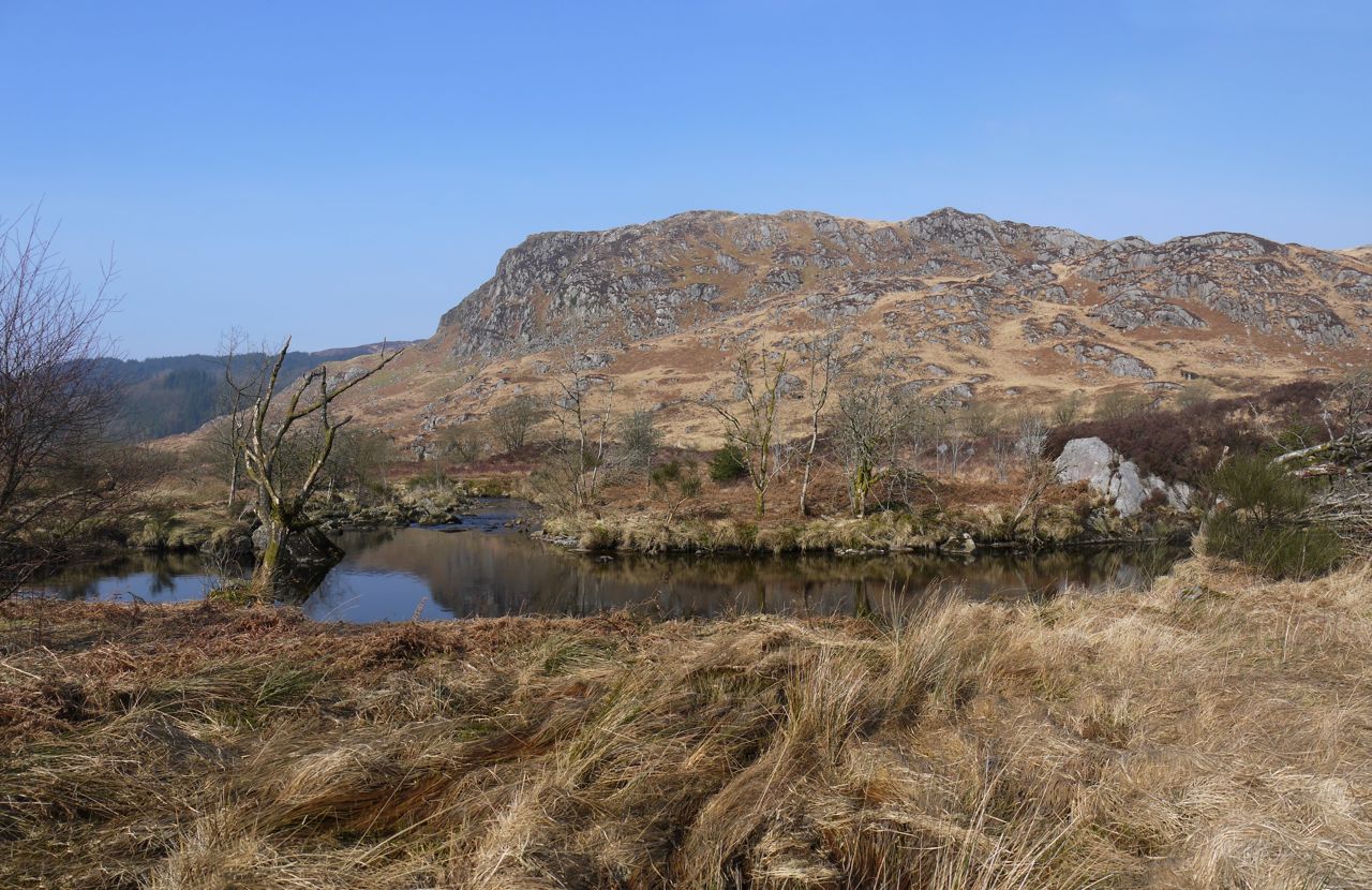
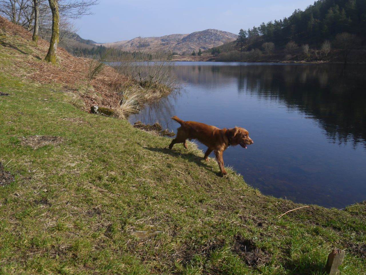
Palnure Burn
Once out of the walled area there is a firm path which must have been surfaced since the last visit when I remember us walking through very boggy ground by the Palnure Burn. The black rocks of Craigdews were living up to their name and the broad slow burn was very pretty in the sunshine.
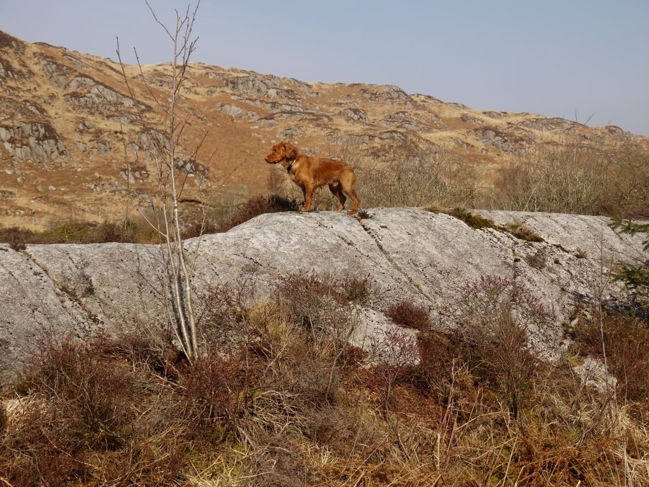
Eddie below Craigdews
There is a footbridge across the burn and a small waterfall a little way upstream. On a warmer day it would have been nice to sit on the rocks and dangle our feet in the water.
There is a small parking space by the footbridge and we passed through that then along the road in front of the wild goat park of Craigdews, crossing the Tonderghie Burn on the A712 and again on the forestry track up to the Black Loch. Tonderghie, (pronounced Tonnergee with a hard g), takes its name from Ton re gaeith, which means the backside of the wind. As strange as this name seems, it is usually applied to low lying land, such as where cattle stand in storms with their tails to the wind.
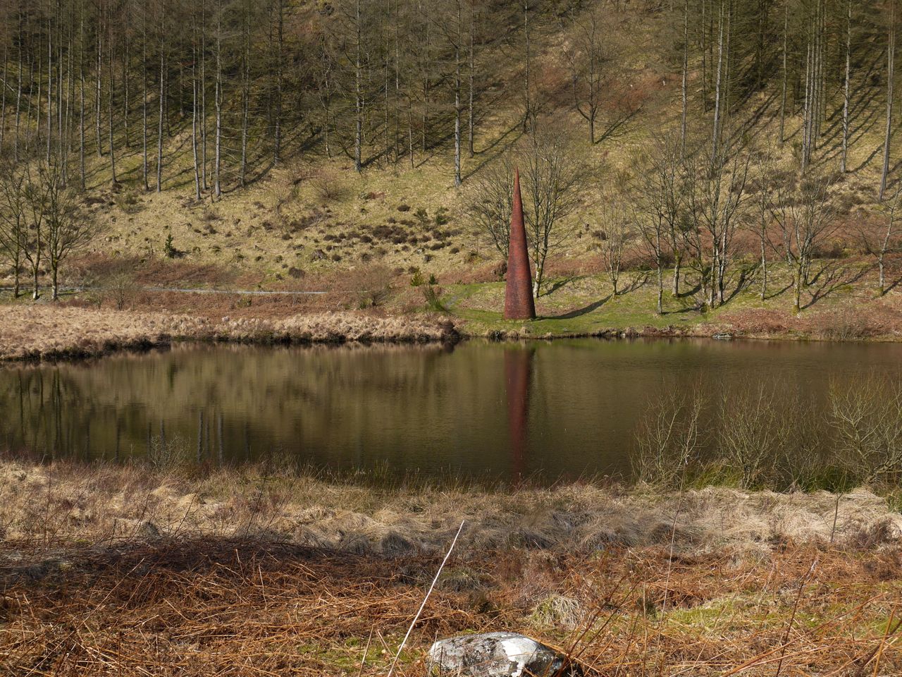
The Eye
The track led us up to the Black Loch, passing a sign warning us to Beware of Bees, under which someone had written “Bees?”. Well we were warned but didn’t see a bee all day.
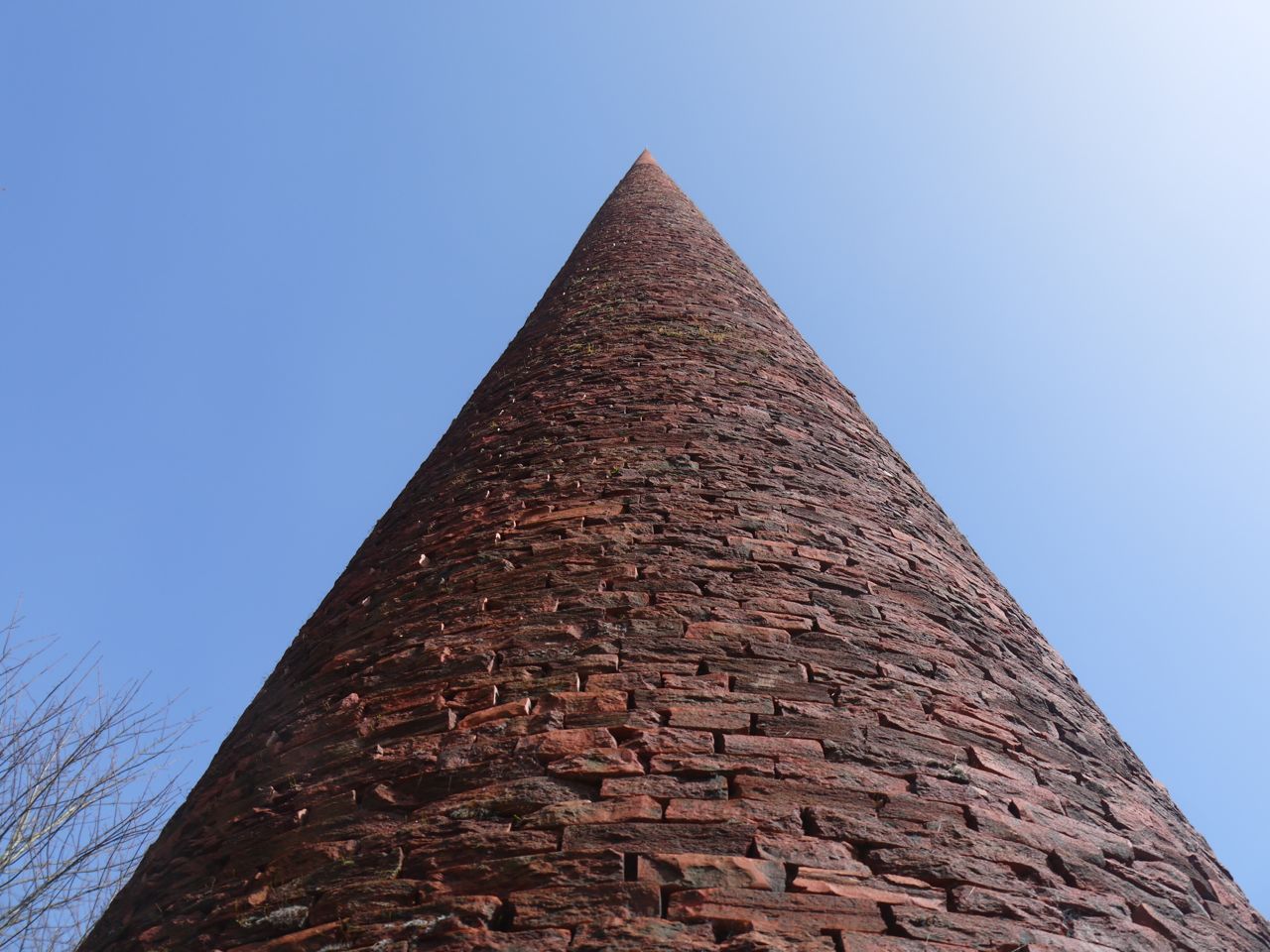 The track here, which was once the old Edinburgh Road is covered with fragments of sea shell. At the far end of the loch is the Eye, a 7m conical terracotta-covered structure by Colin Rose, commissioned in 1997 to mark the 50th anniversary of Galloway Forest Park. There is a hollow section running through it but I don’t know if this is part of the “art” of the piece or something more mundane such as the means by which it was held prior to being placed here. I looked through the hole both ways but there was nothing specific to see.
Near The Eye
I recalled a tale involving the Black Loch involving the Laird of Cardoness, a robber baron and violent man, who was exasperated with his wife who had provided nine daughters but not the son and heir he desired. When she became pregnant again he threatened to drown her and all her daughters if she failed to produce a son. Much to the relief of all concerned a son was born and the delighted Laird arranged a midwinter feast on the thick ice of the Black Loch. Unfortunately the ice gave way and the whole family, save one daughter were drowned. And the Cardoness estates passed to the McCullochs by her marriage. Audrey, ever a sceptic, thought the Black Loch was a long way to come from Cardoness and I had to admit that the story was likely to be less than 1% truth.
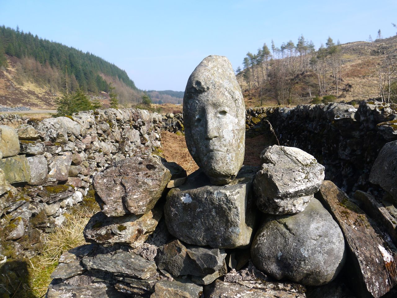
Quorum
Further along the “old road”, at the bridge over the Grey Mare’s Tail Burn are a maze-like group of sheep pens. Among the stones are several carved faces, the Quorum installation by Matt Baker. Some logs by the burn looked like a perfect place for lunch but it was a bit nippy in the wind and rather than stop in the cold, we put lunch on hold.
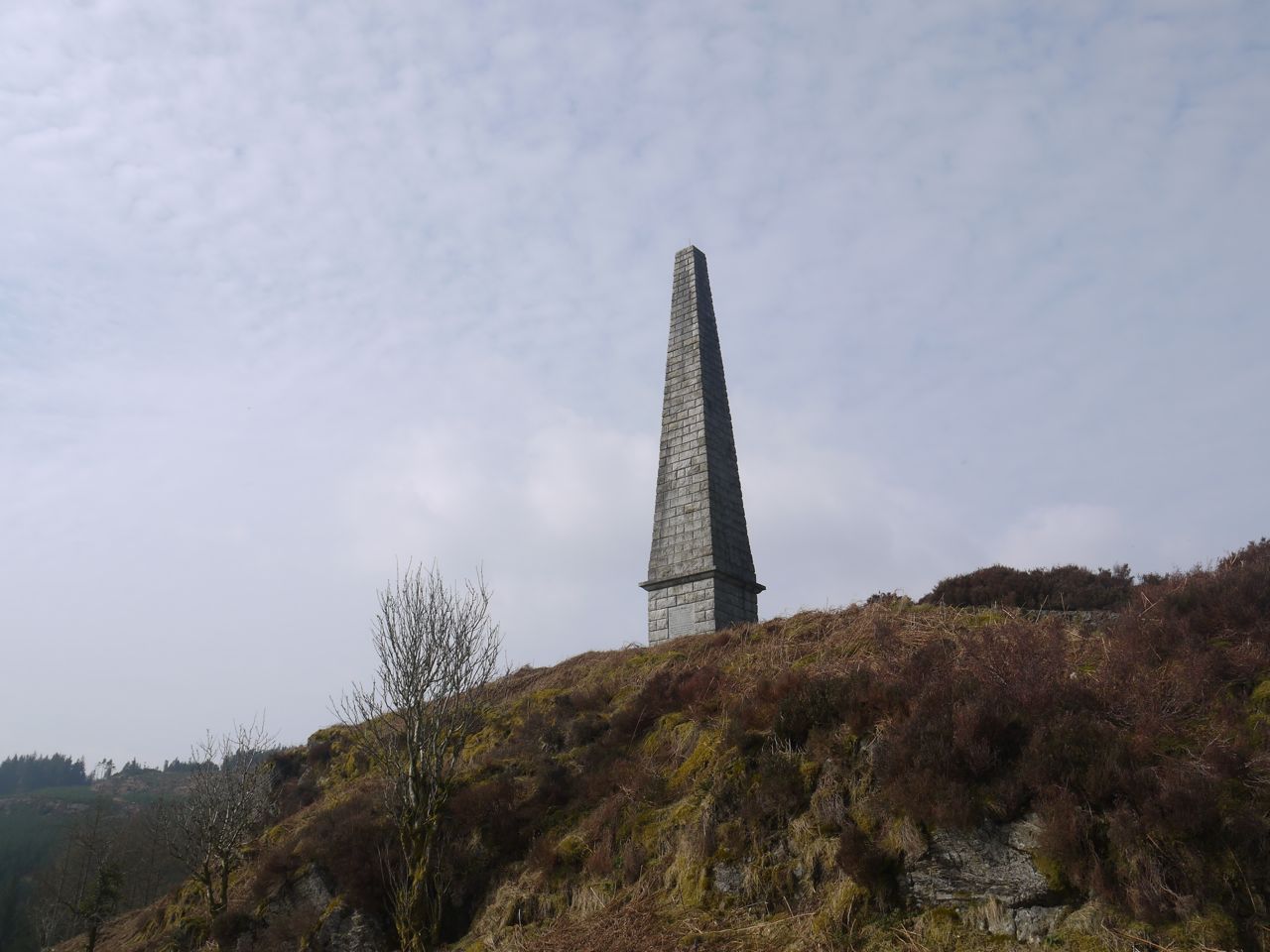
Murray’s Monument
Our next port of call was to be Murray’s Monument on Big Doon. Rather than follow the burn down to the road and climb back up to the obelisk, we decided to stay on the old road and find a way down fourth on. The seed of a navigation error was sown in hat moment.
The map shows a path about 250m beyond the bridge and another more 500m beyond that. There was no sign of the first path as we walked and when we could see along the track I couldn’t see the other. The OS shows a break in the forest at about 500m from the bridge. The area had long been felled but the tussocks of the old forest break stood out from the rest of the ground. My eyes played a trick on me here and I perceived the land beyond the break as a loch of brown water until we were closer.
This route took us up to the top of Garmel and back into forest. We then made our way through the forest which in places was quite steep. I had expected to come out above the monument but had miscalculated and found we were actually descending towards the car park at the Grey Mare’s tail bridge. A problem here was that we could not see through the trees and I went on a couple of short recces to higher ground to see if the monument could be seen. It couldn’t. Though downhill this was still quite tiring and poor Sweep needed help getting over some of the tree trunks. As well as clambering over fallen trees and coping with fallen logs we had to cross a newly felled section with the trunks and branches still lying randomly. Once we could see the path to the monument it was obvious that we could maintain height by crossing the difficult felled section, or give up height but at least find an easier way.
So I will have to admit that this “short-cut” did not deliver reduced effort, reduced distance or reduced time and indeed we could not easily maintain the height we had gained and ended up descending to join the monument path quite low down, it did not deliver reduced ascent either. At least the climb up to the monument was on a good path, but the obelisk is much larger than one would expect, and therefore further away than it seems.
Murray’s Monument
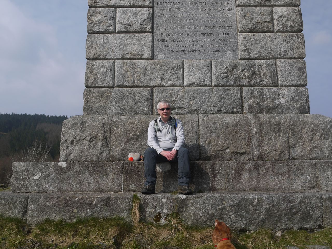
Murray’s Monument did at least offer a seat to rest our weary legs. From there we had views back to the Rosnes benches which could not be seen (by my) naked eye but are there on photos when zoomed in.
When the monument was erected in 1835 but did not have an inscription added until 40 years later. The granite slab with the inscription weighed 16 cwt and newspapers at the time reported “not a little difficulty was experianced in getting it to the summit of the hill. The satisfactory completion of the monument will be a source of gratifiication to every Gallovidian.”
The inscription reads:
“Alexander Murray D.D. Minister of Urr – 1806 – 1813. Professor of Oriental Languages in the University of Edinburgh – 1812 – 1813. Born at Dunkitterick, 22nd Oct 1775. Died at Edinburgh, 15th April, 1813 Reared a Shepherd Boy on these hill sides. Erected by his countrymen in 1835 mainly through the exertions and skill of James Stewart Esquire of Cairnsmore on whose property it stands”
The Wikipedia entry for Alexander Murray is here.
Wee Doon beneath us was , newly devoid of trees, with a forestry harvester parked on its summit, somewhat spoiling the wild views but along the Palnure glen and the surrounding hills.
Our descent was along the alternative path heading west then south which returned us to the car.
Download file for GPS