5.2 miles 2h 46m ascent 536m
 Durisdeer-Black Hill-Turn Hill-Well Hill-Well Path
I have decided to award some hills “Honorary Donald” status for topographical merit. Well Hill is the first Honorary Donald. To be honest this is aesthetic rather than objective, but perhaps I will eventually find some objective criteria.
Well Hill sit among several Donalds but is separated from them by deep valleys. It is 12 feet short of 2000 feet high, but has 200m of drop, and is well over 17 Donald units from its neighbour. I don’t know why it is called Well Hill. There are no obvious wells nearby now but it does stand above an ancient route, the Well Path, sometimes known as the Wald path or Wellpeth. Wald is an upland forest, whereas well can carry the meaning ‘good’ as well as a water well. The hill above the good path, perhaps? Certainly that is true now.
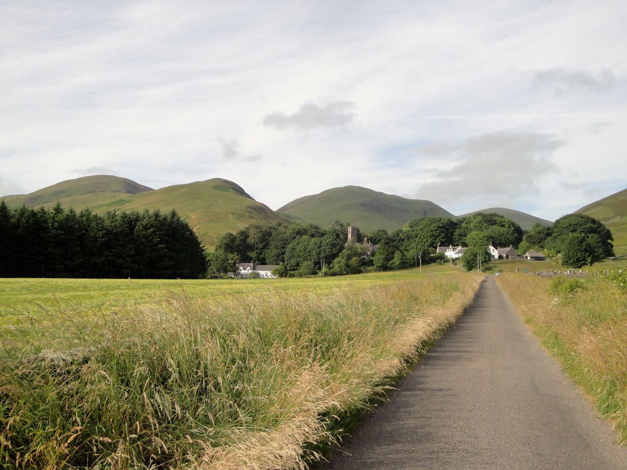
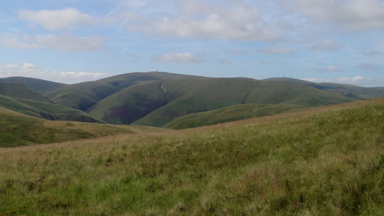
Well Hills behind Durisdeer
This outing was a very hot day so I opted for a late afternoon walk. I applied sun-screen, had a good glug of water at the car and decided to take an extra litre of water along with me. That proved to be a wise decision since soon after setting off I felt water dripping down my legs, the top on my water bladder having come loose. I was spared a complete soaking of my shorts though since I have the bladder in a plastic bag.
When I reached the gate to the Wald Path and the sign informing me that Troloss March was 2 miles away, a chap sat on the memorial bench told me there was a red kite up the valley. He was quite right.
I left the Well Path almost as soon as I joined it and followed a track down and over a small wooden footbridge at the Kirk Burn. From there a grassy track leads up the ridge. This long ridge up to Black Hill goes over several knolls, Wether Hill being just one of them. I don’t know if it was the heat but the slopes felt quite steep in places and each time I reached the top of a knoll and then looked at the descent before the next climb I found myself stopping to admire the view a little more than was necessary for purely viewing purposes. The water from rucksack warmed in the tube to the mouth-piece so I had to take several sucks before being rewarded with some cold water, but I suppose that would help my hydration.
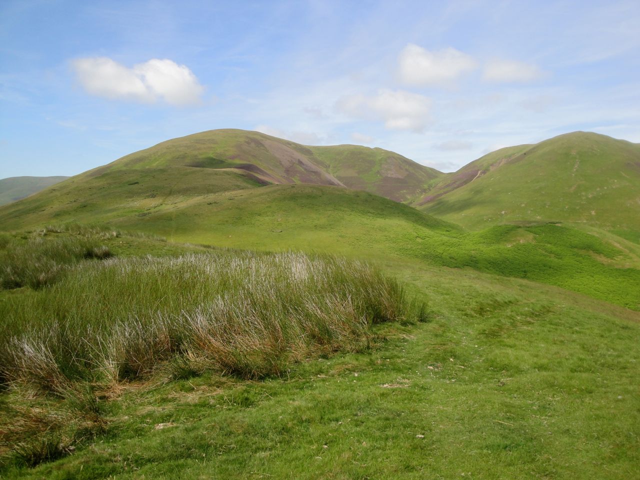
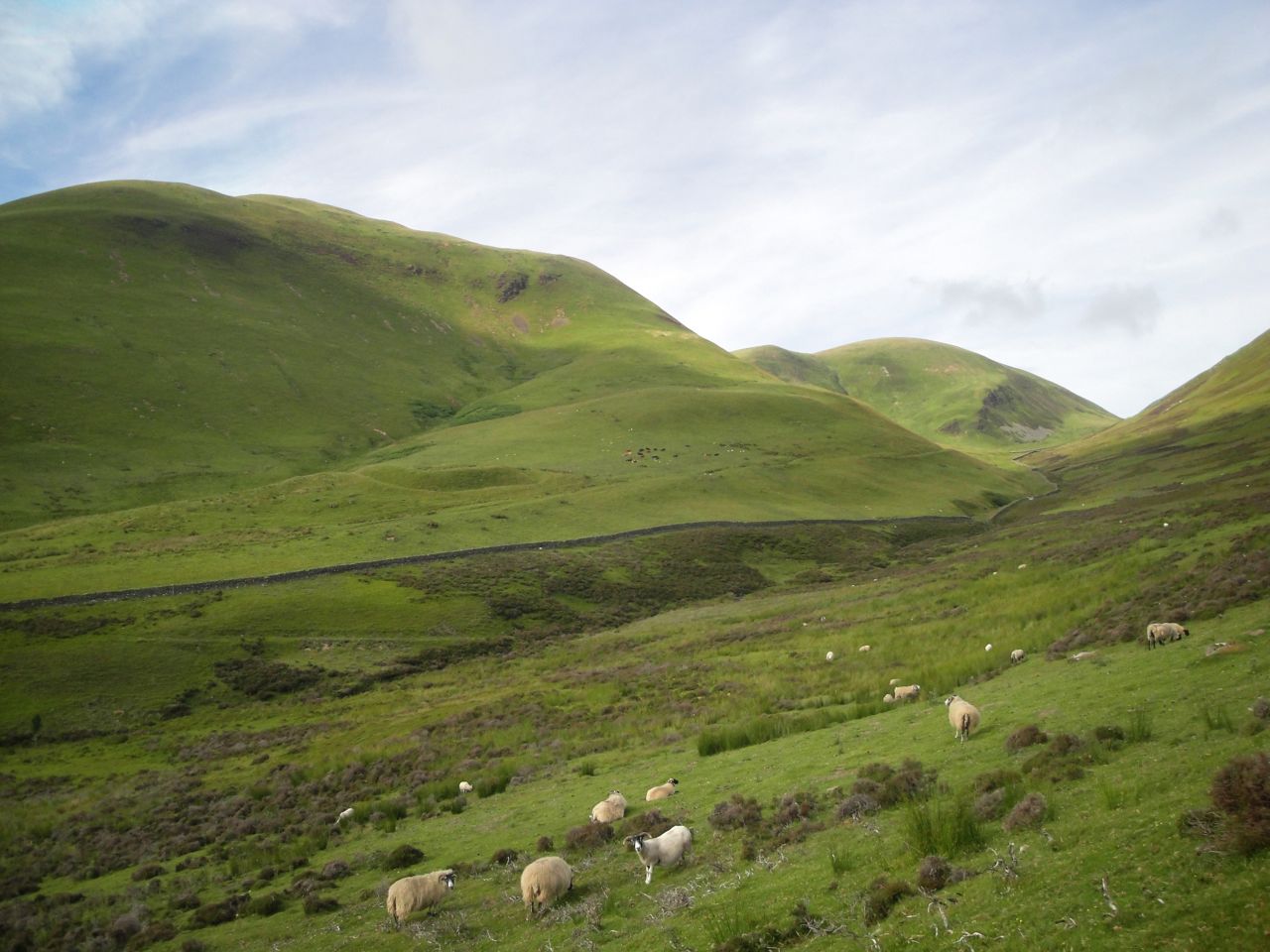
Black Hill from Wether Hill
There was a large bird wheeling high in the deep valley between Penbane and Black Hill and I wondered if it might be the kite I had been told about. As I climbed higher, and closer to the bird, however, it was obviously not a kite and not alone. There were a pair of ravens. Their call was definitely raven and one of the pair gave me a couple of close passes so I could be sure.
Climbing up Wether Hill there are good views of the Well Path and the remains of the Roman Fort. Old maps show a “Celtic or Deil’s Dyke” at about 750 feet. I didn’t notice it on the the way up, but when coming back down the Well Path at the end of the day its line was visible in the vegetation. Once on Black Hill I treated myself to some cooler water from my bag and found there was just enough of a concrete lip at the base of the trig pillar to sit on (in the shade). Scaw’d Law sat to the SE looking particularly unimpressive, and the Lowther Hills with their radio equipment were my northern horizon. The large cairn atop Cairnkinna (Carn Cinaeidh [kinneh], Kenneth’s cairn) was visible to the naked eye seven miles away to the west. Sitting there by the pillar I noticed a wasp and was watching it with the awed interest of an amateur naturalist, but my brain must have calibrated to spot wasps because I soon became aware of wasps everywhere. I would probably have stayed there resting for longer but the wasps had strength in numbers so I relinquished the summit to them. Wisdom rather than fear, I’d like to think.
From Black Hill a track of slightly flattened grass was my guide over the slight rise of Greentrough Head and down into Glenbo Hass. The Hass was mostly dehydrated sphagnum moss but despite the recent dry weather there were still some wet and muddy patches. I imagine this is usually much wetter. Turn Hill stands between Glenbo Hass and Well Hill. The fence actually skirts 30m below the top of Turn Hill but compulsion took me to the top.
Lowther Hills from Well Hill
The ruined wall begins in the col between Turn Hill and Well Hill and leads up to the summit of Well Hill with a faint track up its left hand side. The wall looks to have been built up into a small cairn near the summit, but photos are spoiled by the fence next to it.
When planning the walk I had thought about returning over Penbane but I decided that would be just too much in the heat. Now that I have seen the terrain I would suggest that if Penbane is included, it is climbed by its north ridge from the col below Greentrough Head with a direct descent to Glenbo Hass.
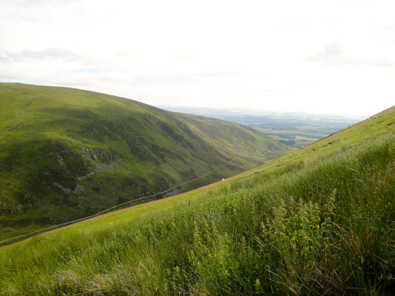
Well Path along Durisdeer Rig
Coming off Well Hill directly to the Well path was interesting. The hill is typically convex and you can see the fence dipping down more steeply just ahead, and then steeper again and then steeper yet again. In the steepest section the soil has slipped leaving some scars of scree, which I thought it best to avoid, but elsewhere the soil had slipped into mini-terraces (solifluction?) that made an otherwise tricky descent manageable. The slope was teeming with rabbits which were in fact the main danger of tripping as they darted out in front of me. The Red Kite was there, presumably for the rabbits.
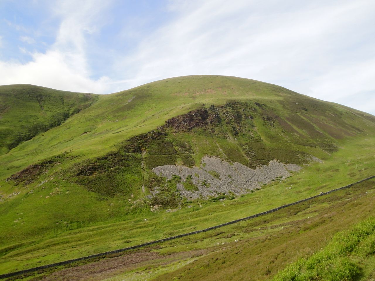
Wee Well Craigs, Well Hill
The 3km back to Durisdeer along the Well Path was all downhill, thankfully. The fields were filled with sheep and large lambs that scattered as I approached. Penbane and Black Hill look to be the larger hills from the vantage point of the path but fro the summit of Well Hill these are significantly smaller hills. I was able to have a good look along the ridge up to Black Hill and had on great view with Cairnkinna visible between Wether Hill and Black Hill.
Roman Fort on lower slopes of Penbane (old path visible)
There were sheep on the very steep slopes of Wether Hill and as I wondered if they ever fell a fluffy white bundle tumbled down the slope. I had thought it was falling but just before reaching the break in vegetation of the Deil’s Dyke it changed direction and came to a controlled stop. So just a rapid descent rather than a fall.
At the end of the walk I was able to make use of bench in Durisdeer for de-booting and cooling down. An ice lolly would have rounded off the walk nicely but the nearest shop was in Thornhill.
Download file for GPS
