It’s been a while since the last post. So long indeed that I have published the previous one unfinished. We didn’t get into a walking project this summer due to a combination of illness, holidays, heatwaves and, if I’m honest, a bit of laziness. We have been walking, but mostly the old haunts locally.
Well. I was browsing the OS routes section and this particular walk caught my eye. The description sounded just what we needed to ease back into it.
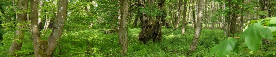
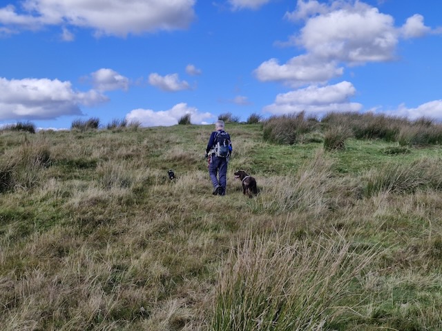
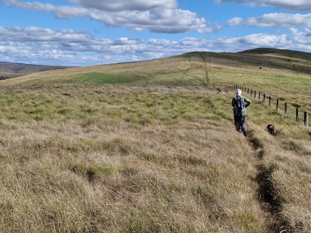
This is probably hill‑walking at its easiest: low, grassy tops reached with a minimum of effort. You’d be forgiven for thinking, therefore, that such walking might be dull. But, although these rounded hills aren’t the most exciting tops, they are located amid gorgeous scenery with mesmerising views. The route starts from Langholm, quickly climbing to a path known as Gaskell’s Walk. Leaving the town far behind, this enters the peaceful, wooded gorge through which Wauchope Water gently tumbles. Later reaching the hills, Calfield Rig (319m), Black Knowe (326m) and Mid Hill (327m) are all climbed. Paths are few (and often squidgy) on the high ground, but the views make up for any difficulties, particularly on the final ridge with Lakeland’s fells visible on the far side of the Solway Firth. This is one of 14 routes established several years ago by the Langholm Walks Group, and, although most of the waymarker posts have now disappeared, a few still provide the occasional guiding hand. By Vivienne Crow
I can’t argue with most of what was written. I might take issue with it being the easiest hill-walking but perhaps the author of that description usually does more challenging hills. We saw plenty of waymarkers with a number 9 and they might have been helpful if we had known we were following that route.
One important learning point was that the OS Map route was not particularly exact and attempting to follow it did lead us astray until I realised it was a drawn route rather than an actual GPS recorded route.
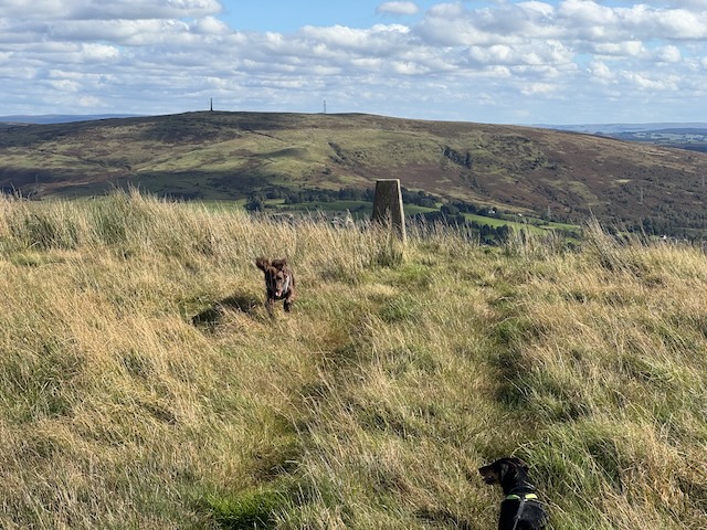
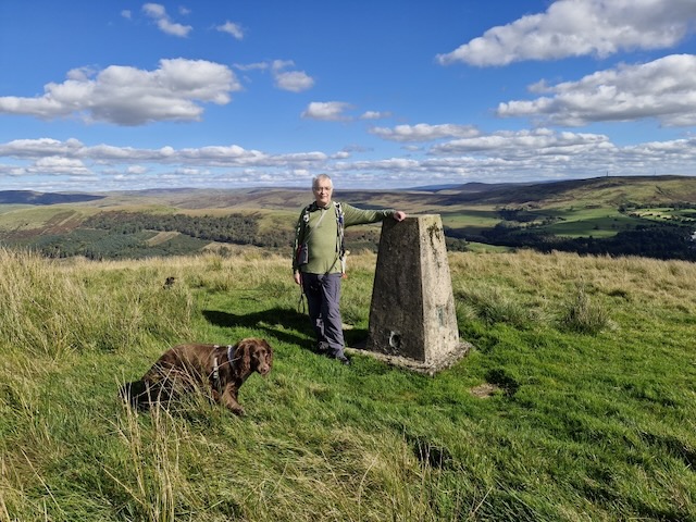
The stroll up Caulfield Rig took me back to my Donald bagging days. No obvious track, boggy ground hidden by tussocks and squidgy sphagnum moss.
Mid HillBuccleuch ParkWauchope waterNo. 9Buccleuch Square PumpThe Esk and Ewes Water
When we stopped for lunch, Audrey sat on a stile and I crouched down. I reached out to tickle the dachshund’s ear, steadying myself on the fence beside me. Mabel let out a yelp as if she had been trodden on and I felt a jolt in my fingers. You guessed it. An electric fence.
I found the descent into Langholm particularly trying. It wasn’t especially steep and the ground was fine but my back was really playing up. The dogs had to stay on their leads (there were sheep scattered here and there). I wondered if I was leaning back more than usual, tried adjusting my rucksack to no avail but the following day I was aching all over, including parts I wouldn’t expect to be made worse by walking (the finger that was broken a decade ago). So I am now blaming the symptoms on the flu jab I’d had the day before.
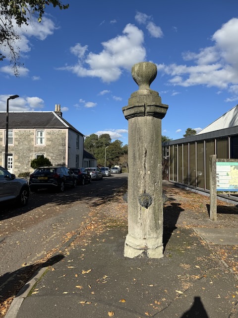
PS. Google has gone down the drain since using AI. When I try searching for information about the stone pillar with small lions’ heads it keeps bringing up the Telford ‘doorway’ and tells me I might be mistaken, asking if I meant Nelson’s column? FFS. The only reference I can find on-line is in geograph, asking what is might be.
I eventually found this on Historic Environment Scotland: Buccleuch Square, Pump: Late 18th century. Free-standing octagonal (ashlar) shaft. with 4 cast-iron lion-mask spouts; cornice and chalice-shaped.
Millenium Garden, Boredom Buster Playground with wooden dragons, snakes and turtles, Auchencairn Burn, boardwalk, Mussel, Lobster, Starfish, Old Torr Cottage, past the chalets, past the cows, Red Haven Beach, woods, Torr Point, Swing, Tar Pit, views, old woodland, the un-inscribed stone, Bowe Wood, Torr Cottage, Mabel giving up the ghost, Time capsule.
It was a simple enough route, minor roads from Ecclefechan to Burnswark, up the hill, then back again. But ……
A world unfurls, if you but look, Beyond the grand, beyond the book. A dewdrop clinging, clear and bright, Reflecting sun, a tiny light.
The spider’s silk, a silver thread, Across the garden, softly spread. A whispered hum, a busy bee, Lost in the heart of calendula’s glee.
The bark’s deep lines, a map untold, Of seasons past, of stories old. A pebble’s hue, a mossy sigh, Small wonders dancing in the eye.
In these small truths, a richness found, The quiet beauty all around. A deeper peace, a gentle art, To see the world, piece by subtle part.
…. the real experience is in the details.
It was a glorious day. My arms covered by sun-creme rather than sleeves, we walked in Summer’s weather, while Spring’s work still filled the hedgerows. Despite seeing Burnswark’s distinctive flat top on many walks while a few miles away, we could not see the hill for the first half hour of this walk.
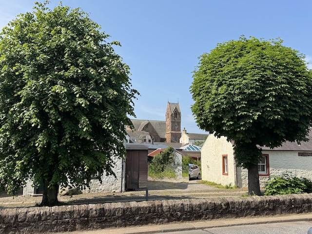
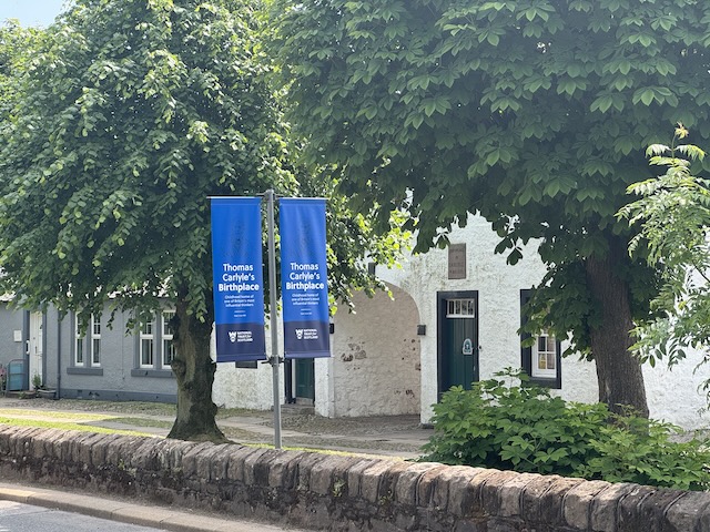
We found a spot to park opposite “The Arched House” in Ecclefechan. This house, which carries the inscription, “Birthplace of Carlyle, 4 Dec 1795”, is now a museum in the care of the National Trust for Scotland.
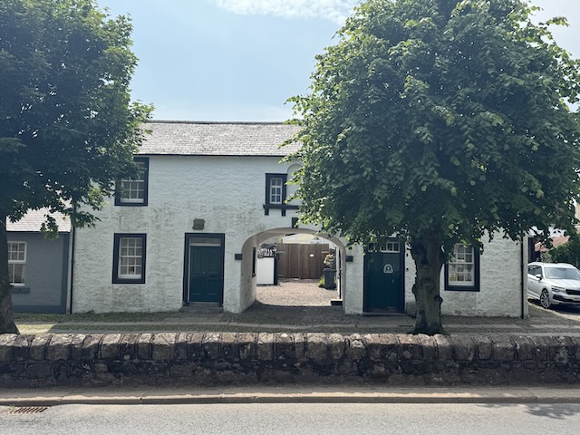
Ecclefechan is a small town, perhaps more akin to a large village. It would once have been a key stop on the Carlisle-Glasgow road and the Ecclefechan Hotel, which we would visit later, was originally a coaching inn. Today’s turnpikes, the motorway and railway run parallel to the old road but by-pass the town changing it from a traveller’s halt to sleepy hollow. The town’s name is source of many a jape, “I missed the ‘fechan bus” etc. though its origin is the Brittonic eglwys fechan, small church.
Carlyle’s BirthplaceEcclefechan
Thomas Carlyle is the town’s most famous son. A writer, historian and philosopher, he was world renowned in his day and known as the “sage of Chelsea”. He famously walked to Edinburgh, a hundred miles away, at the age of 13 to study at the University. His writings popularised the “Great Man theory” of history which is now regarded as overly simplistic but still has momentum in some leadership teachings. The internet throws up a great many wise quotations from the sage but the simplicity of this verse from his poem “Today”was one that made me think.
Here hath been dawning Another blue Day: Think wilt thou let it Slip useless away.
He died in 1881 having uttered his final words “So this is Death—well …”. His fame was such that he was offered a burial in Westminster Abbey but declined this in his will. He is buried instead in Ecclefechan churchyard.
An information board at what must once have been a crossroads, had a map showing places of interest in Ecclefechan and a few lines from Burn’s “The lass o’ Ecclefechan”.
Gat ye me, 0 gat ye me, O gat ye me wi naething? Rock an reel, and spinning wheel, A mickle quarter basin: Bye attour my Gutcher has, A heich house and a laich ane, A’ forbye my bonie sel, The toss o’ Ecclefechan
Which left me none the wiser.
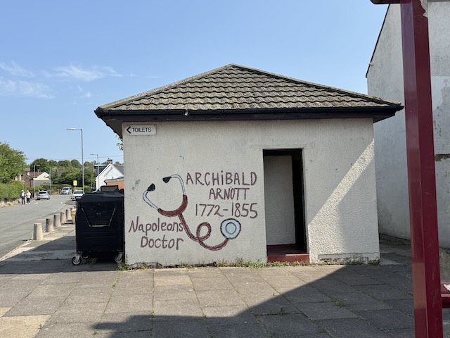
Behind the information board, the town’s public toilets are graffited with the names of other Ecclefechan notables: Archibald Arnott, Napoleon’s physician; and Janet Little, the Scotch Milkmaid, a poet and contemporary of Robert Burns. Her poems aren’t really my cup of tea but “From Snipe, A Favourite Dog, To His Master” reminded me of Burn’s “Twa dogs”.
Langlands Road would once have been a direct route to Burnswark but the A74(M) but now a footbridge is the only way across.
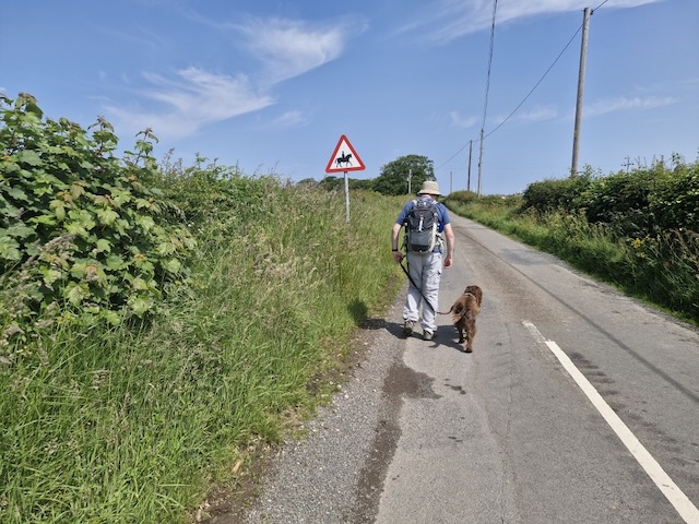
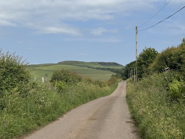
Burnswark Hill was still hidden from sight as we took up the road again on the far side of the motorway. We crossed the railway then continued up a minor road. There were only a couple of vehicles though signs did warn of horses. This was a gentle climb uphill up to the radio aerial on Clint hill.
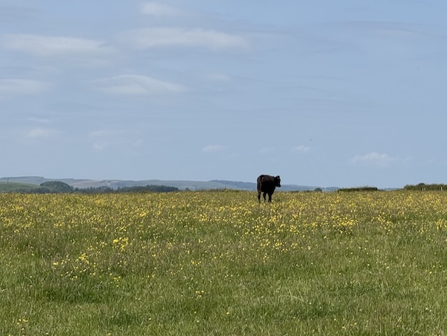
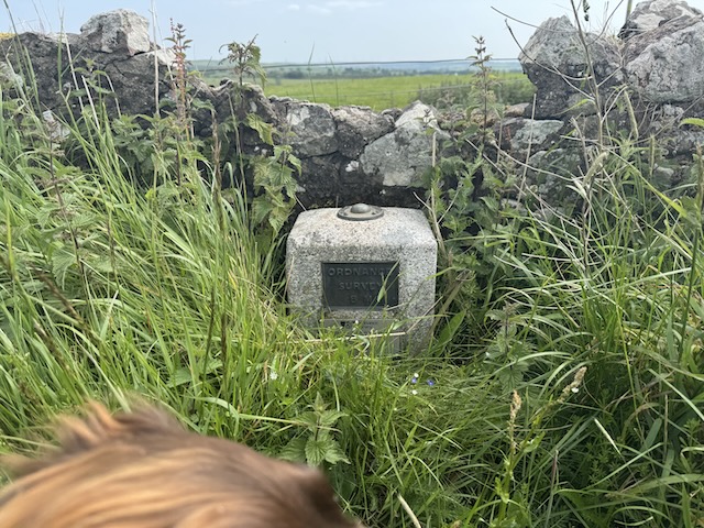
Beehives, views of Criffel and the Solway, fields of buttercups, a bull by the road, OS GPS marker. Then downhill past Axletreewell to Relief, both rather unusual names.
Burnswark Hill. Just shy of a thousand feet. A Roman fort and before that a hill fort of the
O’er Criffel hill, he loudly roar’d, O’er Burnswark hill, he wildly snor’d; Through entries blew wi’ sic a birl, Baith ricks and houses he did tirl; Susannah Hawkins – Address to Satan
Kirkconnel Hall Hotel, “a good place to sop for coffee”. Closed. Indeed its closed-ness looked rather longstanding. We almost didn’t find Kirkconnel Tower, a ruined 15th century tower house.
Elizabeth I of England sent a force under Lord Scrope into Dumfriesshire in 1570 to destroy the houses of those who had supported her cousin, Mary. The town of Ecclefechan was burned and the estates of Lord Herries, Lord Maxwell and Murray of Cockpool were singled out for special treatment, they having been deemed to be particularly sympathetic to Mary. Whether or not the tower suffered the same fate is unclear. Stravaiging around Scotland. May have been a victim of the feuding between the “river” families in the area.
This is a “circular village and country route” from the access@dumgal.gov.uk website. It is said to be 6 miles, but the way was blocked by cows so we took a slightly longer route.
We arrived at the Old Blacksmith Shop in rain heavy enough to warrant waterproof overtrousers. I don’t think either of us wanted to walk in that but neither wanted to be the one to suggest abandoning it. So we waited. Looked at the weather forecast. Waited a little more, then decided to bite the bullet.
Out of the car, the rain didn’t seem quite as heavy. Waterproof jackets, yes, but overtrousers, no. It was a bit windy and I wondered if Mabel would refuse to walk, but she accepted the challenge so the walk was on. The rain continued for most of the walk so I didn’t take as many photos as I might usually do.
From the Old Blacksmith shop we turned north along a quiet country road through farmland then beside Bensmoor Wood. Audrey noticed Jacob’s Ladder growing in the hedgerows. Presumably a garden escapee. I would have mistaken it for a bellflower if not for the characteristic leaves that give it its name.
Blacksike Bridge crosses the main railway line close to the site of Britain’s worst rail disaster. The bridge carried a memorial plaque and a wreath of poppies.
I took a photo of the railway line and only later realised the image included the rail loops where the rail crash occurred.
It was on the 22nd of May, In the year Nineteen Fifteen, The great railway catastrophe Happened near Gretna Green, A troop train speeding to the South, With the Royal Scots aboard, Ne’er reached their destination, The holocaust- “Oh Lord.”
A local to let the express pass, Was slipp’d on the main up line, O, fatal lapse of memory, On that Saturday morning fine, The Signalman, God forgive him, To the troop train gave “all clear,” Into the local train it crashed, With a scrunching roaring tear,
From Carlisle, Longtown and Gretna, To the rescue many rushed, They fought like heroes in the flames, To save the wounded- crushed, Amidst the wreckage, groaning, They lay in agony, Each brave heart did his utmost, To set the sufferers free.
This terrible disaster Shall never be forgot, All eyes on Quinton’s Hill, That dread historic spot, A prayer breath’d on the heroes gone, Those gallant soldiers brave, All Britain gives with many a tear, Which waters each quiet silent grave.
Harry Robinson, The Great Railway Disaster
Quintinshill Loops
A little further along the road we turned right at a sign indicating “Quintinshill Walk”. This took us through Errolston farm with its large stock sheds, then around Corner Wood. A well maintained gravel track brought us alongside Black Sark, whose water was light brown rather than black.
Black Sark
The track swung right to pass under the railway at Quintinshill Bridge, a wee underpass. An information board there had details of the 1915 rail crash and photographs. 226 people lost their lives but some of the bodies were never recovered, having been completely consumed in the fire. The Wikipedia page gives full details with diagrams to show how the accident happened.
Quintinshill
The track took us to the outskirts of Springfield where we came to a wee crossroads. A “Quintinshill Walk” sign pointed onwards but our route turned left. We wondered if the sign was for a shorter version of the walk, visiting Quintinshill but not the Sark or Gretna.
We turned left along a minor road carrying national cycleway 7. Five minutes later we ran into our first problem. We should have turned right through a field. There was a metal kissing gate but a group of cows crowded that corner of the field.
There was no way through and calves with the cows. Even without the dogs I would not have wanted to brave that field. But all was not lost. This was not completely unexpected. I had read a report of this walk where this happened and though the report didn’t give a detailed description of the alternative route there was a route map. We had a Plan B. Or perhaps I should say, we had a rough idea of Plan B.
We walked on. In the distance, just before a bridge, I could see a sign. When we drew closer I could read “Path Springfield 1¼”. Wooden steps took us down to the river bank. We were back beside the Black Sark. As we were to find, however, this was a “Path” in the sense of “right of access” rather than an actual thing one could point at, let alone walk on.
We had a choice as soon as we reached the riverbank. Thigh high grass on the riverbank itself or the field beside us with ankle high grass. There was no discernible path either way but a walkers gate gave access to the field. We chose the field which was easy walking down to where the Black Sark emptied into the Sark. A little way along was another gate, wooden, neglected with the same choice of overgrown riverbank or field of grass. There was a broken post beside it that might once have held a signpost, or could have been a support post.
Beyond the gate was a ford, the water of the Sark flowing fast enough to whisk away a vehicle never mind a person. We didn’t need to cross but still had a decision. We tried the riverbank with its thigh-high wet grass but the ground was very uneven and we could see no sign anyone had walked there, or in the field for that matter. We turned back and chose the field once more. It was easier going, the grass ankle-high and the ground still firm, despite the rain.
The field’s fence curved away from the river at a small wood not marked on the OS map. We could see a gate between the riverbank and the field beyond the wood but could not reach it.A barbed-wire fence ran all the way around the wood and back to the road we had been on.
So we slogged back to the gate at the ford. I don’t know if it was just my imagination but the rain seemed to get heavier, and the wind picked up blowing my hood off and threatening to take my cap. Mabel had to be carried through the overgrown riverbank and I kept Christy close so he didn’t fall into the water. But we actually did find a path of sorts (flattened grass) after a few paces and Mabel squirmed to get back down.
On Sark’s riverbank
We made it to the next gate, much overgrown with nettles and stepped from the mixed growth of the riverbank into another field of grass, but now high enough to soak my trousers well above the knees. Mabel was lost beneath it and was jumping like a springbok to make headway. I picked her up again so she wouldn’t tire herself out.
Where the river curved, whirlpools formed in the brown waters of the Sark, overlooked from the English side by a stand of sickly larches. Beyond there, the ground we walked on became firmer, flattened by vehicle tracks and at the next gate we joined a farm track. Though a little muddy in places, the grass in the centre always kept us out of the puddles. The spaniel, of course, just splashed through the muddy water.
Weels in the Sark
The track brought us to the road at Plump Bridge. The old stone bridge with its single carriageway was anything but plump, standing beside its much wider two-carriageway concrete replacement. England was on the far side of both but we stayed in Scotland, turning towards Springfield.
A sign with stone squirrels welcomed visitors to Scotland and a large “S” shaped stone seat added to the branding. There was a millennium cycleway sign and a more traditional bench, with wooden slats but we didn’t fancy sitting on a wet seat in the rain.
Road furniture at Plump Bridge
Our planned route would take us into Springfield but across the road I noticed a sign, “Path Gretna 1”. This presumably followed the riverbank, a continuation of the “Path” we had followed from the bridge over Black Sark. A riverside walk sounded a better option than the road into Springfield, but would it be walkable? Another sign warned “Bull in field” but that looked to be a permanent fixture. I left the dogs with Audrey and went through the kissing gate to check it out.
The field was hourglass shaped, with a great many cows, and calves, in the narrowed section. It might have been an option if the cows had been in another part of the field but I would have had concerns even if we didn’t have the dogs. We stuck with plan B and headed up into Springfield.
Do they still eat the cats and dogs?
We walked up into Springfield. and opposite the The Queens Head we saw more “Path” signs. This is where we would have arrived had the pesky cows not blocked the way earlier but we had walked a little under 2 miles rather than the half mile from the bovine-mobbed gate.
The Queens Head had an information board explaining that it had been the place where couples fleeing the marriage laws in England would tie the knot. Gretna only took centre stage after the bridge was built there in 1814. Scotland’s marriage laws allowed marriage without parental consent. The information board told of Lord Erskine, a widow with eight children from his first marriage, and previous chancellor of the exchequer, marrying his housekeeper, Sara Buck, who had borne him several children.
At that time Scottish law legitimated children on the subsequent marriage of their parents. It would be more than a century before the same law would be passed in England. In order to give their children His name, Lord Erskine decided to marry Sarah in Scotland. He arrived in Springfield dressed as a woman, wearing a large bonnet and long veil. Superstition stated that children should be seen to be unborn and kept ‘under mother’s apron string’, so through the ceremony, Miss Buck kept her children hidden under her cloak. In an attempt to stop the marriage, Lord Erskine’s eldest son from his first marriage arrived in Springfield a little too late, just as the couple were leaving. Thomas tried very hard to persuade his father to dissolve the marriage, but it was proved to be valid and binding. (from the information board)
The pub’s other claim to fame was that it had been nationalised during WW1, to deal with drunkenness in workers from the local munitions factories, an “experiment” that continued until 1971.
At Springfield we rejoined the official route taking a farm track from the village. A couple of bridges took us a road and then the railway. We picked our way over the second bridge which was coated in a thick layer of … “bovine mud”.
Solway in the distanceBedraggled dogs
The track a petered out in the middle of a field but opened to give us our first views of the Solway. We zigged into the next field then a gate let us into a field that sloped down to the Sark. More “Path” signposts suggested we had rejoined the path passing through the hourglass field. We turned right and headed under the M6.
The waters of the Sark very rapid beside us and I thought it best to put Christy on his lead. He partial to jumping in anything wet. A set of steps back up to the footpath had risers built for basketball players so Mabel needed a lift.
River Sarka week earlierSark bridge, built circa 1814, widened 2001
The footpath took us around the Auld Acquaintance Cairn but having visited it a week earlier we just nodded towards it and walked on. The road was very busy but there was a Puffin crossing at hand. Something I would have thought was a Pelican crossing until a few days ago but now I am better informed.
We walked down to the Sark bridge memorial displaying what I now now is Telford’s mark and we then followed another “path” sign. A sign warned that dogs must be kept on a leash no longer than 2m. No problem there since the field was full of sheep. It was a nice touch though that a dog friendly step stile was provided. The Path followed the Sark but we turned right when the river bore left.
We walked by a Japanese garden that looked very tranquil. I couldn’t tell if it was a private garden so we didn’t explore any further. Perhaps it’s a place for wedding photos.
The rain had stopped as we came into Gretna but the air still felt wet. The town was eerily quiet, so much so that it was a relief to eventually see a chap walking his dogs. I thought the town looked like an army base, with roads like avenues, wide and laid out like a grid and a central green. I wasn’t too far off the mark. The town was built by the Ministry of Munitions during WW1 to support the massive cordite factories nearby. A statue of a munitions worker stand in the town centre, recalling its history.
Anvil HallCycleway 7StatueAll Saints ChurcgGretna
National cycleway 7 passes through the town and is marked by a millenium marker close to All Saints Church, which was also built by the Ministry of Munitions. We walked by the Anvil Hall but didn’t go in to investigate. This was another WW1 construction, originally a catholic church but now a private wedding venue.
A footpath took us out of Gretna, a subway beneath the railway and A75 took us into Gretna Green, famous for weddings and anvil-priests.
A marriage in the Scottish tradition could take place anywhere on Scottish soil. Being so close to the English border, Gretna was popular with English couples wanting to marry but when in the 1770s a toll road was built running through the village making it even more accessible from south of the border, it soon became renowned as the destination for eloping couples.
English couples usually preferred to keep some English marriage traditions and so looked for someone in authority to oversee the ceremony. The most senior and respected craftsman or artisan in the countryside was the village blacksmith, and so the Blacksmith’s Forge at Gretna Green became a favourite place for weddings.
The tradition of the blacksmith sealing the marriage by striking his anvil led to the Gretna blacksmiths becoming known as ‘anvil priests’. Indeed the blacksmith and his anvil are now symbols of Gretna Green weddings. Gretna Green’s famous Blacksmiths Shop, the Old Smithy where lovers have come to marry since 1754, is still in the village and still a wedding venue. Historic UK
Gretna Green
We finished the walk at The Old Blacksmith Shop, with a stroll through the sculpture garden and a look at the courtship maze.
Rockcliffe-Gretna (the old Cumbria Coastal Way, now the KCIIIECP)
O young Lochinvar is come out of the west, Through all the wide Border his steed was the best; …. He staid not for brake, and he stopp’d not for stone, He swam the Eske river where ford there was none;
Lochinvar
This was a completion walk of sorts. The old Cumbria Coastal Way fell into disuse some years ago as permissive access lapsed and path maintenance stopped. The route stopped being shown on OS maps after 2010 but its way markers and signposts lived on as reminders. We often saw them on our forays along the coast while walking the Hadrian’s Coastal Route (2019), Hadrian’s Wall Trail (2017) and Eden Way (2019). With those walks we had covered much of the Cumbria Coastal Way’s route between Ravenglass and Carlisle and then up the Eden to the Esk Boathouse.
It was very tempting to complete the few remaining miles between Esk boathouse and Gretna but access to the paths was uncertain and I didn’t fancy miles of walking along a busy road, especially with the dogs. But this part of the coastal route has re-opened as part of the new King Charles III England Coast Path so it was time to complete the walk to Gretna.
England Coast Path sign in Rockcliffe
So this was our chance to complete the northern section of the Cumbria Coastal Way. The day would take us from the banks of the River Eden in England, over the River Esk into the Debatable Lands and finally over the Sark into Scotland.
Unfortunately I’m more the “old antiquity Nickettey-Nox” than “young Lord Lochinvar“. So… I did stop for a break, and even had the luxury of a picnic bench. I did stop to look at a stone. And, more importantly, the Esk River, where we crossed, now has a bridge.
The second part of the AW’s Lockerbie route was the longer of the two, but had much less road walking which was better for the dogs. Most of the walk was on farm tracks or woodland paths and included the riverside Salmon Trail. We walked through garlic scented woodland, paddled in two rivers (well, the dogs did), found unexpected ruins, had ice-cream at a castle … and still had change from half a crown.
It was a warm day and I decided to switch from long sleeved to T-shirt, getting an unexpected “We’re not watching!” shouted by a guy in the car park. We started beside the Lockerbie Memorial Gardens, where we had ended the last leg, and luckily the main road was quiet enough for us to cross over easily. A forestry track runs through the woodlands of Turnmuir Plantation but there was a barrier to keep vehicles out.
As is traditional in our walks there was a profusion of benches, four in the first fifteen minutes then no more until near the end.
Turnmuir Woods
We were to leave the vehicle track for a footpath and found the turn off relatively easily. The Annandale Way looks to have renovated or replaced its signs, some look brand new, while you still see the old faded ones dotted about, but this junction was unmarked.
The road less taken
I thought at first the path had been closed but it was just a fallen tree. Enough people had walked around the tree to make a desire track. Mabel is looking that way in the photograph. The footpath beyond climbed gently into Craw Wood. Unfortunately there wasn’t a wall. I had been hoping to take a photo I could caption “fourth craw”. There were a couple of substantial stone gateposts leading nowhere but giving a view across the roofs of Lockerbie.
up to Craw Wood
After Craw Wood we had a short dog-leg along a minor road and turned up to Pillmuir. That’s how it was spelt on the farm sign, though the OS map gives it just one “l”. Once past the agricultural supplier’s depot we were on a farm track and then a footpath where we came across some stands of Star-of-Bethlehem and our first views across the valley to Almagill Hill with the pyramidal shape of Joe Graham’s monument clearly visible.
We crossed a very minor road and after a short walk through Hallmuir Woods came to a gate into an open field. There were sheep in the distance so the dogs were on their leads. A well made track lead across to a footbridge where we found an official AW sign and a faded home-made sign that from a distance I misread and found unusual. Closer I could see it said “WALKERS”.
The Annandale Way leaves the track before crossing the bridge, following a culvert then climbing Hungryhill to follow the edge of a narrow wood. I wondered if the trail had once gone through the wood since there were gates but it looked as though some effort had gone into making these impassable. But the edge of the wood at least gave us some shade. There were great views across to Almagill Hill and the the shade it would have been a great place to stop for coffee, but the air was still and filled with tiny insects.
Walking up Hungryhill, Burnswark in the distance
A gate left us near a junction of four single track roads. I couldn’t really call it a crossroads, there were no right angles. We headed down the road signposted “Kettleholm ¾”. Fate smiled on us. There was a large tree trunk in the woods so we had somewhere comfortable to sit while drinking our coffee. Mabel had a good roll in the leaf litter and Christy chewed a stick.
We both looked at our map/GPS and wondered if we had taken the correct road. Both our GPS devices suggested otherwise. So once we were back on our feet we walked back to the junction (only a few paces). Yes, we were on the correct road. There was even an Annandale Way sign to confirm it. I don’t know what happened to the GPS in the woods.
We didn’t walk as far as Kettleholm, leaving the road at Glenholm. We could see the church in Kettleholm and a castle (Castlemilk) about a mile away. The next section was along a dirt track in the woods above the Water of Milk. It would have been nice to have a riverside walk but we only had glimpses of the river.
As we walked we noticed a tower ahead of us. My first thought was something industrial but then I noticed it was topped with a balustrade. It is not marked on the OS. It was once a grand house but now there are trees growing within it and signs warning of falling stones. This is what remains of Milkbank House, once the residence of William Ogle, whose business interests included presidency of the Bank of Bengal. There had been a Georgian house on the site but he found it too small and had the larger sandstone house built in 1895. The original house was incorporated into the new building as kitchens.
The house and grounds were requisitioned for military use during World War II and when they were returned in 1949 the family decided it was too expensive to maintain. Perhaps if the original Georgian hose had been kept, the military would never have taken it and the family might have been able to maintain it.
Milkbank House
The track brought us out near a small bridge and even though that wasn’t our route we walked onto the bridge to get some views of the Water of Milk. The river certainly does not appear milky. The origin of the name is a bit of a mystery. There are suggestions that it refers to a milky appearance of the river due to sediment or the perhaps the production of milk nearby. I find neither particularly convincing. One author points out that in 1124 the area was recorded as Abermelc and the melc could be Cumbric for honey. The Castlemilk in Glasgow is named after the Dumfries Castlemilk.
Water of Milk, at Milkvale – but no bees
We then walked along a track through fields towards Broom. There we turned away from the Water of Milk to walk along a tree-lined avenue into Square Wood. And there was even a section pf banking at just the right height for us to sit down for lunch.
The path into Sorrysike
In Sorrysike Moor the Lochmaben and Lockerbie branches of the Annandale Way join and we completed the Way, after nine years.
The lockerbie and Lochmaben routes join at Sorrysike Moor
But we were still a couple of miles from Hoddom. A farm track took us by fields with sheep , cows and even a white horse with her foal. Repentence Tower, an actual watchtower rather than a folly was visible ahead of us.
Brocklerigg
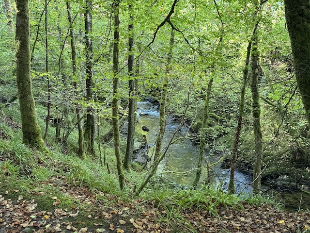
We crossed the Water of Milk again and then walked along the Salmon Trail. This riverside woodland path runs beside the Water of Milk and then the River Annan. Both were low enough for the dogs to have a paddle
The Salmon Trail
The salmon train has several installations representing different stages of the fish’s life. There is a wall representing salmon roe in the river’s rocks, larger rocks with carvings of parr, a carving representing an eagle and otter chasing fish, a seat reprinting an angler and a carved totem pole that is said to show how high salmon have been known to jump.
The dogs cooling down in the River Annan
A sign warned us to take care crossing the weak bridge. I was more worried getting across the field on the far side. There was a bull at the far end. A path through the trees brought us to Hoddom Castle.
Hoddom
We celebrated finishing the Annandale Way with a Magnum (ice cream, not champagne).
The Annandale Way splits as it emerges from the woodland of Corncockle, near Templand, one route to Lochmaben, the other to Lockerbie. They join again in Sorrysike Moor, a little north of Hoddom. Both of my Annandale Way walks (2010 and 2016) used the Lochmaben route. I think this was more about finding places to park at the right distance rather than an aesthetic choice.
The Lockerbie route is a manageable 10.3 miles but there is not easy parking where the routes meet, so I expected the actual walking distance to be more like 13 miles. Given our recent experience on the Comedy Way where the published 12.9 miles stretched into 15, I decided to cut this walk into two sections, this one a mere 5.5 miles.
If you think you are too small to make a difference, try sleeping with a mosquito in the room. Eric Morecambe
If Day One of the Comedy Way was the ‘main course’, and Day Two the “dessert”, the third day was “coffee and biscuits”, a winding-down, an easier outing. We walked along canal tow-paths, pavements and a beachfront promenade with only the gentlest gradients. All in all, a good way to complete our walk around Morecambe Bay.
It was a walk of four parts: the main street of Carnforth; the Lancaster Canal; Mount Pleasant; and then Morecambe’s promenade.