 8.7 miles 4h 24m 842m ascent
Selcoth-Croft Head-West Knowe-Loch Fell-Windfell Nick-some SUW
One problem with the western Ettrick hills is access. Moffat Water is too wide to cross except over bridges and the Ettrick valley is a long drive. For this walk I crossed Moffat Water at Sailfoot, signposted to the fishery. A new bridge is being built but the old one was still in use. There is a new parking area for walkers with space for about five cars.
From the car park I headed along the track towards Selcoth, passing the farm buildings and heading up the slope at a gradient enough to warm the old muscles. At 250m the path ends at a gate in a dyke. The is a noticeable track continuing up the hill but this peters out pretty quickly.
Croft head has a steep eastern face and a long less steep finger stretching west. This finger is split by the Steinstane Burn and from the lower slopes looks like two separate hills. I was climbing the northern finger which gradually develops a very steep northern face. There is a steeper section at about 400m which is a false summit (one of many in fact). Looking up I could see what looked like a group of stones about a kilometre ahead, but their positions gradually changed and I realised it was a group of walkers slowly climbing a steep section.
By 400m I was on the crest of this ridge and had excellent views of the Moffat hills, Capel Fell with its impressive scree slopes and later the other Ettrick hills. The walkers ahead of me were hidden beyond false summits until the last pull up to the summit, where they paused then left before I arrived.
Unfortunately the weather started to deteriorate. Not terrible but enough to spoil the views as the cloud base fell and force me to put my jacket back on. Croft Head, at least with this approach has good terrain, mostly short grass without any waterlogged sections.

Croft Head
As I trudged up to Croft Head’s summit I was contemplating shortening the walk, particularly once I was back in mist, but a banana seemed to refuel me so on I went. I had been looking forward to making my way down Cat’s Shoulder with its zig-zag path and the cloud did lift enough to give excellent views along the steep sided valleys meeting here, the forest covered hills to the south, the grass covered Ettrick hills and the impressive Craigmichen Scar, a mixture of rock outcrops and scree. Unfortunately the drow n smirr put paid to reasonable photos.
The Southern Upland way crosses Croft head so my way down was on the SUW with its waymarkers. I passed the walking group on the way down and did not meet them again until we were back at the car park.
There is a sheepfold at the foot of Croft Head, a good place to rest and shelter from the elements. The SUW has alternative routes here, one climbing over the hill, the other in the valley for use in bad weather. The sheepfold is where they meet.

Craigmichen Scar
From the shelter of the sheepfold I headed along the SUW and at a large cairn left the path to head up the slopes of West Knowe. I suppose I could have headed straight up from the fold. The contour lines look similar but the reality is different. By using the SUW I was able to climb a little on a well trodden path and climb a slightly easier section.
In fact looking up from the cairn there is another cairn on the slope which I presume is there to guide folk, such as me, who are daft enough to climb the hill. The alternative is to follow the SUW further to the footbridge and climb the even easier slopes there. I chose not to do that since the SUW descended beyond the cairn.
The climb up this grassy slope was not too difficult but I would have worried about coming down it in wet weather. It was steep enough in one place to be able to reach out and touch the grass while standing up. The gradient here was 50%. I didn’t look down. The GPS track records my zig-zagging up this section.
Unfortunately, once I was on the flatter sections of West Knowe, above about 600m, I was back in cloud, the wind had picked up, it was raining and the ground was waterlogged, squelching underfoot. (Aah, Home at last.)

Ginger Grass of West Knowe
Soon the fence atop West Knowe came into view and I gazed about wondering where the summit might be. Somewhere on the far side of the fence according to the map. I little wandering about and I found a spot that seemed higher than anywhere else.
I then followed the fence all the way to Loch Fell. There is a small rise between West Knowe and Loch Fell which fooled me at first into thinking I was at the summit but three fences meet at the summit so I realised there was further to go. I do wonder whether the hill names here have become confused. It would seem more reasonable to have the central hill, or the entire group of hills named Loch Fell, and the two outer hillocks West Knowe and East Knowe. I lunched in the lee of the trig pillar on Loch Fell but had to cut it short since I was growing cold standing still.
From East Knowe I followed the fence, tramping through sodden grass and mud, in the pouring rain, the wind blowing so strongly that I had to hold my hood up, but at least it was downhill and brought me out of the cloud.
At Windfell Nick, the col between Loch Fell and Wind Fell I turned left and headed for the SUW near Ettrick Head. The ground here was marshy but passable by standing on heather or tussocks. Once on the SUW the way was easier to see.

SUW
The path took me across the steep lower slopes of Capel Fell and into a deep gorge between Capel Fell and West Knowe. A wooden bridge here crosses the Selcoth Burn and ahead is the zig-zag path on Cat shoulder. The SUW then climbs opposite the Craigmichen Scar to bring me back to the cairn where I had left it about an hour and half earlier.
Back at the sheepfold I had a breather and thought about my way back. Having seen the path along the Selcoth Burn I was worried about crossing the scree slopes. Should I climb back over Croft head? back over Capel Fell? No. I would take the lower path. The path is narrow and crosses steep slopes with a couple of sections across scree. The worse case scenario would be that the scree slipped and I decided if that happened, the best plan would be to fall onto the slope and slide down into the burn 50m below. It was steep but not sheer, about 45% I reckoned, so I would probably stop before I got all the way down. I deployed the walking pole adjusted to cope with the steep gradient and set off. As it was the scree sections looked worse from afar compared to close up and there are reasonable paths across the scree.

Selcoth Path across scree
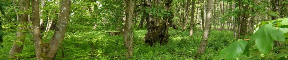
Soon I was past the worrying section and walking across relatively flat farmland. A little way past a sheepfold is a vehicle track cut into the slope which, rather irritatingly, slowly climbs. On the map is a lower track which stays closer to the burn but I didn’t see it. The vehicle track cut into the hill ends at about 280m and from there I headed directly down towards the buildings at Selcoth. In retrospect it would have been easier to contour around the hill and rejoin the track I had started on, by the gate at 250m. My easiest way back to the track would have been through gardens, which isn’t really on except in an emergency, so I made my way through some trees and across a bridge to get back on the track.
Ahead of me were the group whose path I had crossed earlier in the day. They said they had had a good walk, returning over Broken Back. I didn’t ask how they got there but I presume from Capel Fell one could head down towards Sailfoot Law then join the forestry track to Broken Back.
Croft Head and Loch Fell are the last of the Ettrick Donalds, the most westerly, but also the last two of the group I needed to walk, hence the title.
.
Download file for GPS
