7.9 miles 3h 43m ascent 539m
Innerdownie-Whitewisp Hill-Tarmangie Hill-Cairnmorris Hill-Ben Shee
This was a straightforward route starting from the reservoir; through the forest to Innerdownie; along the ridge to Whitewisp Hill and Tarmangie Hill; across the shallow col to Cairnmorris Hill; along the ridge to Ben Shee then back down to the reservoir.

Glensherup reservoir: a snow-tinged Tarmangie just visible
This is a walk for early birds. The car park at Glensherup Reservoir was almost full when I arrived at 9am and there were already several people fishing in boats on the reservoir. Mine was the last parking space I think. I started by walking across the dam and then up a short steep bank through the trees to reach a forestry track. Previous walkers had left steps in the bank and I can see this section being a slapstick area if it was muddy. At the top of the bank is a signpost for the various reservoir walks. At the top of the bank I met an old chap who looked quite startled to see me and remarked that I must have started out really early. (PS my wife reminds me that other people will think of me as an old chap). I’m not sure where he thought I had come from. Unless he actually knew me and realised I’d driven over a hundred miles to get there? I’ll Have to wait and see if any acquaintances complain grumpily that I just walked by them near Glensherup.
The forestry track climbed gently through the trees around Gled’s Nose (a wonderful name for a hill), the sun beating down and the air filled with birdsong. I do wish I could recognise different birdsongs. Perhaps I should try listening to recordings of the five most common, then listen out for them when walking. The rocks by the track were also unusual. The banks by the track had been quarried, presumably to get rocks for the track itself, and didn’t look the the rocks I’m used to seeing. The closest description I could come up with was that they were the shape, but much larger than, pieces of crumble (as in an apple crumble). The unquarried rock face looked much the same and I could not make out any definite layering. I looked as though it might be volcanic rather than sedimentary. I’ll have to look up the geology I suppose.
I had been in two minds as to how I might get up to the ridge NE of Innerdownie. There were two forest breaks from Lamb Hill on the map, the first being longer and steeper, so I had thought the second would be the better choice. The trees on the OS map and on Google Earth images have been felled and I regard felled forest as “avoid at all costs” terrain, but where the first forest break would have been, by a small burn, there was a faint track of trampled grass heading up that looked inviting. I did wonder if if might turn out to be trap to lead me into a morass of ditches and felled trees, but what the hell.

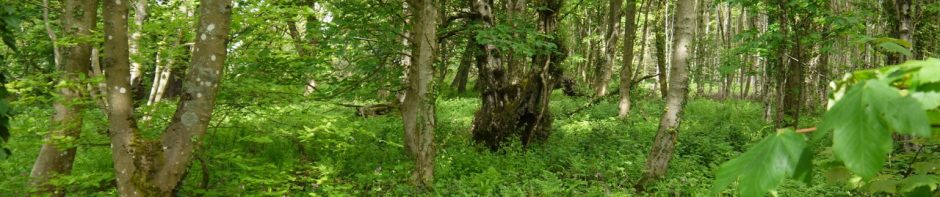
View down Lamb Hill
The hillside had newly planted spruce, the saplings about knee to thigh high. The track had some sections too boggy to walk across and was occasionally obstructed with the remnants of earlier felling, but the ground was mostly firm and it proved to be an easy climb. I imagine it will become a more difficult route once the trees have grown.
For once, the tree lined horizon ahead of me was actually the ridge and not a false horizon. Some of the trees left at the apex of the ridge looked to be prostrate forms, having presumably been blown over in some past maelstrom. As I approached the trees I could spy a deer fence just beyond them and beyond the trees was a ladder stile, so presumably my route is in regular use. I had climbed in bright sunshine in a tee-shirt but once on the ridge a cold wind soon had me in jacket, hat and gloves. It was a north wind so I’m surprised I hadn’t felt it on the climb through the baby trees.

Ladder on Glenquey Hill, below Innerdownie
The ridge to Innerdownie had a well worn track which followed the stone dyke, so the remainder of the climb was easy, though I was fooled a false summit. There was another ladder over the deer fence further up but I didn’t investigate whether there was a track down beyond the trees there.

Innerdownie summit cairn
Innerdownie’s summit has a large cairn and extensive views both north, to the crystal clear snow-capped munros, and south in haze to the Forth. Just beyond Innerdownie there was a rock outcrop with a wall built to shelter the open face. A good place to shelter but it was still a bit early for a break so I pressed on.

Shelter below Innerdownie
From Innerdownie the track continued over Bentie Knowe, a small rise, then climbed gently up Whitewisp Hill. This was easy walking, with just a few sections of bogginess to avoid, so there was plenty of time to gaze at the views, though the view west was still obstructed by Whitewisp Hill.
The fence, which had separated from the dyke below Bentie Knowe, ended where it met another fence, and another ladder stile, just below the top of Whitewisp Hill. My plan was to continue in a line extrapolated from the fence, and indeed, the track I was on continued on that line up to the summit of Whitewisp Hill. The summit had a broad flat cairn, more a foundation than a cairn, really. I headed over to the SE end of the summit to have a look down from there, and found a couple of rocks at what I presume was the 642m spot height.

Whitewisp Hill summit cairn
Tarmangie was then only a short walk along the ridge. I could see a number of people milling about at the summit of Tarmangie but they had gone by the time I got there. As I plodded along the ridge in my hat, gloves, and jacket I passed a couple of lads walking along in shirts and shorts, their exposed skin bright red. Fell runners exhibiting their rare walking behaviour on a flat section. Tarmangie, a little like Innerdownie had a brief steeper climb to its top. Its cairn was a little lower than the true summit. There is a stile here which I commandeered as a seat to have my elevenses, taking care not to put my rucksack down in the patches of snow.

Tarmangie summit ridge

Glensherip from Tarmangie
My next port of call was Cairnmorris Hill. The track led down to the col between Tarmangie and Cairnmorris, where the deer fence had a gate. The track there split right and left, but I continued straight on for the summit of Cairnmorris Hill. This was pathless wild tussocks initially but I headed for a pole on a wee knoll from where I spotted a faint trace to follow. This led all the way to the summit, becoming more definite as it rose. At the summit I joined the more substantial path shown on the OS. Had I turned right at the split in the track at the col I would have joined this same path lower down but I wanted to come up Cairnmorris Hill to have a look north from there.

Tarmangie from the slopes of Cairnmorris Hill
By Cairnmorris it was time for lunch but I had run out of anywhere to sit, the ground being mostly grass or boggy. But in the distance, perhaps 1km away, I spied an erratic and decided it would be my seat for lunch. Once I reached it, however, I found it defended by a moat. There was no way to get onto it with dry feet. Luckily, just a little further along I found a dry spot sheltered by the shoulder on which the erratic stood, and was able to enjoy my sandwiches while looking down on the reservoirs.

Erratic on Scad Hill
The descent over Scad Hill and Mailers Knowe had been a pleasant easy stroll on the track, if a little boggy in places. I had originally intended heading back down to the reservoir along the wall by Darn Stripe, but Ben Shee ahead of me was to prove too inviting.

Ben Shee
Below Ben Shee there was a constructed path and even a sign “Ben Shee summit 0.5km 100m climb”. The path bypassed the summit but it was obvious were walkers had headed up and I followed their footsteps up the grassy slopes.

Glendevon Reservoirs from Ben Shee
From Ben Shee a track led NE to rejoin the constructed path. I followed a track until I was down the steeper section, but rather than joining the path, I left the track and headed down towards the reservoir. This section was through shoulder high deciduous saplings, and like the earlier section of the walk, will likely be less easy after a few years growth. The terrain was poorly drained tussocks with water filled holes, but some drainage ditches had been dug and by staying near these I avoided the worse of the bogginess.

Glensherup Reservoir from Ben Shee
Once on the lower slopes the ground was much drier, gravity presumably aiding the drainage, but the track along the reservoir, once I got there, was so boggy in places that I had to climb back onto the slope to avoid wading through mud. Just before the car park there was a rather complex combination of a stile and kissing gate in a deer fence, the first kissing gate I’ve seen with a latch.
Well, this was a much easier walk than last week’s outing in the Ochils, being only about half the distance and half the ascent, and it was nice to have a walk that started and ended close to where the car was parked.

88/89
That’s my 87th and 88th of 89 Donalds (or 84th and 85th of 86 of the originals).
[osmap gpx=”http://www.screel.co.uk/walks/wp-content/uploads/2013/04/RK_gpx-_2013-04-27_0909.gpx”]


