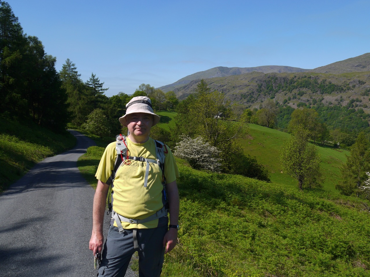
This was the first section where we used two cars, leaving one in Keswick and the other close to the Cumbria Way near Mosedale. The weather was forecast as sunny spells but reality gave us sunshine throughout the walk.
There are several distinct terrrains in this walk: the town of Keswick itself, woodland paths up towards the higher grassland of Latrigg, exposed paths across the rocky slopes of Glenderaterra, heather clad moorland surrounding Skiddaw House and, finally, bracken covered rocky slopes between Knott and Bowscale Fell.
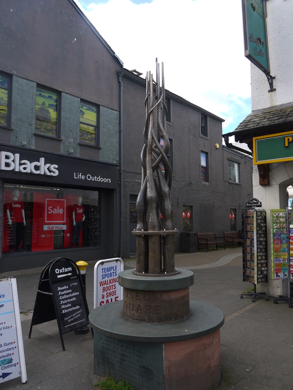
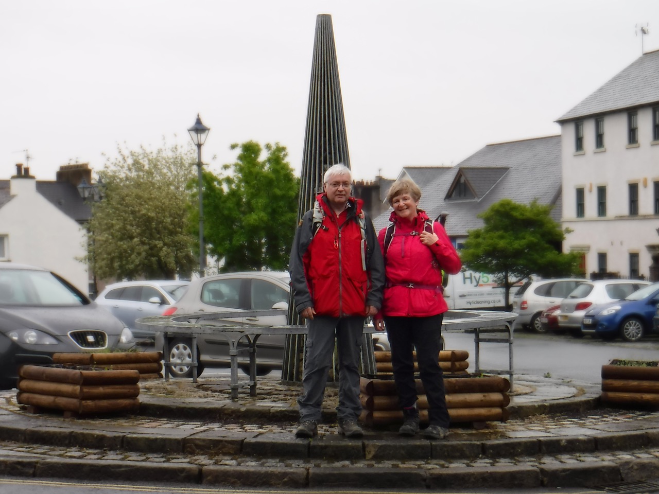
Museum Square Keswick
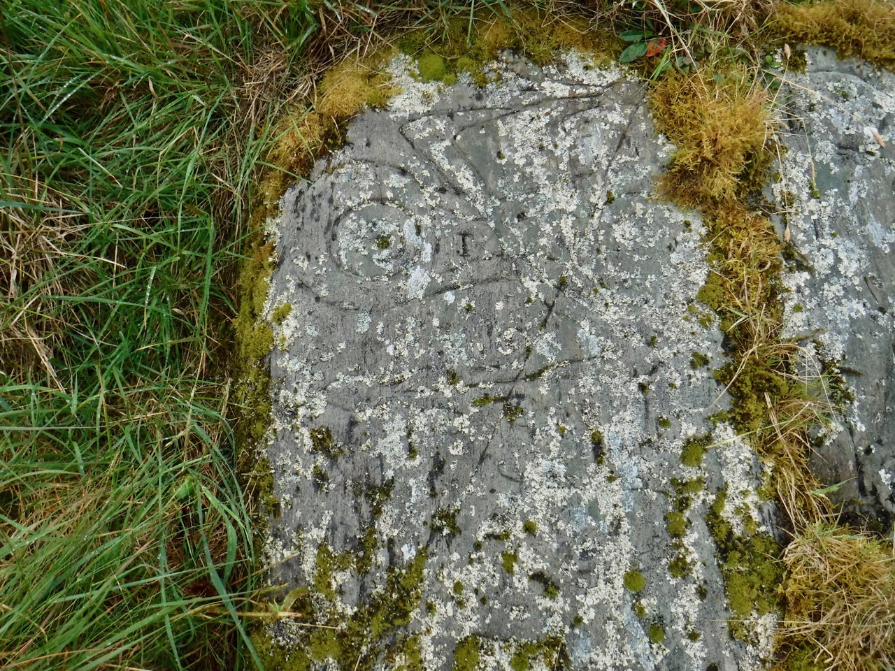
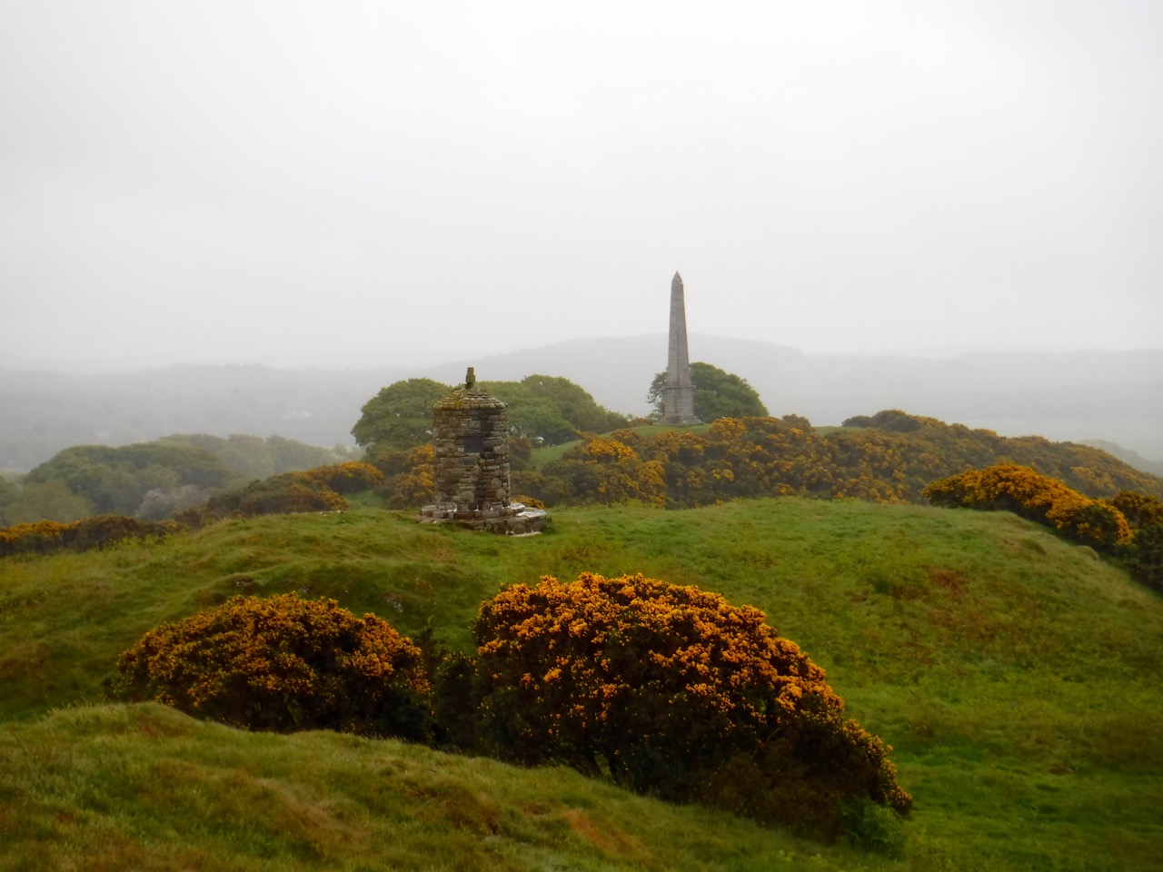
In Keswick we read the inscriptions describing the PUPs clock, purchased by the pushing young peoples society (PUPs) in 1932, and a strange monument dedicated to Peter Crosthwaite 1735-1808. The latter looks like a collection of pipes but I haven’t been able to find out what is is meant to be. The town was very busy with a market filling the main street but we soon left the crowds after turning left at the Moot Hall. This took us down past the war memorial and Fitz Park. My map suggested the Cumbria Way went through the grounds of a hotel here but a sign directed us along a path beside a leisure centre.
Another sign indicated some wooden steps to an area that on my map is a field but is now a housing estate. It was unclear whether we were to walk around or through this, so we guessed at walking around on the basis that there was a footpath. This led us parallel to, and then on to Brundleholme Road for a short distance before turning onto Spoonygreen Lane.
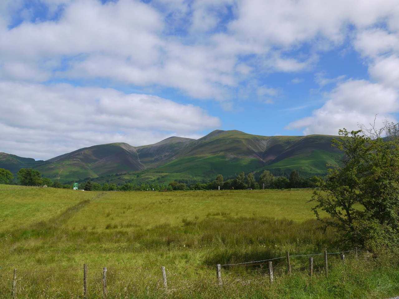
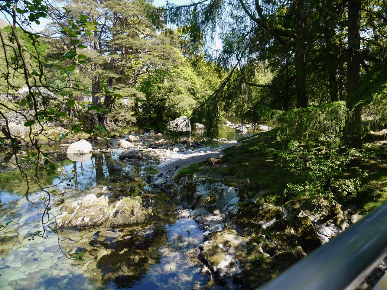
This lane took us over the A66, past Spooney Green farm and climbed up through Ewe How Wood. A gate here had a side hole for hens. We had hedgerows to examine (loosestrife, foxgloves, woundwort) as we climbed, and gradually improving views of Skiddaw, Bassenthwaite and Grasmoor.
Skiddaw
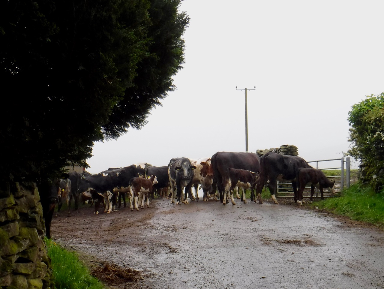
The track took us around Latrigg, through the carpark for Skiddaw and onto the grass covered slopes of Lonscale Fell. A shepherd and his collie were moving a flock of sheep and the shepherd actually shouted “come by”. A sign of the times though was that once the sheep had been moved, the dog jumped onto the quad bike and he and the shepherd drove off.
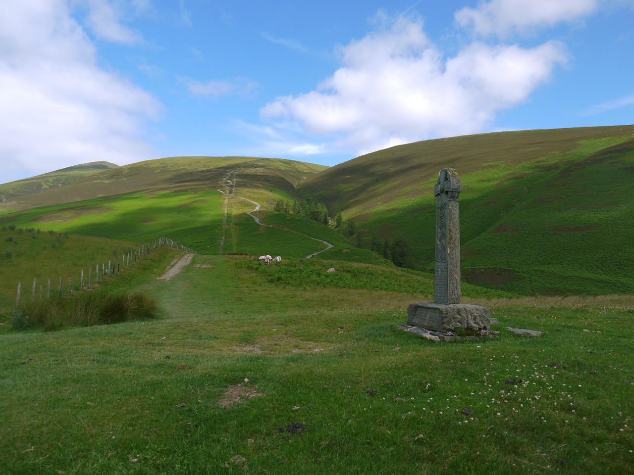
We followed the Skiddaw path as far as the Shepherd’s Monument. This is a memorial to members of the Hawell family and is inscribed:
Great Shepherd of Thy heavenly flock
These men have left our hill
Their feet were on the living rock
Oh guide and bless them still
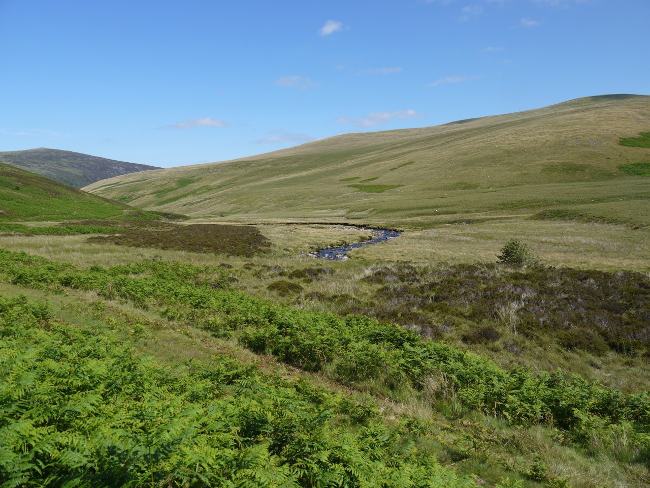
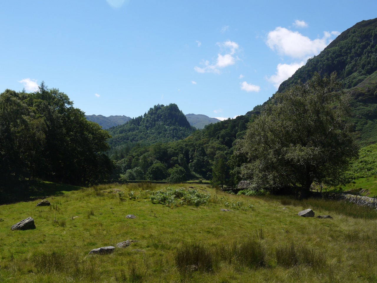
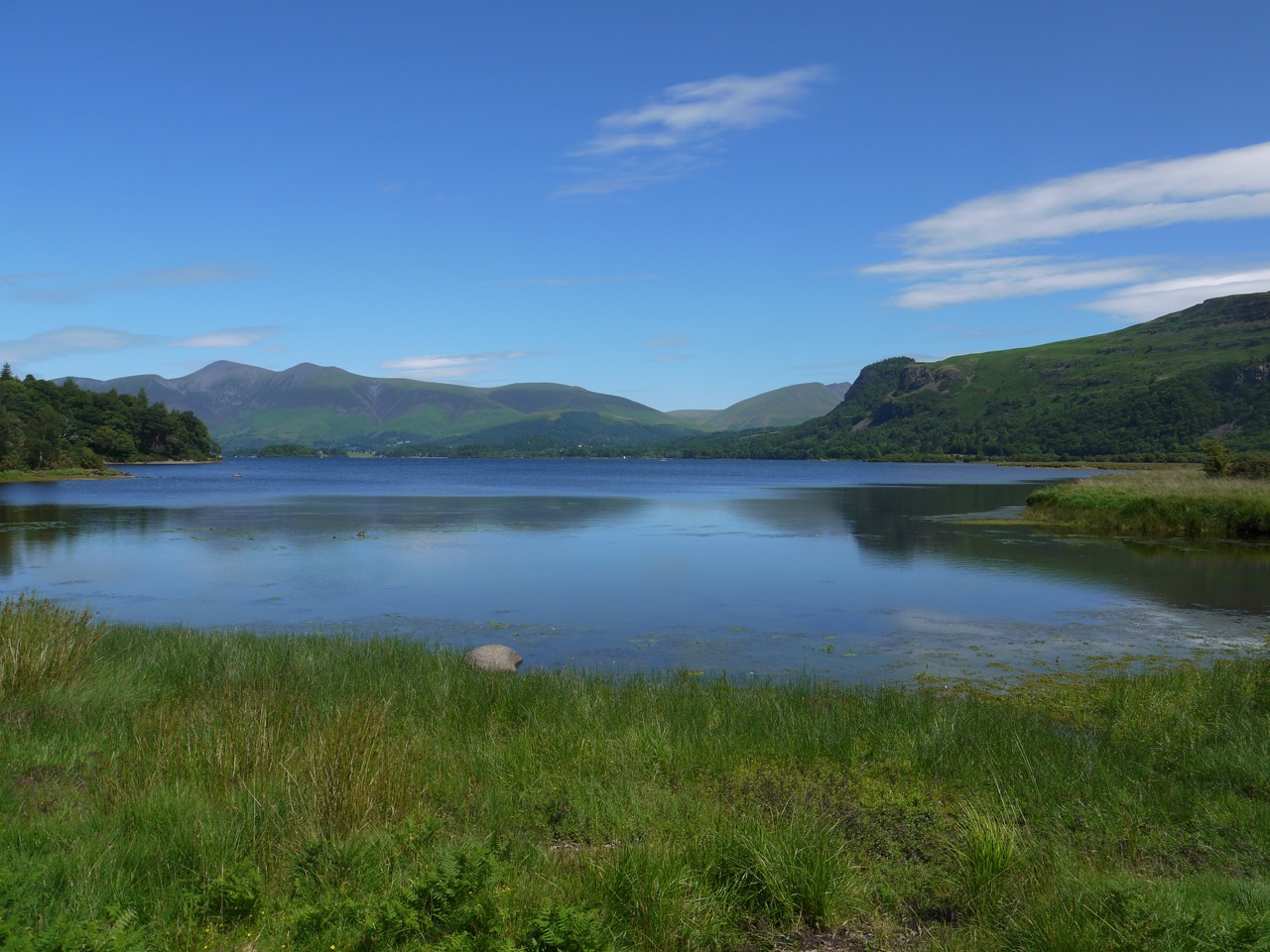
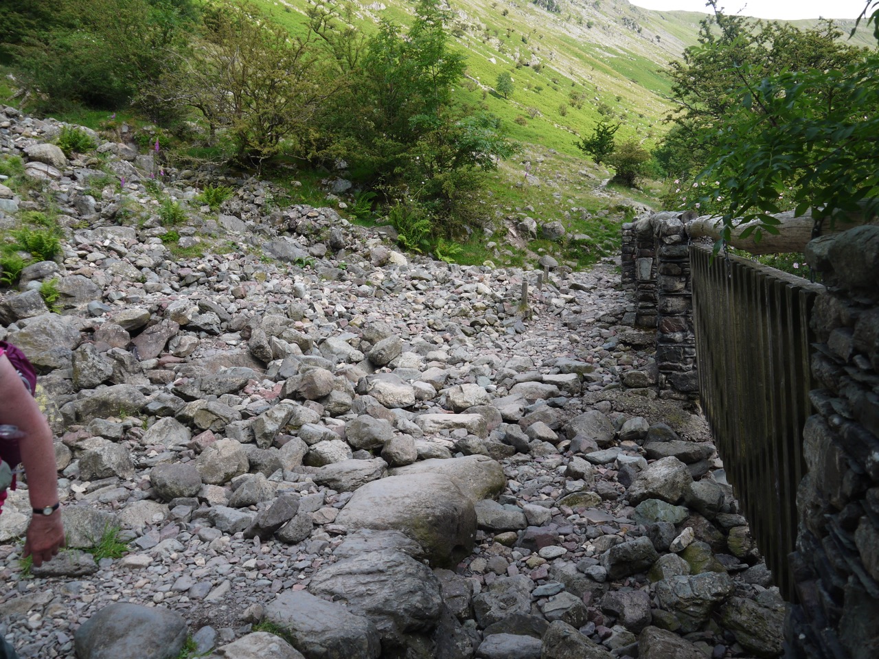
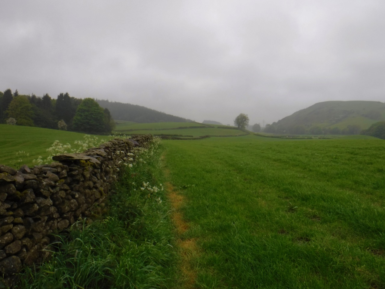
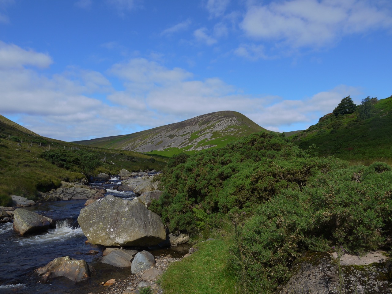
It was then back to the Cumbria Way to ford Whit Beck and continue our slow climb across the southern slope of Lonscale Fell. This section is best walked in good visibility for the views which stretch from the Hellellyn group of hills to the Bassenthwaite Fells. I could see all along Borrowdale to Castle Crag.
Shepherd’s memorial
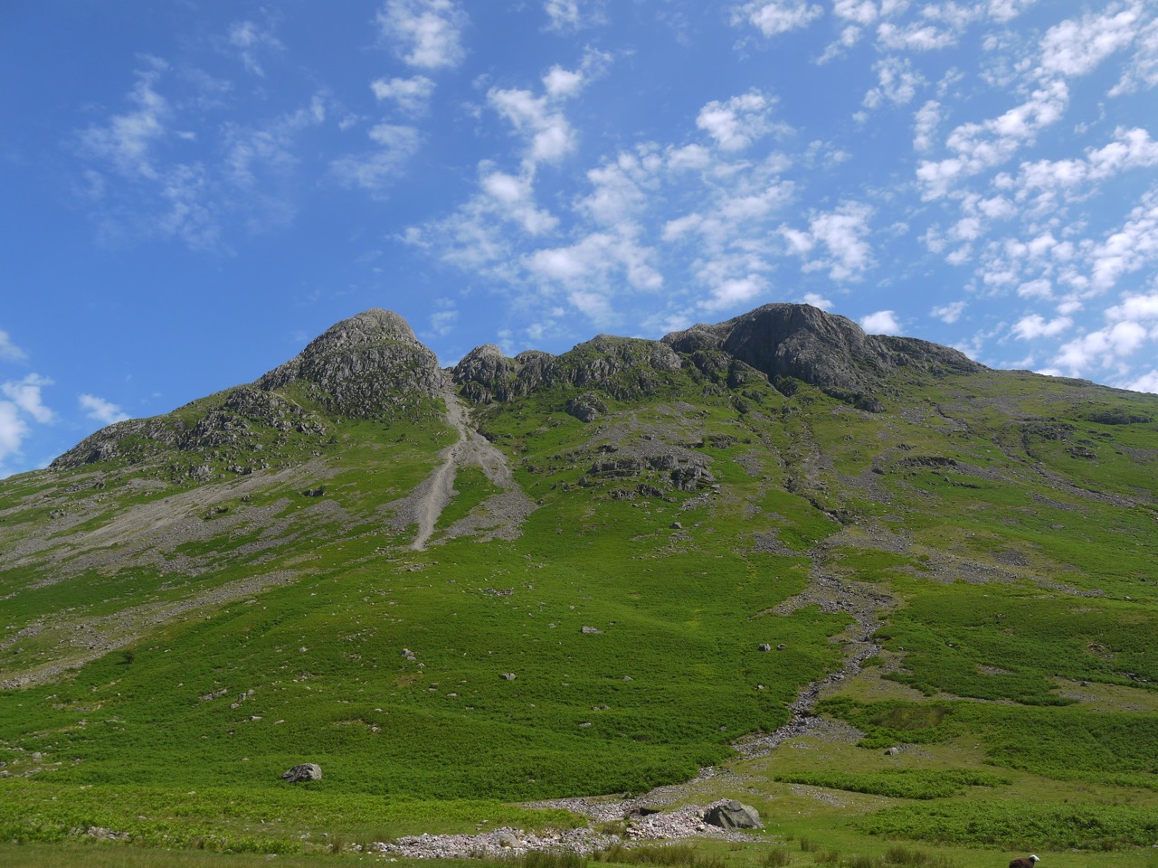
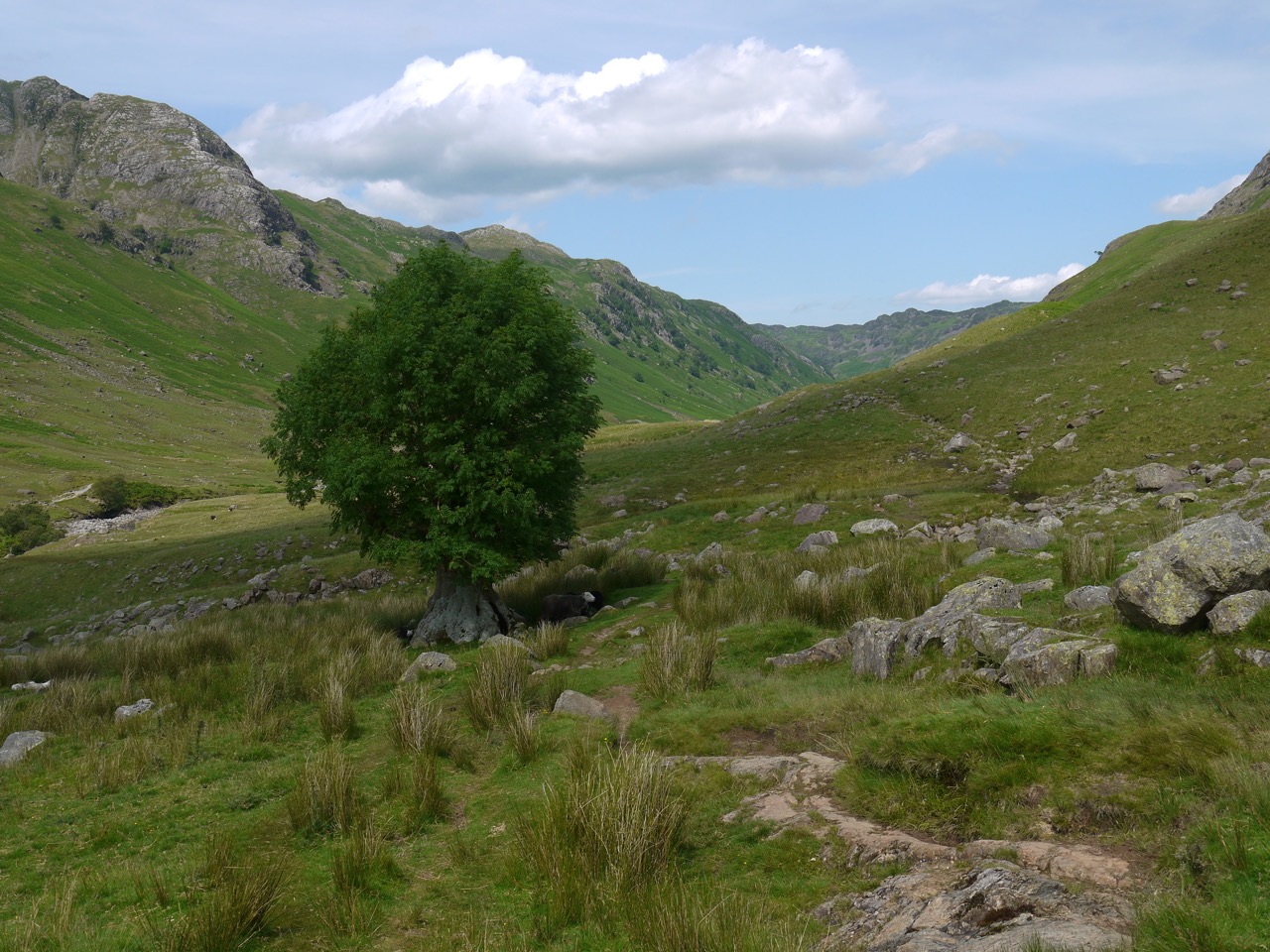
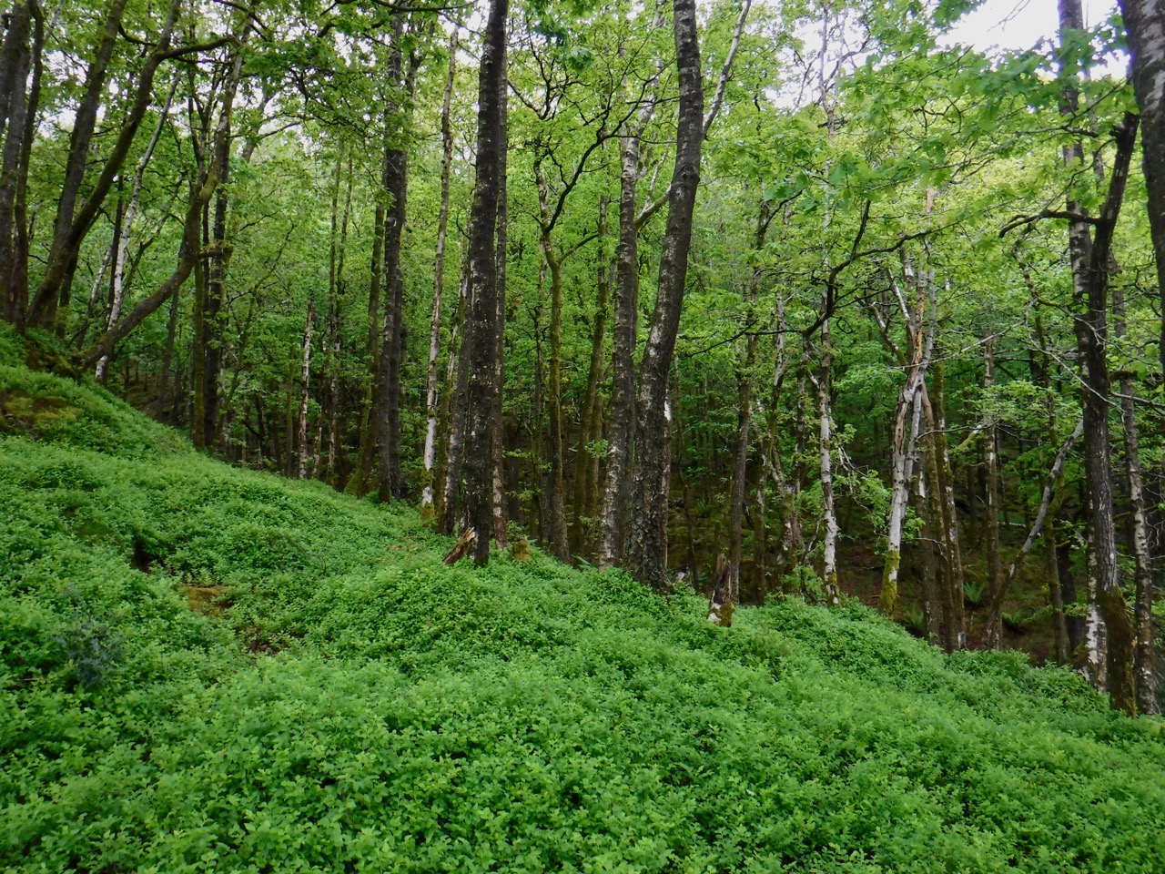
Bright green bracken covered the hillside until we turned into the Glenderaterra valley with its rocky heather covered slopes. The Glendera- of this namederives from the Brythonic glyndwfr meaning river valley, but I haven’t been able to find the etymology of -terra. It seems unlikely to be the Latin terra and the most plausible source I can find suggests the suffix is an obscure personal name.
We stopped at a convenient rocky outcrop for a rest, the sun and breeze working together to keep us comfortable. The valley lies between Skiddaw and Blencathra, and the gentle green slopes here reminded me (and Audrey) of the hills of the Southern Upland Way, especially those of the Ettrick Valley.
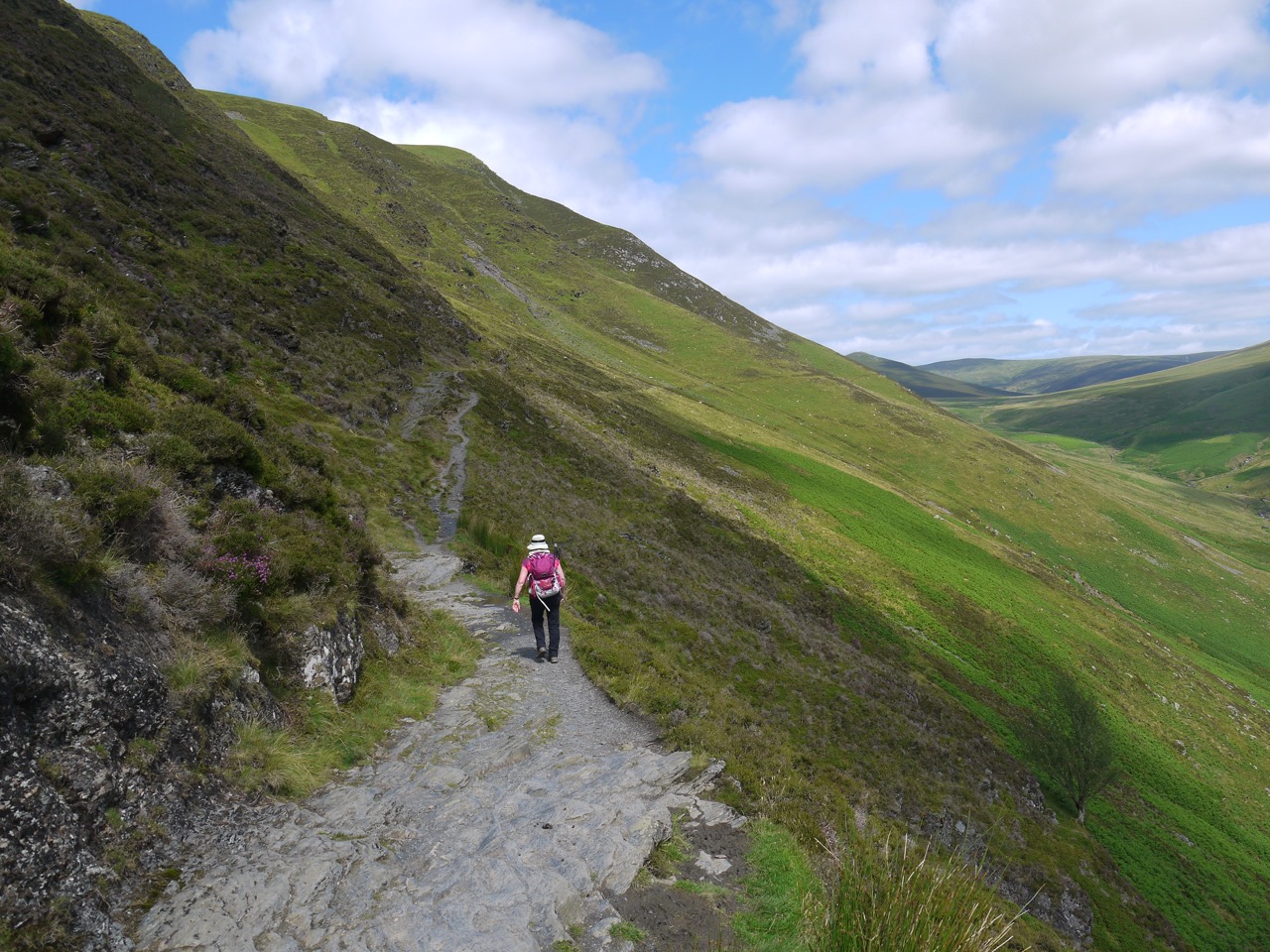
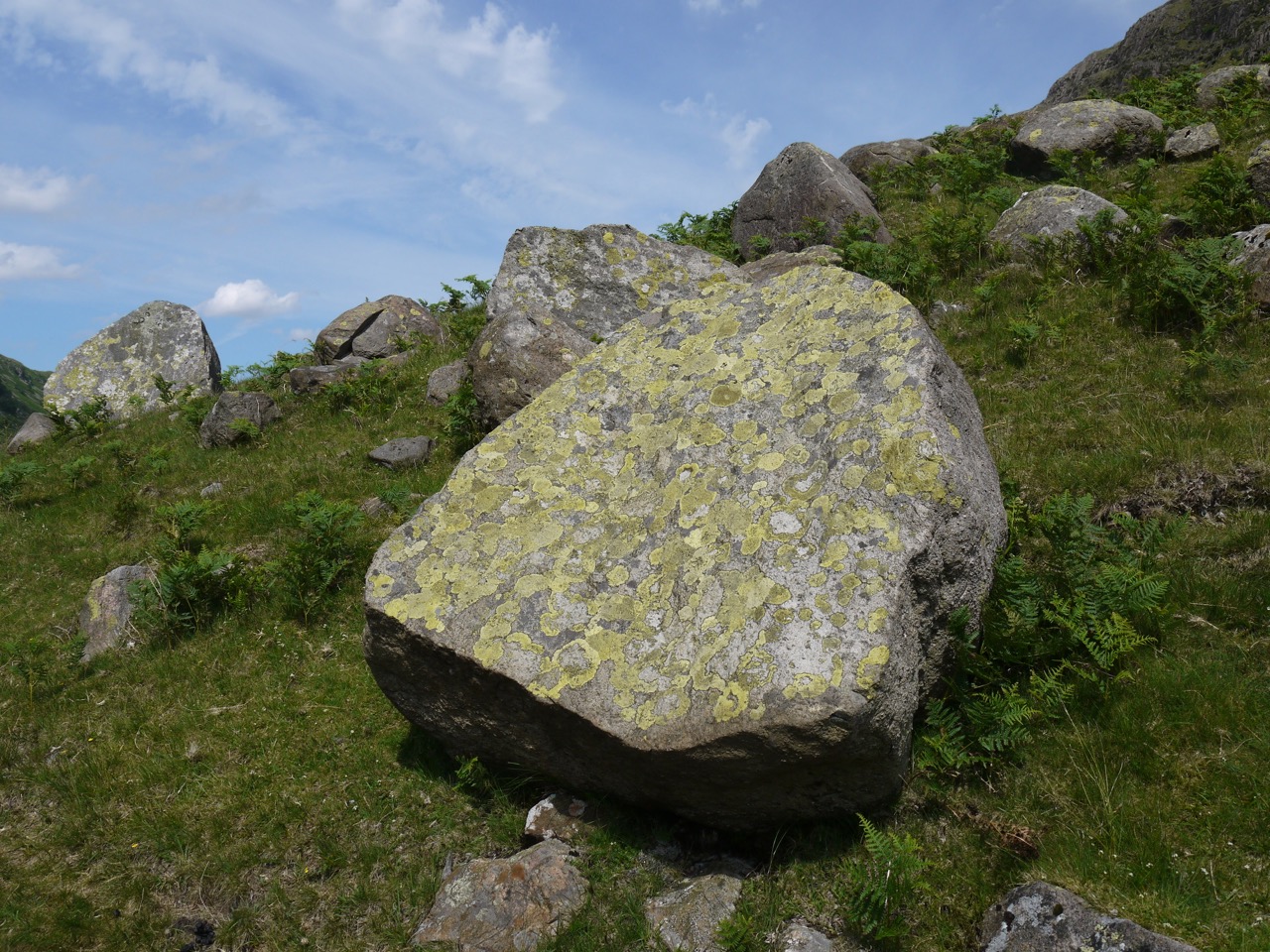
Our route would continue to climb all the way to Skiddaw House. The path was well frequented by mountain bikers so we found ourselves stepping off the path to let them by several times. One poor biker was carrying his bike up a steeper section. The flora changed from bracken to heather as we climbed.
Glenderaterra
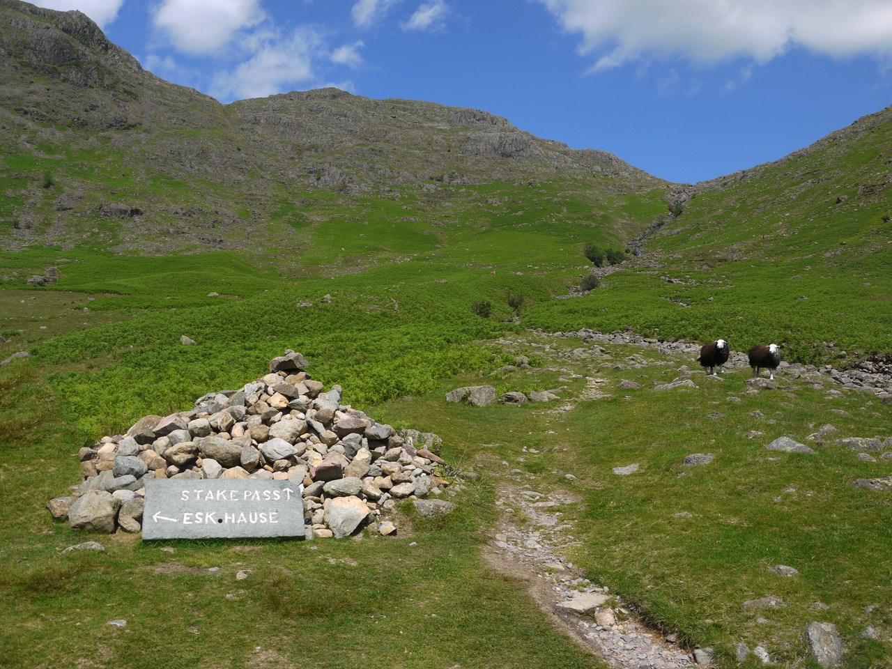
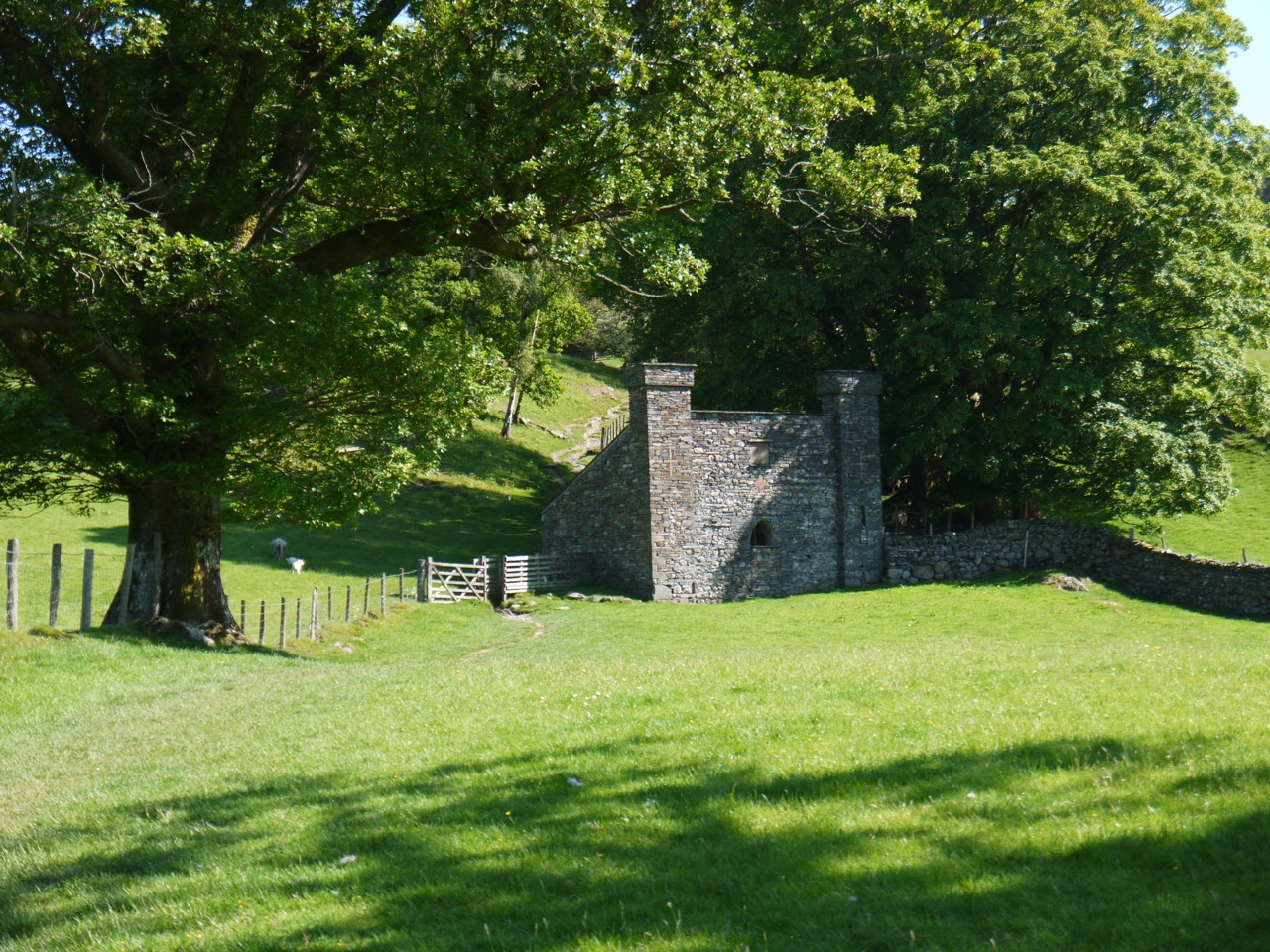
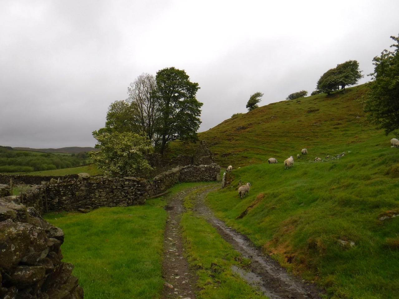
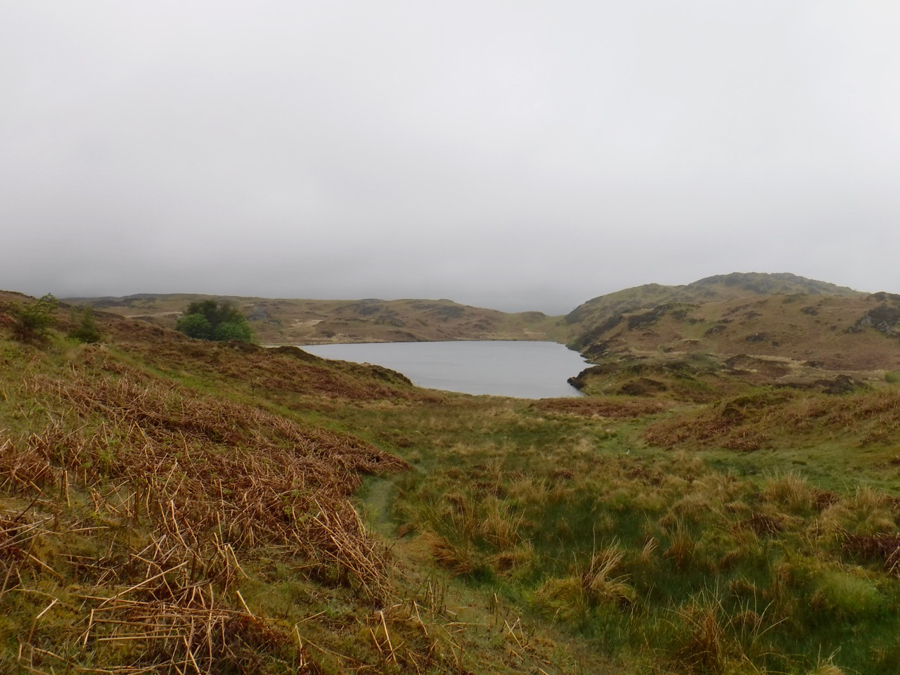
The local watershed is at a finger of Lonscale Fell called Burnt Horse. and once over that we were in a rather desolate heather covered moorland watched over by Skiddaw House, which apparently is the loneliest house in England. Lonely perhaps, but welcoming. there was a box of flapjacks by the house and a note to leave £1.50 if you took one. I might have been tempted but we had just had lunch.
We had stopped beside Salehow Beck for lunch. An old sheepfold here had enough scattered rocks at the right height for seats and we were sheltered by the higher bank of the stream.
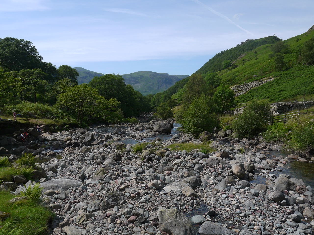
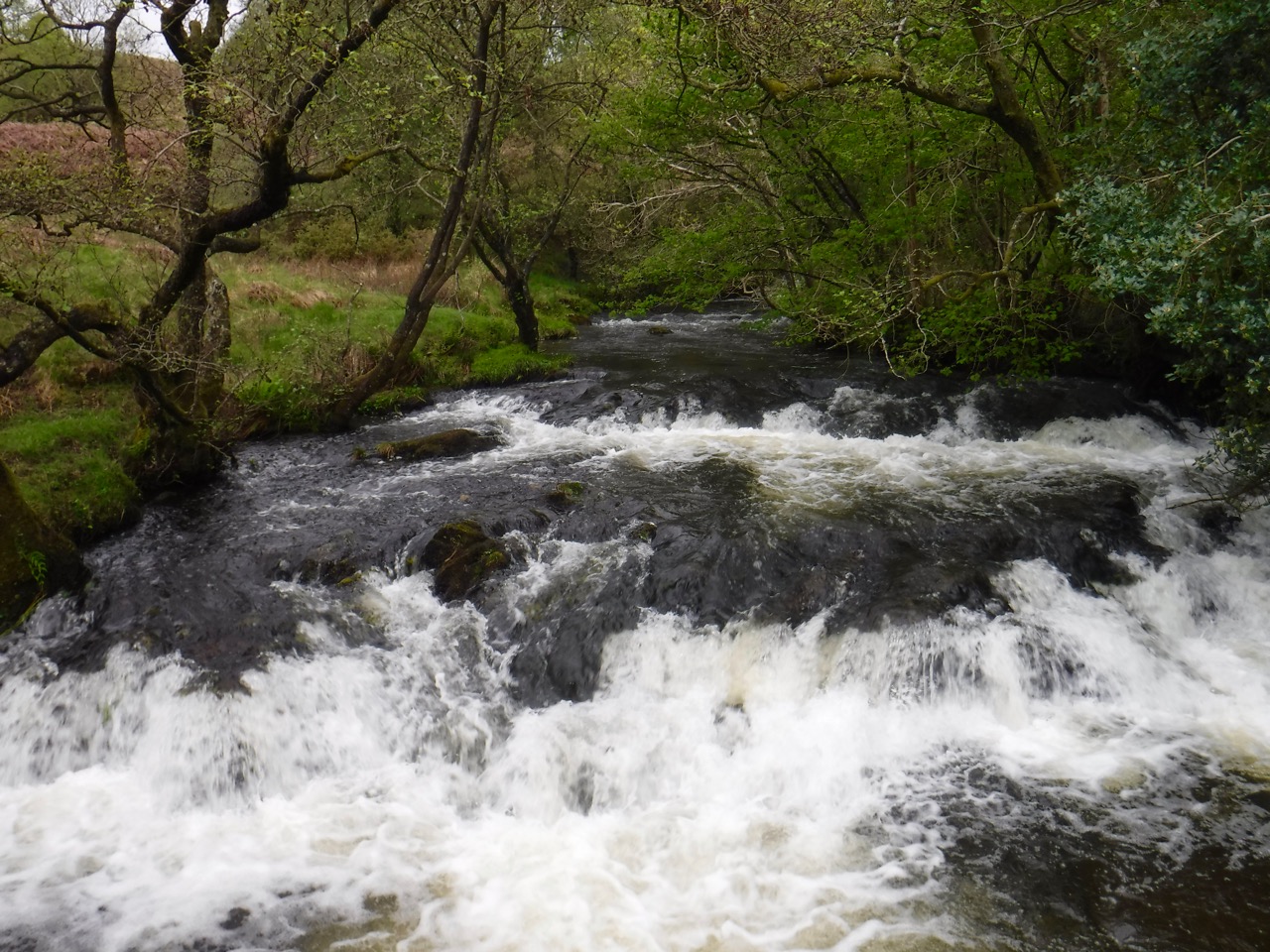
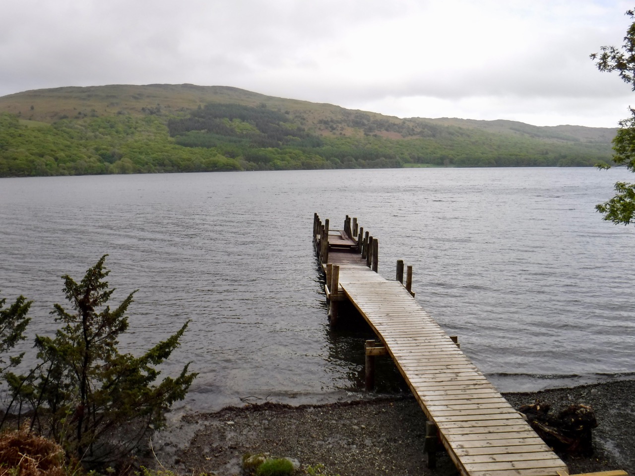
After Skiddaw House it was all downhill (well, mostly downhill). We walked across the barren moorland and then joined a track following the valley with the River Caldew at our side. The bell heather here was in bloom, but the ling hadn’t yet started to make much of an effort. There were also stands of blaeberry with fruit ripe for eating. I had one deliciously sweet berry but the rest were a bit tarty.
River Caldew
I had thought we would be walking back to the car in a deserted valley, and was looking forward to winding down in relative privacy, cooling my feet in the the river, and listening to the wind. But as we drew closer it became obvious that we would be sharing the end of our walk with a couple of dozen other people. But we took the time to rest our feet in the waters of the River Caldew, which was very cold indeed, but what should we expect of a river whose name means cold water.
Yan, tan, tethera, methara, pimp…..
Posted inCumbria, Lake District|TaggedCumbria Way|Comments Off on Cumbria Way: Pimp – the glyndwr of terra and the cold river
It might sound a little more like a journey in the Lord of the Rings than the Cumbria Way, but we were neither beset by orcs nor tempted by an accursèd ring, and we strode toward Skiddaw rather than Mount Doom.
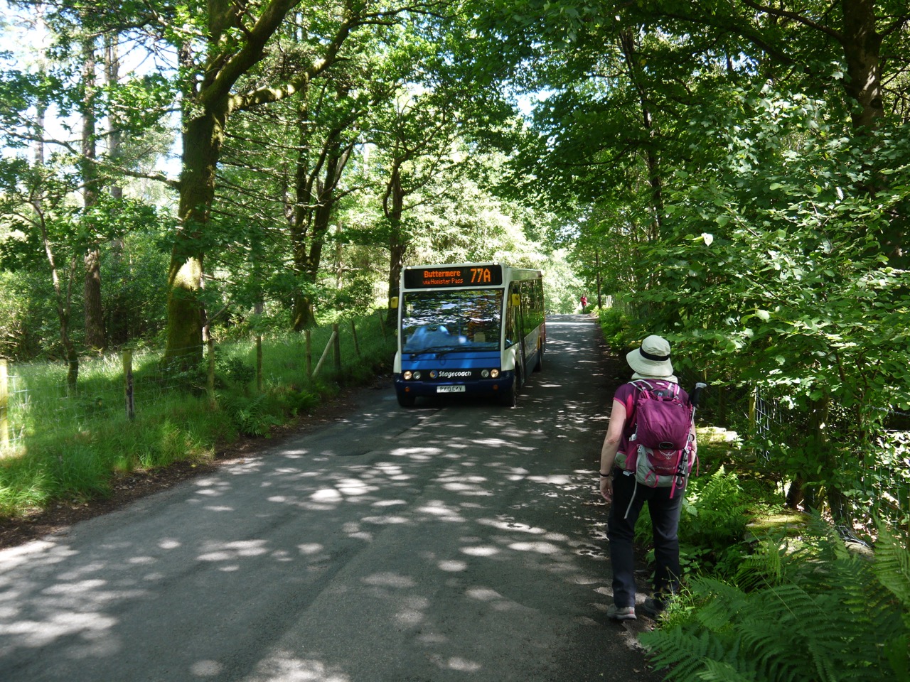
Unlike characters from a fantasy journey, we parked in the pay and display carpark (in Keswick). It was only a brief walk round to the bus-stop and we had five minutes to spare for the No.78 to Rosthwaite. Despite this well planned timing however, the bus was just driving away as we turned the corner, so it was our fate was to wait for the next one.
The weather squaring up to give us a sunny day so I used the time to apply some sunscreen. But five minutes later the No.77 (Buttermere via Honister) arrived and offered a useful alternative to waiting in Keswick, and as it turned out, the 77 gave us better views than the 78 (which we had sampled a couple of weeks earlier). I would definitely recommend the 77 over the 78 (a phrase that would be so much more impressive were I discussing wine vintages rather than Cumbrian buses).
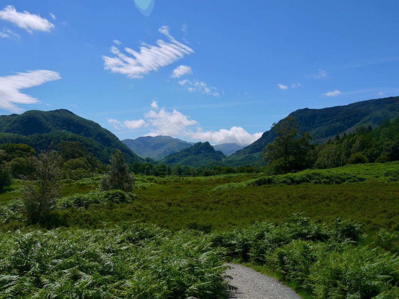
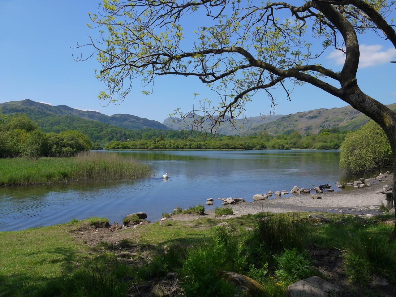
Our walk proper started in Rosthwaite, a small village on a wide flat valley floor, bounded by craggy fells to the east (Scawdel) and west (Watendlath), with Catbells just visible along the Borrowdale valley to the north and the Borrowdale Fells to the south.
Borrowdale (Borgar-á-dalr) is the valley of the fortress, which presumably had once stood on Castle Crag, while Rosthwaite’s naming is less certain. Thwaite (þveit) is old norse for a clearing, but there seem to be several interpretations of the Ros- including cairn/heap of stones/cave (hreysi), horses (hross), or Hroarr a personal name, but in modern Icelandic hreysi is a hovel/crude hut and I wonder if that might have been its provenance. But who knows if Hroarr cleared some forest, the clearing stood by a cairn, or when hreysi came to mean a crude building? Or perhaps diminutive versions of hreysikǫttr (wildcat), or hreysivísla (weasel) described the clearing?
Catbells, in the distance, from Rosthwaite
Rosthwaite no longer looks like a clearing in the woods. Only small stands of trees remain. The buildings cannot be be described as wretched hovels, there are neither wildcats nor weasels to be seen, nor horses for that matter. If there were cairns remarkable enough to name a place they are now gone, perhaps incorporated in the dry stone walls. As we set off, a race looked to be finishing at the village hall. They must have started early.
River Derwent
We followed a farm track which led us to the River Derwent (alternatively said to derive from dwr-gwyn, white water, and derwa, oak tree). The track reaches the river at a ford which has stepping stones, but our route remained this side of the river and we crossed at a stone footbridge a few hundred metres further on. We then walked in sunshine through grassland with Low Scawdel above us.
High Hows Wood allowed us to swap direct sunlight for cooler dappled light beneath its trees. Crab apples hung over the path but were small enough that even I wasn’t tempted to eat any. After crossing a narrow bridge we emerged into the sunshine at a wide curve in the River Derwent. It was still a little early for paddling though.
Old Rover
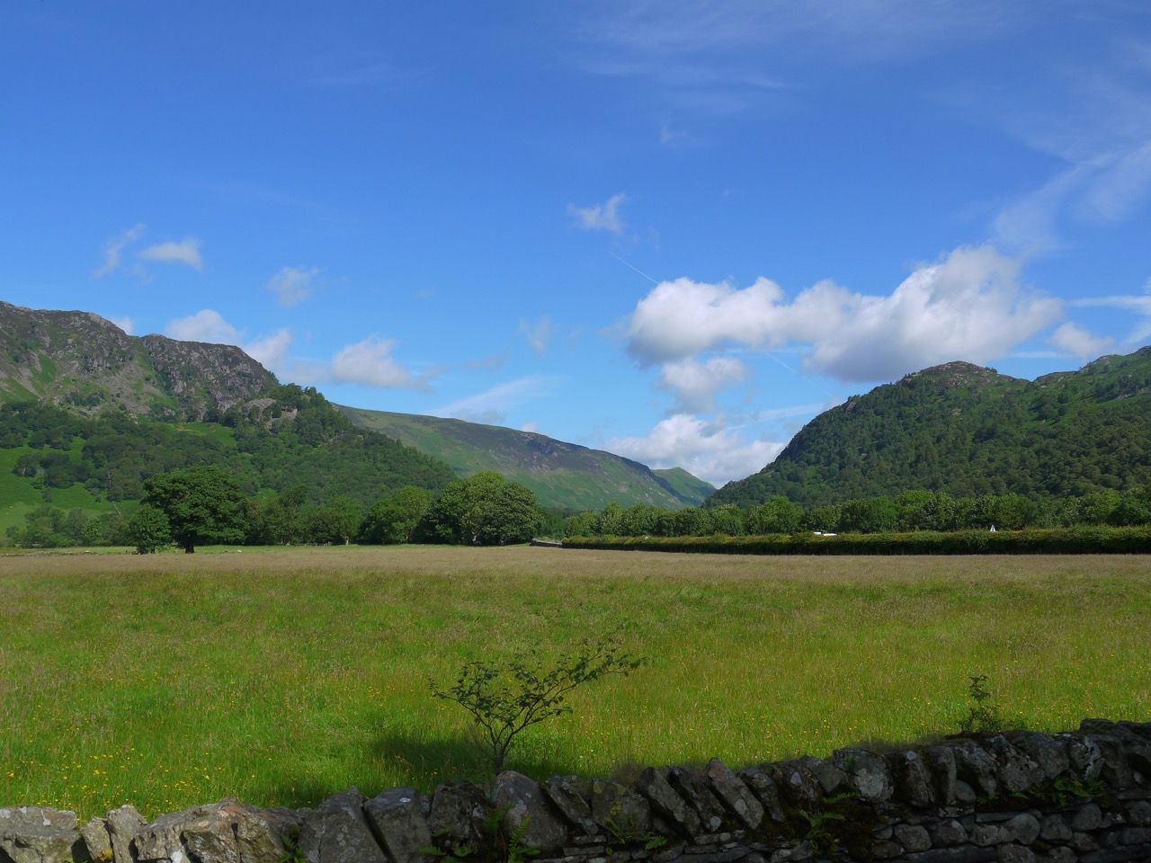
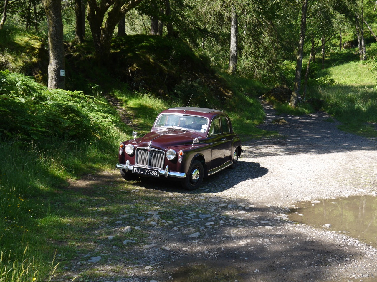
A little further on we passed a purple Rover. That’s not a flower, but an old car with 1964 plates, parked beside the path. The next clearing was at Hollows Farm, the half way point of the Cumbria Way (by my estimation). The open ground allowed us a glimpse of Skiddaw,which we had last seen from Stake Pass above the Langstrath. And looking back along Borrowdale gave us a good view of Castle Crag, guarding the valley.
Castle Crag
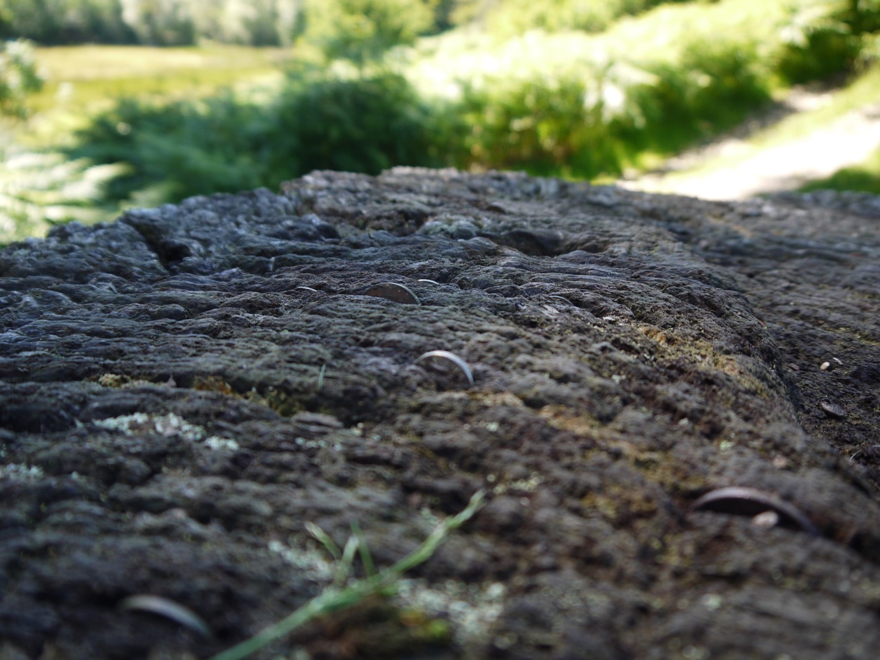
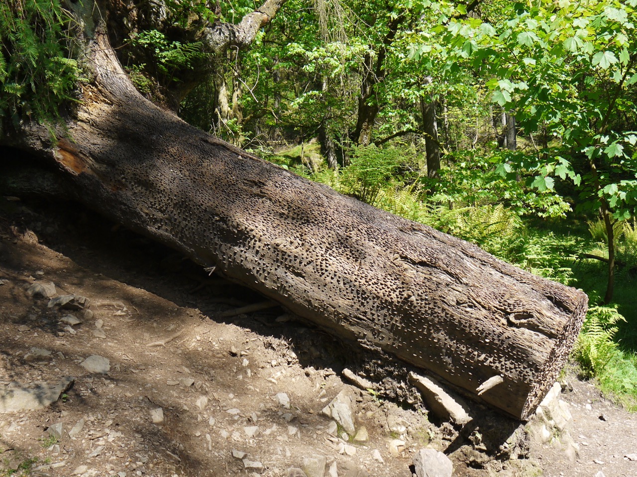
Being in the open there were more wildflowers by the path: fox and cubs, yarrow, foxglove, bedstraw, bell heather, bird’s foot trefoil, horseshoe vetch, yellow corydalis, and spotted orchids. By now we were looking for a shaded spot for a short break, and after walking across a slope covered with wild thyme, with Blencathra making its first appearance in the distance, we found a shaded tree stump.
This tree stump had coins hammered into it, and I decided to get into the swing of things by pushing in a coin using a handily placed rock. Hopefully it will bring me some luck.
Lucky coins in the wood
After a brief rest and a cup of coffee we walked a short way to join a minor road for half a kilometre. This was the way we had come on the bus and as we walked the 77A bus came by again. It was getting quite busy around here with plenty of walkers from the nearby Borrowdale Hotel.
The 77
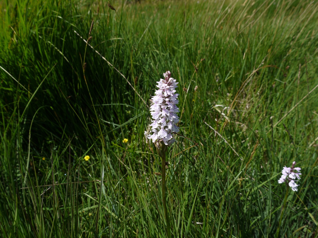
The road walking was soon over and we left the road to head down towards the Lake. The ground here was moorland with bracken and bog myrtle but then became wet enough that boardwalks had been built to carry the footpath. The dry days though meant it was possible to leave the path to have a closer look at the orchids and asphodel growing there.
Spotted Orchids
Catbells was now visible and as we drew closer, walkers on the ridge gave us a better idea of its size and distance from us. Larger and further away than it would have otherwise appeared.
The path then led us down to Derwent Water, with Skiddaw and Blencathra on it far side. Just being beside the water seemed to cool the air a little and knowing we had completed the first half of the day’s walk was a morale booster.
Derwent Water
The path beside the lake was easy walking, and for the most part easy navigation as well. There were open areas filled with bog myrtle and bracken and then broadleaved woodland. Near Brandlehow Bay we found a sign informing us we were at Rupert’s Wood which had me reminiscing about Rupert the Bear annuals when I was a child. And a little way beyond this wood we found the Teddy in the window, a small teddy bear in the window of a large shed. Walkers had taken the trouble to send him postcards and several were on show in his window.
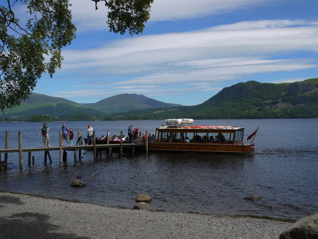
Derwent Steamer
We passed through a body mass index filter (a narrow bridge) and came down to the landing stage just as the Derwent Steamer was disgorging some of its passengers. We would see several times more as it plied its way up and down the lake.
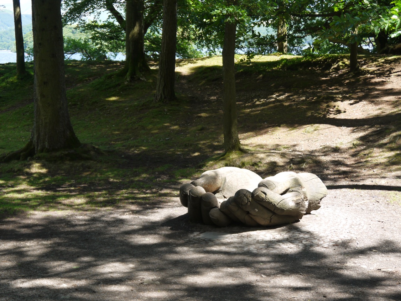
Brandlehow Hands
The Brandlehow Hands were free for photos and we spent a little time trying to get photos before stopping for lunch. I had thought about climbing to higher ground for a better view for our rest but we settled instead to climb down to the lakeshore and eat our lunch to the sound of lapping water. There was St John’s Wort nearby just in case we were tempted to induce some CYP3A4, but I stuck to eating sandwiches. It was certainly a nice place for lunch, excellent views, reasonable rocks for seating and shaded from the direct sunlight.
Refreshed and refuelled we set off through more woodland then fields of marsh thistle and then farmland with alpacas.
The Cumbria Way then joined a minor road that took us through Portinscale then along a rather busy footpath into Keswick. By then the blue sky had filled with cloud and it looked as though the rain wasn’t too far away.
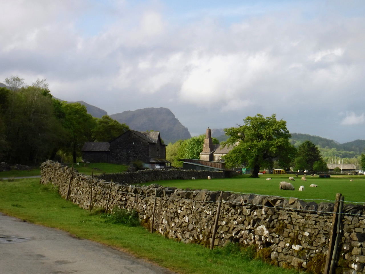
This was our third Cumbria Way walk. The official third stage runs from Dungeon Ghyll to Keswick but we decided to split the walk and end this day at Rosthwaite. I am pleased we did. The day was a glorious, but the heat got the better of us, sapping our energy such that the walk felt twice as long as the miles we walked.
The walk was originally planned for a weekend but a delay found us walking on a Monday and the differing bus times forced some logistical changes on us. We parked at a pay-and-display in Keswick, took the 555 to Grasmere, and a taxi to Old Dungeon Ghyll, having changed the taxi times often enough to tax the patience of our driver. Audrey repayed his good nature with a chat about sheep and cattle breeds, and a tip.
We arrived back at Old Dungeon Ghyll in much the same weather as the last visit, blue sky and warm still air. I had my new rucksack, an extra 11 litres capacity but still full with the same gear I usually carried in the smaller one. The waistband was tight at first but within a few minutes it needed tightening a few inches. The same thing happens with my trousers belt as well; I’m tempted to take a tape measure along and see how much my waistline changes when walking. Perhaps I stand up straighter when striding out or exertion redistributes my fat acutely.
Raven Crag
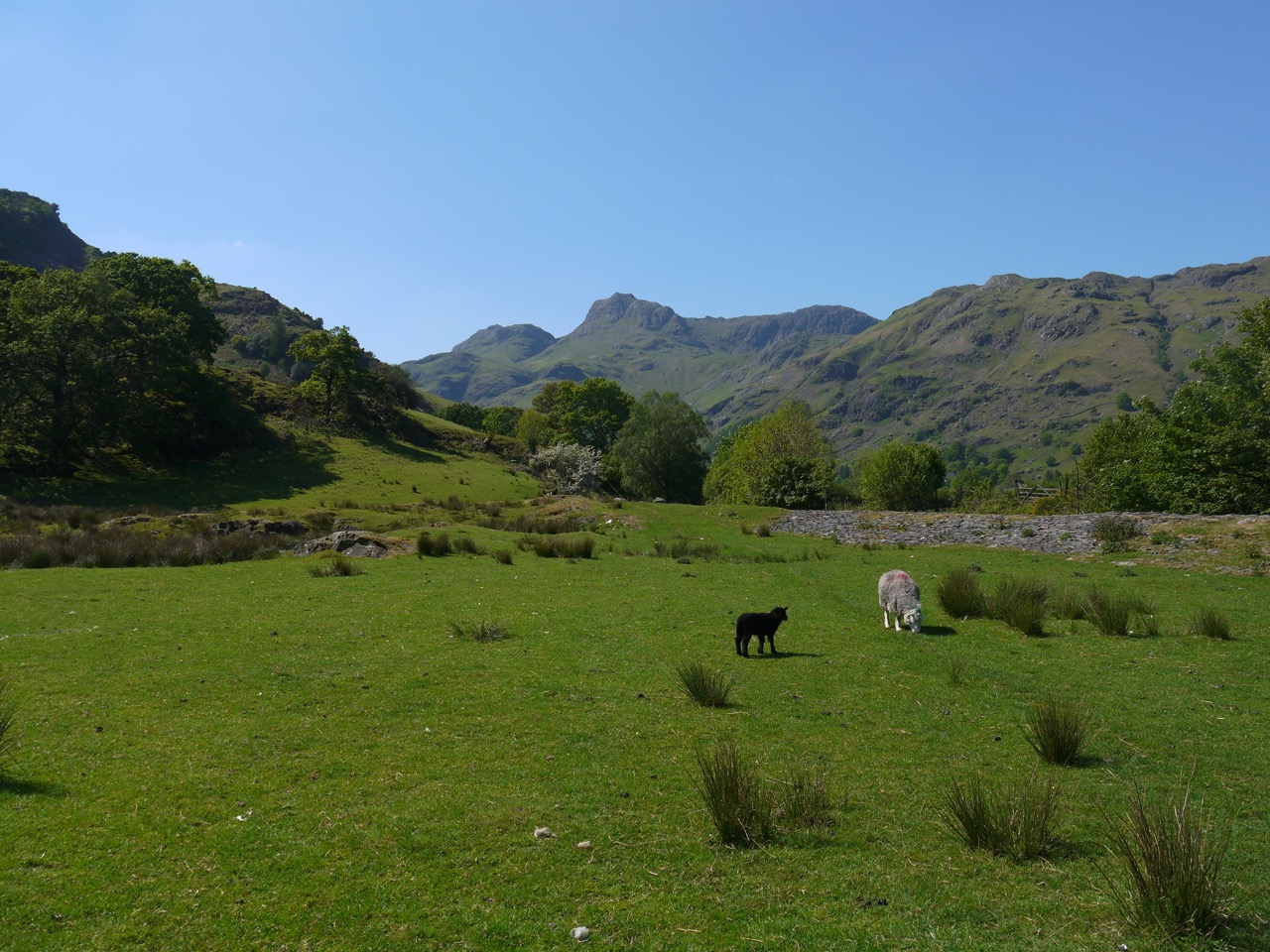
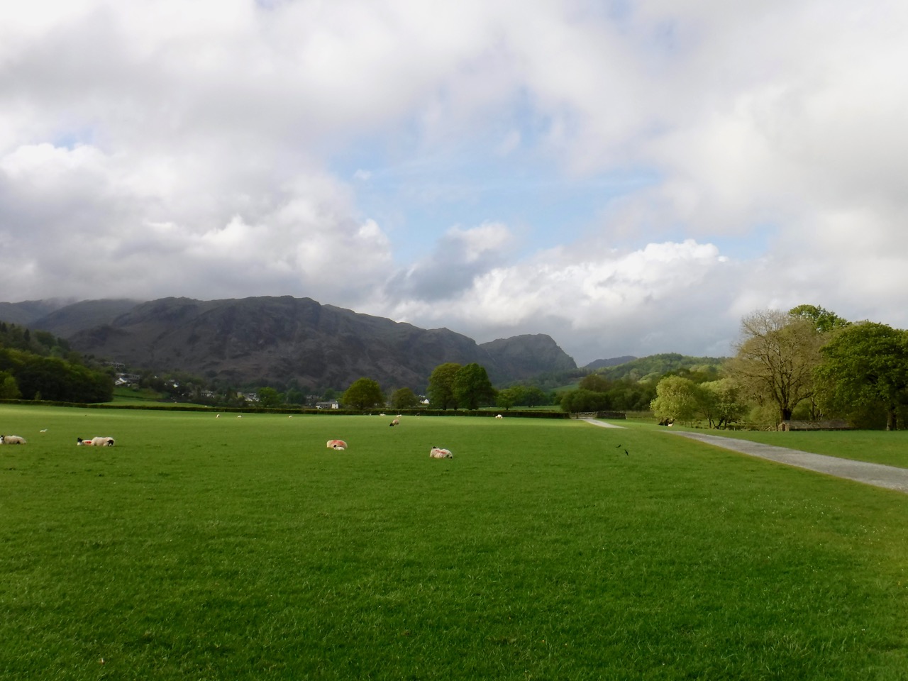
We headed up behind the pub and rejoined the Cumbria Way where we had previously left it just below the rocky outcrops of Raven Crag. From here we looked back into Great Langdale then turned west and set off past a wee sign informing us we were now in Mickleden, whose name means big valley. Mickle being an archaic word for large and den, a valley, sharing its origin with words such as dene.
Crinkle Crag and Bowfell
A rocky path runs between a tall stone dyke and the bracken and red sheep’s sorrel of the the hillside. Foxgloves, wild thyme and tormentil added spots of colour and the bog asphodel warned us that there was wet ground about. For scenery we had Crinkle Crags and Bowfell at first then as we turned fully into Mickleden Pike of Stickle came into view with its jutting summit and skirts of scree. As we came closer to the end of the valley the steep slopes of Rosset Pike gave little hint as to how we might climb out.
Pike of Stickle
The valley’s grey herdwicks and their black lambs stood about, occasionally lifting their heads from the grass to watch us pass. Closer to the valley’s end the path approaches Mickleden Beck which has small fairy pools with clear water flowing over multicoloured pebbles.
Mickleden Beck
By now the day had grown very warm, but we were still fresh. A walker ahead of us made it easier to gauge the distance ahead. A cairn marks where the paths to Stake Pass and Esk Hause diverge and though it looked quite close the walker’s size showed it to be further than it would otherwise have seemed.
We crossed a wooden footbridge over Stake Gill, and rested on some flat boulders for a drink and some jelly babies before the effort of the climb up to Langdale Combe. The sheep were wise enough to rest in the shade from the walls of a sheep fold, whereas the humans sat in the sun. A couple of brown sheep watched as we headed up to Langdale Combe. (I have checked the photographs so I know I wasn’t seeing double).
We took the climb slowly, zig-zagging with the path, but the heat, and the effort both of the climb and of taking notice of each footfall on the uneven rock steps, tired us quickly. I found myself picking a spot ahead then walking up that far and taking a rest. We didn’t fall further behind those ahead of us and weren’t overtaken from behind so I’m happy we kept a reasonable pace.
Langdale Combe
We could see a (false) horizon which marked the steeper climb from more gentle climb across Langdale Combe. We stopped for lunch and a rest, but I was feeling quite warm and decided to dangle my feet in Stake Gill to cool down. I left my boots where we sat and walked barefoot to the stream, my feet and ankles sinking into the warm water of the peat’s shallow pools. The gill’s clear water though was wonderfully chilled, there was tiny blue milkwort growing on the stream’s bank and mountain air was clean. Had there been a breeze it would have been an idyll.
I had initially sat on a boulder by the gill, but then moved to sit on a grassy bank, only realising later that the ground was damp. I had a soggy bottom. I tried sitting on dry rocks to dry my behind but realised that I would just have to let evaporation do the job. In retrospect I think that this may have helped me shed some heat. Thank you, latent heat of vaporisation.
After paddling I enjoyed my now warm sandwich and drank some of my still cool water. By then my feet had dried and the boots went back on. Rested and cooled we crossed Stake Gill, picking our way over a ford using natural stepping stones. Langdale Combe is a hanging valley filled with post-glacial moraines. The ground was boggy in places and the path occasionally disappeared into boggy ground forcing us up to higher ground. Perhaps I should have carried my boots and walked barefoot through the bog?
Stake Pass
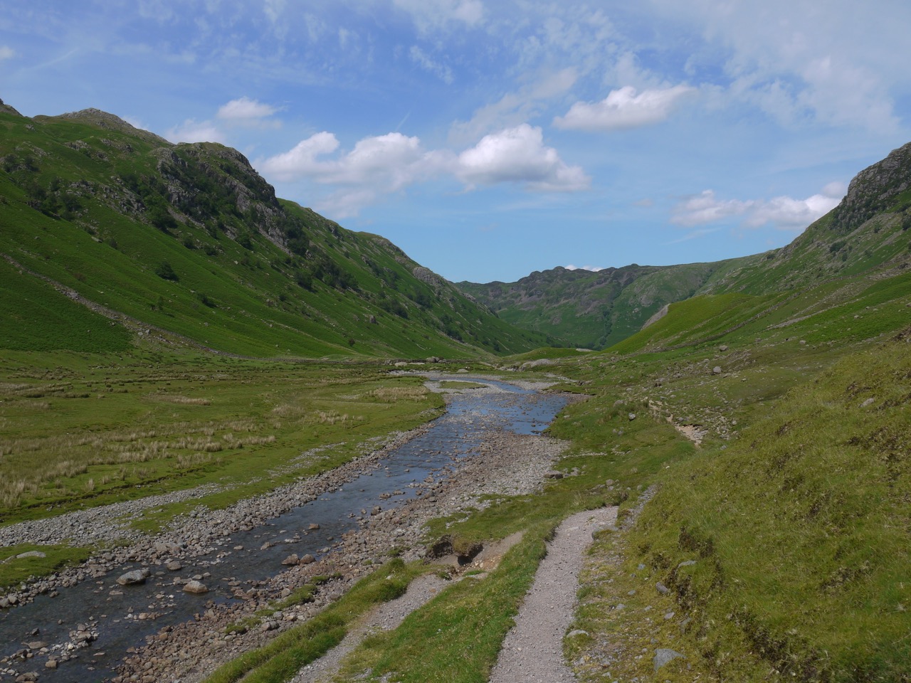
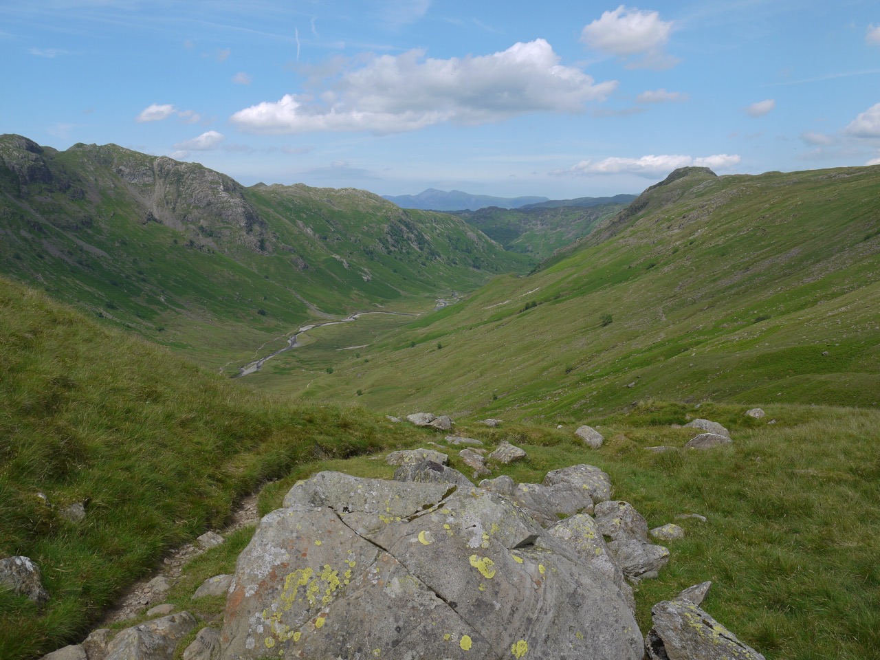
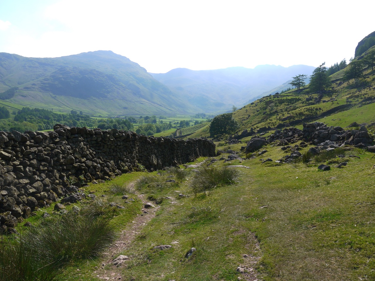
Crossing Langdale Combe took us across the watershed, leaving Stake Gill flowing away to the south and meeting Stake Gill its waters tumbling north over its waterfalls. A cairn at the northern end of Stake pass marks a crossing of routes and also marked the end of our climbing for the day. We paused for photos at the highest point of the day’s walk and then took a short detour to an un-named tarn just above the path. I breathed a sigh of relief as we began our descent into Langstrath thinking end of the climb was the end of our effort. All that remained now was to stroll down to the valley floor then downstream to the end of the walk. But Langstrath is literally the long valley, and the miles were country miles.
Langstrath
The descent into Langstrath we had spectacular views of the valley in brilliant sunshine. But he who looks to the distance ignores his footfalls and the path was treacherous. The path winds down the hillside like a giant ribbon snaking from side to side to beat the gradient. It seemed to have been topped with stones and pebbles so walking on it was akin to walking on scree. We both lost our footing several times despite walking with care, but both stayed upright. And despite this being descent I was exhausted by the effort. As soon as we crossed Stake Beck, on its footbridge, we paused to rest by an ancient Rowan.
Ancient Rowan in Langstrath
Judging by its circumference that tree has stood at the head of the Langstrath through the reigns of six monarchs, for decades before a man-made aeroplane crossed the sky above it, and may even have been gazed upon by eyes born in the eighteenth century. Humbled, we sat on a nearby boulder and watched the sheep resting in the shadow it had been provided for them and their ancestors all that time. Perhaps shepherds in older times sat on the same rocks, by what was then a wee sapling, and counted their sheep, “yan, tyan, tethera…”.
The ancient rowan was the walk’s half way point, but the first half contained the main ascent and descent. The second half should have been easier and certainly we did not have to face any more climbing. I would love to say that we strolled easily drinking in the surroundings but we were beset by two challenges: the rocky uneven path and the temperature. I don’t know how hot it was but the following day was the hottest day recorded since 1976.
Aaah…1976…’O’ levels, Bohemian Rhapsody, the Wurzel’s Combine Harvester, and a heat wave. (Nostalgia kicked in and had me looking at photos of Manchester from 1976. My it looks old.)
Back to 2017…we strode along the Langstrath joying the sun, the towering valley sides, boulders covered in lichen, (some still showing striations scraped by the glaciers), sheep, lambs and, hiding in the shade, several tiny carnivorous sundews. Several streams cross the path and were either dried up or easy to cross, but in wetter weather they might have been more of a problem.
Blackpot Moss
Langstrath Beck winds along the valley, perhaps a little less full than it can be, but at Blackmoss pot it enters a rocky ravine and stills to a deep pool. There were several youngsters there climbing the rocky ravine sides to dive into the cool water.
We left the swimmers to their pools and pressed on, but when we reached Greenup Gill the water was just too enticing and our bodies just too hot to walk past. So below the footbridge we stopped to cool in the water. In retrospect I think both of us were showing early signs of overheating so the rest and cooling were more than just for comfort.
Greenup Gill
The bridge above our heads had a small plaque dedicating it to a young man who had died in the valley from exhaustion in 1939. A reminder that this beautiful and calm place of nature’s powers.
Cooled, and rested, we set off alongside Stonethwaite Beck, but now at least we were walking in woodland and I found myself wondering why the ancients worshipped the sun but seemed not to have sent their prayers to a god of the shade. (PS on reflection, I suppose the deity to thank would be the one controlling the trees).
The path
We continued to stumble over rocks never daring to mention when the path flattened out in case in made it become rocky again. I had slipped into trudge mode and found myself counting my paces to check we were walking at a reasonable pace. There was some question as to whether we should take a detour to Stonethwaite for a chilled drink or press on for Rosthwaite. The choice was uncertain until we reached the Stonethwaite bridge, but once there we looked at each other and decided to keep going for Rosthwaite, which by then was only 20 minutes away.
At Rosthwaite we headed straight for the pub and a well deserved ice-cold drink. Due to a misunderstanding we missed the bus, but that gave us an excuse to have a second drink.
A short journey on the 78 bus returned us to Keswick and the car.
[osmap gpx=”http://www.screel.co.uk/walks/wp-content/uploads/2017/06/RK_gpx-_2017-06-19_1046.gpx”]
Some more photos….
Without doubt the main theme of this section of the Cumbria Way was the weather. I don’t know how warm it was during the day but it was 28°C when we were driving home in the evening; and there was little if any breeze.
We parked in the NT pay and display car-park at Old Dungeon Ghyll and got a local taxi to the Crown Inn at Coniston and there rejoined the Cumbria Way where we had left off previously. The weather was glorious, with sunshine and clear blue skies. I had remembered my sun hat but had forgotten sunscreen but was able to scrounge some.
Dog Kennel Folly
We set off along the road out of Coniston, then turned along a minor road for a short time before crossing Yewdale Beck and walking through park-like farmland, passing resting Herdwicks with their lambs, and heading towards the shade of Guards Wood. Along our way we passed the Dog Kennel Folly, a gothic styled edifice with turrets and arrow slits built originally to house foxhounds. It is apparently a listed building.
Guards Wood
We climbed gently and passed through Guards Wood at its narrowest point, then had a gentle descent back down to Yewdale Beck at Low Yewdale. There was then a steady climb up through Tarn Hows Wood and then more uphill along a minor road over Tarn Hows Intake. (An Intake being an area of higher fields by open fells…the same as an outbye?).
Having left the trees behind and climbed out of the valley we now had views back to the Old Man of Coniston and forward to the Langdale Fells. I wasn’t sure which fells we could see, but looking at the map now, I am pretty sure that the hills in the distance were Blea Rigg. Though the most common beast to see in the fields was the Herdwick we did also see some Belted Galloways to remind us of home.
The Old Man of Coniston (not the one with a hat)
For some reason I had misinterpreted the contour lines and was expecting to be descending to Tarn Hows. Audrey pointed out that a tarn would be high up and the road was undoubtedly climbing. At least we were close to the highest point for the day. We stopped for a photo with the Old Man of Coniston behind us.
Tarn Hows
By the time we reached the tarn itself we were ready for a break. The Tarn was very pretty in the sunshine and the woodland track was easy going on the feet. There were several benches but always in direct sunlight, so we pressed on, deciding that shade was more important than sitting down at that point.
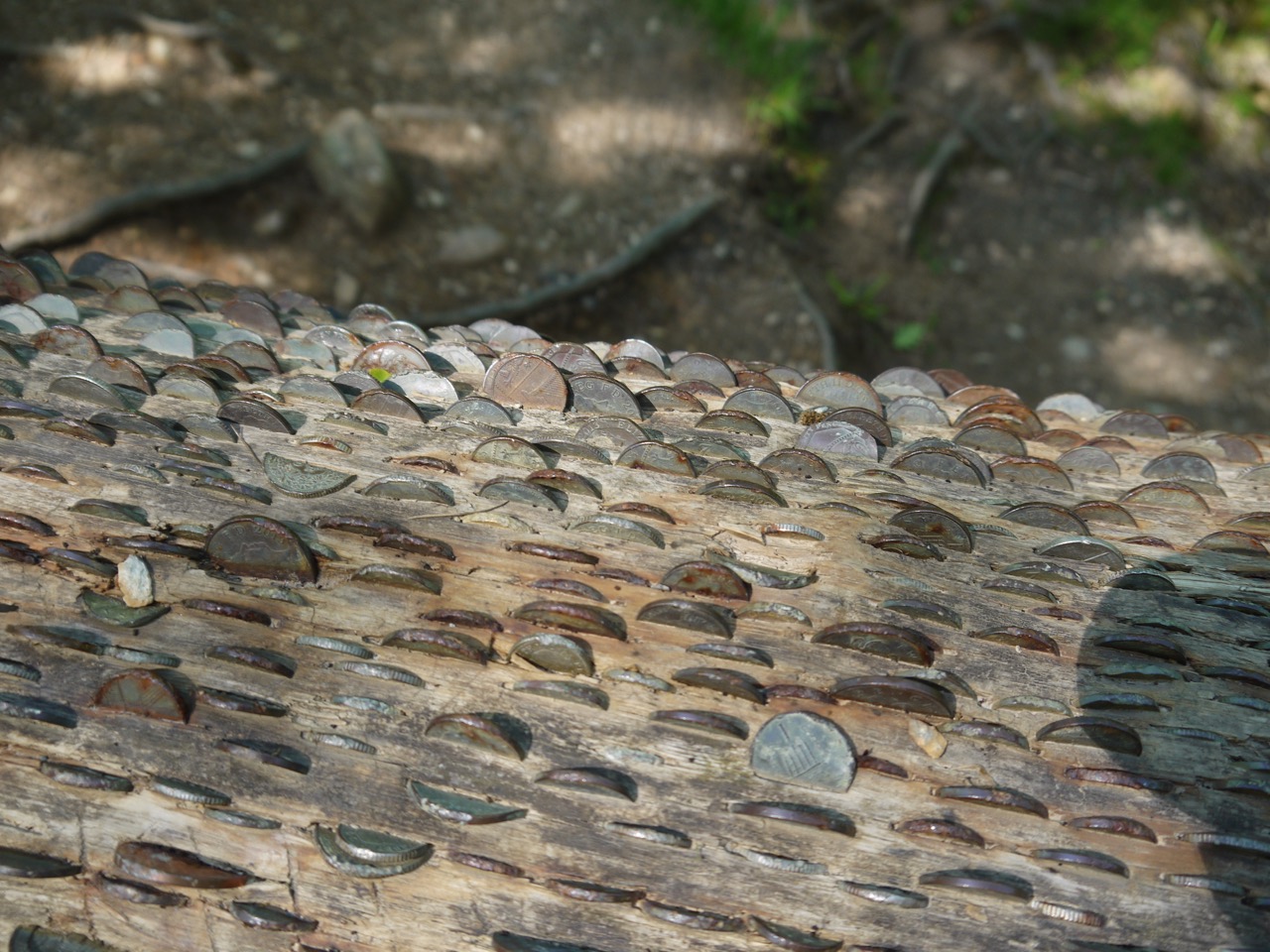
We paseed a fallen tree with what from a distance I presumed to be fungus growing over its entire trunk, but close up these were coins hammered or pressed into wood. When we did find a bench in shade there were coins embedded in it as well. We saw several other trunks or stumps embedded with coins later in the day; apparently pounding a coin into this dead wood is said to bring luck.
Ten minutes to sit, rest, and have a drink was welcome by this time.
The Cumbria Way doesn’t have consistent waymarking and we did find ourselves uncertain at times despite having the map to hand at all times. At those times we referred to the CW book, but sometimes found it unhelpful. A good example was the turn off from the path along the tarn. It was clear from the map that we should leave the main track perhaps 250m before the end of the tarn, but the end of the tarn was not obvious until you actually reached it. When we found a track leaving, there was no CW marker, so we looked in the book, which said we should leave on a track with a signpost to Arnside and Langdale. The track we met was signposted to Skelwith Bridge and Langdale, so we decided to pass it, only to find ourselves at the end of the tarn.
So we took retraced our steps and took the track despite the sign differing from the description. This took us through woodland on a rough narrow track, all the time wondering if we had strayed from the route. Then after about 0.5km we met a very rough wider track and a signpost with a CW plaque. We passed Arnside Lake and then continued on the rough track across moorland with our last views back to the Coniston Fells.
When is a fence not a fence
We crossed the A593 at Arnside (the one not mentioned on the signpost), and walked parallel to the road through a field with sheep and lambs. The was a curious “fence” made of one or two strands of wire, high enough that a sheep could easily walk under and incomplete. Its only use could be to encourage walkers to remain beside the wall between the field and the road. This did seem quite an effort though since a stream ran less than ten metres away and would have discouraged walkers from straying that way.
This route eventually led us back to the road but then immediately turned along a minor road climbing beside the Woodlands of Tongue Intake towards a wee hill, Great How. Once over the col beside the hill we were in Little Langdale.
We were now heading for High Park Farm, which served refreshments, but we ere not ready to stop at that time. After the farm we followed a well made farm track to the edge of some woodlands and then took the less travelled, lower, woodland path so we could visit Colwith Force. This was quite a pleasant walk but I can see why it is an alternative, rather than the main CW route here. If over used I am sure it would erode quickly and in wet weather it would be easy to slip and fall where the track is at an angle more appropriate for contour hugging haggis. I dropped the map here and had to clamber down to retrieve it.
Colwith Force wasn’t perhaps at its best with no recent heavy rains. It represents a fall of about 40 feet in the River Brathay, over a series of small waterfalls. Above it was another “wishing tree” embedded with coins.
We rejoined the main CW route by a road bridge over the Brathay, but the CW turns along the road away from the bridge for a few metres before crossing a strange hybrid between a styal and a gate, then climbing some wooden steps and heading up past Park Farm and Park house. By this time we were looking for a good lunch spot and we found it beneath a large oak tree with a couple of rocks for seats.
As much as I enjoyed sitting in the shade a the large oak tree, the rock I had chosen as a seat proved a little too sloped and low for my hip joints. So at a time when I should have been relaxing, there was a growing tension in my muscles which eventually brought me back to my feet and doing stretches. A breeze would have been pleasant but the air remained still.
Trevor Woodburn Bridge
The next section took us into the woodland beside the little village of Skelwith Bridge, crossing the River Brathay near Skelwith Force on the Trevor Woodburn Bridge, which is named after the local man who originally put forward the idea for a ‘miles without stiles’ route for pedestrians, cyclists and wheelchair users avoiding the traffic on the existing road bridge.
For the next few miles we walked beside of close to the River Brathay, past Elter Water then beside Langdale Beck. Crossing back and forth in Elterwater, Chapel Stile and Dungeon Ghyll. Much, but not all, of the walk to Elterwater village was shaded by riverside trees, but the temperature was definitely climbing and as we approached Elterwater village I was flagging a little, and had to stop for a drink of my, now warm, water.
Langdale Beck
The CW actually misses Elterwater village, passing between an old slate quarry and the river, through very welcome woodland shade. The river here was beautiful, the clear water covering multicoloured stones. I think at any other time I would have wanted to stop and dangle my feet in the water, but I was in “one foot after the other” mode and just kept trudging on.
Having crossed the river here we were brought back to the “main” road and found ourselves walking by the Wainwright Inn. It was a team decision to call in for cold drinks. I would really have loved a shandy but since I would be driving later I stuck to soft drinks. Much better than drinking my warm water. While sitting in the shade outside the pub, my hands cradling an ice cold soft drink the countryside noises were interrupted by what sounded like an air-raid siren. I mused jokingly that we probably had 3 minutes before the nukes hit Sellafield. The siren stopped and then there we heard the boom of an explosion. While I was trying to get my mind around this, Audrey realised it was from the nearby slate quarry.
The ice cold drinks went a long way to kick me out of trudge mode and back into strolling mode.
Langdale Pike up ahead
From there onwards there was to be little in the way of shade. The remaining walk was half flat farmland and half rocky hillside, with Dungeon Ghyll and Stickle Ghyll visible on Langdale Pike ahead of us, drawing ever so slowly closer. I think Audrey hit her own “tank empty” state along here and defaulted to trudge mode much as I had done earlier.
The path across the base of Lingmoor Fell was energy sapping, with ascent along rocks that shifted underfoot and required continued care and watchfulness for every step. But eventually we could see the buildings of New Dungeon Ghyll, not the end of our walk , but another opportunity for buy some cold drinks.
At New Dungeon Ghyll, or more accurately Sticklebarn we crossed into a car park and found a sign for Old Dungeon Ghyll, half a mile. Encouraging news, I felt.
We had a cold drink watching a couple attempt the Sticklebarn loose rope challenge, which involved walking a loose “tightrope” about six inches of the ground. I decided against trying it since I could foresee broken bones as an outcome for me.
Almost there
Refreshed again we set off back to the signpost to ODG but once there I realised that it was not the route of the CW, which skirts the lower slopes of the hill above rather than crossing the farm fields. So that final half mile turned out in fact to be 0.9 miles of rocky track.
Once Back at Old Dungeon Ghyll we turned off the GPS trackers, took off our rucksacks and boots and headed to the bar for a celebratory ice cold drink.
CW2 was five miles shorter than CW1, but felt longer, mainly because of the heat I think. We decided that the next, 17 mile section, would have to be split if we were to enjoy it.
This was our first section of the Cumbria Way, from Ulverston to Coniston.
We drove to Coniston, parked the car near the Crown Inn, and caught the X12 bus to Ulvertson, but that doesn’t quite capture the experience. I had set off without my spare (dry) clothes and, given the heavy rain, thought it would be tempting fate to go without a change of clothes. I hoped the brief detour back home would ensure, by a reversed Sod’s Law, that they were not needed.
Once at Coniston, in plenty of time, we kitted up ready for the walk, in light drizzle, with time to spare to make use of the facilities. Luckily I had some 20 pence pieces. A sign explained that by spending a penny I was ensuring that the public toilets remained open. So I felt both public spirited and relieved after spending a penny (attached to 19 other pennies). We then sheltered in a bus-stop provided, as a sign informed us, by the Coniston and Torver District Nursing Association in 1959.
The bus arrived in plenty of time, but it transpired that the driver had cut his hand. A passenger, who he clearly knew, did her best to patch him up using the bus’s first aid box but this clearly wasn’t satisfactory so she announced that she would go home and get some better dressings. Time passed and with the other passengers we boarded the bus. More time passed, the driver finished his snack, then settled into his seat, closed the doors and set off.
It occurred to me that the good Samaritan had not yet returned to the bus with her medical supplies. She had been left behind. Should I remind him? But before I could decide we stopped beside some houses and she rejoined us, with her bandages. The driver was soon patched up and the bus carried on, with some nifty driving as the bus-driver managed to squeeze us by a coach on a very narrow road.
Once in Ulverston, we made our way to the start of the Cumbria Way, which is marked with a sculpture containing a cairn of rocks from different parts of the Way.
By the time we started, the rain had decided to turn it down a notch such that waterproof trousers were deemed unnecessary. We posed for our “Start of the Walk” photos then took our first step of the 39,083 of the day.
And the walk started as it meant to go on. We found ourselves faced with a fork in the path and no pointers. The CW it tuns out is the left fork, which follows a small stream beneath mature broadleaved trees and hedgerows and walls dotted with wildflowers. A short footbridge then lead us to a narrow rocky path between two stone walls and this was just steep enough to quickly blow off any remaining chill in our muscles.
The path ended and we passed through a gate and on to a minor road. My attention was caught by a bench dedicated to “Happy Wilkinson 1926-1996”, and my cynicism led me to look closely and see if those really were Ps rather than adulterated Rs…they were Ps. After a few more paces I was glancing at the map and noticed that the CW route appeared to just touch this road then head off across farmland. We backtracked and found a gap built into the wall allowing us to climb into the field.
Farmland above Ulverston
This was to be the first of many such slim gaps built into walls that we would encounter. I haven’t quite got the technique of shuffling through these but doubtless that skill will come.
The day was warm, and with walking I soon transitioned from comfortably warm to too hot, but the rain itself had stopped so I was able to stow my coat without getting my upper body wet. The grass we were walking through though was very wet and long enough to soak my trousers up to the knees.
In my mind I had broken this section into 3 slightly unequal parts, Ulverston to Gawthwaite, Gawthwaite to Beacon Tarn and Beacon Tarn to Coniston. The first part took in farmland, moorland, woodland, minor roads and farm tracks, farmyards, old churches (such as St John’s of Osmotherley) and small villages. We headed from farm to farm, confirming our position by finding the correctly named farms on our way.
Near Old Hall Farm
Route finding was not without problems, however. We soon realised that the CW plaques were identical to those for other public footpaths except that the words “Cumbria Way” were written within the small direction arrow. Since many of the signs were weathered this led to some confusion. Was this weathered way marker a CW waymarker with the “Cumbria Way” words eroded, or did it point along some other footpath? Later we were able to factor this into our decisions.
I should perhaps digress a little here to reflect upon the usefulness of particular objects. Both Audrey and I have the Cicero Cumbria Way book. Identical, I would have said, but now experience has brought wisdom and I know better. It is not the object per se that is useful, but the object and its context. My book was resting, dry and safe on a bookcase a hundred miles away, while Audrey’s copy was in her rucksack.
Wee fellows who cast some spell to confuse us near Broughton Beck
We found ourselves referring to the book on a few occasions, usually in retrospect. Broughton Beck to Knapperthaw saw us stray from the route. Just past the village we came to a farm, and three choices of route, two had official footpath signs, one marked “Cumbria Way”. There was also the farm track itself, with a gate fastened shut and an unofficial (hand-painted) Cumbria Way sign. I suspect this unofficial sign is the correct one. We followed the direction indicated by the official sign, and followed weathered signs. This took us to a minor road at Nettleslack, perhaps 300m east of where the route would have joined.
Our way barred at Nettleslack
This wouldn’t have been too much of a problem except that there was a herd of cows with their calves walking up the lane towards us. I would have no problem walking through sheep, but cows with calves are another matter. We waited, and waited, and waited some more, but more cows were joining the group.
Eventually we decided to backtrack a few metres, get into the field on our right and bypass the herd. Unfortunately, though we could get past the cows, there was no exit from the field beyond them without climbing the wall. I was ready to suggest scaling the wall but by then the cows had passed the gate so we walked back, rejoined the road at the gate in the photo, and were on our way to Knapperthaw again.
Tired horse near Knapperthaw
Keldray Farm was the next challenge. We walked on to find our way barred by a rather unwelcoming iron gate. Heading back along the path Audrey spotted a track, much overgrown, and we followed that, finding for once a way marker confirming we were on the CW route.
We could soon hear then see cars on the B5281 which told us we were approaching Gawthwaite. This was our planned spot for a lunch break, and as we arrived so too did our friend the rain, but a lunch stop was a necessity and we made the best of it. I had hoped for a bench, warm sunshine and a lovely view, but we sat on a low wall beside a stream, visibility was poor, and it was a bit on the chilly side. But I was at least partly rejuvenated by the sandwich, pork pie, coffee and the jelly babies, washed down with coffee.
Beyond Gawthwaite we were in the Lake District National Park, and the walk to Beacon Tarn would take us past the 10 mile point, a rather arbitrary but nonetheless important achievement. The farms now looked more like hill farms and more time was spent walking in wilder moorland. We had fewer route problems on this section. Again we were walking in farmland or on minor roads but with an increasing amount of moorland.
Hillfarm near Kiln Bank
Though we hadn’t climbed much above 200m the ascent from Cockenskell to Beacon Tarn sapped our energy and I was looking forward to our next refuelling stop. Beacon Tarn was Beacon Tarn, what more can I say. Perhaps on another day with the sun glinting on the water I might have stopped to enjoy the place, but trudging over waterlogged ground picking a way around standing water, and seeing nowhere to stop and sit just drove me to walk on. That said there was some colour hiding in the brown and green, lousewort (pink) and milkwort (blue) scattered among the grass and moss.
Beacon Tarn
After leaving Beacon Tarn we entered another hollow with a small unnamed tarn surrounded by a larger area of marshland. The track here was uneven, rocky and in places waterlogged so we had to range away from the path at times. This higher ground then opened out giving us a view to the north. I am sure that in better weather we would have been able to see the Old Man of Coniston, but not today. Beneath us was Stable Harvey Moss (we were roughly two thirds of the day’s walk).
Stable Harvey Moss, Coniston Fells in the distance
The footpath skirts the edge of the marshland and stays high enough to be dry most of the time. By now we were ready for our next stop and looking out for likely seats. If we found none I thought we would stop on the firmer ground of a track just past Black Beck. Unfortunately Black Beck was a stream to be forded, and with the recent rain the ford was wide and deep. This meant a bit of a detour to find a section that could be jumped.
Just before the aforementioned track we found some rocks large enough to sit on and close enough that we could still see each other without binoculars. By now it was becoming colder so we we didn’t tarry long, and despite the snack I have to admit that my morale was flagging.
We trudged on again, and looking at the lousewort and milkwort I had also noticed some tiny white flowers. I wondered aloud if they might be albino milkwort (if it exists) and Audrey suggested I have a look at its leaves. I did and … Wow! It was Bog Rosemary, the county flower of Kirkcudbrightshire. I had been on the look out for this wee flower for some time, and here it was. My flagging morale soared.
So I took the flooded Mere Beck in my stride, climbing a small tree to get across. I did begin to have some misgivings, though, when I saw Torver Beck ahead of me, its white water cascading over rocks. The misgiving grew as I drew closer, but then I saw Audrey, taking photos of the river, from the footbridge.
Torver Beck
As we crossed the A5084, tired as our legs were, I felt the end was in sight (figuratively), with just 3 miles to go. As it would turn out, it was four miles to go, and felt like five.
Coniston Water
These final four miles along the banks of Coniston Water, could have been quite enjoyable, the sun was shining, the path being beside the lake there little in the way of climbing, we walked through beautiful woodland casting dappled light on wildflowers, and when the woodland ended we walked through park type farmland with sheep grazing and their lambs gambolling about.
But we were tired, the path was uneven and covered with slippery tree roots, and there was no easy way to know how far we had walked. We were really only certain that we were close to the end when we could see Coniston and the fells beyond it. The old Man of Coniston, though, remained in cloud.
Approaching Coniston
The building you can see in the photograph above is the 16th century Coniston Old Hall and we found its chimneys drew our eyes. They looked rather industrial and suggested to me that it had once been an industrial rather than residential building, but as far as I can find out it has always been residential (but now owned by the National Trust) and just has huge chimneys. They are referred to as “traditional chimneys” on some websites.
At Coniston Hall we were just over a mile from the car and at least we were walking in sunshine.
The Cumbria Way is a 74 mile trail from Ulverston to Carlisle passing through the Lake District. We walked the Way in seven sections varying in length from 8.3 to 17 miles.
Walking the dogs and I realised spring is definitely here.
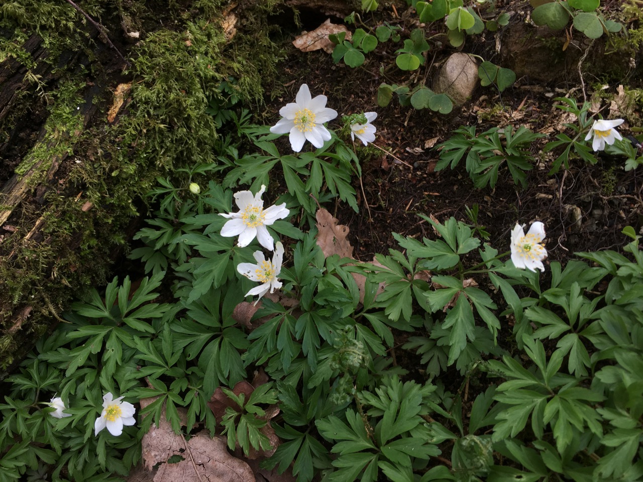
Wood anemone
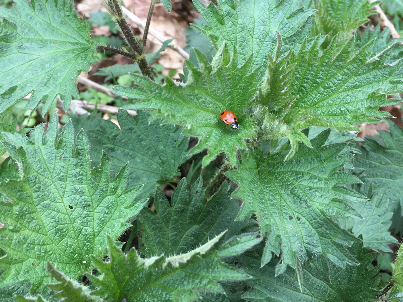
The equinox passed a couple of weeks ago, the air is filled with birdsong, some recognisable (teacher-teacher), some not, and though the broadleaves still stand bare, they have buds aplenty and the ground is carpeted with bright dog’s mercury in flower. Bracken is lifting its curled stems as I presume its ancestors did for hundreds of millions of years before there were any flowering plants.
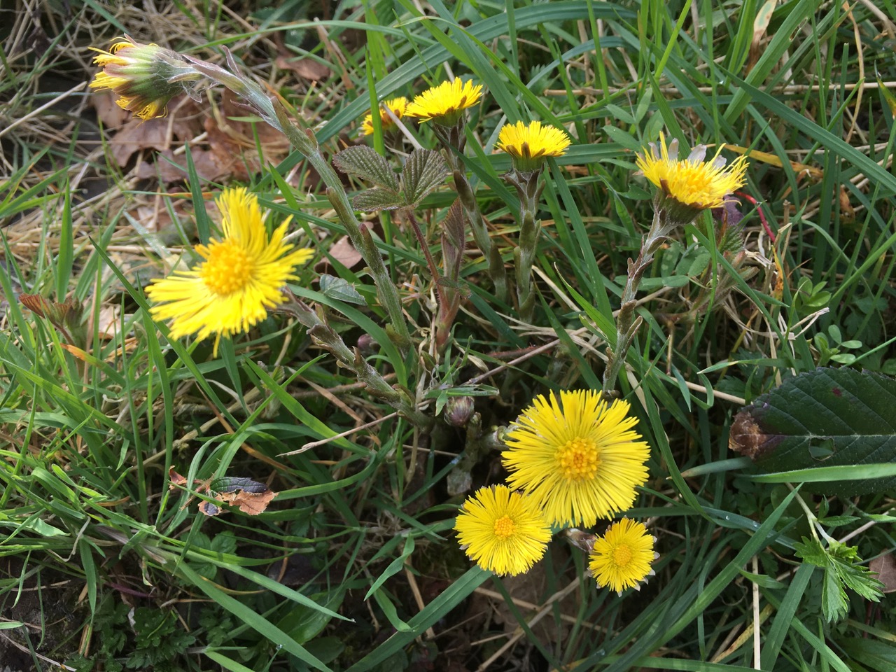
Coltsfoot
Winter’s snowdrops and crocuses have gone, and the daisies and broom are expanding their numbers. The bright green leaves of bluebells mark where the explosion of blue will come in the next weeks, and where I saw just one bluebell a few days ago, now many are lifting their unopened flowers above the ground. The whites of wood anemone and wood sorrel are coming into their best and the first wood avens are in flower. Dandelions are making an effort and some have reached the clock stage already.
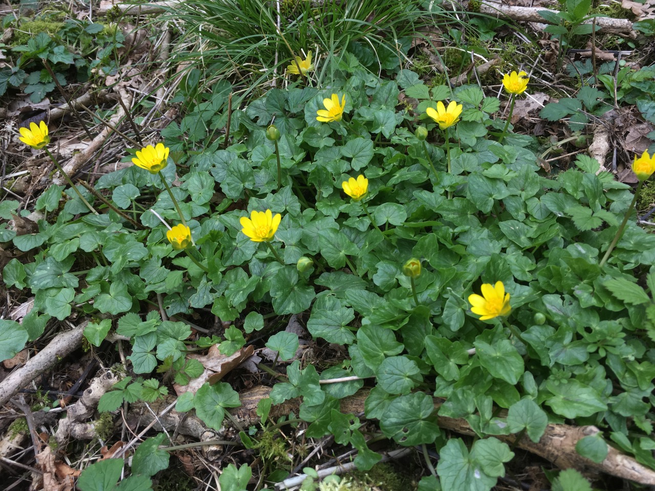
Lesser celandine
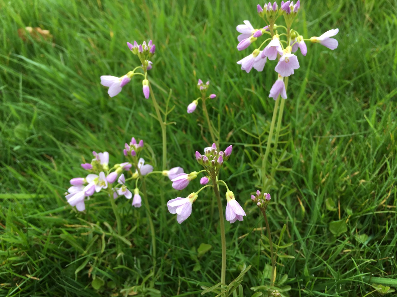
There are the yellows of wild daffodil, lesser celandine, creeping buttercups, golden saxifrage and primrose but the pinks are only just starting, the pink purslane and red campion growing within a few inches of each other. (PS I forgot the hairy bittercress and groundsel)
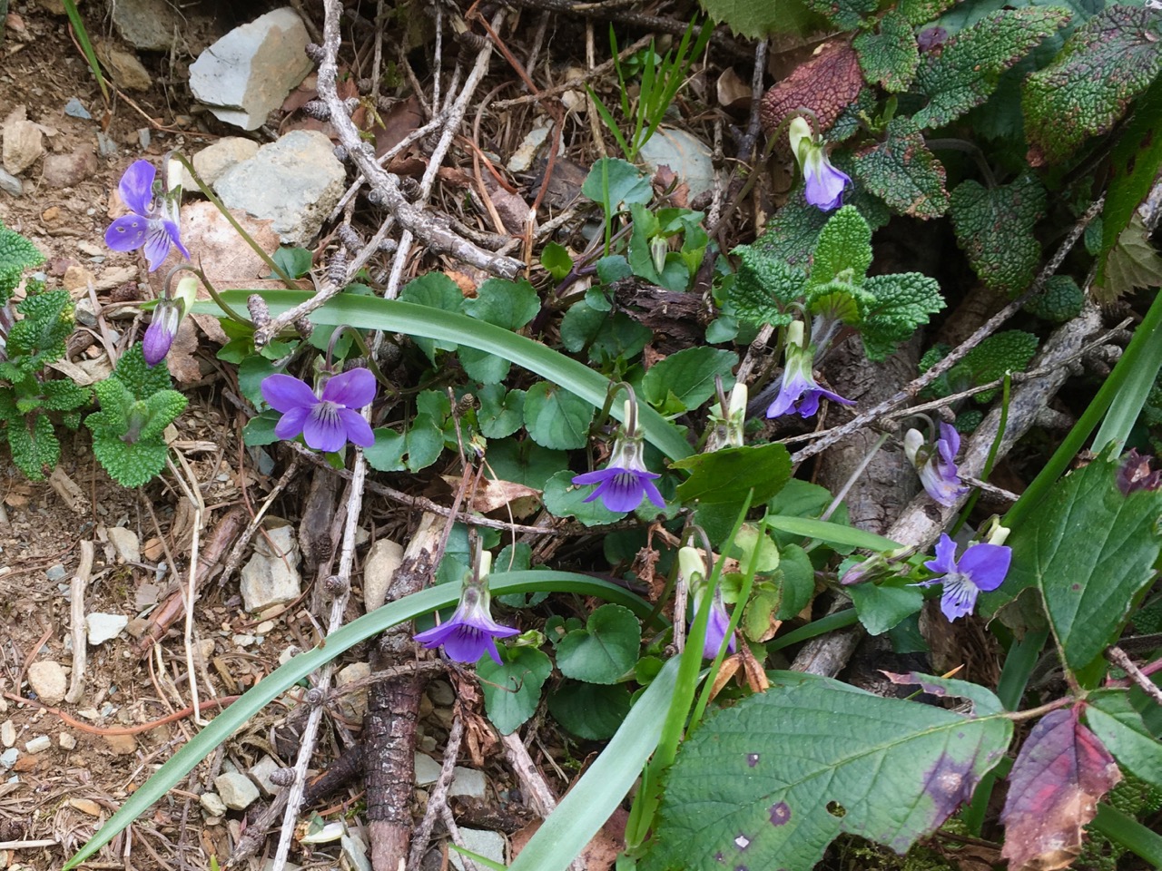
A few days ago I had walked off the path to investigate a hint of purple, to find a few violets. A couple of days later the dog violets are everywhere.

 Keswick-Glenderaterra-Caldew Valley