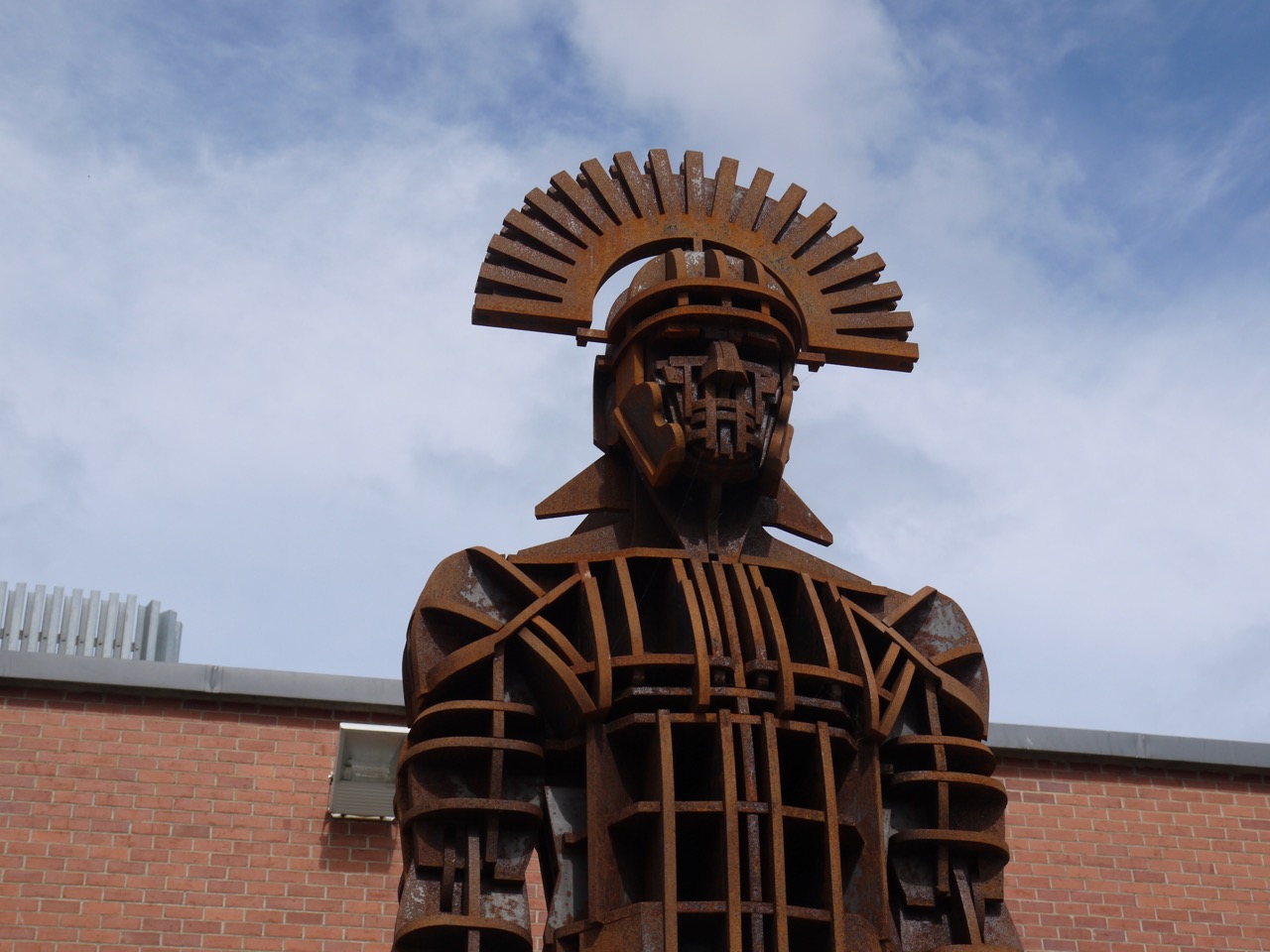
After an unintentional detour, and some uncertainty as to whether I had started the walk in the correct place, the car was parked and i sat looking out at the rain. This was a day for full waterproofs, and what’s more if I were to put on said waterproofs outside I would be wet before I started. Continue reading →
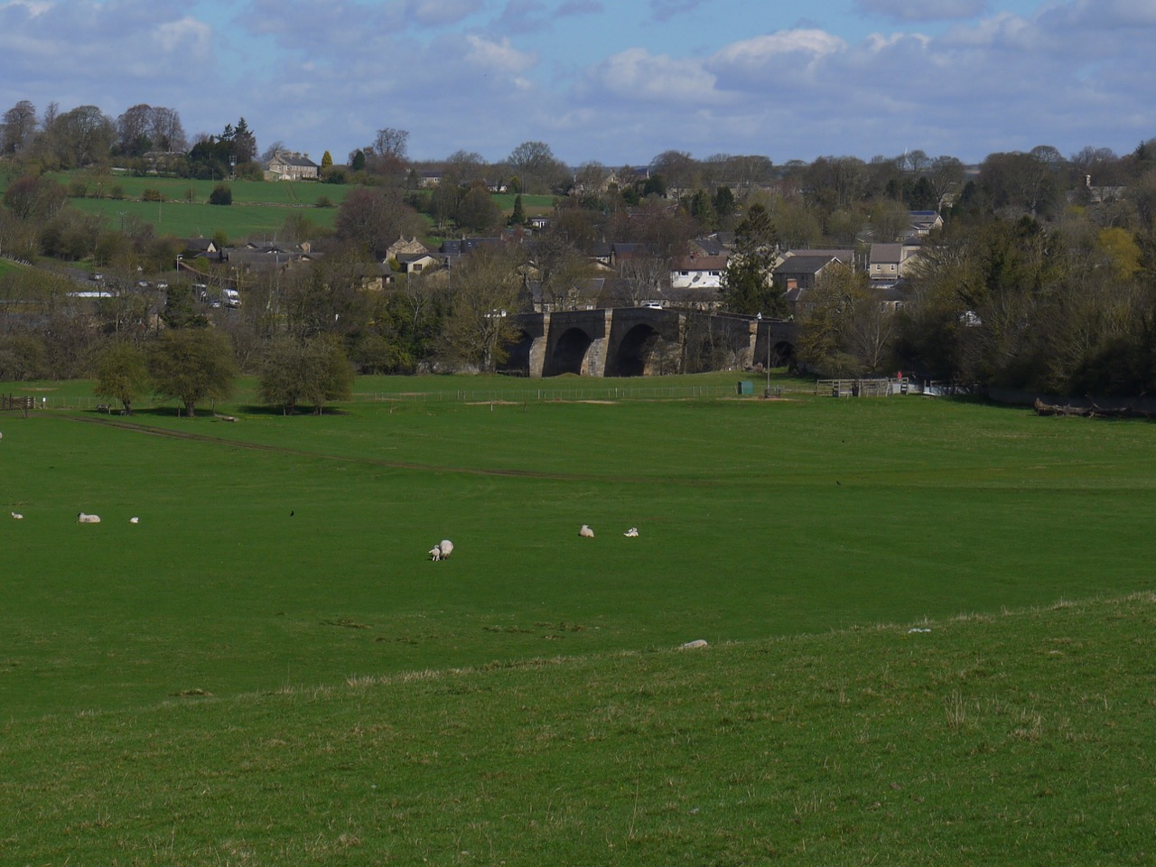
A heron watched us then took flight as we eased our way to the parking spot near Little Cullendoch. This usually has space for a three or four cars, and though it proved a little less accommodating, with a couple of fallen trees lying in it, we were able to squeeze in. We paused to look back towards the Big Water of Fleet viaduct before striding out leaving me to wonder if future archeologists might find remains of that edifice and quite reasonably presume the plaque it wears must bear its name. They will refer to it as “Danger Falling Masonry”.
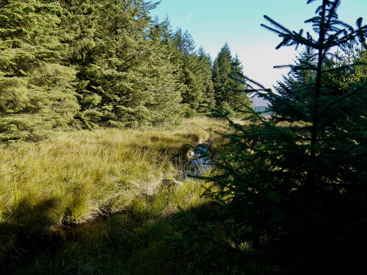
This walk was a gentle climb along forestry tracks. We crossed the Big Water of Fleet at the bridge near Meikle Cullendoch and then left the national cycleway to take the track heading between Dunharberry and Benmeal. This had once been forest but much is now felled and, as yet, fallow.
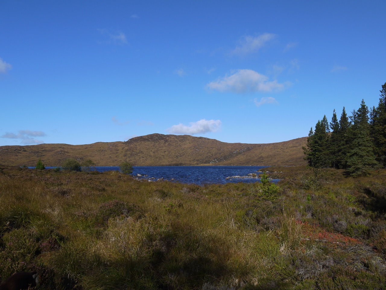
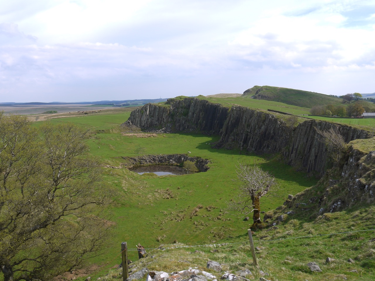
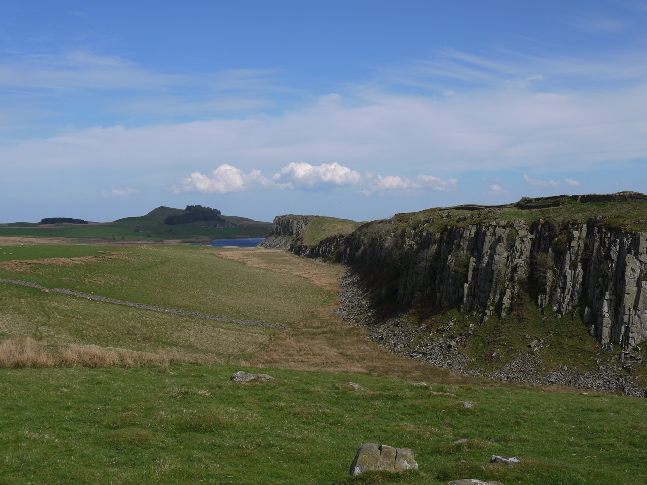
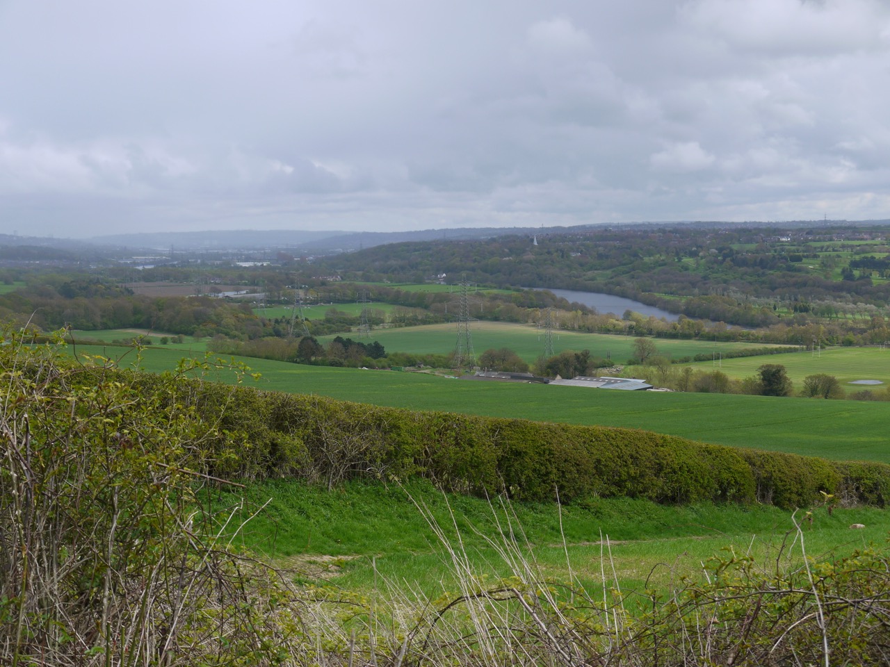
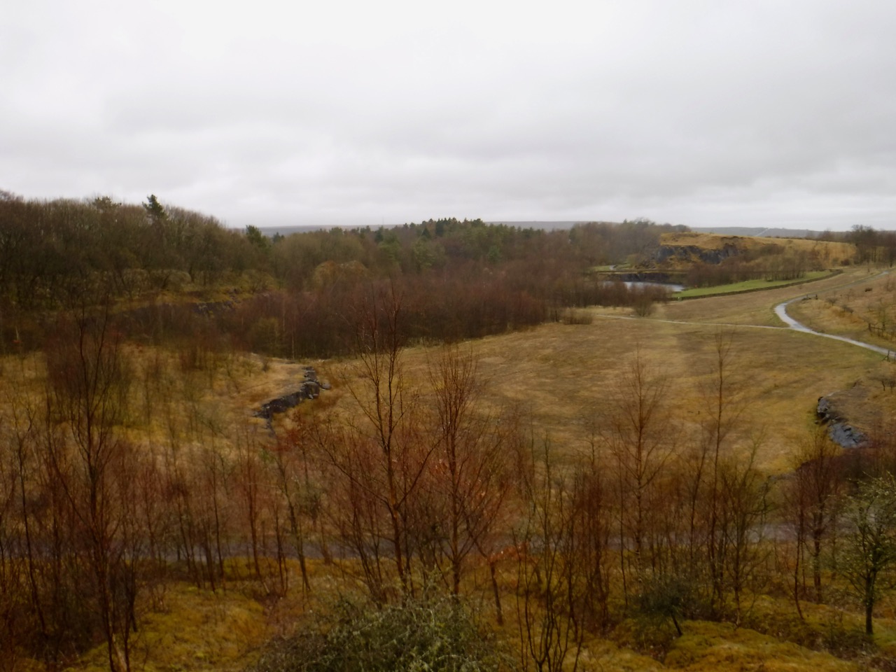
As we gained a little elevation on the SW slopes of Dunharberry the views opened up showing us the long curving ridge of Cairnsmore of Fleet, standing like a giant amphitheatre around an autumnal tinged Cullendoch Moss.
Cairnsmore of Fleet across Cullendoch Moss
I was looking out for Dunharberry but couldn’t see it and presumed it to be a bit of a hump, hidden by the forest, rather than a real hill. Our gentle stroll was interrupted close to Benmeal, the track barred by fallen trees with uninviting terrain either side of the track. We had bog with a mess of recent felling to our left and fallen trees barring the forest, also standing in bog, to our right. Christy made short work of the obstruction but the boggy ground proved unappealing to us humans and we were forced to clamber across nature’s barricade.
Human versus fallen tree
Dog versus fallen tree
Dunharberry, the hill I could not see, might take its name from Cairbre’s fort, dùn Chairbre. There are similarly named hills in Ireland. The name Cairbre is attached to several characters in Irish legend and myth, but I doubt any of these legendary heroes had a fort here. Cairbre (Carberry) was a relatively common Irish name in St Patrick’s time and some common Cairbre might have made a home on the hill in the distant past. Benmeal with its bare rocks reflects its name more directly, beann mael meaning bare hill.
Back on track after our jungle climbing we came to a track junction beneath Benmeal and found some crocosmia growing wild beside the the forest. I merely thought this a little unusual, failing to register “unusual” plus “forest” as a sign of something magical or enchanted. So I did not notice that a subtle spell had ensnared me. After walking past this junction any recollection of its existence was lost to me.
Sundog in the sky, regular dog on the logs
As we walked on I began to be concerned. Recalling that we were to take a right turn at a junction after Meikle Cullendoch (remembered), a right turn (forgotten) south of Benmeal, and a left turn east of Benmeal (taken), I convinced myself that the left turn we were walking westwards south of Benmeal rather than north to its east. Maps were consulted. My brain, enchanted by the crocosmia, Lucifer’s flower, became convinced that Fell of Fleet to our north was actually Benmeal. I ordered a halt and considered retracing our steps. Luckily my companion was in full native scout mode and pointed out that it being near midday our shadows which stretched out before us indicated we were walking north rather than west. The crocosmia enchantment remained strong though and continued to cloud my navigational sense with doubt. It was only once we had come to an unmistakeable zig-zag in the track that I was released from the spell.
Many years ago, human bones were found in the area between Craigwhinnie, Lea Larks and Benmeal. This had led to the area being called the Nick of the Dead Man’s Banes. The book ‘Cols and Passes of the British Isles’ relates that the surveyors in 1848 recorded it as ‘A hollow between Craigwhinnie and Benmeal in which human bones have at different times been found’. Canmore suggests it might have been an ancient burial site. Or perhaps Cairbre allied forth from his fort and defeated an advancing enemy there, leaving their bodies to rot where they fell? Perhaps other readers will wonder that I own a book such as the Cols and passes of the British Isles. But who among us could see such a tome and not wish too have a copy for their own collection? But as usual I digress. That some local would tell the surveyors this name when Queen Victoria was in her twenties and the name would sit on the OS map over the long years that would see Victoria’s great great granddaughter celebrating her own diamond jubilee, and that I would read the name and be drawn to visit the eponymous hollow, must rank as a form of magic.
Sadly though we were able to look across the natural ossuary, we didn’t get to visit it, the path that way being well and truly blocked by fallen trees. We took a track much less used for the final climb up to Loch Fleet. There were several species of mushroom growing on the path and the diminutive Little Water of Fleet tumbled over rocks to our left. The hill named Lea Larks to our left is not a place to see larks but is liath leargs, the grey slope.
Little Water of Fleet
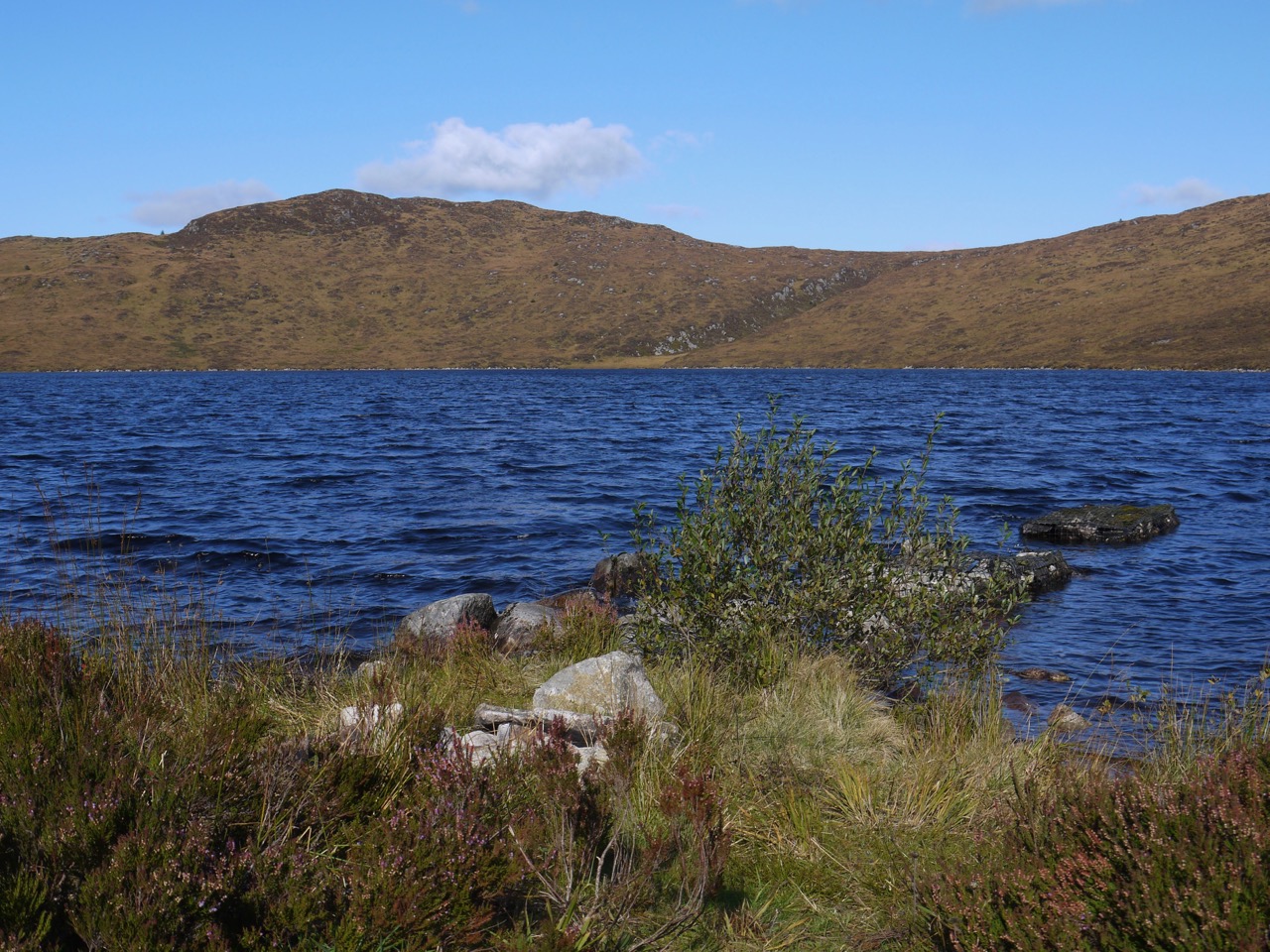
We had one more fallen tree to pass, a scots pine and this we scuttled beneath having taken off our rucksacks and passed them through. Soon enough we came into the hollow in the Fell of Fleet containing Loch Fleet. Photos of the Loch I have seen show a wooden jetty, but that is long gone, just the rocky foundations remaining. Christy jumped in the water but soon scuttled out shaking the water on to us as he passed.
The old jetty
The loch is at 340m and the hill behind it 470m. The terrain is upland moor and I recall climbing Fell of Fleet from Back Hill of Ochars a few years ago and making my way through what I described as a granite strewn bog with areas of standing water. I kept to the track this time. Though the loch side was pretty, and someone else had obviously had a fire there at some time, there was nowhere dry to sit so we turned about to retrace our steps looking for a good lunch spot. the sun had dipped below the tops of the trees in these last few minutes so though we had walked up to the loch, we walked away in shadow and it was noticeably colder.
the way back down on the slopes of Benmeal
At the blocked track to the Nick of the Dead Man’s Banes, I had a go at finding a way around the fallen trees but came to a wide water filled ditch which was essentially a moat where the fallen trees left off. The ossuary will have to wait for another day. Or perhaps the spirits of those whose bones lie in the Nick had induced the forest dryads to cast trees in my path?
I had entertained the faint possibility of crossing the Nick of the Dead Man’s Banes and finding a way over to the other forestry track beside Loch Garroch, but that was not going to be so we headed back the way we had come, mostly in sunshine and with a brief pause for lunch.
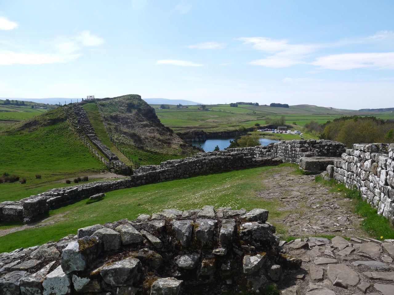
These were our penultimate and final sections of the Hadrian’s Wall Trail, the official trail ending at Segudunum, the alternate, unofficial, finish at Arbeia, and our own extension to make it into a coast to coast walk.
Day IX: Completing the Official Trail
12.9 miles 5h 39m ascent 153m; Newburn to Segedunum
After a few weeks of heatwave unconducive to enjoyable hiking we had chosen a couple of pleasantly warm days, with temperatures of 23° and 26°, a light easterly breeze and sunshine enough to catch me out on the first day and reminded me to use sunscreen the next.
We set out from the the green and monument marking the site of the Battle of Newburn Ford in 1640. The River Tyne must have changed since those days and I wouldn’t want to try fording it here now.
We crossed a wee footbridge over the Reigh Burn and were back on cycleway 72 walking along what would once have been a waggonway. In places we strolled in the shadow of mature trees, while in others the path was surrounded by what I can only think to call urban meadow, with tall grasses and a wealth of wild flowers growing on land that would once have been factories. There was teasel in abundance with yarrow, knapweed, thistle, ragweed, wild parsley and scabious. The route took us by the Tyne Rowing Club with its figurehead of Old Father Tyne, the Boathouse pub (handy for the rowers, but not open for business when we passed), and the suburb of Lemington where an information board with old photos showed us just how industrial the area had once been.
The A1 is quite an obstacle for the HW walkers trail and cycleway, but the trail copes by leaving the old waggonway at Neptune Road, heading through the parkland of Bell’s Close and crossing the Great North Road by way of a footbridge. This took us into Denton Dene which isn’t so much a narrow wooded valley as its name suggests but a series of football pitches with youngsters’ teams giving us our first sight of a Newcastle Football top in its native land. Surprisingly this was one of only three we were to see in two days walking through Newcastle. Whereas I saw nine actual (corvid) magpies in that time. Depending on which rhyme I read I am either looking forward to a kiss or meeting the Devil himself.
One for sorrow,
Two for joy,
Three for a girl,
Four for a boy,
Five for silver,
Six for gold,
Seven for a secret,
Never to be told.
Eight for a wish,
Nine for a kiss,
Ten a surprise you should be careful not to miss
Eleven for health
Twelve for wealth
Thirteen beware it’s the devil himself.
Or
One’s sorrow,
Two’s mirth,
Three’s a wedding,
Four’s a birth,
Five’s a christening,
Six a dearth,
Seven’s heaven,
Eight is hell,
And nine’s the devil his own sel’.
Oh dear! I looked up Devil’s kiss in urban dictionary. That’s given me a shudder.
To be fair I think these refer to total numbers seen at the same time, in which case I was to expect joy or mirth. Both were to come at the end of day one, as you will hear.
The trail dumped us onto Denton Road and we turned back towards the river, passing the rather intriguingly named “Da’Wah Invitation Restaurant”. This left us mulling over whether locals sit in their homes waiting for an invitation, and whether this would be a good business model. A little Google Fu enlightened me, Da’Wah means invitation in Arabic.
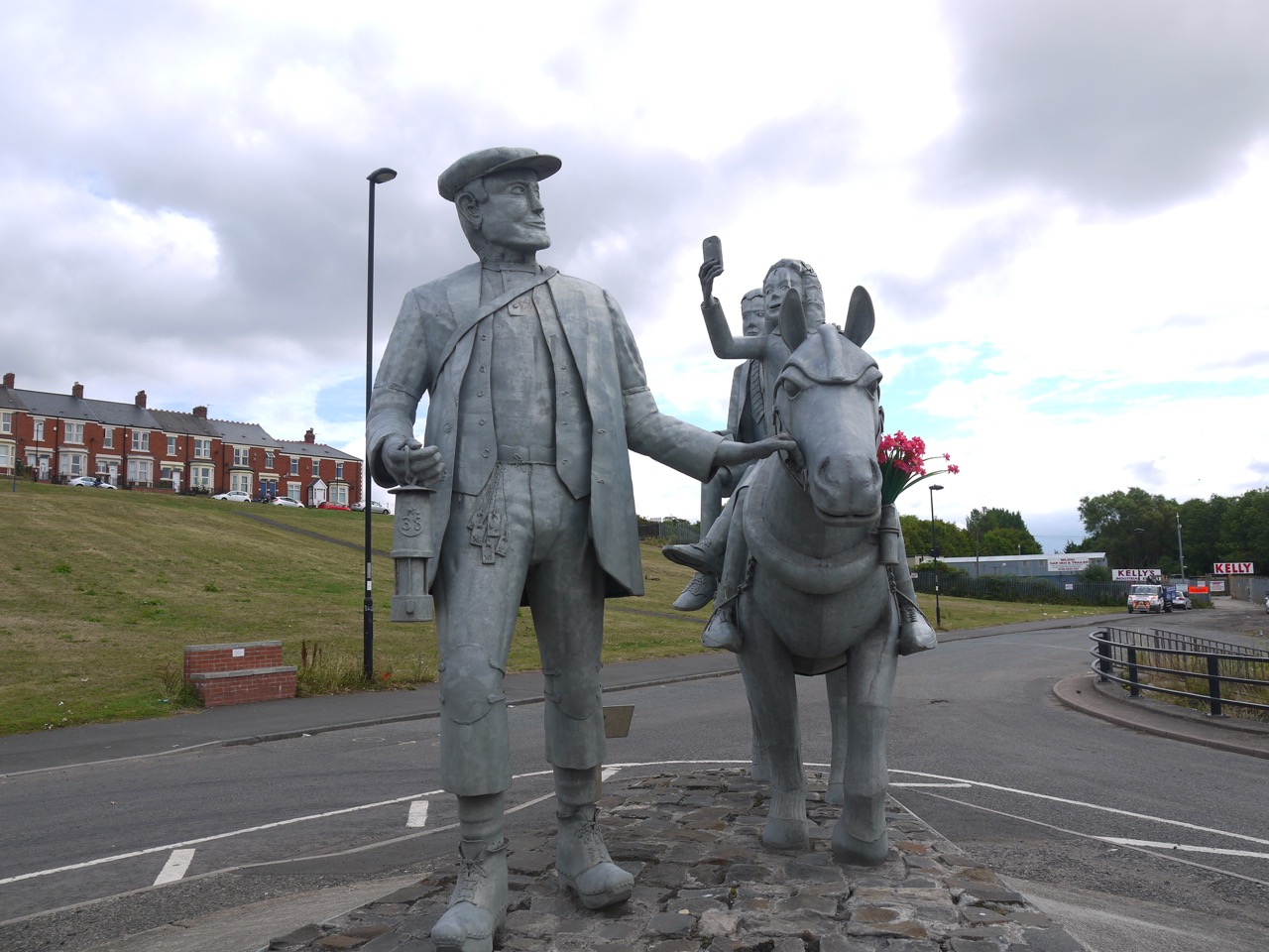
Our musings on invitation-only dining were brought to an end when we noticed a statue by the next road junction. A man in old-fashioned working man’s attire led a pony ridden by a boy who from a distance looked like Pinocchio and a girl lifting a mobile phone as if to take a selfie.
A nearby plaque informed us that this was:
In memory of the 38 mean and boys who tragically lost their lives in the Montagu View Pit Disaster on 30th March 1925, when an inrush of water from a burst seam flooded the mine shaft. The pit finally closed on 13th November 1959.
The pitman, pony and tank depict our past heritage. The house represents the regeneration of our community. The children are our future.
The sculpture was made by Exceptional designs.
In Remembrance of Men of Steel.
I pondered on the tank and the house. Where were they? I found the house in the boy’s right hand and I presume the tank is what they they are standing on. The lamp the miner carries is inscribed No.38 representing those who died and I only noticed when looking at my photos that there are flowers in the pony’s bridle. Reading the sculpter’s website, the piece is said to show a miner on his day off taking his children to the Blaydon Races, so recalling happier days. Why does the girl have a mobile phone?
The HW trail rejoined the old waggonway and took us through more post-industrial urban meadows to Paradise, and as the song Blaydon Races says “Noo when we gat to Paradise thor wes bonny gam begun“. Walking on the HW trail one would not have noticed Paradise were it not for road signs and the Paradise Gardens are long since gone. I found a modern version of Blaydon Races’ lyrics which contrasts the emotions in passing through Paradise then with those of today (or ten years ago).
We went further on the journey
But before the bridge was crossed
We tried to visit Paradise
But Paradise was lost
The pubs ‘n’ clubs the shops ‘n’ aal
The streets the bairns had played in
It’s like the middle o’ neewhere
When you’re on the road to Blaydon
That said Newcastle does seem to be regenerating, new growth spreading over the lost industrial landscape, especially around the quayside.
For the first time on the trail we had a walk along a length of a major road. The pavement of the A695 perhaps allowed us to clear our minds for the next section which followed the old quayside. The sound of traffic is not new to me, but it washed through my mind, the weeds of the roadside adding a little colour to the grey of road and paving. I took a deep sniff hoping to notice the flora amidst the cars and lorries and found myself nothing a different smell. My mind immediately said “petrol” but then corrected itself to “like petrol but sweeter”. Neither Audrey nor I could place it, but when we turned off the road and passed a sign proclaiming “JP Ltd Asphalt Plant” we knew the smell.
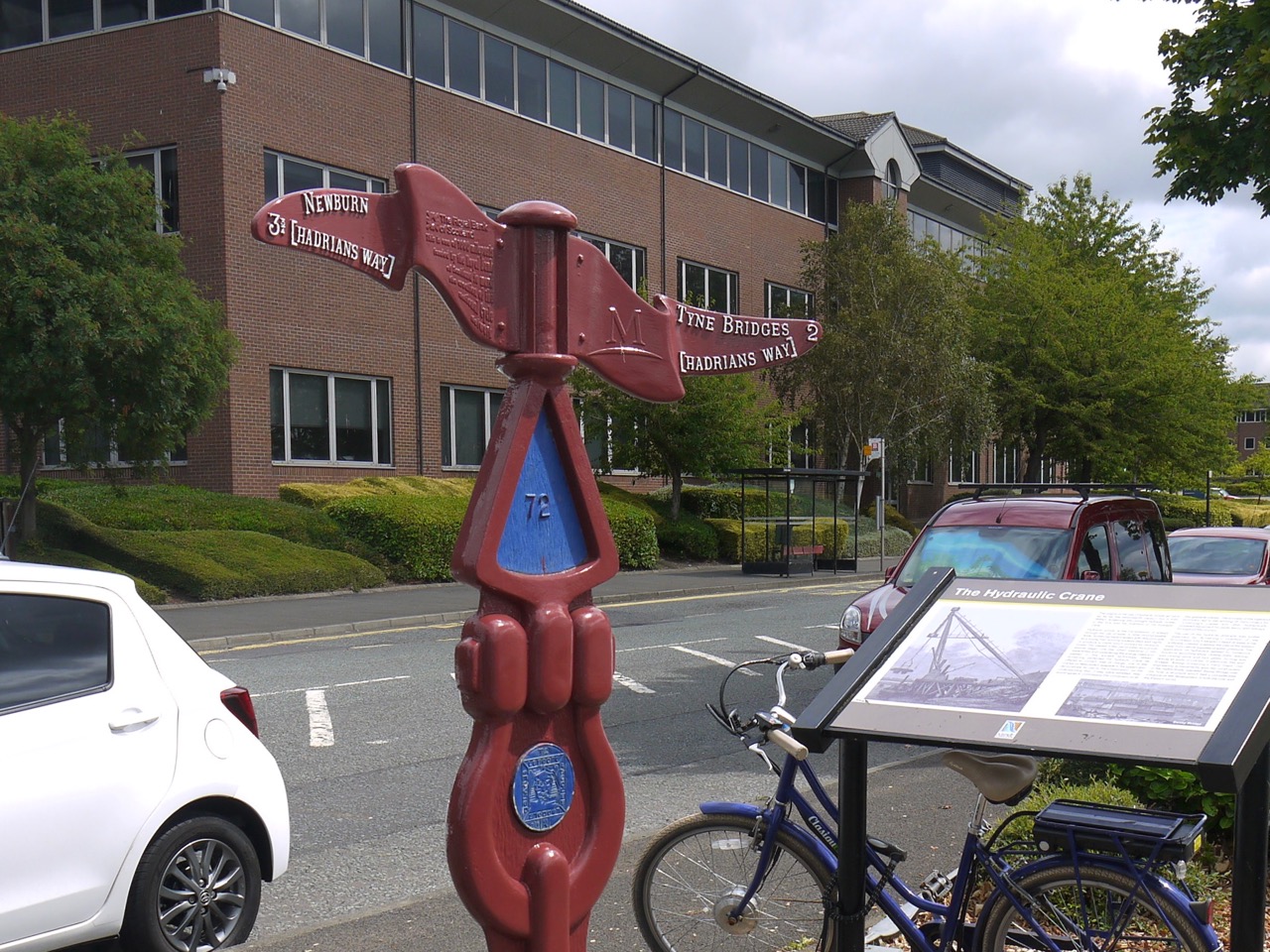
Two miles to the Tyne Bridges
The Quayside has been renewed, old piers have been repaired repainted and now sport artwork and anglers, the footpaths are decorated with a variety of art, millennium cycleway signs and information boards describing the industrial heritage of the area. Apparently almost all the warships involved in the 1905 Russo-Japanese war were built here (which you may interpret as good or ill as you see fit).
Sculpture by David McMillan 1990.
This piece looked like waves to me but it is said to represent the undulations of the Northumberland hills.
Armstrong’s Arches
The Armstrong works which once covered 230 acres would have dominated this part of the riverside are gone, replaced by new businesses, expensive dwellings, statues and recreation spaces. These arches are all that remains of the Armstrong Works.
Elswick Pier
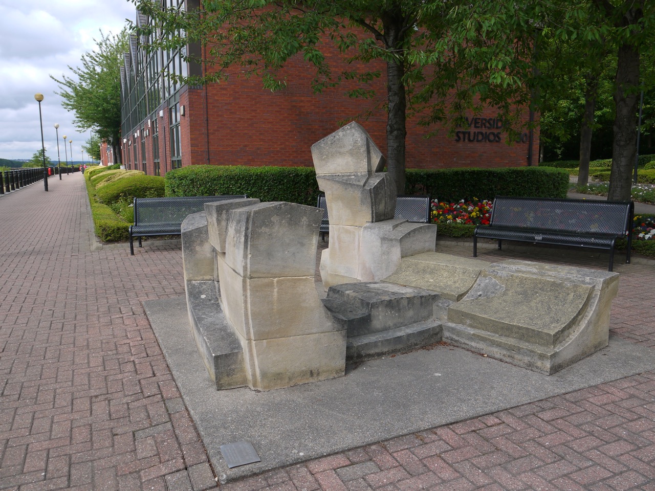
Lintzford. Nick Lloyd 1990.
Lintzford is constructed from Ancaster hard white limestone. The title refers to the place in the Derwent Valley where the artist lives and works. The work looks as if it is made up of the remains of a building.but the artist describes the work as portraying the countryside of Northumberland and Durham.
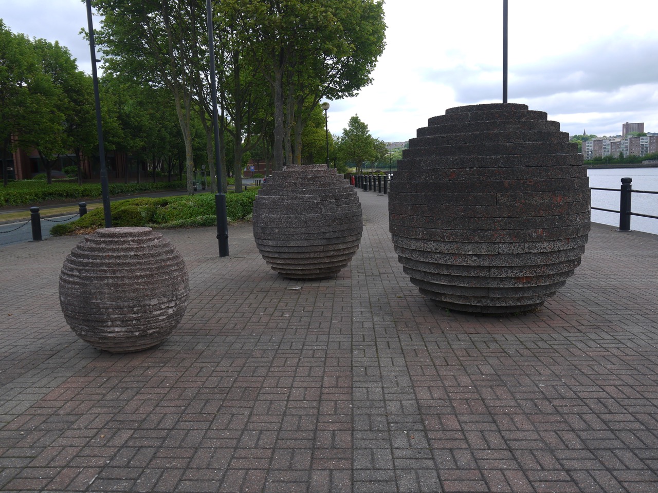
Spheres by Richard Cole
There are several giant spheres made up of concrete rings of varying sizes at three different places along the walkway.
I hadn’t noticed we were in blue and pink
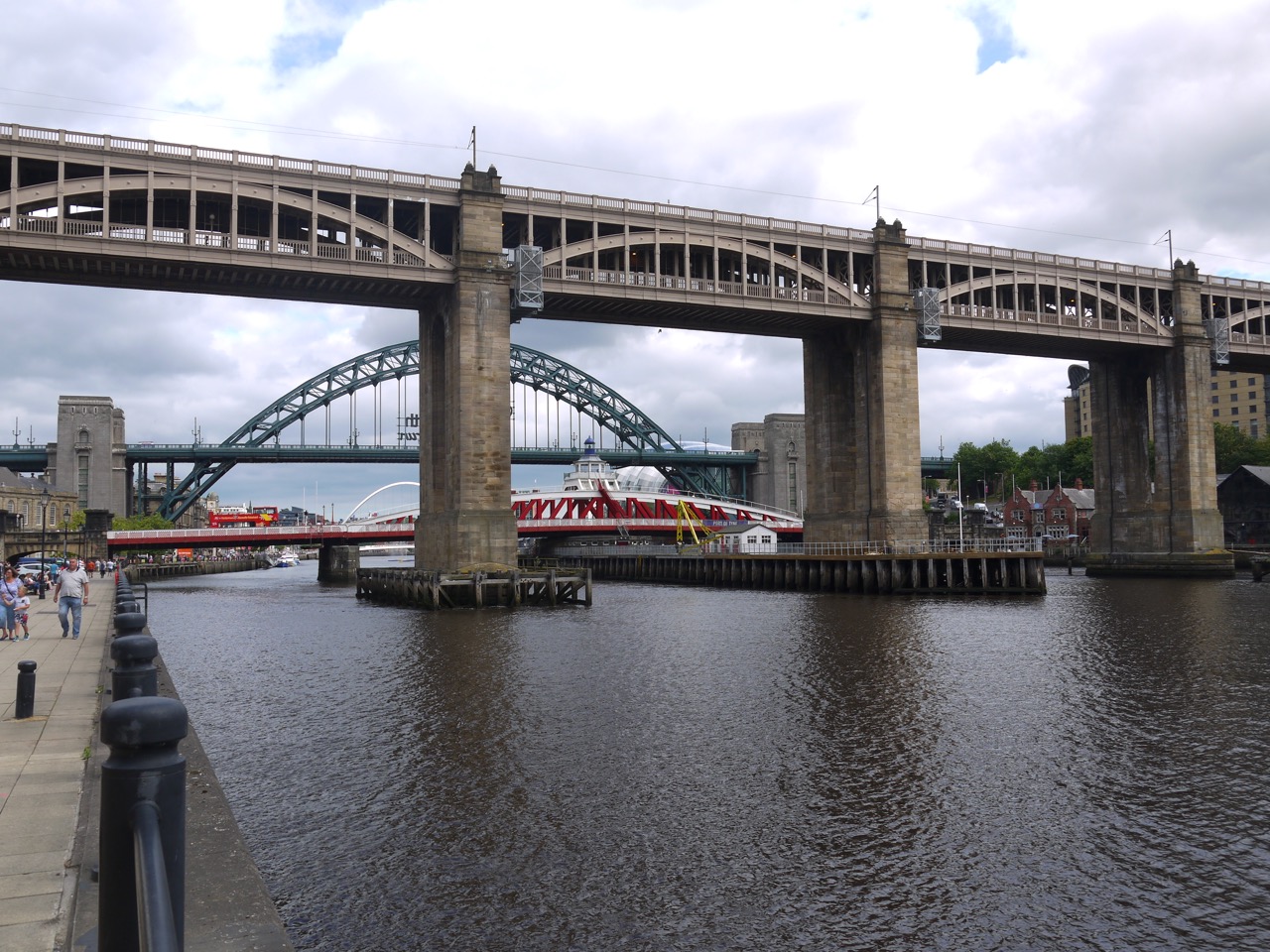
We made use of the seats here to have a rest, take a selfie and look across the river. We could see the Angel of the North on the distance and the Tyne bridges, which in my mind marked Newcastle proper, a little further downriver. Once we reached the bridges we found Newcastle’s quayside busy with people walking, resting and filling the seats outside pubs and cafés. A real promenade.
Tyne Bridges
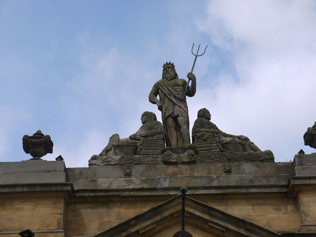
The city has several bridges squeezed close together. (Edit: autocorrect tried to make that into “togither”. It must be turning Geordie). The old Fish Market, topped with a statue of Neptune himself, had obviously changed its purpose, since it sported a neon sign “Hot Tramp I Love You So” and was surrounded by teenage girls in going out gear (not quite party gear but not just everyday gear). Perhaps they saw themselves as Rebel Rebels.
The Fish Market’s Neptune
Wow. I just looked it up. That song was released 44 years ago.I pause, and look up, my mind wandering, the world becoming monochrome. The cadence of my rocking chair slows, disturbing the old hound who lifts his head, looks at me with milky eyes and sniffs the air. I murmur “don’t worry boy, that was long ago. The diamond dog will be as grey as me and his joints stiffer than yours.” He rests his head back down and I turn my gaze back to the laptop as the nostalgia passes and colour refills my perceptions.
Bringing me back to earth, my laptop shows me that the Fish Market is now described as “a high class ale house for the booze sodden partygoers that make the nightly pilgrimage to this centre of revelry.” There’s a sentence fit to spawn an entire sociology lecture.
By now we were looking for a place to sit and eat our sandwiches, but Newcastle seems to have taken a decision to only provide public seats without backs. We soft north-westerners searched for an elusive backed-bench, but had to make do with a low wall topped with a wrought iron fence (against which we could rest our weary backs).
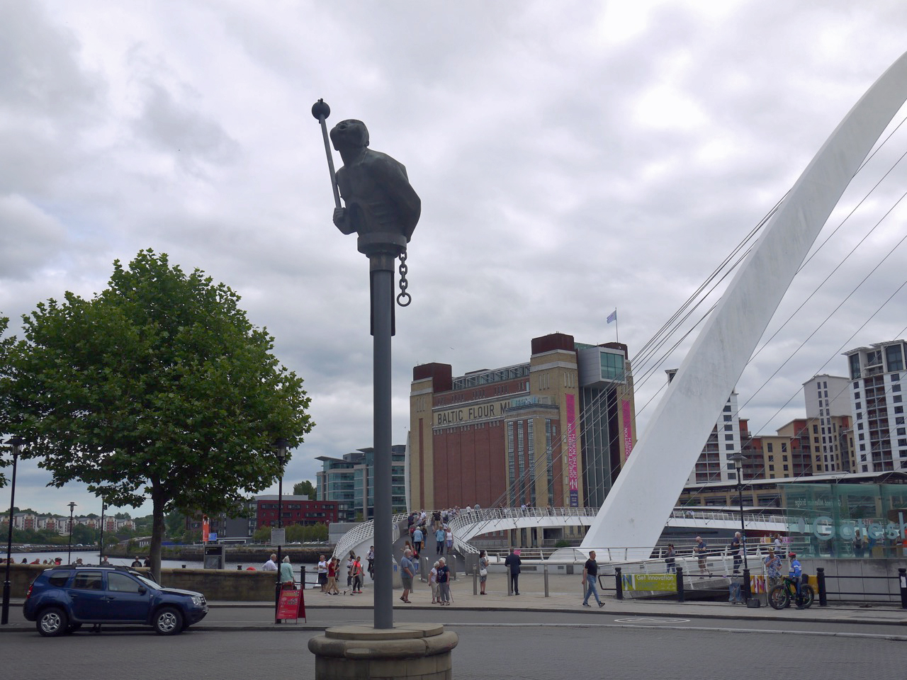
River God
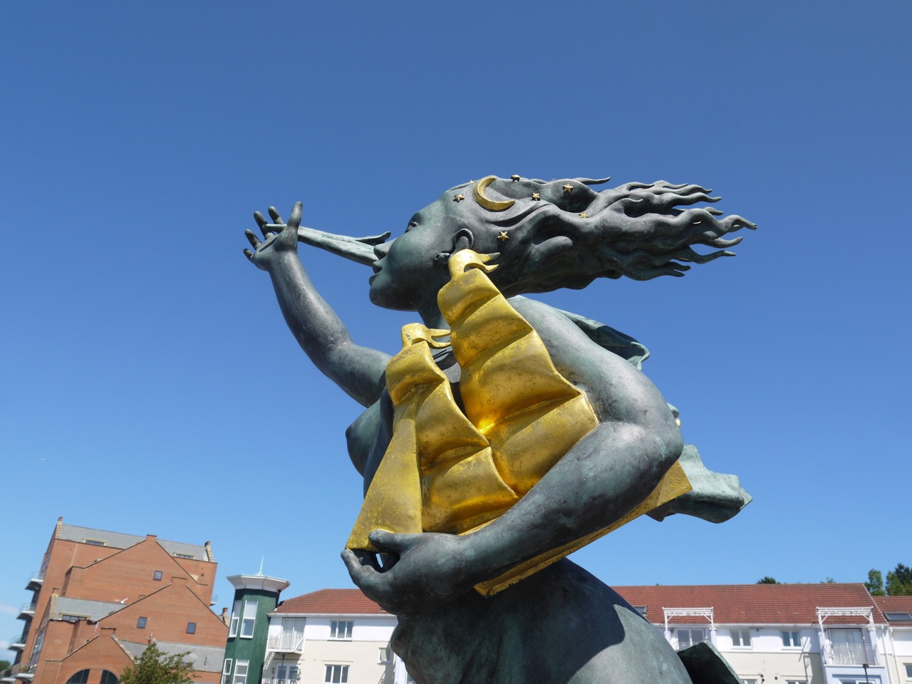
I sat eating my ham and mustard sandwich on Sandgate, the Millennium bridge framing the Baltic Flour Building, a busker singing the works of Dire Straits and a bronze figure, The River God, looming above me. The River god, atop a steel column, holds a mace and chain and appears to be blowing at the Siren, another statue.
Siren
The Siren had her effect on me. I climbed the steps to reach her (for a photo) and while there a local woman, identified as such by her accent, mumbled about her husband being back where we had come from. At first I thought she was talking about her own husband but she meant the Siren’s husband, the River God.
The wall beneath the Siren was inscribed:
As Aa cam thro Sandgit
A hard a lassie sing
Weel may the keel row
That ma laddie’s in
This is a traditional song Keel Row. It is not a poem by Kipling as several internet sites claim – presumably someone has made a mistake and others have copied it. Audrey recognised it and broke into song, but I had not heard of the song. It certainly wasn’t one of the traditional songs such as “The big ship sails through the Alley Alley O” that I sang at primary school. I did intend linking to a version of Keel Row but boy do the recorded versions sound dire.
So after a brief chat about sirens and school songs we set off along the quayside once more. There were several more art installations each of which I paused to contemplate, and one that I thought was a corporate logo for a hotel, and ignored. What does that say about my appreciation of art? (Authorial intent does not art make…repeat one hundred times).
Rudder – Andrew Burton (1996)
Blacksmith’s Needle (1996)
This needle has six sections each relating to one of the six senses.
Swirl Pavilion (Raf Fulcher 1998)
This is described as a folly for the Quayside. It has the names of destinations carved around the inner rim, which the artist found on a faded sign for a local shipping company. The Swirl takes its name from is a hidden stream that joins the Tyne nearby.
?
I’m not sure what to make of this fish
As we had strolled along the quayside promenade at Elswick, a walker resting on a bench called to us asking if we were on the Hadrian’s Wall Trail. when we admitted we were he said he had begun just that day and warned us that the way ahead was industrial. After the nnnamed fish statue we crossed the Ouse Burn and left the regenerated quayside and passed into an post-industrial landscape of concrete, where sharp topped fences surrounded abandoned and neglected plots of land and To Let signs provided the brightest colours. Even the pavements were overgrown.
Beyond the Ouse Burn
And then amid the dire colours was an oasis of colour and regeneration at St Peter’s Marina.
St Peter’s Marina
The HW trail then took us back to the riverside towards St Anthony’s Point, passing a small shipwreck in the tidal mud and more artwork (its artistic effect unsullied by knowledge of authorial intent).
Artwork at Walker Riverside
As we walked we looked across the river to a large factory each of us trying to read the name on its sign. It eventually revealed itself as AKZO Nobel, a manufacturer of paints and coatings and not explosives as I had guessed from the name.
The final mile to Segudunum was along a cycleway between houses to our left and what were once shipyards to our right. As we walked we mused on how we would mark the end of the official Hadrian’s Wall Trail. We agreed photos would be in order, and given the temperature we decided that ice-cream would be our “champagne”.
Joy at reaching Segudunum
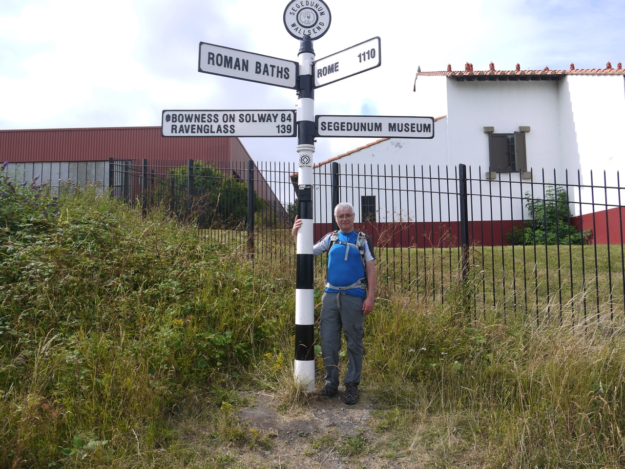
Segudunum has a rather imposing, and somewhat out of character tower, which from a distance I had presumed was some sort of coastguard building. We knew we had reached the fort when we found the signpost.
Statue at Segudunum
After that we walked into the fort museum ready for our ice-creams. I mentioned to the lady on reception that we had walked for 12 miles in the sun and were now ready for ice-cream. Her face fell a little and she told us they had no ice-cream. Inwardly I sighed thinking I had been looking forward to ice-cream but I could make do with an ice-lolly. Then the truth hit home as she told us that the Café wasn’t open. She obviously saw our disappointment and offered to make us a cup of tea, but we didn’t think that was what we needed.
We headed across the road to ASDA and got our celebratory ice creams there. It wasn’t funny then, but it is now (mirth).
Segudunum marks the end of the official Hadrian’s Wall trail which is listed as 84 miles, and the wall itself was 73 miles long. We had clocked up 86 miles getting from Bowness at the start of the trail to here, but had already decided to carry on our trek to Arbeia fort in South Shields, and then on to the coast, so we returned to Newcastle for R&R before the final day’s walk.
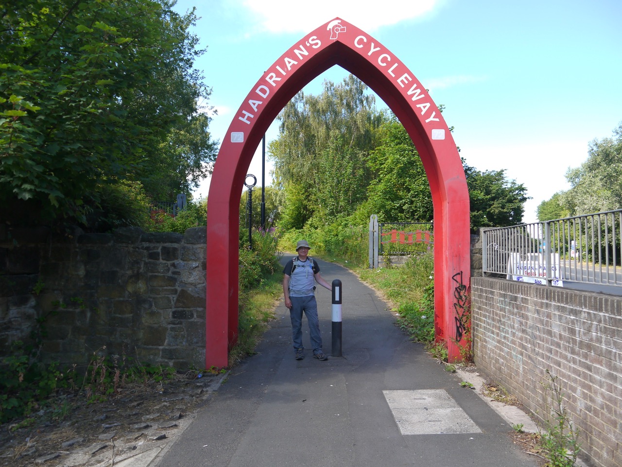
Our second day proved hotter than the first, with more blue sky than cloud, and sharp shadows dogging our steps. Having learnt from the previous day I applied sunscreen at Segedunum Fort, quod praesidio sine glacies crepito, then strode east along Hadrian’s cycleway through a post industrial landscape between old shipyards and corrugated fences. The end of this part of the cycleway was marked by an arch, painted to blend subtlety into its surroundings. Our route was the No.72 national cycleway and it was signs for that route that would guide our way through the day.
The Hadrian’s Wall Hotel once stood here
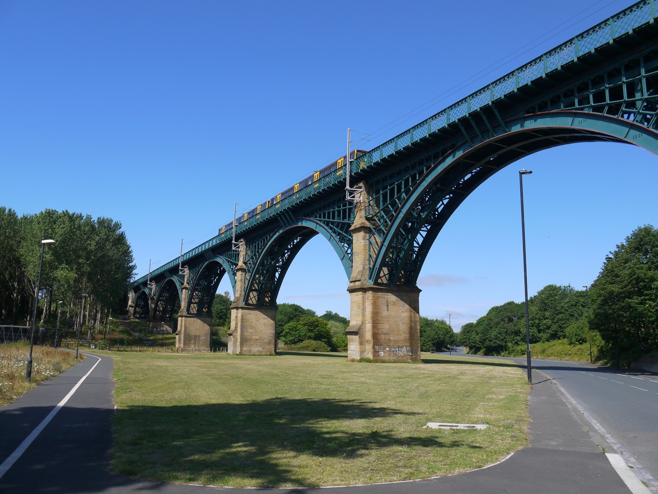
After Hadrian’s Cycleway we stepped onto Hadrian’s Road for a few hundred metres then left the road to cross Willington Gut by footbridge. The impressive viaduct looked newly painted and as we stood admiring the structure a local chap asked if we had seen the date stone on the viaduct. Since we had not he told us where to find it. He told us the viaduct dated from 1839 (as the stone inscription said) and then asked if we knew how old the footbridge we had crossed was. Eight years he told us, chortling. Info on the net says it was designed by John and Benjamin Green who were also responsible for Grey’s Monument and the Theatre Royal in Newcastle. The viaduct was originally built in wood and stone, the present ironworks added in the 1860s. It now carries the Tyne and Wear Metro line.
Willington Dene Viaduct
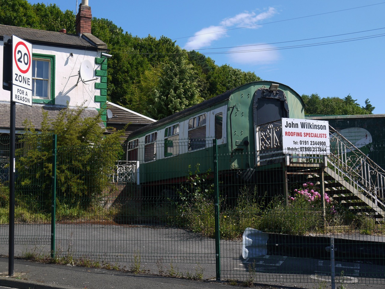
From the viaduct we headed along Western Road, past the derelict Bogie Chain pub, with a railway carriage built into it, and on to the Old Albion Inn. I liked the road speed sign that emphasised the speed limit was “for a reason” but didn’t tell us what.
We then reached a route conundrum and wandered about for a few minutes trying to find our way. The map and a cycleway sign suggested a particular direction but there did not appear to be a way through. Just a factory.
With a reason
There is in fact a path but its entrance was hidden by branches and overgrown hedgerows. This took us to a Coronation Street type road then through more industrial meadows, across the A19 on a footbridge near the Tyne tunnel tolls, and on to a cycleway beside a dual carriageway.
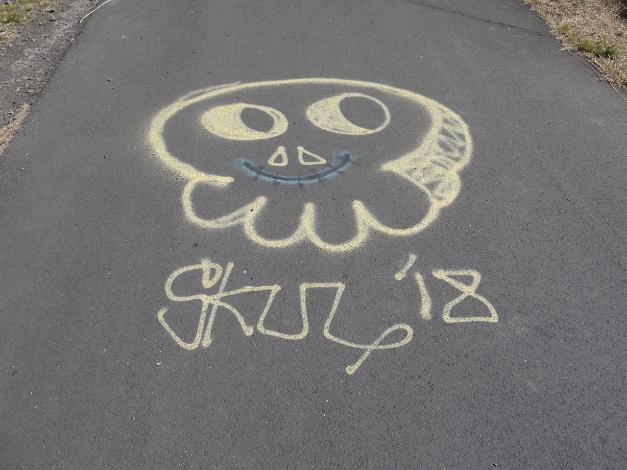
We saw a number of repeated graffiti tags, the name Rogers, unadorned with drawing and the more artistic one below.
Tag on the footpath
The A19 proved to be a border between a neighbourhood in the Autumn of its economic existence, where land abandoned by industry was being steadily reclaimed by nature and another in its economic Spring with newly built roads, modern buildings and parkland. Each area has its own aesthetic.
We could see the slides of Wet ‘n’ Wild, and as tempting as it might have been in that heat to cool off there, we still had miles to go (more than we thought) and neither of us had thought to bring a swimming costume.
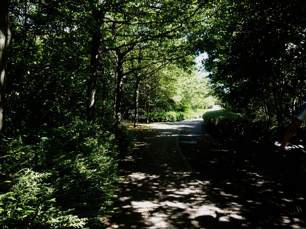
Path into Redburn Dene
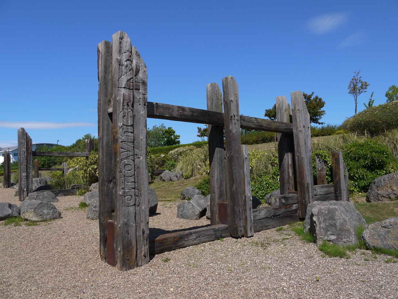
There is a landscaped park at Redburn Dene. A quite unexpected find. Reclaimed Groynes stand beside the path and a henge atop a low hill (perhaps just a grassy knoll).
Groynes
I recognised these as groynes when we came to them and was pleased to find I was correct on finding the name written on them. It is a testament to serendipity that I should come across such a construction so soon after learning about groynes, and their use in preventing coastal erosion, during an impromptu tutorial from a civil engineer at my son’s stag party. And let that be a lesson to you all. Don’t mix alcoholic drinks and civil engineers.
Henge overlooking Redburn Dene
The henge affords excellent views of the Tyne and the nearby Marina. Within the henge itself is a mosaic of the British Isles made with pebbles.
At this point we both thought that we were almost at the ferry, a belief that had been supported by the various signs we had passed each suggesting a gradually lessening distance to said ferry. So we were surprised on reaching the Marina to find a sign informing us we were still two and bit miles from the foot ferry.
I saw Audrey pass through the five stages of loss: denial (“it can’t be two more miles, the sign two miles back said two miles”), anger (facial expression became a scowl), bargaining (did not help), depression ( “Oh Hell”) and then acceptance. I think I skipped straight to acceptance when I had looked at the map and realised the signs we had seen earlier had been for the vehicle ferries.
Just to rub salt into our open (psychological) wounds, the road we should have walked along was closed and the poorly signed diversion added both a little extra distance and some unnecessary backtracking. But at least we could look forward to refreshments and amenities (toilets) at the ferry terminal.
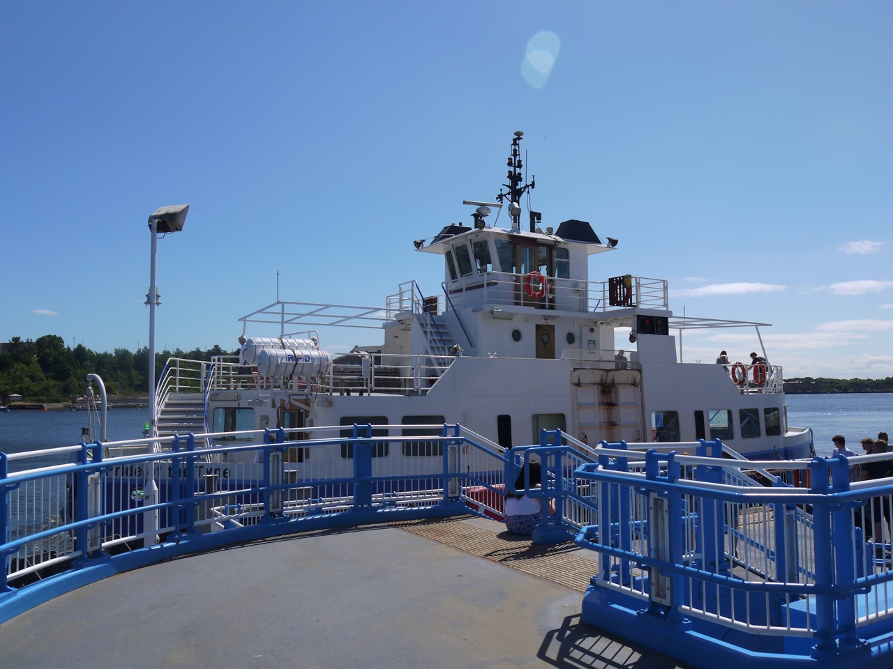
Tyne ferry -Pride of the Tyne
With regard to the refreshments and amenities, we were at least well versed in denial, anger, bargaining, depression and were able to move quickly to acceptance that we would not be enjoying these.
We had a 15 minute wait for the ferry and a chance to have a seat for the journey across to South Shields. The shorefront here has newish apartment buildings either overlooking the river or overlooking water filled pools that were once docks I imagine.
Spirit of South Shields – by Irene Brown
This wee girl ‘The Spirit of South Shields’ stands on the shorefront, a protector guiding ships through the seas safely, holding a sailing ship in one arm while raising the other in greeting. She stands on a plinth which shows a contour map of South Shields with several local features: the Groyne, Arbeia Fort, the Old Town Hall and Westoe Colliery.
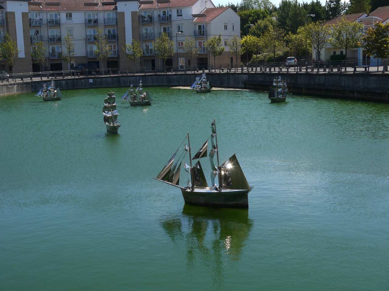
The Fleet
Nearby, one of the enclosed pools of water has these steel ships, an installation by Irene Brown. “The Fleet” is made up of seven Collier Brigs floating in an old dry dock. They are said to give the impression of a fleet heading out to sea, but they each seem to heading in their own direction.
I stopped to look at a road name “Comical Corner” and a local couple told us that it was so called because the South Shields sea cadets building here used to be a theatre where comedies were performed. They also told us that this is where the original ferry landing had been which is directly opposite the Ferry terminal we had left on the river’s opposite bank.
At little googling suggests another explanation for the name Comical Corner, that ships would often misjudge the bend in the river here. I prefer the theatre story but can’t verify either. While researching it though I did come across this titbit:
May 27 1856. A woman, living at Comical-corner, South Shields, was cleaning a haddock for dinner, when she found a pair of gold ear-rings in the intestines of the fish. (from Historical Register of Remarkable events …. Newcastle 1833-1866 by T Fordyce. Which sounds like the sort of book Arthur Bryant would have on his bookshelf. He was reading “Diseases and Treatments of Congolese Tribal Elders 1870–1914” in Strange Tide, the last Bryant and May book I read.)
Arbeia
From Comical Corner we walked a little further along the road then climbed several flights of steps up to The Lawe, and Arbeia Fort. Arbeia is said to be a Latinised form of the Aramaic for ‘the place of the Arabs’, because the last known unit stationed there was a company of bargemen from the region around the mouth of the Tigris. But its strange that its name reflects the last garrison there. Others think Arbeia might mean ‘the stream where wild turnips grow’, but that seems an awfully large amount of information in a word with six letters.
An inscription on a stone at the fort reads:
To the gods the Preservers for the welfare of the Emperor Caesar Marcus Aurelius Antoninus Augustus, Most Great Conqueror of Britain, [and of the Emperor Caesar Publius Septimius Geta Augustus, conqueror of Britain], the military unit at Lugudunum paid it vow for their safe return.
Perhaps Lugudunum was its real name, perhaps the locals started calling it the Arab Fort when the Mesopotamian marine unit was there. There is also a suggestion that it was called Horrea Classis.
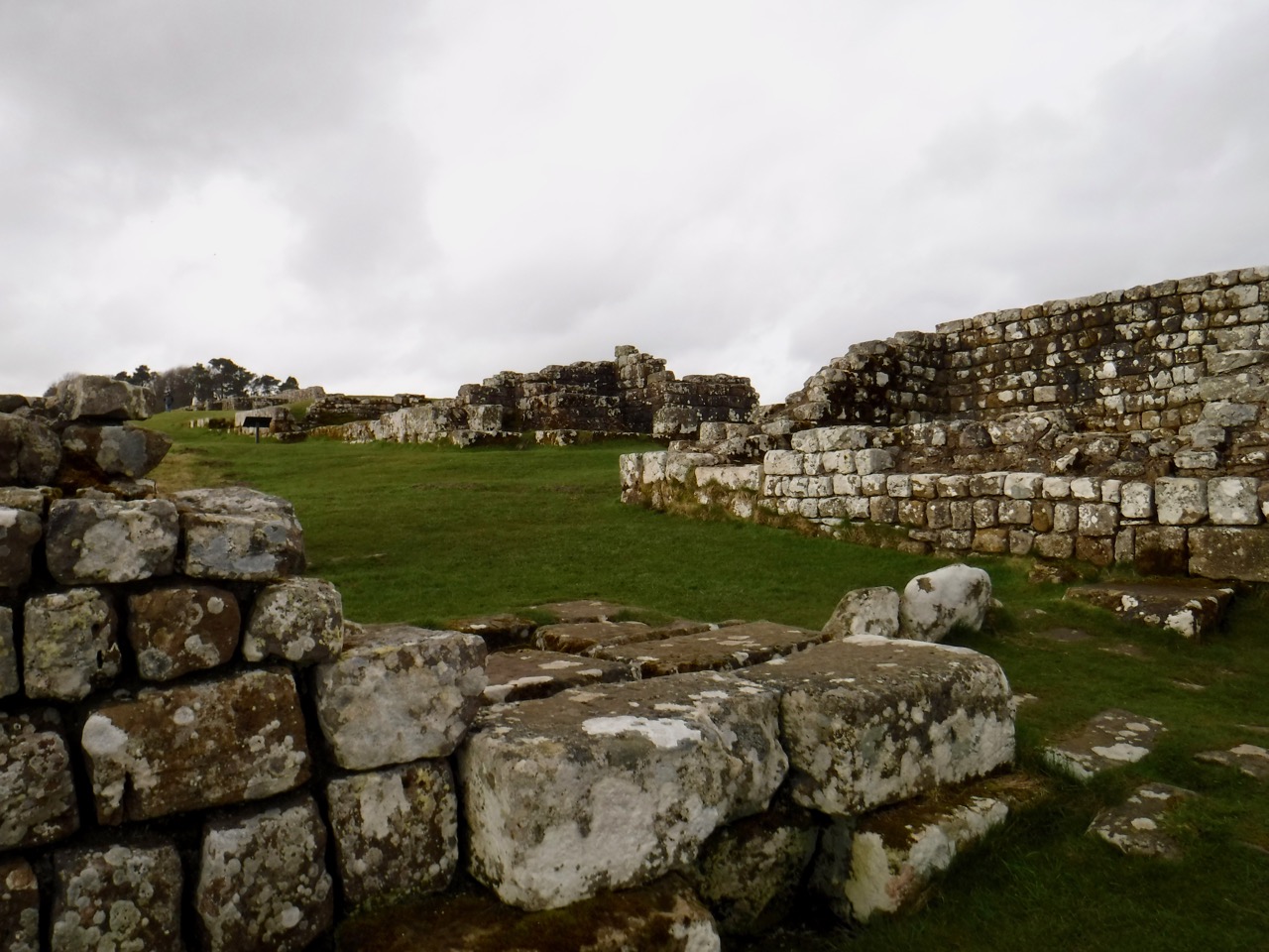
The fort, dates from AD120, and both protected the sea approaches to Hadrian’s Wall and served as a supply station. There is a reconstructed gatehouse and the usual Roman ruin foundations as well as a small museum. Interestingly the word ‘museum’ above its entrance is written in uncial letters which might look “old” but are several centuries younger than the Roman Capitals seen on inscriptions at the site. I suppose Roman capitals look too modern despite being a couple of thousand years old. Enough musing.
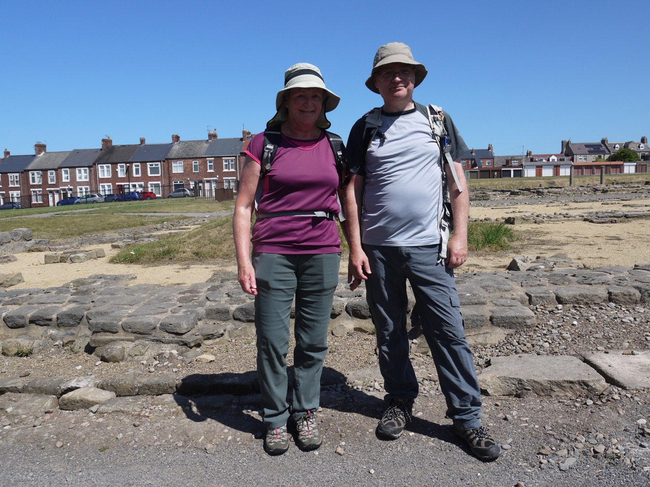
Walkers at Arbeia
This was the completion of our Hadrian’s Trail, so it seemed fitting to pause and reflect on our achievement as we looked across the remains of this ancient Roman Fort. The camera was then called into action from a celebratory photo before we packed up and set off for the coast just a few minutes walk away.
Our last artwork was Conversation Piece, a 1998 sculpture of 22 life sized bronze figures by Juan Munoz known locally as “The Weebles” .
Once we had crossed the beach and stepped into the waves I turned off the GPS and considered the walk over.
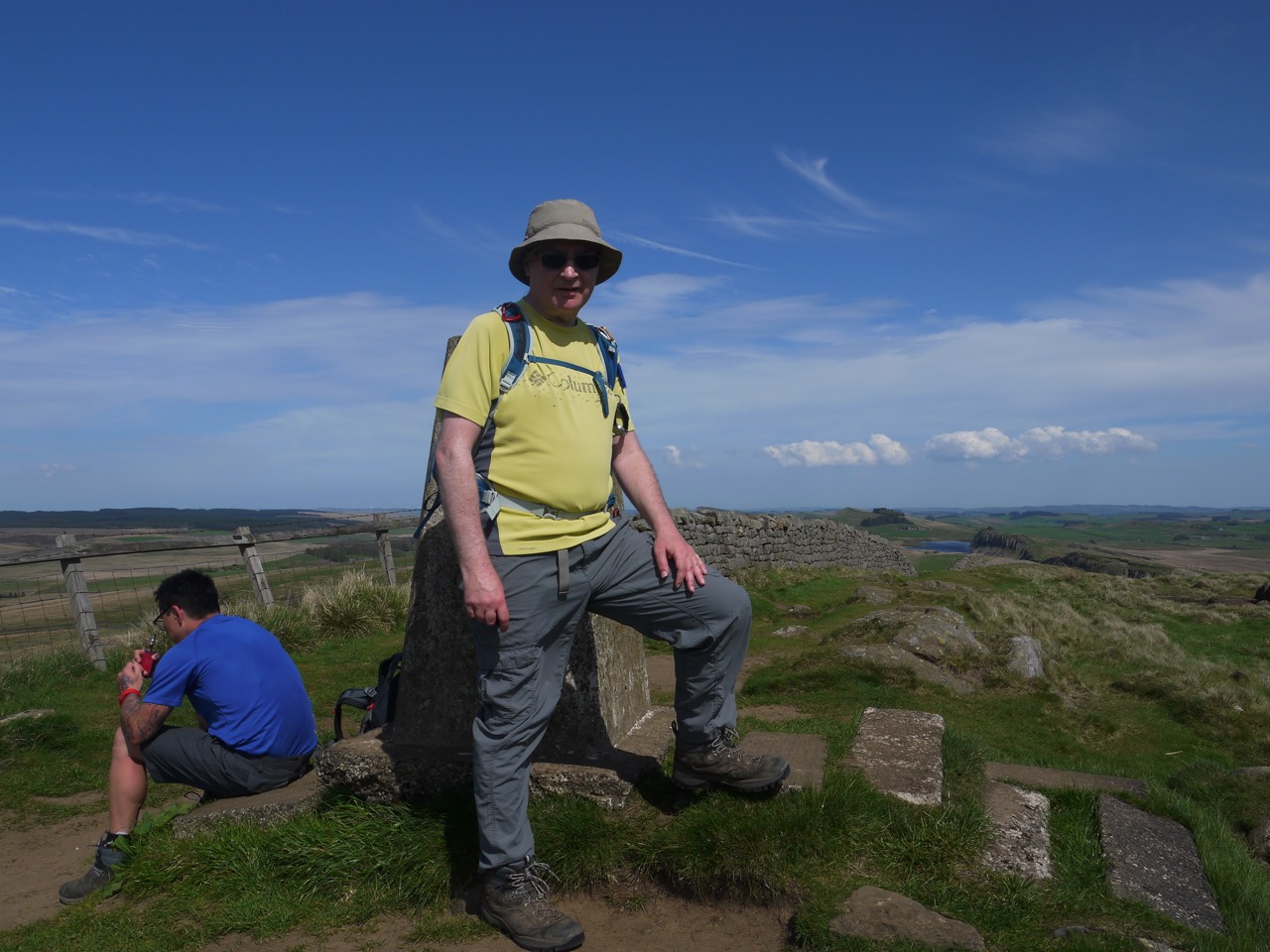
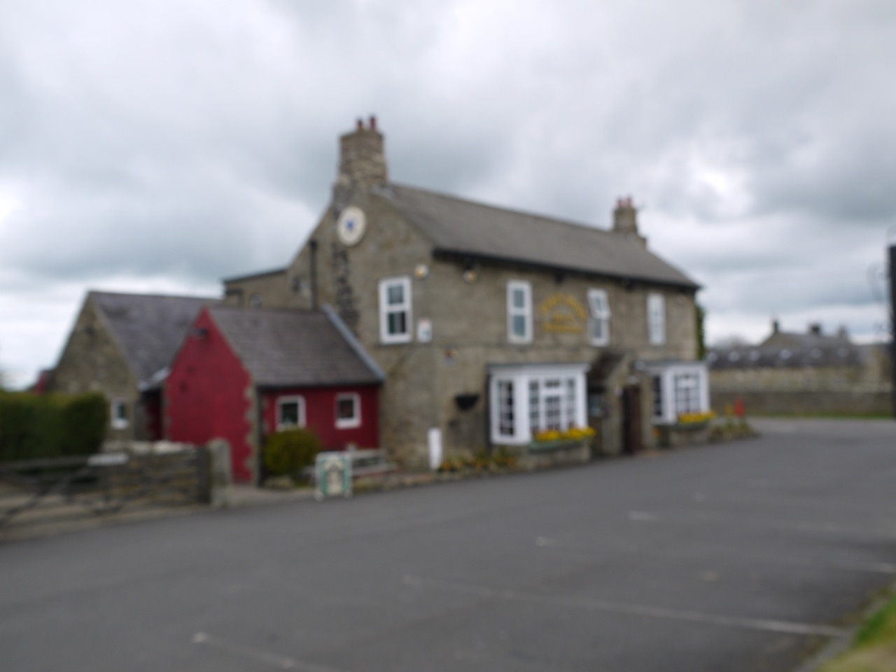
Ice-cream was again called for, and yet again we had to go without. But to make up for that we called in at Twice Brewed on the way back for some refreshment, and to say we had been there. Nothing exciting happened while we were there.
At Twice Brewed
Our Hadrian’s Wall Walk Statistics:
Total miles 101 (plus 9.5 miles we repeated in better weather)
Ascent 1884m (plus 394m repeated)
Time 50h 42m (plus 6h 15m repeated)
Average speed 2 mph
Longest walk 12.9 miles
Shortest walk 7.6 miles
Weathers: dry, wet, hail, snow, fog, winds on our back, wind from the side, wind in our face, and every temperature from bitterly cold to heatwave.
Highest point: Winshield Crags
Lowest Point: no ice-cream
Longest Duration 7h 10m
Shortest Duration 3h 31m
Number of times lost: None!
Falls 3
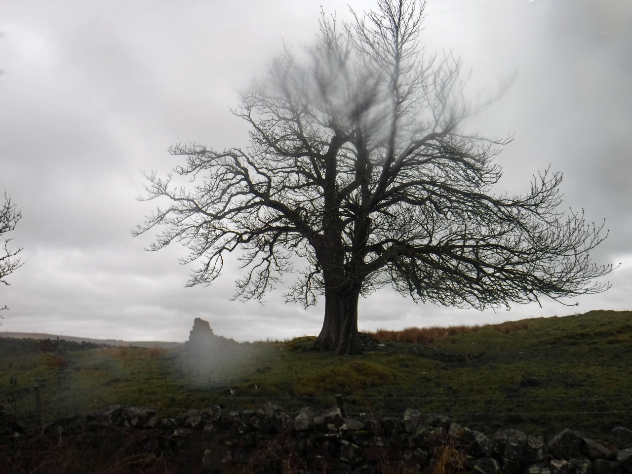
Well this was a different walk from the same route a month earlier. We returned to this section of ridges between Walton and Houseteads, which we had walked in rain, mist and a strong headwind last month. Now with a sunny day forecast, and a gentle breeze at our backs we were looking forward to an easier walk with a chance to see the views.
The wet weather camera was left in the boot of the car, but I was less optimistic than Audrey when it came to waterproofs. I took my jacket whereas she left hers. She hinted that she might play the chivalry card if we found ourselves in a storm. Little did she realise that behind my blank expression my mind was doing the equivalent of laughing maniacally and wringing may hands as I considered her likelihood of getting the jacket.
We took the AD122 bus from Housesteads car-park to the Roman Army Museum near Walltown, though had I not been restrained I would have boarded the earlier bus (going the wrong way). I just thought the bus I wanted had come earlier. I have
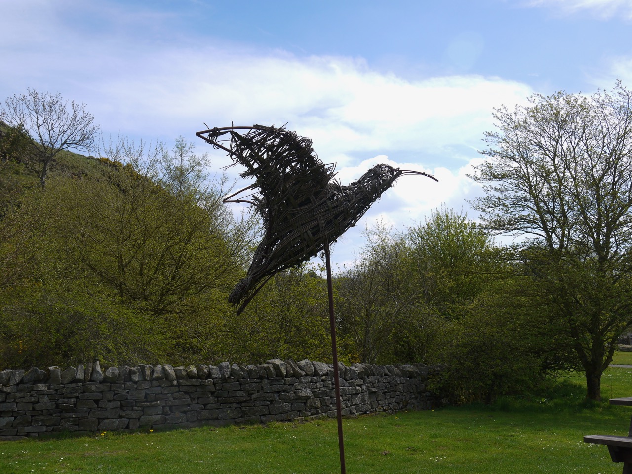
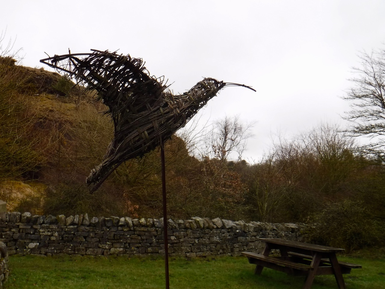
Bird at Walltown quarry
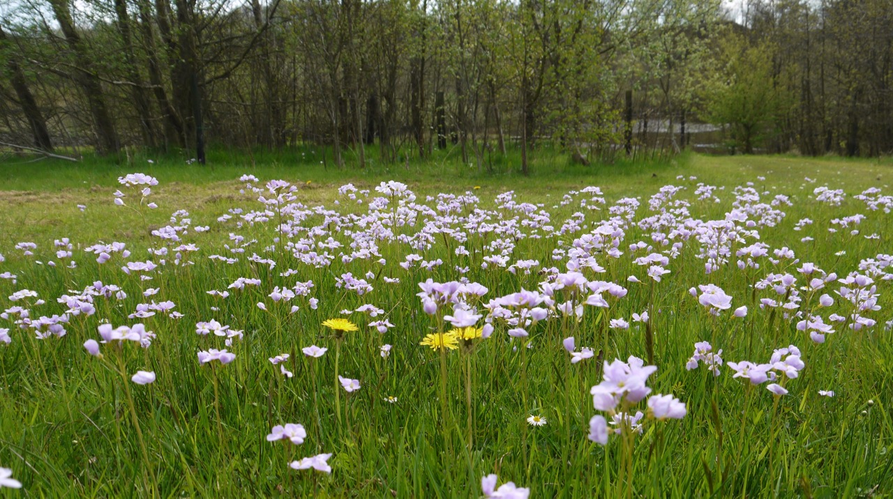
There were no frogs on the path this time in Walltown Quarry. And no deer this time. We did though have swathes of cuckooflower and trees in blossom this time.
A month earlier
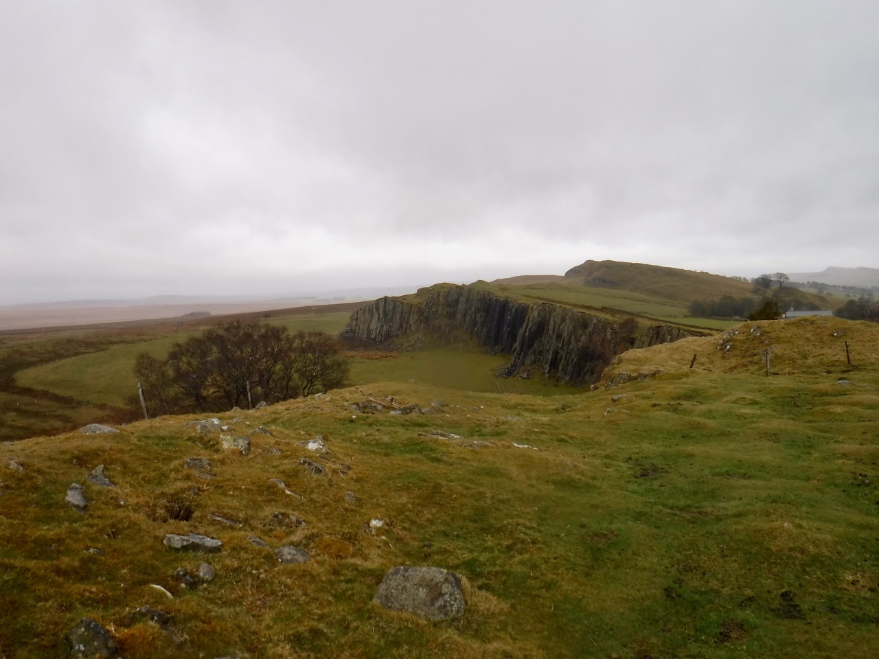
The visibility was good enough that we could see Criffel and Burnswark from the top of Walltown Crags.
Walltown Quarry
Cuckoo flowers
Walltown Crags
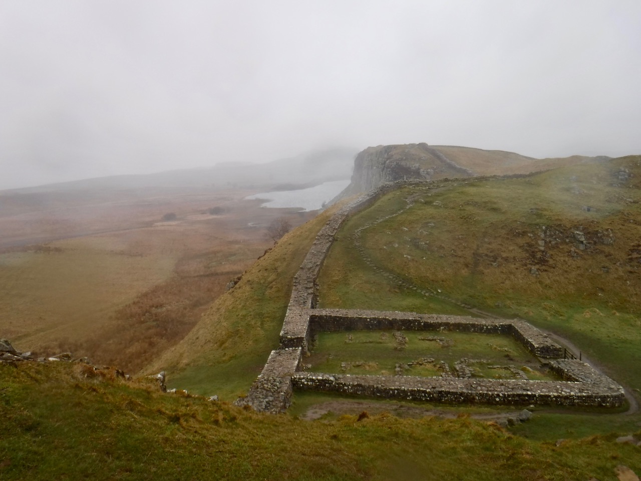
Cawfield Quarry from Milecastle 42
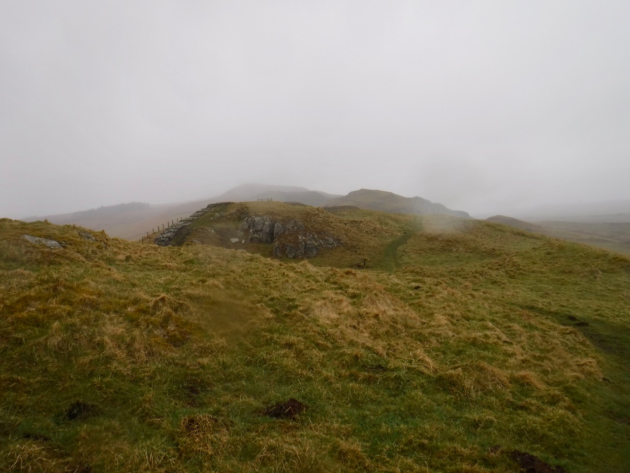
The visibility was good enough that we could see Criffel and Burnswark from Walltown Crags. I had been reading about the Nine Nicks of Thirlwall, but my research had been incomplete. I hadn’t been able to work out which hills were the Nine Nicks. Apparently there are only seven nicks now due to extensive quarrying. So we spent some time looking back later in the walk and trying to count the nicks. We presumed a nick to be gap rather than a summit and we were looking westwards from Cawfields Crags. I now wonder if the picture below, looking east, is actually the nine nicks.
This was a surprisingly sparse write-up given that I took 164 photos, and this probably being the most iconic ten miles of the Hadrian’s Wall Trail. The blog post looks as though I pressed the publish button before I had finished writing it. I took 164 photos that day yet the only topic I mentioned was the question of the Nine Nicks.
I thought I should try to reconstruct a write-up from my photos and memory.
As a brief summary I could say…
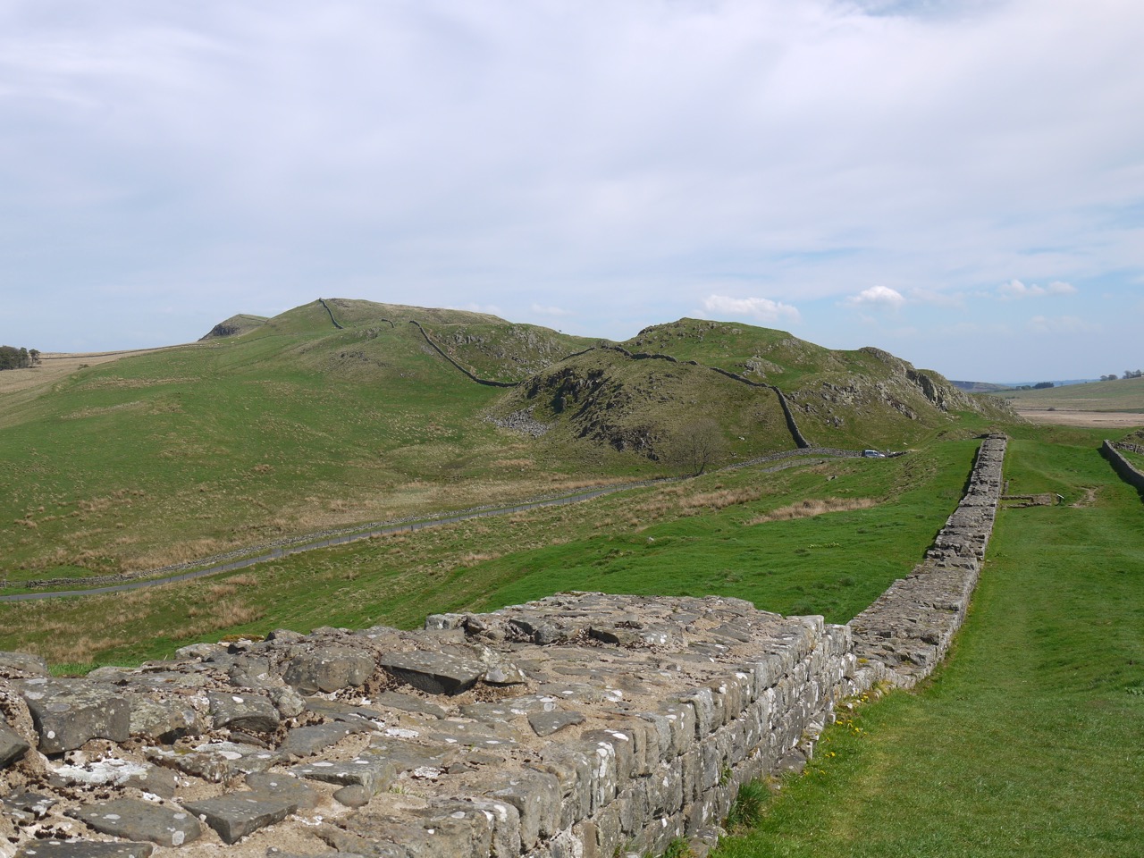
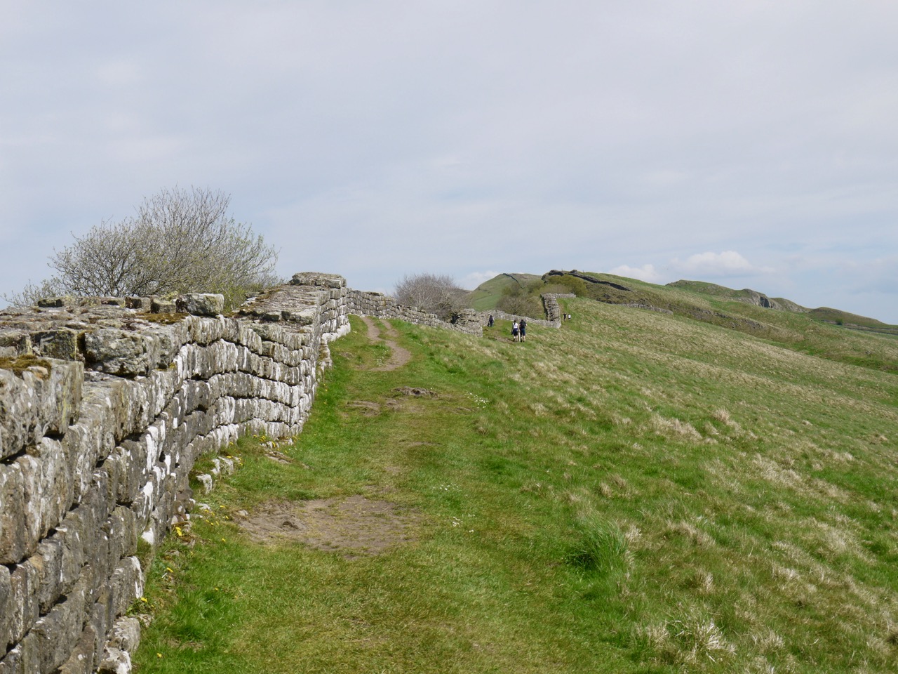
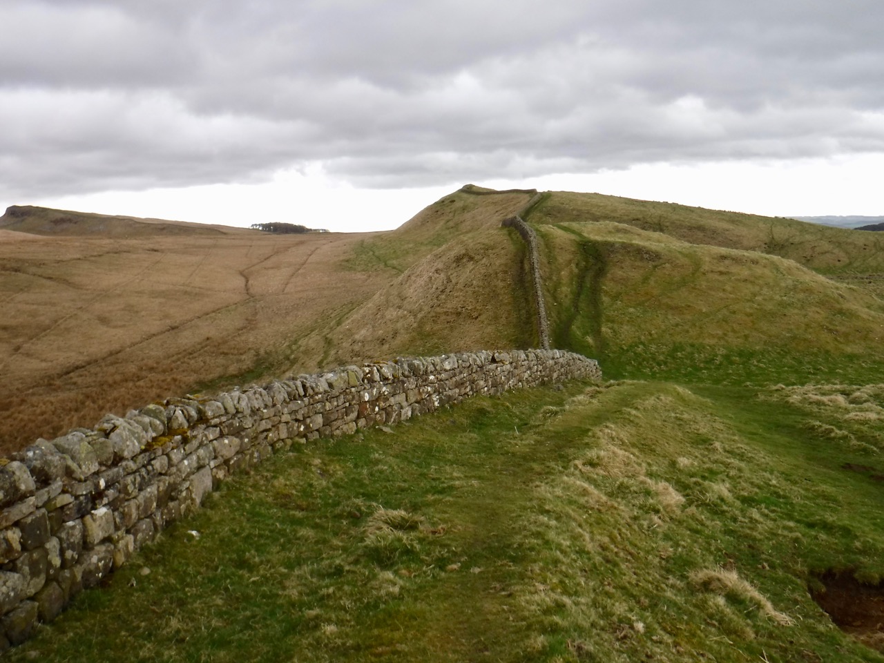
Hadrian’s Wall throws up something of interest wherever you walk but this is probably the most iconic section of the trail. The climb onto Whin Sill heralds a wilder terrain and longer sections of surviving Wall
There were milecastles and military roads, forts and gateways, trigs and turrets. The loughs are pronounced loff and the becks are called burns. It’s a place where low places are named and tops nameless. We tramped down and then up a miscellany of dips in the ridges: the Nine Nicks of Thirlwall (well, there are only seven), Walltown Nick (which sounds more like like a gaol), Hole Gap, Thorny Doors, Bloody Gap, Caw Gap, Bogle Hole (a bogle is a ghost), Lodham’s Slack, Green Slack, Peel Gap, two Castle Nicks, the famous Sycamore Gap, Milking Gap, Rapishaw Gap and many without names.
Looking along the ridges you would might expect a gently undulating stroll but glacial spillways have left surprisingly steep sided gaps.
I remember looking north across what the Romans would have known as Caledonia and thinking that this section of Wall would have been quite a substantial defence both physically and emotionally.
I tried to pull Excalibur from a wall only to find it was a ‘steadying handle’ for a stone stile and failed to find King Arthur’s Well, though we walked where it once was. J. Collingwood Bruce in his book “The Roman Wall” (1863, page 155) says that “the true story of the well, like its water, is now lost”
Walltown Quarry to Walltown Gap
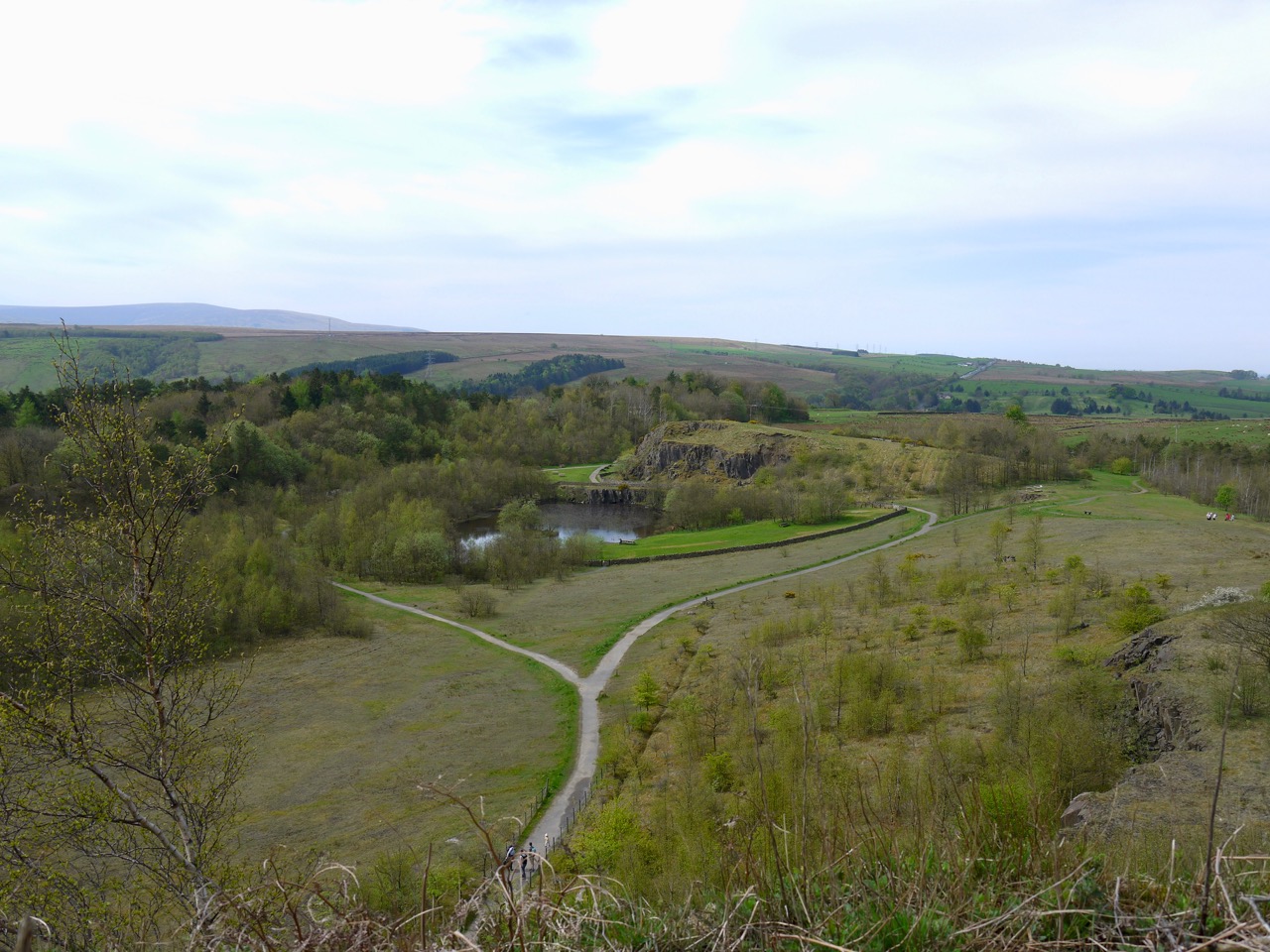
We began this section at Carvoran Roman Museum from where it was only a short walk to Walltown Quarry, a country park with information boards, picnic tables, and ‘ornaments’ such as a wire bird that looks rather like a hummingbird and a wood burning oven of all things. The grass was short and dotted with cuckooflower, occasional primrose and a stand of something we couldn’t identify on the day but turned out to be common cudweed.
The path was dry so we didn’t have to dodge frogs this time but the park was busier so we didn’t see the deer either. We passed several ‘artistic’ collections of stones. I presumed these were examples from the Hard Rock Trail each had a number beside it but we didn’t see a list anywhere..
A path led past boulders, which I presumed to be the local whinstone, and took us by a bench with ‘Walltown” carved into it. From there we climbed up onto Walltown Crags and were rewarded with views back over the quarry. By rewarded I mean given an excuse to stop and catch our breath.
We took photos to compare with our rainy walk then set off to walk the nine nicks, past milecastles and turrets, the Wall beside us. There were great views along the crags. Photo
Walltown Gap to Aesica
Walltown Gaps has King Arthur’s Well marked on the OS map and I made a point of looking for it. It is no longer there. All I have to show for my search is a photo of some rough marshy ground where the well was said to be. There are reports of the well being there in 1989 but also a report from 1863 saying it could not be found.
The ground there is so marshy that a flagged path was laid across it in 2008. There had been water running down this path when we were here in April. Before the path was laid an archeological investigation was conducted. A report dated 2020 is available on-line.
They had found the remains of a building with a hearth and a small altar stone. From its characteristics and dating of materials found it was Roman, though different in style of construction to the Wall or its attached buildings. Its purpose was unclear but there was no evidence of it being a well. The building had either collapsed or been demolished. I wonder if a pile of stones in marshy ground might have accumulated water and come to be known as a well.
As to its association with royalty, the archeologists wrote that “the tradition that Paulinus undertook a royal baptism at King Arthur’s Well during the seventh century is unlikely to have any basis in fact”, and “associations with King Arthur” were described as “fanciful”.
On the day I looked back down from turret 44B and thought I could make out a rectangular shape in the ground. But that was north of the Wall on higher ground and likely to be something else.
This section of the Hadrian’s Wall Trail is also the Pennine Way so there was a national trail acorn carved into a stone on a dyke. As we came down towards a small woodland, the Wall gave way to a traditional dry stone wall though I imagine it was built with stones scavenged from the old Wall. Indeed, the wall itself has been ‘consolidated’ with fallen stones in decades past which is why it has a rectangular cross-section rather than a naturally ruinous appearance. The modern walls, which I imagine are themselves several hundred years old have lunky holes, and stones sticking out halfway up. I don’t know if these are structural “through stones” or purely ornamental.
Before entering the trees I paused to reflect on my fall on our wet April walk. Friction had returned.
The woodland is Cockmounthill Plantation. I recall thinkinging that neither it nor the Cockmounthill Farm were on a hill. But looking back at my photographs, it is on a wee rise.
Ahead were the farm buildings of Great Chesters, and the Roman walls at Æesica. This fort which is a little larger than two football pitches, kept a small force to defend the gap where the Haltwhistle Burn crossed the Wall. Its name may be derived from Æsus, a Celtic god of water and rivers.
My attention though was drawn to a pair of ponies. One standing, looking dejected (if you will pardon the anthropomorphism) and the other lying on the ground. Which I found somewhat worrying. WE drew closer trying to see, from afar, if it was breathing, but it got up and seemed to walk about normally.
There was a military road the soldiers could use to get to Caw Gap, but we followed the line of the wall, which here is a dry stone dyke rather than roman Wall. Wooden ladder stiles took us over the crossing walls. Approaching an old bathtub with green stagnant water, I had to ask. Audrey declined but said I could take a dip if I really wanted, The spaniel would have been right in there.
There is a bridge over Haltwhistle Burn but the water was low enough to reveal natural stepping stones that had been under white water a month earlier. We sat in the small woodland opposite the quarry. A small footbridge taking us back to the other side of the burn.
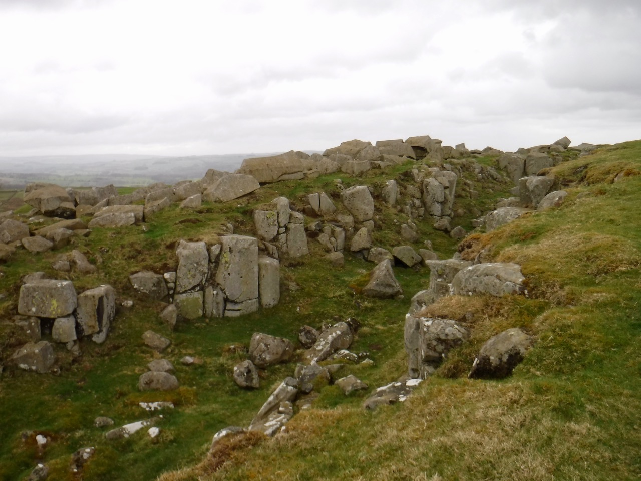
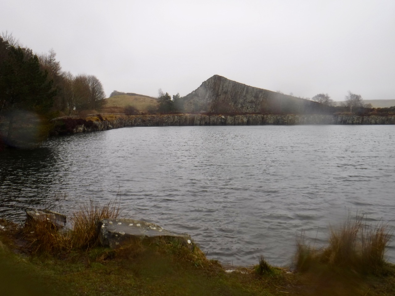
Fed and watered we crossed into Cawfield quarry, the quarried end of Cawfield Crags standing like a a pyramid that has been split open. A little more climbing brought us onto the top of the crags to reunite with the Wall and the substantial remains of milecastle 42.
The view along Cawfield Crags was the typical undulation whereas the walk included some steep gaps, with rock steps taking us up from Thorny Doors. The next gap is not named on modern maps but was once called the Bloody Gap. After that we walked down into Caw Gap and crossed the road. A lone tree stood to the north, a National Trust sign announcing “Shield on the Wall” by the road. We looked up the imposing slope ahead, took a breath and set off.
Caw Gap to Crag Lough
The way to Shield Crags is a steep walk out of Caw Gap and another out of Bogle Hole. The ladder stiles we had met earlier in the day were replaced with stones jutting from the wall wooden grabs that looked like Excalibur jutting from the rock. I tried but I am not “the once and future king”.
I have a photo of some rough ground which from the GPS I presume is Lodham’s Slack. Why I took the photo I don’t know but it was just before the final push up to the Trig on Winshield Crag, the highest point on the Hadrian’s Wall Trail.
Beyond here the walk is just what you would want from the HW trail. Stunning views along the Wall, well preserved milecastle and turret sites, crags towering over still water, and it was now mostly downhill.
After crossing a wee road near Peel Gap we briefly walked along a broad earthwork beside the wall, the old Roman Military Road. Signs on the wall itself warned against walking on the Wall, which itself was topped with grass.
A gate let us join to a path that at first sight looked to be heading down to Crag Lough but took us to a paved path across Peel Gap and its small turret foundation and steps up to the top of Peel Crags. A paved section led around milecastle 39, and into Sycamore Gap.
For some reason I have a photo of a jelly baby lying in the dirt on Highshield Crags. Was it a chance finding? Did one of us drop it? Or was it an offering? I don’t remember.
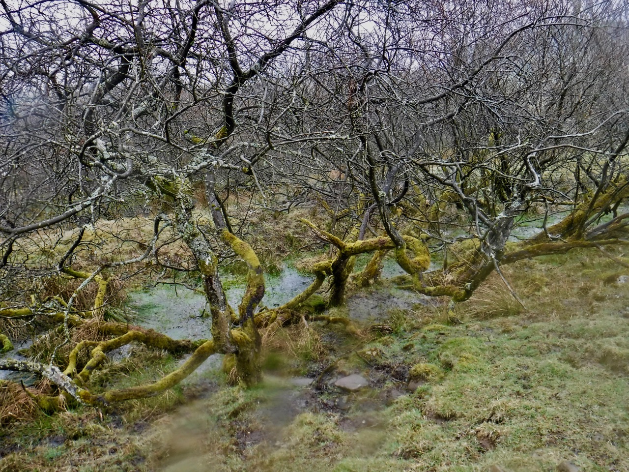
When the path above the lough entered trees we had only an hour or so to go. The woodland slopes were flush with small white flowers. From a distance I thought it would be wood anemone but turned out to be wood sorrel. The trees with serpentine markings were still there. My money is on deer eating lichen and taking the bark with it.
Crag Lough to Housesteads
We had a breather on some rocks near turret 37B on Hotbank Crags before taking on some more rollercoaster ridge-top walking beside the Wall.
We parted way with the Pennine Way below Cuddy’s Crags, The path takes a roundabout route rather than resorting to scrambling. Broomlea Lough was now visible.
Milecastle 37 was slightly unusual in that it must have been a way through the Wall. Its gateway is still there.
Approaching Housteads Fort there is a short section where the path is raised. One of the few places where the trail is on the Wall rather than beside it.
It had been a long day but we had a wee look around We Housesteads before walking down to the car park
Posted inNorthumberland|TaggedHadrian's Wall|Comments Off on The rollercoaster: Hadrian’s Wall V (II – iter repetivit)
This was a walk of three halves, and I am not referring to beer. The first half was dry with a chilly breeze, the the first half of the second half was cold enough to need jackets and hats and the remainder was wet, but warmer.
We parked by the river in Tyne Riverside Country Park and walked up to the Keelman Pub to get a taxi to the start. When I had looked at the route beforehand I had been left with a feeling that we would be walking mostly downhill, but once on the ground there were undoubtedly some sections with a gentle ascent.
If the last section had seen the celandine blooming, it was the dandelions that were putting on the show this time. There were plenty of red dead-nettles and some white dead nettles.
Robin Hood Pub
The taxi driver had told us that the Robin Hood pub had been where some pub scenes from the Likely Lads had been filmed, but it was blurred so we couldn’t go in for a drink.
Looks like a Roman Road
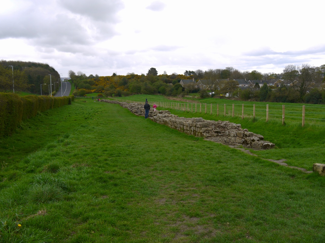
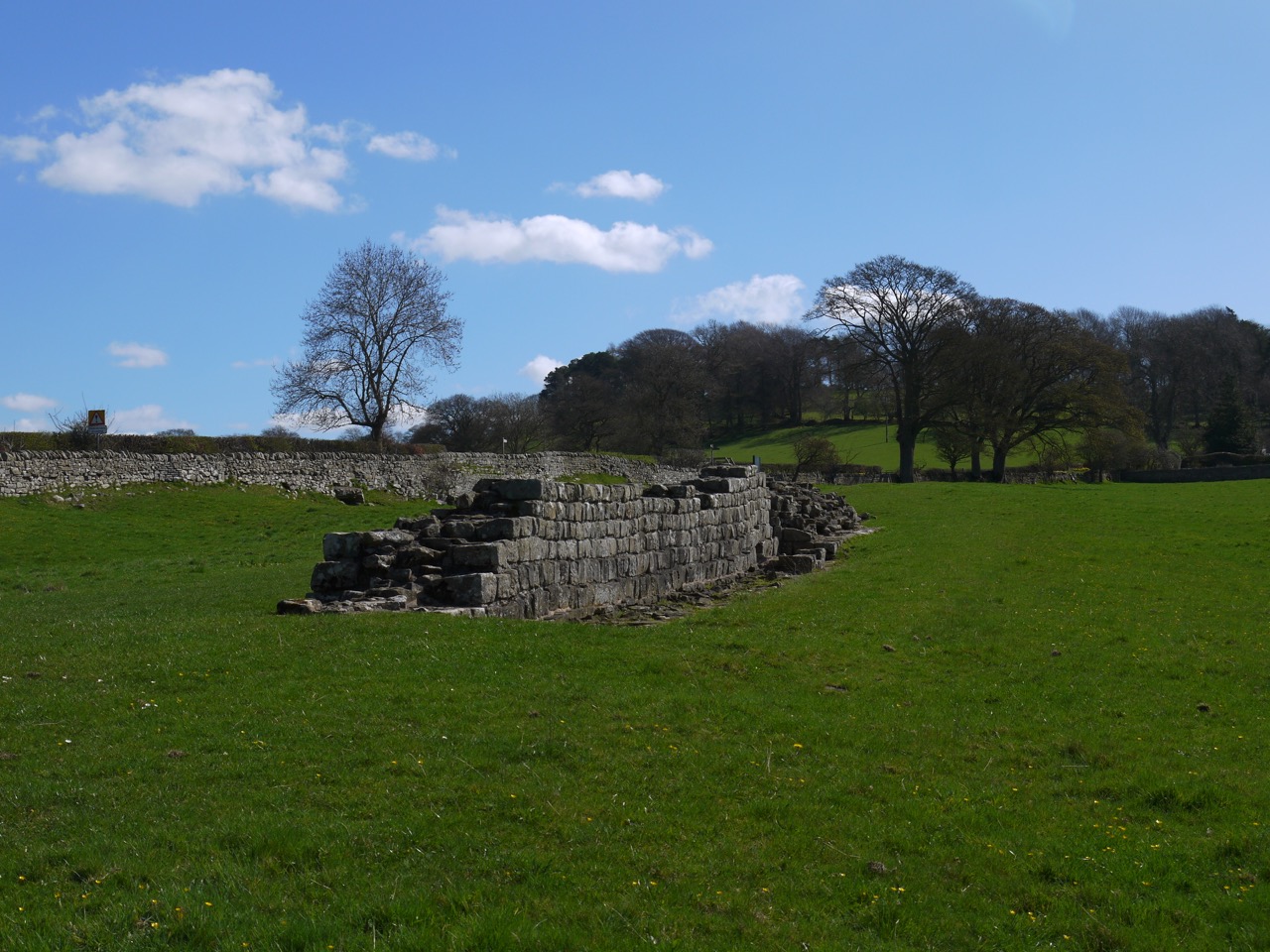
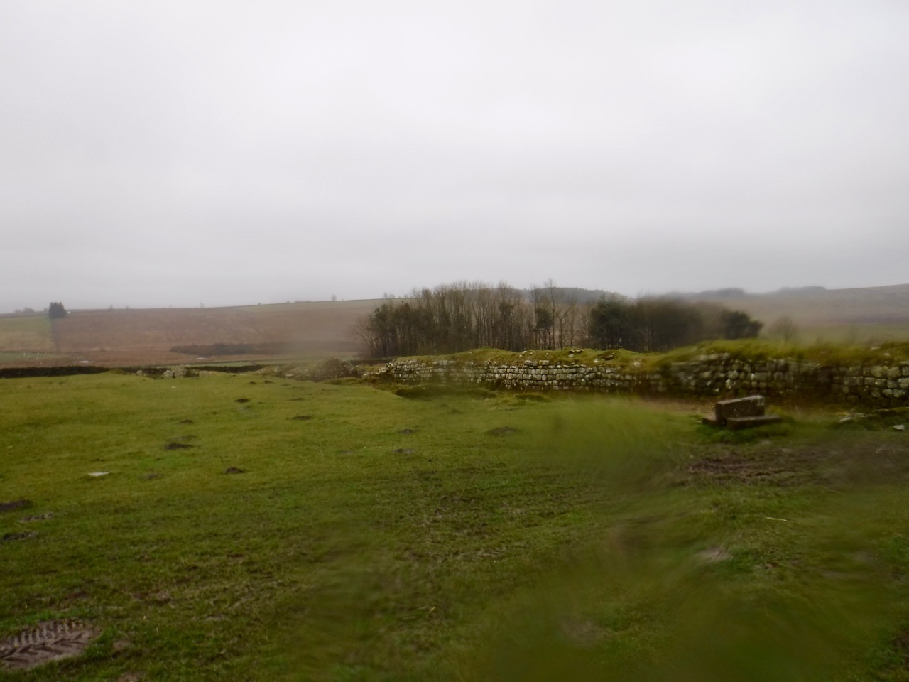
This section is beside the B6318, which follows the route of Hadrian’s Wall, as far as Heddon-on-the-Wall where it leaves the route of the Wall to descend Heddon Banks and then follows the Wylam Waggonway beside the River Tyne. Initially there is still some remnant of the Wall in the form of a ditch, but no mile castles or Turrets remain here, though there is long section of surviving wall at Heddon-on-the-Wall.
Much of the day was spent walking along the edge of cultivated fields or fields with sheep. There were hedgerow flowers aplenty with primroses, cowslips, and dead nettles red and white.
Whittle Dene
From Wallhouses we walked down to the reservoirs at Whittle Dene. There were carpets of butterbur growing close to the water and cowslips on the grassy banks. Fences made getting access for better views difficult and signs warned against trying to do so. These reservoirs were built in 1848 to provide Newcastle with a regular, clean supply of water. Prior to their construction the city’s water had been pumped by windmill from flooded colliery workings.
Red Dead Nettle
There was then a gentle ascent to Harlow Hill, once the site of milecastle 16. A sign at some holiday cottages here confused me a little. It read “Harlow Hill, No Boundaries, MXVI”, and I spent quite some time wondering what had happened in 1016. It was the year Æthelred the Unready, the last monarch buried at St Paul’s, died and that Canute invaded England, but I couldn’t see the link with Harlow Hill. Then the penny dropped…MXVI = Milecastle 16. But I’m none the wiser as to the lack of boundaries alluded to.
We walked on towards Eppies Hill, passing the site of Milecastle 15 of which nothing remains, and past a gate with a large red metal heart with attached padlocks, each painted with a single letter, reading Indians Indians with 16/20 in the centre. God only knows what this means.
Heart on a gate
Above us we watched airliners descending into Woolsington having me crick my neck looking up at them while a long line of bikers in their leathers roared past on the road.
Wall at Heddon on the Wall
Heddon-on-the-Wall nearly had me going off piste. I was following the fingerposts but my attention was diverted by a guy walking his westie. He kept us on the right route (almost) and bumped into us a little while later to give us directions again. The Hadrian’s Way doesn’t actually visit the long section of Wall in the village, but it is only 60m off the Way. You would think the HWW would include it.
Looking across to Newcastle
As we walked down Heddon Banks we got our first glimpse of the Tyne, and I joked that it did look as if there was fog on the Tyne. But it wasn’t fog, it was rain and within a few minutes it had reached us and it stayed with us all the way to the end of the walk. There were bluebells beneath the trees and what looked like oversized C3POs peeping at us from a clearing. Actually an observatory.
After passing a rather unwelcoming sign we joined a cycleway/footpath running along the route of the old Wylan Waggonway. The waggonway was built around 1748 to carry coal from Wylam Colliery to Lemington for shipment down the River Tyne. Originally the wagons were pulled by horses along what were initially the wooden rails then from 1808 iron rails. During the Napoleonic Wars demand for coal was high and the colliery owner wanted to improve the transport of coal. In 1812 he asked the Colliery Manager, William Hedley, to build a locomotive. By 1813 Hedley had a working prototype and in 1815 Hedley’s steam engines were established on the Waggonway pulling eight wagons compared to the single wagon a horse could manage. So Hedley produced his steam engine locomotive a year earlier than the better known George Stephenson. Both men were locals, Hedley was from Newburn and Stephenson’s cottage is close to the waggonway. William Hedley also had the important insight that coupling the locomotive wheels meant the weight of the locomotive alone would allow adequate grip between smooth wheels and smooth rails.
Totem at Newburn
The final section of the walk took us along a riverside path back to where we were parked, at the site of the Battle of Newburn. Information boards around the memorial stone give quite a bit of detail about the battle and where the Scots and English forces were deployed. If it hadn’t been raining I might have spent a little more time there.
Except for a wee diversion at Brunton, this section ran beside the B6318, rarely drifting more than a stone’s throw away. The B6318 is apparently the longest B road in Britain, and because it is so straight I had presumed it was following the route of an old Roman road. But I was mistaken. It is labelled as “Military Road” on the OS map and dates to the 1750s. At the time of the 1745 Jacobite uprising, Marshall Wade had been unable to move his troops from Newcastle to Carlisle to intercept the rebels because of the poor roads, so a new road was planned. It was built close to Hadrian’s Wall which provided a handy source of stone for the construction.
The days of military rebellion now lie in the past, hopefully and the B6318 is frequented by tourists visiting Hadrian’s Wall. I wonder how much more may have survived if the military road had taken another route.
We began at Chesters Fort and walked along the pavement into Chollerford. The hedgerows suggested that Spring had sprung with profusions of flowers, and unlike the previous day’s walk which was carried out in waterproofs I was in tee-shirt and sunhat with exposed skin sheltering behind SPF30. Though despite these efforts I was greeted with “looks like you’ve caught the sun” when I arrived home.
North Tyne River
The North Tyne River is a substantial watercourse here, and though the name Chollerford suggests that Ceola forded the river here, we crossed on Chollerford Bridge, a single lane affair dating from 1785. The first bridge here was built in AD122 (What did the Romans ever do for us?), and the military road had used a bridge dating from 1394, but that was destroyed in the Great Flood of 1771 which laid waste to most of the Tyne’s bridges include the original medieval Tyne bridge connecting Newcastle and Gateshead.
Chollerford bridge
After the bridge we walked uphill to a a crossroads and waited patiently for a gap in the traffic before heading along the A6079 looking across to see where the original Roman bridge would have stood. A waterwheel stands beside a house here in the absence of a watercourse. I’m not sure why the Hadrian’s wall Path has this little diversion. Perhaps because there is no route to take beside the road, which itself has no walkway, or perhaps it is to soften the climb with a zig-zag.
Brunton Turret
Anyway, the diversion took us by the remains of Brunton Turret so we walked up to have a closer look before returning to the road. We then turned up a minor road to walk under the shade of trees back to the military road. The woods here had a carpet of wood anemone and we could spy a small building described on geograph.co.uk as an obelisk. I wonder though if it might be a dovecote or a well.
Hadrian’s Wall Planetrees
Once we reached the B6318, we did not walk along the road but parallel to it through Planetree woods, which were rich with spring flowers. It was a gradual climb through the woods and then across fields and we took a bit of a breather at the section of Hadrian’s wall. There were excellent views back as far as Whin Sill from here.
The trail then crosses the road to continue climbing up to Heavenfields, the site of a battle in 634 where Oswald of Northumberland defeated an army of britons led by Cadwallon.
Before the battle Oswald had a vision in which St Columba told him “Be strong and act manfully. Behold, I will be with thee. This coming night go out from your camp into battle, for the Lord has granted me that at this time your foes shall be put to flight and Cadwallon your enemy shall be delivered into your hands and you shall return victorious after battle and reign happily.” This led Oswald to erect a large wooden cross before the battle a modern replica of which still stands beside the road. He was victorious and Cadwallon was killed. Oswald went on to unite the Northumbrian kingdoms of Bernicia and Diera.
A small church now stands at the site of the battle surrounded by trees and fields in which sheep quietly graze. The clash of battle has now been replaced by the calls of birds and the occasional rumble of traffic on the B6318.
In planning the walk I had realised there would be a climb out of the river valley at Chollerford and thought Heavenfield would be the end of the ascent, but the trail continued to climb all the way to the trig pillar on Whittington Fell.
Quoits pits Portgate
Once we were ‘over the top’ there was a gentle descent to Portgate where we came across some strange square areas partially covered in wood. A little research has identified these as quoits pits. The game originated from throwing horseshoes at spikes and is likely to have been introduced into Britain by Roman soldiers.
HW path Whittington Fell
Portgate marks the site of a major fortified gateway in Hadrian’s Wall controlling traffic on Dere Street. Dere Street was a major Roman Road running from York to Scotland, reaching as far as the Antonine wall. The Roman name is not known and Dere likely dates to Saxon times referring to the Northumbrian Kingdom of Deira. The name Portgate is also of Saxon origin, the original Roman name for the gateway being unknown.
We had intended to have lunch at Portgate. We could I suppose have used the facilities of the Errington Arms, but we had our sandwiches and the weather was lovely so we wanted to be outside. Portgate itself is a junction of two busy roads, the A68 (the old Dere street) and the B6318 (the old military road), so we walked on until we found a quieter spot off the road and overlooking the site of Onnum Roman Fort.
Down Hill
Ahead we could see Down Hill, which proved to be less massive than it looked from afar. The trail passes around the woods here and there are a number of large rocks that be great to sit on for lunch. But we had just had lunch and there were already people on the rocks. One chap asked us to look out for his cap that had blown away and asked us to return it if found. It apparently had his email address inside.
Halton grounds
From here it was a gentle descent (flat really) through the grounds of Halton Castle with its large gates, and through Halton Shields. The OS has a phone box marked here and I had read that it was bilingual, English and Welsh, probably due to a confusion between Wrexham and Hexham rather than harking back to Cadwallon’s time.
I pleased to say I finished this section without exhausting myself. Firmer ground, and better weather certainly helped.
Since our drive to and from these walks has taken us through Once Brewed and Twice Brewed, on the B6318, I thought I would look into the names a little more.
“These peculiar names stem from the thirsty soldiers building the Military Road in the 1750s whose gratitude at reaching the local inn was tempered by the weakness of the beer, and they suggested that it needed to be brewed for a second time to make it stronger. The name “Twice Brewed” therefore became associated with the local inn, and the hamlet that grew up around it. Roll forward a couple of centuries to 1934, and the opening of the Youth Hostel (one of the first in the country) by the local Lady Bountiful. As she was a confirmed teetotaller (and the YHA was a temperance movement) she disapproved of the boozy association of the hamlet’s name, insisting that nothing stronger than tea would be served in the Youth Hostel, and that only needed brewing once! So was coined the name of the Youth Hostel, and subsequently the adjoining Visitor Centre.”
Better weather. The last two sections we walked into a strong headwind, first with snow and then with rain. Today the wind was at our backs and though rain and despite we walking beneath ominously grey cloud, the rain held off except for short light showers.
Spring was here. There were banks of celandine by the roadside, daffodils in various states of flower, and what will probably be the last snowdrops we see this year.
We parked at Chesters Fort (Cilurnum) and took bus number AD122 to Housesteads. I like taking public transport between sections and this was particularly enjoyable since much of the trail was visible from the bus. The air felt ready for rain and we had seen some walkers stopped, putting on waterproofs, as we drove along the B6318, so we walked in waterproofs.
Housesteads car park is about a kilometre away from and 40-50m below the Hadrian’s Wall trail, so we had a bit of a warm up right at the start. Vercovicium was obviously a sizeable fort. It was built in AD 124, the Wall itself was begun in AD 122 (hence the Hadrian’s Wall bus number). As soon as we reached the ridge beside the fort we knew we were in for better visibility than our last outing since we could see Broomlee Lough.
Vercovicium
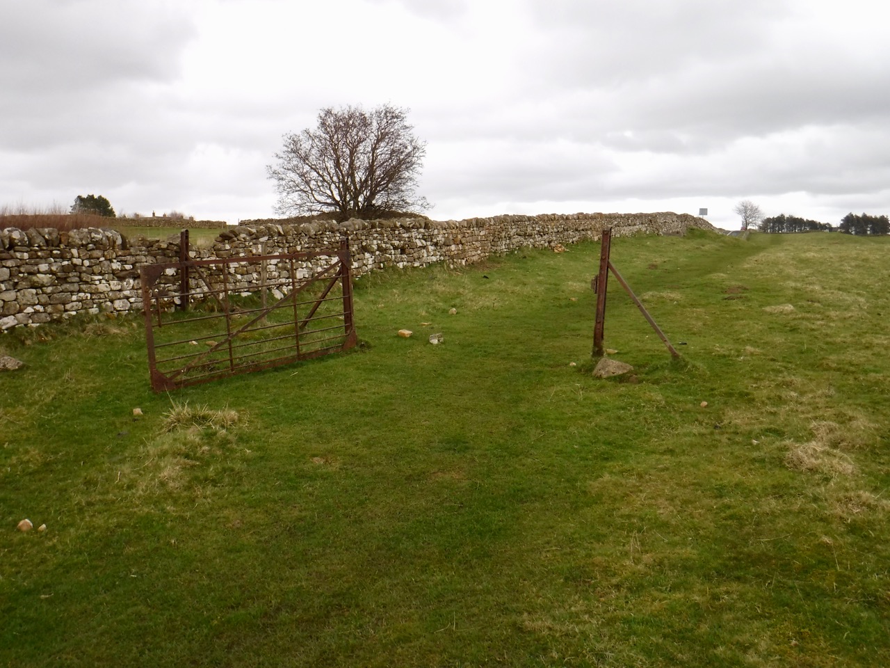
From the Fort we had a slight descent, crossing Knag Burn into a muddy quagmire and then made our way to the far side of the wall to climb beside it up Kennel Crags. The path beside the wall then seemed to peter out. I looked across what was now just a stone dyke rathe than Hadrian’s Wall and saw a gate through another wall on the other side. A gate with an acorn sign. We had crossed outside the wall when we should have stayed to its south. So we could either go back down, cross the quagmire and climb back up, or….
We clambered over the wall, Audrey pulling her shoulder as she did so. So I took javelin duty for the rest of the day.
Clew Crag and King’s Crag
We were now on the ridge proper and strode out over Clew Hill and King’s Hill, with a flock of sheep watching us find our way up the latter. The ancient wall is no longer here but a dyke, no doubt made up of stones from the original wall runs along the whole ridgeline from Hosesteads until just short of the trig on Sewingshields Crags. Then the original wall reappears. We met the wind once we were on Sewingshields but it was at our back and the few spots of rain were easily ignored. We passed a gate marked with a sign “King’s Wicket” where the wall and path turn north to climb to Sewingshields and this had me wondering what a wicket is. I wish now I had taken a photo of the gate rather than just the sign, because a wicket is a gate.
Broomlee Lough
Sewingshields has nothing to do with sewing or shields, but derives from Sigewine’s Shiel. A shiel is a temporary shelter, perhaps used by a shepherd and Sigewine is an Anglo-Saxon name. “The Place Names of Northumberland and Durham” gives a variety of previous spellings: 1279 Swyinscheles, Sywinescheles ; 1286 Schiwynscheles, Siwinshell ; 1296 Sewynsheles ; 1407 Swynscheleys ; 1479 Sewyngshelez ; 1610 Sewenshield ; 1663 Sueingsheels ; 1711 Sewen Shields, which show its evolution. Presumably the crags and the wood take their name from the nearby farm.
Sewingshields Crags
There is a small burial cist beside the wall up on the crags, a little east of Milecastle 35. This is thought to be post-Roman. The trail then passes through Sewingshields wood which is a sparse plantation of Scot’s Pine that wouldn’t offer much shelter from the elements. The land then flattens out and the trail crosses a boggy moorland, but the path itself raised, presumably on the walls foundations, are only superficially muddy in places. Grindon Turret (34A) has substantial remaining foundations but Milecastle 34 itself is gone, though its position is marked by a walled stand of trees.
Cist
I had wondered about stopping in the lee of theses walls for elevenses, but someone was having a pee in the woods so we walked on and sat in the open at the remains of the next turret. As we sat a gentle rain started to fall. But we stopped for a rest anyway. Since I was not driving I had brought along a wee dram, choosing a lightly peated whisky which I thought fitted the terrain, (Glenglassaugh Torfa). Hip flask and collapsible cup used together for the first time. It is important to keep in mind that the cup will collapse if put down.
Shield on the Wall
It was then a long straight walk in one-point perspective. We passed the site of Milecastle 33 which had some of the Wall remaining but otherwise existed only as a small raised area of ground. Shield on the Wall Dam (a small lake) was on our right.
Milecastle 34
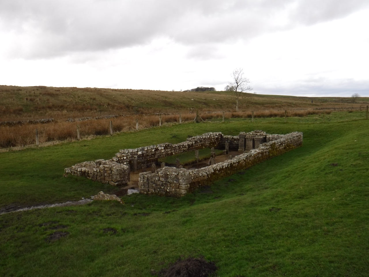
I wondered about stopping for lunch near Carraw, since the buildings and trees there might offer some shelter from the wind, but the path beside the farm, though paved, was under semi-liquid mud so we pressed on intending to stop at Brocolitia Fort. That would mean no shelter but the car park ought at least to give us firm ground to sit on.
Somewhere before Carraw my right hip had started to ache and I was hoping for a rest in the near future. But it wasn’t far to go. Down a gentle slope. But the ground grew softer and muddier. The trail crosses the B6318 and leads up to Brocolitia Fort via the Mithraeum. What I wasn’t expecting was Meggie’s Dene Burn/Coventina’s Well. The burn here arises at Coventina’s Well and takes its name from Old Meg a witch who was burned at the stake, and buried in the Dene with a stake through her heart. No half measures in those days.
Meggie’s Dene Burn
This was a waterlogged area. No, that doesn’t capture it, submerged is closer to the mark. Water stood between us and the Mithraeum. Stepping stones looked to have been flung into place rather than placed with thought. Another walker stood on the opposite side surveying the same problem. “You first” he shouted.
So I went for it. My undoing was the largest stone, close to the middle. It rocked. And I don’t mean it had flair akin to a rockstar, I mean it was unstable. As my left foot landed, the stone rotated forwards. the next stone was to my left, so without a pirouette I wasn’t going to get a foot there. So I launched as far to the right as I could, the water there looking shallower. then back to rocks. On the plus side I remained vertical and still had one dry foot. The guy on the other side, dressed in walking gear but wearing what appeared to be plimsolls, proved more agile. But to be fair he was probably half my age.
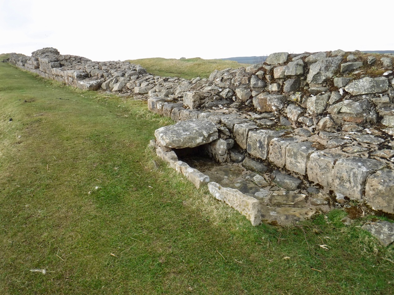
Mithraeum
The Mithraeum was just a stone’s throw away. I wondered why a temple had been built in a waterlogged hollow, since most churches and temples are on high ground. Temples to Mithras, however, are usually in caves or constructed to appear like caves, and running water was a part to play in the devotions. This temple was only found in 1949. Another temple, to Coventina had also stood nearby, but no longer exists.
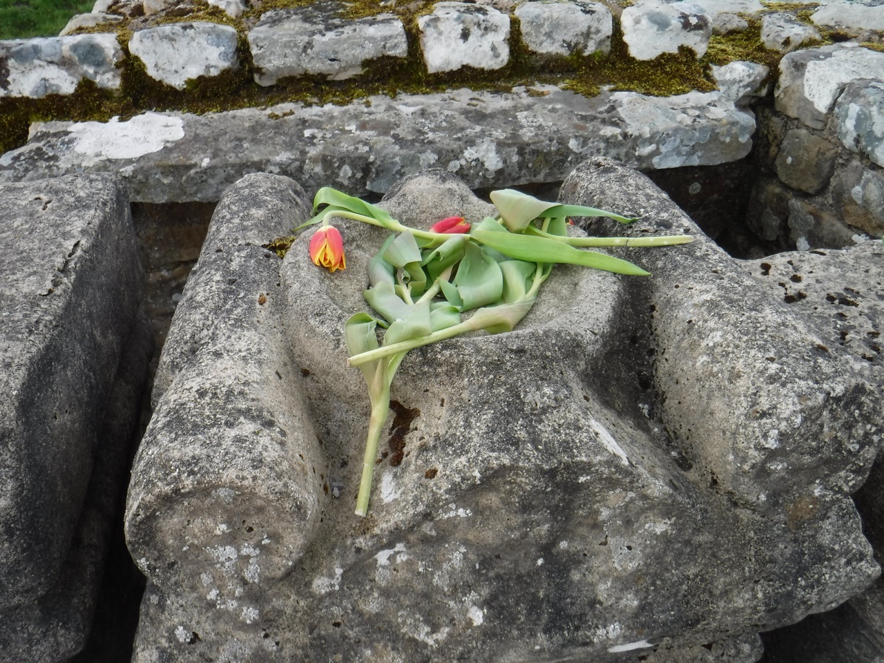
Tulips on the Altar
Mithras was originally a Persian God of light and truth, and in the Roman pantheon became associated with the battle between good and evil, bravery and manliness so was often worshipped by Roman soldiers.
The altar stones in the temple had tulips laid upon them. We have sat in the temple for lunch but it seemed a little disrespectful, so we plodded up over the mounds of Brocolitia fort to a car park surrounded by hal-metre high walls offering the options of firm seating but no shelter, sitting on the ground with a bit of shelter, or the one we chose, sitting on concrete steps with partial shelter. Sandwiches, chocolate, coffee, whisky, and rest until we started to cool down too much.
a gate without a fence
Beyond Brocolitia there was one of my favourite sights, a gate without a fence. Not quite as impressive as the locked gate without a fence we saw on the Southern Upland Way. We had another long walk along a mound stretching to the horizon at Limestone Corner. The boulders there certainly did not look like limestone, and the muddiness and general bogginess of the ground suggests that the underlying rock is not limestone either. Wikipedia says it is quartz-dolerite whinstone. I see now why the long ridge is called Whin Sill.
Limestone Corner
We passed a couple of walkers sat on perhaps the only dry ground, just beside the wall. They told us there was a waiting list for the place.
Black Carts
After crossing another minor road we passed first Green Carts and then Black Carts (carts deriving from cearts meaning rocky), where there is a section of Hadrian’s Wall and the remains of a turret. The ground here became even softer and sapped my energy pretty quickly. The trail takes a detour around Walwick Hall, “a country boutique hotel” then reaches a minor road leading back to the B6318.
The last half mile was on the pavement, which was a relief after the soft muddy ground, past some stone lions and along to Chesters Fort for a coffee in the shop.
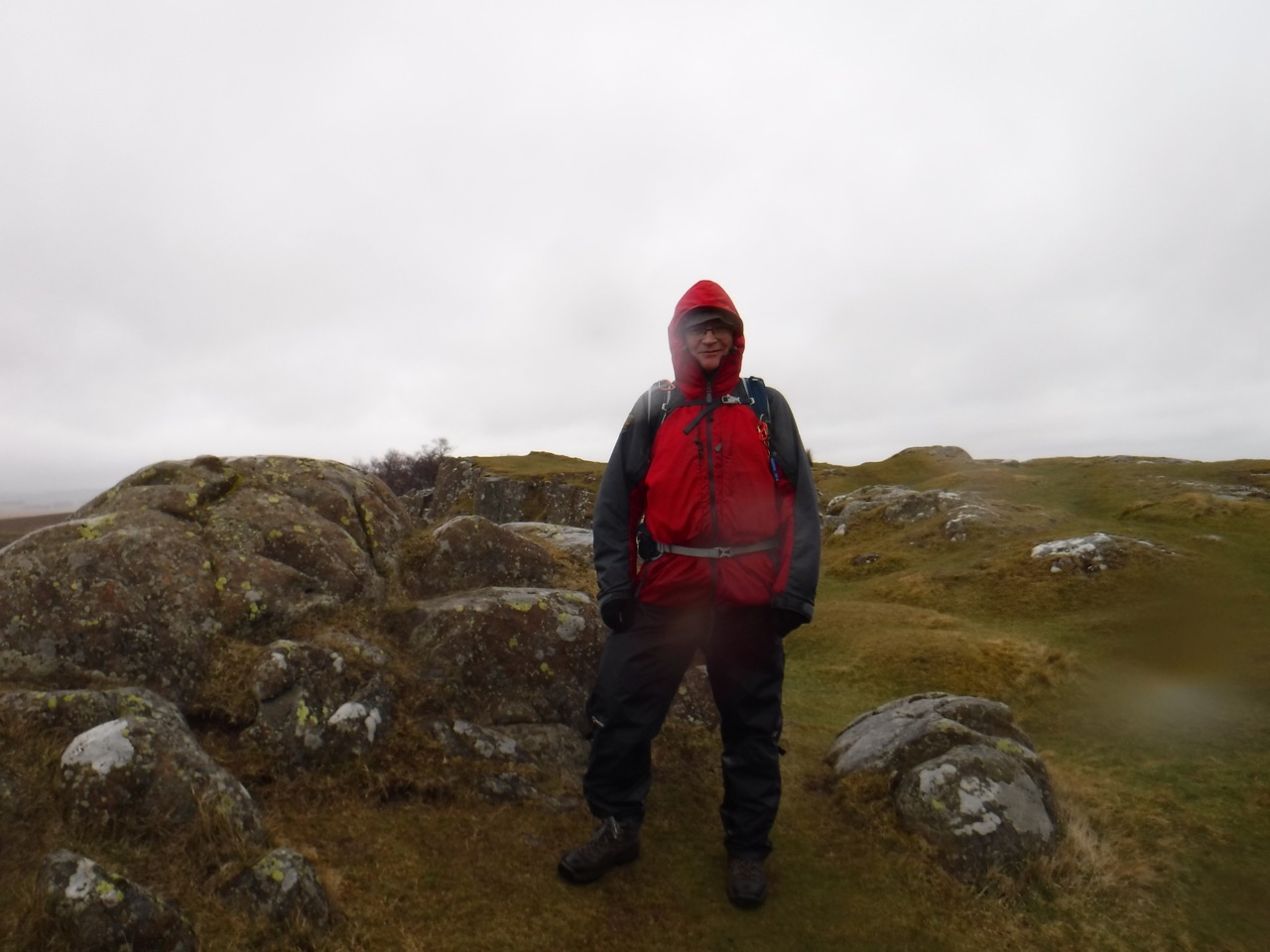
This was a walk in the rain. When we set out the rain was light enough that I decided against waterproof trousers. The forecast suggested it would stop by 1pm. Both the decision and the prediction proved to have been overly optimistic. But walking in the rain and mist has its own delights. It’s just annoying trying to take photographs with rain on the camera lens.
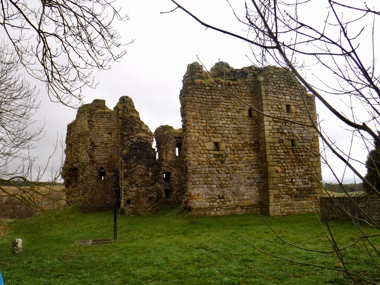
This section started beside some houses that presumably were originally for railway workers, and we crossed the railway itself at an unmanned crossing, then the Pow Charney Burn on a footbridge. From there it was a short walk to Thirlwall Castle.
Thirlwall Castle
The castle dates from 1225. Its name means something like “hole in the wall” and it is likely to have been constructed with stone from Hadrian’s Wall. The castle was important enough that Edward I stayed in 1306, and a later Thirlwall, Sir Percival was killed at the battle of Bosworth Field in 1485, fighting for the Yorkist cause. He was Richard III’s standard bearer and is said to have held the standard even after his legs were cut from under him. He likely died by the King’s side. With the union of crowns in the early seventeenth century, the borderlands lost their need for castles and Thirlwall fell into disrepair.
From Carrvoran or the head of the hill just over against it, down to Tippal water, both the walls and ditches are very conspicuous. They leave Thirlwel castle to the north. Here, according to tradition, the Scots and Picts broke through the wall. But the castle might be so called from the passage of the river through the wall. Just beyond Tippal water and this castle Hadrian’s vallum makes a little turn, whereby the walls begin to diverge, and Hadrian’s vallum becomes more obscure. Farther west, at a house called the Chapel, which stands within a castellum, the walls are about five chains distant from one another. For about a quarter of a mile before, Hadrian’s vallum and ditch, the south and north agger, are all in the second or third degree. But at the Chapel all of them again begin to be obscure. For the space between the two rivers Tippal and Poucherling, Hadrian’s wall is mostly in the second degree, and from thence, except a little here and there, continues obscure to Burdoswald. But near the chapel Severus’s ditch is very large, being in the third or fourth degree, and the wall itself in the second. The military way isalso visible in the first or second degree. At Foultown the way is lost, but the wall and ditch continue in the second degree. And Hadrian’snorth agger is here and there pretty large.
William Camden’s Britannia 1789
After the castle, we crossed the Tipalt Burn and headed back to the Hadrian’s Wall trail. We had left the land of becks (Saxon/Scots) for that of burns (Norse). It is interesting that the Pow Charney Burn is the Pow Charney Brook in the 1829 civil engineering report of the Newcastle Carlisle railway, and the Tipalt Burn here is the Tipple River. In 1789 we had the Rivers Tippal and Poucherling. I can’t find the derivation of either.
Lovely weather
Our stroll up a gentle climb brought us to a stone dyke with a gate that proved too tricky to open and a stile which took us out onto exposed moorland. Once back in the wind (and rain) there was no question that full wet weather togs were needed so we climbed back over the stile into the lee of the wall to change. A couple of walkers caught up with us while we we changing, but they didn’t really seem properly attired and we noticed they turned back soon after. But we pressed on, walking into the wind and rain.
Though the photos may look as if there were times without rain, that is because I dried the lens for each shot and took two or three shots at each place.
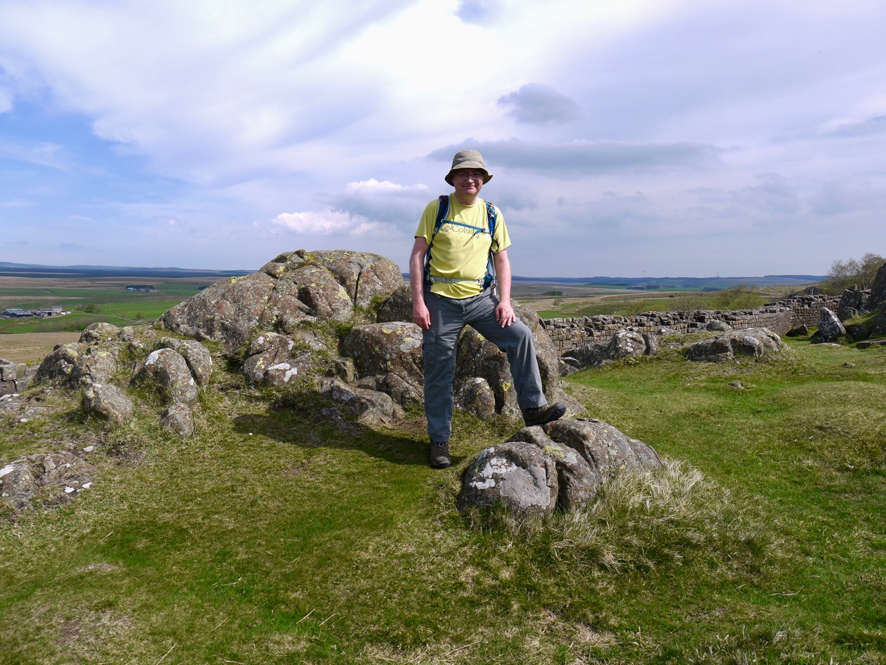
Walltown Crags
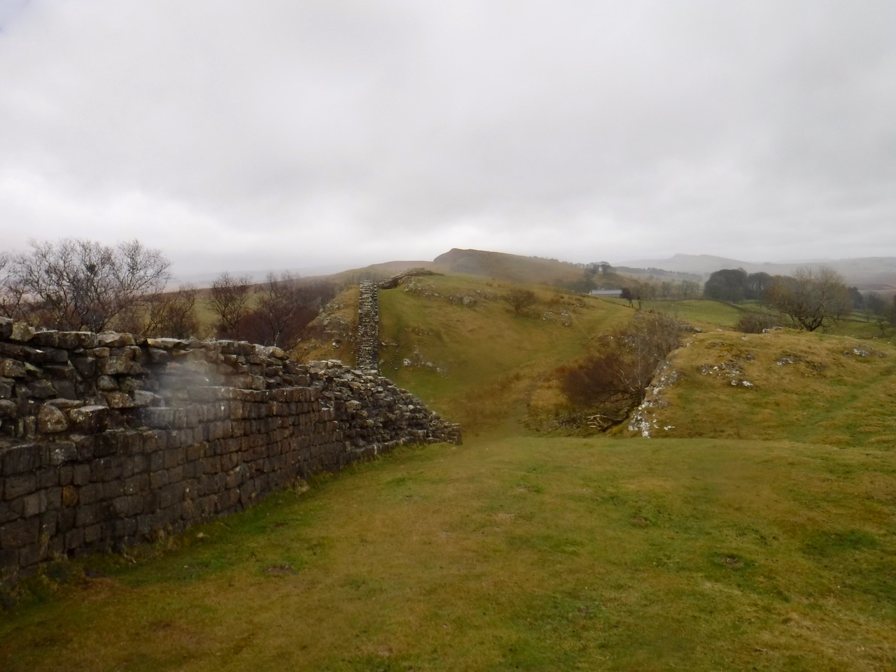
The day’s walk was mostly on exposed ridges with more names than I can remember without looking at the map, and included Walltown Crags, Cawfields Crags, Winshield Crags, Steel Rig, and Highshield Crags. We had multiple ascents and descents on slippery rocks making it slow going. But much of the walk was beside actual remains of Hadrian’s Wall or visible remains of the vallum. We reflected that Roman soldiers would have experienced similar weather while building and manning the Wall we walked beside.
Cawfield Crags
There are a few places along the way where the trail drops off the exposed ridge, and in better weather these would have been pleasant places to stop for a wee drink or a bite to eat. We had a wee break for coffee in a shallow hollow in on of these gaps. ( I originally described these as cols, but gaps feels better.)
Bird at Walltown Quarry
Walltown quarry had an empty car park, toilets, picnic benches, a bird sculpture, and a kiln/oven. A deer watched us from a stand of trees by the Quarry Lake, and we had to watch where we were stepping because of all the frogs on the path. I stopped counting after two dozen. There were a few riding piggy back on others and at first I thought they were mating but those riding were all much smaller than the frogs being ridden. Apparently some frogs will carry their young, but I’ve never seen it before.
Looking back to Walltown Quarry
We passed turrets and milecastles, and every so often a larger fortification such as Aesica and Vercovicium. At Aesica (Great Chesters) we noticed that the field by the farm had the remains of turrets at each corner, not something one normally sees in farms in the UK.
Aesica Fort’s Western Wall
We were looking out for a likely spot for a lunch break and eventually gave up and decided to stop anywhere with a bit of shelter. So lunch was at at Cawfields Quarry. It was still raining, a heavy drizzle really. There were picnic benches, but no shelter other than the public toilets. The best shelter we could find was in some trees and these might have protected us from the rain a little better had they been in leaf. But there were moss covered trunks for seats and the rest was welcome.
Cawfields Quarry
At lunch I got the map out and realised we were making quite slow progress, having taken three and a half hours to walk a little under 5 miles. The terrain was mostly to blame I think, forcing us to take care with each step, and later in the walk this was brought home to me since I fell three times, and almost fell many more times. I took special care on the rock steps which were often muddy, and when walking through mud, but I must have let my guard down when walking on grass. The mud I fell into had mostly been washed off by the rain but I fell a final time as we walked towards Housesteads and the rain didn’t get a chance to wash that mud off. I probably should have taken more notice of myself rather than looking at my footing. I caught my foot on rocks a few times, and rather than recognising that I was tiring, I spent my mental effort thinking how I would describe it in the write-up. I had decided that something like “the foot lifting sub-routine became corrupted” would do nicely, or perhaps “walk.exe became corrupted”.
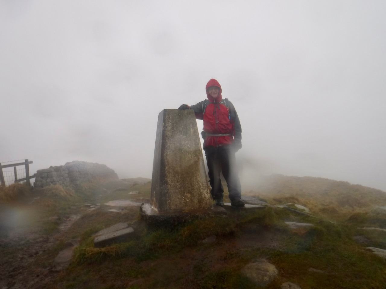
Winshield Crags Trig
Along Winshield Rig we were walking in mist. We paused at the trig point to admire the ‘view’, see above. Each time we had descended and reclimbed a gap we hoped it was the last, but then another height would emerge from the mist. Each time sapping a little more of our morale. Esmerelda warned me that she was approaching her tantrum threshold.
Hadrian’s Wall
My failure to recognise fatigue came home to roost half way up the climb onto Steel rig. We were passing a French Family, with cries of laissez le passé (or something like that) from the father when I was then struck down with cramp in first my left thigh and then a few seconds later the right. I couldn’t walk any further and found I couldn’t even bend my legs to sit on a rock. Stretching didn’t help. The cramp seemed well localised to vastus medialis on both sides. If only we had brought a physiotherapist with us. But we hadn’t so I took a stiff dose of Jelly babies (about ten) and after a few minutes I could complete the climb. I suspect that the repeated step-like climbing up and down had fatigued my thighs. The cramp recurred a little later, but settled with more rest and water.
I decided to look into exercise induced muscle cramps, and it turns out I was mistaken in my beliefs that these are related to electrolyte imbalance or dehydration. I suspect my problem was repeatedly performing an unaccustomed type of exercise (climbing rock steps) with inadequate rest breaks (due to the weather). I’ll take catching my foot and falling more seriously next time.
Bog near Hotbanks
As we approached Highshield Crags we climbed into a Scots Pine woodland with Crag Lough beneath us. Some of the trees looked to have had shapes carved into their trunks and I wondered if some ‘natural artist’ had been up there carving the trees. But as we walked on I noticed that some of the ‘carvings’ were too close to the ground for art, and I wonder if deer had been stripping lichen producing these curves. The photos are all blurred due to moisture on the camera lens.
This walk seemed to have been going on forever. I had put my map away since it had become waterlogged inside its waterproof case inside my waterproof pocket, so had not been able to keep track of where we were.
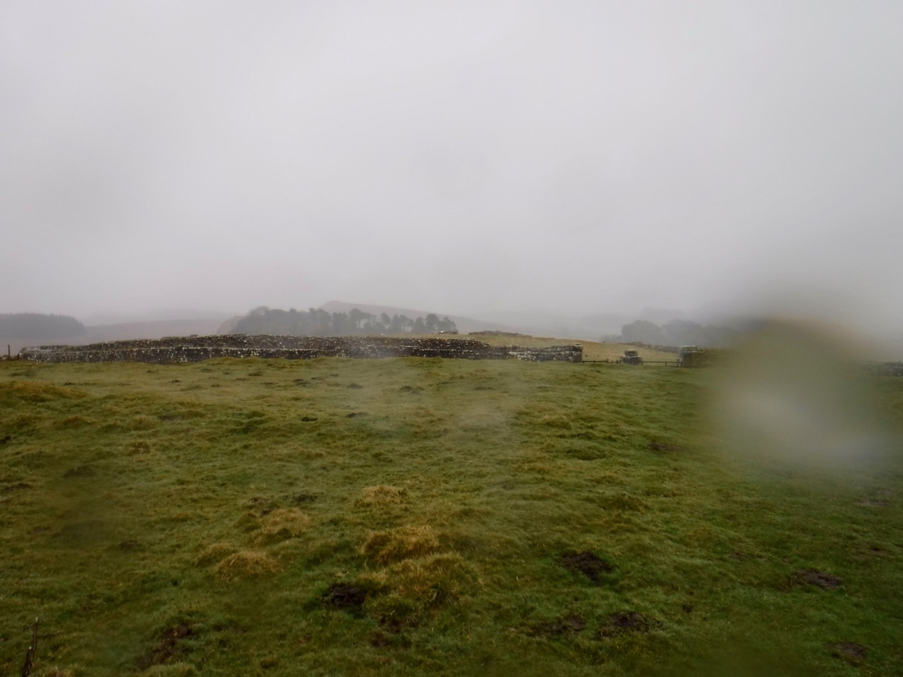
Housesteads
We walked on looking for Housesteads Fort, hoping we hadn’t missed it in the mist, and eventually out of the mist we saw a wall that was too robust for a farm wall and knew we were there. We followed it off the ridge and found a footpath to the nearby carpark. I was too tired to go round the museum shop.
Luckil there was some shelter at the car park to change into dry clothes for the drive home.