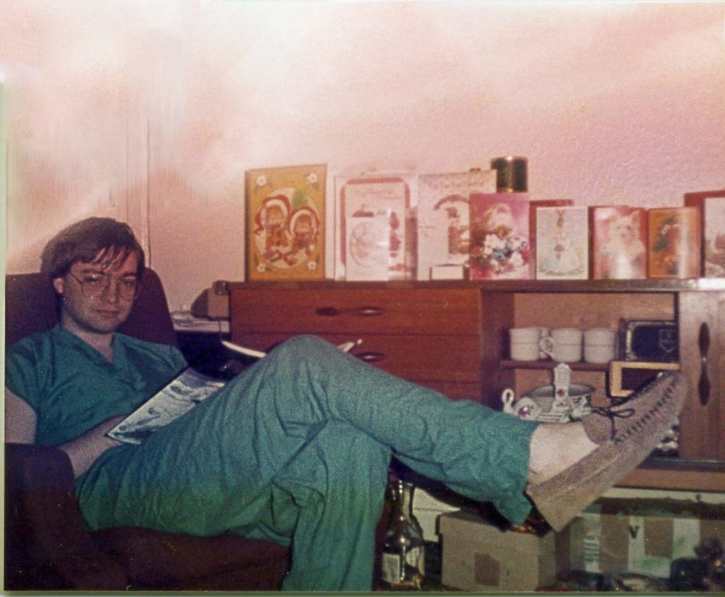
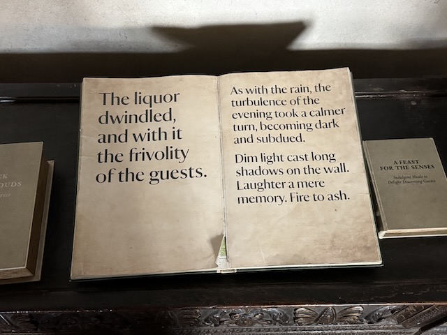
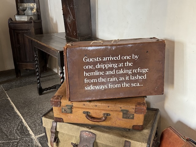
A houseman walks in the treacle of night, Weary, uncertain, and spent.
The white coat weighs heavy, a mantle of sorts, Through corridors hushed in the deep of the night. With the ward-weary tread that the darkness exhorts, He carries the tools that provide him his light: The stethoscope’s coil and the dog-eared guide, The ink of a pen, the tools of his trade. Twenty hours of service are etched in his stride, With twelve more to go ‘ere the shadows will fade.
Through a wrinkle in time, the long hallway slows, A stillness that lingers, a pause in the beat. A quiet diastole — the spirit’s repose — To steady the rhythm of mile-burdened feet. In this silvered silence, the emptiness heals, A hollow for breathing, a peace for the mind, Refilling the vessel before the bell peals To leave the soft hush of the hallway behind.
The ward door waits, a heavy, fireproof seal, Between the silvered silence and the shriek; Beyond it lies the crisis and the real, Where questions wait, and answers are to seek. He stands a moment, hand upon the plate, The corridor has stilled the inner storm; He sheds the man outside the heavy gate, And lets the doctor’s mask begin to form:
Unhurried, capable, and sure. He draws a breath — And pushes open the door.
MJM
Christmas Day 1984
The Land of Lost Content (1984)
Into my heart an air that kills From that lost country blows: What are those blue remembered hills, What spires, what farms are those?
A different walk in years long past, When “this year’s prince was born,” And questions in the press were cast: “Wish you were better informed?” The blast at Brighton, Orgreave’s fight, Greenham’s wire, Band-Aid song; A world of shadow in the light, Where once we did belong.
That is the land of lost content, I see it shining plain, The sunlit highways where I went And cannot come again.
With apologies to A. E. Houseman for butchering his verse
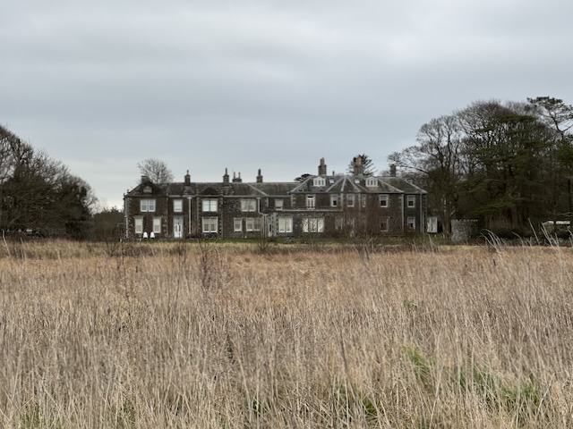
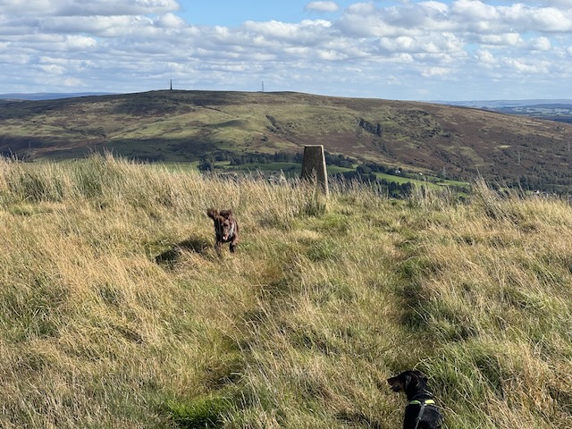
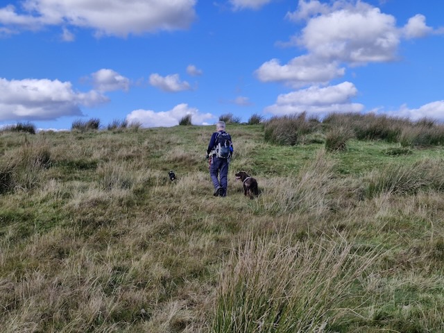
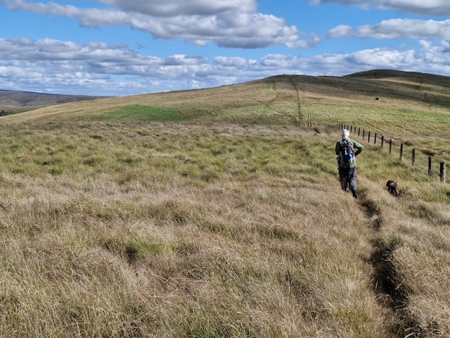
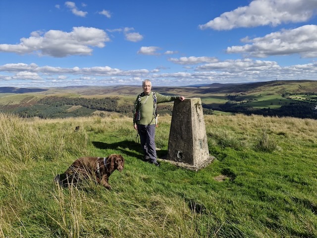
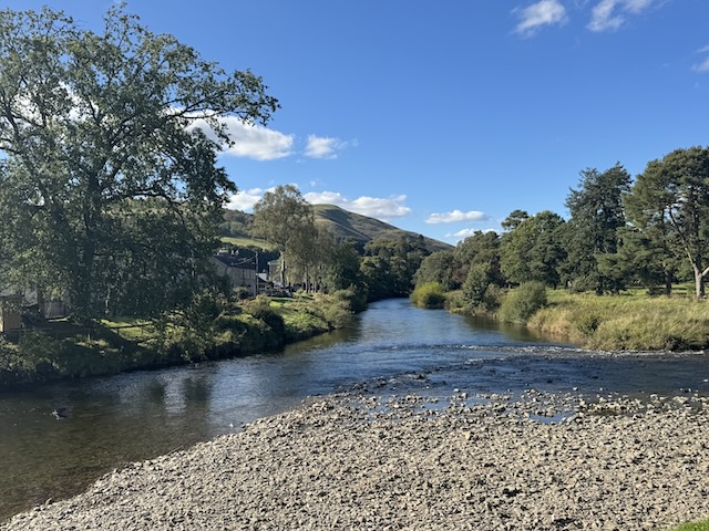
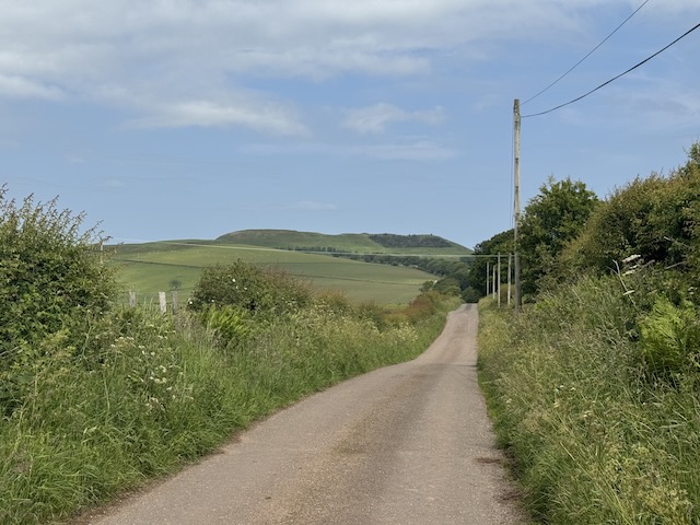
It had been a while since I had walked with a rucksack and I woke this morning with rigor mortis. It was not generalised so either the early phase or already beginning to wane. I had been unusually tired the previous evening but was pretty sure I had been alive. So it was too soon for rigor mortis to be wearing off yet. I didn’t recall any interaction with the undead, though I had mentioned seeing a photograph of a zombie. (I had intended leaving a link but cannot now find the photo).
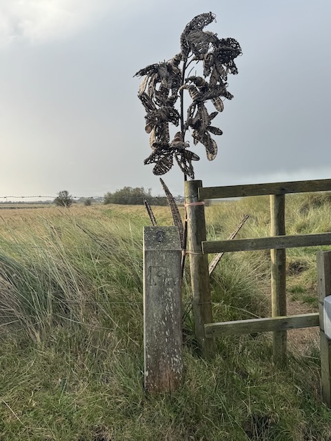
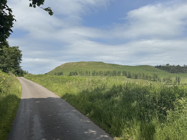
This walk had not been particularly arduous and Knockbrex Hill, its highest point, is only 40m high (and not 130m as some internet sites claim – it is 130 feet high). But it was my first outing with a rucksack this year, and the first over uneven ground. These two factors left me with stiffness in trapezius and quadriceps femoris.
I’ve heard them lilting at our ewe-milking, Lasses a-lilting before the dawn of day; But now they are moaning on ilka green loaning- The Flowers of the Forest are a’ wede away.
3.70 miles 1h 44m ascent 88m (Budle Point walk) 1.99 miles 1h 5m ascent 53m (Bamburgh Castle)
Wyrd bið ful aræd
The Wanderer
I’m so out of touch with TV that I didn’t recognise the Last Kingdom inspired posters. Nor did the quote “Destiny is All” that was plastered on them ring any bells in mt memory. I know now. In my defence, I have met the phrase before in “The Wanderer”, a poem from the 9th or 10th century, where it is usually translated as something like “fate is fully fixed”.
The point of the posters is to highlight the Anglo-Saxon heritage of Bamburgh Castle. Kings Kings of Northumbria ruled lands from the Forth in the north, south to the Humber and Mersey, from the Galloway coast, to the North sea. The Celtic fortress at Din Guaire was captured by the Saxon King, Ida, who was said to be descended from Woden. It would become the royal seat of Bernicia and then of Northumbria. Ida’s grandson, King Æthelfrith , named it for his wife Queen Bebba. It became Bebbanburh, and in time Bamburgh
But enough musing on the distant past. The weather forecast another bitterly cold and windy day with rain from midday so we planned a relatively short walk after which we would explore the castle itself.
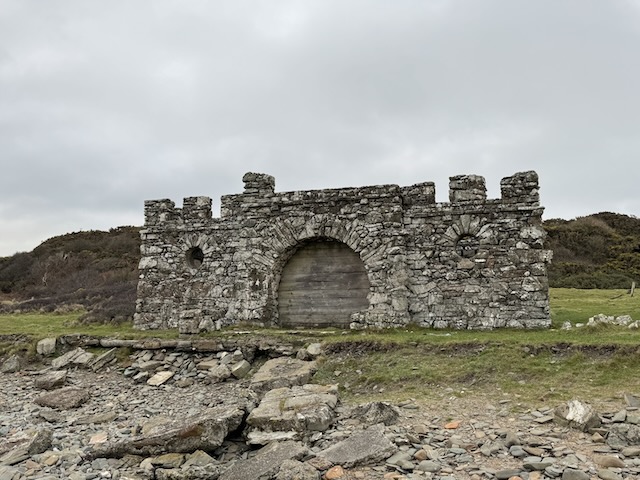
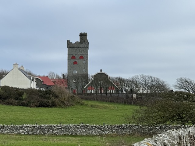
A castle (that’s not a castle), on an island (that’s not an island).
National Trust
DRAFT STILL BEING WRITTEN
6.01 miles 4h 2m ascent 64m
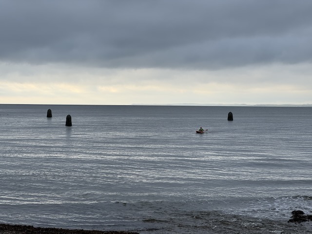
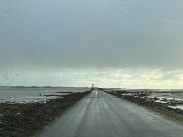
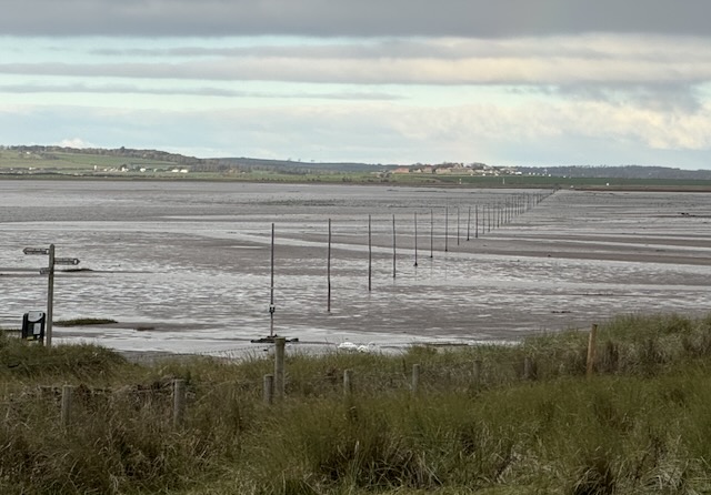
Holy Island is an island, for 12 hours of each day. A pilgrims’ route across the sands is marked by tall poles and was the only access, other than boat, until the modern causeway was built in 1954. Apparently, before that, local taxi drivers would happily drive across the sands.
Holy Island Causeway
We checked the tide times and drove across half an hour or so into a “safe crossing period”. I’m pleased we weren’t walking because the road is narrow and the ground beside it either under standing water or very waterlogged. The small parking bays along the route were still submerged.
There is a large car park near where the causeway joins the island and several signs asking folk to park there rather than in the village. Contactless pay-and-display. Our route was straightforward: around the island on the coastal path, strike out for the north coast if we could see a way and explore the castle and village towards the end. There was light rain when we set out and though the temperature was above freezing, we were walking into a 35 mph north wind. The rain bit into our faces like hail and the “feels-like” temperature was -5°C. I wished I had brought winter rather than autumn gear.
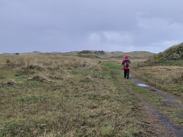
At least the ground wasn’t too wet. The first section, heading north, was over scrub land with cows grazing here and there. It is obviously well walked and the route obvious. I don’t have many photos from there because my phone was tucked away from the rain.
A number of faint tracks led northwards into the dunes but we decided against turning into the wind again. The wind would be a constant companion throughout the walk but the rain stopped and patches of blue sky appeared. The sun broke through.
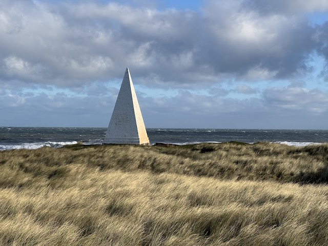
Emmanuel Point Daymark
A triangular object to the north caught my eye. It looked like the steeple of a Scandinavian church. We decided to head up onto the dunes for a better view and eventually made our way to it.
What we found was a 10m tall pyramid. This is a Daymark, an old navigation aid for shipping, standing on Emmanuel Point. It was built between 1801 and 1810 by Trinity House and is one of the earliest Daymarks built in Britain (possibly the earliest one).
The waves crashing against the coast were an impressive sight with spumes (is that a word?) of white water jumping up when huge waves collided. But there is obviously some law of nature that prevents such things happening while I try to catch it on video.
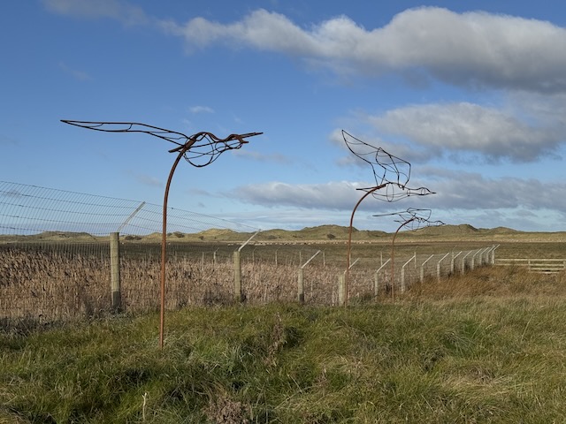
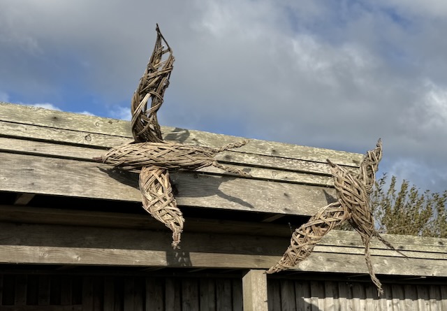
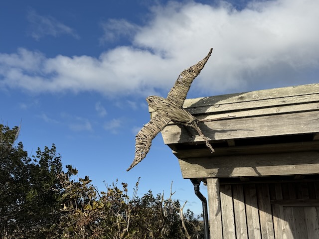
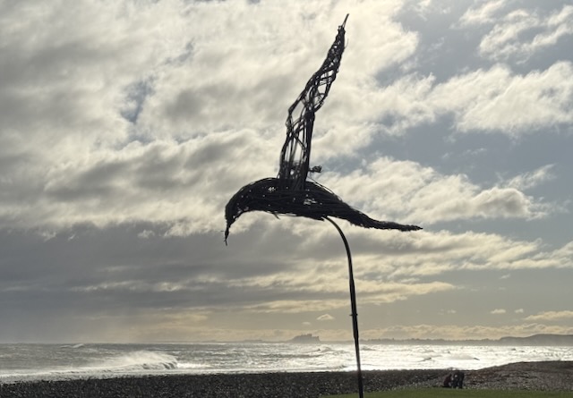
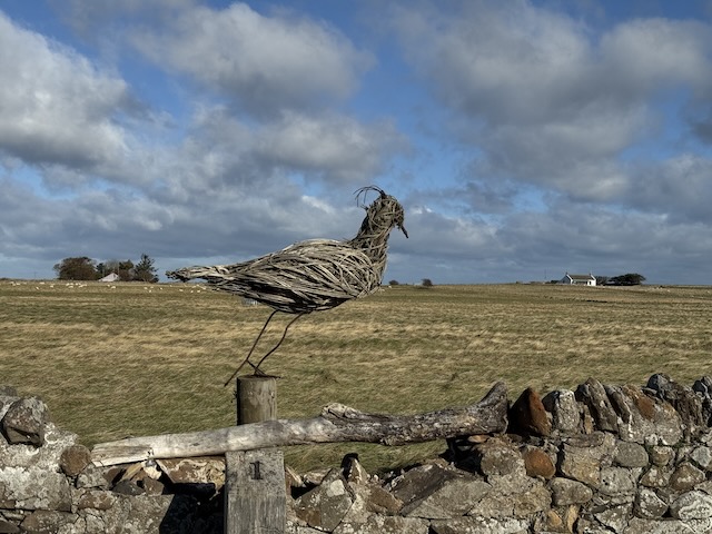
We turned our back to the wind, which made a considerable difference and headed back of the coastal path which took us past a bird hide and several birds of wire or willow. I asked Audrey if those with a forked tail were swifts, swallows or house-martins but she couldn’t help me. I didn’t consider sand martins. My money is on swift.
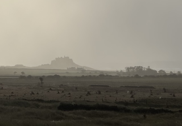
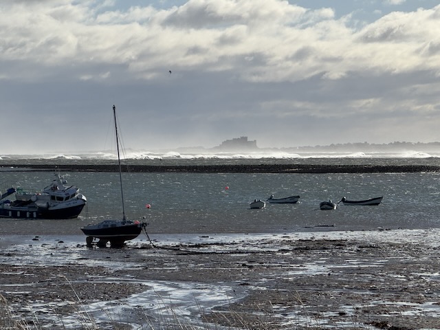
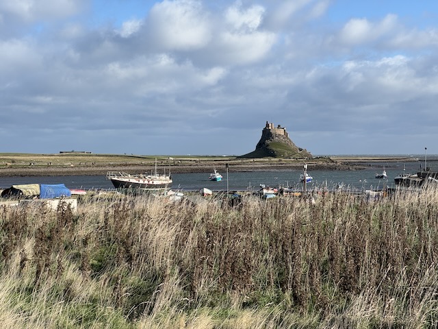
Our initial view of Lindisfarne Castle was a silhouette, distant, atmospheric, devoid of colour. The photograph at the beginning of the post. as we approached now, it was intermittently bathed in sunshine. Once we could make out details the castle struck me as looking Spanish or perhaps French, definitely not a classically English or Scottish castle look. And as we came closer it looked stranger still with features reminiscent of Tudor houses. I knew nothing of the castle at that time so found the history given on information boards quite interesting.
The Castle was built about 1550 on the order of Henry VIII. It was strategically important in the Anglo-Scottish wars and saw action in both the English Civil war and the Jacobite rebellion. It remained garrisoned until 1893 after which it fell into disrepair but was rescued by Edward Hudson who bought it in 1901. He engaged the architect Edward Lutyens for the renovation.
“The result was an Edwardian country mansion set largely within the structure of the old fort. It comprised four public rooms, nine bedrooms, and a bathroom (a second bathroom was added later). Most of those who visited loved Lindisfarne Castle, including Lutyens and his children. Others were less enamoured, including the Prince of Wales (the future George V), and Lutyens’ wife Emily, who liked neither Hudson nor what she saw as his cold, smoky castle. Another visitor, the author Lytton Strachey, was obviously a city boy at heart, and found the castle uncomfortable and far from his taste.”
Hudson never married and had intended passing Lindisfarne to the son of a friend when he died but that chap was killed in the war. [Correction: Hudson married Ellen Woolrich when he was in his 70s]. Hudson sold the castle and one of its subsequent owners passed it into the care of the National Trust in 1944. I can’t help being surprised that the National Trust was active in the midst of WW2. But the castle one visits today is the National Trust’s recreation of the Hudson/Lutyens version.
I’m not really sure how to describe the inside of the castle. The rooms wouldn’t have been out of place in “Myst”. Each is like a page from one of those “search and find” books so popular in the 1980s. There is even an I-spy trail, aimed I am sure at children, but who can resist walking round a room trying to find a pipe, a book, a ship… I couldn’t find the phoenix, unless phoenix is another name for fireplace bellows. The National Trust have some nice pictures of the rooms.
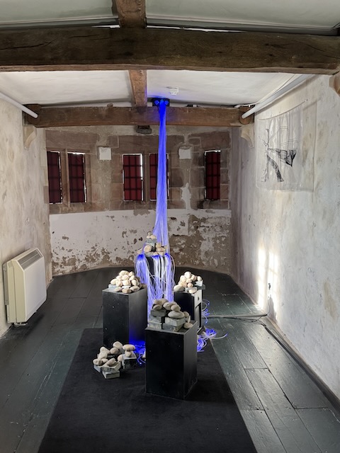
And just in case all this wasn’t enough, there was also an immersive light and sound installation, ‘Embodied Cacophonies’ by Liz Gre. It is best I not comment further lest I come across as a philistine. Oh, sod it, they could have done with losing the storage heater.
Embodied cacophonies
Outside the castle there are the Lime Kilns, which we glanced at from afar, and “The sheds”, made from upturned herring busses (boats), also part of the original Lutyens plan. There are three of these sheds by the castle and more near the harbour. These were, apparently, the inspiration for the shape of the Scottish Parliament building.
Gertrude Jekyll, “Bumps” to Edward Lutyens, created over 400 gardens in her time, was a regular visitor and designed what is now the Gertrude Jekyll Garden beside the castle. We sat in the garden very briefly but it was too cold and windy to stay. I didn’t take any photos. Summer photographs show it better. The NT restored Jekyll’s original planting plan in 2003 but it is past its best this late in the year.
I was intrigued by Jekyll, perhaps because of her surname. Robert Louis Stevenson was a family friend borrowed her surname for Dr Jekyll and Mr Hyde. At that time the name rhymed with Seek-All and the title was a play on the Victorian’s name for hide and seek, hide and seek-all. Apparently the modern Jek-ill pronunciation is a 1940s Hollywood development.
I googled the great lady, expecting tales of an elegant socialite but found photos showing someone I would expect to call me “Young Man”, despite my grey hair. But she seems to have been quite a very accomplished woman: author, artist, landscape and garden designer, embroiderer, blacksmith. And it was she who influenced Lutyens rather than the other way round.
“A garden is a grand teacher. It teaches patience and careful watchfulness; it teaches industry and thrift; above all it teaches entire trust.”
Gertrude Jekyll
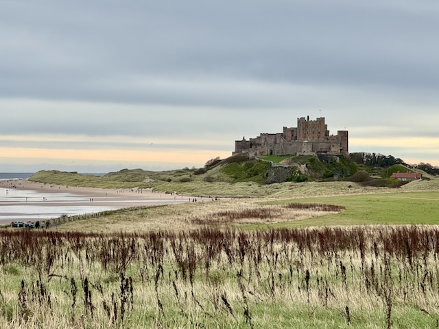
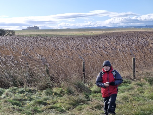
From Gertrude’s garden we headed along to the harbour. A line of benches gave us somewhere to sit while we went “full-British”, coats fastened up tight, eating sandwiches and drinking from a thermos, looking at Bamburgh castle across the bay and marvelling at the waves.
View at lunch – Bamburgh Castle across the bay
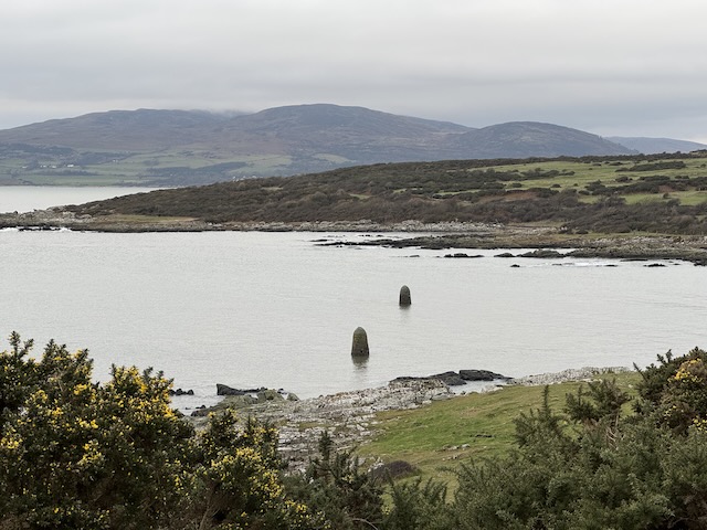
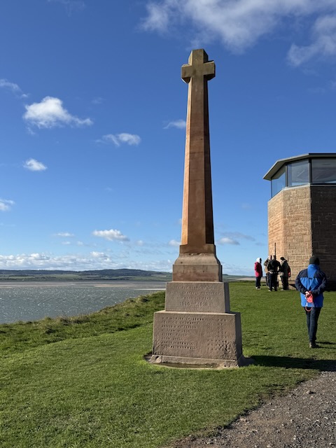
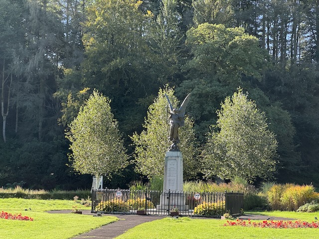
The harbour had more of the herring busses, used as sheds and a great many lobster pots, all looking quite new. Our next stop was the Heugh (p. Hee-uff), a short rocky ridge with the foundations of an Anglo-Saxon church, remains of the Lantern Chapel, a shipping beacon, a war memorial Lutyens designed by Lutyens and a coastguard observation tower converted into a public viewing point.
Lindisfarne Castle from the Heugh
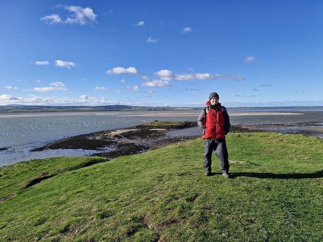
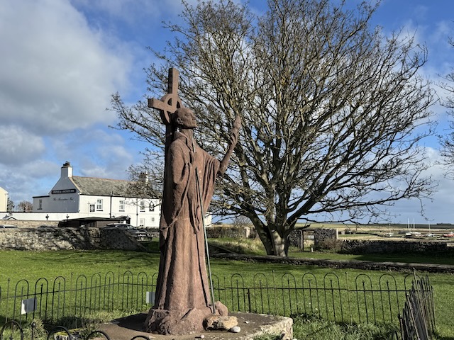
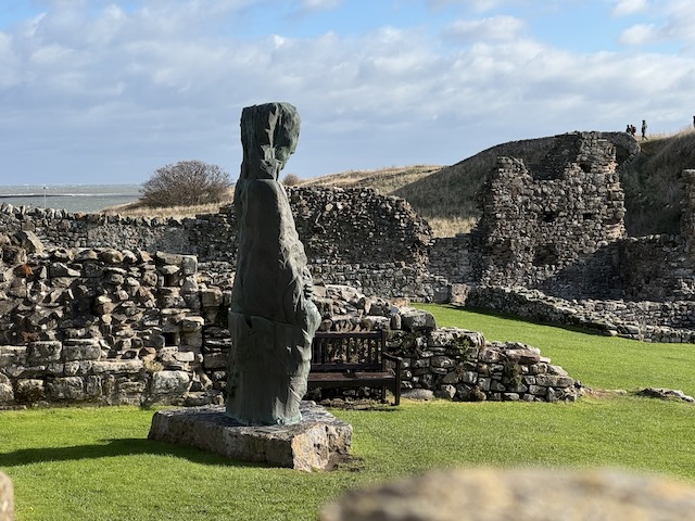
The Heugh does offer good views, the castle standing proud like a mini Mont-Saint-Michel, the ruins of St Osborn’s fort, Bamburgh Castle and the Farne Islands across the water beyond Guile point, the priory ruins with their rather unusual statue of St Cuthbert and the tiny St Cuthbert’s Island (otherwise known as Hobthrush). Cuthbert is said to have lived their when he wished to escape the other monks and as a prelude to his move to the Farne Islands.
War MemorialSt Cuthbert’s Isle
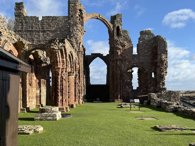
For some reason the Priory and its museum were so we had to explore from the outside.
King Oswald (St Oswald) gifted Lindisfarne to the monks of Iona who sent St Aidan to establish a monastery here in 635AD.
Sometime in the 670s a monk named Cuthbert joined the monastery at Lindisfarne. He eventually became Lindisfarne’s greatest monk-bishop, and the most important saint in northern England in the Middle Ages.
As prior of Lindisfarne, Cuthbert reformed the monks’ way of life to conform to the religious practices of Rome rather than Ireland. This caused bitterness, and he decided to retire and live as a hermit. He lived at first on an island (now called St Cuthbert’s Isle) just offshore, but later moved across the sea to the more remote island of Inner Farne.
On the insistence of the king, however, Cuthbert was made a bishop in 685. His new duties brought him back into the world of kings and nobles, but he acquired a considerable reputation as a pastor, seer and healer.
English heritage
I feel a connection with St Cuthbert. I was in St Cuthbert’s House at school and would live on a road named for him. He had a recognisable “saintly” life. Born in a well to do family, he became a warrior and fought in at least one battle. but his life changed on August 31st 651AD. He saw a light descending from heaven then return escorting a soul. That was the day St Aidan, died on Lindisfarne. Cuthbert went to the monastery at Melrose, also founded by Aidan, and asked to be admitted as a Novice.
“St Cuthbert was called to be a hermit on Lindisfarne. This was more than a thousand years ago. There were only small wooden huts there then, and the wind and the wild sea and everything that lived in the wild sea. Cuthbert went out there to the monastery, but the monastery was not far enough and he was called out further. He rowed to an empty island, where he ate onions and the eggs of seabirds and stood in the sea and prayed while sea otters played around his ankles. He lived there alone for years, but then he was called back. The King of Northumbria came to him with some churchmen, and they told him he had been elected Bishop of Lindisfarne and they asked him to come back and serve.
There’s a Victorian painting of the king and the hermit. Cuthbert wears a dirty brown robe and has one calloused hand on a spade. The king is offering him a bishop’s crosier. Behind him, monks kneel on the sands and pray he will accept it. Behind them are the beached sailboats that brought them to the island. The air is filled with swallows. Cuthbert’s head is turned away from the king, he looks down at the ground and his left hand is held up in a gesture of refusal. But he didn’t refuse, in the end. He didn’t refuse the call. He went back.
Paul Kingsnorth, Beast
After his death a Cult of Cuthbert gradually formed. His body remained “uncorrupted” for years after his death and his shrine became associated with numerous miracles. Lindisfarne became a major pilgrimage centre and became wealthy. Cuthbert’s body was removed in 870AD to protect the holy relic from despoilment in the ongoing Viking raids. Wherever the body rested, more miracles occurred. He was eventually buried in Durham, where the cathedral now stands.
St AidanSt Cuthbert
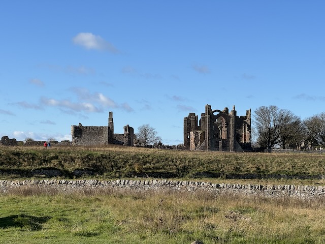
The monks returned from Durham in the 11th century, fleeing William the Conqueror’s ‘Harrying of the North’, and the priory ruins are date from that time. The monastery was dissolved by Henry VIII but the buildings remained in use as a military base until the castle was complete. They were ruins by the late eighteenth century.
It’s been a while since the last post. So long indeed that I have published the previous one unfinished. We didn’t get into a walking project this summer due to a combination of illness, holidays, heatwaves and, if I’m honest, a bit of laziness. We have been walking, but mostly the old haunts locally.
Well. I was browsing the OS routes section and this particular walk caught my eye. The description sounded just what we needed to ease back into it.
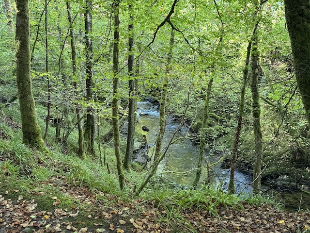
This is probably hill‑walking at its easiest: low, grassy tops reached with a minimum of effort. You’d be forgiven for thinking, therefore, that such walking might be dull. But, although these rounded hills aren’t the most exciting tops, they are located amid gorgeous scenery with mesmerising views. The route starts from Langholm, quickly climbing to a path known as Gaskell’s Walk. Leaving the town far behind, this enters the peaceful, wooded gorge through which Wauchope Water gently tumbles. Later reaching the hills, Calfield Rig (319m), Black Knowe (326m) and Mid Hill (327m) are all climbed. Paths are few (and often squidgy) on the high ground, but the views make up for any difficulties, particularly on the final ridge with Lakeland’s fells visible on the far side of the Solway Firth. This is one of 14 routes established several years ago by the Langholm Walks Group, and, although most of the waymarker posts have now disappeared, a few still provide the occasional guiding hand. By Vivienne Crow
I can’t argue with most of what was written. I might take issue with it being the easiest hill-walking but perhaps the author of that description usually does more challenging hills. We saw plenty of waymarkers with a number 9 and they might have been helpful if we had known we were following that route.
One important learning point was that the OS Map route was not particularly exact and attempting to follow it did lead us astray until I realised it was a drawn route rather than an actual GPS recorded route.
The stroll up Caulfield Rig took me back to my Donald bagging days. No obvious track, boggy ground hidden by tussocks and squidgy sphagnum moss.
Mid HillBuccleuch ParkWauchope waterNo. 9Buccleuch Square PumpThe Esk and Ewes Water
When we stopped for lunch, Audrey sat on a stile and I crouched down. I reached out to tickle the dachshund’s ear, steadying myself on the fence beside me. Mabel let out a yelp as if she had been trodden on and I felt a jolt in my fingers. You guessed it. An electric fence.
I found the descent into Langholm particularly trying. It wasn’t especially steep and the ground was fine but my back was really playing up. The dogs had to stay on their leads (there were sheep scattered here and there). I wondered if I was leaning back more than usual, tried adjusting my rucksack to no avail but the following day I was aching all over, including parts I wouldn’t expect to be made worse by walking (the finger that was broken a decade ago). So I am now blaming the symptoms on the flu jab I’d had the day before.
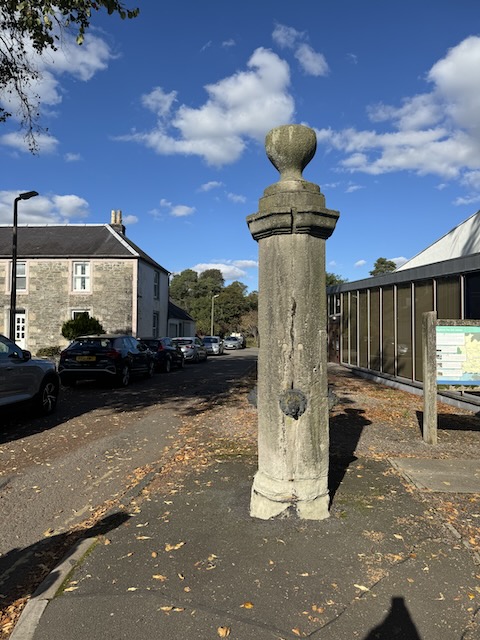
PS. Google has gone down the drain since using AI. When I try searching for information about the stone pillar with small lions’ heads it keeps bringing up the Telford ‘doorway’ and tells me I might be mistaken, asking if I meant Nelson’s column? FFS. The only reference I can find on-line is in geograph, asking what is might be.
I eventually found this on Historic Environment Scotland: Buccleuch Square, Pump: Late 18th century. Free-standing octagonal (ashlar) shaft. with 4 cast-iron lion-mask spouts; cornice and chalice-shaped.
Millenium Garden, Boredom Buster Playground with wooden dragons, snakes and turtles, Auchencairn Burn, boardwalk, Mussel, Lobster, Starfish, Old Torr Cottage, past the chalets, past the cows, Red Haven Beach, woods, Torr Point, Swing, Tar Pit, views, old woodland, the un-inscribed stone, Bowe Wood, Torr Cottage, Mabel giving up the ghost, Time capsule.
It was a simple enough route, minor roads from Ecclefechan to Burnswark, up the hill, then back again. But ……
A world unfurls, if you but look, Beyond the grand, beyond the book. A dewdrop clinging, clear and bright, Reflecting sun, a tiny light.
The spider’s silk, a silver thread, Across the garden, softly spread. A whispered hum, a busy bee, Lost in the heart of calendula’s glee.
The bark’s deep lines, a map untold, Of seasons past, of stories old. A pebble’s hue, a mossy sigh, Small wonders dancing in the eye.
In these small truths, a richness found, The quiet beauty all around. A deeper peace, a gentle art, To see the world, piece by subtle part.
…. the real experience is in the details.
It was a glorious day. My arms covered by sun-creme rather than sleeves, we walked in Summer’s weather, while Spring’s work still filled the hedgerows. Despite seeing Burnswark’s distinctive flat top on many walks while a few miles away, we could not see the hill for the first half hour of this walk.
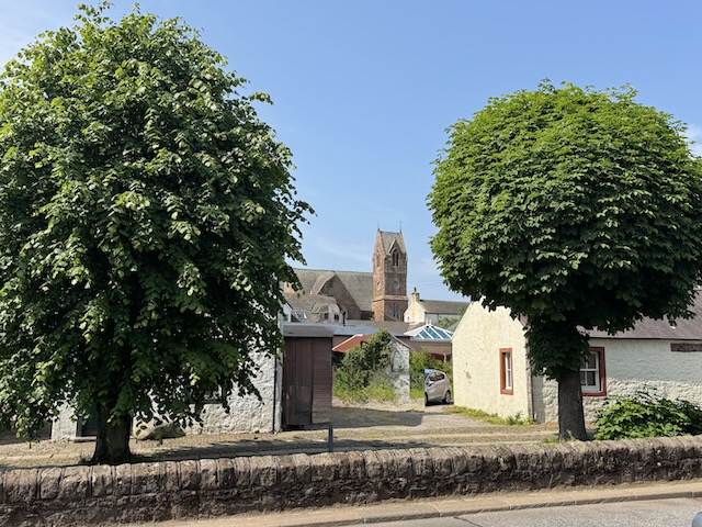
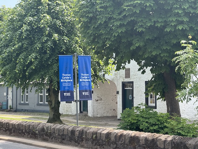
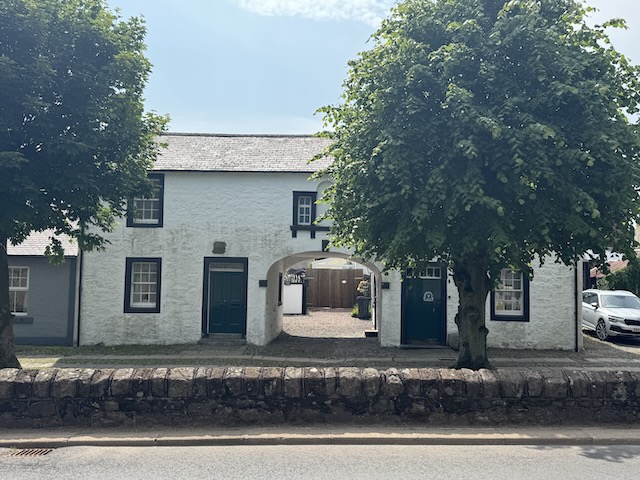
We found a spot to park opposite “The Arched House” in Ecclefechan. This house, which carries the inscription, “Birthplace of Carlyle, 4 Dec 1795”, is now a museum in the care of the National Trust for Scotland.
Ecclefechan is a small town, perhaps more akin to a large village. It would once have been a key stop on the Carlisle-Glasgow road and the Ecclefechan Hotel, which we would visit later, was originally a coaching inn. Today’s turnpikes, the motorway and railway run parallel to the old road but by-pass the town changing it from a traveller’s halt to sleepy hollow. The town’s name is source of many a jape, “I missed the ‘fechan bus” etc. though its origin is the Brittonic eglwys fechan, small church.
Carlyle’s BirthplaceEcclefechan
Thomas Carlyle is the town’s most famous son. A writer, historian and philosopher, he was world renowned in his day and known as the “sage of Chelsea”. He famously walked to Edinburgh, a hundred miles away, at the age of 13 to study at the University. His writings popularised the “Great Man theory” of history which is now regarded as overly simplistic but still has momentum in some leadership teachings. The internet throws up a great many wise quotations from the sage but the simplicity of this verse from his poem “Today”was one that made me think.
Here hath been dawning Another blue Day: Think wilt thou let it Slip useless away.
He died in 1881 having uttered his final words “So this is Death—well …”. His fame was such that he was offered a burial in Westminster Abbey but declined this in his will. He is buried instead in Ecclefechan churchyard.
An information board at what must once have been a crossroads, had a map showing places of interest in Ecclefechan and a few lines from Burn’s “The lass o’ Ecclefechan”.
Gat ye me, 0 gat ye me, O gat ye me wi naething? Rock an reel, and spinning wheel, A mickle quarter basin: Bye attour my Gutcher has, A heich house and a laich ane, A’ forbye my bonie sel, The toss o’ Ecclefechan
Which left me none the wiser.
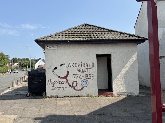
Behind the information board, the town’s public toilets are graffited with the names of other Ecclefechan notables: Archibald Arnott, Napoleon’s physician; and Janet Little, the Scotch Milkmaid, a poet and contemporary of Robert Burns. Her poems aren’t really my cup of tea but “From Snipe, A Favourite Dog, To His Master” reminded me of Burn’s “Twa dogs”.
Langlands Road would once have been a direct route to Burnswark but the A74(M) but now a footbridge is the only way across.
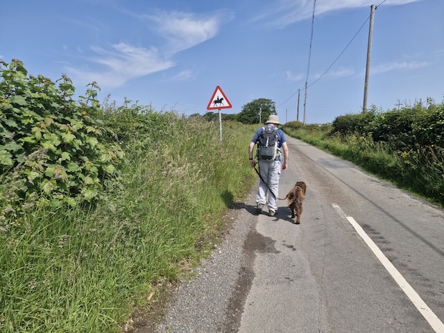
Burnswark Hill was still hidden from sight as we took up the road again on the far side of the motorway. We crossed the railway then continued up a minor road. There were only a couple of vehicles though signs did warn of horses. This was a gentle climb uphill up to the radio aerial on Clint hill.
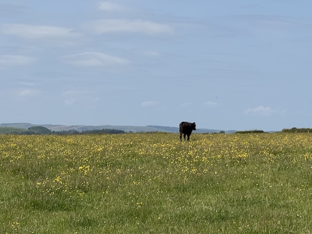
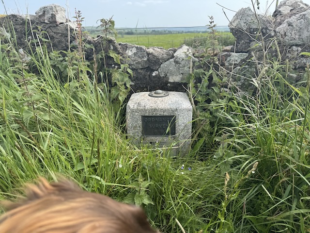
Beehives, views of Criffel and the Solway, fields of buttercups, a bull by the road, OS GPS marker. Then downhill past Axletreewell to Relief, both rather unusual names.
Burnswark Hill. Just shy of a thousand feet. A Roman fort and before that a hill fort of the
O’er Criffel hill, he loudly roar’d, O’er Burnswark hill, he wildly snor’d; Through entries blew wi’ sic a birl, Baith ricks and houses he did tirl; Susannah Hawkins – Address to Satan
Kirkconnel Hall Hotel, “a good place to sop for coffee”. Closed. Indeed its closed-ness looked rather longstanding. We almost didn’t find Kirkconnel Tower, a ruined 15th century tower house.
Elizabeth I of England sent a force under Lord Scrope into Dumfriesshire in 1570 to destroy the houses of those who had supported her cousin, Mary. The town of Ecclefechan was burned and the estates of Lord Herries, Lord Maxwell and Murray of Cockpool were singled out for special treatment, they having been deemed to be particularly sympathetic to Mary. Whether or not the tower suffered the same fate is unclear. Stravaiging around Scotland. May have been a victim of the feuding between the “river” families in the area.


