9.5 miles 4h 28m ascent 511m
Afton-Jedburgh Knees-Windy Standard-Blackgrane-Millaneoch-Wedder Hill
A walk in the snow.
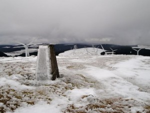
Windy Standard has eluded me on a previous walk which I abandoned in bad weather. As you can see from the picture, the weather was challenging but I made it this time.
The road from New Cumnock to Afton Reservoir is one of those that starts in a reasonable condition but gradually shrinks to single track and then becomes littered with pot-holes. After the Afton Waterworks the road was covered in semi-melted and re-frozen snow and the car=park, marked on the OS map, was closed off. I managed a seven point turn in a passing place, taking care not to slip off the road and left the car at the waterworks.
A snow covered path led up and to the back of the waterworks from where I crossed a watercourse and climbed over a small fence to get onto the slopes of Green Knowe alongside a bubbling brook with small waterfalls, Sandy Syke. This brought me to a track which I followed as it climbed the hill. At this stage the land was cloaked in mist so there was little to see other than the path, a few boulders and several sheep who watched me walk past. I looked up the hill wondering what the cloven stone, marked on the OS, might look like.
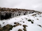
As the path climbed it gathered patches of ice, then a full covering of ice and snow. This was a warning of what was to come. The path reaches the trees at about 520m. As I walked up the hill, I was thinking, as ever, that every metre climbed was a worthwhile effort. Once the path moved into the trees, however, it descended and the snow covered path lost the vehicle tracks that had made walking easier.
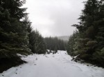
The snow here in the forest was about ankle deep, occasionally hiding puddles but was relatively easy going. In fact the main irritation was trees abutting the path and shedding water whenever I brushed against them. I took special care crossing small streams since it was difficult to know where a bridge ended and overhanging snow began.
The path continued to descend as far as the Water of Deugh. The mist occasionally cleared to allow fleeting views of wind turbines on what I thought to be Windy Standard, but they were more likely on Jedburgh Knees. This did also give me a glimpse of the fire break I had planned on climbing. It looked easy on the OS but as it “stood naked before mine eye” it was obviously a non-starter without crampons and ice-axe (not included in my rucksack).
There is a small wooden bridge over the Water of Deugh, where I stood in a foot or more of snow, reviewing my options and scowling at the map. A path runs south but ends in the forest well short of Windy Standard. There are firebreaks but with crowded contours. It didn’t make the shortlist since I could see no sign of the path.
I continued along the path I was on for another half mile then headed up a wide firebreak. This turned out to be easier than I had thought. A fallen tree partially blocked the way forcing me onto a steeper section and did have me on all fours a couple of times.
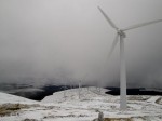 The snow on Jedburgh Knees was mid calf level so I was relieved to get onto the road heading up towards Windy Standard. The snow on the road had been compacted by tracked vehicles and looked as though a piste basher had been at work. The relief however was short-lived. Every few steps my foot would sink to mid calf making the going somewhat tiring.
About this time I received a text from Mrs Drow ‘n’ Smirr asking when I would be home. The summit was just ahead so I replied that I was just near the summit and would then be heading back down. Only minutes later the mist cleared and I wasn’t as close to the summit as I had thought. There was another 45 minutes to the summit. Of course by then the phone had no service.
I continued along the compacted snow sinking every few steps. The path eventually started to descend again and it dawned on me that the path didn’t go to the summit, which was again lost in the mist. So I took a bearing and headed off the path towards my goal. The snow here was just less than knee height and hard going to say the least.
Then I had a stroke of luck. The mist cleared and I could see the the trig point, covered in ice. I say it was lucky because it was several metres to the left of where I was heading. I suppose I’d have got there in the end just by heading uphill, but this saved me a little time.
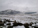
Lunch was taken next to the trig pillar and the mist lifted to allow a few photos. Moorbrock Hill and Cairnsmore of Carsphairn were now visible, beautiful in their coating of snow but Alhang and Alwhat were still lost in mist. I headed for the nearest wind turbine so I could follow its path back to the compacted road.
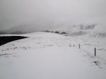
My way back over Blackgrane, Millaneoch and Wedder Hill, following the fence, was now visible and in different weather could have been an easy stroll. As it was the snow proved irritating. In places, with care, it was possible to walk on the snow but my feet would suddenly sink to calf or knee every few steps. Beyond Millaneoch the snow was softer and all steps sank, sometimes into standing water.
On the southern slope of Wedder Hill I met a group of walkers heading in the opposite direction. Their footprints gave me some warning of what lay below the surface. Deep prints in snow surrounded by brown marks identified hidden muddy puddles. Unfortunately I was eventually caught out and gifted wet feet by the accursed ground. The going was very tiring but at least I could see my goal, the path I had started on, which I rejoined where it exited the forest.
Though covered in snow and ice, the path was, relatively speaking, like a walk in the park compared with the previous 80 minutes. What was more, with the mist cleared I could now see Afton Reservoir and its surrounding hills. I couldn’t see the cloven stone but did see Castle William, a large rock formation.
I did wonder if it would be possible to get down to the dam and follow the lower path back to the car. It was only a short distance down through some trees but again the area was covered in snow and I thought it safer to just retrace my steps on this occasion.
.

