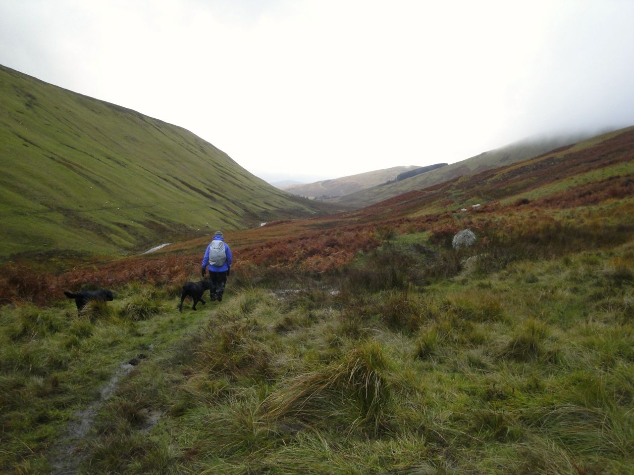
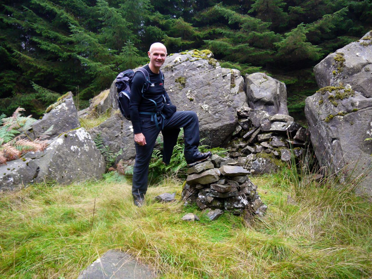
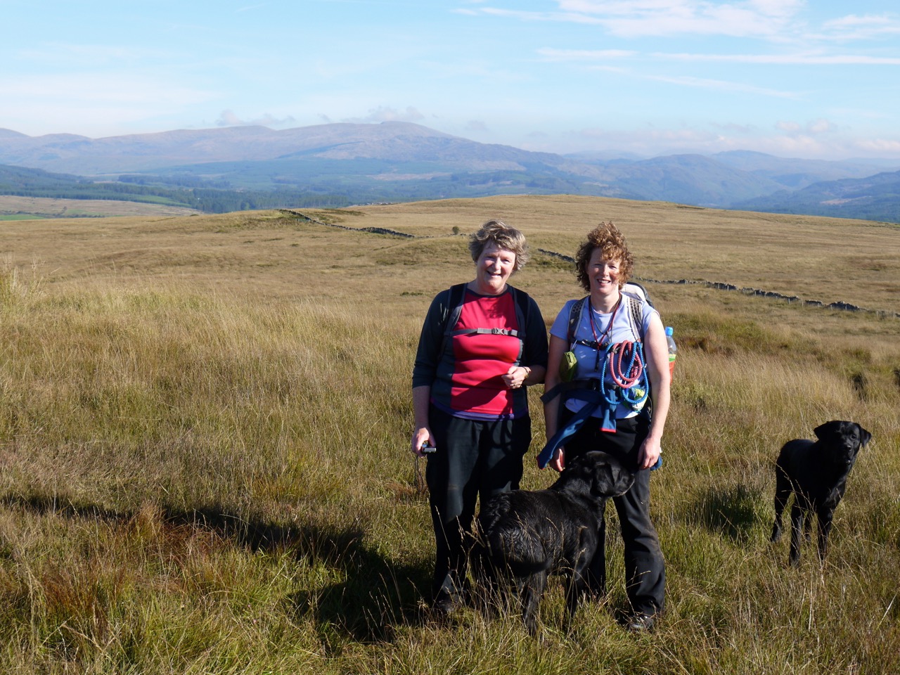
Route: Mabie Forest, around Marthrown Hill on MTB tracks then up and over in the trees
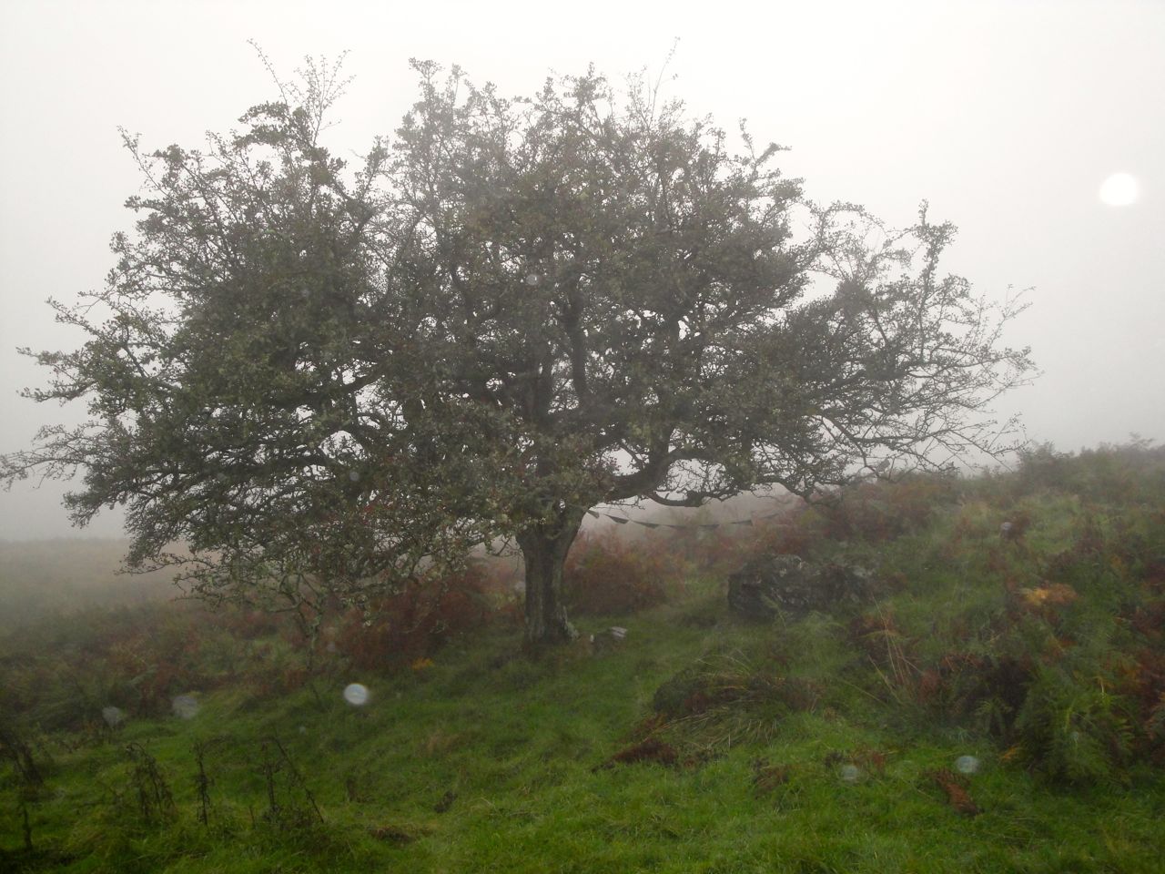
Feeling a little under the weather I decided to ditch the planned walk (which included an FFS section) and instead just mosey around Mabie with the dogs. I thought I might perhaps visit the top of Marthrown Hill. The OS map has a fire tower near the top, so I thought there must be a way for people to get to the tower relatively easily. That was my mistake. On reflection, nursing my bruises, I realise now that it actually means there must have once been an easy way.
Various paths run around Marthrown Hill so I got myself on the highest one I could find then set off clockwise looking for a likely way up the hill. Much of the path has young trees densely planted beside it, so on and on I walked.
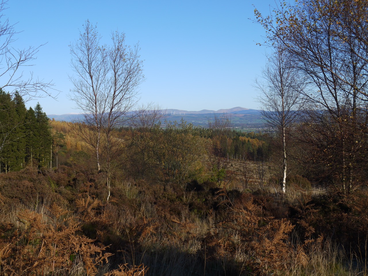
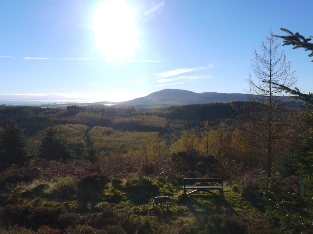
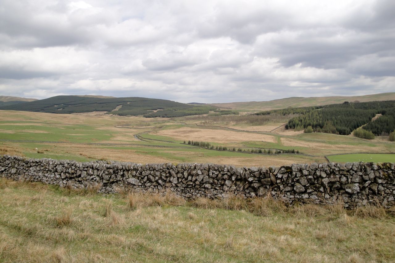
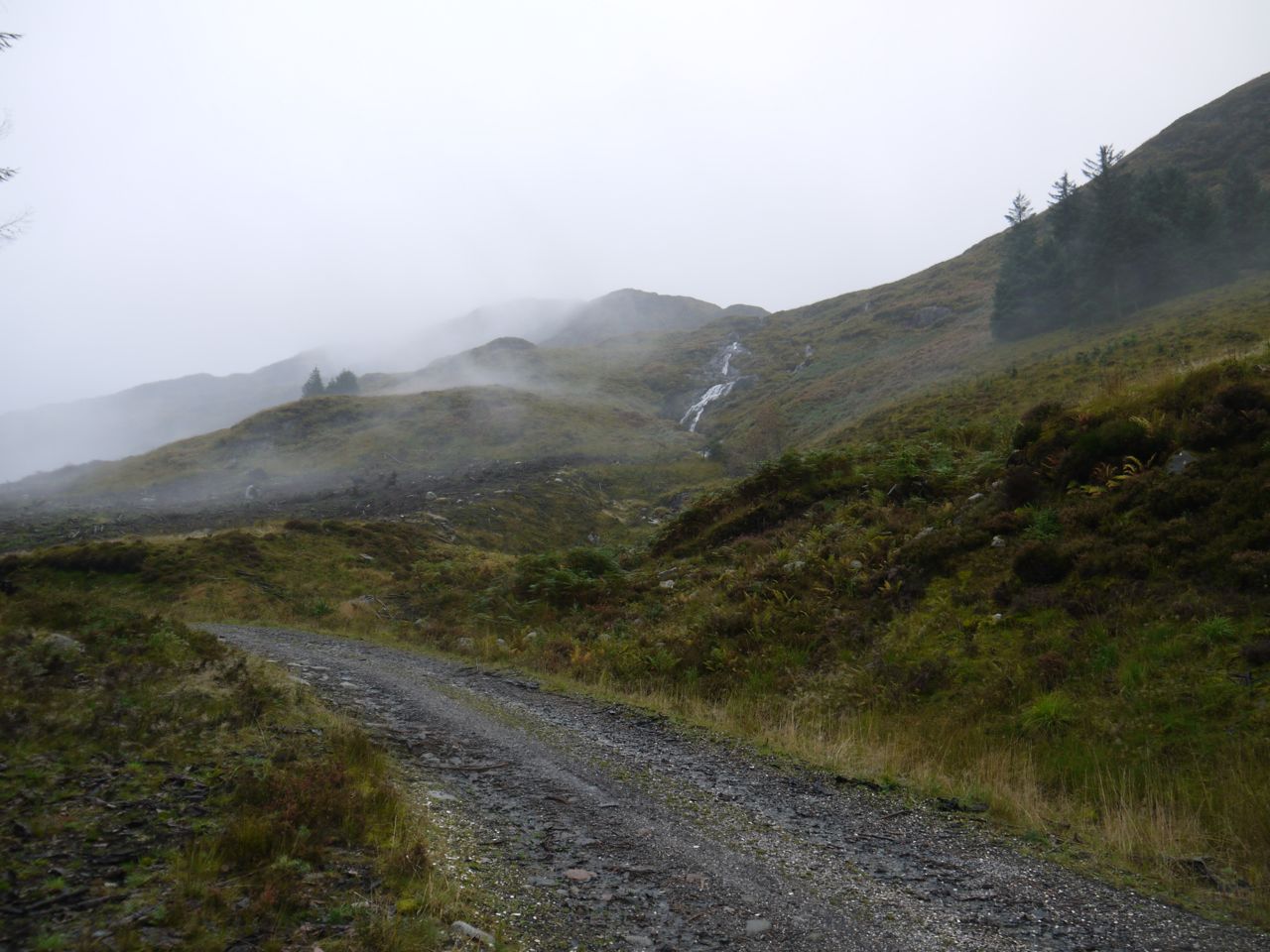
There is a viewing point with a bench at about NX936738 with nice views over to Criffel and the Solway. This was actually the highest point on the track. Behind this I noticed a faint track up into the trees. Within 10m however, the trees were too dense to pass, so I returned to the path and continued on around the hill.
Criffel from Mabie
The path from the bench is part of the official walking routes and carried me onto a forestry road with orange way marker posts. The lochans here were frozen over so I rushed past before Sweep noticed and jumped in. He had already fallen foul of frozen puddles in the ditches but that was just wet paws.
I stayed with this route for a little while but left the orange route to stay on a higher path.
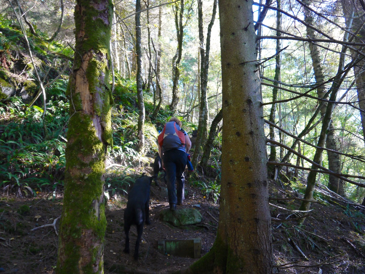
Eventually I began to experience deja vu, and realised that I had done an entire round of the hill without finding a way up. Since there was no obvious route I would just need to find a way through the trees so I left the path and headed directly up at a section of forest that looked relatively passable. This was somewhere around NX939709.
This was steep but the trees were tall without low branches and the undergrowth was sparse. At first.
Eventually the trees became younger and more densely packed. Where there were gaps in the trees they were filled with felled or fallen tree trunks with dense bracken overlying hidden ditches.
The higher we went the closer the trees became and the terrain more difficult. Leo could not get over some of the obstructions and had to be lifted while Sweep forged on a ahead, his position shown by movement of the undergrowth or the noise of him flopping into a ditch.
Having struggled across some particularly difficult ground to a slight rise we had reached a point where I could see a likely candidate area for the summit, a stand of trees a little higher than where I stood, but the terrain separating it from me would have been impossible for a small, elderly, terrier. Time to bail out. The GPS tracker shows I was probably within 100m of, and just 13m below, the summit.
I thought the previous 100m had been too difficult for the wee dog to go back that way. There seemed to be an easier way almost directly north and the closest path was that way. Seemed is the operative word here. The grass always looks greener etc.
This proved to be a rather unpleasant descent. 400m of horizontal distance, downhill, took almost half an hour. I was plagued with mirages where I thought I glimpsed a break in the trees only to find that it didn’t exist. The trees with intertwined branches were too close to pass between at times and fallen trunks blocked other ways through.
I caught my foot in a root just above a 1m step and experienced acceleration at 9.8m/s/s followed by a rapid mud-induced deceleration. Wet, muddy, and covered in pine needles I lay there looking up at one dog while the other barked at me. I thanked my lucky stars that nothing was broken, bones or equipment.
Leo looked down at me, unable to see how he would get down (answer: by manhandling him). Sweep, always unhappy when I stop on a walk, continued barking at me until I had disentangled myself and was on the move again. The terrier had to be manhandled in several other sections as well as the step I had fallen over, but give the old dogs their due, they kept going.
When I could at last see the MTB track, my way to it was again blocked by young trees growing amongst fallen older trees so a further diversion through the forest was needed to find a way onto the path.
I sighed with relief on escaping the trees. If I’d had a flask of whisky, that would have been the time to take a slug. Instead I picked the pine needles from my hands, brushed the mud from my camera and took the shortest route back to the car park.
I will no doubt have to return to Marthrown Hill and climb those additional 13m and it will be all the more exciting having failed this time. So much for a stroll around Mabie.
12.2 miles 6h 5m ascent 648m; max elevation 580m Benbrack
How does it work?
Route: The SUW from Stroanpatrick to Polskeoch Bothy then the Lorg Trail to Lorg.
At the start of the walk, I actually wondered whether I should leave the waterproof trousers in my rucksack until needed. Since it was a little chilly I decided to go with the full wet kit, and within minutes it was confirmed as the right choice. We were to have a day of almost constant rain. I say “almost constant” because sometimes we had light drizzle and sometimes hail. Needless to say, it was wet underfoot.
David posed at the pick-up point for his photo and then, full of energy, we set off up the track by Stroanpatrick farm. Those who were not paying attention went to see how the gate opened while those paying attention left the track at the SUW post to start up the gentle slopes of Stroanfreggan Craig.
We then ran out of SUW posts (i.e. strayed from the SUW) and drifted a little too far up the slope so that we reached the tree line of Manquhill forest 300m off track. We had been tempted further off course by a fence post with a spot of lichen that looked like an SUW post until we got to it. Joanna and I went to the left to see if there was a way into the forest or any sign of the SUW and had to negotiate a couple of watercourses which would have been wide enough to turn me back, but Joanna, a few paces ahead of me, leapt with hardly a pause so I followed. I didn’t want to seem a wimp by crying off when I’ve got longer legs than her.
Stroanfreggan Glen
Stroanfreggan Glen in better weather
Having decided that the SUW wasn’t to the left, we headed back to the rest of the group who were waiting on an island amidst the bog that bounded the forest. 300m the other way, through more tussocks and bog, and we found a gate in the wall and an SUW post.
So back on track, with posts to guide us, we headed up Manquhill Hill between forestry planted firs and lichen hung deciduous saplings. I don’t know what these saplings are but I hope they are hazel since Manquhill (Moin Chuill) means moor of the hazel. A hare, our first wild fauna of the day, bounded away from us.
The SUW doesn’t visit the top of Manquhill Hill, but the actual path we followed did, so I presume that enough walkers have gone that way to have left a well-trodden path. Our only views though were grey cloud.
From Manquhill Hill we had a resting downhill section to the twin ponds of the Craigencarse Burn where we found several deer. Most ran into the woods but one stayed behind to watch us a little longer before following the others. This happened during one of the periods of heavier rain so my camera was packed away.
The SUW over this section is raised slightly above the boggy ground but there was still plenty of bogginess and standing water to keep us in eyes-down mode. Walking along I could hear a strange humming from the trees to my right and wondered if it was the wind or perhaps an animal howling. Audrey thought it sounded like a saw, and as soon as she said that it sounded mechanical rather than natural to me as well. Perhaps the noise was carrying up from work going on in the valley.
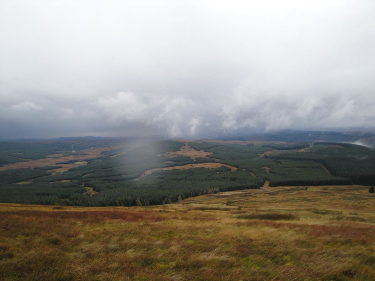
The weather was showing no sign of changing as we were approaching the exposed slopes of Benbrack. On a better day I would have liked to have a quick breather before the climb then a leisurely lunch at the summit enjoying the views. That plan was going to be unfeasible with the strong winds and heavy rain, so we clambered into the trees for a relatively sheltered lunch. Not the most most comfortable lunch spot I’ve had, but at least there was a firm, if wet, place to sit.
The climb up Benbrack took the wind out of me and the space between walkers gradually became longer. Looking back, as I got my breath back, Manquhill Hill and Whether Hill’s turbines appeared as the cloud base lifted.
Manquhill Hill
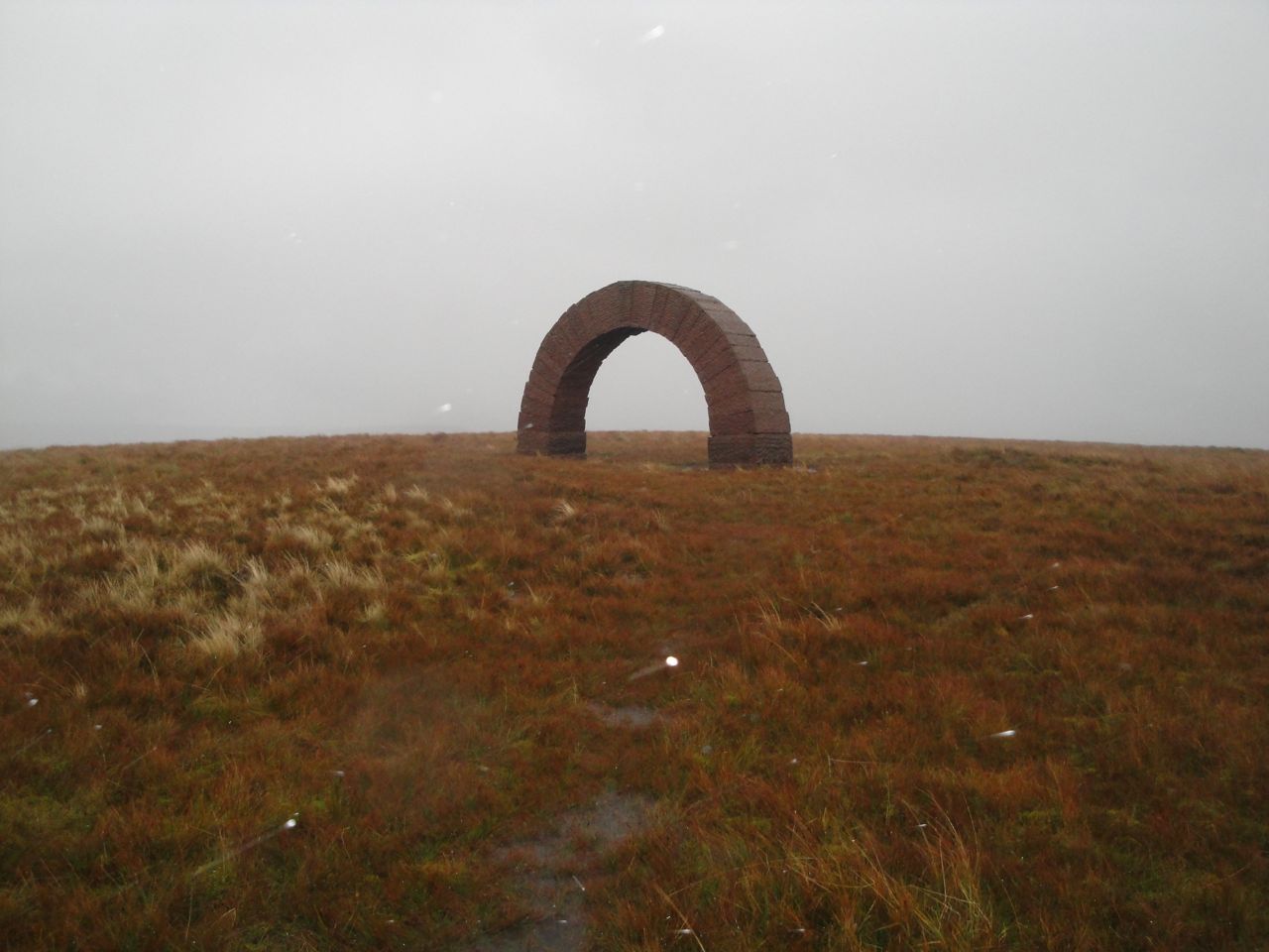
We followed SUW posts up Benbrack following a route that is a good 150m away from that shown on the OS map. When the Striding Arch on Benbrack appeared I was very pleasantly surprised. Benbrack is a typical hill that hides its top from those on its slopes, and I had thought there was still another 150 metres to climb. I had been comparing my position to the top of Manquhill Hill and had obviously got it wrong.
Unfortunately our arrival at Benbrack’s summit was greeted with hail driven into us by a strong wind. I had hoped for a group photo but the vanguard had already pressed on so it was a person free pic. The photo has white spots where the flash has illuminated falling hailstones. You can usually see the Colt Hill arch through this one.
Striding Arch, Benbrack
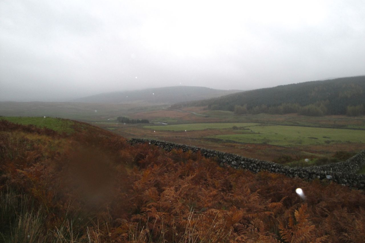
As we began to descend Benbrack, picking our way around waterlogged ground, it became clear that I had camouflaged the truth in saying it was “downhill from Benbrack, on average”. Perhaps I mumbled the part about the gradient averaging downhill. Anyway, this was a white lie made with good intent and I felt no need to exhibit contrition. Admittedly, Cairn Hill does look a lot more of a climb in real-life than it does on the map.
The ground between Cairn Hill and Black Hill has been very muddy on my previous visits but it was more waterlogged/submerged this time, and tended to clean rather than dirty our footwear.
Fingland Glen from the slopes of Cairn Hill
I was expecting to see trees near the top of Black Hill but the forestry have been a’felling, so there was now a fence rather than a tree line to guide us. Some unthinking person had padlocked the SUW gate shut, leaving us to manhandle dogs over a stile.
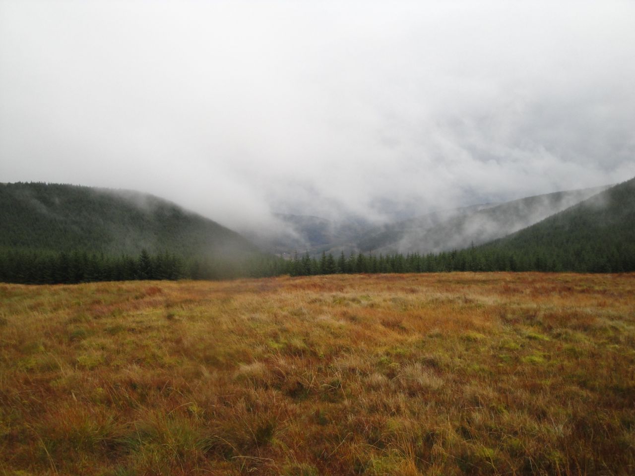
From Black Hill we followed the edge of what had once been forest, with views across to Ewe Hill and Lorg Hill. At High Countam the path turned into the forest and made its way along a narrow waterlogged path in a forest break. I see that the area to our right is named Good Bog on the OS map. A strange name.
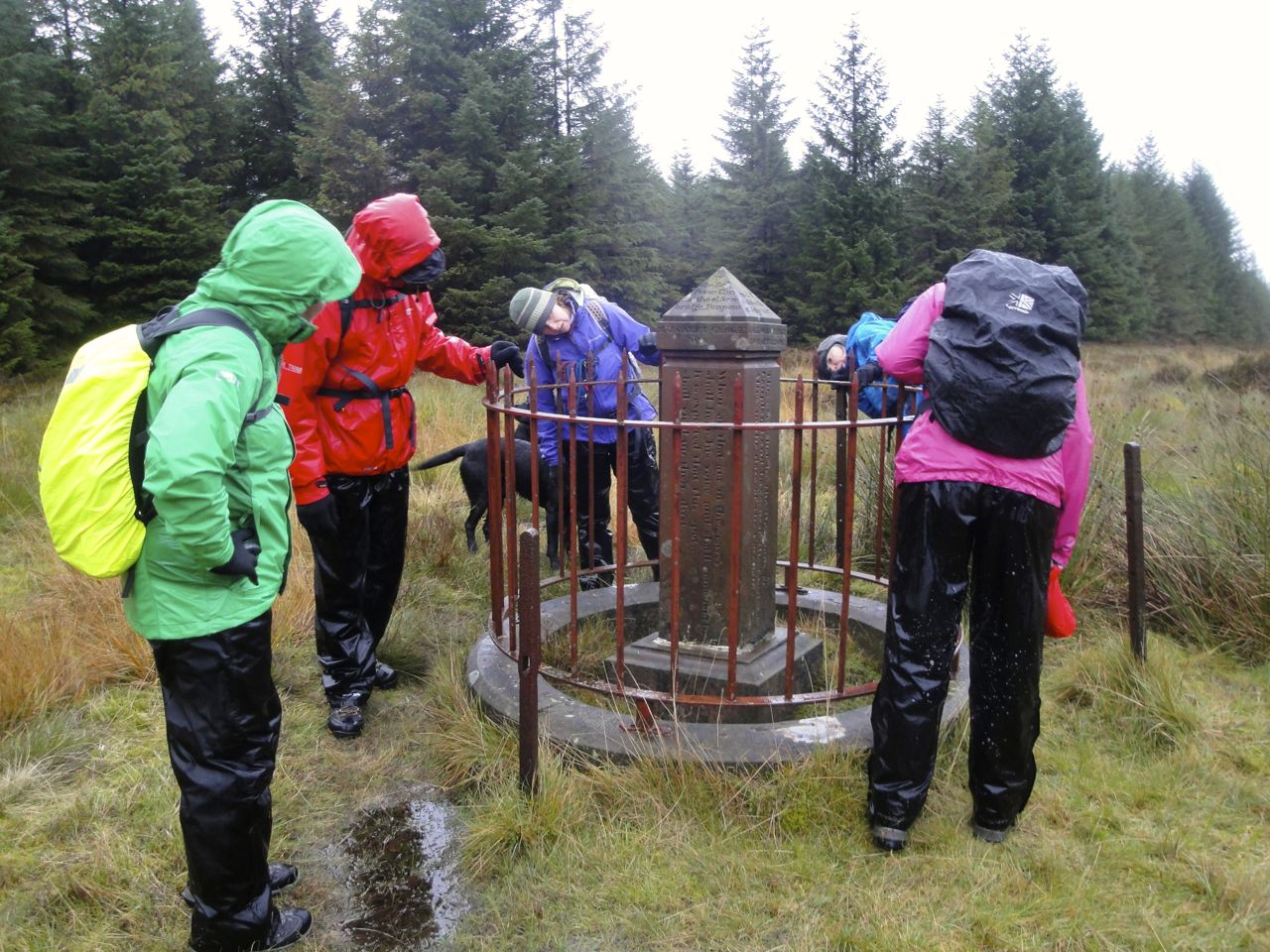
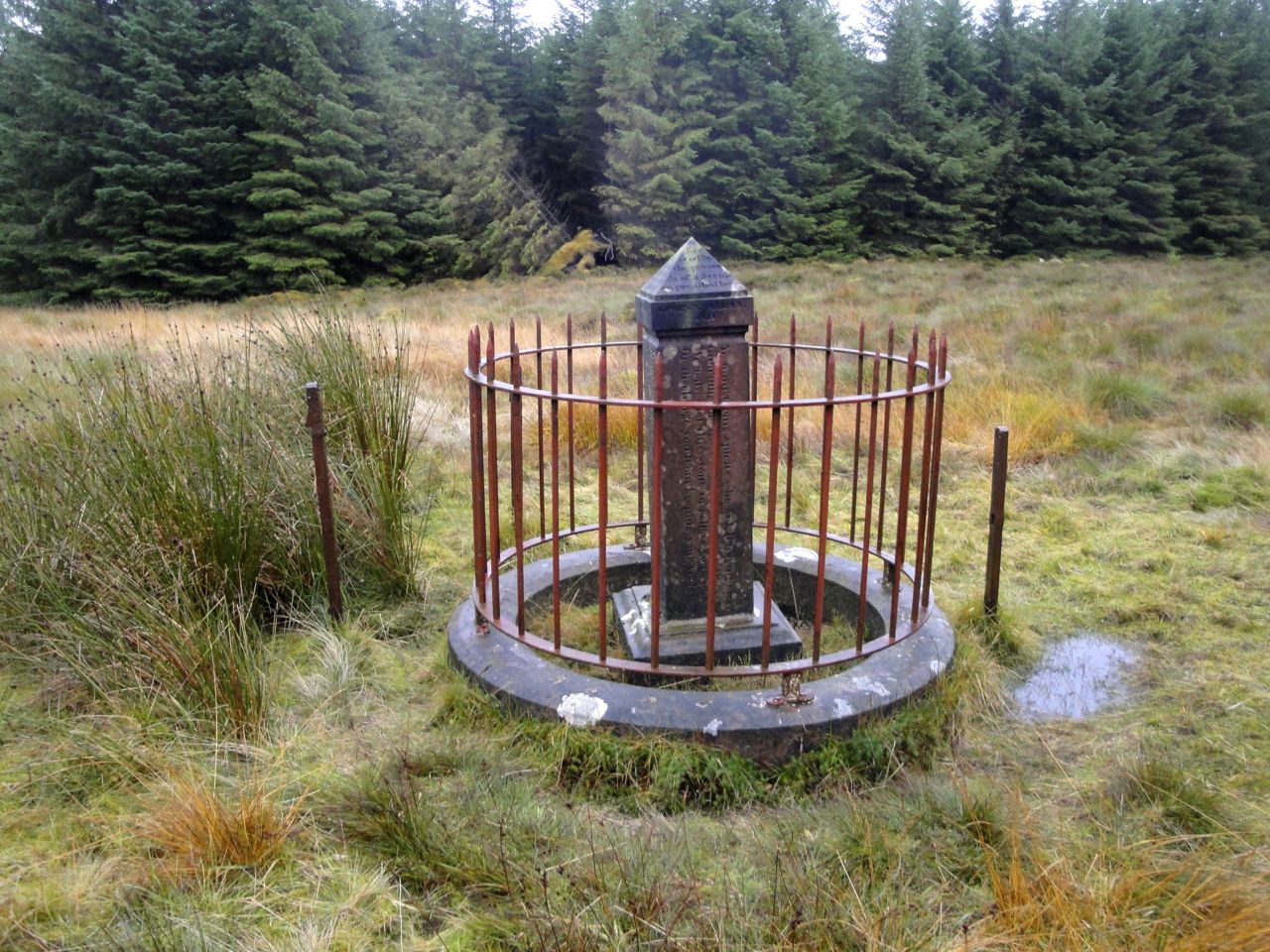
After crossing a forestry track we continued in the forest break to a clearing where several breaks met. Allan’s Cairn stands here at the junction of three old counties: Dumfriesshire, Kirkcudbrightshire, and Ayrshire. This is a memorial to two Covenanter’s killed in the persecutions of the 17th century. There is apparently some question as to the story behind this, with a suggestion that the place itself was named Allan’s Cairn before the memorial was placed there.
Allan’s Cairn
After Allan’s Cairn it was all downhill (well, mostly) eventually descending to a forestry track above the Fortypenny Burn. A bird of prey, a buzzard from its colouring, was patrolling here.
Sheep Pen, Polskeoch Rig in the background
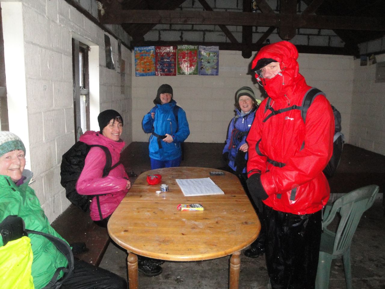
The forestry track takes a rather irritating dog-leg adding almost half a mile to the walk but I am sure the direct line across the felled forest would have taken longer. After the dog-leg we found ourselves at the Polskeoch Bothy. I thought I had taken a photo of the green roofed building but I must have not pressed the shutter release properly because it wasn’t on the memory card. So there is just the interior photo.
The bothy did though give us a brief respite from the rain, though it was quite dark inside.
In the bothy
After our rest at the bothy we crossed the Water of Ken (on a bridge) and left the SUW when we found the signpost for Lorg.
The first half of the Lorg Trail is amongst trees along very friable ground that either slips as you stand on it or accommodates your foot like thickened blancmange. This was not especially difficult terrain but did require care. I think we did well in that no one fell.
Lorg Trail
Lorg Trail
After the trees we made our way across the waterlogged and muddy lower slopes of Lorg Hill and soon could see our goal, the car.
The weather, poor visibility and waterlogged ground made this section more of a challenge than it might otherwise have been. Our early stray from the path added about half a mile (or a mile for Jo and I) to the distance. Damn those lichen encrusted posts that look like SUW signs.
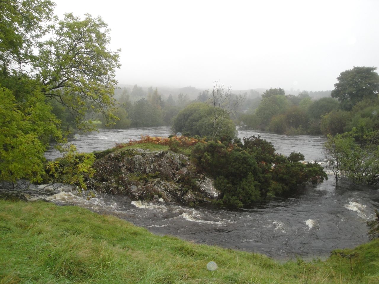
Dundeugh Forest is bounded by the Waters of Ken and Deugh, and became an island with the damming of these rivers to create Kendoon Loch.
A pot-holed road near Polmaddie leaves the A713 and crosses the Water of Deugh on a small bridge after which there is space to park a few cars. A padlocked gate prevents driving any further.
From the gate a forestry track turns left but I headed right along a less used track that soon narrowed to a single-file woodland track and meandered through the trees. Occasionally fallen trees blocked the way, but the forest is not particularly dense and the detours were easy.
The woodland track took me down to the southernmost part of the island but from where I was the rivers could be heard but not seen. A footbridge could be glimpsed through the trees. The path came close to the Water of Ken, but the river itself remained mostly hidden by the trees.
We then turned away from the river and climbed up to reach the vehicle track that was to be our route for the rest of the walk. The trees mostly obscured any views but the Cairnsmore hills could be seen across Kendoon Loch. We passed a short track down to the dam on the Water of Ken but it was extremely muddy and must have been submerged in last week’s floods, so I didn’t visit the dam.
Walking back, the path was close enough to see a little of the Water of Deugh.
Perhaps I’ll be back to tackle Dundeugh Hill another time.
14 miles 6h 37m 509m ascent; max elevation 296m Culmark Hill
Route: SUW from Hen Craig to Stroanpatrick (with a couple of detours)
I have not seen the phrase “Very wet underfoot” in a weather forecast before, but I’ll have to say that the MWIS were spot on with it. Driving to and from the walk I sometimes had to use the windscreen wipers on the fast setting. The rivers were full on the drive out, but by the time we were driving home many had flooded beyond their usual banks. We had some torrential showers on the walk, but most of the time it was drizzle. There were times though when we could take our hoods down when the drizzle abated, and at least there wasn’t much wind. Driving rain would have been worse than the dreich day we had, I think, so things could have been worse.
Our drive took us through Moniaive to leave a car by the black hut at Stroanpatrick then over Kendoon Loch by the wee bridge that is “not suitable for HGVs”. Later in the day the loch’s waters were much higher and had flooded its banks near the fish farm. Driving along the road to Hen Craig, our parking spot, I looked out for the sign where the SUW left the road but didn’t spot it.
We left a car at the parking spot near Hen Craig. Behind us was Drumbuie Hill (the yellow ridge, Drum Buidhe) which did have an autumnal yellow tinge. I hadn’t noticed this huge looming ridge when were last here in the mist so it was a bit of a surprise. It was raining so heavily that we had to put on our boots and waterproofs while in the car otherwise we would have been absolutely soaked through.
So, fully togged up we checked the time, 9.45 am, and set off down the gravel track that soon joined the single track road. The rain continued and we could hear the Garroch Burn roaring to our right, making it difficult to hear a car when it came up behind us. I knew that the SUW left the road near the bridge over Garroch Burn but the rain drops on my specs and on the waterproof map cover made it difficult to see exactly where.
I was sure, at first, as was Audrey, that we had seen a sign post indicating the route when we were here before. Unfortunately my memory began to play tricks with me. I began to doubt my recollection. The map, seen through the multiple refractions of raindrops, looked to me to show the path leaving the road at the bridge, rather than 200m beyond it, and there at the bridge was a track heading in what appeared to be the right direction.
We had a period of indecision in which we considered walking back up the road, further along the road, or along the track, which I’ll have to admit was beckoning me as if by an enchantment. We discussed the lack of a signpost, and I convinced myself that my memory of such a post was a figment of my imagination. At such times it is important to make a decision and then imbue that decision with confidence, and that I did. We set off along the track, me 100% confident with the decision.
This track was muddy in places, flooded in others. We had to duck through trees at times to find ways around muddy pools or across flowing water and eventually reached a rusting gate. The gate stood, as gates so often do, across standing water. It looked as if it had not been opened in a generation, and there was no path beyond it. I searched the distance for the non-existent SUW post then felt my confidence ebb as the enchantment wore off.
Cosulting the map again I could now see that the SUW left the road between the bridge and a track heading to Old Garroch. We retraced our steps through the woods to Garroch Bridge and continued along the road until we reached the SUW signpost. As soon as I saw it, I remembered it. It is about 250m past the bridge.
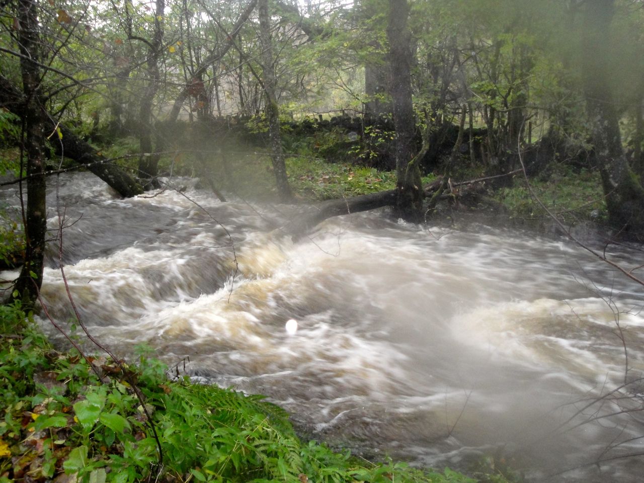
Garroch Burn in spate
So we left the road and walked through the woods to the banks of the Garroch Burn which was roaring along. A footbridge took us back across the burn, through a metal kissing gate and into a quagmire. Here the trail went dark but we spotted a wooden walkway/footbridge and took that as a sign of the SUW.
The burn to our right was only a couple of handbreadths short of flooding our path and we had to pick our way carefully. There were more walkways though some were close to being submerged. A gap in the bracken was our only clue when the SUW left the side of the burn for Waterside Hill but after a hundred metres or so we noticed a marker post hidden in the bracken to confirm we were on the right track.
Garroch Hill from Waterside Hill
On Waterside Hill we found ourselves walking along a firm grassy path through the bracken. There are said to be great views from this hill but the weather denied us the opportunity. Having said that we enjoyed the view back to the nearby mist covered Garroch Glen while we got our breath back and munched some Jelly Babies. In better weather Waterside hill would be a good place to stop for a bite to eat. There are plenty of rock outcrops to sit on while enjoying the views and on the way down we passed an ideal spot, a lichen covered tree standing over some seat sized rocks. Someone else must have thought the same and had bedecked the tree with bunting, though the colours had long since faded.
Bunting hung tree, Waterside Hill
We headed down towards Earltoun power station with the Water of Ken now coming into view. The SUW crosses the A762 to reach the river bank and follow it downstrean to the Boatweil footbridge. The river was obviously fuller than usual with trees sprouting from the water where they would usually stand on islands.
The Boat Weil bridge was built for the SUW by 33 Independent Field Squadron RE in Spring 1982. The Boat Weil, where bridge now stands, is the section of the Water of Ken previously crossed by a ferry. This ferry was used by pilgrims heading for Whithorn including King James IV who in 1491 paid 5s for being ferried across the water with his retinue. The ferry worked until 1800 when the Allengibbon bridge was built. A weil, by the way, is a whirlpool.
Water of Ken
The Boat Weil is a suspension bridge and bounced up and down as we crossed. I suspect that Audrey was bouncing it on purpose behind me to give me motion sickness. Once back on firm ground we walked up by the church and an SUW information board standing beneath the old motte.
On a drier day we might have sat on the picnic benches outside the pub but the bus-stop provided better shelter. The design of the bus-stop, with a misericord rather than a seat, had ensured there were no horizontal surfaces to set a cup or bottle upon. We did have the ground of course.
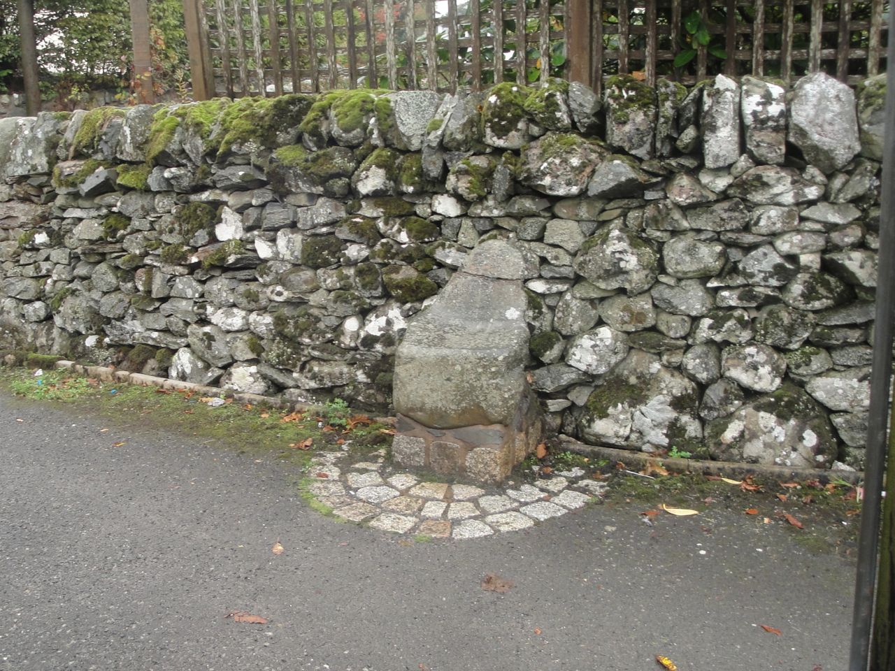
I took a picture of McNaught’s fountain and the unusual church, which I have now found out is the town hall. Then, re-fuelled, we set off through St John’s Town of Dalry. I was keeping a keen eye out for St John’s Chair, a child’s size seat. Historical descriptions are of a large stone which this certainly is not. I suppose I should have sat on it but didn’t think to do so.
St John’s Seat, Dalry
The SUW leaves the main road at St John’s Chair and passes some houses before joining a farm track past the house at Creaganfois. A large black and white hut here would make an excellent summerhouse but seems to be a storehouse. After the hut the path took us past autumnal trees then across rough rocky farmland. A large pile of stones here looks very much like a cairn, but I’m sure an ancient cairn would have been robbed of rocks to build the nearby stone dykes so this is more likely to be a pile of stones cleared from the field.
We made our way towards the farm buildings at Ardoch, with little to mark the SUW itself, other than the gates in walls. At Ardoch we found some SUW markers and followed these alongside the tall trees of Ardoch Glen.
After Ardoch Glen the track split in three directions, without any clear sign which was the SUW. From the map it looked as though the SUW continued in much the same direction and this seemed to fit with the left fork, so we went that way. The track from the middle tine of the fork rejoined us quite soon. As we were to find, the right hand fork was probably the correct one.
Three ways
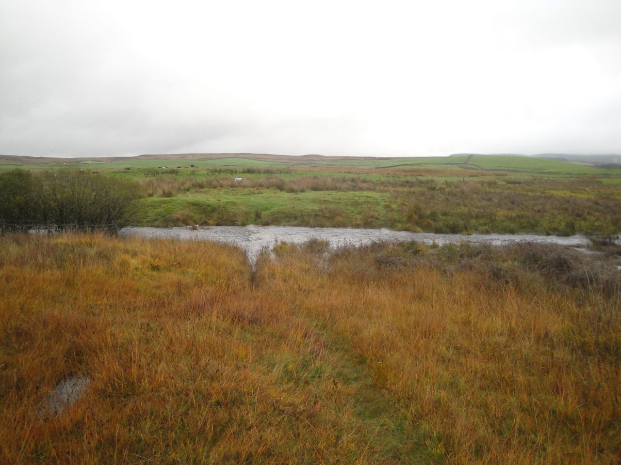
Our path should have skirted around the lower slopes of Ardoch Hill but we found ourselves drifting higher albeit still on a well-trodden path. But the path then gave out leaving us looking down towards the Earlstoun Burn. Since the SUW runs in a 150m gap between the burn and the forest, we decided to head for the gap. The dykes here were all augmented with barbed wire fences so we detoured to gates where we could and in doing so found ourselves back on the SUW. We could see a marker post behind us but none on the way ahead so headed on towards the burn-forest gap.
To say this area was boggy would be to expect too much of the word boggy. We came upon an un-named burn that was far wider than a leap and already spreading beyond its usual boundaries. I looked into the clear waters trying to decide how deep it was if it had to be walked. Just as I was creating the words to say it “wasn’t that deep”, I realised that the “pebbles” I was seeing at the bottom were the upper leaves of a submerged bush.
We followed it upstream but were really just trying to find a way across a flooded field with a burn in it. Having found the least worse of the crossing points we went for it, tramping through flattened reeds lying on the water. Sadly worse was yet to come.
Having reached an island of dry ground beside an SUW marker post and got our energy back we looked around to see which way the SUW might go. A faint trace through the reeds led back into bog but we chose to stick with the high ground and were delighted to find an SUW gate into the next field and a waymarker post half-way across that field.
The OS map shows a small burn crossing this field and the track we were on led to this burn and out the other side. I presume one can normal step over this but we found a fast flowing stream more than 3m wide. We could not see the bottom but judging by the tops of trees that were poking out of the water I thought it too deep to wade across. Looking upstream there was no obvious crossing point and if anything the burn seemed to widen.
Burn blocking our way
This was a potentially walk ending problem. We decided to follow the burn upstream for a while to look for a crossing and failing that we would need to walk 5.5 miles back to Dalry and get a taxi to one of the cars.
We could not follow this burn upstream along its banks since the field around it was flooded so we headed back through the gate and across the trace we had seen in the slightly less boggy grass and reeds. We made our way to the wall at the edge of the forest and climbed another wall into the corner of the field with the flooded burn.
Audrey’s crossing of one of these watercourses was not entirely successful, measuring success as dryness and uprightness. I will say no more except that she remained calm and carried on.
The wall between forest and boggy field was acting as a dam to water flowing from the forest and had water issuing wherever the wall had collapsed and between its stones where the wall was complete. Our only way forward was to climb sideways along the wall until we found a shallow section and get back to dry land.
The original Earlstoun Burn had been diverted from here, the original river having meandered through these low lying fields. You can see that the modern Earlstoun Burn is unnaturally straight here. I think the various un-named burns blocking our way are the original routes of the burn, but with the heavy rain these “drained” waterways were reverting to their natural state.
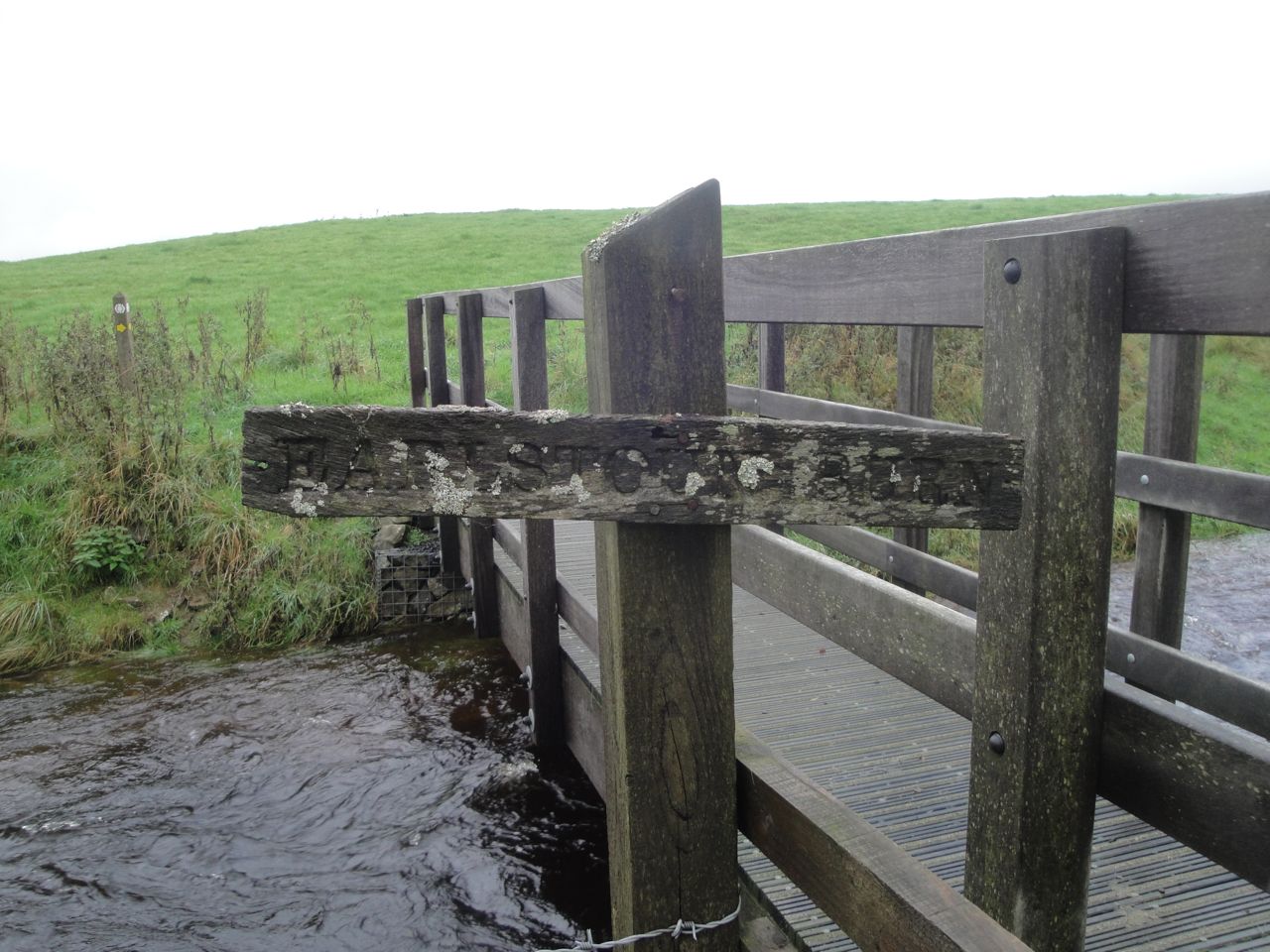
Footbridge at Earlstoun Burn
After the watery unpleasantness we crossed a footbridge over the new Earlstoun Burn and followed the SUW along the river bank. The river bank was not easy going being made up of randomly scattered rocks and mud. I wonder if it might have flooded later in the day. The grass 5m away on the other side of a stone dyke looked much more inviting but eventually a marker pointed us away from the river and we climbed on to the moorland heading from one marker to the next. I would normally have said that the going was boggy in places, but compared with our recent experience this was firm and dry.
On featureless moorland it can be difficult to keep to the SUW and when there were no SUW posts we followed any tracks we could see, but these sometimes led off in several directions. Shorter marker posts could be hidden in bracken but we also passed at least four posts lying on the ground without any hole to re-plant them in.
Moorland at Corseglass
Above Coreglass we could at least see the road to our right and knew that we should eventually converge with it. Despite this, following a trodden track led us astray, onto the 220m knowe marked on the OS as having a settlement. Once on top of it however we could see the road again, but also a marker post where we should have been.
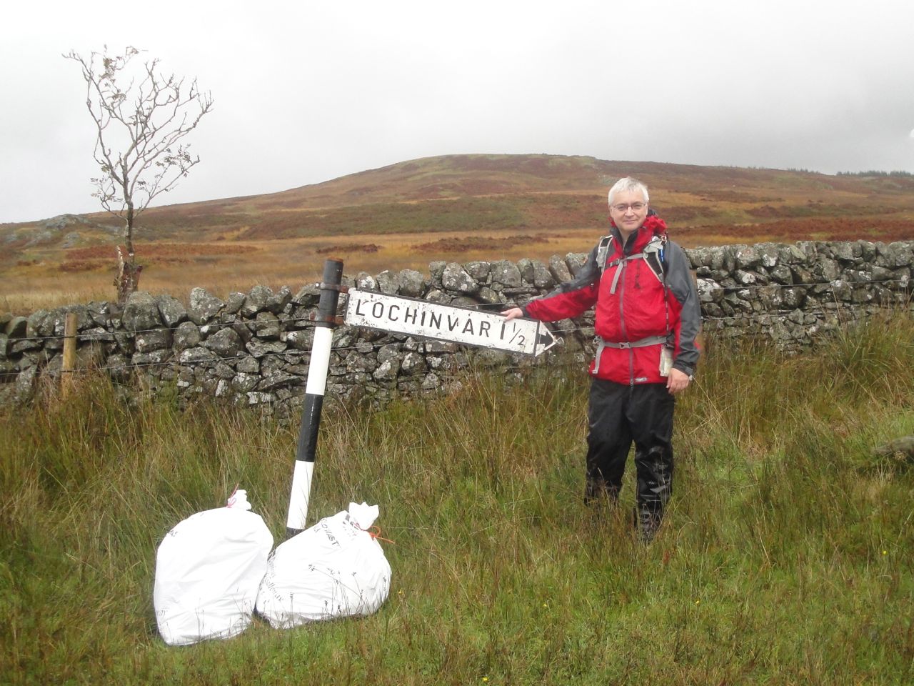
Once over the last brew we could see the road junction. There is a sign to Lochinvar and one warning us that the road is liable to flooding. It was indeed flooded to the west of us. The rain had stopped (almost) and having my feet back on firm ground I decided it was time for a rest break. Four miles or so to go but no more bogs.
Young Lochinvar is come out of the west
The road north was a welcome break, no need to look for marker posts for a while, no boggy sections to avoid, no rocks to twist an ankle. We walked down crossing the Black Burn on a road bridge and then I started counting the paces for the 400m to where we would leave the road but stopped before 200m when I spotted the SUW sign in the distance.
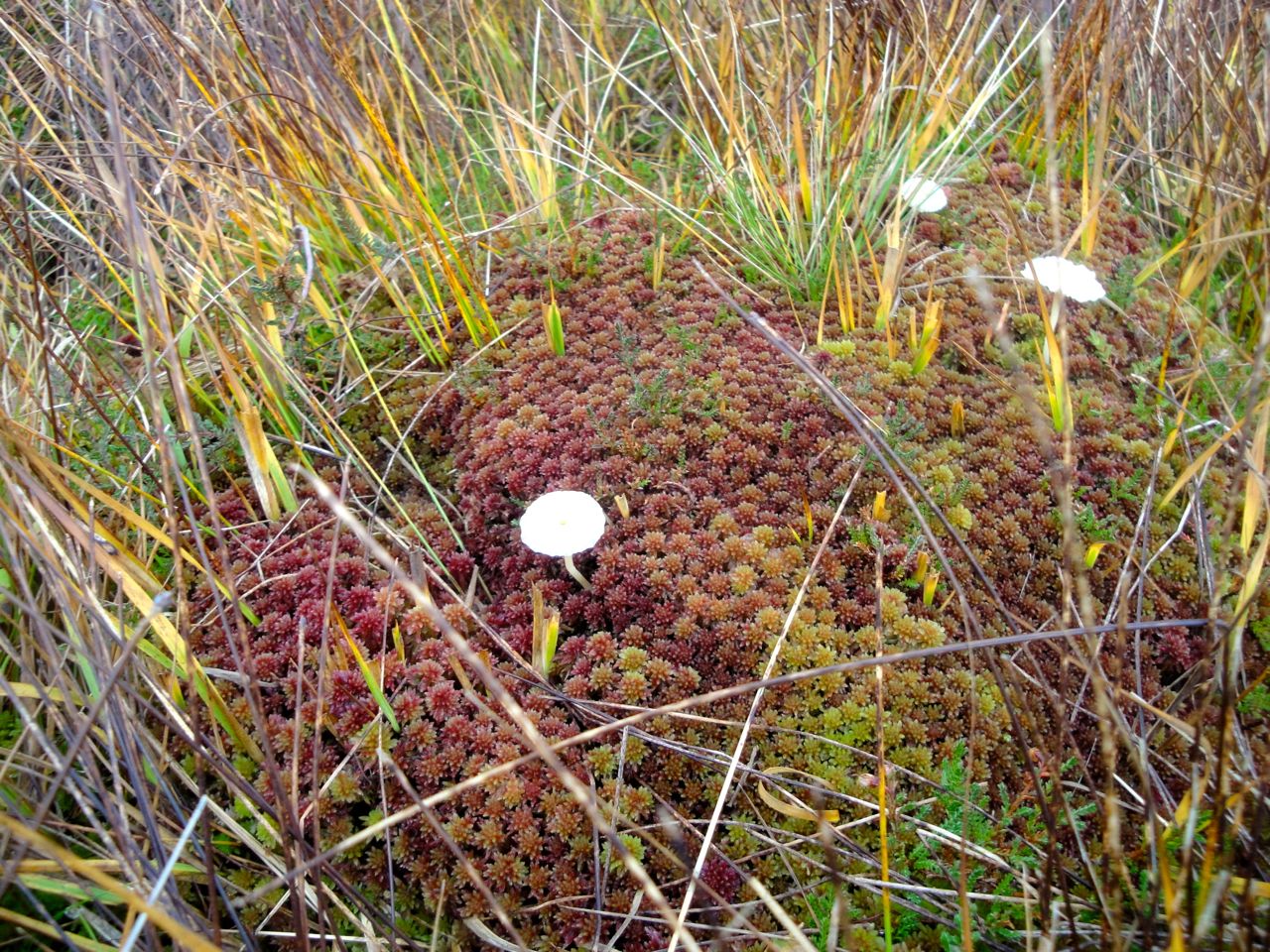
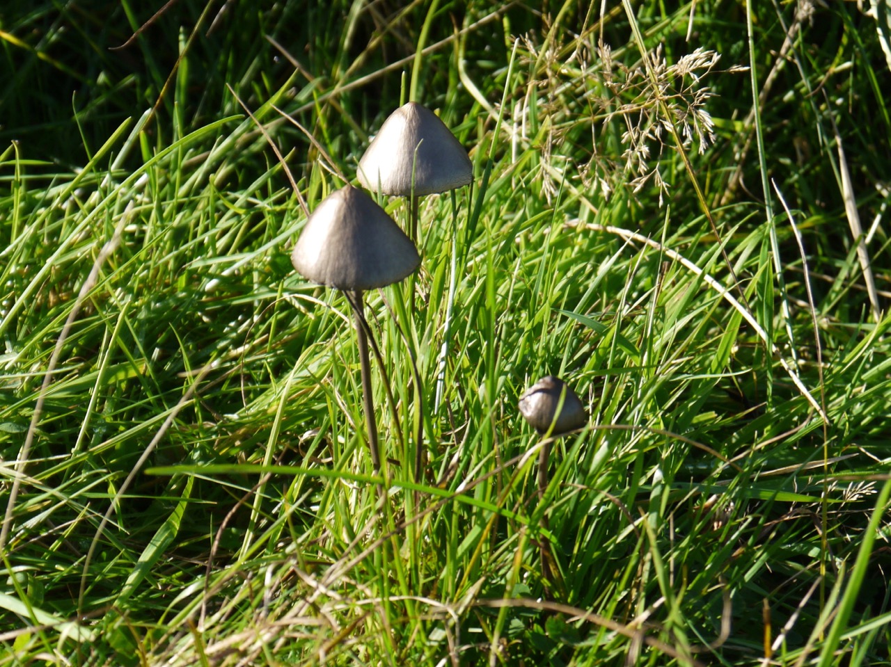
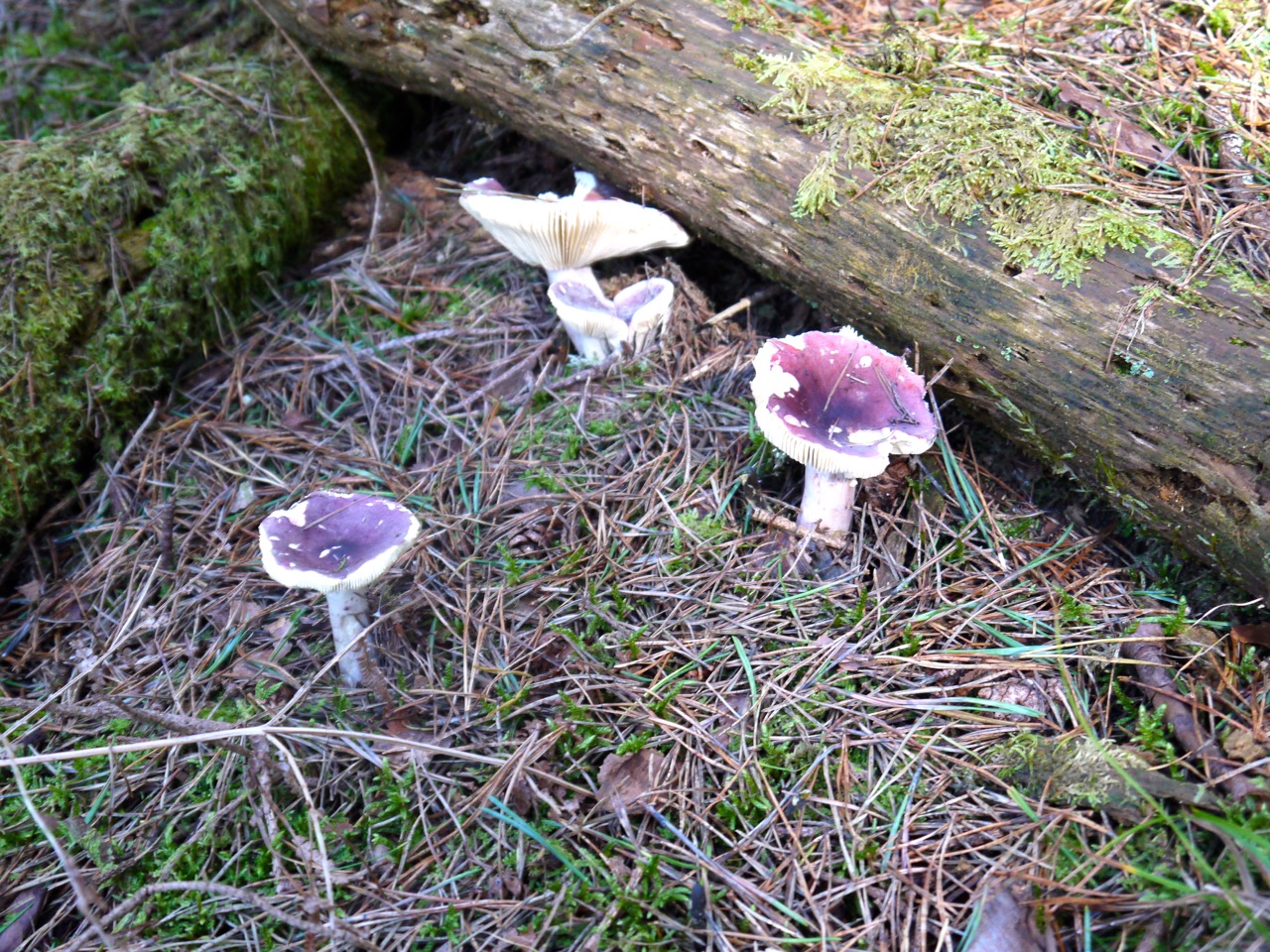
Mushrooms on moss
Several marker posts were lying on their sides on this stretch but there was enough of a track to keep us from straying. We climbed over Marskaig Hill and onto Culmark Hill. I had hoped we would be able to see the black hut or the car to boost our spirits and though we could see the farm at Stroanpatrick the car wasn’t visible until we were close to Stroanfreggan.
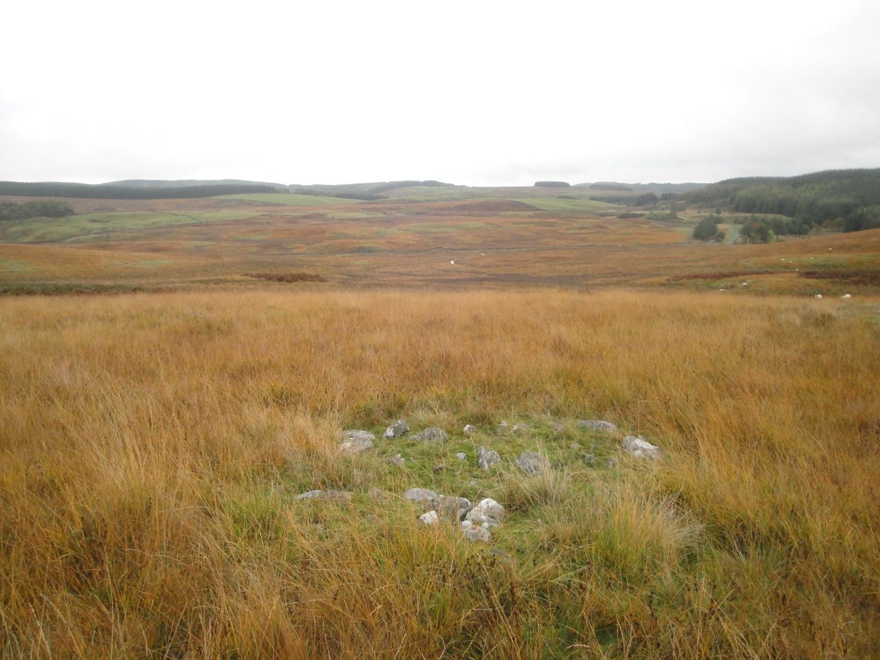
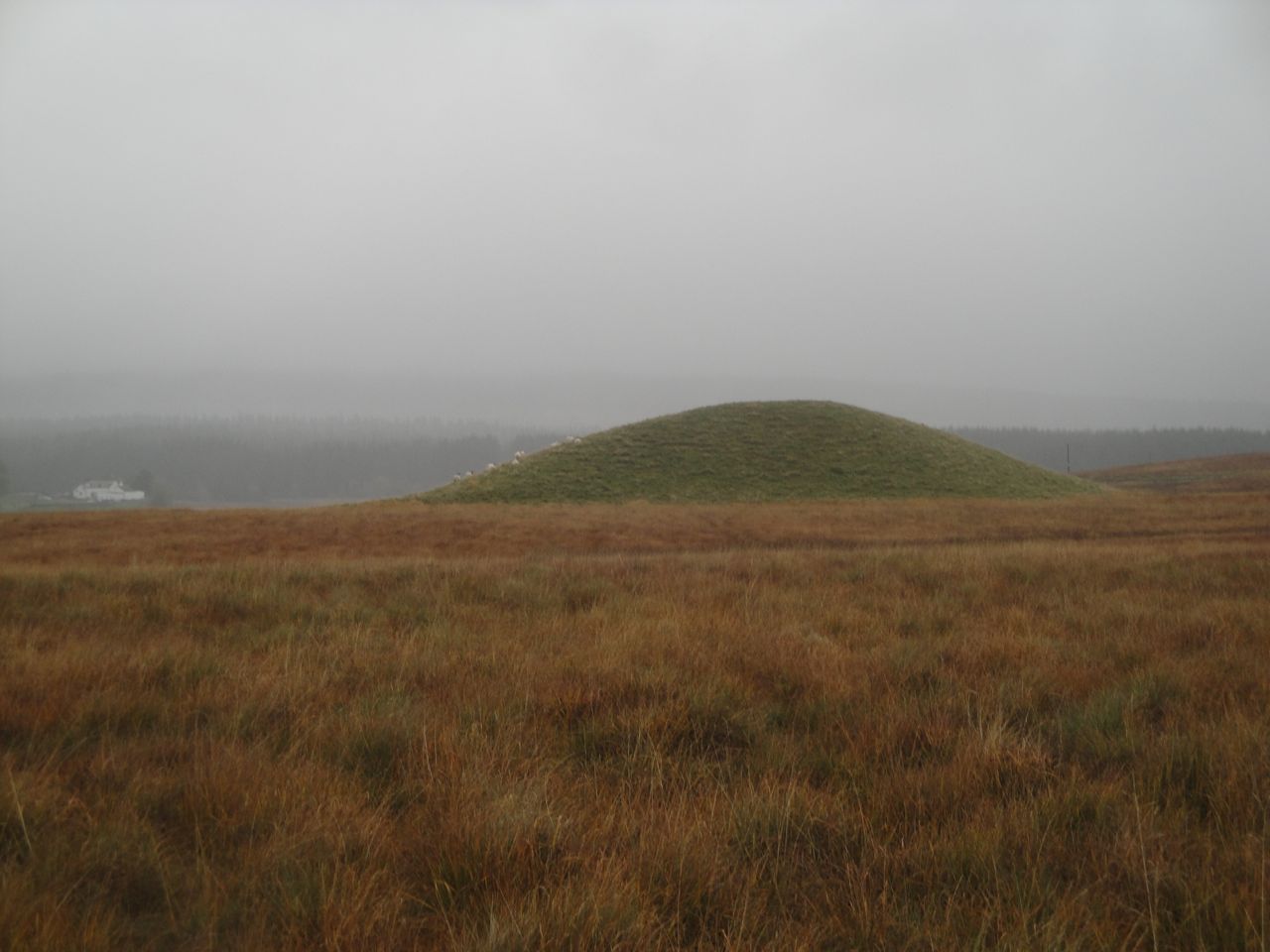
Mound at Stroanfreggan
Once at Culmark Farm we joined a farm track that took us across the Stroanfreggan bridge and back to the car. The track between bridge and road has a large green mound to the west and the remains of an ancient cairn to the east. The cairn once contained bronze age items but has seen better days. I’ve read that the origins of the grass covered mound are uncertain. It is not clear if it is natural or man-made but I hope it hides another burial cairn.
The unrelenting rain and bogginess underfoot left us a little damp at the end of the walk and it was a relief to get some dry clothes on. Unfortunately the heavens opened with a vengeance while Audrey was transferring her stuff into her car so she didn’t stay dry for long.
15.23 miles 6h 5m ascent 794m; max elevation 314m slopes of Shield Rig
Route: SUW Caldons to Knockmulloch
This was our fifth section of the SUW challenge, and would take us past the 25% mileage mark (indeed, up to 30%). It was a warm day and as we arrived at the Water of Trool, a few light raindrops were hitting the windscreen, but not enough to need the wipers. I climbed from the car, sensing the atmosphere and wondered if I needed to wear a jacket. The pessimists were already getting togged up in waterproof trousers but I convinced them that waterproofs wouldn’t be needed.
On reflection, I should have let them get fully gore-texed thus invoking the inverse Sod’s Law to keep the rain away.
As it was, within 10 minutes my prediction was proved wrong. We had to huddle under some trees getting waterproofs on ourselves and our rucksacks. I’ll have to send back my meteorology badge.
Loch Trool
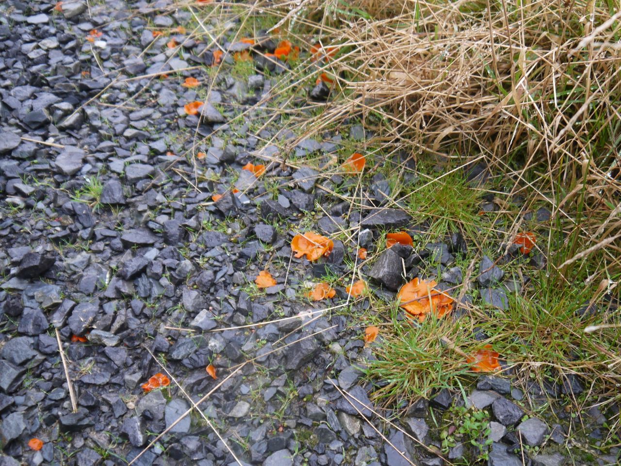
The path along Loch Trool has been “improved” since I last walked it. The old dirt path has been covered with a layer of stones, presumably to prevent erosion and spare us a muddy walk. There was plenty of orange peel fungus, Aleuria aurantia, looking very much like orange peel strewn along the path.
The path starts close to the water of Loch Trool and climbs steadily giving more elevated views across the loch up to the Gairland Burn which was in spate with the rain. The vibrant green of the woods and blue of the loch, seen the previous week, were transformed by the mist into variations on a theme of grey with hauntingly still water.
Orange Peel Fungus
An information board towards the eastern end of the loch gives details of the 1307 Battle of Glentrool, a turning point in the Robert Bruce’s campaign, apparently. And after we had read of this great Scottish victory, our Cumbrian had to be reprimanded for referring to the water as a “lake”. Tut, tut…when in Rome….you don’t hear me calling it a “mere”.
There have been changes in the route of the SUW at Glenhead. The route shown on my OS map crosses Glenhead Burn at the second footbridge but now the signs turned us away from the bridge along a forestry track which carries the number 7 national cycleway up the hillside towards the waterfall of the Shiel Burn. By now the rain had eased off but Craiglee was hidden in mist.
Shiel Burn waterfall
The Giant Axe Head, one of the Seven Stanes is beside the track at the watershed between Loch Trool and and Loch Dee. The runes carved on the stone are “The Mystery” an ancient poem ascribed to the Irish druid, Amergin. They are the words spoken as he first set foot on Ireland.
I am the wind which breathes upon the sea,
I am the wave of the ocean,
I am the murmur of the billows,
I am the ox of the seven combats,
I am the vulture upon the rocks,
I am a beam of the sun,
I am the fairest of plants,
I am a wild boar in valor,
I am a salmon in the water,
I am a lake in the plain,
I am a word of science,
I am the point of the lance of battle,
I am the God who created in the head the fire.
Who is it who throws light into the meeting on the mountain?
Who announces the ages of the moon?
Who teaches the place where couches the sun?
(If not I)
The Axe Head gave us an excuse to stop for a breather and some photos. Unfortunately the mist still hung around us so we could not yet see Loch Dee or the hills beyond it. After our pause it was downhill to Loch Dee. The original plan had been to have lunch at White Laggan Bothy, but it had stopped raining so we pressed on intending to stop near the angler’s hut.
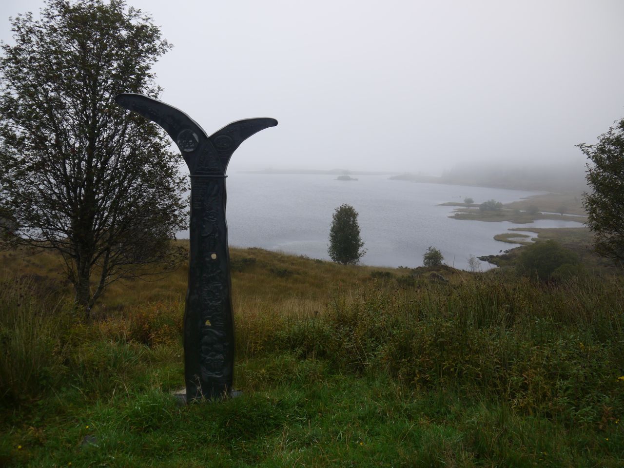
National Cycleway sign at Loch Dee
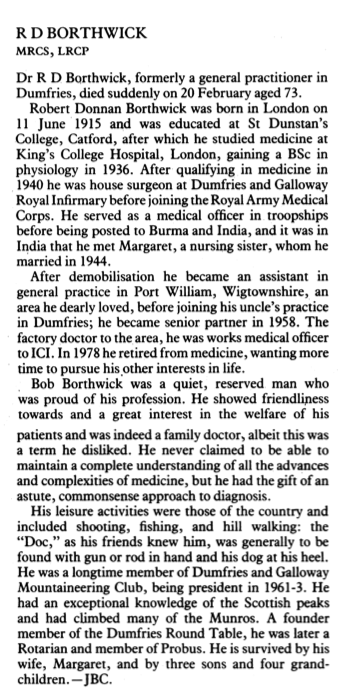
We walked on along the path by Loch Dee, past the cycleway sign that looks like mermaid’s tail and the bench dedicated to “Robert Donnan Borthwick 1914-1989, a doctor in Dumfries for 33 years”. Here is his obituary from the BMJ.
By the time we reached the road off to Craigencallie we realised that the Angler’s Hut must have been removed, so we stopped at the rocks by the gate with the sign, “Fishing by permit only- 2 fish limit”.
After lunch we crossed The Blackwater of Dee which is about the quarter way mark of the SUW. From there the forest tracks took us across to Clatteringshaws, and then to the minor road near Craigenbay. We stopped on the bridge over the Garrary Burn while Elaine tried to remove her waterproof trousers the hard way. It’s so much easier if they are unzipped first. The next section had quite a variety of toadstools, including the classic Amanita Muscaria in the forest and colourful fungi on fallen trees.
The SUW signpost near Craigenbay is marked “pick-up point” so the necessary jokes were voiced.
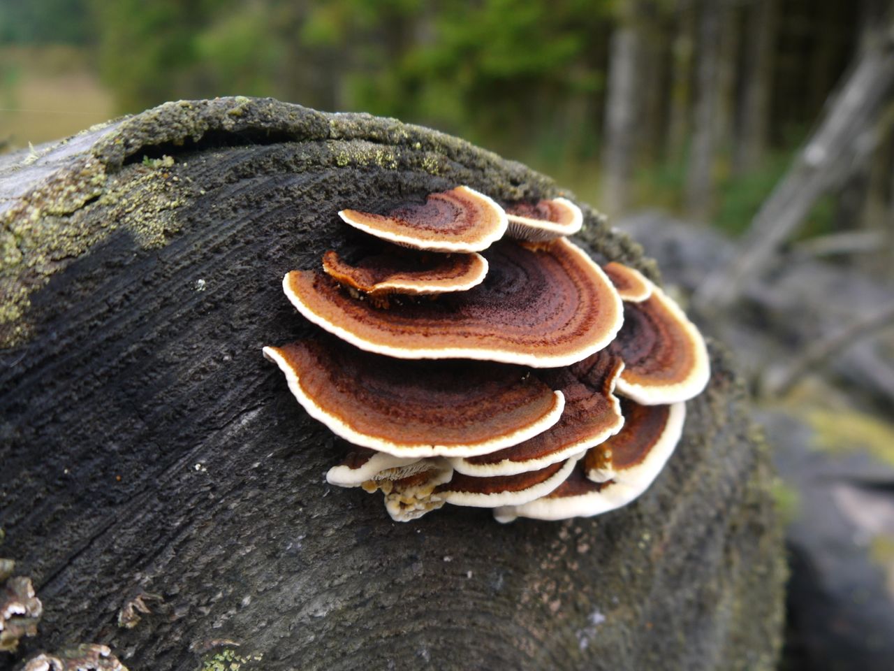
Many-zoned Polypore Fungus
We had about a quarter of a mile on the road before the SUW turned off to the right. Up to this point we had been on constructed paths of one sort or another since leaving the car. From here on though the walk became a little wilder crossing uneven boggy ground first in forest breaks and then across the moorland of Shield Rig.
I had been falling behind the vanguard, spending too much time gawping at toadstools, then turned a corner to find Elaine and Joanna standing on a raised forest road. This road looks newly constructed and isn’t on the OS map. From a distance it looked more like a wall and my first sight of it had Elaine and Joanna pretending to be balancing on the “wall”.
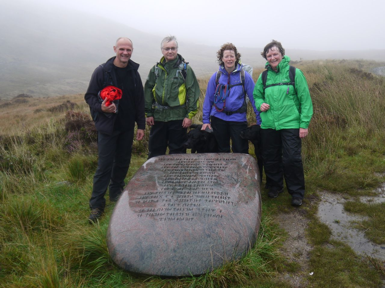
Just before leaving the woods we passed an Ultreia SUW marker post, so David and I struck off to look for the hidden hoard which we found in an old sheep pen with the rotting remains of wooden shed. The pen was unusual, the walls had been built enclosing a massive erratic which must have limited its capacity and the ground leading to the pen and within its walls were so boggy that it could not have been used for animals as it was. Perhaps the bogginess has developed with the planting of the forest. I plunged my hand through the spider webs into the hoard, took our waymerkers and then headed back to the SUW.
SUW Hoard
Out of the trees we had a mile or so of moorland and initially lost the path before spotting some way markers and picking our way across Shield Rig to the abandoned buildings at Clenrie. From there we were back on a track and headed down to the car at the parking place below Hen Craig.
12.5 miles 5h 50m 263m ascent; max elevation 184m Ochiltree Hill
Route: SUW Tannylaggie Bridge to Caldons
We were treated to a beautiful Autumn day, with sunshine to shame a summer’s day, reds and yellows emerging from the greenery and just the right amount of breeze to keep us comfortable.
Tannylaggie Bridge, the end of our last walk, was our starting point for this section. Despite having driven along this road several times, this was the first time that I had noticed we were driving downhill. I sighed at the thought of setting off with an uphill section but it was hardly noticeable with our rested legs.
The River Bladnoch meandered along amongst tall grass and conifer plantations and the roadside bracken was still green with only occasional yellowing fronds, quite different from the autumnal colours later in the walk. We seemed to walk further into Autumn as we headed east.
The SUW followed the road we had just driven along but the only traffic we saw was a tractor working in the fields.
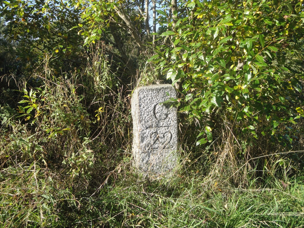
A little north of Knowe we spotted a cairn on a wee hummock a couple of hundred metres away, but what it signified I do not know. Knowe itself gave us our first taste of red with red leaves, berries and an old red telephone box. A milestone, opposite an SUW signpost, where the SUW leaves the road is marked G22 on one side and N8 on the other giving the distances to Girvan and Newton Stewart.
Milepost at Knowe
The next mile of SUW proved more difficult than I had expected. On the OS map it crosses a forest between Knowe and Glenruther Lodge. In reality it is much more exciting. After a brief trek between trees we found ourselves in a wide clearing with occasional trees and tall grass. The track was obvious but the grass hid the ground from view so I didn’t see the hole that got me. The first I knew of it was a sudden change from upright to sprawled. Luckily I was in the company of experienced nurses, though in my shocked state my hearing must having been playing up because I thought I heard “I wish I had had my camera ready”. I took the rest of the section more slowly and carefully.
Unfortunately the eastern half of the forest had been felled and the path of the SUW was lost amongst the debris, pools, and mud. How we decried the lack of direction posts here. The only saving grace was that we could see our target, Glenruther Lodge, so we knew which direction to head as we picked our way through the arboreal devastation and searched for ways around the stinking stagnant pools. It was quite a relief to emerge onto the road at Glenruther Lodge and turn towards Glenruther Farm. The dry stone wall by Glenruther farm has a “lunky hole”, a gap large enough for sheep but not cattle to pass through.
Emerging from the felled forest
Glenruther does not sit in a glen and is Clonryddin on older maps, taking its name from cluain-ridir, knight’s meadow, suggesting a possible link with the Knights Hospitaller of the Order of St John, who have connections with St John’s Town of Dalry. With this history in mind I was in the mood to see the Deil’s Dyke on Ochiltree Hill.
I had seen the Deil’s Dyke on older maps and our route should have crossed it on the slopes of the Ochiltree Hill. Sadly there was nothing to see of it.
The summit of Ochiltree Hill is a lowly 184m but offers excellent views: The three lochs, Ochiltree, Black and Fyntalloch; and the hills, Craig Airie Fell to the west from our previous outing, and the Galloway Hills, where our second car was parked, Merrick and the Awful Hand, Lamachan and Cairnsmore of Fleet, to the east. Later in the walk we would even be able to see the summits of the Rhinns of Kells. Ochiltree with its views was good spot to stop for a rest and a bite to eat and the trig pillar even has enough of a lip at its base to sit on.
Ochiltree Hill
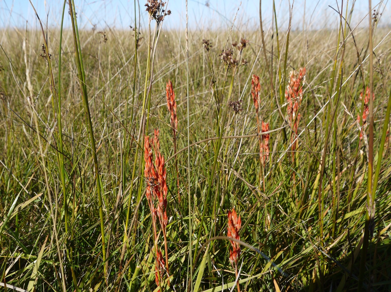
Having moaned about the lack of marker posts where the forest had been felled, we now looked along the obvious track off Ochiltree Hill with four marker posts visible. The ground here was boggy on places but generally easy going. We passed a gate and then came across some golden mushrooms. They look bronze on the photos but were more golden in real life. Amanita phalloides, death cap, I think. We also saw a grass shoots with red seeds.
Red grass seeds
Death Cap?
The path follows a wall for a short while but then bears left towards a broadleaved wood at Garchew. We followed the trodden path into the wood but it soon petered out leaving us in very boggy ground beneath the trees so we headed back to the open ground and eventually found the SUW which skirts around the edge of the trees. There is firm ground to be had here but cows with their calves had taken station there and we thought it best to stick with the more difficult terrain away from the beasts.
After crossing the Bargrennan-Knowe road we headed across a boggy meadow but there were several short footbridges across the stagnant pools leaving just one challenging boggy area to cross on foot.
Having climbed out of the meadow and back on firmer ground we could see the forests across the Cree with Merrick in the distance. The path brought us to a step-ladder over a stone wall over which Jo had to man-handle the dogs only to repeat the job 2 minutes later. It did look as though a minimal diversion could have avoided the need to cross the two walls. Ours not to reason why.
Crossing the Cree at Bargrennan marked the half way point of the day’s walk and also the end of the official third section in my guidebook, though of course we have been slicing up the walk in our own way. I had thought the remaining half of the walk would be a riverside amble (no climbing) and looked forward to stopping for lunch dangling my legs in the cool water. I was to be disappointed on both counts.
Cree woods
Despite walking along the Cree in a downstream direction, we climbed, and climbed, and then when I thought we couldn’t climb any more, we climbed. No rocks or fallen trees presented themselves as likely lunch spots and the river fell away beneath us putting more distance between my toes and the cool water. There were a great many purple topped toadstools, all looking past their best and we wondered if this is what becomes of Fly Agaric, but I now wonder if they were primrose brittlegill.
Primrose Brittlegill
After the conifers by the Cree the SUW turned away from the river and crossed the peninsula made by the Cree and Minnoch. This involved a short section on forestry tracks but we were soon back alongside the water, this time the Water of Minnoch and found a pleasant shaded spot for lunch.
There is an oakwood beside the Water of Minnoch, Holm Wood, with numerous mature oaks as well as a great many new oak shoots. Beneath the towering oaks were hazel and holly. Hollyoaks, no less.
At the end of Holm wood we crossed the Minnoch and followed its far bank for half a mile before reaching the final section of the walk beside the Water of Trool. The bracken here was in full autumnal colours.
Cree Woods
Just to confirm that the purple fungi were not Amanita muscaria we came across some of these classic toadstools and their structure was quite different from the purples earlier in the walk.
Beyond Stroan Bridge the SUW is a stone path, a little harder on the feet but better than bog. Our final fungal find was here, some orange peel fungus.
The last mile and a half did seem to drag on a bit but was briefly livened up when we met a fox coming along the path. He seemed as surprised to see us as we were him, but he bounded off before I could snap a picture. The dogs didn’t seem interested.
Eventually we spotted an SUW information sign, looking a little like a bus shelter but in the woods and knew we had reached Caldons and the car.
With: Audrey, Joanna
PS We did not find the kist during this section but subsequently found it in May 2015
11.8 miles 5h 47m ascent 365m, max elevation Craigairie Fell 320m
Route: SUW, Dranigower to Tannylaggie
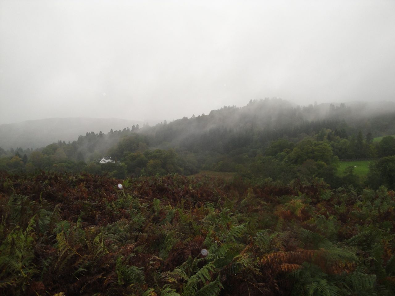
A warm damp day, with neither rain nor drizzle, but dampness precipitating directly from the air. Though humid doesn’t seem a word one would use for conditions in D&G, it does seem the best descriptor for this day. The low cloud put paid to any views of the surrounding hills, but we had seen them last month so were able to give more attention to closer things, like the plants underfoot.
Our start point was Dranigower Bridge. Dranigower means blackthorn thicket of the goats and I was a little disappointed at first to find Hawthorns close by, but I’m pleased to say that we did pass a lichen covered Blackthorn a little further along. No goats though.
Blackthorn
The road climbed gently past the cottage at Balmurrie to the farmhouse and soon had us warmed up. Within a quarter of an hour I realised that I had dressed a little too warmly and stopped to peel off a layer before I overheated. We then crossed one of those worrying areas where the OS has the tufts of grass in both blue and green, but the track remained firm and dry. We soon came to a sign off to the right which read “Cairn Na Gath 800m”. I set off up the wee slope to see if I could get a view of it but gave up before I got to the top of the brew.
In retrospect that decision was a mistake since had I gone the extra 50m I might have noticed that we had missed a turning in the SUW. Needless to say we followed a well trodden track that became progressively less well defined then disappeared leaving us in moorland with no visible landmarks and no SUW posts. We headed for some higher ground and then followed the dyke eastwards on the assumption that the SUW would have to cross the wall and would have a way of crossing the wall. I suspect that were not the first walkers to have gone that way since there did seem to be a faint track at times. Eventually we found steps over the wall and an SUW way marker, albeit a midget one half the usual size.
I suspect that the path marked towards Cairn na Gath is actually the SUW at that point and if not it would certainly have to cross the SUW. Carn na Gath (Cairn of the wildcat), is a neolithic burial cairn 30m long.
Cairn na Gath in the background
But we did get an opportunity to moan about the lack of marker posts where they are needed and to experience a walk across pathless moorland even if it was only for a few minutes. I will admit that finding the path again was a relief.
Funny walking stick
Back on the way-marked path we followed the marker posts into a quagmire on the far side of Knockniehourie where the height of ones boot mattered as much as its waterproofing. I gathered from the sounds behind me that Audrey’s boot height had been tested and found wanting.
The next section was along a wide forest break through knee deep grass that led us to a footbridge at the Purgatory Burn. The burn here is narrow and deep but widens to the west. This rather unusual name derives from the time when lepers were given the last rites at Glenluce Abbey then journeyed across the moors to the leper colony near Loch Derry. Once the lepers had crossed the Purgatory Burn they could not return. They would later wash in water from the Wells of the Rees which were thought to have healing properties.
The point of no return
A path of sorts has been laid beyond the footbridge which gives firmer footing for a while. There were a great many red topped mushrooms (without white spots) at the edge of the forest and when we got a little closer to take photos we could see that the entire forest floor had them.
Red Mushrooms in the forest
We next joined a forestry track for about half a mile. The red mushrooms were still seen here but less numerous than in the earlier section. The SUW leaves the track to head through the forest (with a large signpost) and here we found a bucket of disinfectant with a brush and a sign asking us to clean our boots and carefully remove pine needles from our clothes to help prevent the spread of phytophthora. It must be the first time I have cleaned my boots on purpose in the middle of a walk.
Laggangarn and bothy
Laggangarn was only a few minutes away. Our first glimpse was of a ruined wall and a cairn and then the wooden “beehive” bothy. The visitors book (vol. 6) explained that it had been built in Autumn 1993 by Charles Gulland as a place for rest and shelter for users of the SUW. We rested in the bothy and had our lunch sheltered from the elements. The door is quite small, so much so that at first I thought it was a window, and I somehow managed to bang not my head but my back on the lintel. The last entry in the visitors book was two days earlier from a ranger who had just met power workers scouting for sites for turbines. What a shame.
I had thought that the Laggangarn standing stones would be in the same clearing so went up to the higher ground to look for them. They are actually in another clearing 300m further on but I didn’t know that then. On the higher ground is another ruined building and quite close is a substantial road/track not marked on the OS map, perhaps for the coming turbines.
Laggangarn standing stones
Once rested and fed, and just a little drier, we set off and were soon at the Laggangarn standing stones. I looked at these two stones and for some reason the first thought that came to mind was “Lot and his wife”. They certainly are a size and shape to suggest a man and his wife. These two grey sandstone monoliths are said to be the survivors of a bronze age circle of 14 of which 7 were still present in 1873. Some of missing stones are now lintels in the nearby ruins. Though the stone circle dates back 4000 years these stones have been decorated with christian crosses, the style of the crosses suggesting they were added in the eighth century.
Laggangarn. Lagan g-carn, hollow of the cairns. There are some remarkable remains at this place on the Tarf. The old pack-horse track crosses the river under Kilgallioch and there used to be here three standing stones, of which two now remain, each bearing large incised crosses. A story is told of a man who, in rebuilding the now deserted farm-house of Laggangarn, carried off one of the standing stones to form a lintel. Some time afterwards his sheep-dogs went mad and bit him. He also went mad, and his wife and daughters ” smoored him atween twa cauf beds “ (smothered him between two mattresses filled with chaff), and buried him on the hillside, placing the broken stone over his grave. It is a desolate region.
Topography of Galloway, Herbert Maxwell, 1887
Despite the desolation, the ground around the two standing stones had been newly mown, presumably by Historic Scotland,
The Tarf Burn runs close by with a wooden footbridge that leads to a forestry track. The SUW though leaves the track almost immediately and heads through trees up to the bracken covered moorland of the Wells of the Rees. Having battled through the wet bracken to the Wells less than a month earlier we decided to revisit them in our memories rather than in reality.
Craig Airie Fell summit
We now passed through a section of felled forest draped in mist and looking like a film set for Mordor or the Somme. The ground was squelchy and occasionally very wet. The excellent views we had in August during the recce for this walk were lost in the mist but we still stopped at the summit of Craig Airie Fell for a snack and looked into the mist.
We then made our way down out of the mist and back along the SUW, past Loch Derry (Liberland, the leper’s land was on its far side) and Derry farm and then along the potholed road.
Polbae Burn
The road near Polbae has forestry fir trees to the right and broad leafed trees along the Polbae burn to our left. It looked as if Polbae may once have been a planned garden that has now run wild. We walked along trying to identufy the trees and plants until we reached Tannylaggie bridge and crossed the Bladnoch to reach the car with its promise of dry footwear.
SUW 2 Ultreia!: the write up will be a bit delayed but here’s some info to keep you going. 9.9 miles (9.0 miles of SUW), 4h 45m (a little slower than planned), 292m ascent, max elevation Caves of Kilhern 145m, 1,133 calories burnt, (I forgot how many paces it was), 1 ruined 15th century castle, 1 ruined 12th century abbey, 1 neolithic (4000-5000 year old) burial site, 1 unexpected airfield, our first major river crossed (Luce), discarded clothing passed, 1 waterfall, our first kist with an SUW coin hoard, Mike’s animal husbandry skills on show, a glimpse at male and female seeds (snigger), signs warning of squirrels and elephants, “Ultreia” on an SUW sign (something pilgrims would shout to encourage others, meaning “Walk on” or “go further”), and all rounded off with cakes. But I did forget to caress David’s new trousers.
We set off from Castle Kennedy, having parked by the ruined castle, and headed back over the watercourse to rejoin the SUW along an estate road. This gave us some good views over the Black Loch with its crannog before we walked through woodland leading to the New Luce Road we had just driven along.
After a short stint of road walking with just the hedgerows to look at we found an SUW sign and turned right off the road. The track then climbed gently past the cottages and remnants of farm buildings at Chlenry, through broadleaved trees and farmland before coming to the road again for a short stretch. Chlenry derives its name from claen meaning sloping and this is main climb of this section, only about 50m but enough elevation to give us a better view looking back over Cults Loch with its own wee crannog. A couple of Cessnas were parked on Castle Kennedy airfield undermining my earlier assertion that the airfield was no longer used.
An SUW information board and signpost marks where the way leaves the New Luce road for the second time and pointed us onto a track over moorland. On the OS map the SUW leaves this track where the woodland begins, but the older forest has long since been felled here and is now bracken and heather covered moorland. An SUW post just after a gate marks the turn off on to a grassy path.
Even on this drab day the moorland was colourful with purple heather, bright green bracken, a variety of greens on young trees, red berries, yellow flowers and grey stone in a small quarry.
The path of the SUW crossing the moor runs beside a wall and seems to be raised above the marsh on a causeway which in places has substantial stones suggesting that another wall may have once stood there. Finding somewhere to sit for lunch though was a little difficult. There where occasional outcroppings of rock but they were too big and the wall itself, though a tempting seat, was usually sat in boggy ground.
View across Glenwhan Moor
When we did find a likely lunch spot, I made the mistake of choosing a tree stump as my seat and was lucky to escape injury when it disintegrated converting from a flat topped cylinder into a sharp point.
At Drumfleugh we passed an SUW post marked with “Ultreia” a phrase pilgrims in days gone by would call out to each other, meaning something like “Onward!”
A little later we entered the forest between Airyolland and The Water of Luce. The strange installation pictured below was amongst the trees and had a collection of Waymerker coins.
SUW Kist
Water of Luce
The forest walk passed from forestry fir trees to mature broadleaf and was quite a pleasant section. This brought us to a footbridge over the railway line and another over the Water of Luce, the first major river of our trek.
Beyond the river we were faced with a dilemma. The SUW enters a field and leaves the other side but the field was planted and there was no obvious path. A sign asked walkers to cross in single file which we did avoiding plants where we could, but I still felt uneasy crossing a crop.
After a brief section of road walking we turned along a track and climbed back up to the moors.
Hieland Coo
The path was boggy in sections along here and there were cows and calves standing in our way. They didn’t much like us though and wandered off as we approached making ourselves look big.
Caves of Kilhern
After ruminating on the uses of a small brick building near the ruined farmhouse at Kilhern I was looking forward to visiting the burial cairns nearby. We found a sign leaning against a stone wall “Caves of Kilhern 200m” and I thought it must have fallen over and been placed there against the wall. There seemed to be a faint track a little beyond that which I encouraged the group to use. Once we had walked well past 200m without any burial chambers in sight I realised I had led them a astray.
The sign, it would appear, was in the right place and following the wall would be the best way to get to the ancient stones. As it was, David and I just had to climb the wall and have a short jaunt across the moorland to get to them.
It was only a short walk then to the end of this leg. Audrey remembered seeing a waterfall on her map and as we walked we could hear it so scrambled over a wall to get a photo. There is a footbridge over the Cross Water of Luce that allowed me a view of the waterfall but the bridge looks as if it could fall down anytime.
Having collected the car we drove back Castle Kennedy for refreshments in the visitor’s cafe.

 Dundeugh Forest is bounded by the Waters of Ken and Deugh, and became an island with the damming of these rivers to create Kendoon Loch.
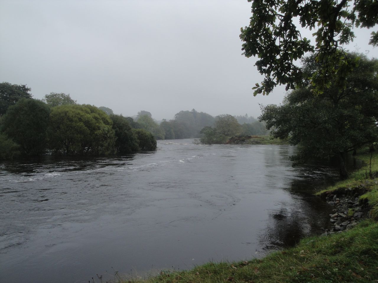


 SUW 2 Ultreia!: the write up will be a bit delayed but here’s some info to keep you going. 9.9 miles (9.0 miles of SUW), 4h 45m (a little slower than planned), 292m ascent, max elevation Caves of Kilhern 145m, 1,133 calories burnt, (I forgot how many paces it was), 1 ruined 15th century castle, 1 ruined 12th century abbey, 1 neolithic (4000-5000 year old) burial site, 1 unexpected airfield, our first major river crossed (Luce), discarded clothing passed, 1 waterfall, our first kist with an SUW coin hoard, Mike’s animal husbandry skills on show, a glimpse at male and female seeds (snigger), signs warning of squirrels and elephants, “Ultreia” on an SUW sign (something pilgrims would shout to encourage others, meaning “Walk on” or “go further”), and all rounded off with cakes. But I did forget to caress David’s new trousers.


