Bamburgh: royal castle, aviation museum and a sycamore gap
October 26, 2025
3.70 miles 1h 44m ascent 88m (Budle Point walk) 1.99 miles 1h 5m ascent 53m (Bamburgh Castle)
Wyrd bið ful aræd
The Wanderer
I’m so out of touch with TV that I didn’t recognise the Last Kingdom inspired posters. Nor did the quote “Destiny is All” that was plastered on them ring any bells in mt memory. I know now. In my defence, I have met the phrase before in “The Wanderer”, a poem from the 9th or 10th century, where it is usually translated as something like “fate is fully fixed”.
The point of the posters is to highlight the Anglo-Saxon heritage of Bamburgh Castle. Kings Kings of Northumbria ruled lands from the Forth in the north, south to the Humber and Mersey, from the Galloway coast, to the North sea. The Celtic fortress at Din Guaire was captured by the Saxon King, Ida, who was said to be descended from Woden. It would become the royal seat of Bernicia and then of Northumbria. Ida’s grandson, King Æthelfrith , named it for his wife Queen Bebba. It became Bebbanburh, and in time Bamburgh
But enough musing on the distant past. The weather forecast another bitterly cold and windy day with rain from midday so we planned a relatively short walk after which we would explore the castle itself.
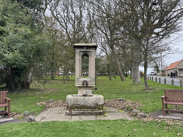
Most of the walks routes we looked at were anti-clockwise but one, by a photographer, suggested that approaching the castle from the north gave better views. So we went clockwise. The road out of the village took us by some very impressive houses and what seemed to be a memorial where the road forked. There was no dedication plate to be found and the edifice is described online as the “Pant and Trough on The Grove”. A pant, apparently is a public drinking fountain. Google says the term is most common in Northumberland but is also found in Scotland, Cumbria and Lancashire. A little more digging suggests that the meaning outside Northumbria is more likely to refer to pool below a midden. I’ve not heard pant used in either context before. I’ll ask my Newcastle acquaintance when I next see her.
The trees of the grove seemed to glint as we walked by. Fairy lights were strung through their branches (but not turned on). Ready for I presume.
Pant and Trough
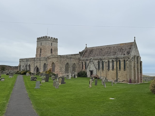
We should perhaps have gone into St Aidan’s Church but I always feel a little uneasy walking into churches. My apostasy does not preclude reverence. According to the Venerable Bede, St Aidan built a wooden church here in 635 AD and died on the site AD 652 AD. A wooden beam preserved in the church is said to be the one he rested against as he died. We both thought the present church had a “Norman” look and indeed it was built in the late 12th century. It was the squat square tower in an old church that said “Norman” to me, but since most Saxon churches were wooden that’s likely correct because of probability rather than me recognising an architectural style.
St Aidan’s Church
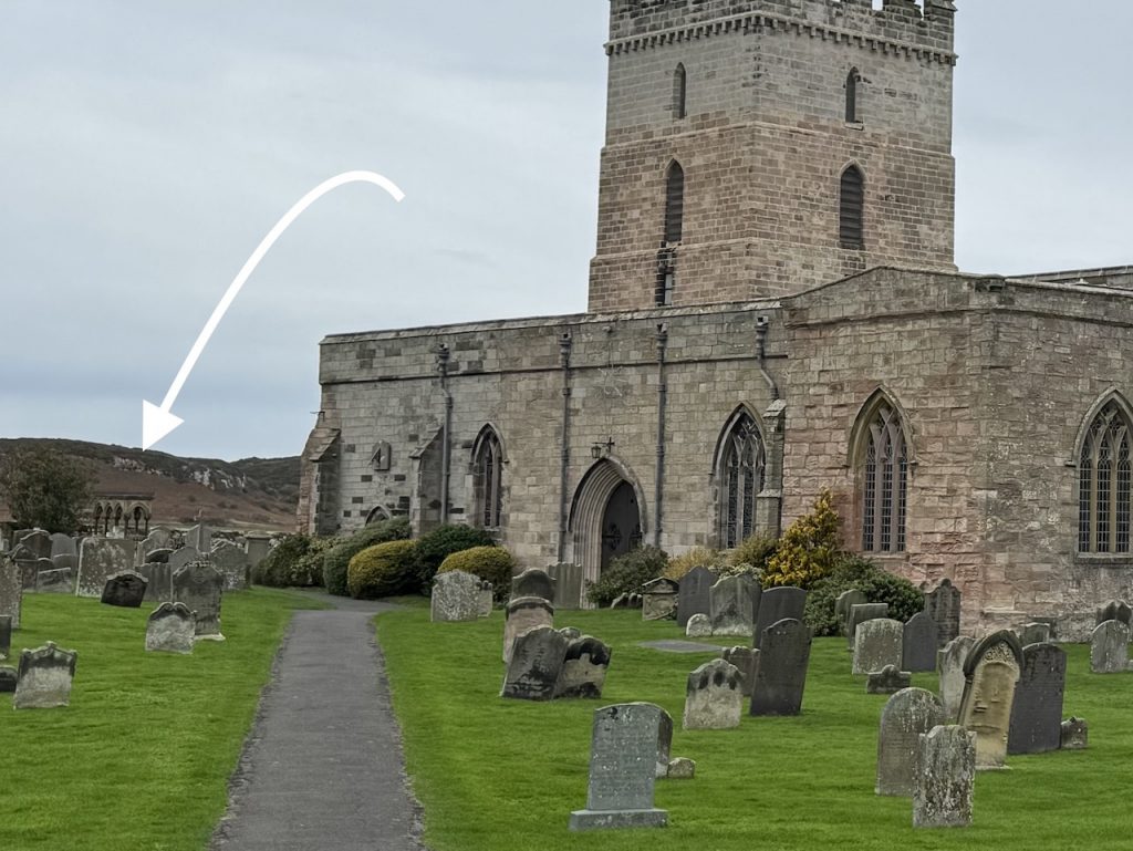
The Grace Darling museum stands opposite the church, its unapologetically modern look either chosen to contrast to the ancient church or without due consideration. It was not open. I didn’t know it at the time but the Grace Darling memorial is just at the far left in the image above.
Grace Darling museum
The pavement ended a little way past the church but there was a verge to stand on when cars came by. We left the road at a public footpath finger post close to the lowest part of the road and made our way down a dozen or so steps. I suspect some “looking the other way” regarding this access to the public footpath since the overhanging hawthorns were well on their way to claiming the steps as their own. We had to duck very low to avoid their grasp and Audrey’s rucksack was still snagged.
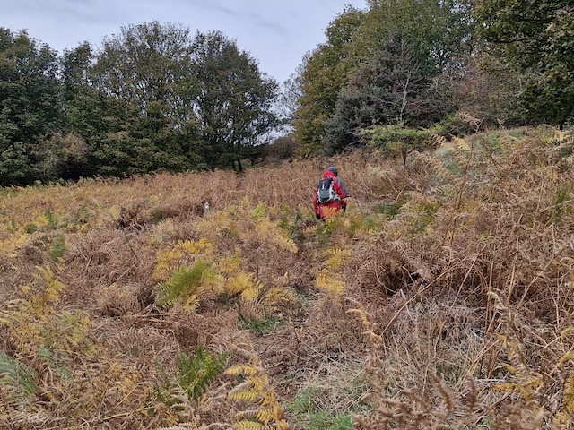
Once out of the hawthorn gunnel we found a field cereal only finger-high, wheat or barley perhaps. Another line hawthorns formed a hedgerow but a metre-wide firm unplanted section was easy walking. Then we made our way up through bracken, but with a reasonable way through – enough other people must walk there to have kept it passable.
Bracken leading to a wee gap with sycamores
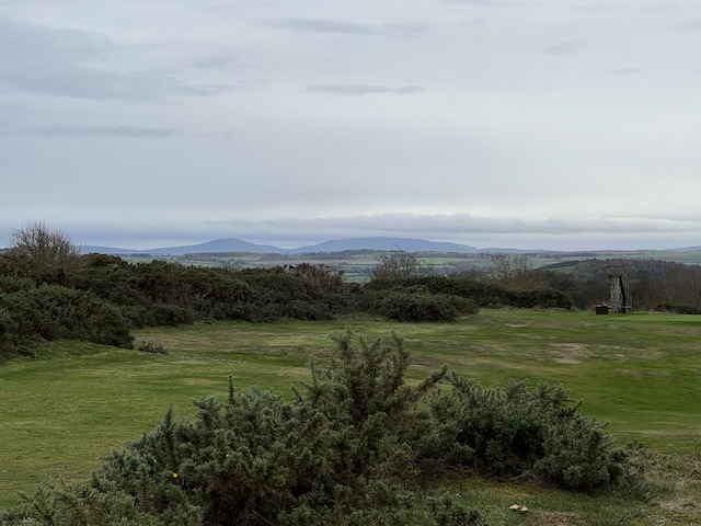
The gap had a small stand of sycamores after which was the golf course – and our first views across Budle Bay to Lindisfarne and inland to the Cheviots. Signs warned us we were crossing a golf course, telling us to keep to route shown by the blue posts and to look out for flying golf balls. Two points: the blue posts were sparse such that we could not easily follow them; I’m pretty sure we wouldn’t see a golf ball that was going to hit you. (I asked Google’s AI and it said it was very unlikely.)
Cheviot Hills in the distance
Having passed a small farm we reached the Coastal Way/St Oswald’s Way, not that the trail changed in character, We thought there would now be some official way markers to follow but when we were faced with a fork in the path, we looked in vain for way markers. Obviously there were you-are-on-the-correct-path markers where no option existed. There must be a bye-law that stipulates that,
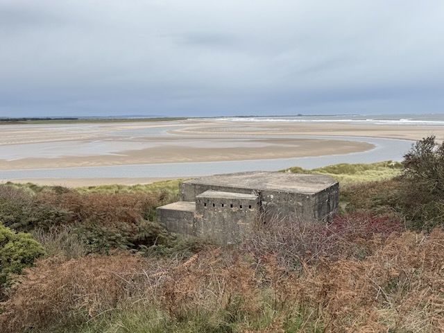
A Pill box, presumably WW2 vintage looks across Budle Sands giving the (false) impression that we could have walked all the way to Holy Island. Lindisfarne castle is the small bump on the horizon in the picture below. It looked larger to the naked eye but not much.
Budle Sands at low tide
The coastal path runs above the beach though there were several paths that looked to lead down. We skirted the golf course, following blue posts and watching for the golf balls we were unlikely to see. We were back in the wind but had good views of the North Sea waves, Tall spumes rising where they battered the Farne islands.
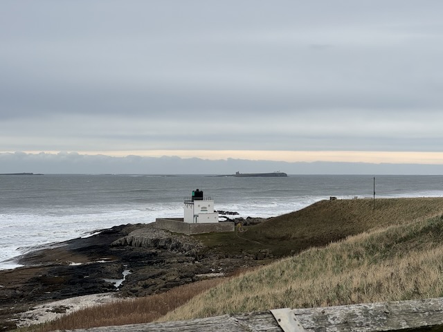
Out on the islands Longstone lighthouse, home of Grace Darling, and a smaller lighthouse on Inner farne were easily seen but I suppose that’s the point of a lighthouse. Inner Farne looks a little like a submarine rising to the surface. the conning tower looked to be a ruined church but is neither a ruin, nor a church. It is Prior Castell’s tower, used now to house National Trust rangers.
Inner Farne from Stag Rock
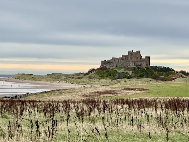
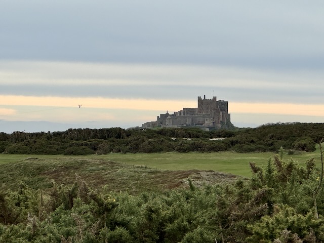
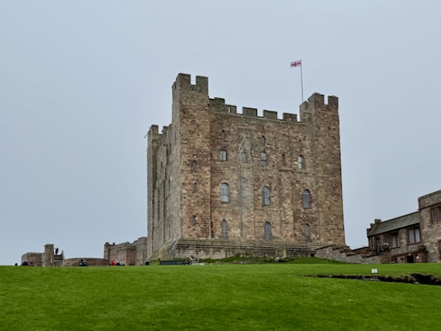
The rock formations (Harkness Rocks) below us looked a little like the Giants Causeway, with discrete hexagonal columns. They are apparently among the oldest rocks in the world. But our eyes were drawn to Bamburgh Castle just along the coast.
Bamburgh Castle
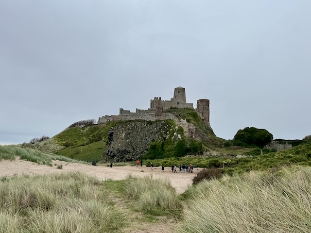
As we drew closer to the castle, our path tried repeatedly to take us down to the beach. We managed to stay on the dunes above it but the firm ground gave way to sand making the going a little more strenuous. But it was easy enough.
In olden times, boats would have been able to reach the castle but no more. Now there is a sandy beach below the castle. And there were a surprising number of people on the beach given it was the end of October and bitterly cold (it was a feels-like temperature of -2°C).
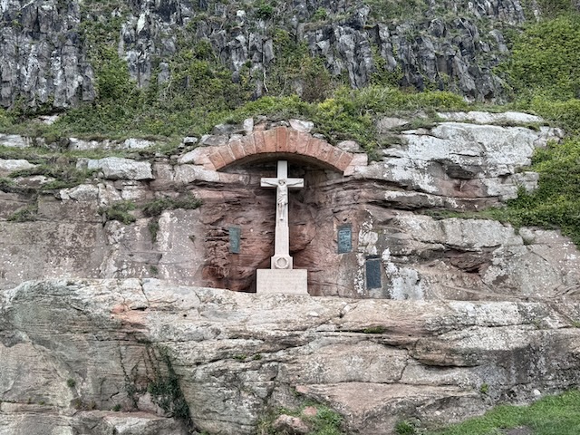
Having walked past the castle we had a look of the war memorial. I don’t recall seeing a crucifixion war memorial before but a quick google search shows they are not rare. [Comment: the autocorrect changed crucifixion to crucifiction. I don’t know if that is some king of sly comment or an alternative spelling, Anyway I changed it back]
By now the rain had reached us, about an hour earlier than forecast, so we didn’t hang about to savour the castle from the green. Hoods u and heads down, we headed back to the car to drop off our rucksacks. ready to go up to the castle, and some shelter.
CASTLE VISIT PART STILL TO BE WRITTEN
Bamburgh was an Anglo-Saxon citadel, a Norman stronghold and a border garrison during the Anglo-scottish wars, but it was finally broken during the Wars of the Roses becoming the first castle in the world to succumb to cannon-fire.
The final siege used King Edward’s Guns “Newe-Castel”, “London” and “Dyson”. The bombardment was so severe, “stones from the walls flew into the sea”. One of the Castle Towers, where Sir Ralph was positioned, collapsed under bombardment; he fell with it. It was thought he was dead; sadly for him, he survived and was later executed at York.
Despite upping sticks to Scotland many years ago, I still remember when having addresses ending with “Lancs.” so feel compelled to remind readers that the Red Rose would eventually defeat the White Rose at Bosworth Field. Oh how my school-boy history floods back. I even had a ladybird book “Warwick the Kingmaker”. I bet they don’t publish stuff like that nowadays.
Bamburgh Castle was sold to Sir John Forster by Henry VIII for £664. A white elephant if ever there was one. It eventually bankrupted the Forster and .gradually fell into ruin until it was rescued by Lord Crewe, the Bishop of Durham. There’s more to that story, but google it if you want to know. The short version is, he left money to maintain the buildings and it placed it in the care of his friend John Sharpe. He would oversee restoration of the buildings and developed a pharmacy, a school for girls and hostel for shipwrecked mariners. There was even an early coastguard system and lifeboat. But
In 1894 a local industrialist, William Armstrong, bought the castle and set about renovating it.
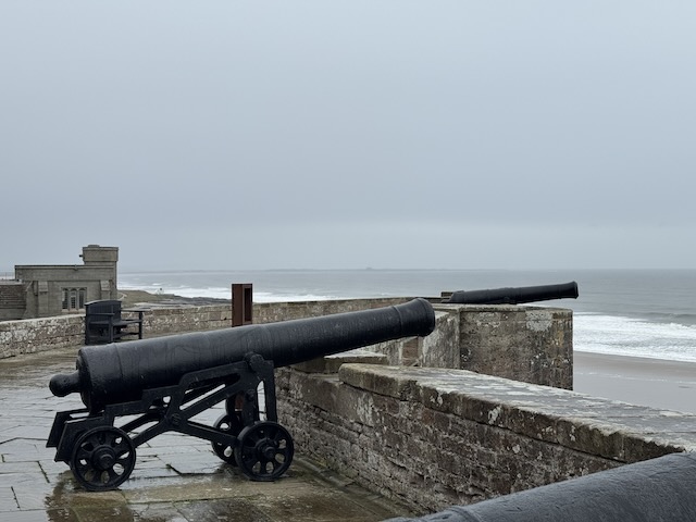
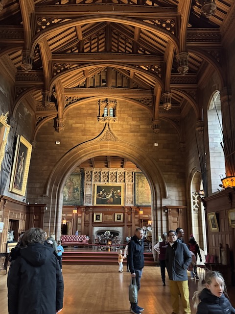
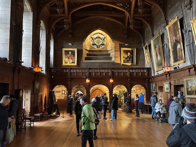
A scathing review of the castle (one star) complained that the rooms were just one collection of plates after another. So we found ourselves looking for plates in each room. Needless to say the review was a bit over the top. I quite enjoyed the castle which had a reasonable mix of stately home, military museum, and historical artefacts.
plates, guns, propeller, durgeous. The gay at the entrance hold is o head in the state rooms, follow the flow to the old Keep and we would know our quest was complete when we found the gift shop. [I thought I would leave this line just as the handwriting-to-text produced it. The fact our quest was guided by a “gay” rather than a “guy” gave the whole visit a different slant.]
The guy at the entrance told us to head into the staterooms, follow the flow to the old keep, and we would know our quest was complete when we found the gift shop. The difference a single vowel can make.
Queen Bebba was perhaps the most important because her name lives on through the centuries and gives the village its name. Legend has it that King Æthelfrith (died c. 616) was King of Bernicia from c. 593 until his death. Around 604 he became the first Bernician king to also rule the neighbouring land of Deira, giving him an important place in the development of the later kingdom of Northumbria. Legend has it that he named his fortress after his second Queen. Bebba, as detailed in Bede’s Ecclesiastical History.
Queen Philippa, wife of Edward III lived at Bamburgh and led an army to repulse the scots while her husband was away fighting in the Hundred Years war. She was number 5 in the 2003 poll of “100 Great Black Britons”, a controversial choice since she was not black. She had some distant Turkic and armenian ancestors on her father’s side.
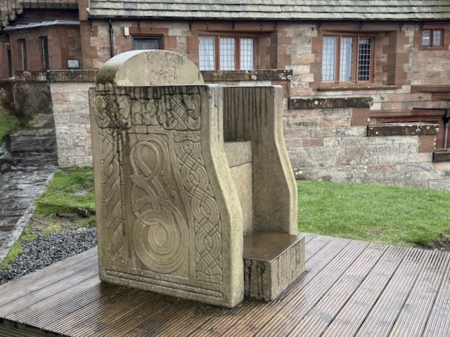
A replica of an Anglo-Saxon stone chair, also called the “Bamburgh Chair,” which is a replica of a throne or “gift-stool” from the 9th century.
Even an aviation museum. The castle was bought and restored by Lord Armstrong in Edwardian times. He had shipbuilding interests and the company also made aircraft.