 I’ve been limited to short walks of late with little to report so I thought I’d write something a little different to keep my hand in. I had hoped to be out and about this weekend but Mrs Drow ‘n’ Smirr has decreed it stupidity to go out in the cold, wind and rain while still coughing, spluttering, whining and disturbing her sleep. So instead, here is my homage to the A75.
I have travelled along the A75 between Dumfries and Stranraer regularly over the last 18 years. The villages, buildings, monuments and hills along the way have gradually stirred my rather sluggish curiosity and led me to find out more about them.
The A75 is part of the 1,170 mile European Route E18 running from Saint Petersburg, Russia to Craigavon, passing through Norway, Sweden and Finland. In Dumfries & Galloway the road runs through countryside and a few villages, bypassing the larger towns it once bisected. In places it follows the path of an old military road built in the 1760s to aid troop movements to Ireland. There had been a major programme of military road building in Scotland in the early eighteenth century aimed at improving troop movments in controlling the rebellious Jacobites. The project was led by General Wade, who is mentioned in the notorious anti-scots verse, oft mentioned but not actually in the official national anthem.
Lord grant that Marshal Wade
May by thy mighty aid
Victory bring
May he sedition hush
And like a torrent rush
Rebellious Scots to crush
God save the King.
General Wade’s assistant was Major William Caulfeild, a fellow Irishman, and following General Wade’s removal from command after failing to prevent the Jacobite army’s incursion into England in 1745, Major Caulfeild took charge of the construction of military roads in Scotland. Caulfeild’s road from Gretna to Portpatrick is in many places an upgrade of older routes. Some of these may be military routes dating back to Roman times, and pilgrimage routes to the holy sites at Whithorn will have been used for centuries. The A75 is in short stretches on Caulfeild’s route but the military road tends to take a more direct route than the modern A75. The military road can be seen at times, in use as a minor road or footpath, near its modern counterpart.
Another reminder of past times are the railways, these came about a century after Caulfeild’s road but were dismantled in 1965 following Lord Beeching’s recommendations. They remain now as overgrown embankments and redundant bridges. The old Paddy line lies close to the road at Dumfries but leaves to head further north before rejoining the route closer to Newton Stewart.
In places the A75 runs between grassy embankments hiding the views and in others between trees or hedgerows. In these stretches there is little to be seen other than that which is directly ahead, but there is always the rain to admire, and the magnificent rainbows. Despite the predominance of fir trees throughout the forestry commission’s lands in Dumfries and Galloway, the trees that line this road are mostly deciduous and they are a study in colour when autumn paints their leaves yellow, brown and gold.
Part of the A75 is said to be haunted, but that is a section between Annan and Gretna so the only ghosts on the more western stretches are those we bring ourselves.
Leaving Dumfries the old dismantled railway is close to the road, crossing Cargen water on a small viaduct and the older A75, unbelievably narrow, can be seen snaking its way up the glen. The road climbs the glen over a ridge of hills joining the two local marilyns, Woodhead Hill and See Morris Hill, the latter with its aerials, and there is little to see other than the road before you. On the return trip, however, the whole of the Nith valley and Dumfries lie basking before you. The hospital stands out white amidst the more natural colours of the town and its surroundings. When the weather has been wet, flooded fields glint in the sunlight and on the northern horizon there is a conical hill, Queensberry, whose near neighbour Gana Hill collects the headwaters that will become the Clyde. When there air is clear, just to the right of Queensberry are the Moffat hills, making Hart Fell the only Corbett visible from the A75.*
Once over the lip of the glen there is undulating farmland. Criffel, and the smaller Lotus Hill can be briefly glimpsed to the south but the north tends to catch the eye with Bishop Forest Hill with the longer ridge of Bennan Hill running westwards from it. Turner’s monument is definitely visible on Bennan and the cairn atop Bishop Forest Hill is just identifiable.
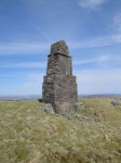
Turner’s monument marks the resting place of John Turner. He was an itinerant worker, visiting farms to repair tack and make such things as cutlery from horns and bones. He may also have been a preacher and the inscription he has left suggests he was an educated man. He bought a plot of land on the the hill, prepared his own grave and erected the monument. The story goes that local youths filled in the grave with stones and damaged the monument; vandalism is not new. John repaired the damage and then kept it intact until it was needed. Apparently the guilty youths were made to carry his coffin up the hill which must have been quite a feat. The climb took my breath away just carrying a rucksack. The inscription now much faded reads
In memory of John Turner who
died at Glen 1st December 1841 aged 60 years.Jordan I have passed through many a weary day
On earth I wandered waiting to be free
Honest and poor I trod life’s thorny way
No comfort here save hope in Heaven for me.
Though on this bleak hilltop my body lies
Under this stone it moulders into dust
Remember stranger it will yet arise
Nor taste of death again, but with the just
Eternal Anthems to my Saviour raise
Redeeming love will be our theme of praise.
Here in this place I made my grave
Four years before I died
And I did ask some decent men
To see me safe interred
As I did get the grant of it
From J. Lennox Esq. of the land
Which he did grant to give me
As long as time doth stand.
Many of the farms around this particular area are painted pink and at least two can be seen from the road as you drive. The first village the road passes through, nine miles from Dumfries, is Crocketford. The licensing laws of old prohibited the sale of alcohol within 9 miles of Dumfries on Sundays hence Crocketford’s other name, Ninemile Bar. The A712, with the Galloway Arms and the Nine Mile Bar Toll House either side, leaves the A75 here, taking a more more direct, but slower, route to Newton Stewart.
Crocketford has pride of place as the highest point of this journey at 122 metres. It was founded by a religious sect, the Buchanites in 1787 after they had been expelled from Irvine and then from Closeburn. When the last sect member died in 1846 the mummified body of Elspeth Buchan, the sect’s founder, was discovered in his house. He had been awaiting her resurrection, and that of the other members of the sect buried nearby. The Buchanites had believed that Elspeth Buchan could confer immortality by breathing on another person, though it is implied that other methods were used as well. The Buchanites were said to have behaviours that contravened social norms and are described in letters by Robert Burns, who may have had a paramour amongst the sect.
A little after Crocketford the road passes Auchenreoch Loch, and Springholm village. Both Crocketford and Springholm are mentioned in R.S. Crockett’s The Raiders and are the only two villages the A75 does not by-pass. After crossing the River Urr, Screel hill comes into view almost directly ahead. This is a rhomboidal shaped hill and will remain the main sight as far as Castle Douglas. I’ve read that Screel Hill takes its name from the Gaelic sgreamhail meaning disgusting or nasty but having climbed this hill several times I can only presume this is incorrect or something about the hill has changed over the years. An alternative sgrath-eileach, meaning turf bank or mound sounds more plausible.
Once the road approaches Castle Douglas there is a change in terrain with a swarm of drumlins. The town’s clock tower is visible south of the by pass, and directly ahead, where the road begins to descend, Threave Castle, once the home of Archibald the Grim, Lord of Galloway and scourge of the English, is briefly visible with the Glengap hills as a backdrop.
The road then crosses the River Dee, at Threave bridge, and immediately north of the bridge is the tree covered Lamb island. This now houses a bird watching hide but once carried the Kirkcudbright to Castle Douglas railway. Further along the road, near Ringford the railway’s embankments are alongside the road, on the south side. The road here is also on the route of the old military road.
There are a couple of unimpressive hills to the north of the road here. The first is Barstobrick Hill, which in Roman Times was topped by a fort, the Giant’s Dyke, but now has the 12 metre pyramidal Neilson monument, commemorating the inventor of the hot blast process in iron smelting. The second, unadorned group of hills has the unusual name of the Towers of Kirkconnell. The two L’s differentiating it from the Kirkconnel on the A76.
The old sandstone railway station house at Tarff, now amongst a collection of newer buildings, is on the hill just south of the road. Once the road crosses the River Tarff there is a slow climb past the village of Twynholm, which boasts the David Coulthard Museum and a chocolate factory. When heading east, Bengairn, Screel’s taller neighbour, is the large hill seen directly ahead.
There is then a slow climb, to the second highest point of the journey at Glenterry, 117 metres. At this point Cairnharrow and Cairnsmore of Fleet appear ahead in the distance. The road descends into Fleet Valley, the jewel of the drive as far as views go. Directly ahead stands Cairnharrow hill, with its smaller companions Barholm and Ben John standing before it like pawns before their queen. Behind it is Cambret hill with its collection of aerials and behind that the bulk of Cairnsmore of Fleet, the most southerly Donald. The Old military road passes behind Cambret Hill. Cairnharrow and its surrounding hills have several ancient stone circles and the ancient burial grounds of Cairnholy. The lower slopes of the hills are forested, their colours changing with the season.
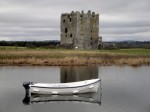
In the valley itself runs the river Fleet, and guarding its entrance is Cardoness castle, a tower house built by the McCulloch family in the 15th century. When built this castle stood on the coast but is now several hundred metres from the sea. The castle was abandoned following the execution of Sir Godfrey McCulloch in 1697. He was beheaded for the murder of a neighbour, one of the last to be executed using the Maiden, an ancient form of guillotine.
South of the road, and across the Water of Fleet is an area of flat land with Boreland of Anwoth sitting on a raised area. This is a white farmhouse dating from 1771. To its left is a large earthwork, the Green Tower Motte, the remnants of a motte and bailey castle dating from about 1160. This castle was built by David fitz Teri, an Anglo-Norman lord who is likely to have received or seized lands from the Lords of Galloway and then built himself a strong castle to maintain his position. The descendants of fitz Teri had the name Kerdenes (Cardoness) by 1220.
The Cardoness estates passed to the McCullochs by marriage. There is a local tale that the Laird of Cardoness, a robber baron and violent man, had grown exasperated with his wife who had provided nine daughters but not the son and heir he desired. When she became pregnant again he threatened to drown her and all her daughters if she failed to produce a son. Much to the relief of all concerned a son was born and the delighted Laird arranged a midwinter feast on the thick ice of the Black Loch. Unfortunately the ice gave way and the whole family, save one daughter were drowned.
The Saltire flies by Cardoness castle, and the Rutherford monument, a 17m granite obelisk stands on the hill behind it. The monument commemorates Samuel Rutherford who had been minister of Anwoth in 1627, but was subsequently expelled by the Bishop of Galloway for non-conformist beliefs. He would later become Professor of Divinity at St Andrews. Following the restoration of Charles II, Rutherford’s book, Lex Rex, The Law, The King, which called for limited government and disputed the divine right of kings, was ordered burned. Lex Rex included many ideas regarded as deeply seditious at that time. “The law is not the king’s own but given to him in trust; power is a birthright of the people borrowed from them”. Rutherford was accused of high treason. He received the summons on his deathbed and answered,
“Tell them I have a summons already before a superior judge and judicatory, and I behove to answer my first summons, and ere your day come I will be where few kings and great folks come”.
Rutherford had suffered previously with tertian fever and one wonders if the same illness finally killed him. The other covenanters condemned at the same time all went to the scaffold as would Rutherford had he not died of natural causes.
To your right it is usually possible to see another Saltire flying above the Cally Palace Hotel within the trees. To the left is Fleet bay with two of its islands visible, the flattened Murray’s Isles and larger Ardwall Isle. The third of the larger Fleet Bay Islands, Barlocco Isle can be spotted from a little further along the road.
Fleet Valley looks at its very best when rain has enhanced the colours and the sky behind Cairnharrow is a dark brooding purple but with the sunlight still bright. I’m not the first person to think this part of the route is special. Queen Victoria asked Thomas Carlyle for his opinion as to the most beautiful route in her realm, and he told her that it was the road from Gatehouse-of-Fleet to Newton Stewart. When she asked him what was the second most beautiful route he replied “Why surely, ma’am, it is the road from Newton Stewart to Gatehouse-of-Fleet!”
Having crossed the Fleet, the Garvellan rocks, a small promontory are seen a little way after crossing the Fleet. The road then follows the western side of Fleet Bay. Though trees initially obscure the view, where the Skyre Burn is crossed there is a good view of Fleet Bay. Though the eyes are naturally drawn to the bay, if you glance inland the old bridge over the Skyre Burn is still there carrying an older version of the road. The lay-by after Skyreburn has the Teapot Cafe, a wooden affair in the lay-by, with picnic tables for hardy types. Good for a bacon butty (personal communication, CGI).
Then we have a further three castles. The most easily seen is Carsluith Castle, dating from the early 15th century, which is very close to the road. This is a typical fortified house of the time and really more of a tower house than a castle. It had been built originally by the Cairns family, but passed to the Browns as a Dowry. It is now ruined but tidy. The adjacent Marberry Smokehouse cafe offers the opportunity to have a closer look. The white Barholm Castle, is north of the road about half way between Cardoness and Carsluith castles and is best seen when heading east. Barholm was a McCulloch stronghold, just two miles from their sworn enemies the Browns at Carsluith. Sharp eyes will spot the 16th century Castle Cary east of the road just before Creetown.
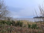
Past Carsluith, the road runs close to the coast giving a view, across Wigton Bay, of the Machars peninsula. The term Machars derives from the Gaelic machair, meaning low lying level land. It certainly has no hills but I think I would call it rolling rather than flat. The town of Wigtown is immediately across the bay, across Wigtown Sands and Baldoon Sands, which are uncovered at low tide. Though small and relatively isolated, Wigtown has the honour of being Scotland’s National Book Town, and has a great number of second hand bookshops. Immediately south of the town is the disused RAF Wigton airfield. This is one of several airfields in the area, most dating from the second world war and built to house training units moved from the then dangerous south coast of England. The airfield’s runways were originally grass but had to be concreted due to the ground’s propensity to flood. Truly Gallovidian. Looking further south still there are two headlands visible, Eggerness point which shelters Garlieston and the Isle of Whithorn itself. Garlieston’s beaches were used in testing and modifying the Mulberry harbours used in the invasion of France because of their similarity to those of Normandy. The Isle of Whithorn is where Christianity was introduced into Scotland by St Ninian in about 390 CE and was a place of pilgrimage for centuries. Little is known of St Ninian, since no contemporary descriptions survive. The first brief mention of him in writing is by St Bede three centuries later. There is a suggestion that he was actually Finnian of Moville and his name has been transliterated. He is also known as St Trynnian. There are other, more modern, connections between Whithorn and the cinema with the town claiming Scotland’s most southerly cinema and many scenes from the cult classic The Wickerman being filmed hereabouts. The modern Wickerman festival, however, is held across the bay near Dundrennan. The Isle of Man is usually visible from here on the horizon, in good weather.
The route then runs along the river Cree beside Creetown, which houses a Gem Museum. There is an expanse of tidal land between Creetown and Wigton Bay, best seen when the road crosses the Moneypool Burn. I can’t help but think the name Moneypool must have a interesting history, but as yet my researches have failed to uncover it. Since Creetown was once called Ferrytown of Cree I imagine the river has silted up over the centuries. Cairnsmore of Fleet stands behind Creetown and later the smaller Crammery hill can be seen standing beneath it. When the road crosses the Palnure burn the old railway makes another appearance, as an embankment.
The Minnigaff hills now start to come into view, though they are perhaps seen better when traveling east and on the western side of Newton Stewart. Larg hill, Lamachan Hill and Millfore are rather featureless but Curleywee lying between Millfore and Lamachan has a characteristic shape. I often think it looks a little like a dog curled up in sleep. There is another hill visible beyond the western end of Larg Hill, and as much as I would love this to be the Merrick, it is more likely a lesser hill such as Bennan (a common hill name)*. The lower Garlick Hill stands below the Minnigaff hills. I wish it was named for Magrat Garlick, for whom I have a soft spot, but the hill will have been named long before Terry Pratchett created the character. The weather on these hills is reflected in the origins of their names. Curleywee, Cor Le Gaeith (pronounced gwee), the hill in the wind and Millfore, Meall Fuar, cold hill. The names we have for the hills of Scotland probably became fixed with the military mapping of the eighteenth century, the original ordnance survey, which was prompted by the Jacobite risings. I wonder if the locals just made some names up for them.
Once over the river Cree near Newton Stewart the surrounding land has a wilder appearance, the granite outcroppings being much more evident than further east. The road now heads across the base of the Machars and joins the routes of the dismantled Paddy line and the Old Military Road, the remnants of both being evident at times. Indeed in places the A75 is on the original Caulfeild road.
On the eastward journey the Minnigaff hills and Cairnsmore of Fleet dominate the views here. Heading westwards the views are less impressive. The road passes just south of Culvennan Fell, a minor hill, if you can call it that, then slowly climbs around Barlockhart Fell near Glenluce. Challoch hill stands across the River Luce behind Glenluce village, and Luce bay comes into view with the southern arm of the Rhins of Galloway. The southern tip of the Rhins is the Mull of Galloway, the most southerly point in Scotland, where there is an active lighthouse. I imagine it should be visible at night from the A75 at Luce Bay, but I have not seen from there. Luce sands were once, and perhaps still are firing ranges. The airfield at West Freugh can be identified by its white golfball radar equipment. West Freugh was involved in the UK’s most reported UFO incident. On 4 April 1957, while monitoring a bombing exercise, radar operators found an object as large as a ship which was stationary at an altitude of 15km for ten minutes then climbed vertically to 21km. The UFO, and three smaller echoes were tracked for 36 minutes heading initially towards Newton Stewart then turning towards the Isle of Man.
Across the River Luce the road is joined by an active railway at Dunragit and then the final run into Stranraer is amidst flat farmland then treelined road. A little way after an electric information sign the trees thin a little and in the field beyond, on the north side of the road, is Castle Kennedy airfield, another remnant of the last century’s wars. The Southern Upland Way crosses the A75 at the entrance to Castle Kennedy gardens and those with an eagle eye should be able spot the SUW way marker with its thistle badge.
The A75 becomes London Road as it enters Stranraer and northern arm of the Rhins can be seen across Loch Ryan. The last of the disused railway bridges is passed before entering the town and a little way afterwards an active railway is crossed, but easily overlooked. I leave the A75 here to drive along Station Road, named for a railway station that is long since gone.
The A75 can be a frustrating road, being single carriageway for much of its length and carrying its fair share of HGVs which vie, often unsuccessfully, to overtake each other on the short sections of dual carriageway. But with its views and history the A75 is still king o’ the roads for a’ that.
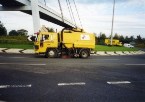
PS I seem to have taken many photos taken from the A75, but none have captured the road itself even by mistake. I even looked to see if I had cropped it off, but no. Only four of the pictures in the post are taken from the A75. The first picture of the post, the cleaning truck, is the only actual picture of the A75 itself in my collection. It was taken by Conor as part of a school project (primary school) 11 years ago and also shows the Glasgow Road Footbridge which won the Saltire Award for Design and Saltire Award for Construction. Those with a careful eye will spot Conor somewhere in the post’s pictures. It sounds as if the A75 will have to be a photo project now.
Thank you to Jim, Chris and Ewen for explanations, confirmations and suggestions.
The research for this piece has got me interested in the Machars for low level walks when the weather dictates.
*Post Scriptum (July 2012): I have now had a chance to make the journey as a passenger on a day with excellent visibility, and must therefore correct some errors. The Awful Hand Mountains (including Merrick) can be seen from the road. A pyramidal hill is visible between the Awful Hand hills and Minnigaff hills. It looks the right shape for Mullwharchar but is more likely Buchan Hill.

