
10.27 miles 4h 38m ascent 354m
The Eye
Tonderghie Burn-Auchenleck (and back)
There must be a great many Old Edinburgh Roads. This one joined Edinburgh, the country’s secular capital, to Whithorn, its religious heart and was a route for pilgrims. James IV* travelled it several times. As times changed, the route would become the main coach road to the harbour of Portpatrick. The railways, and then our modern roads have replaced it, but its route is still shown on the OS maps between the Water of Ken and the Cree. The Forestry have built some of their tracks along it and Sustrans seem to have quietly adopted some of it into National Cycleway no. 7. I say quietly adopted, because the section we walked from the the Tonderghie Burn to Auchenleck it is marked on the OS map as a cycle route, has cycle route 7 signs every few hundred metres but isn’t on the Sustrans website. It is now a forestry track, recently resurfaced. It had been topped with sea shells when I walked it a few years ago but now has a surface of bluish grey gravel. There had been quite a lot of felling hereabouts so presumably this was for the benefit of logging trucks. But at least it lends itself to dry feet on a walk through a pretty boggy landscape.
The route follows the curve of the Palnure Glen but not in the valley which, in the days before the A712, would presumably have been an impassable bog. Instead the old road wound along the higher ground skirting Talnotry Hill. This is not much of a hill, but its name, Dun Ochtraidh, Uchtred’s Fort, suggests it was once more than a forestry plantation. A fort here would control the old road and overlook the wide valley to the south. The eponym likely refers to Uchtred, Lord of Galloway from 1161-1174, a grandson of Henry I and great-grandfather of Dervorguilla of Galloway, the sponsor of abbeys and bridges, founder of Balliol College and mother to King John of Scotland.
Anyway, back to the walk. Though it is through forestry there are interesting things to see along the way. We began just short of Black Loch, its water grey to the eye but blue to my camera’s sensor. But its name might reflect tragedy rather than colour.
A local tale tells of the Laird of Cardoness, a robber baron and violent man. He had grown exasperated with his wife who had provided him with nine daughters but not the son and heir he desired. When she became pregnant again he threatened to drown her and all her daughters if she failed to produce a son. Much to the relief of all concerned a son was born and the delighted Laird arranged a midwinter feast on the thick ice of the Black Loch. Unfortunately the ice gave way and the whole family, save one daughter were drowned. I wouldn’t want to dwell on the unlikeliness of the choice of venue for that midwinter fete but the journey from Cardoness Castle isn’t easy even with modern roads.
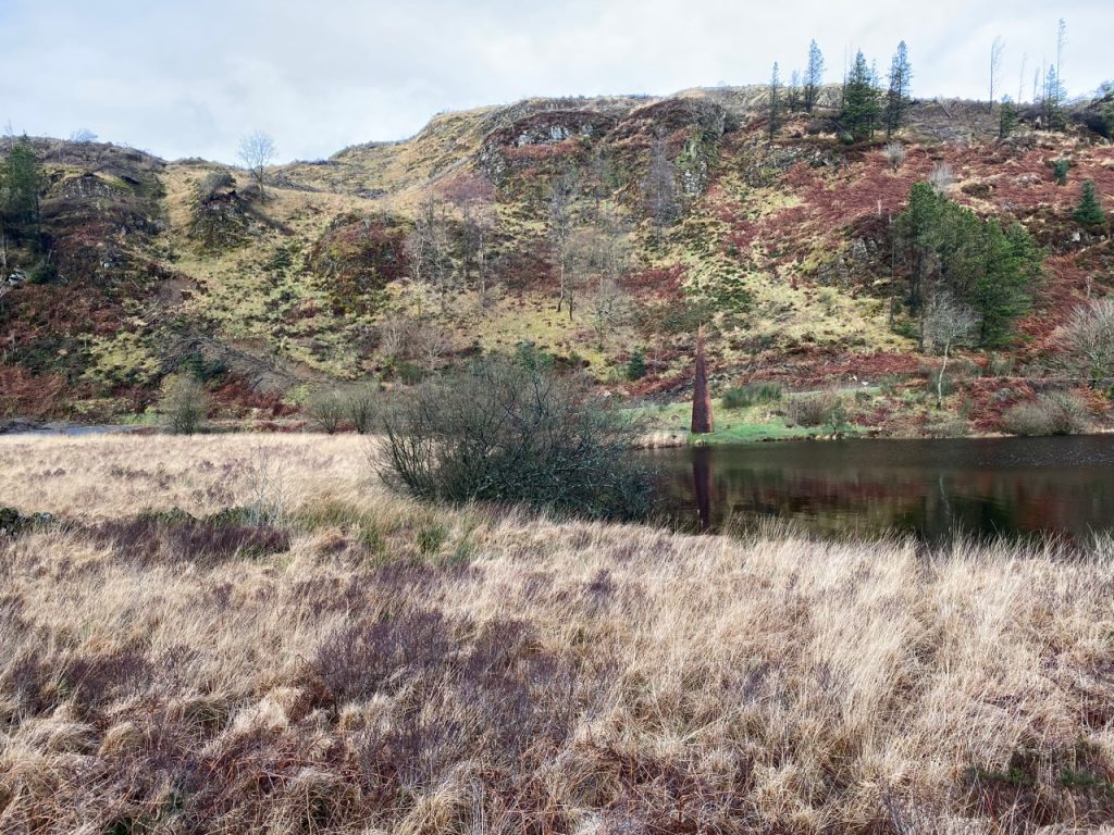
It looks Black from here
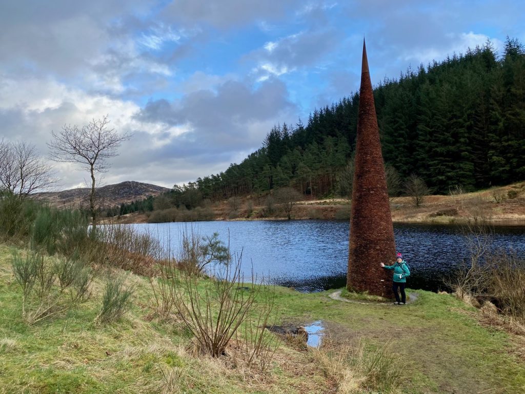
There is a conical terracotta structure at the western end of the loch. The picture at the start of the post gives an idea of its size. When I first wrote about it a few years ago it was generally said to be 7m tall but most sources now seem to claim it to be 8m tall. It is The Eye, by Colin Rose, commissioned in 1997 to mark the 50th anniversary of Galloway Forest Park. There is a narrow hollow section running through it which may be part of the “art”, representing the eye of the the needle, or something more mundane such as a means to hold it during construction. I lean towards the former since it would have been easy enough to cover the holes.
It’s a shame the Eye couldn’t somehow have had the legend of the loch woven into its story…. The daughter who survived had dropped her embroidery on the banks of the loch. By the light of the moon and the braziers at the feast she had seen a light on the banks of the loch. Laying down her plate she had gone to investigate. And looking down at her embroidery in the heather, the glinting of the needle suddenly stopped as the braziers, and revellers, fell into loch’s icy water. And they all lived happily ever after.
The Grey Mare’s Tail Burn is about 500m from the loch. There is little doubt where its name comes from. It has several waterfalls, one down by the A712 served by a car park and one a little upstream from the forestry track. We had a go at following a rough path up to it but were presented with increasingly wet, muddy and eventually flooded ground. Dry feet were chosen over approaching the falls. There is a waymarked path down to the lower waterfall, but I have walked that before. A wet journey, I recall. I suspect it would be very muddy just now.
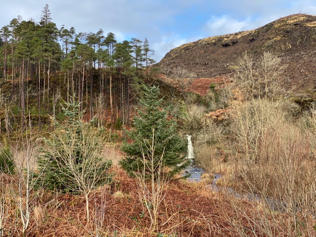
Grey Mare’s Tail from the forestry track
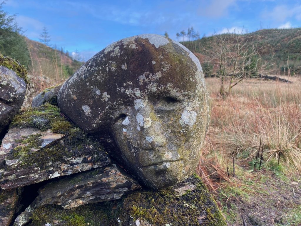
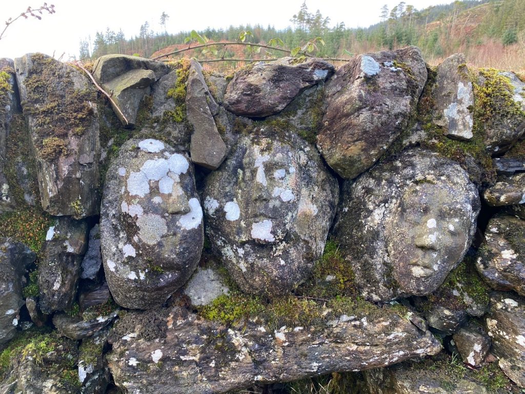
There are a number of faces carved into the walls remains of the sheep pens beside the burn. These are more of the ‘art in the forest’ from 1997, Quorum, by Matt Baker and Doug Cocker.


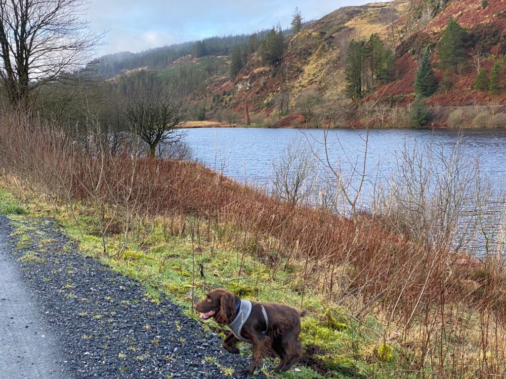
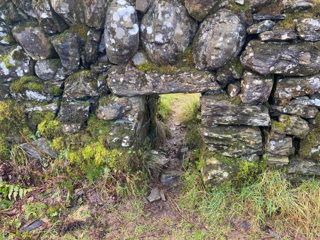
And for those interested in dry stone walls, here’s a lunky hole (with a miniature dachshund for scale). These are also known as creeps, smoots, smouts, hogg holes (Cumbria) or cripple holes (Yorkshire), but they are lunky holes in SW Scotland. They allow sheep, especially younger sheep (hoggs), to graze more widely and are easy to block as needed.
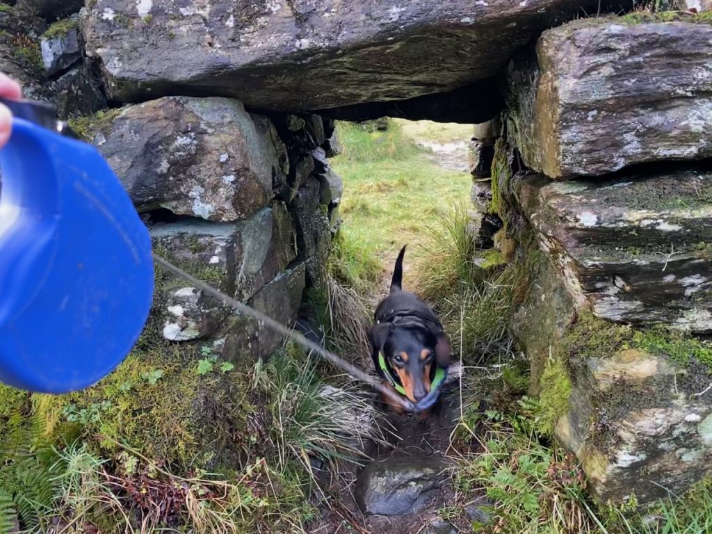
Why was I compelled to murmur “Yan” as Mabel ran through the creep?
After we crossed the burn, a rusting grate caught my eye. More art? No. The OS map has a Shaft (dis) marked here and the grate covered the access to the shaft. Talnotry has the only magmatic copper-nickel ore in the Southern Uplands so this was likely a nickel or copper mine.
Murray’s Monument, was soon visible. Official sites give its height as ‘circa 80 feet’ and standing atop Big Doon it is an imposing sight. The obelisk commemorates Alexander Murray (1775-1813) the son of a local shepherd, who became a Professor of Oriental Languages at Edinburgh University and it overlooks Dunkitterick Cottage where he was born.
There is an uninviting mass of tussocks and semi-felled forest between the forestry track and the monument. We had trudged over it a few years ago and felt no need to relive the experience, especially so since we now know there is a footpath just a few hundred metres further along the forestry track. We did venture down the footpath but only went far enough for the picture below. Audrey chose the low risk path and I chose the I-wish-I-hadn’t-taken-this shortcut. Splitting the team was a crisis for Christy who likes to keep the pack rounded up when we are out walking. Only he is allowed to roam about.

Murray’s Monument
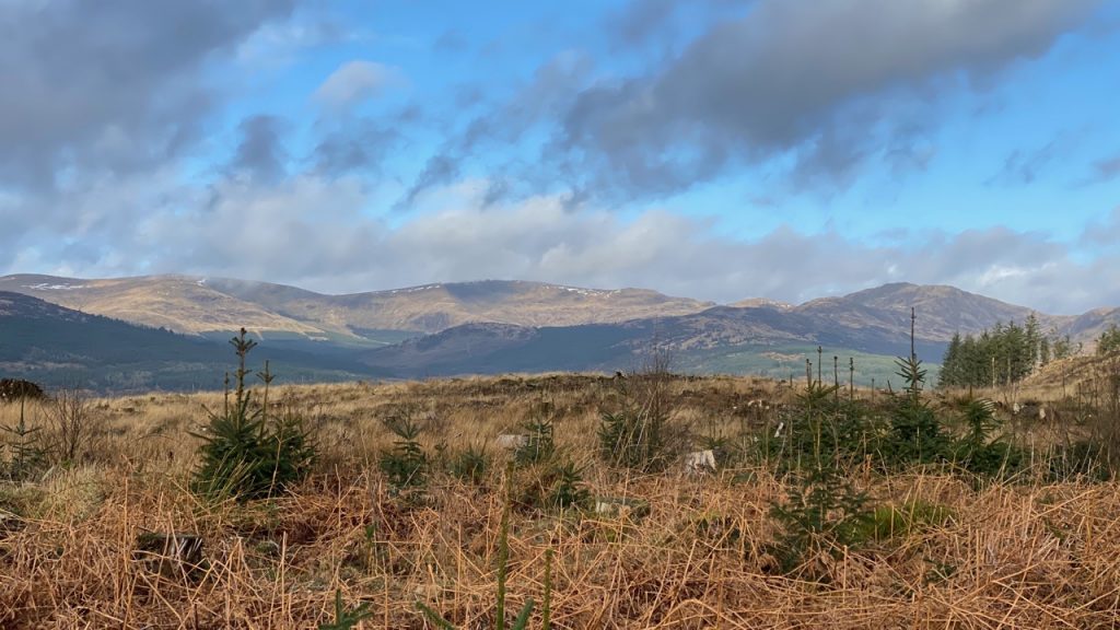
The felling in the last few years has left quite a mess but it does mean there are excellent views. South was Millfore Hill, Meikle Mulltaggart and Cairnsmore of Fleet arranged around what must once have been a glacial cauldron, and west the horseshoe of Largs Hill, Lamachan, Curleywee and Stronbae. Curleywee is one of my favourite hill names, Cor Le Gaeith (pronounced gwee), the hill in the wind.
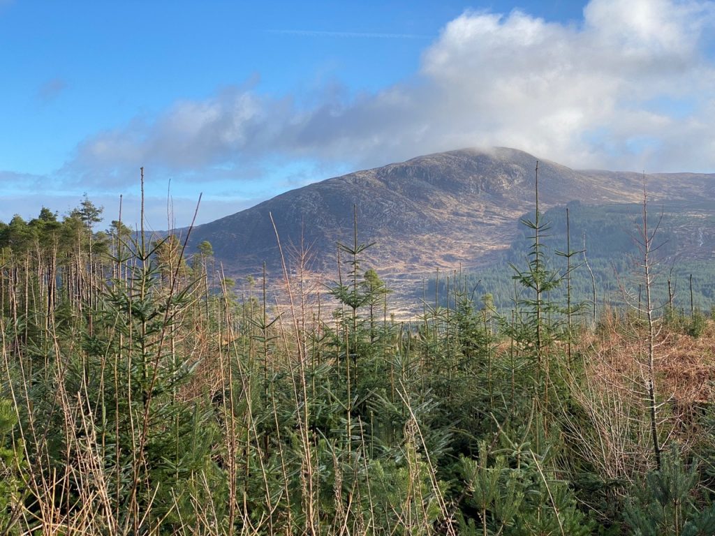
Big Gairy of Millfore Hill
Views of the Black Loch, Loch of the Lowes, Millfore Hill and Cairnsmore of Fleet,, waterfalls, the largest of which was the Grey Mare’s Tail on the aptly named Grey Mare’s Tail Burn, the rocky wild Craigdews Hill, the giant upended carrot of The Eye and the carved faces of Quorum (one has moved), Murray’s Monument, trees snapped mid way up their trunks, others toppled with their roots, warnings against wading and grids across mine shafts…and a lucky hole.
Curleywee is on the far right
The track next took us by the Loch of The Lowes, and a sign warning us that wading is dangerous. There seem to be quite a few Lochs of the Lowes about. We walked by one of them on the Southern Upland Way one windy day. Lowes is a modern version of the Scots, lowis, or Brythonic luhes, equivalent to the Gaelic, lochs. Places called Lowes are usually named where there are multiple lochs in one place.e.g. The Loch of the Lowes next to St Mary’s Loch in the borders.
But The Loch of the Lowes by the Old Edinburgh Road stands all alone, so I’m no wiser as to how it got its name.
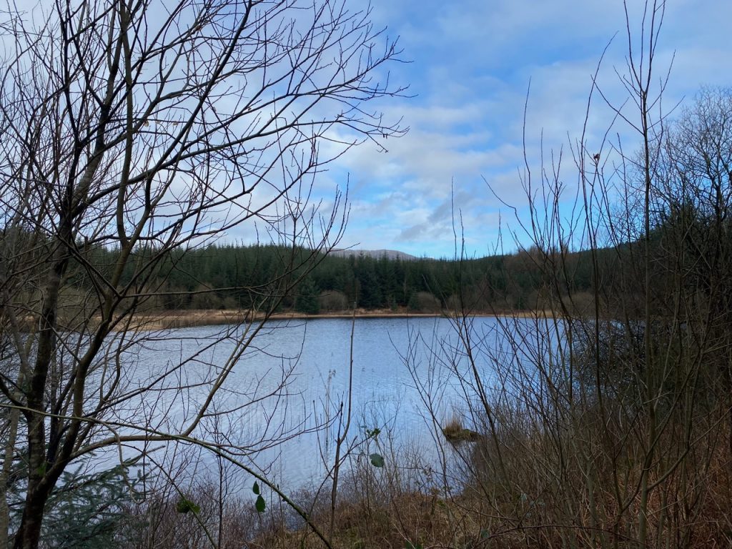
Loch of the Lowes
The Forestry track winds along through moorland and what few stands of trees remain have taken a battering in the recent storms. We passed close to Drumlawhinnie Loch, but could not see it from the track. At NX 4578 6912, the Old Edinburgh Road would have gone onwards but now there is no sign of it. The forestry track turns left towards the A712 or right to Auchenleck, Achadh na lic, the field of the tombs. The latter sounds more exciting, but its not like we were discovering the valley of the kings, there were just dense woodlands, thick bracken, a big quarry and some uninterested sheep. We reached the road turned round and headed back, the return journey broken for a coffee and a moan about the lack of anything that might be construed as a seat.
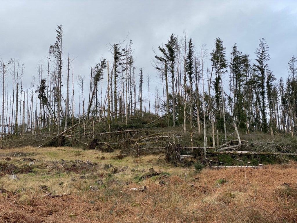
Storm 1, Forest nil
*The James IV who agreed a Treaty of Perpetual Peace with Henry VII of England in 1502 yet was killed in battle by the English at Flodden in 1503.
[sgpx gpx=https://www.screel.co.uk/walks/wp-content/uploads/2022/02/RK_gpx-_2022-02-08_1027.gpx]
