
12.4 miles 607m ascent 5h 34m; max elevation 487m on Middle Rig
 Route: SUW Tibbie Shiels to Traquair
Sunshine at last. Though we started with a grey sky, the sun eventually showed its face and gave us a great day. Not quite hot enough for cooling one’s feet in running water, but that day might yet come.
We were only the second car parked by the Loch of the Lowes in the morning but when we returned in the afternoon the place was teeming. But as it was, the cold overcast morning gave us our usual SUW solitude.
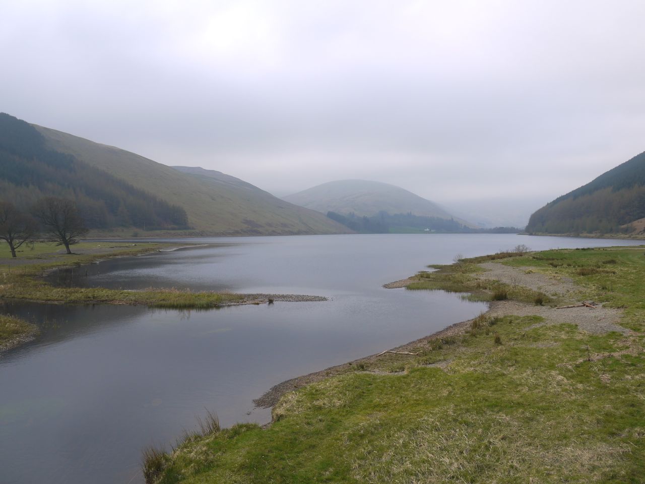
Loch of the Lowes
The weather forecast stone at Tibbie Shiels indicated “windy” but the water was relatively still on St Mary’s Loch. We climbed our first stile of the day just after the boathouse and set off along the southern side of the loch, firm ground and short grass beneath our feet, and watched by sheep and their lambs. It was strange not to have our feet sinking into soft ground and mud.
There is a good track beside the loch, though it is single file in places. I have read that the original road, now on the northern side of the loch, once ran on this side. It must have been a narrow track back then and I can’t see how even a cart could have come this way.
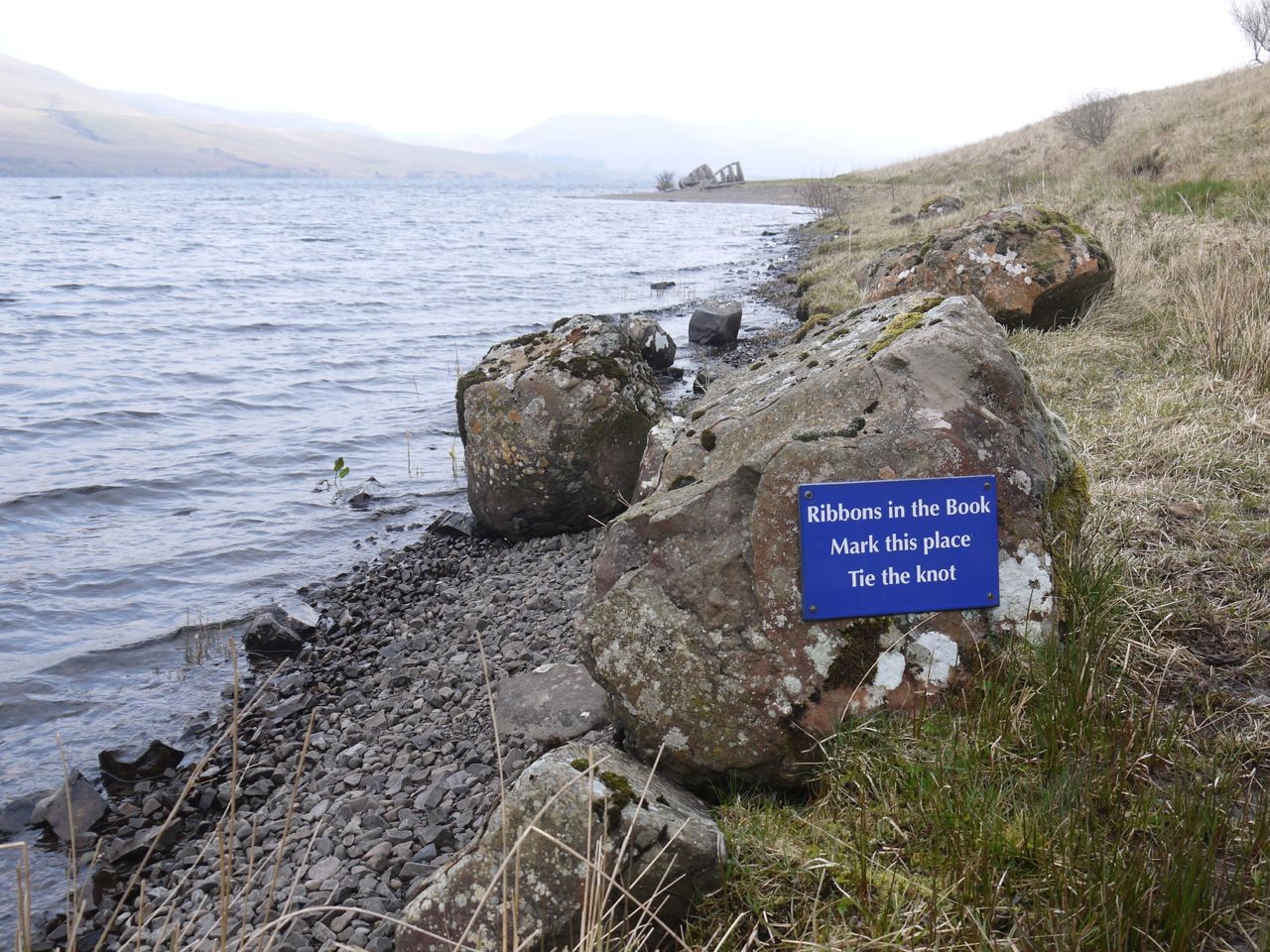
Ribbons in the book, St Mary’s Loch
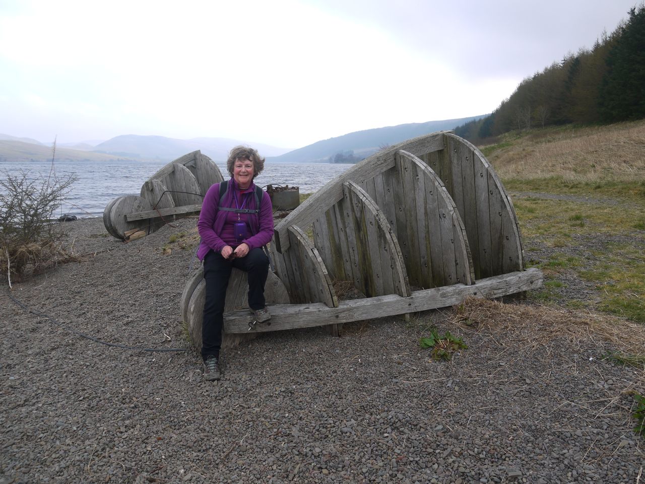
As we approached the mid part of the loch, opposite the Megget Water’s in-flow we passed two blue signs. One reading “Bloodline” and the other “Ribbons in the Book, Mark this place, Tie the Knot”. In the photo above and the one at the beginning of this post you can see the two Oak Land Anchors of the Shinglehook installation by artist Matt Baker. These stand on a small gravel spit and indicate where an alluvial land bridge will grow across the loch from the opposite shore. There were originally four floating bronze casts connected to these land anchors, but there is no sign of them now and their cables lie on the shore.
There were several more stiles to cross as we walked by the loch, the first few of a great many on this day. I wish I had counted them, but it is the most I can recall on any walk. At Bowerhope we came across more sheep, this time with some black sheep amongst them. Behind the farm buildings the forests on the slopes of Peat Law and Thorny Rig had been felled leaving the hills looking rather messy.
After Bowerhope we had a farm track for the last mile of the loch. We saw our only other fellow walkers here, a couple of German lads I think. We didn’t mention the….
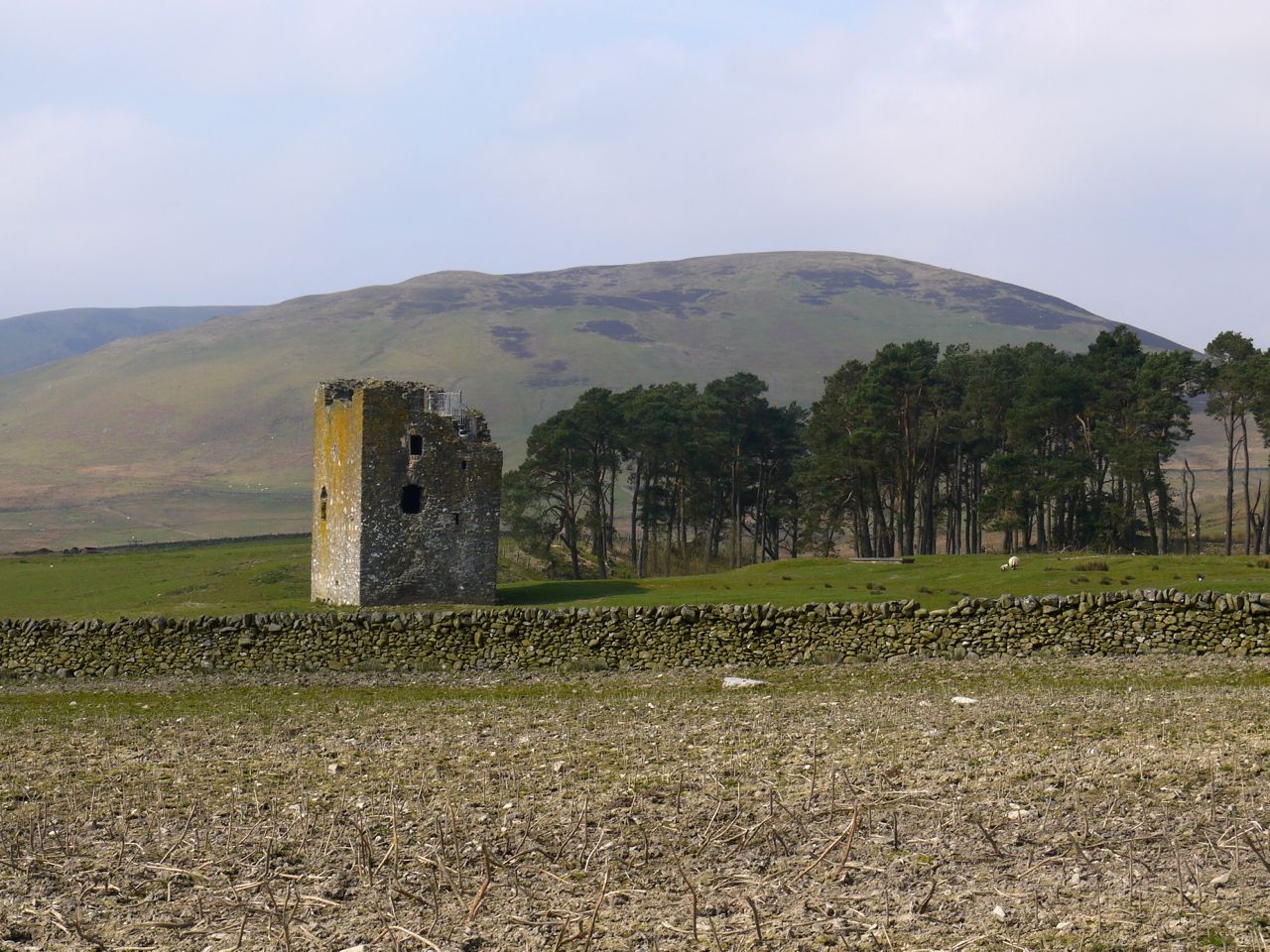
Dryhope Tower
After the loch side walk we paused for some photos of Yarrow Water from the bridge and then made our way across Dryhope Haugh, following the SUW signs asking us to follow the new SUW route. I think this was the same three years ago, so perhaps it isn’t so new anymore. There are some ditches in the fields of the haugh but small footbridges over these kept us out of any mud, and we didn’t have to ford the burn.
We climbed another stile over the wall and crossed the A708 to start the gentle climb up towards Dryhope Tower. The first field was entirely churned mud which would in other weather have been an utter quagmire. The mud was now dry though and the cows were grazing up on top of Ward Law. They must have been hillwalking cows, or perhaps they were tired of the mud. After another couple of fields we came to the final field and found a fence with no gate or stile. On the SUW that is usually a sign that one has strayed from the route and I wondered if we should have headed diagonally across the field but we had not strayed, the SUW actually heads along a narrow section between the fence and a wall.
The ruins of Dryhope Tower are by the SUW just across the steep gully of the Dryhope Burn. It is a 16th century pele tower built the Scott family which included Mary Scott, mentioned as the Flower of Yarrow in some traditional ballads. Her husband Wat is described in wikipedia as an infamous freebooter, rebel and outlaw. It sounds as though the Flower of Yarrow herself encouraged her husband in his crimes though, since there is a tale that when supplies were low she served up a set of spurs on a platter, instead of meat, for her husband’s dinner, implying that he should ride out with his men and restock the larder from their neighbours’ herds.
Hawkshaw Cleuch
By the time we reached Dryhope the sun was shining giving good visibility to the east but haziness when looking back to St Mary’s Loch. The SUW climbs gently around the southern slopes of Hawkshaw Rig, over a wee hummock with a 359m spot height. I remember walking up here on the Hearts and Heroes walk a few years ago and seeing a walker stop to have a cigarette “to get his breath back”. So to me this unnamed hump will always be Cigarette Hill.
From Cigarette Hill there were good, albeit hazy views back over St Mary’s Loch and its surrounding hills. Looking east and south there is grassy moorland with sheep. The lower ground after Cigarette Hill must be boggy at times since there are several short wooden walkways, but the ground was dry enough that we were able to walk beside these, except one over the wee burn.
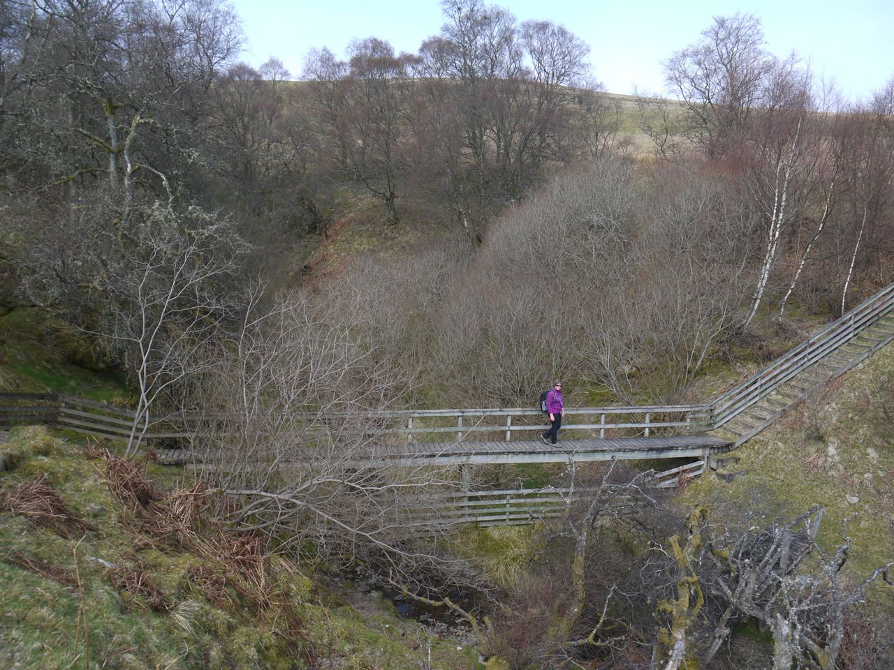
We then passed a sheepfold and crossed Hawkshaw Cleuch on its substantial wooden footbridge. A little more easy walking on grassy slopes, with Audrey murmuring about needing haggis legs to cope with the slope, and we were walking down towards the Douglas Burn at Blackhouse.
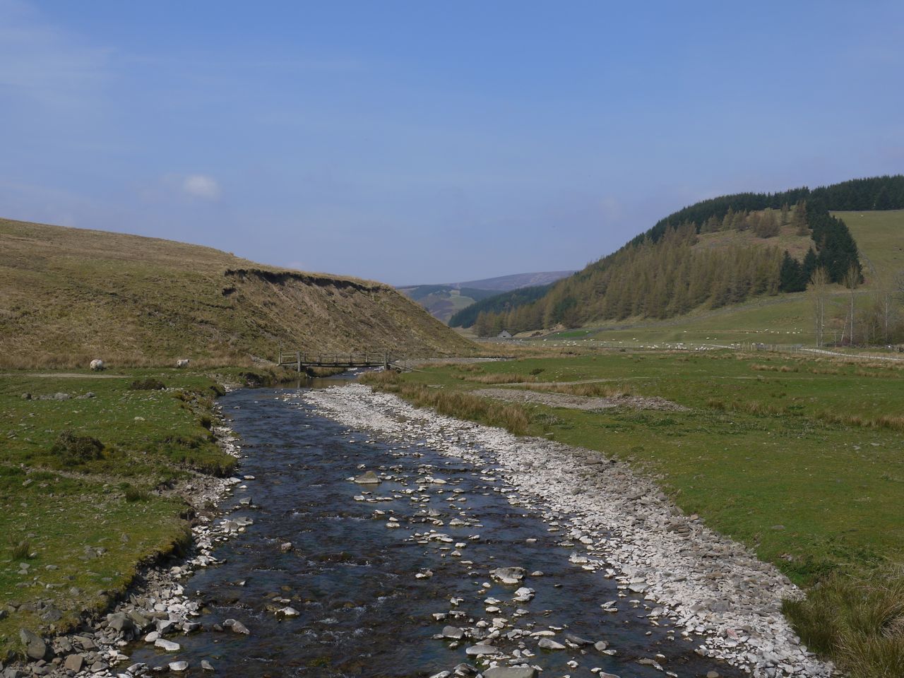
Douglas Burn, Blackhouse
There is an old rickety bridge which I’m pretty sure I’ve used in the past, but would not choose to use now since there is a newer more robust footbridge over Douglas Burn. Looking along the Douglas Burn from the bridge we could see the Glenrath Hills.
James Hogg, the poet whose statue stands above St Mary’s Loch was a shepherd at Blackhouse between 1790-1800. The other historical feature here is a ruined tower. This is another 16th century tower but Blackhouse Tower has fared far worse than that at Dryhope with only the lower storey surviving.
The ballad “The Douglas Tragedy” is supposedly based at Blackhouse. The Black Douglas’s lived at Blackhouse, with seven sons and a daughter Lady Margaret who eloped with a Lord William. Her father and her seven brothers caught up with the pair and fought. Lord William killed all the Douglas’s but was mortally wounded and later died.
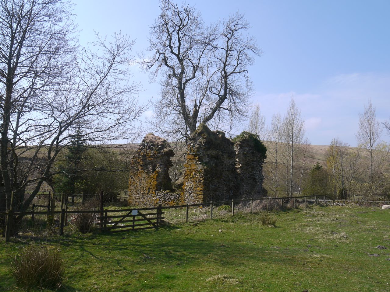
Blackhouse Tower
We reached Blackhouse a little early for lunch so we pressed on up the grassy slope taking it nice and slow. The track is just a little more steep than gentle, but we took our time. A young man came running down past us and we were to met him again later on his return towards Peebles!
For once fate smiled on us and as lunch time approached we found a wooden bench beside the track. This faced back towards St Mary’s Loch and the waters could just be seen between the tree tops. Walking up the hill in the sunshine had warmed us both up so the bench was just what we needed. I could have spent the afternoon there, relaxing in the sunshine, enjoying the views and cooled by the breeze, but there were still a few miles to go.
St Mary’s Loch, view from the bench
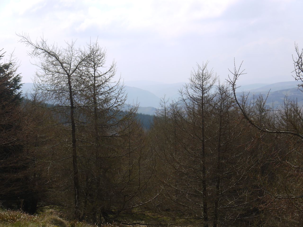
Just beyond the bench was a signpost telling us we were 5 miles from Traquair, so we were past half-way. The grassy track levelled a little and we soon reached the edge of the trees and walked out onto Blake Muir. My memory of this section was a flat moorland walk, but there were some ups and downs.
The path across the moor was good firm grass and as the path climbed onto the higher ground we had good views of the Glenrath Hills, Dun Rig and Birkscairn Hill. Eventually we could see Innerleithen and the Moorfoot Hills.
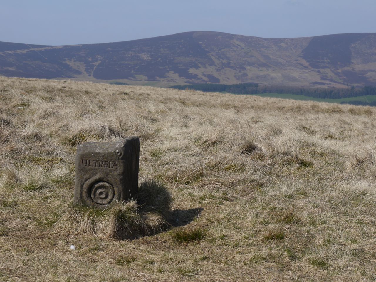
Ultreia stone, Blake Muir
There is a waymerker kist on the moorland, so we were keeping an eye out for “Ultreia” plaques on the SUW posts. I had an idea where the kist should be but there were no Ultreia signs. Luckily we spotted the kist and took a coin each from the hoard.
The moorland gradually changed into farmland with sheep, lambs and an avenue of hawthorns. There were more stiles to climb, both stone ones in walls and wooden stiles over fences.
Once down on the road it was mile of road walking back to the car in Traquair.
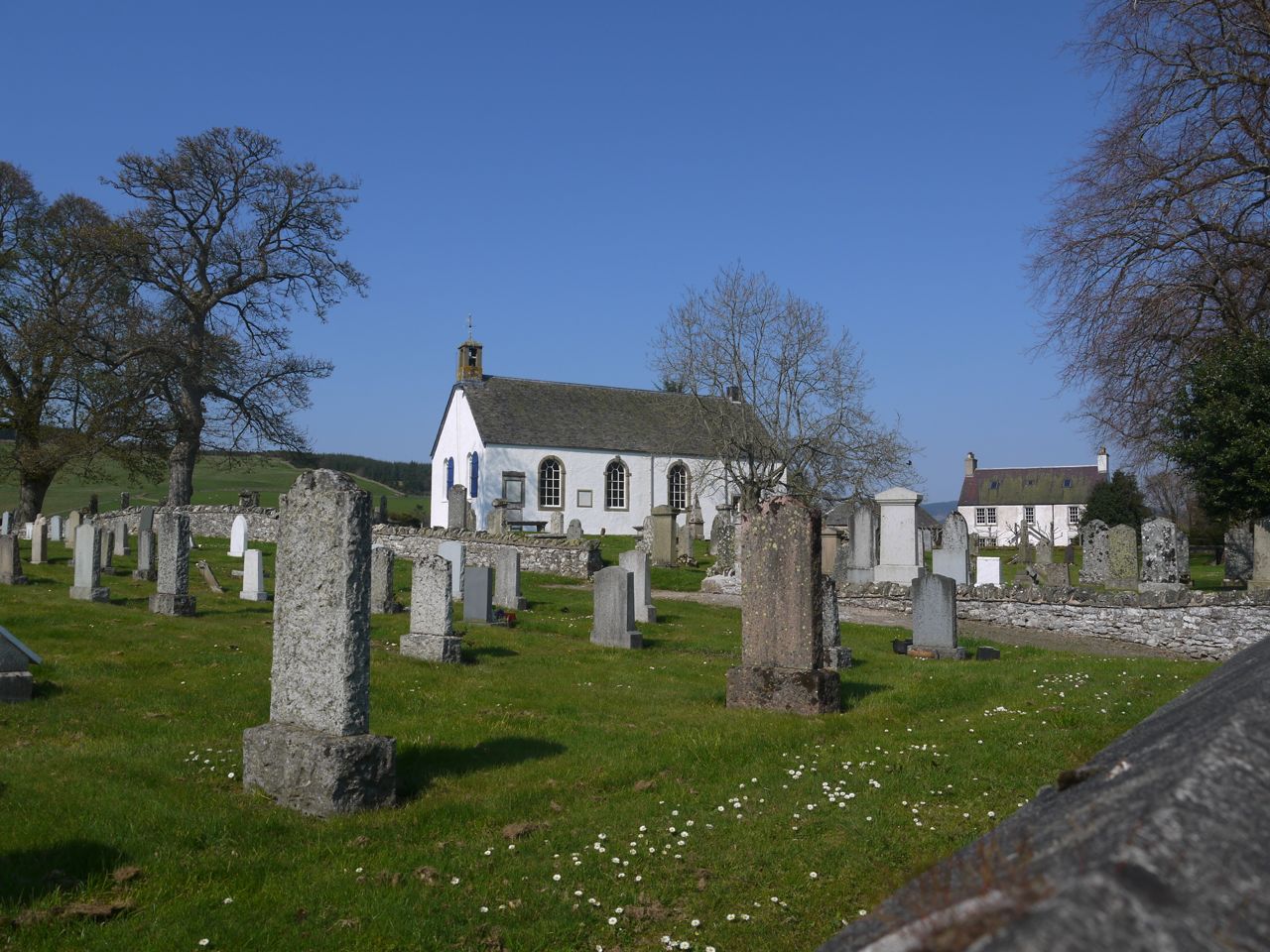
Traquair Kirk
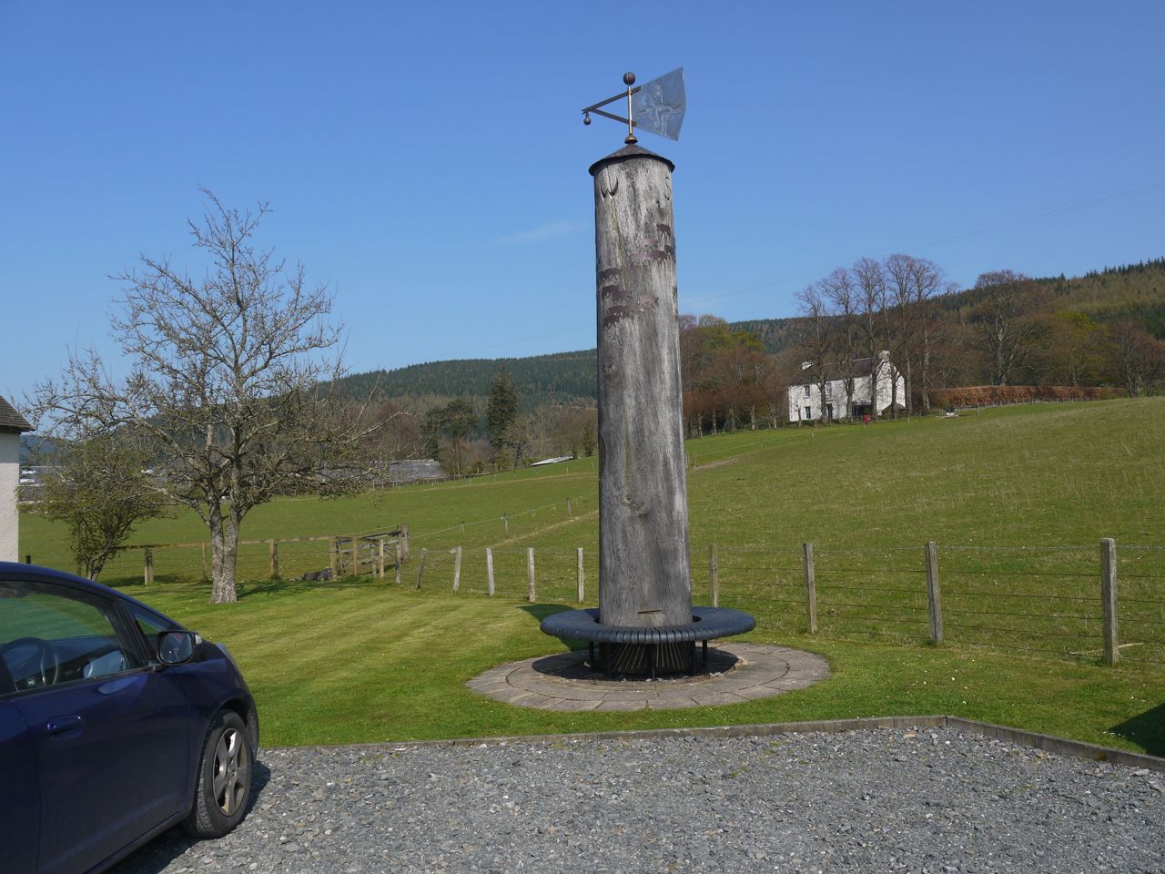
Weather Vane, Traquair
A very enjoyable section with some of the best weather we have had. A good combination of loch-side, moorland, and farmland walking, with fields full of young lambs, ancient towers, good views, another SUW coin hoard and a good place for lunch.
[sgpx gpx=”http://www.screel.co.uk/walks/wp-content/uploads/2014/04/RK_gpx-_2014-04-21_0953.gpx”]
