I’ve read that Screel Hill may take its name from the Gaelic sgreamhail meaning disgusting or nasty. Having walked this hill several times I can only presume this is incorrect or something about the hill has changed over the years. An alternative is sgrath-eileach, turf bank or mound sounds more reasonable.
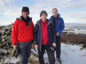
The weather forecast was for snow so we opted for a low level walk close to home and since David had missed the Screel outing in March, Screel it was. As it turned out we had excellent weather and the best visibility I’ve had on this hill.
We set off from the usual car park and up the forest track, staying on the track to make the walk a figure of eight. So we followed the track as it wound round and then climbed up the Glen of the Screel Burn. The last time we walked up here it was boggy and slightly hard going. Today the ground was frozen under a thin layer of snow, not much actual ice to slip on.
I had expected a very cold day and heated up rapidly walking up the path in sunlight. It was a little chilly on the ridge but not the biting chill I had expected.
We climbed the western end of Screel which is steep but not quite a scramble. From the summit we could see all the major hills: Cairnsmore of Fleet, Merrick and the awful hand range, the Rhinns of Kells, Cairnsmore of Carsphairn, Hart Fell and the Moffat hills, and the hills of Cumbria.
Bengairn sat just to the south, begging us to conquer it. There even seemed to be a path, albeit made for tracked vehicles that went much of the way. Another day.
We were of course able to see Almorness, and having been bitten by its accursed flora I am drawn as if by a geas to return. Another day.
It would appear however that I was tarrying a little too long to take in the views. The vanguard struck on without me.
The top of Screel is usually boggy but today the ground was solid. At the eastern end of the ridge we met a trio of paragliders who were using high tech equipment to assess the wind direction (wet fingers). The camera toting member of this trio suggested we take a different path down which was less steep and likely to be easier in the icy weather.
The downward path was the more direct way and passed through forests on pine needle covered paths. I seem to remember these being treacherous for slipping when wet but today the moisture was all frozen. In summer time this part of the walk is less well lit when the trees are better covered and it has a magical look.
The clouds had been gathering as we stood on the ridge, and by the time we were in the forest light snow was falling.
A good outing for a short walk, fantastic views but only decaffeinated coffee afterwards. I was forced to have a proper coffee once I got home.
[osmap gpx=”http://www.screel.co.uk/walks/wp-content/uploads/2010/11/RK_gpx-_2010-11-28_1101.gpx”]


