
1.67 miles 1h 22m ascent only about 80m
Second failure, in two days, to reach its summit. The first, yesterday: I had intended going from the summit of Lochbank Hill across the Craigend Hill, which is really just a second top of the same hill off to the SW. But Lochbank’s top has been felled and the the way across looked as though it would be a bit of a bind.
So, I was back to have another go at Craigend Hill.
I had noticed a track shown on some cycle maps, though not the OS. From its winding route I presumed it was an MTB track. Correctly as it turns out. It passes within 100m of the summit. For some reason I had decided to walk around the hill to its NW and follow the track SW to near the summit, bushwhack across then head down SW. Glad I didn’t
A change of mind on the day. I would go the opposite way, starting in the SW and heading NW.
I found the trail and would have described it as
“easily identified, very slightly overgrown”, but that soon became
“easily identified, slightly overgrown”, then
“not easily identified, overgrown”, then
“difficult to see, very overgrown”, then
“gone, just young trees in a bog”, then sudden joy,
“perhaps this is a trail”, then
“no it isn’t”.
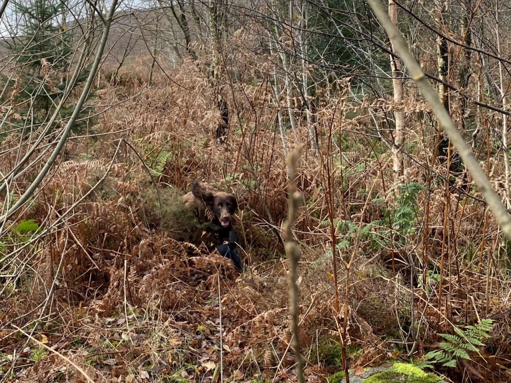
It was then just a case of bushwacking through heather, bracken, brambles and sphagnum while irregular rocks and fallen rotting branches tempted my feet into holes and pools. Mabel had to be carried through the brambles, which she did not like but Christy had found a big stick so he was happy.
Then I spotted a boardwalk.
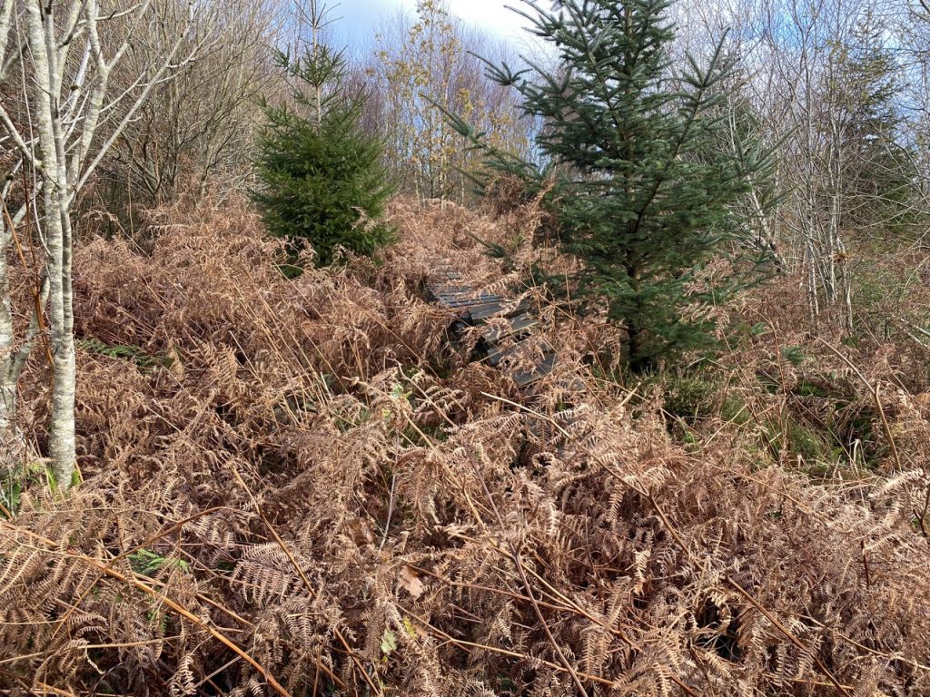
The boards were more slippery than ice so I walked beside them. At least we had found the MTB track. But soon enough it disappeared and we were bushwhacking again.
Then more boardwalk. This time it was quite a long section and again far too slippery to stand on. This went over some very rocky sections which had me actually climbling, helping the dogs up then scrambling up myself.
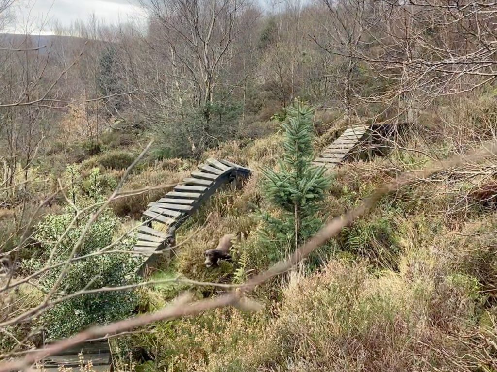
Eventually though, the boardwalk went over quite a deep rocky ravine. I’m not saying it was the Grand Canyon but deep enough for broken bones. Christy stepped on the boardwalk and almost slipped off it. Then Mabel ran out onto it and had to be coaxed back. My options were: to climb down and up the gully (ruled out as too dangerous even if I didn’t have the dogs); climbing up a heather covered mini-ridge (I tried it but the dogs couldn’t manage); or backtrack and climb up to the ridge (this was the choice even though it involved scrambling and dog-hefting). I hoped to be able to walk parallel to the MTB track and rejoin it further along. But….
The ridge was as good as impassable uphill. I decided to give up the day’s attempt on Craigend Hill. I would have liked to get off the hill more directly but it was too steep to head towards the forestry tracks to the north or the south. I would have to go back the way I had come. More bushwhacking to get back to reach the MTB track below the higgledy-piggledy boardwalk.
It was a little easier coming off the hill but I couldn’t find the track at first, only finding it when I spotted the lower boardwalk. I am glad I hadn’t gone up the hill from the NW and tried to descend this way.
Yesterday, standing on Lochbank Hill, I was 200m from Craigend’s summit, today I turned back when I was 400m away. Crossing the felled slopes of Lochbank would have been easier.
I suppose I will have to try another route. Watch this space.
