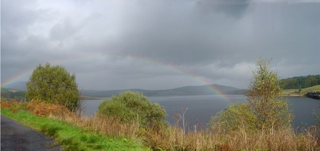
 A walk around the Clatteringshaws cycle path. It was sunny most of the way round but clouded over and started to rain when we stopped for lunch. At least we were treated to some rainbows.
13.7 miles elevation 227m time 4h 5m
Retrospective:
This was planned as a relatively easy walk, no climbing to speak of, since David was recovering from knee surgery I seem to remember. Nevertheless he seemed to be setting the pace. We parked at the Clatteringshaws visitor centre and headed east along the Queen’s way for a brief spell before joining a forestry track running northwest through Craigenbay. This leads to the SUW which carried us back to the Loch.
The views here were excellent with the sunlight glinting on the Loch and the surrounding hills rejoicing in their best summer greens. The River Dee was dammed at Clatteringshaws in 1935 creating Clatteringshaws Loch which is much larger than its natural neighbours, Loch Dee and Trool. Beneath its water lies Craignell, the site of a battle, commemorated by Bruce’s Stone on Raploch Moss.
The SUW then follows Blackwater of Dee upstream for a couple miles until you reach the small bridge over it. After crossing the bridge there is a T junction. The SUW goes right towards Loch Dee and we headed left past Craigencallie House and down to the loch again. There is a small bridge over Darnaw Burn where we decided to stop for lunch, since it was somewhere to sit and it was there that we had our first drops of rain. At least we had a rainbow for dessert.


