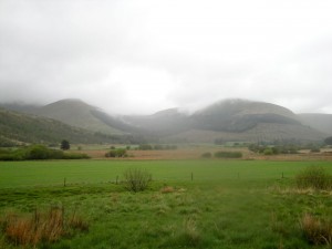
As I drove to Netherholm of Dalquhairn my path was crossed by calves, lambs, hares and deer.
The walk was a curtailed outing. I had initially intended a wide circle taking in Dodd Hill and Windy Standard. Photo’s of Dodd Hill’s crosses and Windy Standard’s wind farm had been the aim, but when I arrived even lowly Dodd Hill was in cloud.
No problem, the forecast said the cloud would lift later in the day so I would go anticlockwise. It had been raining heavily when I arrived, so I opted for full wet weather get-up. Waterproofs, electronics inside a waterproof bag inside a rucsac with its waterproof cover, map in its cover. Within 10 minutes it stopped raining.
The original route had returned down Mid Rig, though I had toyed with returning over Ewe Hill. As I stood, under the rainless sky, I gazed at Mid Rig, no path, and Ewe Hill, forestry path. The cogs of the grey matter turned: it was a no brainer, Ewe Hill and the path it was.
As the path steadily climbed, I smiled inwardly. Gaining height on an easy path, what more could I ask for? When the path began to head downwards, I presumed it was just a brief irritation. Ahead I could see the path forking, one path heading back down hill and the other heading up.
Where the path crossed Spout Burn it turned back on itself, the upwards path lasted 10m, ending in 4m of sheer rock. I realised that the path and I would need to part company. All I needed to do was follow the burn up. The waterfall on the OS map should have been a clue as to how steep this section would be.
I managed to climb a steep area at the side of the sheer rock and was met at the top with a deep water filled ditch and dense forest. I tried to cross the the ditch on a fallen, moss covered, tree but following a risk assessment, clambered down into the ditch and up the other side. The walk up beside the burn led to the waterfall. This seemed quite an impressive water feature but I was wary of getting too close for a photo, because the ground was steep and muddy.
Indeed it seemed safer to head away from the burn up the slope to get out of the trees. This was more steep ground, muddy in places. The lower branches of the trees were still attached and kept catching on my rucsac-mounted walking pole. When I slipped backwards I would grab for a branch but they always snapped off.
But there was light at the end of the forest. Before too long I was on a grass covered slope. Of course there were tussocks, waterlogged ground and standing water on steep slopes in keeping with Galloway. I was heading for the fence which would be my guide but visibility on the hill top was minimal and I was wary of heading off in the hope of meeting the fence in case it was not always present.
Alternative plan: follow the burn and it should lead to the col between Alwhat and Alhang where I would have another fence to follow. Unfortunately I had to leave the burn to find a way across a rather wide tributary and by the time I got back to the burn, I mistook it for another tributary and crossed it. The weather by now had taken a turn for the worse. Visibility was very poor, the wind had reached buffeting levels and the rain was both heavy and horizontal.
It was easy enough to keep heading upwards and, despite the poor visibility, I scored a bullseye for the wee cairn on Alhang. Strangely, there was another walker up there just putting on his waterproofs. He had come up Mid Rig.
I had expected to find a fence on Alhang which would lead me all the way to Windy Standard. But since there was no fence and no visibility it was time to reassess the walk. I didn’t fancy trying to find Windy Standard by following bearings without any other guides. Since coming home and looking at the map without rain covered specs I see that the fence passes a little to the north of Alhang’s summit.
Anyway, after a morale boosting banana, I decided that discretion is the better part of valour and it was time to call it a day. Mid Rig was the quickest way back down. I asked the now waterproofed chap if there was a path, but no, he reckoned I’d just have to follow a bearing.
So map and compass it was until at about 450m I emerged from the cloud to see Netherholm of Dalquhairn in the distance. The wet grassy slopes were steep in parts but eventually levelled out. It was clear I was descending into a triangle of land bounded by Holm Burn and Spout Burn.
I spied a track on the far side of the burn and hoped there would be somewhere to cross near to it. Unfortunately, this was a ford and the burn was pretty full. Looking back up Holm burn I could not see anywhere else to cross. So I headed back up Spout Burn and spotted a possible crossing place. But between me and it was a bull and several cows with calves. As I walked towards them they stood silently watching me and I planned just to launch myself across/into the burn if they started to move towards me. As it was they just watched as I edged past and I managed to get across the burn with dry feet.
Then I found myself in someone’s garden and had to escape via their garden gate. At least the last half mile was straightforward.
It is particularly galling that as I write this the sky is now blue. Perhaps there are still gales blowing in the Carsphairn hills?


